Cancel

    Open app

    Search

    Chiques Rock Outfitters

    2.2 (6 reviews)

    Chiques Rock Outfitters Photos
    You might also consider

    More like Chiques Rock Outfitters

    Recommended Reviews - Chiques Rock Outfitters

    Your trust is our priority, so businesses can't pay to alter or remove their reviews. Learn more about reviews.
    Yelp app icon
    Browse more easily on the app
    Review Feed Illustration
    Photo of Tom L.
    0
    35
    33

    2 years ago

    Helpful 0
    Thanks 0
    Love this 0
    Oh no 0

    3 years ago

    Helpful 0
    Thanks 0
    Love this 0
    Oh no 0

    6 years ago

    Helpful 0
    Thanks 0
    Love this 0
    Oh no 0

    6 years ago

    Helpful 0
    Thanks 0
    Love this 0
    Oh no 0

    13 years ago

    Helpful 1
    Thanks 0
    Love this 0
    Oh no 0

    6 years ago

    Great service! Great price for kayak rentals. We enjoyed ourselves greatly, and the location is perfect.

    Helpful 1
    Thanks 0
    Love this 0
    Oh no 0

    Ask the Community - Chiques Rock Outfitters

    Verify this business for free

    People searched for Boating 290 times last month within 15 miles of this business.

    Verify this business

    Chickies Rock County Park

    Chickies Rock County Park

    4.6
    (13 reviews)
    1.1 mi

    This is a straightforward hiking path - pretty much straight and up to be rewarded with a beautiful…read moreview of the Susquehanna River. If you are lucky, like we were, you will see a low flying plane from the nearby military base. We stopped during the week, but I could imagine the parking at this area could get filled and you may have to wait for a spot. I'm seeing from other reviews that there are other parking spots and entrances, but the one we were at seemed fairly direct to the overlook. It was a beautiful quick hike to see some impressive views.

    This was stop #2 on a beautiful late-September Sunday adventure. I'd done my homework ahead of time…read moreand planned to tackle the Chickie's Rock Overlook Trail first, then swing by the nearby Breezyview Overlook (just a 4-minute drive away). Chickie's Rock Overlook Trail: Parking was plentiful, and I appreciated the history sign at the trailhead--it turns out this path was once a trolley line leading to an amusement park near Chickie's Rock. So you're not just walking, you're walking through history. The trail itself is wide, relatively flat, and about a 20-minute walk to the overlook if you're taking your time (we were chatting the whole way--it was Sunday morning, not a cardio day). Pro Tip: Not far from the parking lot, the trail forks. Go LEFT for the easy stroll. Go RIGHT if you want a steeper climb and some cardio. Either way, the two trails meet up again before the overlook. When you arrive, the payoff is worth it: a panoramic view of the Susquehanna River and classic Central PA scenery--rolling hills, farmland, distant ridges, train tracks running at the base, and acorns plinking down around you. Pure magic. Just note: the overlook itself requires scrambling over some big rocks to get to the railing. Sneakers or boots are a must, and it's not super friendly for little kids or anyone with mobility challenges. Bonus history fact: Chickie's Rock was actually used as a Union lookout post during the Civil War in 1863, when Confederate troops invaded PA. That blew my mind. Breezyview Overlook: From Chickie's Rock, it's a quick 4-minute drive to Breezyview Overlook. This one's a lot easier--park, take a few steps on grass, and you're there. You even get the fun perspective of looking back at Chickie's Rock and seeing where you'd just been. Parking was easy, and they had a port-a-john if needed. The view is nice, but not nearly as epic as Chickie's Rock. Then again, the best things usually require a little extra effort. Overall, this was the perfect low-impact Sunday adventure. Bring water, pack out your trash, and don't forget to smile and say hi to fellow hikers along the way. If you're looking for an accessible trail with a stunning payoff, Chickie's Rock is a must.

    Photos
    Chickies Rock County Park
    Chickies Rock County Park
    Chickies Rock County Park

    See all

    Northwest Lancaster County River Trail

    Northwest Lancaster County River Trail

    4.4
    (8 reviews)
    4.9 mi

    We biked from Koser Park to the Decatur Street Access in Marietta. It's a very well maintained and…read morepaved trail.  Great condition good enough for skates though we only saw mostly bikers and one skateboarder during our visit.  The trail must be relatively new because the donated benches are still in mint condition.  There are placards along the trail providing background on various subjects.  The trail offers many nice amenities. Among others, Porta-Johns are available at 4 locations and bike repairing stations at 2. The 6.5 mile trail offers good variety in terms of views and terrains. Though mostly flat and straight, there are short sections that are windy or sloppy.  There are open fields and woody areas. The trail is near the Susquehanna River and you can see the water in many sections of the trail which is great. There are even a few spots where you can gain access to the river. We crossed 2-3 small bridges and had a great view of the Shocks Mills Bridge. Around the midpoint is the River Front Park which offers a great view of the river and well maintained picnic area for large groups, and 2 vending machines! We were surprised to see a sign to Columbia when we reached Decatur Street access, our destination.  Per Google Maps the trail ended right there.  We asked a couple who just came from that direction and they said the trail doesn't go all the way and riding on public roads would be required to make the connections.   So we stuck with our plan and did not continue. Overall I'm absolutely impressed with how well the trail is maintained, all the amenities it offers, and its vicinity to the river. UPDATE: Google Maps is not to be trusted! I have since found out the trail continues 3 miles north of Koser Park access, and 4.5 miles south of the Decatur Street access. From the Decatur Street access, you can continue 2 miles of nice windy trail before having to venture out onto S Bank St in Marietta. At this point you can either cross the railroad and turn right to eventually get to Furnace Rd where the off-road trail resumes, or if you're adventurous, you can continue with the unpaved trail which will end up in the parking lot of the Chickies Rock County Park and when you come out through the tunnel you will end up with the same Furnace Rd connection to the River Trail. This gap is well worth it because the next 1.5 mile towards Columbia is such a delight to ride through. Once in Columbia, you can head back, unless you want to visit the Columbia Crossings Trails Center, in which case, you'll have to ride the sidewalks and cross busy Rt 441 twice.

    Fun day on this trail today, then we hopped off the trail and did some boulder hopping. The trail…read moreeventually becomes to complicated since you can't tell where it stops and begins the closer you get to TMI. The 'hunger rocks' were exposed today due to low river levels. Yahoo!!

    Photos
    Northwest Lancaster County River Trail
    Northwest Lancaster County River Trail
    Northwest Lancaster County River Trail

    See all

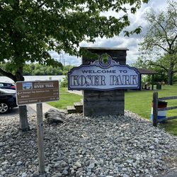
    Koser Park

    Koser Park

    4.6
    (5 reviews)
    9.5 mi

    Along the water in Bainbridge is a small park with a covered area and a small lot where many hikers…read moreand bikers park to use the nearby trail. Personally, I parked to walk 1.5 miles to the White Cliffs of Conoy, an old quarry along the water with stunning views and photo opps.

    The white cliffs of conoy is located here, which is roughly a 3 mile trek round trip (1.5 miles one…read moreway). Parking is limited in Koser Park. When heading towards the paved trail that is tree lined, take the paved path opposite of the side the picnic tables (on your right if your back is to the Susquehanna river). The trail can get quite busy, numerous people bike down the trails, others are just walking &/or walking their dogs. You eventually cross a small bridge, once you hit the 1.5 mile mark you will come up on a port a potty on your right. You can enter the first mound by walking through the overgrown brush/trees. The view from the first mound doesn't have as much impressive views as the second mound. When we arrived there were two kids biking on the first mound. The white cliffs of conoy was named after the resemblance of the white cliffs of Dover, however these mounds are actually industrial waste from crushed excess limestone & dolomite fused from an old limestone quarry that was once private land, but is now publicly owned. The second mound can be accessed if you walk a few feet past the port a potty, take caution as there are old metal rods etc poking out through the mound in various areas. There are also signs to take caution away from the ledge, as some of the areas can be unstable. The view of the Susquehanna River is beautiful. Are the white cliffs of conoy impressive? Not necessarily, but it's something unique, & quirky to see in person. It's also a popular spot for engagement/proposal photos for the locals. I wouldn't say it's a must see, but if you are out of state visiting, it's a nice short, paved easy hike that will probably last roughly an hour or so, dependent upon your speed & physical fitness level. You can combine this hike with the Chickies rock overlook trail, as it is only a 15 minute drive from one another. When leaving to head back to Hershey, we drove pass Three Mile Island, where the unit 2 reactor partial meltdown caused roughly 2 million people living nearby to be exposed to small amounts of radiation.

    Photos
    Koser Park
    Koser Park
    Koser Park

    See all

    Highpoint Scenic Vista & Recreation Area

    Highpoint Scenic Vista & Recreation Area

    4.2
    (6 reviews)
    2.0 mi

    After my Yelp friend David H. posted about this small gem last month, I had to take a look myself…read moreas I have been in the area numerous times but had honestly never heard about this place. Just to keep the history lesson short, it was built by York County in 2007 and it is one of a series of ten overlooks that are at different points in the county all of which give views of the Susquehanna River. susquehannariverlands.com/the-great-outdoors/scenic-overlooks/highpoint-scenic-vista-rec-area/ The set up is fairly simple. There is a small parking lot at the base of the overlook on Hilt Road. At the base there is a picnic bench and a port-a-blaster along with some literature about York County parks/area trails. From there it's up and around the trail which is a 1/2 mile loop with five way point stops that I guess are made to have you appreciate the view from different angles? At the top the view is very nice. It's literally the same as if you were over at Samuel S. Lewis State Park except that now you're two-ish miles closer to the river. The overlook from Samuel S. Lewis is higher and is visible from here and the top of the vista here is very visible from Sam Lewis. We were here around 35 minutes and the parking lot was packed but people were at different point of the incline and on other trails nearby so things never felt cramped or rushed. While I'm not necessarily sure that this place needs a return visit, I'm glad we came and I appreciate David putting this one on my/everyone's Yelp radar as it is a unique spot worth a brief stop.

    An absolute and positive must! It's an inclined walk but beautifully and impeccably paved -…read morecouldn't be easier. And it literally feels like you're in the clouds. Truth be told we went on a cloudy day, but if it's sunny I would avoid since there is absolutely no shade. There are rocks positioned to take a break during the five points.

    Photos
    Beautiful view.
    Beautiful view.
    Same one
    Same one
    View of York county

    See all

    View of York county
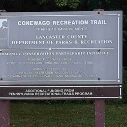
    Conewago Recreation Trail

    Conewago Recreation Trail

    4.3
    (13 reviews)
    11.5 mi

    The Conewago trail is 5 miles long and connects directly to the Lebanon Valley Rail-Trail. The…read moretrail is a crushed stone trail; however, it's apparently old enough that gravels beneath begin to be exposed, making it rough to ride on. Furthermore, not only is the trail narrower than a typical rail trail, sections of it have a surface which is rounded or convex with ditches on both sides. This may make beginning bikers uncomfortable. As well, it could cause a bit of a congestion on a crowded day like today, when a family with a stroller is in the way. Scenery-wise it's also ranked low in my book. It's mostly a wooded scene without much of anything else; making the ride very monotonous and boring.  The trail has to cross Rt. 743 (Hershey Rd) which has heavy traffic but without any light or sign, making it dangerous to cross.  I do appreciate all the trails created by volunteers, but I also want to provide relative ratings based on my experience.  Regretfully, this is one of the lower ranking trails for me.

    Very nice trail, my wife and I rode Thursday morning (31 AUG). We did it out and back 10 miles…read moretotal. Was in town to ride some of the other rail trails as well. While nicely maintained and great environment overall, this trail is not absolutely perfect for bikes. The crown is rather high (smart for water management), so you have to stick to the lanes or disaster would await. There is a mixture of surface, small loose gravel, and some crushed limestone. But with a gravel bike, we were on our Cannondale Topstone's or a hybrid with wider tires (28mm +) it's just fine. There is very slight grade in either direction. It is indeed beautiful. Beware there is a crossing for a Mill road, very steep on both sides, blind curves for cars. Do honor the caution and walk across. Also there are a lot of older & middle aged walkers especially lady dog walkers. Honor the speed limits for you own safety, and don't ride like a jerk and give us all a bad name. We got some tolerant smiles, but we were the only cyclists (did see one woman the day before when we walked a couple miles to check it out.

    Photos
    Nice tree canopy most of trail
    Nice tree canopy most of trail
    The end of the trail- joines LVRT in another county
    The end of the trail- joines LVRT in another county
    Ignore at your peril

    See all

    Ignore at your peril
    PPL Holtwood Environmental Preserve

    PPL Holtwood Environmental Preserve

    4.0
    (2 reviews)
    16.7 mi

    Wow, How do I review this... We wanted to go and hike around…read morepinnacle overlook, so we found some info and went. Boy some parts were great, others....well.. THE VIEW: Spectacular. At the peak, you can look out over a bend in the river and see the whole valley. Its really a cool summit. Its something that you need to see as there arent very many places like it in Lancaster county. HIKING: These are some of the poorest marked trails Ive ever been on. It would be pretty easy to get lost but they are well defined trails. They have 2 separate trails that have red marks, if you can find the mark that is, then you can guess at which one your on. They were faded, hidden behind a bush or non existent. And they have no starting point. Some places put up a sign. They could at least clearly mark a tree to show where it starts. Oh and the map! Talk about a doodling! The trails had forks that werent even on it. We just pick one and hoped for the best. The hike itself was nice tho. Anyway.... Id give it 1.5 stars for hiking trail issues. The view is pretty awesome tho. Check it out just for that!

    Wow, I visited here yesterday with a Meetup hiking group. This place was fantastic. There were…read moreseveral stream crossings since our leader took us off the beaten path a few times. Eventually, we followed the orange trail markers to the pinnacle. You will notice as well there is a parking area as well if you just want to drive up there. However, it's more satisfying trekking up to the top. The view is spectacular and you get a great view of the Susquehanna River. Plenty of wonderful boulders and small waterfalls to see here and photograph.

    Photos
    PPL Holtwood Environmental Preserve
    PPL Holtwood Environmental Preserve
    PPL Holtwood Environmental Preserve

    See all

    The Pinnacle

    The Pinnacle

    5.0
    (15 reviews)
    45.7 mi

    Came here on Sat 10/25 to hike with a couple gf's and brought my doggo, Linc, since it's a dog…read morefriendly trail. I work out but I wasn't ready for this trail as a first time hiker lol! I wore sneakers but would have greatly benefited from hiking boots for more ankle support after slipping and tripping my way along the dense leaf covered dirt trail that continued to get more rocky on the ascent. Also, you will need to climb some legit large rocks/boulders to reach the Pulpit Rock overlook but the challenge was well worth it for the views! My gf's & I chose the easy way down which was to take the gravel road alongside the observatory that eventually transitions to pavement. Even the decline of this road was steep in itself. No easy way up or down haha! I saw people of all ages and fitness levels along my hike and plenty of cute dogs! Bring snacks and water to re-energize during a rest break. My one friend packed some TP and I thought it was a great idea cuz you just never know when you might have to go! Parking lot is a joke with ~20-25 spots but many ppl, including us, parked along Reservoir Rd so make sure to get here early in the morning or expect to walk a couple extra miles just to reach the start of the trail.

    Great spot for a day hike, with beautiful views at the two main lookouts - Pulpit Rock and the…read morePinnacle. The hardest part of the hike is getting to Pulpit Rock, as it starts with a fairly steep road to get to the trail, and then some more elevation climb as you get up to the lookout. From there, it's probably another 2.5 miles or so to get to the Pinnacle, but the elevation gain is minimal. Both of these stops provide great views, with lots of raptors flying around if you're lucky! Bring snacks and water, especially on a hot day, and cameras to take pictures!

    Photos
    Jerico and myself on a pinnacle hiking adventure  Loving life and the gifts God provides
    Jerico and myself on a pinnacle hiking adventure Loving life and the gifts God provides
    Pulpit Rock overlook with my pup
    Pulpit Rock overlook with my pup
    The Pinnacle

    See all

    Chiques Rock Outfitters - boating - Updated August 2026

    Loading...
    Loading...
    Loading...