Delaware Water Gap National Recreation Area Photos


You might also consider

More like Delaware Water Gap National Recreation Area
Recommended Reviews - Delaware Water Gap National Recreation Area
Start your review...


Reviews With Photos


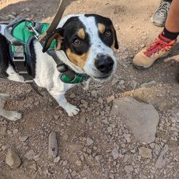
The Delaware Water Gap National Recreation Area is one of my favorite spots in New Jersey. I have visited here during all seasons of the year. Oatie my mini-golden/doodle and I both agree that the Water Gap deserves a 5 star rating. Oatie and I like hiking the Appalachian trail here at the Water Gap. The Appalachian Mountains were formed 200 million years ago when the North American and African plates collided eventually forming the supercontinent called Pangea. The Appalachian Mountains run from central Alabama to Newfoundland some 2,050 miles. Once as high as the Himalayas, they have significantly eroded through the forces of wind and water. Oatie and I pick up the easily marked Appalachian trail at the Mt. Tammany exit off Route 80 west. It's the last exit before entering Pennsylvania. There are other reasons I visit the Gap. There are a lot of photographic, fishing, canoeing, kayaking and white water rafting opportunities. Rivers are cataloged according to how challenging they are. The Colorado is a 5 and the Delaware is a 3. Additionally each section of a river is given a rating from 1-5. The Delaware river does have sections which are rated 5. The Delaware river was once millions of years ago only a series of streams which eroded the limestone, eventually converging and forming the Delaware river and the Delaware Water Gap. The top of the Kittatinny Ridge is 1,200 feet from the top to the river and almost a 1/4 mile wide at the Gap.

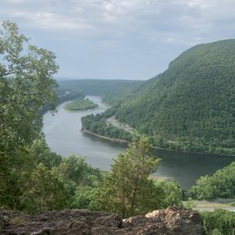
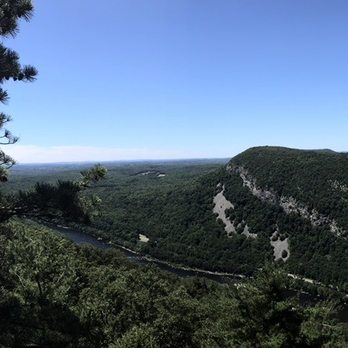
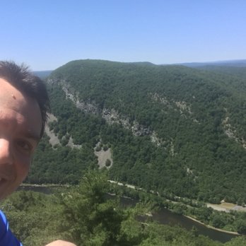
My chum and I come here every two years or so to either hike up Mt. Tammany or to do a hike in the nearby vicinity. Depending on the weather/time of year, it's gorgeous - you're treated to a pretty expansive view of the Delaware River Water Gap on both the NJ and PA sides - and the area by Sunfish Pond is pretty nice too. This isn't in my absolute top tier bucket list hikes of the area, but it's a solid option. We stopped by here last Saturday morning just as the Canadian wildfire drama was starting to dissipate. You could definitely still see its effects at the top of the mountain, with a haze that limited the optics a bit, though the air (hopefully) seemed okay and wasn't noticeably smoky or anything. If you're hoping for a legit parking spot by the trailhead, I'd recommend getting here before 9am and honestly closer to 8am. There are a lot of parking spots on the other side of 80 and it's not THAT long of a walk, but you can't beat the convenience of those first two parking areas right by the highway. There's also a consistent port-a-potty presence, which is a huge selling point. And usually on the weekends there's a few volunteers set up with a card table providing maps and FAQ-type stuff. On this particular day, we just did the 3.6-mile loop going up the red trail to the summit of Mt. Tammany overlooking the Gap, then taking the blue trail shortly thereafter back down, a little further into the woods/Recreation Area. I recently completely a very hardcore Arizona hike so grain of salt; I was in tip-top shape for this and had no issues getting up the mountain. There were definitely some other hikers taking a breather from time to time so depending on your fitness level/skillset, this could be challenging. For someone who regularly does a lot of rugged terrain, up-and-down hiking, I don't personally think this is too nuts - it also helps that it's not that long of a hike to get to the top, at which point it's pretty easy to mosey on back down. Even in its toughest/steepest sections, you're never at the point of rock scrambling or anything dramatic. One downside for me is that this is an insanely popular destination for not just legit hikers (you're bumping up against the AT, so it's not unusual to see backpackers around here) but literally anyone with a functioning pair of legs so the viewpoints are often teeming with hoards of families and large groups out for a quick adventure. I usually like to get a pic by the edge, but I can't recall a time I didn't have to wait at least a few minutes for other people to get their selfie sticks out, etc. A little annoying, but I'm also spoiled by a lot of desolate hikes where I can pretty much do what I want. The other side of the coin though is that you usually have a strong canine chum situation. This one wasn't as good as I would hoping for - maybe some pooches were scared off by the recent smoke - but we did get a nice meet and greet with a young pupper named Finn who literally whined every time his owners stopped because he wanted to keep going. A real trooper. We also saw a wild turkey that wasn't remotely perturbed to be around tons of people, and just casually walked across the trail at one point. Luckily we're not too close to November so I think the danger was minimal for him. The trip back down is pretty pleasant though it's often rocky and you have to be careful of footing issues, even on the driest of days. I'm a big fan of the last stretch of the hike when you get back down from the mountainous section and walk by some very pleasant water sources. There's also a few spots where you can easily wade into the creek and cool off, along with some little wooden bridges and benches. And I'm always impressed that despite the fact that you're right up against Route 80, you don't really hear the highway too often except at the very beginning and end of the adventure. It's popular for a reason. Even with the crowds and chaos that can accompany that, this is a hike worth doing. If you have the option, I'd recommend the fall for the foliage goodness.


Take a hike! See what I did there... Fantasitic and super convenient (when it's really busy in sprint/fall for peak foliage season cars are almost park on the highway) to route 80. Signs up for the turn off which helps make it easier. I've attached a photo of the map of the whole place which is really important and helpful. Typically people do the white/red dot trail to the top of Mt Tammany which I've done a lot. It's got a wonderful pay off view of the mountains, water gap and miles ahead of trees/green! This time I took the white Pahaquarry trail which was not as steep but did have one decent lookout and the pond which is super peaceful and scenic. It can be busy on weekends, especially during Oct and May/June. Parking lots full up but there is signage to others that will be free. Take a couple hours(to hike Mt Tammany) or a couple days and check it all out!


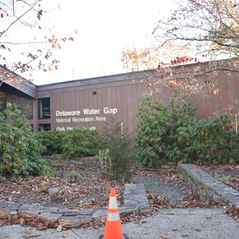
What a beautiful park! We went into the visit center was greeted right away, employees were very friendly. They gave us directions and tips on where to find the waterfalls. I would definitely come back here. Highly recommend!

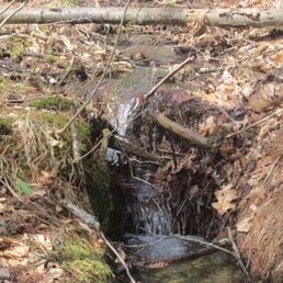
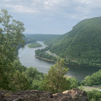
We hiked the red to blue trail at Mt. Tammany. Place was beautiful. A few close parking lots. Definitely a little rough going up. A lot of scrambled but the first viewpoint was awesome and the waterfall at the end of the blue trail was beautiful. We did pass a spot on the way back where people were in tubs , kayaks and it looks like a lot of fun!

There is so, so much to do here that it's really is hard to explain everything. Overall the East is not blessed like the West is in terms of kick ass National Parks. When you think of the great ones you're usually thinking something like Grand Canyon, Yosemite, Yellowstone, Rocky Mountain, Olympic or something of the like. Very rarely outside of maybe Acadia or Shenandoah is something in the East thought of within the same context of visitation, diversity or size. While maybe not as majestic, Delaware Water Gap has you covered in terms of being an outdoor paradise. * Various 18th and 19th century builds to explore * 27 miles of the Appalachian Trail * More than 100 miles of hiking trails * More than 100 miles of scenic roadways * 70,000 acres of forested mountains, river valleys, and fertile floodplains * The spectacular Delaware Water Gap itself * Several areas with waterfalls * Boating * Three in season lifeguarded beaches where you can swim in the river * Fishing * Hunting * A crap load of various ranger led programs through out the year I'm sure there's more that I'm leaving out but if you've made the mistake of reading this far you get the gist. Two funny observations to end with: 1. I'm sure if you come in season on weekends over summer holidays this whole place gets mobbed beyond belief. But, if you come in the off-season even during Spring let alone Winter for the most part you're about as likely to see a bear as you are to see other people. 2. We came last year for Junior Ranger Day which is always on a Saturday in April during National Parks Week and they really do a great job of putting a bunch of activities together for the kids that really shows off a lot of the activities that you can do at Delaware Water Gap. I noticed that it never really got very crowded and the one ranger told me that overall most of their visitors come from the northern NJ/NYC area and that for the most part they get very little visitation/support from the "locals". If true, damn that's sad. If you go: The park has four visitor centers but only the main office in Bushkill, PA stays open year round. The other three only keep in season hours only from May-September. There are a lot of winter closures of various trails, roads, and sub-sections like the George W. Childs Park. Either check their NPS web page or give them a call in the winter to find out if what you want to do is open because chances are it may not be especially if the first significant snow of the year has occurred. www.nps.gov/dewa/planyourvisit/things2do.htm www.nps.gov/dewa/planyourvisit/index.htm www.nps.gov/dewa/planyourvisit/hours.htm www.nps.gov/dewa/planyourvisit/fees.htm


Found the trail via AllTrails App, parking when we arrived was congested. We ended up parking off of the main road. We were directed to park along a road that could fit one vehicle however cars were lined along this road in the grass and partially in the road. If you decide to maneuver up the road, you will find a parking lot at the end of the road. We found this out after parking at the bottom off of the main road, and walking back up. This was a great hiking experience a little different than my prior hikes in that certain parts of the hike reminded us of being in a jungle. We hiked a total of 5.6 miles and as noted the trail go as far as the coast of Maine to Georgia. There were lots of shaded areas which was well appreciated on a hot day. There was a decent amount of foot traffic. We ran into more seasoned hikers with their hiking bags that included sleeping gear. There was a section we came to that required us to climb in order to continue. The return trip was not to appealing (loop). We walked along tons of small rocks, and gravel before finding our way to our initial route.
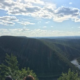
First time hiking Mount Tammany this summer and I am so glad I did! Not knowing exactly what to expect I brought a bag full of water, a small snack and set out for the day. When I arrived the parking lot was very full so i would recommend trying to get there early so you do not have to park across the highway like I did. The trails were rather wide and well kept, but are very rocky in certain areas so wearing a good pair of shoes/hiking boots is a must! There's a wide variety of different terrains to walk on as well as climbing up some rocks to complete the trail, but the view is worth it. I did see some dogs while on my hike, but in my option I would leave small and inexperienced thedogs at home due to the uneven rocky grounds being too rough on their paws depending on the trail you choose. Unknowingly we took the more strenuous trail which at some points going up seemed to never end, but it was absolutely worth it in the end! Would highly recommend this hike to other just be sure to do a little research on the trails and grounds before you start your hike. Also pack lots of water and snacks to keep you going strong! Can't wait to hike it again!
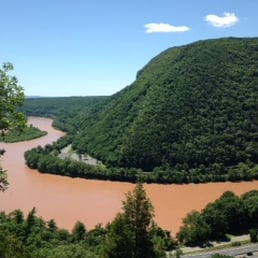

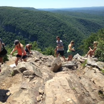
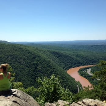
I love this place. There is so much to do, but we went to hike Mount Tammany. This was such an amazing place to hike (some climb) for someone new or intermediary. If climbing Mount Tammany: 1) Take the red trail up. Where you will find some challenging spots. And your hands and feet with come in handy. 2) When you reach up, use the white trail to find the viewing area. 3) Then use the blue trail to come down. Also, there is a small waterfalls there to refresh yourself.
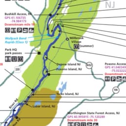

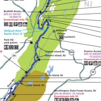
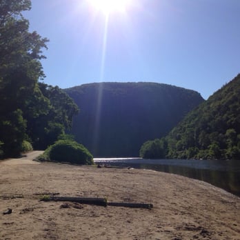
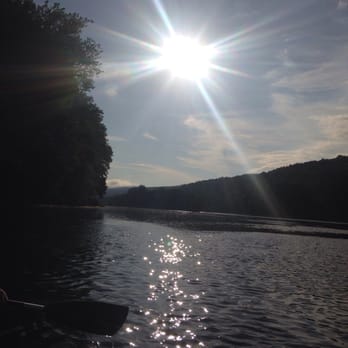
I've been to Worthingtin State Forest for some very picturesque hikes which over looked the river, but this was my first time attacking the Delaware River directly. Our plan was a 20 mile canoe trip (see Adventure Sports review) over two days, stopping about half way to camp over night. Campsites along the Delaware River do not require a reservation, which means it's first come first serve, and if you get there after everyone else, you could be paddling for some time to find an open site. If you're not determined to swim in the river, I'd recommend coming in June as the water is a little bit colder for swimming and thus a little less crowded. We launched from Eshback Access with our end point being Kittatinny Point Access, which is where our car was parked and where the rental company collects your canoe. In terms of River conditions, I couldn't imagine a calmer river; in fact I did wish the river flow was a bit faster as faster water equals less work you have to put in paddling. There was one portion of the trip marked on our map as class one rapids, which had me nervous, until we got there and I realized we have been through one or two areas like this already and it wasn't a big deal. Generally speaking I'd say the part of the river I was on would be good for anyone of any skill level, not challenging and enjoyable, you just have to come prepared to paddle your ass off. I was also pleased by the amount of wildlife we saw: numerous bald eagles and other kinds of hawks, deer, turtles, frogs (heard these at night more than actually saw them), tons of fish, cranes, and ducks. Camping was a mixed bag here. All the campsites are beautiful because your view is of the river, and it really is a beautiful river with a lot of wildlife around. But, there are roads on both sides of the river and in a lot of places (not all spots, but most) it was easy to have the sounds of cars/motorcycles interrupt your tranquility. Each camp site has a number, and each numbered campsite is good for one group. We did find some campsites that were unnumbered on an island, but these sites were poorly maintained and very buggy. The campsite signs are posted on tress and there is usually a little patch of dirt where you can park your canoe. Some of the signs were hard to see because the tress needed a bit of trimming. We stayed at campsite 106 which has a great view of the river, was comfortable, not very buggy, and spacious. Some downsides were there is a fairly popular bike/walking trail about 200/300 ft away, so we had a fair number of people passing by our site. We also could hear the road across the river, but that wasn't too intrusive. Overall this is a great thing to do for a weekend adventure. In terms of canoeing, if you're looking to move at more than a snails pace, find another river (or another part of this river?). In terms of camping, not much privacy here, but the views are great. Overall this is better as a party camping destination because you can bring a lot of stuff to your campsite in your canoe. If you're looking to get away from it all and be secluded in nature, keep looking because you won't find that here.


Super beautiful view! Don't recommend taking kids here, the first half mile of the trail is just rocks that you have to climb. A little bit hard to find; it's right off the highway.


Was looking for someplace to go in the fall and the finger lakes and Lake George were too far away, but gap was only an hour away! Who would think there a place is beautiful so close to home living in Central New Jersey! What makes a Delaware water gap so special in the fall is that there are some large hills here making the foliage extra special! The beauty of this place is incredible, you might feel like you're out west somewhere in the middle of Montana! There's an incredible hiking or biking trail that runs right alongside the Delaware water gap. There's also many absolutely amazing waterfalls in the area! We stayed two nights over a weekend and I felt like I had a great little vacation! Highly recommended if you're looking for a nearby gorgeous spot for nature anytime of the year! If you're like me and live in Central New Jersey, you don't have to go to upstate New York to get that kind of beauty. You can get it right here in Delaware water gap! They have a welcome center with people there that will help you with all your questions and needs for what you're looking for exclamation read more

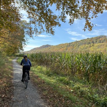

We visited the Delaware Water Gap today, and it was a wonderful experience. This time of year is perfect for exploring the area. If you haven't been here before, I highly recommend it. There are numerous hiking trails, camping spots, and opportunities for photography and kayaking. Plan to spend a few hours to fully enjoy everything this beautiful area has to offer. read more


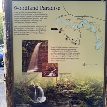


It's a nice place between NJ and PA. The mountains and rivers are breathtaking and lovely, with fresh air. It's an hour's drive from home, where I go to get away from city life. There are many trails where you can see falls and a nice overlook of mountains and rivers. I recommend anyone looking for a place to do outdoor activities. It's near the Poconos mountains and Bushkill Falls. I like to go there to see lovely fall foliage. There is so much to explore in this area. It's also nice to see some deer, too. read more





2 years ago
The Delaware Water Gap National Recreation Area is one of my favorite spots in New Jersey. I have visited here during all seasons of the year. Oatie my mini-golden/doodle and I both agree that the Water Gap deserves a 5 star rating. Oatie and I like hiking the Appalachian trail here at the Water Gap. The Appalachian Mountains were formed 200 million years ago when the North American and African plates collided eventually forming the supercontinent called Pangea. The Appalachian Mountains run from central Alabama to Newfoundland some 2,050 miles. Once as high as the Himalayas, they have significantly eroded through the forces of wind and water. Oatie and I pick up the easily marked Appalachian trail at the Mt. Tammany exit off Route 80 west. It's the last exit before entering Pennsylvania. There are other reasons I visit the Gap. There are a lot of photographic, fishing, canoeing, kayaking and white water rafting opportunities. Rivers are cataloged according to how challenging they are. The Colorado is a 5 and the Delaware is a 3. Additionally each section of a river is given a rating from 1-5. The Delaware river does have sections which are rated 5. The Delaware river was once millions of years ago only a series of streams which eroded the limestone, eventually converging and forming the Delaware river and the Delaware Water Gap. The top of the Kittatinny Ridge is 1,200 feet from the top to the river and almost a 1/4 mile wide at the Gap. read more


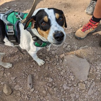
My chum and I come here every two years or so to either hike up Mt. Tammany or to do a hike in the nearby vicinity. Depending on the weather/time of year, it's gorgeous - you're treated to a pretty expansive view of the Delaware River Water Gap on both the NJ and PA sides - and the area by Sunfish Pond is pretty nice too. This isn't in my absolute top tier bucket list hikes of the area, but it's a solid option. We stopped by here last Saturday morning just as the Canadian wildfire drama was starting to dissipate. You could definitely still see its effects at the top of the mountain, with a haze that limited the optics a bit, though the air (hopefully) seemed okay and wasn't noticeably smoky or anything. If you're hoping for a legit parking spot by the trailhead, I'd recommend getting here before 9am and honestly closer to 8am. There are a lot of parking spots on the other side of 80 and it's not THAT long of a walk, but you can't beat the convenience of those first two parking areas right by the highway. There's also a consistent port-a-potty presence, which is a huge selling point. And usually on the weekends there's a few volunteers set up with a card table providing maps and FAQ-type stuff. On this particular day, we just did the 3.6-mile loop going up the red trail to the summit of Mt. Tammany overlooking the Gap, then taking the blue trail shortly thereafter back down, a little further into the woods/Recreation Area. I recently completely a very hardcore Arizona hike so grain of salt; I was in tip-top shape for this and had no issues getting up the mountain. There were definitely some other hikers taking a breather from time to time so depending on your fitness level/skillset, this could be challenging. For someone who regularly does a lot of rugged terrain, up-and-down hiking, I don't personally think this is too nuts - it also helps that it's not that long of a hike to get to the top, at which point it's pretty easy to mosey on back down. Even in its toughest/steepest sections, you're never at the point of rock scrambling or anything dramatic. One downside for me is that this is an insanely popular destination for not just legit hikers (you're bumping up against the AT, so it's not unusual to see backpackers around here) but literally anyone with a functioning pair of legs so the viewpoints are often teeming with hoards of families and large groups out for a quick adventure. I usually like to get a pic by the edge, but I can't recall a time I didn't have to wait at least a few minutes for other people to get their selfie sticks out, etc. A little annoying, but I'm also spoiled by a lot of desolate hikes where I can pretty much do what I want. The other side of the coin though is that you usually have a strong canine chum situation. This one wasn't as good as I would hoping for - maybe some pooches were scared off by the recent smoke - but we did get a nice meet and greet with a young pupper named Finn who literally whined every time his owners stopped because he wanted to keep going. A real trooper. We also saw a wild turkey that wasn't remotely perturbed to be around tons of people, and just casually walked across the trail at one point. Luckily we're not too close to November so I think the danger was minimal for him. The trip back down is pretty pleasant though it's often rocky and you have to be careful of footing issues, even on the driest of days. I'm a big fan of the last stretch of the hike when you get back down from the mountainous section and walk by some very pleasant water sources. There's also a few spots where you can easily wade into the creek and cool off, along with some little wooden bridges and benches. And I'm always impressed that despite the fact that you're right up against Route 80, you don't really hear the highway too often except at the very beginning and end of the adventure. It's popular for a reason. Even with the crowds and chaos that can accompany that, this is a hike worth doing. If you have the option, I'd recommend the fall for the foliage goodness. read more
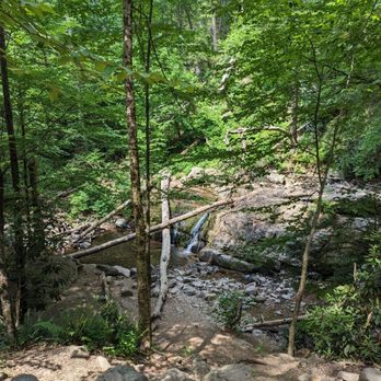


Take a hike! See what I did there... Fantasitic and super convenient (when it's really busy in sprint/fall for peak foliage season cars are almost park on the highway) to route 80. Signs up for the turn off which helps make it easier. I've attached a photo of the map of the whole place which is really important and helpful. Typically people do the white/red dot trail to the top of Mt Tammany which I've done a lot. It's got a wonderful pay off view of the mountains, water gap and miles ahead of trees/green! This time I took the white Pahaquarry trail which was not as steep but did have one decent lookout and the pond which is super peaceful and scenic. It can be busy on weekends, especially during Oct and May/June. Parking lots full up but there is signage to others that will be free. Take a couple hours(to hike Mt Tammany) or a couple days and check it all out! read more





4 years ago
What a beautiful park! We went into the visit center was greeted right away, employees were very friendly. They gave us directions and tips on where to find the waterfalls. I would definitely come back here. Highly recommend! read more


6 years ago

7 years ago

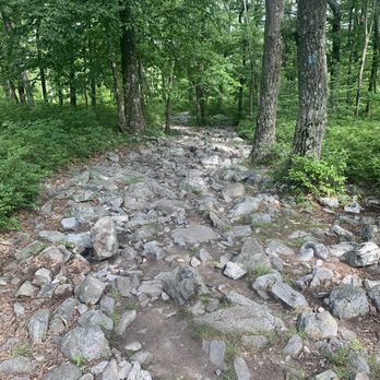
We hiked the red to blue trail at Mt. Tammany. Place was beautiful. A few close parking lots. Definitely a little rough going up. A lot of scrambled but the first viewpoint was awesome and the waterfall at the end of the blue trail was beautiful. We did pass a spot on the way back where people were in tubs , kayaks and it looks like a lot of fun! read more



10 years ago
There is so, so much to do here that it's really is hard to explain everything. Overall the East is not blessed like the West is in terms of kick ass National Parks. When you think of the great ones you're usually thinking something like Grand Canyon, Yosemite, Yellowstone, Rocky Mountain, Olympic or something of the like. Very rarely outside of maybe Acadia or Shenandoah is something in the East thought of within the same context of visitation, diversity or size. While maybe not as majestic, Delaware Water Gap has you covered in terms of being an outdoor paradise. * Various 18th and 19th century builds to explore * 27 miles of the Appalachian Trail * More than 100 miles of hiking trails * More than 100 miles of scenic roadways * 70,000 acres of forested mountains, river valleys, and fertile floodplains * The spectacular Delaware Water Gap itself * Several areas with waterfalls * Boating * Three in season lifeguarded beaches where you can swim in the river * Fishing * Hunting * A crap load of various ranger led programs through out the year I'm sure there's more that I'm leaving out but if you've made the mistake of reading this far you get the gist. Two funny observations to end with: 1. I'm sure if you come in season on weekends over summer holidays this whole place gets mobbed beyond belief. But, if you come in the off-season even during Spring let alone Winter for the most part you're about as likely to see a bear as you are to see other people. 2. We came last year for Junior Ranger Day which is always on a Saturday in April during National Parks Week and they really do a great job of putting a bunch of activities together for the kids that really shows off a lot of the activities that you can do at Delaware Water Gap. I noticed that it never really got very crowded and the one ranger told me that overall most of their visitors come from the northern NJ/NYC area and that for the most part they get very little visitation/support from the "locals". If true, damn that's sad. If you go: The park has four visitor centers but only the main office in Bushkill, PA stays open year round. The other three only keep in season hours only from May-September. There are a lot of winter closures of various trails, roads, and sub-sections like the George W. Childs Park. Either check their NPS web page or give them a call in the winter to find out if what you want to do is open because chances are it may not be especially if the first significant snow of the year has occurred. www.nps.gov/dewa/planyourvisit/things2do.htm www.nps.gov/dewa/planyourvisit/index.htm www.nps.gov/dewa/planyourvisit/hours.htm www.nps.gov/dewa/planyourvisit/fees.htm read more
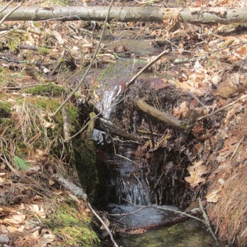


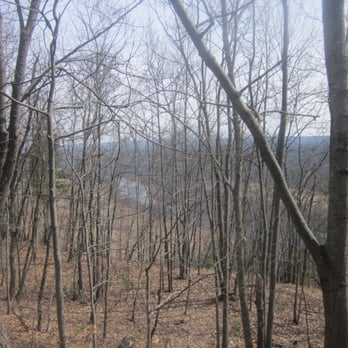


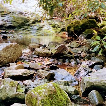
Found the trail via AllTrails App, parking when we arrived was congested. We ended up parking off of the main road. We were directed to park along a road that could fit one vehicle however cars were lined along this road in the grass and partially in the road. If you decide to maneuver up the road, you will find a parking lot at the end of the road. We found this out after parking at the bottom off of the main road, and walking back up. This was a great hiking experience a little different than my prior hikes in that certain parts of the hike reminded us of being in a jungle. We hiked a total of 5.6 miles and as noted the trail go as far as the coast of Maine to Georgia. There were lots of shaded areas which was well appreciated on a hot day. There was a decent amount of foot traffic. We ran into more seasoned hikers with their hiking bags that included sleeping gear. There was a section we came to that required us to climb in order to continue. The return trip was not to appealing (loop). We walked along tons of small rocks, and gravel before finding our way to our initial route. read more





7 years ago
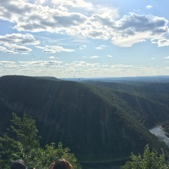
First time hiking Mount Tammany this summer and I am so glad I did! Not knowing exactly what to expect I brought a bag full of water, a small snack and set out for the day. When I arrived the parking lot was very full so i would recommend trying to get there early so you do not have to park across the highway like I did. The trails were rather wide and well kept, but are very rocky in certain areas so wearing a good pair of shoes/hiking boots is a must! There's a wide variety of different terrains to walk on as well as climbing up some rocks to complete the trail, but the view is worth it. I did see some dogs while on my hike, but in my option I would leave small and inexperienced thedogs at home due to the uneven rocky grounds being too rough on their paws depending on the trail you choose. Unknowingly we took the more strenuous trail which at some points going up seemed to never end, but it was absolutely worth it in the end! Would highly recommend this hike to other just be sure to do a little research on the trails and grounds before you start your hike. Also pack lots of water and snacks to keep you going strong! Can't wait to hike it again! read more


4 years ago

12 years ago
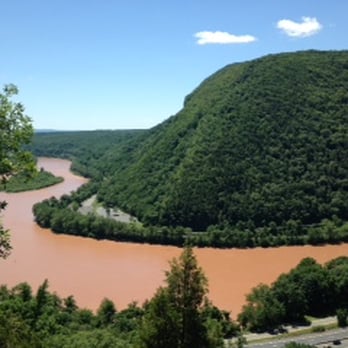
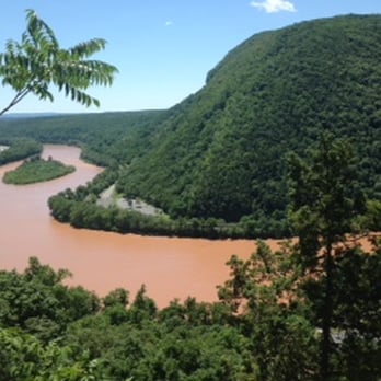
I love this place. There is so much to do, but we went to hike Mount Tammany. This was such an amazing place to hike (some climb) for someone new or intermediary. If climbing Mount Tammany: 1) Take the red trail up. Where you will find some challenging spots. And your hands and feet with come in handy. 2) When you reach up, use the white trail to find the viewing area. 3) Then use the blue trail to come down. Also, there is a small waterfalls there to refresh yourself. read more






13 years ago

7 years ago

I've been to Worthingtin State Forest for some very picturesque hikes which over looked the river, but this was my first time attacking the Delaware River directly. Our plan was a 20 mile canoe trip (see Adventure Sports review) over two days, stopping about half way to camp over night. Campsites along the Delaware River do not require a reservation, which means it's first come first serve, and if you get there after everyone else, you could be paddling for some time to find an open site. If you're not determined to swim in the river, I'd recommend coming in June as the water is a little bit colder for swimming and thus a little less crowded. We launched from Eshback Access with our end point being Kittatinny Point Access, which is where our car was parked and where the rental company collects your canoe. In terms of River conditions, I couldn't imagine a calmer river; in fact I did wish the river flow was a bit faster as faster water equals less work you have to put in paddling. There was one portion of the trip marked on our map as class one rapids, which had me nervous, until we got there and I realized we have been through one or two areas like this already and it wasn't a big deal. Generally speaking I'd say the part of the river I was on would be good for anyone of any skill level, not challenging and enjoyable, you just have to come prepared to paddle your ass off. I was also pleased by the amount of wildlife we saw: numerous bald eagles and other kinds of hawks, deer, turtles, frogs (heard these at night more than actually saw them), tons of fish, cranes, and ducks. Camping was a mixed bag here. All the campsites are beautiful because your view is of the river, and it really is a beautiful river with a lot of wildlife around. But, there are roads on both sides of the river and in a lot of places (not all spots, but most) it was easy to have the sounds of cars/motorcycles interrupt your tranquility. Each camp site has a number, and each numbered campsite is good for one group. We did find some campsites that were unnumbered on an island, but these sites were poorly maintained and very buggy. The campsite signs are posted on tress and there is usually a little patch of dirt where you can park your canoe. Some of the signs were hard to see because the tress needed a bit of trimming. We stayed at campsite 106 which has a great view of the river, was comfortable, not very buggy, and spacious. Some downsides were there is a fairly popular bike/walking trail about 200/300 ft away, so we had a fair number of people passing by our site. We also could hear the road across the river, but that wasn't too intrusive. Overall this is a great thing to do for a weekend adventure. In terms of canoeing, if you're looking to move at more than a snails pace, find another river (or another part of this river?). In terms of camping, not much privacy here, but the views are great. Overall this is better as a party camping destination because you can bring a lot of stuff to your campsite in your canoe. If you're looking to get away from it all and be secluded in nature, keep looking because you won't find that here. read more





8 years ago
Super beautiful view! Don't recommend taking kids here, the first half mile of the trail is just rocks that you have to climb. A little bit hard to find; it's right off the highway. read more


8 years ago
I had the opportunity to enjoy the trails this time in PA I drove for the209 North to Milford Beach and after a great long ride in my bike I jump in to the water so nice place, you have to pay $10 for the parking but it really worth it read more


12 years ago

15 years ago

14 years ago
Beautiful area with great trails and amazing scenery. The Kittatinny Point Visitors Center has trail maps and information about the area. It's Exit 1 on 80 in NJ but was hard for us to find because it isn't marked as well as you would think and my gps didn't recognize the Visitors Center. Just look for an exit on the right (if heading West) for hiking trails and the road will take you under 80 to the other side of the road for the Visitors Center. Even if you don't have time for a hike it's worth a stop. read more


7 years ago

10 years ago
We hiked up Mount Tammany. We went up the red dot and down the blue dot. The red dot trail is difficult at some parts but moderate in general. Would definitely recommend this hike. It's a challenging and rewarding one. The views from the top was gorgeous. Parking is filled up quite fast so you have to arrive there early in the morning. Ask the visitor center for a map and direction to the entrance of the trail. read more


12 years ago
Favorite place to go hiking! Amazing views at Mt. Tammany overlook, pretty falls, great trails. Just a perfect place overall to go hiking. Porta potties available, parking lots plenty, kayak launch areas also! Just overall a must do and see if in the area. read more


15 years ago

12 years ago


15 years ago
11 years ago

12 years ago
More info about Delaware Water Gap National Recreation Area
Ask the Community - Delaware Water Gap National Recreation Area
Review Highlights - Delaware Water Gap National Recreation Area












Why does Yelp recommend reviews?


Delaware Water Gap National Recreation Area - parks - Updated September 2026
Best of Bushkill
People found Delaware Water Gap National Recreation Area by searching for…
Hiking Trails With Waterfalls in Bushkill, PA
Scenic Overlook in Bushkill, PA
Off Road Trails in Bushkill, PA
Waterfalls and Swimming Holes in Bushkill, PA
Swimming Lakes in Bushkill, PA
Running Trails in Bushkill, PA
Secluded Spots in Bushkill, PA
Pick Up Basketball in Bushkill, PA
Browse Nearby
BEST of Bushkill, Pennsylvania Coffee near Delaware Water Gap National Recreation Area
BEST of Bushkill, Pennsylvania Restaurants near Delaware Water Gap National Recreation Area
BEST of Bushkill, Pennsylvania Things to Do near Delaware Water Gap National Recreation Area
BEST of Bushkill, Pennsylvania Hiking near Delaware Water Gap National Recreation Area
BEST of Bushkill, Pennsylvania Shopping near Delaware Water Gap National Recreation Area
BEST of Bushkill, Pennsylvania Breakfast near Delaware Water Gap National Recreation Area
BEST of Bushkill, Pennsylvania Snow Tubing near Delaware Water Gap National Recreation Area
BEST of Bushkill, Pennsylvania Resorts near Delaware Water Gap National Recreation Area


