Cancel

    Open app

    Search

    Drumheller Channels National Natural Landmark

    5.0 (4 reviews)

    Drumheller Channels National Natural Landmark Photos

    More like Drumheller Channels National Natural Landmark

    Recommended Reviews - Drumheller Channels National Natural Landmark

    Your trust is our priority, so businesses can't pay to alter or remove their reviews. Learn more about reviews.
    Yelp app icon
    Browse more easily on the app
    Review Feed Illustration
    Photo of Yara M.
    44
    56
    50

    2 years ago

    Helpful 0
    Thanks 1
    Love this 0
    Oh no 0
    Photo of Tanis L.
    283
    1057
    6362

    6 years ago

    Helpful 0
    Thanks 0
    Love this 0
    Oh no 0

    4 years ago

    Helpful 1
    Thanks 0
    Love this 0
    Oh no 1

    2 years ago

    Helpful 0
    Thanks 0
    Love this 0
    Oh no 0

    Verify this business for free

    Get access to customer & competitor insights.

    Verify this business

    Manhattan Project B Reactor Tours - All these signs are hand painted

    Manhattan Project B Reactor Tours

    4.9(14 reviews)
    40.4 mi

    Wow, this tour is AMAZING. It starts with a 15 minute video at the visitor center which explains…read morethe background of the geopolitical climate that prompted the construction of the reactor. It is the first large-scale nuclear reactor ever built, taking uranium and converting it into plutonium-239 (used in the Trinity test in New Mexico and the Fat Man bomb dropped on Nagasaki, Japan). Then there is a 45 minute bus ride to the B reactor itself (try to avail yourself of the restrooms at the visitor center, but there's a tour bus bathroom and port-a-potties at the reactor itself). The bus ride flew by as the docent talked about the area and his own experience as an engineer. Very engrossing. As you enter, there's another short presentation by a docent explaining the physics behind the reactor, and then you're set loose. There are also small docent-led presentations at specified times too if you want to get more into the nitty-gritty of the design and operation of the reactor. I wish I had more time at the reactor, maybe 15 more minutes, since there was so much to see and read. The exhibits were so well done!

    Definitely worth a visit, though most of the buildings that once were on the site at the height of…read moreHanford's operations are no longer there. Everything went on schedule as described. The bus is a comfy coach and the 45 minute ride to the actual Reactor B is enlivened by the tour guide's info about the history and geology of the area, as well as providing background on the construction and challenges of putting together the entire site so quickly. Free bottled water is provided at the site, and there's a good mix of short talks by guides (about 15 minutes or so each) and time to walk around, read info on exhibits, and take photos. Visitor Center is clean, with chairs inside for waiting as well as benches outside. Because we'd driven almost 3 hours to the site, we took advantage of a shady bench to have our lunch. The timing of the 11:45am tour means you'll want to get something to eat before setting off, because you won't return to the Visitor Center for about 4 hours (and there is no food to purchase at the Center, and no food allowed inside the Reactor B building). There is, however, a place to eat next door to the Visitor Center (The Dive) where I can at least confirm that the beer and onion rings are excellent. We got lucky and had a relatively cool (80 degrees) day. Bathrooms at the actual park site (the reactor) are limited to portable toilets, but again, all the info presented from registration to the actual tour were clear, informative, and well done.

    Photos
    Manhattan Project B Reactor Tours - Building where the tour starts.

    Building where the tour starts.

    Manhattan Project B Reactor Tours - Display of materials and parts in the reactor

    Display of materials and parts in the reactor

    Manhattan Project B Reactor Tours - Exterior of the reactor

    See all

    Exterior of the reactor

    I-90 Vantage Bridge

    I-90 Vantage Bridge

    4.4(5 reviews)
    31.6 mi

    heading down to the coast for a night of racing and come upon this ridiculous thing in the middle…read moreof the desert. don't get me wrong, I've bridged up here a lot but this span is in its own league entirely... besides being a half-mile long ramp across the river it's got twisty turns on the other end feeding in or leading out or just driving past on Rte 26 heading to Tacoma and by the time I realize how cool it is there's no place to pull over and have a look until next time (getting turned around counts as next time) and realizing there's way too many spots to get a better look at the bridge and sometimes it takes two or several passes which is kind of a good problem to have... totally digging the man-gates on the richland side; the stunted brush and broken terrain brings odd notions about what went on here before the fences got staked... enjoy :-)

    Holy smokes, what a great view! But holy smokes, the wind nearly blew me off the bridge!…read more The Vantage Bridge is the second one at this location, which carries Interstate 90 over the Columbia River and joins Vantage with George (and who was clever to name their town George in the state of Washington?). This section of the river is the Wanapum Lake that is formed by the Wanapum Dam that you can't see from the bridge but it's there. This type of bridge is a "through arch bridge" and it has a total length of 2504 feet. It was dedicated in 1962 and is in great condition considering it is 60 years old. There is a "scenic view" spot on the east bank where you can get a great view of the bridge. It was so windy up there that I could barely stand! [Review 17107 overall - 95 in Washington - 623 of 2022.]

    Photos
    I-90 Vantage Bridge
    I-90 Vantage Bridge
    I-90 Vantage Bridge

    See all

    Ancient Lakes

    Ancient Lakes

    4.0(5 reviews)
    37.4 mi

    It's not the landscape, the wildlife, the trails or the views. It's the people. Most are…read moreperfectly fine and are out there to camp, hike, and fish for the sake of the activities. However, there is a percentage that is there because it's free and remote while still being accessible to a town where they can get their drug of choice. You'll recognize them by the ancient, filthy, motorhomes. My son was hiking with his girlfriend when they were approached by one of these "campers" who asked if they had any fentanyl to sell! Wow! Is there no where to escape this scrounge? Anywhere?

    Mileage: estimated about 10 miles total (2 miles to where we set up our tents, then we hiked a loop…read moreof about 6 miles, then 2 miles back to the car the next day) Backpacked: April 16-17, 2016 This past weekend a group of us did an overnight backpack trek to Ancient Lakes. 3 first timers backpacking and it turned out to be an awesome trip! We had some problems trying to find directions out to the place, so here's directions from my personal experience. Directions: we stayed in Quincy the night before, so we took the 28 to Whitetail Road. Made a left on Whitetail from the 28, then a right on road 9 NW. follow road 9 NW and it turns into Ancient Lakes Rd NW. At the end of the road, you'll find the west parking lot. I am not sure how to get to the east parking lot. There's a lot of parking here, when we got there by 11 am, it was really crowded but we still found a spot. (When you are on Whitetail Rd, it might look like you are just driving through farms, but buried in there, there's Ancient Lakes!) There is a port-o-potty at the trail head on the west side. Trail head: is well marked, we hiked in about 2 miles and got to the lakes and the rolling grass area where you can set up tent where ever. There are some man made fire rings scattered through out the area. Hiking: After we picked a spot and set up camp, we hiked a loop around the lakes. We started towards the waterfall. It was a scramble up the side of the waterfall, like a class 4 rock scramble lol. Loose rocks, loose footing. From there, we went pass that waterfall and onto the backside where the east parking lot is. Which there's another waterfall there, and there's also camp spots there too. We looped around, it wasn't too hard. We estimated this part of the hike to be around 6 miles round trip back to our tents. Lots of people camping, we counted about 50 tents, then you estimate about 2/per tent, so like 100 people were out here! But you still are able to find solitude. We came across 3 snakes, an owl, and a marmot. Easy trek, not very hilly at all. Good for first time backpackers. The area can be explored in a day. I found this site useful: https://www.theoutbound.com/washington/backpacking/ancient-lakes-day-hike-or-backpack

    Photos
    Ancient Lakes - Lovely weeds

    Lovely weeds

    Ancient Lakes - More lovely weeds

    More lovely weeds

    Ancient Lakes - Dusty Lake trailhead

    See all

    Dusty Lake trailhead

    Hanford Reach - Birdie enjoying the rocks with me.

    Hanford Reach

    5.0(1 review)
    50.7 mi

    Hanford Reach National Monument is a beautiful area abundant with distinguishing natural landmarks…read more The monument is broken up into a number of different sections, termed units, with different access availabilities. Something to check out in advance if you are thinking of going. Highway 24 (WA-24) makes its way through some of the monument and there are occasional informational/interpretive signs alongside the highway in pullouts. The monument forms a roughly horseshoe shape around the Hanford Nuclear Site a Department of Energy (DOE) site. The importance of the Hanford Reach National Monument is highlighted through the signs providing integrated background of the area and the nuclear site utility locally and in human history. Provides a sobering reminder that the manufacturing and building of man-made structures and technologies, including nuclear reactors, need to be offset with the preservation of areas of pure nature to sustain life on Earth. If the prospect of high radiation doses makes you faint just thinking about it, then it may be best you don't come to a place like this. My work has brought me into the world of nuclear physics more than once and for me fear mongering tactics have long since worn off. Some things aren't so scary when you get to know it/them. I chose to drive out to the White Bluffs Lookout area and the road to the area was gravel and several miles long. The turn-off to this road is located near milepost 63.2 on Highway 24. My car ended up getting rather dusty by the time we made it to the parking lot. I saw only one other car while I was there, a maintenance vehicle. The interpretive signs help provide social and historical context for the monument and are worth a read no matter how familiar you are with the topics presented. A closed road, which one can walk, runs along some spectacular rock outcrops. I chose to eat my packed lunch along the side of this road after walking a little ways. After lunch I did a little bird watching and returned to my car. Very windy on my visit on the 12th of August 2020.

    Photos
    Hanford Reach - Dust accumulated by the time I reached the White Bluffs Overlook parking lot.

    Dust accumulated by the time I reached the White Bluffs Overlook parking lot.

    Hanford Reach - Nuclear reactor just past the Columbia River.

    Nuclear reactor just past the Columbia River.

    Hanford Reach - The dusty drive along the gravel road continues, 8 miles to go.

    See all

    The dusty drive along the gravel road continues, 8 miles to go.

    Blue Bridge - blue, not green...

    Blue Bridge

    3.4(14 reviews)
    50.2 mi

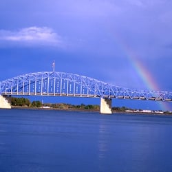
    it's a bridge! and it's blue! and the official name 'Pioneer Memorial Bridge' never had a chance…read more it's not really a bad bridge but it's not really noteworthy either except that it was originally green like the Green Bridge that it replaced and now it's blue. and now the Blue Bridge is about gonna get a fresh coat of blue! the project started some six years ago and work just recently resumed after a years-long hiatus just in time to spoil the commute for thousands of people in the tri-cities area for about fifteen more months. yea!? clocking in a little over 2500 feet from the tips the Blue Bridge caries Route 395 and a much maligned pedestrian way across the Columbia River from Kennewick to Pasco and back. like almost every bridge in the world it is not up to handling the amount of traffic it sees but if y'all drive nice, move over early, and learn to zipper-merge it should work okay for a while longer :-)

    A bridge builder once told my uncle and I in Idaho the taller you build it the more likely people…read morewill commit suicide on it (it was a lot dirtier than that but I cleaned it up for Yelp). Now this bridge isn't tall like the one's those peeps are looking for but the jump still isn't pain free unless the dive is perfect. However with that said if you're a good climber you can reach that sexy red/white/blue USA flag on top before plummeting towards the frigid Columbia Blue. Finally, the bridge is like a D- for safety so make sure you don't fall through like the bridge on I-5 in Western WA.

    Photos
    Blue Bridge
    Blue Bridge
    Blue Bridge - Rivers edge

    See all

    Rivers edge

    Ice Harbor Dam - Getting ready to lock through heading up river.

    Ice Harbor Dam

    4.5(2 reviews)
    49.6 mi

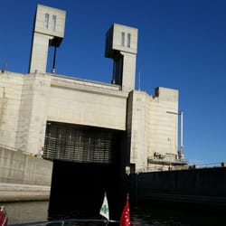
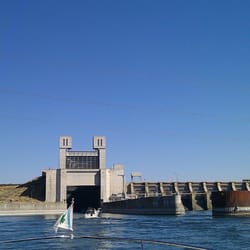
    It looks like you are in a space without offices or a traditional entry. You will need to enter…read morethru a revolving gate entry, and a security guard will meet you there. If you are 18 or over, please have your government issued photo ID available to enter the visitor's center. The visitor center is awesome! Lots of literature and pictures documenting the lock and dam. Be sure to checkout the fish ladders when entering. This experience starts the curiosity to want more information. The greeter is happy to see people and ready to share information. The facility is clean and ready for guests. This establishment has a lot of history and information to share, and we are excited to have this place available for future resourcing. If you want to learn more about Hydro-power and renewable resources, this is your place! No fees required to enter.

    You know, it's not bad, especially for a free exhibit. I would say that the view of the dam from…read morethe outside is more impressive than anything on the inside, but it's still work taking a look. The interior has a view of the fish ladder where you can look at fish through the window and also see the current fish counts (yes, they count every single one, separated by species!). It also has a bunch of historical and informational stuff. However, the strangest thing about the dam is that the entire exterior is controlled by these rather large orb web spiders. No cameras and phones are allowed in the facility, so there's no way to ever get any proof, but I theorize that the humans that work there are actually automatons controlled by these overlords. They're designed to be very friendly and actually rather convincing at times, but I'm pretty sure I know what's gong on here. One visit is plenty for me, but I do think that everyone should see it once -- just don't offend the spiders because there's no doubt that they're the ones that head this operation.

    Photos
    Ice Harbor Dam - Dam!

    See all

    Dam!

    Gold Coast Historic District aka Alphabet Housing - I live in an F House

    Gold Coast Historic District aka Alphabet Housing

    4.5(2 reviews)
    42.7 mi

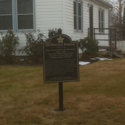
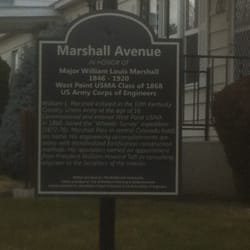
    It's not comparable to neighborhoods like the French Quarter (New Orleans), Beacon Hill (Boston),…read moreor the Jersey Shore, but who woulda thunk MY neighborhood here in Richland, WA was a "Historic District". But my neighborhood of Alphabet Houses surely has a history tied to this country, and it is kind of cool to put your residence in a historical context. Now, what drove me to write this Yelp was my noticing of historic signs popping up on Van Giesen during my drives to work in the morn. One by one, I started to see little black signs magically appear on the corners of various streets: McPherson Ave, Marshall Ave, Warren Ct, Mahan Ave, etc. Now these signs are due to the effort of a local group honoring veterans, so isn't totally Historic District-related, but it certainly helps for telling the stories history. As for the Alphabet housing. During the war effort of World War II, the small farming of town transformed from a small farming town to a metropolis of secrecy (fuel for the first atomic bombs were built on the Hanford Site). Richland Population: 1943: 500 1945: 25,000 (!!) The huge change in population needed to be handled quickly. Yes, many soldiers were housed in tents and temporary barracks, but scientists, technicians, and management (along with their families), needed honest to goodness homes. An architect from Spokane was given 90 days to design homes and neighborhoods for the huge influx of people: enter the alphabet houses (http://www.yelp.com/biz_photos/z_1wFu2h3fGTsjBo6jfv2A?select=TfltN_vfiTmYtBImYep2tg). Each home design was assigned a letter (hence the term "alphabet houses"). The houses range from tiny 1-bedroom houses to huge two-story duplexes. (for the record, I live in a 2-story 3bedroom, home known affectionately as an F-House). It's over a half century later, and many of these houses are still around and generally in their original state. Some areas of the district are quaint and DO look historical, but other neighborhoods do look a wee bit ghetto (like my 'hood!). This is home, and it's nice to know the history behind the area. If you ever get the chance, you should drop by the CREHST Museum (http://www.yelp.com/biz/crehst-museum-richland). There's a cool exhibit about the Alphabet Houses.

    The alphabet housing "district" in Richland is interesting to say the least - the new small metal…read moresigns giving some history about the street names are neat, but unless you go on a walking tour of the area I can't see how you would read them. This part of town is probably the least expensive part of northern Richland, the houses have been remodeled and modified, a least most of them have, but the area still retains its unique vibe.

    Photos
    Gold Coast Historic District aka Alphabet Housing - McPherson Ave History

    McPherson Ave History

    Gold Coast Historic District aka Alphabet Housing - Mahan Ave History

    Mahan Ave History

    Gold Coast Historic District aka Alphabet Housing - Marshall Ave History

    See all

    Marshall Ave History

    Cable Bridge - meh...

    Cable Bridge

    4.2(6 reviews)
    48.3 mi

    an affront to the senses since 1978 the Ed Hendler Bridge connects Kennewick to Pasco in the worst…read morepossible way. when it was dedicated it was the first major cable stayed bridge in the United States and the second longest in the world coming in at just over 2500 feet long and carrying Washington 379 some 50 feet above the Columbia River. adding insult to injury the last bit of the way cooler looking cantilevered Green Bridge (officially: the Pasco-Kennewick Bridge) that it "replaced" sits as a viewing platform beside. it's not too horrible for a cable stayed bridge but I wouldn't want it in my backyard...

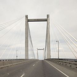
    The Cable Bridge, officially called the Ed Hendler Bridge and sometimes the Intercity Bridge, spans…read morethe Columbia River between Pasco and Kennewick as State Route 397. It was constructed in 1978 and replaced the Pasco-Kennewick Bridge, an earlier span built in 1922 and demolished in 1990. I not only crossed this bridge, but got to see it up close from a boat on the Columbia River (in and out from Clover Island). The "cable stayed" design is quite a sight to see and admire. The Cable Bridge, from the time of its opening, has proved to be a popular landmark in the Tri-City area, so much so it has become an unofficial symbol of the area. The Bridge is lit up at night, and there's an annual Cable Bridge Run across the span. At the foot of the Kennewick end is the Tri-Cities Vietnam Veterans Memorial. The remaining pier of the old Pasco-Kennewick bridge now serves as a scenic lookout, from which one can view its successor bridge.

    Photos
    Cable Bridge
    Cable Bridge
    Cable Bridge

    See all

    Drumheller Channels National Natural Landmark - landmarks - Updated July 2026

    Loading...
    Loading...
    Loading...