Cancel

    Open app

    Search

    Eagle Ridge Trail

    4.0 (1 review)

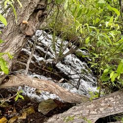
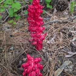
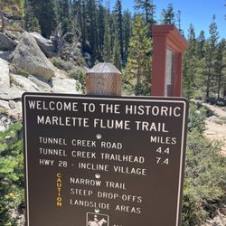
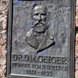
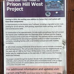
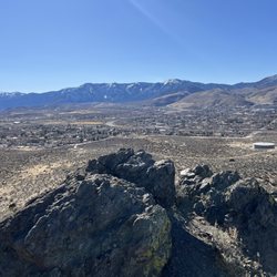
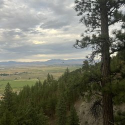
    Eagle Ridge Trail Photos

    You might also consider

    Recommended Reviews - Eagle Ridge Trail

    Your trust is our priority, so businesses can't pay to alter or remove their reviews. Learn more about reviews.
    Yelp app icon
    Browse more easily on the app
    Review Feed Illustration

    2 years ago

    Helpful 2
    Thanks 0
    Love this 1
    Oh no 0

    You might also consider

    Verify this business for free

    People searched for Hiking 1,046 times last month within 15 miles of this business.

    Verify this business

    Mount Tallac Trail - A cool stretch of forest running along a plateau above Fallen Leaf Lake. Awesome section of the trail.

    Mount Tallac Trail

    4.7(91 reviews)
    12.0 mi

    Helluva hike, we're talking a 3500 foot or so vertical rise over a 10 mile or so hike, with most of…read moreit near the end. The vertical rise isn't the only obstacle, also much of the trail is very rocky or even nothing but rocks. That the rockiness isn't as much of a tax as the vertical rise, is proven by how easy it is to return compared to going up! Appreciate that we saw no trash along the trail, so people are respectful. One person had left a doggy bag of doo doo right by the trail, which is a no no - supposed to bury it at least 200 feet from the trail! And per the Desolation Wilderness rules, dogs should be controlled, meaning on a leash, not running around. We did the hike in late July which was about perfect. Not overly warm that day, and even rained a tad for about an hour. For long periods we could not see another human being anywhere even in the distance. Be sure to bring plenty of water and some food. We brought water but no food and this made the hike even more taxing, but we muddled on somehow. Parking is free. You'll also need to pick up a free self-serve wilderness permit for day hikes at the trailhead. Just fill it out with the pen that is attached to the box, drop half into the box and retain the other half with you during the hike.
    Not a destination hike in my opinion but great views and a mixed, scenic hike…read more First, know that the trail itself is a majority of crushed rock. Pebbles. Fist sized rocks. Rock shards. Sandy rock and so forth. It gets exhausting when there's a little slip with almost every step down and every step off. On a hot day the hike to the summit is killer. There is almost no shade. Effective oxygen content in the air is about 15-16% compared to sea level of 21%. Its still doable, but less enjoyable when you're more winded, especially in the dry climate. A couple sources of fresh water not too far from the trailhead but I'd highly suggest packing in a couple/few liters for the last 4 hours or so to the summit and back. Trail is busy and mid-day will feature large groups. Arrive early and catch the sunrise over Lake Tahoe and Fallen Leaf Lake Views at the summit are awesome and the rock formations are super cool. I'd suggest going to the summit, down to Gilmore lake, then cutting across to make a loop before re-connecting for the trail back. The walk down to Gilmore Lake was gorgeous, as was cutting across at the same elevation through the meadows and forest. Hike back down the rocky section (2 hours) sucked because of the loose rock but dreams of home and flush toilets will keep you moving. Overall, really glad I did this hike but would try to find something with better terrain next time.

    Photos
    Mount Tallac Trail
    Mount Tallac Trail
    Mount Tallac Trail - Sunrise over Tahoe

    See all

    Sunrise over Tahoe

    DL Bliss State Park - A little teepee for my bunghole.

    DL Bliss State Park

    3.9(119 reviews)
    14.3 mi

    My 2000th review!…read more Reasons we selected BLISS 1. Central Location: close to Emerald Bay. Relatively close to Eagle Falls, Glen Alpine Falls and 33-minute drive to both south to Stateline and north to Tahoe City in case you want to treat yourself to a restaurant or bathrooms where moths won't watch you poop. 2. Known for their clear sandy* beachfront with almost unrealistically flat movie-set views and shallow, clear water. When we went there were more geese in the water than people. A perfect bike ride from the Pines campgrounds, though walkable. [*Sandy = tiny rocks that looks like sand but feel like dungeons and dragons dice.] 3. Easy access to Lighthouse (highest elevation lighthouse in US), Rubicon, and Balanced Rock trails. DL Bliss has 4 pines areas and 1 beach area. The beach area is not directly on the beach, nor does it have a beach view, and the area seemed more tightly packed with smaller spots and filled with more loud people (shirtless bros, families with unsupervised kids with the camping apps, TikTokers doin' it for the 'Gram), so I am kinda glad my reservation did not go through. Our cheaper Pines area was very spacious, shaded, and peaceful, except for someone who was blasting "We Are The World" for a hot two minutes. I think someone finally approached them. Let us realize that a change can only come when we stand together as one, Things you might want to bring: firewood (they charge $10 cash upon check-in and don't allow wood gathering), bug spray, and eye mask (the nearby bathroom lights were bright). But don't just take my word for it: #1 of 9 Best Campgrounds at South Lake Tahoe, CA Lana Law, PlanetWare, 2022 #1 Best campgrounds for hitting popular attractions TentCampingTrips #1 of 5 Tahoe Campgrounds Near the Water Christina Nelleman, 7x7, 2014 #2 of 10 Best Lake Tahoe Campgrounds CampsitePhotos, 2022 #2 of Best Camping in Tahoe: 12 Scenic Tahoe Campgrounds Laura Gray, California Crossroads, 2022 #2 The Best Camping in Lake Tahoe FoxInTheForest,2020 #2 in South Lake Tahoe RV Parks and Campgrounds Jamie Cattanach, RVShare, 2021 #6 of 8 Best Lake Tahoe Camping VacationIdea, 2022 #9 of 11 of the best Lake Tahoe camping spots to visit Emily Price, SFGate, 2022

    Hiking during the pandemic and during the smoky skies from the forest fires in September!…read more Arrived to Lake Tahoe over the Labor Day Weekend, having made reservations 6 months in advance in South Lake Tahoe, only to find the place packed to the rafters with tourists during the holiday weekend, and smoky skies from forest fires north of Fresno 170 miles to the south. Break in the smoky skies on the last full day of our week stay. Drove into DL Bliss State Park entrance at 8am, and paid the $10 entry fee with our credit card. Missed the entrance to the parking lot to the Lighthouse trail on the right hand side next to the entrance. Drove 3 miles at the 15mph speed limit along a one and a half lane beautifully paved road, through picturesque forests and ugly campgrounds. We rode into the Calawee Cove beach parking lot, getting the last available parking spot. 15 parking spots total, with 14 parked vehicles, including a small Lexus crossover taking up two of the 5 parallel spots! Flush toilet bathrooms here for pit stops and changing in and out of swim suits for going to the beach just below. We are equipped with high top hiking boots, hiking poles, 40 ounces of water, lunch, hats, and face masks. Most of the people we encounter are wearing sneakers, with a few in hiking sandals, and not wearing masks. A lady driving a Subaru Forester comes in a few minutes after us, checks out the too small an opening in front of the Lexus, rolls her eyes, and takes off for another parking lot 200 yards up the road. We are at the northern tip of the Rubicon trail, which goes 4.5 miles to Vikingsholm, or 6.5 miles to the Emerald Bay State Park. Sign at start of the trail says no dogs and no bikes. Narrow trail, single file in many places, wouldn't want to step in your dog droppings that you were too lazy to pick up! Stairs in places, with climbing over boulders on occasion. 6000 feet altitude at lake level. The first mile here is like climbing stairs over a beautiful lakeside trail, rising higher and higher over the deep blue waters, through the green forests. Areas where there are safety railings, due to cliff like overhangs. Periodic vista points, where the trail widens, but no bathrooms, and no cover for going in the bushes. The trail gradually goes inland, away from the lake, through the forests, one area of dying forests -fire in the past? Sandy dirt trail in the forests, hard gravel rising above the lake. Up and down like a yoyo goes the trail. No animals in sight, except for birds, with plenty of yellow jackets hanging around. 2.5 miles into the hike we come back to the lake along the path, across two streams, and stop on a series of granite boulders overlooking the lake. Emerald Bay just around the corner, with the dark blue lake turning green in the shallower waters. Motor boats speeding along the waters, their wakes rippling along the surface of the otherwise deep blue waters. Loud music from a few boats, with boats congregating along the shore for swimming and sunbathing on the rocks next to the waters. One lady in her 20s hikes in Chako hiking sandals, and goes off the trail through the narrowest of paths downhill to the bottom right next to the lake, to be picked up by a guy in a kayak. We turn around at about 2.5 miles , the halfway point to Vikingsholm, which is closed for the entire year due to the pandemic. 4 hours and 5 miles after starting, we are back to our parking lot. Wife checks out the Calawee Cove beach below, wading in the waters briefly, before coming back to our car. A full size extended cab pickup truck parks right in one of the parallel spots, but it's rear end still sticks over 2 feet into the next spot -first time I've seen a vehicle longer than a parking spot. An SUV lets out a group of men and waits. The lady driver asks us in a Russian accent if we are leaving, and is overjoyed with her good luck, when we say yes. As we exit the state park, there is a sign on the entrance saying "Beach Parking Lots Full". Next time will park outside the park entrance trying to save the $10 fee, and hike directly to the entrance to the Lighthouse trail, some 300 yards from the entrance. 1000th review, and hopefully there won't be more than one 1000th review, given the number of my reviews removed by Yelp.

    Photos
    DL Bliss State Park
    DL Bliss State Park
    DL Bliss State Park

    See all

    Donner Memorial State Park - Some boats you can rent by the lakeside

    Donner Memorial State Park

    4.2(169 reviews)
    29.2 mi

    Absolutely gorgeous park with such a rich and heartbreaking history. It's very well-maintained,…read moreespecially the monument erected on 1918 to remember the ill fated Donner Party. There is a museum with educational videos and displays of the Donner Party and the history behind the Chinese immigrants who built the railroad. The gift shop is well priced for the type of shop, and the buildings are all very clean. Great customer service. The park itself is an amazing place to visit and walk, even in the snow. You truly feel one with nature as you soak in the history and peaceful setting. Would absolutely one million percent recommend, and I'm so grateful to my best friend for bringing me here.

    Features: Abundant…read moreparking, an all-levels hiking trail; a small-if-useful museum with lots o' info about the history of the Donner Party and people heading west through the Sierras; snow, if you come on the right days. I dunno--what were you looking for out of a drive up a mountain in winter to learn about people getting stranded for making bad choices about winter in the mountains? It seems like a pretty good metaphor for something. They (the signs and the local authorities enforcing them) threaten that tire chains are necessary during winter weather events (which was most certainly a thing that was happening during our trip), but they seem to give you a pass for AWD and snow tires. Bring chains if that's not what you're driving.

    Photos
    Donner Memorial State Park - Books, mugs

    Books, mugs

    Donner Memorial State Park - 10.06.24 Donner Memorial State Park

    10.06.24 Donner Memorial State Park

    Donner Memorial State Park - Hanging out in camp.

    See all

    Hanging out in camp.

    Eagle Ridge Trail - hiking - Updated May 2026

    Loading...
    Loading...
    Loading...