Cancel

    Open app

    Search

    East and Rice Canyons

    4.5 (20 reviews)

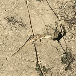
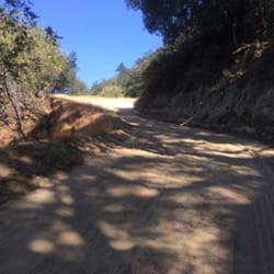
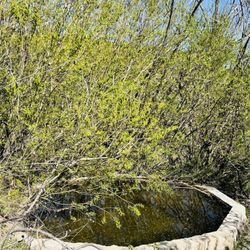
    East and Rice Canyons Photos

    You might also consider

    Recommended Reviews - East and Rice Canyons

    Your trust is our priority, so businesses can't pay to alter or remove their reviews. Learn more about reviews.
    Yelp app icon
    Browse more easily on the app
    Review Feed Illustration

    Reviews With Photos

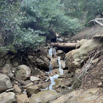
    A hidden gem of a hike in the Santa Clarita Valley. Go with a seasoned hiker for an early morning winter/spring river/waterfall hike.
    Julie L.

    Beautiful reviver/waterfall hike. Must go with a seasoned hiker or group to find these hidden gems!

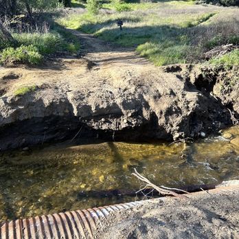
    If you take the Rice Canyon trail, you'll cross the water a few times. Not too difficult for those with mild agility.

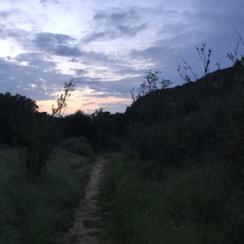
    Perfect for hiking. Especially in the Spring. Even for a short evening stroll up the dirt road.

    https://www.youtube.com/watch?v=Sss7bqLB8Gw
    Robbie G.

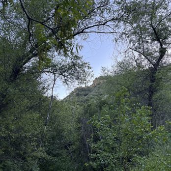
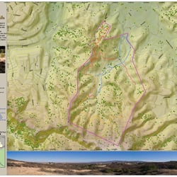
    I hiked this trail on May 9th, the first date that the CA state parks reopened. The trail is a moderate to difficult 6 plus mile hike. There is a horse stable on the right hand side as you begin hiking the trail, which starts off gently to the north. There was a downed tree blocking the trail when I went there. About 1/2 mile in, there is a split with the Rice Canyon trail. But, since the Rice Canyon trail was so overgrown, I stuck with the East Canyon. The hike continues up gradually with only 150 foot elevation gain during the first mile. There are also two stream crossings, which are not currently flowing heavily. The trail picks up elevation fast once you hit the switch backs at 1.2=1.5 mils. There is a good amount of shade during the hike that makes it more bearable. The hiker is treated to nice views of the adjacent ridges, including Towsley Canyon. During the course of the hike, it is likely that you will hear some popping from the nearby firing range--but don't worry, you aren't really close to the shooting! At about the 2.5 mile mark, the trail splits off again, with one fork going to the east (left) and the right fork continuing upwards. There are no trail signs marking the junction. If you turn left, you will find yourself on the Weldon Motorway, which leads all the way back to the Old Road (I would not recommend doing this as a loop because you are going to wind up walking along a 4 lane highway for about a mile to return to the parking lot). About 1/2 mile later in the hike, the trail flattens out and there is a saddle to the west. The end of the trail is somewhat anti-climatic; there is a fenced off area and a gate blocking the trail with no trespassing signs. There appears to be some sort of communications site within that blocked off area. At this point, the trail continues down the other side of the hill towards the Mission Peak trail, which is another 2.5-3 miles away. I will review that hike later! https://www.youtube.com/watch?v=Sss7bqLB8Gw

    Paolo H.

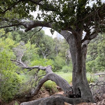
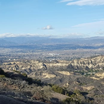
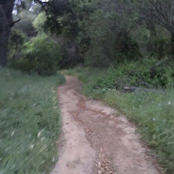
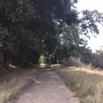
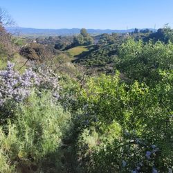
    It seems like hiking has caught on as a popular Santa Clarita activity based on the large number of cars that I see in the parking lots of local trails these days. Fortunately, the East & Rice Canyon trails are a little hidden away and not as frequently traveled. I have to rate the East Canyon Trail as one of the best hikes in Santa Clarita. I can't think of any other trail that comes close. It has a nice gradual incline that gives you the cardio that you want, it's a wide and well maintained path, and it's partially shaded with interesting scenery. It has mature trees with relatively lush vegetation. The LA Mountains web site describes it best, "it takes one through three species of oak, California bay laurel, California black walnut, and bigleaf maple, up in elevation to an unusual forest of bigcone Douglas-fir." As you ascend to the ridgeline of the Santa Susana Mountains you get to appreciate the great views of the Santa Clarita Valley. The Rice Canyon trail is also a really nice hike. It does not have as steep of an incline which makes it an ideal hike to do with the kids. It also has a small stream that you cross a few times along the way. Don't be alarmed by the gunshots that you hear in the distance. It's coming from the Oak Tree Gun Club located nearby. Unfortunately, you'll have to park your car on the Old Road unless you buy a pass that allows you to park in the parking lot. There are no bathrooms or trashcans either. Directions: From the Golden State (I-5) freeway in Santa Clarita, exit Calgrove Blvd. Turn west as Calgrove becomes the Old Road and head south .9 mile to parking on the west side of the road.

    Dog friendly paths!
    Dominique M.

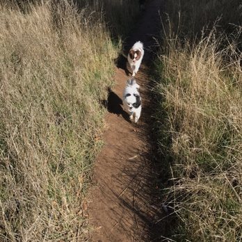
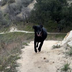
    Super fun hike, even for "indoorsy" folks like myself! I'm no avid hiker, but the Rice Canyon hike was super cute through the valley, across some streams, under the tree cover for the most part, and then up a short but steep incline to see some killer views. Very dog friendly, which was a plus! My two little pomeranians loved it :) Note: this can get VERY muddy after it rains, so plan proper shoes. Entrance note: follow the Old Road, just after the Church of Nazareth (you can drive your car into a small lot and pay for parking, or park on the street for free).

    The beginning
    Lucky S.

    Today we did East Canyon. It's a nice trail without too many people on it although you do see an occasional hiker, horse or mountain bike. You wind up (quite an incline) and technically could do a loop dropping off near Oaktree Gun Club, but that is pretty far and you would be over a mile away from where you parked. You have some incredible views of the city! Tip 1- There appears to be some confusion in this location and that of Towsley Park. I see a lot of pics in that Yelp link that are from here. Towsley is nearby but a different hike. Tip 2 - There are a lot of ticks up here so be sure to check your dog thoroughly once you leave!

    Dried riverbed
    Emily G.

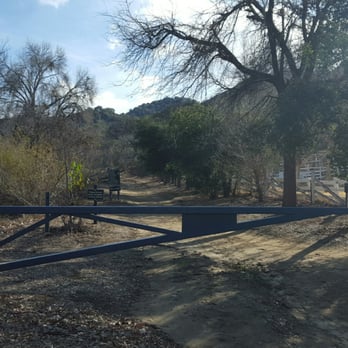
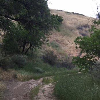
    My boyfriend used to come here and hike with his dad when he was younger so we decided to give this place a view again after many years. Located just past the Post Office and church, this is one of the less populated hiking trails in Santa Clarita. There's a parking lot right in front of the trailhead for paid parking or you can park on the side of the Old Road for free and it's smooth sailing from there! It's a relatively easy hike so it's perfect for newbies or those that just want to soak up some vitamin D. This place has two trails that split from the main one not far into it, East and Rice. We went through some dead flower fields to Rice Canyon to the now dried up creek bed before turning back. It's a nice spot! I just wish they had some stopping points, like a bench and some bathrooms and trash cans.

    Cindy F.

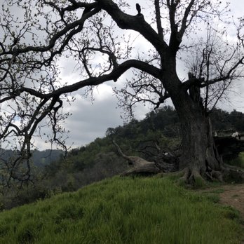
    My kids (15, 13 & 8) and I hiked East Canyon on 3/23/19. It was awesome. Everything was green & the view was amazing. I highly recommend this hike. We parked on the side of the road with no issues.

    He LOVED it !!!
    Dean P.

    Fun spot to hike, it gets nice and cool as you are under all the trees as you feel your thighs burn. If you take east Canyon it goes uphill for an long time but its great exercise. Our dog lived it too just make sure you check them for ticks after and nice bath too.

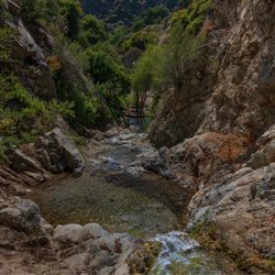
    They just cleared Rice Canyon fully, an awesome hike with a small creek at the bottom, but drying up.

    Runnerlover F.

    Love this hiking trail!!! If you want a wider trail stay to your left at the east canyon and rice canyon split... If you do not mind s narrow trail stay right and you will be crossing small little creeks on your path but both views are breath taking... Do not be alarm if you here gun fire because the fire range is nearby... Bring water and snacks if you plan a long hike ...

    See all

    3 years ago

    Helpful 17
    Thanks 2
    Love this 12
    Oh no 0
    Photo of Troy H.
    1229
    1300
    1282

    3 years ago

    Helpful 2
    Thanks 0
    Love this 3
    Oh no 0

    3 years ago

    Helpful 0
    Thanks 0
    Love this 0
    Oh no 0

    3 years ago

    Helpful 1
    Thanks 1
    Love this 1
    Oh no 0
    Photo of Kathy K.
    124
    22
    34

    3 years ago

    Helpful 0
    Thanks 1
    Love this 1
    Oh no 0

    6 years ago

    Helpful 1
    Thanks 0
    Love this 0
    Oh no 0
    Photo of Robbie G.
    11
    18
    25

    6 years ago

    Helpful 1
    Thanks 1
    Love this 0
    Oh no 0

    12 years ago

    Helpful 6
    Thanks 1
    Love this 1
    Oh no 0

    10 years ago

    Helpful 0
    Thanks 0
    Love this 0
    Oh no 0
    Photo of Lucky S.
    56
    1266
    3912

    10 years ago

    Helpful 1
    Thanks 0
    Love this 0
    Oh no 0

    11 years ago

    Helpful 0
    Thanks 0
    Love this 0
    Oh no 0

    7 years ago

    Helpful 0
    Thanks 0
    Love this 0
    Oh no 0

    6 years ago

    Helpful 1
    Thanks 0
    Love this 0
    Oh no 0

    5 years ago

    Beautiful. But the gunfire from the neighboring range is relentless.

    Helpful 0
    Thanks 0
    Love this 0
    Oh no 0
    Photo of Dean P.
    175
    983
    4627

    10 years ago

    Helpful 1
    Thanks 0
    Love this 1
    Oh no 0

    7 years ago

    Helpful 0
    Thanks 0
    Love this 0
    Oh no 0

    12 years ago

    Helpful 0
    Thanks 0
    Love this 0
    Oh no 0
    Photo of Brian U.
    0
    2129
    128

    9 years ago

    Helpful 0
    Thanks 0
    Love this 0
    Oh no 0

    11 years ago

    Helpful 1
    Thanks 0
    Love this 1
    Oh no 0

    11 years ago

    Helpful 0
    Thanks 0
    Love this 0
    Oh no 0

    Ask the Community - East and Rice Canyons

    Review Highlights - East and Rice Canyons

    If you want a wider trail stay to your left at the east canyon and rice canyon split...

    Mentioned in 7 reviews

    Read more highlights

    You might also consider

    Verify this business for free

    People searched for Hiking 4,682 times last month within 15 miles of this business.

    Verify this business

    O'Melveny Park - Someone made a Peak sign.

    O'Melveny Park

    4.7(273 reviews)
    3.4 miGranada Hills

    Love this place! Recently came here again in 2026. Went on Grotto trail by accident a year or two…read moreago. Omg! It was so intense but so worth is at the top I saw some coyotes on the others side- like a pack but the stayed on their side. Some people bring their hiking sticks and whistles and some just brave the wild :/. While we made it out alive, won't lie. Seeing like 5-6 coyotes at once kinda scared me but they were pretty far off. They have a nice little park (not a kid park with swings) you can walk around for a calmer and easier walk. They have other trails there that I haven't been on. So I'd just say wear good shoes if you're gonna tackle the big trails and maybe there hiking sticks (I need to get one) and anything for safety. It has many signs that there are rattle snakes. I haven't seen one but I believe them lol. I prefer to go early because in my mind, they wouldn't be out and about yet ‍ since it's not too hot.

    A great park at the north end of San Fernando Valley. So many areas to spread out and enjoy…read more O'Melvany is listed as the second-largest public park in Los Angeles(behind Griffith Park), but still seems a pretty good secret, for the most part. On any given day you may see dogs playing, or training in social skills, exercise classes, families picnicking and kids running around. BUT ALSO BE ON THE LOOKOUT FOR WILDLIFE! Coyotes and mountain lions are very common, as are rattle snakes. But also bunnies, squirrels and an array of birds, for those who take the time to stop, listen, and try to identify. There is not a playground at this large park. Instead, the draw is toward it's many, well marked, hiking trails. This use to be John O'Melvany's ranch, until he deeded the land to Los Angeles(1976), with specifics for it to be used as a park. You'll still see orchards of grapefruit as you enter, with signs requesting you not remove the fruit from the area. The fruit has not been properly tended to in decades, so it's not really yummy grapefruit, but on occasion you'll see some people plucking and tasting to quell their curiosity. Mainly, to avoid the spread of fruit flies, the city requests that the yellow spheres be left in place. BUT OH THE AROMA OF THE FLOWERS FROM THESE TREES! And so many happy bees flitting about. Quite nice. This is also a park that allows access for equestrians. A very large dirt area for trailers to park and horses to be staged and prepped before heading off into the hills on the marked Equestrian Trail. If you do take the time to hike one of the many trails, you'll be rewarded with beautiful view of SFV. If you squint, you can almost imagine what it looked like pre-WWII, before the tract homes welcomed the veterans here. Many beautiful, very old, oak trees, eucalyptus and various maple species, along with a LOT of native shrubbery are found throughout the park and the one large bathroom at the center is well maintained. Hours are dawn to dusk, with gates at both the pedestrian entry and parking lot. Plenty of free parking in the lot and along the street. If you're up for an easy, but fairly long excursion, check out Bee Canyon Park. It starts just across the street from O'Melvany and DOES have a play area for kids. Also, it's trail runs all the way to Balboa. Cheers! "CC"

    Photos
    O'Melveny Park - Model (myself) IG: @ammysalamii Photography by IG: @richardesque

    Model (myself) IG: @ammysalamii Photography by IG: @richardesque

    O'Melveny Park - Poppy spotting March 2023

    Poppy spotting March 2023

    O'Melveny Park - Model (myself) IG: @ammysalamii Photography by IG: @richardesque

    See all

    Model (myself) IG: @ammysalamii Photography by IG: @richardesque

    Whitney Canyon Park

    Whitney Canyon Park

    4.5(66 reviews)
    3.3 mi

    A friend took me to Whitney Canyon Waterfall today, and wow what an adventure. The hike is…read moremoderate, about 3.5 miles, and parking is free. Reaching the waterfall is not for the faint of heart. You climb uphill, descend back down, reach a small waterfall, and then go through it to finally arrive at Whitney Waterfall. It's a bit sketchy, definitely thrilling, and absolutely worth it but only if you're prepared. Hiking shoes are a must. This trail is not recommended for kids or beginner hikers due to steep and slippery sections. It was 48 degrees and freezing cold today, so check the weather before you go and layer up. Also, there are no restrooms, so plan ahead. If you're looking for a raw, adventurous hike with a rewarding waterfall at the end, this one delivers.

    When you're ending the year 2025 with a hiking adventure. Let's begin this banger review…read more Whitney Canyon Park is a 442-acre park known for its diverse trails for hiking, biking, and horseback riding, featuring oak woodlands, chaparral, and riparian areas with seasonal waterfalls. It is located next to the freeway in Santa Clarita. I have been eyeing this trail/park for months and I am glad I crossed this on my All trails hiking list. I came on a late Monday morning and it was bloody windy (~45 mph) with a cool temp of 64 degrees. This park has multiple trials including Elsmere Trail. WCP has a wide track trail through a canyon that was known for oil drilling and ranching some of its remnants are still visible. Its trail has little to no tree shade but the trailhead was kept clear. I have seen some hikers (family and kids) and bikers along the way; most are friendly and nice. Parking lot is huge with no shades. Trash bins are available. Overall, it's a nice easy park to go hiking. I recommend it.

    Photos
    Whitney Canyon Park - Heart rock

    Heart rock

    Whitney Canyon Park
    Whitney Canyon Park - Wide view down some of the falls.

    See all

    Wide view down some of the falls.

    Wildwood Canyon Open Space

    Wildwood Canyon Open Space

    4.7(3 reviews)
    1.8 mi

    Gorgeous hiking opportunity hidden away in Santa Clarita. ****Note****: GPS takes you to a gated…read morecommunity with no access to the open space. Better to search "Haskell Vista/Cross" to find the trailhead or check out the map here https://hikesantaclarita.com/where-to-go/wildwood-canyon/. Kudos to Santa Clarita for protecting and maintaining this lovely parcel of land. Many native plants and animals find refuge here, as well as humans seeking green space for exercise and reflection. Check the map noted above for trails and level of challenge. The trails are very well-maintained; free street parking is available at the trailhead on Haskell Vista. Take water, a snack, and a charged cell phone with a good camera; there are lots of photo opps here for sure.

    This open space area may not have an interesting backstory but it still has some fun and diverse…read moregroup of trails that are definitely worth exploring. This open space is part of the city's larger ongoing effort to create a greenbelt that will one day encircle the entire city. Park your car at the end of Haskell Vista Lane to start the trail. Zig-zag your way up the north side of the mountain until you reach the top. At that point and you'll have to decide among 3 different routes. You can choose the wide middle path that will take you south along the ridgeline all the way to the Old Road, or you can take the trail off to the left that descends down the canyon to complete a the loop that takes you to a red water tank and two mini bridges, or you can take the path off to the right which leads you to a small private park. The ridgeline trail leads you to some interesting rock formations and a metal box located below a solitary oak tree. It is filled with short inspirational quotes. For-the-most-part, the trail is fairly sun exposed and not very interesting. The red water tank lower loop trail takes you through some interesting narrow paths. When you get to the bottom of the canyon be sure to break off the trail and head up the canyon off to your right. There is a dense canopy of oak trees that are absolutely breathtaking to walk through.

    Photos
    Wildwood Canyon Open Space
    Wildwood Canyon Open Space
    Wildwood Canyon Open Space

    See all

    Bear Divide Trail - Natural succulents

    Bear Divide Trail

    4.4(7 reviews)
    3.3 mi

    "The Bear" is used by the local firefighters for conditioning. From the trailhead to the water…read moretank, the record I'm told for completion is about 16 minutes for a little more than a mile. Since my first visit back in 2014 till now, the trail has really gone through the wringer from being ravaged by the elements. Burnt trees left over from previous wildfires as well as dips and ditches caused by runoff from heavy rain. The firefighters maintain the trail to an extent, but at its current state there is still work to be done. With that said, if it's a challenge you're looking for, then you've come to the right place. The sharp inclines and loose dirt make the ascension treacherous, but all the more satisfying. On the last visit, the foggy skies were leveled with one of the few false summits, literally heads in the clouds. The sunset off to the distance made for beautiful views of the city down below, and the wildflowers along the way were not only plentiful, but varied, including lupins, poppies, and buttercups. After reaching the water tank, we made a quick stop at the fire station before heading down. On the backside of "The Bear" to put it kindly, fallen trees, narrow paths, and poison oak makes this leg of the trip almost as daunting as the uphill. Where there used to be a bridge there's now a chasm that one must trek down and up before being back on the trail. In another instance, a fallen log was repurposed as a bridge for those brave enough to cross. Branches that used to grow out along mountain have been chainsawed, old shrubs swept out of the way. Despite all that, the views coming down were wonderful to take in, making it a calming stroll back down. Recommended for the bold and seasoned folks.

    Great spot just did it, no one around Went up to water…read moretower ,in the beginning of hike go right !instead of left it keeps you on ridge of mountain, I absolutely love this hike

    Photos
    Bear Divide Trail - Viewtiful

    Viewtiful

    Bear Divide Trail - Respite

    Respite

    Bear Divide Trail - It's doable

    See all

    It's doable

    Rivendale Park And Open Space- Taylor Trailhead

    Rivendale Park And Open Space- Taylor Trailhead

    5.0(2 reviews)
    1.5 mi

    Found this lil gem of a trail on a whim while I was stuck in traffic on the 5. Saw a buck and my…read moredog had a blast. Was gorgeous on a Fall evening.

    This park has nice and excellent trails! If you start walking from this parking area, you need to…read morewalk back on the same trail. The new addition of parking spaces at the end of the Taylor Trailhead has added a little confusion amongst hikers and walking entusiasts. I did not pay attention to the trail map and I thought I would just do the short loop at the begining of the parking lot. When I was in the middle of the hike, I asked two ladies if they knew where to go to get to the parking area. They said follow the Taylor trail signs, thinking that we all are doing the small loop that we saw on the map. We did not pay attention that the loop starts from Towsley Park, not the Taylor Trailhead parking area. After getting to the bigger parking area at Towsley, one of the ladies called her son and offered me a ride back to our parking area. Thank you! When we got back, I was just sitting in my car when I see a couple in dispair looking at the Old Road. I said, do you want a ride back to your parking area, I explained my experience and the lady said, now you are paying it back. There needs to be an update on the trail map, like a "you are here" dot? Just saying... I am starting to get sore! :O Nice trails, beautiful views, I want to go back, I just need to leave a car on each end of the Taylor trail!

    Photos
    Rivendale Park And Open Space- Taylor Trailhead
    Rivendale Park And Open Space- Taylor Trailhead - All images taken near trailhead, within. 3 minute walk from car.

    All images taken near trailhead, within. 3 minute walk from car.

    Rivendale Park And Open Space- Taylor Trailhead - Cute! :)

    See all

    Cute! :)

    Limekiln Canyon Trail - Little river

    Limekiln Canyon Trail

    4.5(75 reviews)
    4.2 miPorter Ranch

    Do you ever not realize you haven't heard a certain noise in years until you finally hear it again…read moreand it's like music in your ears? This is how I felt yesterday evening as I stepped foot into Limekiln Canyon trail! What was that noise? Frogs!!!! I did not realize that I haven't heard the sound of frogs croaking in years and suddenly it was the most beautiful noise so peaceful and serene I wanted to spend the night on a log just listening!!! I attended a meet up hike and I had no idea this trail existed! As a side note it was funny I didn't know this is the same hiking group my step dad attends so it was a fun surprise when we saw eachother and we hiked it together! I've lived around the area and explored all my life but this is the first time I heard of this trail or seen it!!! Parking is street parking off Tampa and across from the church. The entire path is dirt roads and very very well maintained brush on all sides. My step dad said he's had a run in with rattlesnakes on this trail and to be very careful on the parts of the trail that get narrow with bushes on both sides so close to where you're walking. All the trees are huge and give great shade and cover. We hiked at around 6pm and I did see people with dogs who were all on leashes which was good and the trail wasn't too congested so I do believe next time I come to this trail I can bring my dog along! When it gets dark the trees don't let in too much light from the sky so make sure you bring your flashlight. I'm really excited to have such a nice place to hike so close and, well, as I said the sound of the frogs has me hooked and you might catch me there just sitting on a log listening to the beautiful nature sounds!

    Limekiln Canyon Trail is a nice place to go on a casual walk/hike. Its a cool trail because you can…read morefeel like you are in nature, however the trail is located close to the street, or at least this is the case for the section I like to hike in. The trail extends into the mountains so if you are into longer hikes there is that option. Pros: easy access, convenient escape into nature. Not a difficult hike. Cons: there is graffiti/street art on the trail. Some of it looks cool, so this might not be considered a con to some. But I would prefer that it wasn't there.

    Photos
    Limekiln Canyon Trail - Hello.

    Hello.

    Limekiln Canyon Trail - Sticky Monkey Flower

    Sticky Monkey Flower

    Limekiln Canyon Trail

    See all

    Weldon Canyon - https://www.youtube.com/watch?v=pedRMX5xCNs

    Weldon Canyon

    4.0(3 reviews)
    1.3 mi

    Similar to the neighboring East Canyon hike (see…read morehttps://www.yelp.com/biz/east-and-rice-canyons-newhall) and goes to the same Jones Junction. Weldon and East both have a similar 3-mile one-way distance but Weldon starts 400' higher which makes it easier. Like East, the hike lacks escaping into nature with annoying gunfire from the nearby firing range, distracting freeway noise, and the blight of a massive evacuation site (the same one seen from the 5 freeway). The trail is a dirt service road of mostly clay. The road follows low powerlines on wooden poles surrounded by oak trees that looked prime for another forest fire. Most of the 750' elevation gain is in the first mile.

    For a detailed view of this trail, please click on my YouTube channel RobbieGarnz at the following…read morelink: https://www.youtube.com/watch?v=pedRMX5xCNs Actually, I started at the East Canyon and Rice Canyon trail head and made the trek to Mission Point. However, when I did the East Canyon to the junction trail a couple days prior, I accidentally went onto Weldon Motorway (without knowing what it was!) and wound up backtracking to the end of East Canyon trail. For a review of that hike, check out this link: https://www.youtube.com/watch?v=Sss7bqLB8Gw As for the trek to Mission Peak, be prepared to be flexible! Once you reach the fenced in area at the trail junction about .6 miles north of the East Canyon/Weldon Motorway intersection, there is a rather steep decline. Then, all of a sudden, you run into a locked gate that prevents you from continuing on the primary trail. However, if you walk to the left and slightly down hill, there is a "path" from foot traffic that allows you to go around the sealed off area. I would strongly advise a good pair of hiking boots though, because there is significantly tall grass. A hiking pole would also be a good idea because you never know what could be hiding in that grass! Once you are past that obstacle, the trail slopes downward and then up slightly, and across the ridge for the next mile. You will come to two more gates about 600-800 meters apart. The first one was open when I went, the second was not. There is a sign for Mission Peak on the fence, but the arrow points in both direction. I spent quite a bit of time tromping around the area to figure out a way around and up. Spoiler alert, do not go into the grass on the northeast side above the fence--it only leads to a shear cliff! However, if you turn left (NW) at the gate, the trail continues downhill, which is counter intuitive because you're trying to go up. However, about 250 meters down the hill, on the right, there is a small footpath that traverses the hill side upwards and keeps you away from the restricted area. Once you get on the path, keep going! You will come out on the other side of the fenced in area onto the main trail. From there you are treated to a beautiful view for the next 3/4 of a mile until you hit a fork in the trail. Turn right at the fork and keep going uphill (although I did see some hikers coming up from the other side and we wound up meeting at the top..). The final climb is a great push but well worth it. There is a 360 degree view of unbelievable scenery overlooking the valley. There is also a monument, the widowers bench, and a stack of rocks that has remained undisturbed for quite some time. Coming down is also a joy as you get to relive the awesome view until you get sucked back into the firebreak and remember that you still have to tromp through tall grass to get around the same obstacles you faced coming up. Would be 5 stars if not for that inconvenience! For a detailed review of the hike, check out this link: https://www.youtube.com/watch?v=pedRMX5xCNs You can subscribe and see other epic hiking and fitness videos at this link: https://www.youtube.com/channel/UCSnBYnWYktiqxynCwGrak1Q?view_as=subscriber
    Photos
    Weldon Canyon
    Weldon Canyon
    Weldon Canyon

    See all

    Pico Canyon

    Pico Canyon

    4.5(2 reviews)
    2.9 mi

    I loved this hike. I was really surprised how much fun it was. I generally don't expect great…read morethings, in regards to views, with the local hikes...drought. However, This one may cause me to reconsider such low expectations... Due to lack of time..I'll have to plan another day to come back and go further... However we still managed to explore 5miles...But this is the type of trail that makes you want to keep going. And from the looks if it, you could keep going for days. Keep in mind that this is the hike that is past mentryville, they have a $5 parking fee, bring cash. So the first part if the hike is a paved road (which makes jogging a really nice option) there are two places where you have the option to take a left which would lead to picnic tables... However if you keep going straight you will get a nice photo op. Of the Pico Canyon plaques where the first oil well once was. Right past this you can begin your climb up the mountain. The incline is perfect... It offed a great workout opportunity... And it's not too hard where it makes you feel like you may die if you continue. The view is surprisingly gorgeous.. Seriously, I have lived out in Santa Clarita my entire life and I never would have guessed such views existed. It is a hike that you should not attempt on your own, only because it's pretty secluded, my partner and I did not see another single hiker. I definitely look forward to coming back, the path seems endless and I would love to continue on... It also helps that the weather was in our favor today... Couldn't have asked for a better day. I thoroughly enjoyed this hike today

    Does it really count as a hiking when the trail is mostly a paved road? Nevertheless, the Pico…read moreCanyon trail is still a fun and exciting trek. The trail starts at Mentryville, an interesting old and historically significant town that has been used for a number of movies. Further up the road you'll encounter a mini trail on the left. It's a great trail for kids. It has some small bridges and ends with a picnic bench on a hill. Continuing up the paved road you will encounter a neat little area on the left that has some old oil field relicts. Further up the road on the right you will encounter Well #4, the first commercial oil well in California. The paved road will eventually end and then you will start the trek up the mountain. Even though there is a fairly wide path, when you start to get high up the mountain the height can be a little intimidating. The views at the top of the mountain are probably the best in Santa Clarita.

    Photos
    Pico Canyon
    Pico Canyon
    Pico Canyon

    See all

    East and Rice Canyons - hiking - Updated July 2026

    Loading...
    Loading...
    Loading...