Cancel

    Open app

    Search

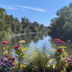
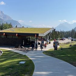
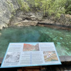
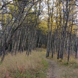
    Forget Me Not Pond

    5.0 (3 reviews)

    Forget Me Not Pond Photos

    Recommended Reviews - Forget Me Not Pond

    Your trust is our priority, so businesses can't pay to alter or remove their reviews. Learn more about reviews.
    Yelp app icon
    Browse more easily on the app
    Review Feed Illustration

    4 months ago

    Helpful 0
    Thanks 0
    Love this 0
    Oh no 0

    5 years ago

    Helpful 2
    Thanks 0
    Love this 3
    Oh no 0
    Photo of Dee H.
    1
    52
    72

    5 years ago

    Helpful 0
    Thanks 0
    Love this 0
    Oh no 0

    Verify this business for free

    Get access to customer & competitor insights.

    Verify this business

    Troll Falls

    Troll Falls

    4.7(3 reviews)
    26.8 km

    A lovely, easy hike with a HUGE beautiful pay off at the end! It's a family friendly stroll with…read moreplenty of parking at the trailhead and it's easy to do in a couple of hours at most. The elevation is easy, and the stroll through the forest is leisurely and beautiful. In the winter you may want cramp ons or hiking poles since the packed down snow can get slick, but they're not necessary. At the end you'll find the beautiful Troll Falls. In the winter they're frozen the most miraculous bright blue and ice climbers have a great time climbing it's relatively easy verticals. Unlike the Johnston Canyon hike in Banff National Park, the Troll Falls hike allows you to get right up to the water falls, which makes for a truly special experience. Check my photos for proof!

    In the mountains and wanna go hiking, but need a spot that's not too difficult and also…read moreentertaining for wee kids? This is it. We were looking at different trail maps and unsure where to take our two year old for a hike that would grasp her attention span and also would be able to drag her along in a sled if she gets tired from all the walking. When Troll Falls popped out and had everything e were looking for. It's right at the bottom of the ski slope so if you find yourself driving up the mountain, you've gone too far. There is a decent sized parking lot by the entrance to the trail. The secret weapon for kids entertainment (aside from nature chats) are the hidden Troll Dolls around. Fun for everyone to try to be the first to spot them along the way! Even in December this was a fantastic crisp walk to do and at the end you come to a frozen waterfall. It was the most amazing thing to see, and to be able to walk on the frozen river. Just breathtaking! My husband is a geologist so he gives me all the geology chat along the way too. Really fantastic walk, I can't wait to do it again in summer and have a totally different experience. We seen a wolf run across the main road as we drove down to the trail so remember to stay safe when you are out there!

    Photos
    Troll Falls - Spot the troll dolls

    Spot the troll dolls

    Troll Falls
    Troll Falls

    See all

    Lussier Hot Springs - Upriver view

    Lussier Hot Springs

    4.8(12 reviews)
    90.1 km

    How much fun was that???? It was amazing and beautiful. So well maintained by the park! THANK…read moreYOU!! I think there were four or five pools but we stayed in the hot and medium ones. I will not lie and say it wasn't busy but everyone was awesome to chat with. Met lots of folks from Calgary and a couple on their honeymoon. I'd definitely go back next time we are around the area.

    A private, rarely populated, hidden hot spring tucked away in the mountains! What can get better…read morethan that? In the area there are two other hot springs, Radium Hot Springs and Fairmont Hot Springs... both are naturally heated, but are made into swimming pools... boring! You might as well just jump into a heated pool. Lussier Hot Springs is none of that! Lussier Hot Springs is set aside on a 12 mile gravel road... please don't let that dismay you! Past the private property of cow fields, the roads do get pretty dangerous. We almost turned around because we were nervous that we may slip off the mountain. At a few points you may need to stop and pull to the far right on the turns to let the truckers pass by because some parts of the road won't let two cars pass. Just a tad dangerous... When you finally see the sign for the Hot Springs your almost there, just park and it's a short, less than 5 minute, hike down the walkway. The Lussier Hot Springs are made up of about 3 rock pools with rocky peddle bottoms. The top most pool is the hottest of the bunch, so I'd recommend going in there last. The water from that pool then leads into the other two rock pools. Those two aren't as hot because they are cooled down by the Lussier River that keeps pouring into them. If you're feeling extra brave or maybe a little too hot, the river makes an excellent icy dunk. The Lussier Hot Springs are a serene and secluded hot springs set in the perfect environment. You can warm up and watch the river rush by you or you can scam for wildlife in the forest or the mountains all around. I highly recommend paying this hot springs a visit!

    Photos
    Lussier Hot Springs - The main hot pool

    The main hot pool

    Lussier Hot Springs
    Lussier Hot Springs - Great summer fun!

    See all

    Great summer fun!

    Moose Mountain

    Moose Mountain

    4.3(3 reviews)
    15.7 km

    Fabulous hiking trail, provides great views at the top although you can't go all the way to the top…read morebecause there is a ranger station up there...... Our mutual friend J uses it for training because the driveway to go up to the parking lot is maintained in the winter so it's good for burning lotta calories and running straight uphill while training in cleats if that's your kind of thing....... I should mention that only go this route if your car is in good shape or you have a 4 x 4 because the dirt road is pretty rough on the way up and on the way down. We broker serpentine belt for the second time in a year !

    Moose Mountain is fat tire mountain bike freedom. The mountain is host to to countless miles of…read morecommunity maintained gorgeous mountain bike single track. There's a big difference between riding your mountain bike on trails, and riding on trails that were creatively crafted for the sole purpose of mountain biking. These trails have been crafted corner by corner from the dirt up for the very best mountain bike experience. The result is a breathtaking combination of smiles, thrills, and high fives. Respect these trails! If you pack it in, pack it out. If you break it, fix it. If you can't jump it - don't. If it's a downhill trail, use it in the down hill direction. If you don't feel like riding in the uphill direction, the road is open from May 15 - December 1. There's no shame in loading a pickup truck full of bikes and driving to the top. Just make sure to drive with respect and do your best not to dust storm them people who choose to ride up. If you do like pedalling upward and onward, there is a really fun trail (Pneuma) that rides along near moose mountain road. While it's not as efficient as riding up the road, it's a far more enjoyable. Pneuma is possibly the most fun I've ever had riding up a hill. Going for a hike? Great - there's room for that too! Grab your best walking stick and a hiking map so you can stick to the hiking trails. While it may be tempting to walk up the downhill mountain bike trails, please don't. You won't be missing out - trails that are intended for hiking have far more interesting hiking terrain, scenery, and take you locations with gorgeous views. Group hikes up DH mountain bike trails are just detrimental to the trails and dangerous for everyone. Here's your hiking info - http://www.braggcreek.ca/kananaskis/trails/moosemtn.htm Directions: Head south on 22 until you reach Bragg Creek. Hang left at the 4-way stop sign until a T intersection with a stop sign. Turn right at the 'T' intersection onto HWY 66. Continue to drive west past McLean Creek, past "Station Flats", the next road on the right side is Moose Mountain Rd. Moose Mountain Road is open Most trails are accessed by driving up Moose Mountain Rd and end out at Canyon Creek/Ing's Mine. There is parking at Ing's Mine and Station Flats.

    Photos
    Moose Mountain
    Moose Mountain - 25 degrees Celsius and there be snow in them hills!

    25 degrees Celsius and there be snow in them hills!

    Moose Mountain

    See all

    Galatea Creek - Avalanche fall out

    Galatea Creek

    5.0(3 reviews)
    21.1 km

    When: Mid-October Difficulty: Moderate to Advanced,…read moredepending on weather Distance: 8 miles out and back to Lake Lillian (We couldn't get to Galatea due to weather) Time Required: 5-6 hours out and back (Keep sunset and daylight in mind when choosing a start time) Conditions: Trail offers large expanses of shade broken up by sections that show the mountain tops and allow you to look down into the valley. Interesting Elements: Rock slide and avalanche path crossings Payoff: Lake Lillian, Backpack Camp, and (if reachable) Galatea Lake Would you recommend this hike to visitors?: Yes. Especially in the Spring/Summer The Kananaskis area is just off the beaten path for many tourists who are either visiting Banff or Canmore, so you'll find a trail that's frequented by locals and a bit quieter than those closer to town. Under normal conditions, I'd say this trail is most definitely moderate. There's about a 1,500 ft elevation gain over the course of about 4 miles, and it's extremely gradual save for a section or two. For us, the trail ended up being slightly more advanced due to overnight temps below freezing and light snow which, over the course of the day, turned to ice. Ascending was tricky, but careful foot placement had us moving at a steady pace. Descending was another story, making sure to step cautiously to maximize what little traction was available from unmolested snow and rocks. In these conditions poles and/or traction aids are recommended, and if we had them, the trail would have been moderately difficult. The views of the creek as you cross the multiple bridges are peaceful. Mountains are in view almost the entire time, and there are several points at which you really get a sense of scale for this incredible place. Sadly the big payoff for us was not Lake Lillian, but rather the campsite where we found two hikers who'd started a wonderful fire! We also shared some mulled wine with two Russian hikers too, warming us up from the inside and making the descent a lot more enjoyable.

    Came here on a weekday afternoon around 2PM, parking lot about half full. Saw a lot of people on…read morethe way down when we were going up. Trail crossed the creek a few times, lots of bridges. Path wasn't too steep, definitely moderate, good views along the way. Rocky in some parts but manageable. Took about two hours to the lakes - Lillian Lake was pretty, and Galatea Lakes were awesome! Basically had the lakes to ourselves, it was great. Didn't see anyone on the way down, we were the only car when we got back around 7PM. Great hike!

    Photos
    Galatea Creek - Lillian Lake en route to Galatea

    Lillian Lake en route to Galatea

    Galatea Creek - Remote campsite next to Lillian Lake

    Remote campsite next to Lillian Lake

    Galatea Creek - Wanna feel small??

    See all

    Wanna feel small??

    Forget Me Not Pond - parks - Updated August 2026
    Loading...
    Loading...
    Loading...