Fresno Dome Photos
 - Hiking Near Me")


 - Hiking Near Me")
You might also consider
More like Fresno Dome
Recommended Reviews - Fresno Dome
Start your review...

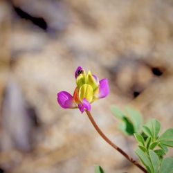
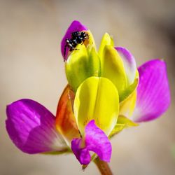
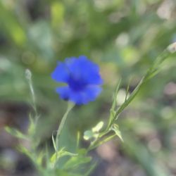
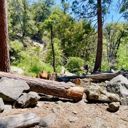
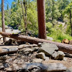
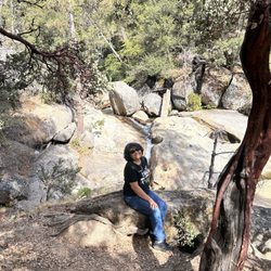
Fresno Dome: 2025 Sep 23 (5 of 5) We're hosting a friend who's never been to Fresno Dome so we decided to take him there. Fresno Dome looks like a smooth dome from afar but it's actually granite rocks of different shapes and sizes coming together to create this geological marvel. I'm always amazed when we reach the top of the dome. Once you get to the top of this granite dome, you can be assured of breathtaking panoramic views of Sierra Nevada and Southern Yosemite National Park. Its rocky facade made this easier to climb, but the last time I hiked Fresno Dome was in July - so, I felt a need to get lessons from a goat. Goats are incredibly agile climbers - ascending steep slopes and leaping over mountains in their sure-footed hooves. I wonder if they'll give me lessons on how to climb mountains. Hmm... What to wear: Layer your clothing. You get sweaty on the way up, but at the top, you may feel a chill. Hiking shoes or hiking boots are a must. We actually saw a woman in sandals. That's a firm No-No. One slip and you'll be flying down the slopes. What to bring: Water and snacks. You'll need more than one bottle of water per person (I usually bring 3). Dehydration sets in fast, especially when you sweat. We bring snacks because when you reach the top, you would want to stay to enjoy the breeze and the views. Just remember to bag your trash and take them with you. What to expect: Mosquitoes, bugs, ants, etc. It's their land you're wondering into. On the flip side, you'll be amazed by beautiful butterflies, plants and wildflowers (depending on the season). read more
 - Hiking Near Me")
 - Hiking Near Me")
 - Hiking Near Me")
 - Hiking Near Me")
 - Hiking Near Me")
 - Hiking Near Me")
 - Hiking Near Me")
 - Hiking Near Me")
 - Hiking Near Me")
 - Hiking Near Me")


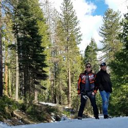
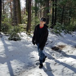
Situated between Oakhurst and Yosemite National Park at an elevation of 7,450 feet, Fresno Dome is one of those elegant granite formations for which the Sierra Nevada is famous for. Fresno Dome is a popular destination for rock climbers, but hikers can also reach the summit via a short trail that climbs the dome's gently sloping backside. Reference: MAREK WARSZAWSKI / THE FRESNO BEE | FEBRUARY 03, 2009 11:17 AM I didn't realize it's only a 1.6 mile round trip , it felt much longer but it's an easy peasy hike which rewards you with beautiful views of the Sierra from the top. Easy at first but gets pretty steep at the top . Since my baby bear has intellectual disabilities and autism, he's not too aware of danger, we stopped midways of the dome . We were still rewarded with gorgeous views from midways. It was pretty muddy at the begging of the hike , we had to hop from one rock to another to avoid getting our hiking boots wet. After that it's a easy hike ( except pretty steep at the top). Hella winding road to get to the trailhead, it's unpaved dirt road towards the end. I don't recommend you going if you don't wanna get your vehicles dirty lol. We saw a beautiful owl with his wings wide opened atop a tree stump near the trailhead. I wasn't able to capture it with my phone but the image is still very clear in my head after four years. Cheers to the great outdoors (^。^) read more


More info about Fresno Dome
Bass Lake, CA 93604
Directions
Hours
Outdoor Amenities


Fresno Dome - hiking - Updated June 2026
Best of Bass Lake
People found Fresno Dome by searching for…
Hiking Trails With Waterfalls in Bass Lake, California
Waterfalls and Swimming Holes in Bass Lake, California
Scenic Drive in Bass Lake, California
Things to Do in Bass Lake, California
Secret Spots in Bass Lake, California
Off Road Trails in Bass Lake, California
Easy Hikes in Bass Lake, California
Beautiful Views in Bass Lake, California
Scenic Overlook in Bass Lake, California
Indoor Rock Climbing in Bass Lake, California
Parks in Bass Lake, California
Bouldering in Bass Lake, California
Stair Climbing in Bass Lake, California
Scenic View in Bass Lake, California
Hiking Shoes in Bass Lake, California
Secluded Spots in Bass Lake, California
Forest in Bass Lake, California
Nature Parks in Bass Lake, California
Things to Do on a Rainy Day in Bass Lake, California
Walking Trails in Bass Lake, California
Trending Searches in Bass Lake, CA
Bait And Tackle Shop near Fresno Dome
Cliff Jumping near Fresno Dome
Dog Friendly Trails near Fresno Dome
Fishing Spots near Fresno Dome
Jet Ski Rental near Fresno Dome
Lakes & Ponds near Fresno Dome
Off Road Trails near Fresno Dome
Pick Your Own Farms near Fresno Dome
Public Shower near Fresno Dome
River Swimming near Fresno Dome
Strawberry Picking near Fresno Dome
Swimming Holes near Fresno Dome
Swimming Lakes near Fresno Dome
Browse Articles
Browse Brands
Related Searches in Bass Lake, CA
Affordable Kayak Rental Services in Bass Lake, California
Best Fishing Locations and Guides in Bass Lake, California
Best Fun Things to Do in Bass Lake, California
Best Gymnastics for Kids Activities in Bass Lake, California
Best Places for Horseback Riding in Bass Lake, California
Best Sledding Spots and Fun in Bass Lake, California
Best Waterfalls and Swimming Holes in Bass Lake, California
Check Out Off Road Trails in Bass Lake, California
Discover Dog Friendly Trails to Explore in Bass Lake, California
Discover Exciting Adventure Options in Bass Lake, California
Discover Fun Activities to Do in Bass Lake, California
Discover Fun Recreation Activities in Bass Lake, California
Discover Outdoor Gym Facilities in Bass Lake, California
Discover Scenic Mountain Bike Trails Near Bass Lake, California
Discover Scenic Waterfall Spots in Bass Lake, California
Discover Top Yoga Options and Studios in Bass Lake, California
Discover the Best Night Hike Trails in Bass Lake, California
Enjoy Camping Adventures Around Bass Lake, California
Enjoy Hiking Adventures in Bass Lake, California
Enjoy Indoor Lap Pool Facilities in Bass Lake, California
Enjoy Kayaking Adventures in Bass Lake, California
Enjoy Tent Camping Spots Around Bass Lake, California
Enjoy Water Activities and Fun in Bass Lake, California
Enjoy a Beautiful Waterfall Hike in Bass Lake, California
Enjoy the Best Bouldering Experiences in Bass Lake, California
Enjoy the Best Family Activities in Bass Lake, California
Enjoy the Best Walking Trails in Bass Lake, California
Exciting Cliff Jumping Spots in Bass Lake, California
Experience Thrilling White Water Rafting in Bass Lake, California
Explore Beautiful Parks and Green Spaces in Bass Lake, California
Explore Bike Rentals Throughout Bass Lake, California
Explore Boxing Gyms in Bass Lake, California
Explore Easy Hikes Perfect for All in Bass Lake, California
Explore Fitness Centers and Gyms in Bass Lake, California
Explore Fun Activities to Do in Bass Lake, California
Explore Martial Arts Options in Bass Lake, California
Explore Popular Campgrounds Near Bass Lake, California
Explore Popular Recreation Centers Around Bass Lake, California
Explore Popular Scenic Overlook Points in Bass Lake, California
Explore Scenic Lakes to Visit in Bass Lake, California
Explore Summer Camps for All Ages in Bass Lake, California
Explore Top Gyms in Bass Lake, California Now
Explore Top Parkour Spots and Activities in Bass Lake, California
Explore Top Trampoline Parks in Bass Lake, California
Explore Top Water Parks in Bass Lake, California Today
Explore Volleyball Courts Available in Bass Lake, California
Explore the Best Beach Spots in Bass Lake, California
Explore the Best Boating Spots in Bass Lake, California
Explore the Best Rock Climbing Areas in Bass Lake, California
Explore the Best Swimming Holes Around Bass Lake, California