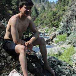
1. Gansner Park

    0

    Quincy, CA

    Cancel

    Open app

    Search

    Gansner Park

    5.0 (1 review)

    Gansner Park Photos

    You might also consider

    Recommended Reviews - Gansner Park

    Your trust is our priority, so businesses can't pay to alter or remove their reviews. Learn more about reviews.
    Yelp app icon
    Browse more easily on the app
    Review Feed Illustration
    Photo of Hele L.
    0
    30
    10

    1 year ago

    So chill here to come with family and friends! The whole park is very clean and not too busy at all.

    Helpful 0
    Thanks 0
    Love this 0
    Oh no 0

    Verify this business for free

    Get access to customer & competitor insights.

    Verify this business

    Feather Falls Trailhead - A little info from the view of the 2nd waterfall

    Feather Falls Trailhead

    4.8(25 reviews)
    43.9 mi

    A challenging hike around 2 hours from EG/Sacramento. It's nearly 9 miles round trip but has a…read morebeautiful view of Feather Falls from the viewpoint deck. We went in March when the weather was unusually warm this year and the water was f l o w i n g. There isnt much tree cover as there used to be after the fires in this area, so if you're coming on a sunny day, be well prepared with sun protection and water. The majority of the hike is uncovered if you start after the morning hours. Parking lot is decent sized, on the day we came there were hardly any cars at 9am, but we saw more people when we finished around 1pm. There's also vault toilets at the trailhead

    How amazingly gorgeous it is here!!! Full of sweet sweet serenity…read more.. For Easter, my daughter & I decided to go here for our hike!! First, the directions on Google maps suck. You need to keep going down the freeway passed Coal Canyon Road We parked in a large rocky parking lot. At this point, you need to use the bathrooms because there aren't any along your path or trail. I found it hard to stay hydrated because since there aren't bathrooms along the way. I didn't want to drink too much water in case it makes me have to go. We started our hike at 1:15pm. The first part of the hike is a very rocky dirt path. No shade. So wear your sun screen! It was beautiful along the way with beautiful green grass, gorgeous flowers. There were free range cows roaming around. This hike can be very challenging to someone who doesn't work out or get their heart rate up daily. There were a couple large Oaks trees offering us some shade just before you approach the quarry. It's a good resting point but we kept on. For this part, we were climbing down into a quarry, surrounded by trees and bushes, over the rocks, down the path, going back and forth... to come to the first waterfall. It was refreshing and rewarding! Being able to feel the water coming down over you after hiking down from the sun was exhilarating! Now, you have to climb your way up the other side. This is where a big challenge comes in. Up the other side, walking up a very vertical hill, over the rocks... really takes your breath away and makes your legs burn.. we loved every minute of it. When you get to the top, there are no trees up here, just more hills to walk up with rocks below your feet. So wear some good shoes! Getting to the top of that part was another waterfall. It was only visible from far away, but even more gorgeous! The sun was hitting it just right to make a rainbow in the mist. It took us 2 1/2-3 hours to get to that particular part of the hike (we spent quite a bit of time at the previous waterfall). At this point we decided to go back... but you need to go back the way you came. We were pretty out of shape for this hike but we love challenges. So up and back over the hills, back down the steep quarry full of trees, down the rocky path, back to the first waterfall (and we spent time down there again, lol) and then climbing out of that quarry, we decided to stop at those big oak trees to make a sandwich to share. After our long rest, getting some fuel in our bodies, and getting nice and hydrated, we started out way down the rocky path. Again, the rocky path made it very challenging. Our legs were really worked from all the climbing up the hills we did so we've smaller hill after that made us feel the burn! Oh... there nothing like the motivation of seeing that parking lot, lol. It was indeed time to get into the air conditioned car and into a comfy seat in the car. Oooh and finally!!! Bathrooms!!! Lol My daughter & I had a blast on our hike for Easter. There were so many families that day who had the same idea. The weather was perfectly sunny with a slight breeze. It was 6 p.m. by the time we sat in the car and turned on the air conditioning. Great timing since I didn't have to drive in the dark on our way home!

    Photos
    Feather Falls Trailhead
    Feather Falls Trailhead
    Feather Falls Trailhead - We definitely underestimated the hike, bring plenty of water and snacks. It took us 4 to 5hrs, but definitely was an experience.

    See all

    We definitely underestimated the hike, bring plenty of water and snacks. It took us 4 to 5hrs, but definitely was an experience.

    Plumas-Eureka State Park - Camp!

    Plumas-Eureka State Park

    4.3(29 reviews)
    18.8 mi

    We love this state park for camping, hiking, biking, fishing, and especially for the history! It is…read morean old gold mining town, and home to America's first downhill ski races! We love the museum and the volunteers who work there.

    I don't want to be the one to spoil the secret, but I recently camped here, and it was incredible…read more I think this will probably be one of my favorite places to camp from now on. I stayed at Upper Jamison Creek, and loved it. I made reservations about a week ahead of time on Reservecalifornia.com My site was very spacious, private, and well shaded. There were lots of redwoods on my site, some purple irises, and even some snow plant. There are a few lovely short trails that run throughout the park, like the one mile hike from the campground to the Visitor Center, or an extra mile to Camp Lisa or the Jamison Mine Complex. From the historic mine complex, the PCT is just three miles away. Or, you can also drive to the trail head and park there. In the other direction, the Trail carries on to a series of alpine lakes and waterfalls. Like other reviewers have said, it was very cold at night. Even in June, I needed both sleeping bags. There are several other amazing hikes within driving distance. If you look carefully, there are some free campgrounds, too. The only time this state park charges fees is to camp at the nicer campgrounds. All parking is free. Showers are free. Plumas Eureka is more accessible than some state parks. They Reserve disabled sites for people with disabled passes, which is something to keep in mind if you have a pass and are looking for a site at the last minute. Lots of gorgeous lakes and opportunities for kayaking, too. Pretty much as good as it gets for a state campground.
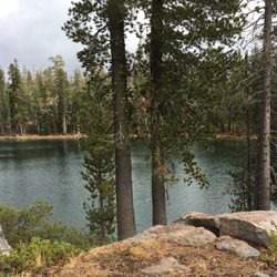
    Photos
    Plumas-Eureka State Park - Johnsville cemetery

    Johnsville cemetery

    Plumas-Eureka State Park - Jamison Creek

    Jamison Creek

    Plumas-Eureka State Park

    See all

    Bidwell Park

    Bidwell Park

    4.7(101 reviews)
    47.6 mi

    We stopped by Lower Bidwell Park on Tuesday because we had a couple of hours before a scheduled…read moreactivity. What a gem of a park. Beautiful trees shading an asphalt-paved walking/biking path. We really wanted to do loop walk, but never actually found that trail. I would want to give 4.5 if you could give half points, because more signage is needed to direct people toward the nature center and specific trails. That said, this park is such a great feature in Chico!

    This is a really cute Park in a nice neighborhood that has a playground and a cement path where you…read morecan walk around and around all day. It's very useful and I love to see a lot of people be utilizing it. The park is clean and maintained and every time I have visited there have been a lot of people walking or playing with their dogs and children playing and riding bicycles. This is a great spot for a picnic or a walk or just to sit in the shade and relax. It also has one of those tiny free libraries in case you want to grab a book and just read for a while. They have two picnic tables, one on each side of the park and a water bottle refilling station. Even though it's a small park, I came here many times when I was in the area I would love to give it five stars but there is no restroom here and I saw lots and lots of people not picking up after their dogs. So walking in the beautiful green grassy area can be kind of a mind field. . Oh and they also have a couple of disc golf stations but I don't play and I never saw anyone using them just in case that helps.
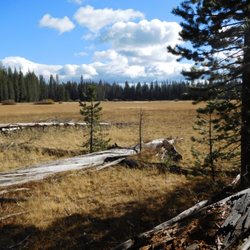
    Photos
    Bidwell Park
    Bidwell Park - Walking path

    Walking path

    Bidwell Park

    See all

    Caribou Wilderness - One of the Hidden Lakes.

    Caribou Wilderness

    5.0(3 reviews)
    36.1 mi

    This is one of my favorite spots around lassen county. Great spots to hike and beautiful lakes. You…read morehave to come check it out, it's a beauty you must see for yourself. I went swimming here during summer and the dogs as well. Very cold water, but what do you expect in higher elevations with wind! So worth the drive and hike.

    If your idea of a good time is to stroll through the forest past pretty lake after pretty lake and…read moreto see no other people, head up to the Caribou Wilderness on the eastern edge of Lassen Volcanic National Park near Chester. Hubby and I recently spent an October Saturday there, hiking a seven mile loop from the Hay Meadow trailhead. Reaching the trailhead itself is something of an adventure, requiring a twelve mile drive on forest service roads. Fortunately, most of the route is paved and in decent condition; the last couple of miles are gravel, and if it's rained could be a problem. We crawled down the last bumpy downhill stretch in our sedan to see a large gravel lot with nary a car in it. There is a restroom, but it was locked. Hay Meadow on the southern edge of the wilderness, where the trail starts, is large and picturesque; I imagine that it is gorgeous in mid-summer with the wildflowers. We hiked in a counterclockwise direction, taking the Indian Meadow, Hidden Lakes, Posey-Beauty, and Cone-Hay Meadows trails. There's an early climb of some few hundred feet, but after that nothing taxing. Much of the hike is relatively flat, and the range in elevation is from 6500 to 7000 feet. About 1.5 miles in you start to see what you came for: the lakes. The essence of this hike is the pleasure of woods and lakes. And plenty of lakes there are. In our seven miles, we passed at least 15 lakes, and that doesn't count the small ponds. The largest was Long Lake, about mid-way through the hike, and the most beautiful was Evelyn Lake, set among rocky ledges, on the return trip. The Caribou Wilderness is typically open mid-June to mid-October. There is no entrance fee nor backpacking fee. While there are no campgrounds near Hay Meadow, there are two campgrounds at the Caribou Lake entrance on the east side of the wilderness. Mosquitoes can be bad in June and July, but we didn't see any in October.

    Photos
    Caribou Wilderness - Long Lake.

    Long Lake.

    Caribou Wilderness - This was on the trail in the middle of nowhere!

    This was on the trail in the middle of nowhere!

    Caribou Wilderness - Hay Meadow.

    See all

    Hay Meadow.

    Gansner Park - parks - Updated July 2026

    Loading...
    Loading...
    Loading...