Cancel

    Open app

    Search

    General Grant Tree

    5.0 (1 review)

    General Grant Tree Photos

    You might also consider

    More like General Grant Tree

    Recommended Reviews - General Grant Tree

    Your trust is our priority, so businesses can't pay to alter or remove their reviews. Learn more about reviews.
    Yelp app icon
    Browse more easily on the app
    Review Feed Illustration

    2 months ago

    Helpful 8
    Thanks 4
    Love this 8
    Oh no 0

    Verify this business for free

    Get access to customer & competitor insights.

    Verify this business

    Grant Grove - Tree bark, each pattern is unique

    Grant Grove

    4.8(48 reviews)
    0.7 mi

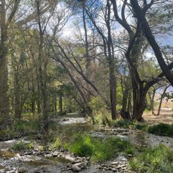
    We visited on Jul 4, 2025 ... Happy Independence Day,…read moreAmerica! The General Grant Tree is located in Grant Grove in the Kings Canyon National Park. You will need to enter the gate of Kings Canyon National Park or Sequoia National Park to see it. Once inside either of these National Parks, you can traverse to the other without going through another entry gate. We arrived at the gate to Kings Canyon National Park by 8:38 in the morning. I highly suggest arriving as early as possible to avoid slow-moving traffic and potential line of stopped vehicles on the road with a prolonged wait time at the gate. We stopped in at the Kings Canyon Visitor Center & Grant Grove Village for a potty break and to check out souvenirs and information there. There's also a restaurant here if you need sustenance for your day. If you need Wi-Fi, you can connect here. Otherwise, reception is spotty at best out in the park! There are so many majestic Sequoia Trees to enjoy! This park is home to a famous tree named General Grant. We came to take in its grandeur! This is the second largest tree in the world by volume! By viewing this tree, I've now seen the world's widest-known Sequoia! After viewing this tree, we went over to Sequoia National Park to see the largest tree which is the General Sherman Tree. General Grant Trail is completely paved and is accessible by wheelchair. There is a parking area there as well. There are information signs pointing out things of interest. The signs are in English & Spanish and also include Braille. Things to see while taking the leisurely stroll around the approximately 0.5-mile loop General Grant Trail are - *General Grant Tree: a) named after General Ulysses S. Grant in 1867. b) In 1926, then President Calvin Coolidge proclaimed it the National Christmas Tree. Instead of taking the tree to a Christmas celebration, it is brought to the tree. A wreath is placed at its' base every second Sunday in December during the "Trek to the Tree". c) It was also named a Living Shrine in memory of the men and women of the Armed Forces who fought & died to keep this Nation free ... by President Dwight D. Eisenhower in 1956. It's the only living shrine in America! *Centennial Stump - the tree was cut in 1875. Part of it was sent to PA. *Gamlin Cabin - built in 1872 by the Gamlin brothers, who lived there until 1878. This park was established as General Grant National Park in 1890. The cabin was turned into a store and later became the first Park Ranger's quarters. It was inducted into the National Register of Historic Places in 1977. *Fallen Monarch - The trunk was hollowed by a fire and is on its' side. You are able to walk through it and get a sense of how massive these trees really are! There's a large hole (skylight) at what is now the top. Fun Facts: The Fallen Monarch was once used as a Saloon! It was also used as a stable for the horses of the Cavalry that guarded the park. FYI: Dogs are not allowed on the General Grant Trail. The General Grant Tree was way less busy than the quite congested General Sherman Tree.

    The General Grant Tree Trail is a must go place for all visitors to the national park. It is…read morewell-paved, not too incline. you will first see the Fallen Monarch which is a fallen sequoia tree so huge that you can walk thru it like a tunnel, it's very photoworthy. Continue walking and you will see Centennial Stump and Gamlin Cabin (closed for repair), then you come to the General Grant Tree, it's huge and if you walk around the tree, you will see the huge fire scar on the tree trunk. Michigan tree is further down the trail, overall this is an interesting trail, don't miss it when you visit the national park Fun fact: General Grant Tree is world second-largest tree by volume, it is also known as the Nation's Christmas Tree.
    Photos
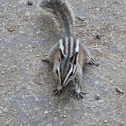
    Grant Grove - Chipmunk  07-04-2025

    Chipmunk 07-04-2025

    Grant Grove
    Grant Grove

    See all

    Sequoia And Kings Canyon National Parks - Giant Tree Museum - also has restrooms and exhibits.

    Sequoia And Kings Canyon National Parks

    4.6(555 reviews)
    19.5 mi

    My first time visiting…read more If you love nature, you will love this park. It's just breathtaking and deserves to be seen. I only spent a few hours there as I drove from San Francisco, which is about 4.5 hours. $35 a car. One thing I didn't like, when paying to get in, the Ranger asked if I was a legal resident. He asked that because he said it's $100 for a non-resident. Trump at his finest because the Ranger said it was an Executive Order. There are so many beautiful sites. Definitely worth visiting. Oh, I almost forgot. They have gas stations, and when I saw the price, I filled my tank. $6.19 for regular.

    Before I visited the place, I had heard of the Sequoia National Park several times throughout my…read morelife and all these mentions amounted to me believing one large fact: that the place was a sprawling, maybe never ending, sea of deep forest pageantry. And do not get me wrong, the place is in fact miles and miles and cubic centimeters of forest as commonly imagined. It had tall trees, meadows, dirt paths with twigs and shrubs all around and views so expansive the word majestic comes to mind. But after walking the same scenery for hours the beauty in green became a dull brown motif. Wood sprites might have heard my words or seen my unimpressed and tired face because Sequoia stopped being a forest of trees and green and it started to become a land of different weathers that not only gave me new challenges and vistas to experience but it also gave me beauty I had to endure. As I saw my friend Denise walk into a spherical cloud of fog, I realized that this place oscillated between being both proof of nature's magic and her jagged disposition. The fog seemed like a portal to Avalon where Pulk waited with prose, but it was also a reminder of all the sailors and drivers lost when the thickness of mist impairs good visual choices. The fog sphere was seen after Denise and I walked for hours, uphill, to see Morro Rock. As we walked up, we first passed mist that seem to have broken from a cloud. This was a sensational moment. She and. had both skydove but this is the first time where we felt like we walked through cloud veils, insetad of zooming past them with the hope of gravitiy abandon. I do not think I will ever re-feel the sensation of walking on cloud air, literally. She and I got separated. I thought I could follow the signs. But the signs were tricksters. As I walked toward the museum I saw a sign that said this way to Crescent Meadow. I did not see a sign that said this way to Crescent Meadow (pointing to the left) and this way to the Museum (pointing ahead). I assumed that because I no longer saw signs assuring me that I was on the right path, I must have gotten into the wrong one. I share this as the biggest piece of advice that I wish to give: Stay the trail, despite not having signs of reassurance that you are still in the right direction. The signs, and my broken internal compass, are both valid reasons as to why I eventually left the designated path and got lost. Like legit lost in the wilderness of Sequoia. I was not in an episode of Naked and Afraid but I did feel scared, disoriented and like I would not see my life tomorrow. Before I got to this point of panic, I arrived at a bluff of a white mountain that saw me greet miles of green pines that streched as far as the eye could see. It was a Rocky-like-triumph moment, except that I had to drag myself, as I sat, down this white mountain, but that was my survival experience that I am proud to have endured. After sliding down, I searched for paths that seemed walked on before, and found several that I had to follow and eliminae. I climbed over trees by hugging their fallen bark, and almost lost my shoe. I continued and eventually found a path and others humans. I was save for now. I got lost again but this time my survival was quicker as I walked down to the road. Rangers told me that I was not able to ride in the truck after I explained I was scared and unable to find my way twice. One of them told me to follow the road and eventually I would hit the museum. I did just that and I found my friend Denise waiting in the museum. After hugs laced with relief, she and I continued our trek to Sherman. But we got hit by rain. I had a hoodie. She did not. Her face looked beautiful covered with the remains of heavy rain. We walked and the sleet followed. We were wet, damp, and we were scared. What could be next? We could not find our path to Sherman. We waved people down, hoping that someone would take us to our car near Sherman. Eventually, we met Chester and he let us both into his car. The snow now was falling hard. She and I did not expect snow. We did not expect white to fall from the sky not when we were promised green on top of green all around. We got to the car and she drove in Snow for the first time. It was both scary and and beuatiful. I imagined that I was in snow caped mountains seeing frozen giants walk around. The night was gray. The monsters were there. She worried about us not having snow tired but still we drove down the snow covered pines, in a pilgramage to safety. Before we left the park we saw mist contrasted in the dark of the knight. It was a spooky evening, yes, the one that frames scary stories. But for us the night mist was further proof that Sequoia offers weather that is cyclical within a day. With space from the experience, I am only happythat I visited the place and was ensconsed by its many seasons. And, grateful that I survived the beauty of it all.

    Photos
    Sequoia And Kings Canyon National Parks - To the top of Moro Rock

    To the top of Moro Rock

    Sequoia And Kings Canyon National Parks - Patty & Levi

    Patty & Levi

    Sequoia And Kings Canyon National Parks - Giant Forest

    See all

    Giant Forest

    Inyo National Forest

    Inyo National Forest

    4.8(4 reviews)
    37.7 mi

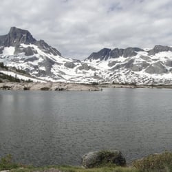
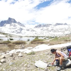
    Located in California's beautiful Eastern Sierra, the Inyo National Forest offers clean air,…read morecrystal blue skies, mountain lakes and streams, challenging trails, high mountain peaks, and beautiful views. With over two million acres, the Inyo National Forest is home to many natural wonders, including Mt. Whitney, Mono Lake, Mammoth Lakes Basin, and the Ancient Bristlecone Pine Forest, as well as seven Congressionally-designated Wildernesses, comprising over 650,000 acres of land. This is a 3 nights 4days backpacking trip totaling 22.5 miles in the Ansel Adams WIlderness and the setting is amazing. We started at Agnews Meadow to John Muir Trail looping back thru Pacific Crest Trail. John Muir Trail Section: The John Muir Wilderness is massive in length - over 100 miles at its longest point. It covers the central/south portion of the Sierra Nevada range, on both the west and east side. The west side offers access from California's Central Valley and has many small towns and camper facilities. The east side is steep, very steep, and is accessible from the Owens Valley. Named after the father of environmentalism and champion of the national park system, this Wilderness has everything the Sierra Nevada has to offer -- lakes, meadows, streams, mountain peaks, forests and more. The John Muir Trail travels about 53 miles in the John Muir Wilderness. In terms of the John Muir Trail, this Wilderness essentially covers the area between National Parks/Monuments. The mid-point for the Trail lies here. Typically, it is at (or near) Edison or Florence Lakes that the through hiker will take a brief break and re-supply. The John Muir Wilderness also affords the hiker spots to soak their feet in hot springs, grab a warm meal, and "traverse" from "easy" east side access points to west side access points for the trail. As the trail begins a long set of switchbacks, one of the most panoramic views along the entire John Muir Trail is gained. Between the trees one can see the Minarets, Mt. Ritter and Banner Peak. Summer is an excellent time to see wildflowers along the trail. At higher elevations, even in late Summer the wildflowers are blooming due to the late snow melt. The order of the Lakes as we hiked in is as follows: Shadow Lake, Clarice Lake, Garnett Lake, Ruby Lake, Emerald Lake, Badger Lake and Thousand Islands. I can not choose which lake to mention as my favorite. They're all breathtaking. But Garnett Lake and Thousand Island stays in my mind the most. Ruby Lake is mysterious looking and Shadow Lake is rewarding in a sense since this is the first lake you will see after the final push in a difficult steep switchback leading to it. Mosquitoes are abundant during summer here that makes it not my favorite :( but it is beautiful nevertheless. As you ascend to over 9500 feet mosquitoes get lesser and you're back in a cooler condition. There are definitely snow on the trail and in some areas more than others as we started on the JMT above 9600 feet. One section between Ruby Lake and Garnett Lake the whole1000 feet of trail was covered in snow. I would recommend a trekking pole and crampons for faster crossing. You could definitely do it without but the snow will slow you down. Some areas are as deep as 5 feet of soft snow. Clarice Lake at 9600 was about 80% frozen. We took a break here and listened to the frogs complain :) The trail from Clarice Lake to Garnett Lake was covered with snow. I decided to throw my pack down and follow it by sliding down the hill on my behind. It was fun! The majestic beauty of both the Minarets, Banner Peak(12,936 ft) and Mt Ritter (13,143 ft) is the backdrop on most of my pictures of Shadow Lake. Awesome! Lots of wild flowers on the way down thru the PCT. Had a semi encounter with a bear on the trail. We heard him but never got to see him from about 20 feet from us. Hope this review will somehow encourage Yelpers to explore Ansel Adams Wilderness! Enjoy my pictures. I walked uphill to 10,1000 feet and and a total of 22.5 miles to snap them :)!

    Very beautiful and calming. Sometimes being with nature helps you realize that our lives need to be…read moremore laid back.

    Photos
    Inyo National Forest - With Adam

    With Adam

    Inyo National Forest - Thousand Island Lakes on the way out thru the PCT.

    Thousand Island Lakes on the way out thru the PCT.

    Inyo National Forest - Zuma and Mazu. Dogs I met on the trail.

    See all

    Zuma and Mazu. Dogs I met on the trail.

    General Grant Tree - parks - Updated May 2026
    Loading...
    Loading...
    Loading...