Granville Gorge Photos


You might also consider
More like Granville Gorge
Recommended Reviews - Granville Gorge
Start your review...

1 year ago


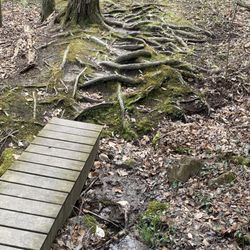
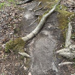
Not far from the center of Granville, MA heading East on 57 is Granville Gorge on the left hand side. There is limited parking no more than 10 cars but I found a spot quickly. From the parking lot to the gorge is a a short walk; the trail continues along side the river with many small falls and pools available for swimming. There many large and smaller boulders which extend out into the water providing picnicking or sunbathing opportunities. The trail in spots can be challenging; you should exercise caution as you can easily slip if you are not paying close attention. It is a beautiful area well worth a stop to take in the natural sights afforded by this scenic natural wonder. read more


5 years ago
More info about Granville Gorge
Southwick, MA 01077
Directions
Hours
Outdoor Amenities


Granville Gorge - hiking - Updated June 2026
Best of Southwick
People found Granville Gorge by searching for…
Things to Do in Southwick, Massachusetts
Hiking Trails in Southwick, Massachusetts
Secret Spots in Southwick, Massachusetts
River Swimming in Southwick, Massachusetts
Swimming Lakes in Southwick, Massachusetts
Walking Trails in Southwick, Massachusetts
Hiking With Kids in Southwick, Massachusetts
Scenic View in Southwick, Massachusetts
Swimming in Southwick, Massachusetts
Sunbathing in Southwick, Massachusetts
Places to Take Pictures in Southwick, Massachusetts
Waterfall Hike in Southwick, Massachusetts
Scenic Spots in Southwick, Massachusetts
Secluded Spots in Southwick, Massachusetts
Things to Do at Night in Southwick, Massachusetts
Running Trails in Southwick, Massachusetts
Waterfalls in Southwick, Massachusetts
Swimming Holes in Southwick, Massachusetts
Off Leash Dog Hikes in Southwick, Massachusetts
Bike Paths in Southwick, Massachusetts
Dog Swimming in Southwick, Massachusetts
Splash Pad in Southwick, Massachusetts