Cancel

    Open app

    Search

    Hathaway Preserve at Ross Run

    4.0 (1 review)

    Hathaway Preserve at Ross Run Photos

    More like Hathaway Preserve at Ross Run

    Recommended Reviews - Hathaway Preserve at Ross Run

    Your trust is our priority, so businesses can't pay to alter or remove their reviews. Learn more about reviews.
    Yelp app icon
    Browse more easily on the app
    Review Feed Illustration

    6 years ago

    Helpful 4
    Thanks 0
    Love this 2
    Oh no 0

    Verify this business for free

    Get access to customer & competitor insights.

    Verify this business

    Chain O' Lakes - Chain O'Lakes State Park

    Chain O' Lakes

    4.2(25 reviews)
    41.1 mi

    I've been making an effort to experience my home state of Indiana a little more these days. From…read morestate parks to roadside attractions to smalltown diners, I've been trying to simply slow down and enjoy Indiana. Chain O' Lakes State Park is one of Indiana's state parks. Located in Albion, a small city of under 2,400 in northeast Indiana's Noble County (think Kendallville), Chain O' Lakes State Park has as its main feature, you guessed it, a chain of lakes. The park has a chain of nine "kettle" lakes (13 lakes total, 9 connected). Kettle lakes are glacial lakes that were formed out of melting ice blocks. Chain O' Lakes offers small boating, 23 miles of forested trails for hiking, a hillside family cabin, a Nature Center, campground, swimming beach, picnic shelters, and the historic Stanley Schoolhouse - a historic one-room schoolhouse. Chain O' Lakes has 426 campsites, 18 cabins, waterfalls, great fishing spots, and you can rent watercraft. This is far enough from Indy that I kind of recommend making it a weekend trip rather than a day trip. There's much to do in Noble County (which also has a decent-sized Amish community). You can canoe a great five-mile path through the park's nine connected lakes (This used to be an official "challenge," though I don't know if it is anymore). There are even canoe camping sites (more isolated than the traditional camping sites). Chain O' Lakes is one of Indiana's under-appreciated gems. It's definitely less accessible than some of the parks, though it has improved somewhat over the years. It's more rustic and natural. It emphasizes outdoor experiences and its just over 2,700 acres feel like you could just get lost in them. The park is only 19 miles northwest of Fort Wayne (Indiana's second largest city), however, it feels like a world away. As someone who typically goes to Fort Ben State Park, I have a major love for these parks where you get there and forget there's a world outside the gates. If you're not the camping type, I'd probably head to Kendallville rather than Albion for the overnight. However, Chain O' Lakes has everything from primitive to more comfortable camping. So, it's easy to find something that works. I hadn't been to Chain O' Lakes in a while. Returning, I was reminded just how much I enjoy the place and how relaxing it is. A few other basics - This is a state park, so there's a fee to enter unless you've gotten the State Park pass (which I recommend for Indiana's 24 state parks). Also, fishing requires the state license and it is enforced. Finally, a couple semi-fun facts. There's a "re-entry center" located directly in the state park with a capacity of 140 incarcerated individuals. It offers educational and treatment programs designed to help people transition into the community - it also helps maintain this park, Pokagon, and the surrounding communities. It's been here since 1967 (and yes, it is safe.). Chain O' Lakes State Park also hosts The HUFF 50k Trail Run/Relay, the 12th largest ultramarathon in North America. Doesn't all this make you want to visit? I'll admit that I tend to stick in the 4-5 star range for most state parks. I love them. In terms of accessibility, I'd go 4-star for Chain O' Lakes. Because it offers so much and is really under-appreciated (in my opinion), I'm bumping it up to 5-stars. The trails, occasionally accessible, really do require someone with mobility issues to have assistance and some simply wouldn't work. Word of caution, as well, with so much water you had best plan for mosquitoes. They can be really serious around here!

    Great camping spot! It's always quiet and beautiful. The boat rental closes at 4 ( I couldn't find…read morethe hours) and we didn't know that and got there at 4:05 :( only downside. The trails are good and the Dairy Queen in town is always a nice backup if the hot dogs aren't enough for your hunger

    Photos
    Chain O' Lakes - Chain O' Lakes State Park

    Chain O' Lakes State Park

    Chain O' Lakes - Chain O' Lakes State Park

    Chain O' Lakes State Park

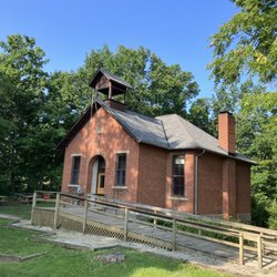
    Chain O' Lakes - School with great free WiFi

    See all

    School with great free WiFi

    Nickel Plate Trail

    Nickel Plate Trail

    4.8(5 reviews)
    16.6 mi

    Much gratitude for the daily care and maintenance in keeping this trail clear and salt-free for…read moreboth 2 and 4-legged visitors.

    I'm a definite fan of the Nickel Plate Trail, an Indiana rail-trail running from Kokomo to…read moreRochester - approximately 37 miles of nicely paved trail that is perfectly appropriate for walkers, runners, wheelers, and bikers. By now, you likely already know that I spend a good amount of time on trails as part of my activism and traveling by wheelchair. I look for lengthy trails that are well connected to city areas where I can make appearances for fundraising, awareness, and outreach. The Nickel Plate Trail goes through cities including Kokomo, Peru, and Rochester. This allowed me to stop in each city and do some significant outreach. If you visit the Peru area, for example, you'll see a fairly new accessible park for which my Tenderness Tour (the name of my event) made a donation. I've built ongoing relationships from the connections I made on the trail and actually still work quite a bit in both the Rochester and Peru areas. I've spoken in Maconaquah Schools, an area not far from the trail. I actually thought I'd already written this review, but when I discovered a photo from my trip that I wanted to post I realized I'd never actually written this review. If there's a major deficit on this trail, it's a significant lack of restroom availability. As someone who was largely traveling by wheelchair, that's a serious need and it definitely caused some hassles. The only place where they have truly available restrooms are in Peru - there's a trailhead/parking area at the First Bank of Berne that offers nearby public restrooms. Other than that, you definitely have to leave the trail to find anything - and you'll be somewhat lucky if you do. For 37 miles of trail, restrooms just plain make sense and the lack of restrooms take this from a 5-star to a 4-star trail. Otherwise, this is a beautiful trail and I'd be stunned if you don't see wildlife on it. Town highlights include: Rochester, Indiana is known as "The Round Barn Capital of the World." It has Lake Manitou (beautiful). Grab lunch at The Dam Landing (They sponsored my Tenderness Tour). Rochester is a small, friendly town. Macy is a cute small town that was developed in 1860 along with the railroad in the area. It was originally known as Lincoln, however, they had to change their name because there was already a nearby Lincoln (word didn't travel fast in 1860). Deedsville is, well, a small town. I like to pretend it's named after Mr. Deeds, but I'm just pretending. I suppose it could be named after a Mister Deeds. Peru is also a very cool city. It's known as the "Circus Capital of the World." It was the birthplace of Cole Porter. You don't know Cole Porter? Go look him up. I'll wait. Back? This is also home to the Miami Indians (This is a Native American tribe - NOT a sports team. Geez. Get with it.). The independent film Little Big Top was shot here. Bunker Hill's a great little town and home to Maconaquah Schools along with Grissom Air Museum. There's also a lot of auto racing around here. Miami is an unincorporated town - whenever I wheel through it, I have my friend blare Will Smith's "Miami." I don't think he was singing about this one, though. Kokomo is known as the "City of Firsts" as the city has had an extraordinary history with technical innovations. My outreach history is kind of weak here, but I like visiting the city. You should go to the Elwood Haynes Museum, though I can't lie - it makes me think of Elwood Blues. At various points, you can connect into other trails. They're also working on expanding Nickel Plate. In many ways, it reminds me of the Cardinal Greenway minus actual restrooms (Can you tell the restroom thing bugs me?). The trail is for the most part fairly level with gentle inclines/declines and really nice paving the entire way. When you're in the cities, you'll definitely experience people along the way. You'll also get your fair share of rural trail, though it's still nicely paved. There's no question this is one of Indiana's best trails. I look forward to returning to it in the near future.

    Photos
    Nickel Plate Trail
    Nickel Plate Trail - I'm wondering if this is supposed to qualify as accessible.

    I'm wondering if this is supposed to qualify as accessible.

    Nickel Plate Trail - Wabash river crossing

    See all

    Wabash river crossing

    Salamonie Lake

    Salamonie Lake

    3.3(3 reviews)
    7.7 mi

    I do not recommend this campgrounds to first time camping or inexperienced drivers…read more Adequate campsites, some are just ridiculously tiny even for an experienced driver and a small camper. Very clean and well maintained. Our site is on a slight slope but driving around this morning before all the Friday guests checked in I would say that most of the sites here have some grade but nothing a little bit of blocking won't fix if you can get into the spot. Cell signal I use the one that starts with a "V" is adequate for calls and some data, not sure that streaming a movie during the daytime would be great but music last night streamed just fine. The trails here are nice, well maintained mostly easy, clearly marked and less than a couple miles although the Bloodroot trail is about 12 miles and moderate. We hiked a couple short trails today without any complaints. If you are camping in the back of the modern (electric only) it's a good hike to the trail heads but there are ample places to park if you have the ability to drive to the trail head. The marina "store" sign said is closed this late in the season but about a mile or so down the road is a bait shop with most of what you might have forgot, grocery about 12 miles, American Legion about 20. It appears that DNR goes home at dark and there is no quiet time. 3AM dogs barking loud music and screaming drunks. This park is known for this sort of thing so I was surprised when speaking with a representative of the parks department earlier in the week and they boasted about all the changes that have been made in the recent year. I can say is take your chances. Use special care when booking your campsite especially if you are over 25'. Camp here during the week and pull out before the circus arrives. Otherwise this camp grounds is an epic fail and an embarrassment to the Indiana Department of Natural Resources due to the lack of adequate law enforcement in the evening and night hours.

    Adding this spot to the "best sunsets" list! This is for the Salamonie Lake State Park. It was a…read morebit tricky to find with all the construction going on. We actually went way out of our way before figuring out we just needed to be the "thru traffic" and drive through the construction barriers (okay to do to access park). To get to the lake, enter on the west side. It's a great beach area. I very much appreciated that they had the picnic area directly behind the beach (only steps away). This is great for families. You can set up a picnic area & watch the kids swim. They had outhouses available. No lifeguards on duty. Swim at your own risk. We stayed until dusk to watch the sunset. It's worth it! I enjoyed watching all the boats go by too. They have field areas for soccer, etc. and a volleyball nets, piers for swimming. And even a handicap accessible pier! The entire beach is accessible and easy to navigate. A few grills are available to use in the picnic area. There is also a skateboard park in the park but we didn't locate it. There's a marina and camping too. It's really a beautiful park! If you are looking for swimming, boating, or fishing - this is your place! Pack everything you need, because the park is very rural & the nearest store is a Dollar General about 20 mins away. With that being said, an cell signal was also hard to come by.

    Photos
    Salamonie Lake
    Salamonie Lake
    Salamonie Lake

    See all

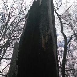
    Mengerson Nature Reserve - At some point this tree caught on fire. Lightning?

    Mengerson Nature Reserve

    5.0(1 review)
    42.0 mi

    I'm fat. Over the last year this statement is no longer a subjective opinion, my pants tell me I'm…read morefat. So, I've made it a point to be more active and start creaking the ole bones again. I've driven past the entrance for this park for a year and had good intentions of stopping. Today I ran into the one neighbor who doesn't hate me, and he told me I can get to the hiking trails from my neighborhood. Cool! I charged up my 1st gen iPod (seriously), dug out my pig wrestling sneakers (seriously), and my fanny pack (seriously) and off I went. Mengerson is owned and cared for by Acres Land trust since 1989. There are approximately 32 acres of forest and hiking trails are about 1.2 miles. This time of year the trails are ridiculously muddy, so I'm glad I wore my pig shoes. There were several points I just went off trail to avoid standing water, and since the trees and undergrowth is still bare, it wasn't too bad. The hike itself is easy and suitable for just about anyone. There can be deer seen (according to my neighbor) and all sorts of bird species. There are a few neat side trails. You are never far from housing, but it's still quiet (my iPod died in the middle of Bel Biv Devo) and once the trees fill in I imagine it's even more peaceful. Now that I know I can walk to a trailhead and not have to drive and park, I can say I'll be back frequently till the mosquitos drive me away. This is a neat little patch of forest and I highly recommend it. Plus its a pokestop for the three people who still play PokemonGo.

    Photos
    Mengerson Nature Reserve

    See all

    Cardinal Greenway

    Cardinal Greenway

    4.4(9 reviews)
    47.0 mi

    It has been nine years since my original review of Indiana's longest rail-trail, the Cardinal…read moreGreenway. Despite the popularity of Central Indiana's Monon Trail, the Cardinal Greenway is a much longer trail at 62 miles of paved trail and another 15 miles of road that many bicyclists use (from Gaston to Jonesboro). I just finished the Cardinal Greenway yet again for one of my Tenderness Tour events, an annual long-distance wheelchair event that I use for fundraising and outreach. As is nearly always the case for me, I started at the Sweetser Switch Trail in Sweetser, Indiana, a smaller trail that leads right into the Cardinal Greenway. My review is based largely upon my experiences as a wheelchair user on the trail, though some of my insights will universally apply. As someone who enjoys long distances, the Cardinal Greenway is ideally suited for a 2-3 trek. It's a mostly wheelchair friendly trail, though some with upper body weakness may struggle on some of the inclines. I will also note that while the Cardinal Greenway tends to have a decent number of trailheads with portable toilets, some of these are surrounded by gravel and may be more difficult to navigate for wheelchair users. \Additionally, multiple parking areas had clearly marked accessible parking yet were either only gravel or had a surface that was so uneven you'd be a fool to try it in a wheelchair. So, a little advance planning is probably a good idea for wheelchair users. Fortunately, the Cardinal has a good team behind it and it's fairly easy to get accurate info. I'd originally given the Cardinal Greenway a 4-star review precisely because of some of my accessibility concerns. I'm increasing to a 5-star this time around because, quite honestly, accessibility has improved over the years and I've simply fallen in love with this trail. It's a fun mixture of city and rural sections. If starting in Sweetser, the lovely Sweetser Cafe is directly off the trailhead and a great place to stop for breakfast/brunch or a drink (before 2pm). In the rural areas, you can go for miles without seeing more than a few people. The Marion section, which goes directly through the more urban parts of Marion, still seems to be under-utilized but is honestly a lot of fun. It looks a little rough, however, I've never had a single issue wheeling through Marion. As you move out of Marion, you start to experience the country area and, of course, once you hit Gas City you either decide to try the bike trail (not advised for walkers...minimal shoulder and occasionally busy traffic) or pick up in Gaston. I loved the Gaston to Muncie stretch and it takes you through downtown Muncie. The trail's main office is at Wysor Street in Muncie, an area I was told isn't the greatest but looks deceptively calm. Again, I had no problems at all but staying aware is important. I will note that the Wysor Street Depot is a beautiful historic landmark that serves as the Cardinal office - yet, it appeared they've reduced their hours. After Muncie, you have a fairly significant period of a modest incline. It was an exhausting stretch for me that ended in Losantville. This is a particularly long stretch and those who want to do an overnight will probably leave the trail in Losantville and stay in Winchester. Losantville to Richmond is, with a couple of exceptions, a pretty nice downhill. Among the three major cities on the trail, I was most impressed with Richmond's care for the trail with the exception of the ending D Street Trailhead that is located in a hard to find and rather run down area a few blocks from City Hall. The trailhead itself is nice and I found several nice people upon my arrival, but the area itself just seems an odd place to end such a wonderful trail. I've always loved this trail and the people I meet along it. The Cardinal Greenway is in the Rail-Trail Hall of Fame (as is the Monon) and continues to get even better every time I ride it. The restroom situation, in particular, has really improved and over 20 trailheads now have a restroom option. If you're looking for a modestly challenging and scenic trail, the Cardinal Greenway is a tremendous option and easily within a couple hours of Indy even at its most distant point in Marion or Richmond.

    My husband and I recently biked the cardinal greenway and had such a nice time. We parked at the…read morestop in gas city and it had a nice lot and bathrooms. We rode north 10 miles and back. The trail is Good despite a decent amount of bumps which can be rough in a road bike. The bridges and scenery were great though. Fun ride!

    Photos
    Cardinal Greenway - Gennett Records - a historic early jazz label that recorded people like Oscar Peterson and Louis Armstrong. There's a walk of fame here.

    Gennett Records - a historic early jazz label that recorded people like Oscar Peterson and Louis Armstrong. There's a walk of fame here.

    Cardinal Greenway - Wonderfully restored Muncie station is the HQ for the Cardinal Greenway Organization - they offer a few trail souvenirs.

    Wonderfully restored Muncie station is the HQ for the Cardinal Greenway Organization - they offer a few trail souvenirs.

    Cardinal Greenway - Round barn along the Cardinal Greenway

    See all

    Round barn along the Cardinal Greenway

    John Craddock Wetland Nature Preserve

    John Craddock Wetland Nature Preserve

    5.0(1 review)
    47.5 mi

    I really enjoyed my visit to this park. First, I don't think many people know about it and so I…read morehad the entire park to myself. I was able to grab one of the limited street parking sites on Bunch Blvd near the north entrance to the park. Second, there was a small plaza with informational signs describing the park, the folks involved with getting it built, and general wetland information that was brief, but helpful. Next, most of the pathway for visitors is slightly elevated on a boardwalk. Even though there was disturbance in the area during the construction, the wetlands have now recovered and the elevated trail makes for easy walking without damaging the surrounding wildlife. The rest of the trail is equally broad and hopefully gives good enough views that visitors won't wander off into the prairie area of the park. Note that during my visit, the wetlands appeared mostly dry but green. About half way through the trail, a large wooden shelter was constructed with a slightly elevated observation deck that offers great views over the lowlands of the park. There are more benches available there and lots of shade in an otherwise open area of the park. I really appreciate that the area has been preserved as a beautiful green area that can accommodate both humans and nature. Review #1053

    Photos
    John Craddock Wetland Nature Preserve - We always have a great time at the wetlands!

    We always have a great time at the wetlands!

    John Craddock Wetland Nature Preserve - Though dry during my visit, you can see how this lowland area near the river would be a prime space for overflow

    Though dry during my visit, you can see how this lowland area near the river would be a prime space for overflow

    John Craddock Wetland Nature Preserve - North entrance to the park had a small plaza before the entrance.  There is a small entrance on the left side of the gate for visitors

    See all

    North entrance to the park had a small plaza before the entrance. There is a small entrance on the left side of the gate for visitors

    Hathaway Preserve at Ross Run - hiking - Updated July 2026

    Loading...
    Loading...
    Loading...