Humpback Rocks Photos


More like Humpback Rocks
Recommended Reviews - Humpback Rocks
Start your review...


Reviews With Photos


A mixture of moderate and strenuous hiking that includes part of the Appalachian Trail. Views at the top are amazing. Outdoor Farm Museum is adjacent to Humpback Rocks Visitor Center. The only downside is somewhat limited parking and this place is very popular.
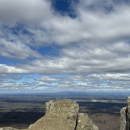

Oh wow !!! It's a hike but so worth it. Going up hill to the rocks is very steep, the entire loop was great ! It's about 4.5 miles. If you decide to to the steep climb first than, it's a breeze coming back around the loop, highly recommend


I've done this hike twice and to be fair, I missed the peak times to see the leaves change color/the trees having leaves. Both times I went up, it was quite pretty for my first time seeing the mountains, however the view was not as pretty due to it being in the cold season. I am also not that great with exercise lol and both times I went up there I was dying and out of breath...but this is a free hike so why not?


This is an amazing hike. It's my favorite location to hike. It's straight up and is a great work out. It's also a bit of a rock scramble at the end. Our kids (12 and 14) can do it and so can our little shih tzu. It's is not a hike for small children. We do not take our two special needs children on this hike. This is a hike you need good hiking shoes before you attempt to it. There are a lot of rocks the entire way. Sometimes the rocks can be loose or slippery so you have to be careful. The view when you get to the top is breathtaking. You have to be very careful at the top because it's truly dangerous. The view is breathtaking and unparalleled.


2019: UPDATE: Who reviews a 'rock'? Here's the update. Rocks're still there. No rattlesnakes, bear off in the distance. It's still a great quick hike, 25min up, at a clip. Destination view at the top. ------ The Hike. This is the one you do first. Steepish at the start- excellent - then bang up super views open at the top. Don't fear the slope. Kids and aged dogs climb. And some guy with ski poles runs up and down twice. And we saw just a rattlesnake, off trail, with a small crowd photographing it. Dunno what the hump is, but the rocks at the top are great.


Really great hike with gorgeous views at the top. It is a straight incline though so be prepared to get a good workout in, but there are seating areas along the way to take breaks at. Dogs are allowed but need to be on leash. It is a fairly high trafficked area, with that I've seen all ages enjoy this hike!


4.8 miles to the top at 2,630 feet, that is Humpback Rocks. I am not very active so the hike felt super long and the rocks seemed so unattainable. After about 3 hours, we made it to the spectacular views which made the struggle so worth it. It is truly breathtaking up there, a testimony of God's wonderful work. The hike down was about .8 miles but felt way longer than that and was very steep (be careful going down).


Strenuous incline but the view was worth it. We chose the harder route because it was faster to the top.


Don't let the low mileage fool ya. I've been here twice and have taken the blue blaze trail(2 miles total) and it is pretty strenuous. I hope to take the white blaze trail one day as it's longer. Walking up is a "bear" but, definitely worth the views once you reach the top. The terrain are rocks, some steps, puddles of mud, & pebbles. I slipped coming down. It's easy to do so, take it slow, be safe, and enjoy. I'm far from an elite hiker but, highly recommend good hiking shoes, walking stick(if not it's ok but, feels more secure), first aid kit, water, snacks to eat when you reach the summit, and pepper spray in case you get attacked by a bobcat(we did see one driving up).


Do this trail. Difficult vertical with a few switch backs. Maybe you'll see bears. Whatever you encounter, the payoff speaks for itself. Anticipate 2-3 hours on this loop. Intersections with the AT.


"Every mountain top is within reach if you just keep climbing." --Barry Finlay Lyndhurst, VA--Road Trip #3 Humpback Rocks (HR) was the main focus for my road trip. It had been a rough year, and I wanted to do something special for my birthday. My friend Jim B. pointed me in the direction of Afton, a beautiful area outside of Charlottesville. I wanted to climb a mountain--or at least something close to a mountain anyway, and then I found HR. There is something about setting a goal, working hard, and reaping the rewards at the end. Of course, there are many rewards at the end of a mountain, but the main purpose is the priceless view. Here are some details for you: If you are coming from Charlottesville, take I-64 West to exit 99 and turn onto US 250. You will see the sign for Skyline Drive/Blue Ridge Parkway on the right. Once you follow the parkway, it will take you about 5 miles until you see Humpback Rocks Visitor Center on the right. Just a smidge up the road on the left is Humpback Gap Overlook and the picnic area. This is where you want to park. If you need to use a restroom, you can drive across the street to the visitor center -I wrote a review (http://www.yelp.com/biz/humpback-rocks-visitor-center-and-farm-museum-lyndhurst)-. If you're there during the off season, you're out of luck. Make sure you use the bathroom before you go! Not even a port-a-potty. HR is a greenstone outcrop with a summit elevation of 3,080 feet. The trail to HR is about 45 minutes--give or take a few depending on your fitness level. The first half of the one-mile trail is "easy" but a steep 700'+ ascent. By "easy" I mean it is a well-maintained, wide, gravel trail that has many benches along the way. However, since I am used to living close to sea level, the immediate steep ascent, and the altitude got my heart pumping and my lungs screaming right away. I had to tell myself it wasn't a race; I used the benches and rested when I needed to catch my breath. The second half of the climb was more difficult in terms of being careful where you step. There are "stairs" a few times, lots of rocks, and switchbacks. Make sure you look for the blue-blazed signs because part of the trail doesn't look like a trail. Don't worry--there are lots of blue-blazed signs--just pay attention. The view at HR is spectacular as you look over the Shenandoah Valley and the Blue Ridge Mountains; you scramble on top of the rocks and it can be a bit scary at first. I was lucky enough to have the whole rocks to myself. It can be quite windy up there, but I wasn't cold during a 70° day with the sun shining down on me. Reminders: * Bring water! * Keep an eye on the time so you don't get lost on the rocks when it's dark. Also, it's smart to keep a flashlight with you when you're hiking. * Carry a map/trail guide with you. I did have cell reception the whole time there (even on the top!), but you never know. It's better to carry the information with you just in case. There are parts of the park where you don't get a signal. * It's always better to have a hiking buddy with you. Also, there is a trail that takes you to Humpback Mountain (HM) if you're looking for a bigger adventure. You can check out a blog about it here: http://hikingshenandoah.blogspot.com/2013/11/humpback-mountain.html. I had wanted to continue on to HM, but being alone, I thought it would be best not to attempt it. Not many people use that trail, and if something were to happen, I might have been stuck. HR was a challenging hike for me, but that was what made it so wonderful. My adventure made me feel alive, and the view at the end was absolutely worth it. Compared to other "mountains," HR wasn't all that difficult, which is great for a beginner like me. Maybe now I can set my sights on Old Rag Mountain... **If you're wondering if you can do it, you can! It was harder than I thought it would be because I'm used to walking/hiking 4 miles easily. The steepness was the tricky part. I saw little children and older people on the trail. For the record, I didn't end up sore at all the next day, but my lungs did hurt later that night. Just take your time and you will be fine.


Such an intense hike, but the view is so worth it! It's a mile up and a mile back, if you take the blue marked trail. The hike is pretty steep the entire time, with some brief flat areas. Halfway up, my boyfriend and I noticed a fork in the trail that went directly up to the rocks. We decided to take this shortcut, despite it being way steeper and having to climb some parts. When we reached the top, we realized the rest of the trail that we skipped went around the mountain. I was kind of relieved we took the route we did, haha. There were plenty of people up on the rocks when we got up there, and taking photos with any clear areas was almost impossible, but we got a few good shots. I totally recommend this hike to everyone, it's something you have to see at least once in your lifetime!


Loved this trail. It wasn't too difficult, there were people of all ages there, dogs too! It took a bit to hike up, of course coming down was much quicker. One you get to the top you have a BEAUTIFUL view of the Blue Ridge Mountains. There's plenty of room so lots of people were there taking pictures, eating lunch, chatting. I had a really good time with my friends!


I love this hike! This is one of the closer beautiful mountain view hikes to Richmond (about 1h30m drive). You can enjoy it as a loop or an out-and-back depending on how long you'd like the hike to be/difficulty level. 0.8 miles of it is very steep and you can decide if you want to go up and down that or if you want to take the long way down. Both are great options. It's great for all seasons, but if you're looking for green I'd suggest May. If you want fall colors, usually October. This is a beautiful hike with stunning views. It can get crowded on weekends, but not in an annoying way. There is a parking lot right at the trailhead. There is overflow parking not too far away with restrooms. They also have some picnic benches. I recommend hiking up to the rocks and having lunch there. While it is a steeper hike, do know that it doesn't last too long. read more


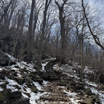


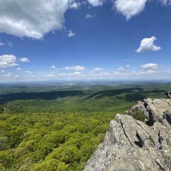

What a great hike. We parked by the restrooms and walked over giving us more steps/mileage. That way you don't have to fight for a spot in the overly crowded parking lot. The hike is straight up. I love a good climb. However, the descent is straight down. The old knees hate that. Overall a fabulous hike that is seriously overcrowded. We passed 100s of people and dogs. read more


4 years ago
Hump Back was a total bucket list climb for close to a decade. I've read it's difficulty makes it possible for amateurs to easily complete. Well it's a bit more challenging than I expected. Good news is I have tips to help if you have never been. First of all... WARNING! Must be physically fit for approximately 2 hours roundtrip of rough terrain. You can take breaks, a few benches are provided. I needed a lot! There is a parking lot at the beginning of the trail. Overflow is at the Visitors Center across the street. Wear proper footwear, no sandals or tennis shoes. Bring hydration and maybe even a small first aid kit. You will absolutely need to hydrate. Choose a cooler and more importantly DRY day. So the ideal timing is AM and season is Fall. Once at the top use caution and be willing to help others. If you see litter pick it up. I saw a single tissue that disappeared in my pocket. Dogs are welcome and they will love it if fit enough to conquer. They need hydration too! Recommend not going alone. Makes sense to me. However if you must the trail is typically busy. Camera is a must, a camera phone serves two purposes. However there is little to no cell service. Don't count on using your phone. I have AT&T and text only worked. There are Bear warnings for a reason, they are in the area. Most common on the parking area. Do NOT leave food out Finally hikers are some of the nicest people you will ever meet. Be willing to converse with others, help if necessary. On my hike we were short of hydration and was provided a bottle of water. You will love the experience. The views are stunning!!! read more


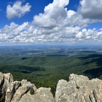

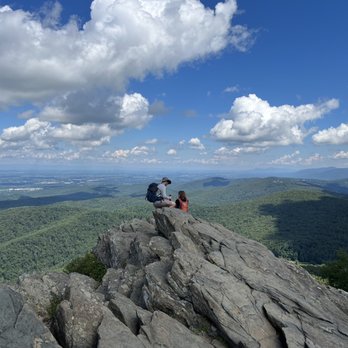


A mixture of moderate and strenuous hiking that includes part of the Appalachian Trail. Views at the top are amazing. Outdoor Farm Museum is adjacent to Humpback Rocks Visitor Center. The only downside is somewhat limited parking and this place is very popular. read more


2 years ago
Oh wow !!! It's a hike but so worth it. Going up hill to the rocks is very steep, the entire loop was great ! It's about 4.5 miles. If you decide to to the steep climb first than, it's a breeze coming back around the loop, highly recommend read more

3 years ago
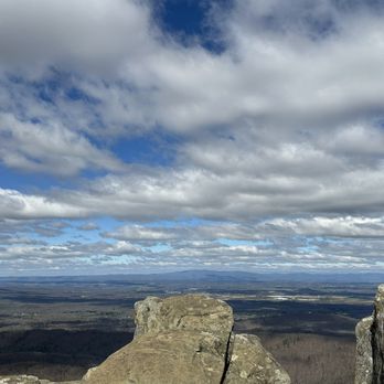
I've done this hike twice and to be fair, I missed the peak times to see the leaves change color/the trees having leaves. Both times I went up, it was quite pretty for my first time seeing the mountains, however the view was not as pretty due to it being in the cold season. I am also not that great with exercise lol and both times I went up there I was dying and out of breath...but this is a free hike so why not? read more


This is an amazing hike. It's my favorite location to hike. It's straight up and is a great work out. It's also a bit of a rock scramble at the end. Our kids (12 and 14) can do it and so can our little shih tzu. It's is not a hike for small children. We do not take our two special needs children on this hike. This is a hike you need good hiking shoes before you attempt to it. There are a lot of rocks the entire way. Sometimes the rocks can be loose or slippery so you have to be careful. The view when you get to the top is breathtaking. You have to be very careful at the top because it's truly dangerous. The view is breathtaking and unparalleled. read more


2019: UPDATE: Who reviews a 'rock'? Here's the update. Rocks're still there. No rattlesnakes, bear off in the distance. It's still a great quick hike, 25min up, at a clip. Destination view at the top. ------ The Hike. This is the one you do first. Steepish at the start- excellent - then bang up super views open at the top. Don't fear the slope. Kids and aged dogs climb. And some guy with ski poles runs up and down twice. And we saw just a rattlesnake, off trail, with a small crowd photographing it. Dunno what the hump is, but the rocks at the top are great. read more


Really great hike with gorgeous views at the top. It is a straight incline though so be prepared to get a good workout in, but there are seating areas along the way to take breaks at. Dogs are allowed but need to be on leash. It is a fairly high trafficked area, with that I've seen all ages enjoy this hike! read more


4.8 miles to the top at 2,630 feet, that is Humpback Rocks. I am not very active so the hike felt super long and the rocks seemed so unattainable. After about 3 hours, we made it to the spectacular views which made the struggle so worth it. It is truly breathtaking up there, a testimony of God's wonderful work. The hike down was about .8 miles but felt way longer than that and was very steep (be careful going down). read more


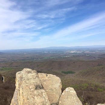
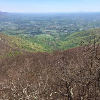
Don't let the low mileage fool ya. I've been here twice and have taken the blue blaze trail(2 miles total) and it is pretty strenuous. I hope to take the white blaze trail one day as it's longer. Walking up is a "bear" but, definitely worth the views once you reach the top. The terrain are rocks, some steps, puddles of mud, & pebbles. I slipped coming down. It's easy to do so, take it slow, be safe, and enjoy. I'm far from an elite hiker but, highly recommend good hiking shoes, walking stick(if not it's ok but, feels more secure), first aid kit, water, snacks to eat when you reach the summit, and pepper spray in case you get attacked by a bobcat(we did see one driving up). read more






7 years ago
Do this trail. Difficult vertical with a few switch backs. Maybe you'll see bears. Whatever you encounter, the payoff speaks for itself. Anticipate 2-3 hours on this loop. Intersections with the AT. read more



11 years ago
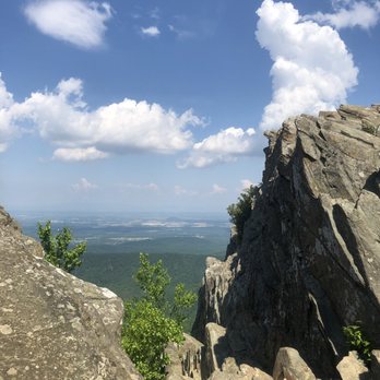
"Every mountain top is within reach if you just keep climbing." --Barry Finlay Lyndhurst, VA--Road Trip #3 Humpback Rocks (HR) was the main focus for my road trip. It had been a rough year, and I wanted to do something special for my birthday. My friend Jim B. pointed me in the direction of Afton, a beautiful area outside of Charlottesville. I wanted to climb a mountain--or at least something close to a mountain anyway, and then I found HR. There is something about setting a goal, working hard, and reaping the rewards at the end. Of course, there are many rewards at the end of a mountain, but the main purpose is the priceless view. Here are some details for you: If you are coming from Charlottesville, take I-64 West to exit 99 and turn onto US 250. You will see the sign for Skyline Drive/Blue Ridge Parkway on the right. Once you follow the parkway, it will take you about 5 miles until you see Humpback Rocks Visitor Center on the right. Just a smidge up the road on the left is Humpback Gap Overlook and the picnic area. This is where you want to park. If you need to use a restroom, you can drive across the street to the visitor center -I wrote a review (http://www.yelp.com/biz/humpback-rocks-visitor-center-and-farm-museum-lyndhurst)-. If you're there during the off season, you're out of luck. Make sure you use the bathroom before you go! Not even a port-a-potty. HR is a greenstone outcrop with a summit elevation of 3,080 feet. The trail to HR is about 45 minutes--give or take a few depending on your fitness level. The first half of the one-mile trail is "easy" but a steep 700'+ ascent. By "easy" I mean it is a well-maintained, wide, gravel trail that has many benches along the way. However, since I am used to living close to sea level, the immediate steep ascent, and the altitude got my heart pumping and my lungs screaming right away. I had to tell myself it wasn't a race; I used the benches and rested when I needed to catch my breath. The second half of the climb was more difficult in terms of being careful where you step. There are "stairs" a few times, lots of rocks, and switchbacks. Make sure you look for the blue-blazed signs because part of the trail doesn't look like a trail. Don't worry--there are lots of blue-blazed signs--just pay attention. The view at HR is spectacular as you look over the Shenandoah Valley and the Blue Ridge Mountains; you scramble on top of the rocks and it can be a bit scary at first. I was lucky enough to have the whole rocks to myself. It can be quite windy up there, but I wasn't cold during a 70° day with the sun shining down on me. Reminders: * Bring water! * Keep an eye on the time so you don't get lost on the rocks when it's dark. Also, it's smart to keep a flashlight with you when you're hiking. * Carry a map/trail guide with you. I did have cell reception the whole time there (even on the top!), but you never know. It's better to carry the information with you just in case. There are parts of the park where you don't get a signal. * It's always better to have a hiking buddy with you. Also, there is a trail that takes you to Humpback Mountain (HM) if you're looking for a bigger adventure. You can check out a blog about it here: http://hikingshenandoah.blogspot.com/2013/11/humpback-mountain.html. I had wanted to continue on to HM, but being alone, I thought it would be best not to attempt it. Not many people use that trail, and if something were to happen, I might have been stuck. HR was a challenging hike for me, but that was what made it so wonderful. My adventure made me feel alive, and the view at the end was absolutely worth it. Compared to other "mountains," HR wasn't all that difficult, which is great for a beginner like me. Maybe now I can set my sights on Old Rag Mountain... **If you're wondering if you can do it, you can! It was harder than I thought it would be because I'm used to walking/hiking 4 miles easily. The steepness was the tricky part. I saw little children and older people on the trail. For the record, I didn't end up sore at all the next day, but my lungs did hurt later that night. Just take your time and you will be fine. read more





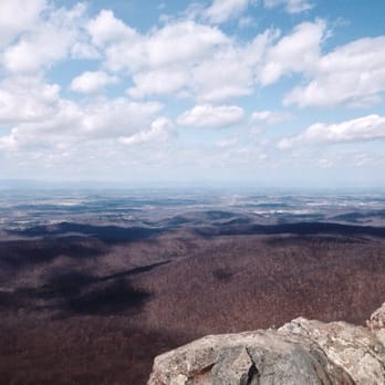

Such an intense hike, but the view is so worth it! It's a mile up and a mile back, if you take the blue marked trail. The hike is pretty steep the entire time, with some brief flat areas. Halfway up, my boyfriend and I noticed a fork in the trail that went directly up to the rocks. We decided to take this shortcut, despite it being way steeper and having to climb some parts. When we reached the top, we realized the rest of the trail that we skipped went around the mountain. I was kind of relieved we took the route we did, haha. There were plenty of people up on the rocks when we got up there, and taking photos with any clear areas was almost impossible, but we got a few good shots. I totally recommend this hike to everyone, it's something you have to see at least once in your lifetime! read more


Loved this trail. It wasn't too difficult, there were people of all ages there, dogs too! It took a bit to hike up, of course coming down was much quicker. One you get to the top you have a BEAUTIFUL view of the Blue Ridge Mountains. There's plenty of room so lots of people were there taking pictures, eating lunch, chatting. I had a really good time with my friends! read more


8 years ago
This was a great hike! Not all that long in the scheme of things, but with over 800 feet in incline you are challenged. A bit rugged at times since the Park Service no longer has the funds for great upkeep we were frequently forced to find a way around downed trees, new creek beds flowing in the trail, and at one point simply picking a spot to clamber up some loose rocks to regain the trail. The view is totally worth it and we met many friendly fellow hikers along with way! Wear good shoes and take some water! We did this off-season and truly enjoyed the pre-leaf scenery and the views at the top! A fun undertaking and some good exercise! read more


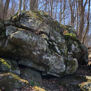

Humpback Rocks is a great hike! The mileage is low, but it's more difficult than it seems. The trail is rather steep, but there are plenty of benches to rest on along the way. The view from the top is beautiful, and there is plenty of space on the rocks to move around or rest for the hike back down! Staying at the top of the rocks is amazing, and there's also space to simply sit and admire the view. I highly recommend this hike, especially to those new to the VA area like I am. It is a great way to be introduced to the Blue Ridge! read more


The entrance to this trail is to the left, just past the humpback visitor center and it's marked as picnic area. Even though this is about a 2 mile hike round trip, the way up is a steep incline! The trail starts off with gravel, but once you pass the stairs, it gets pretty rocky until the top, but view is worth it! I went mid week in the afternoon and there was still a constant flow of fellow hikers. I was able to enjoy the view at the top solo for a little and take it all in..breathtaking!! read more


11 years ago
Absolutely stunning location nearby Charlottesville for views of the Blue Ridge Mountains! This is a must see hike that is challenging but approachable enough with a steep incline and natural path that will entice the novice to savvy hiker. For the early risers, this is another beautiful vantage point for a sunrise hike! This is a popular destination for locals and visitors alike for the accessible path from the parking lot, dog friendly trails, and manageable natural climb. Time and time again we've brought friends and family to this location and they never tire of it. Depending on the time of year and day that you come determines how long it'll take for you to make it to the top. For example in the dead of winter there is much less foot traffic and harsher conditions vs. the dead of summer where everyone and their grandmother is hustling to the top. Make sure you use the bathroom before tackling this 40-60 minute hike, as there are no porter potties nearby. I would not advise tarrying off the main path as the park and rec. organizations have been trying to maintain the area as well as safety for hikers. Lastly? Be smart about maneuvering around on the top of the mountain as it is a stiff cliff drop! read more


This hike isn't for the out of shape or for those looking for a leisurely stroll. The Rocks are 3,000 plus feet in one direction: UP. There are two ways to get a bucolic view of The Valley: A shorter mile (or so ) STEEP climb and about a 3-mile uphill hike that's still challenging, but more balanced. I took the second option, which is on the white tree colored route, the other being blue tagged. It's the better way to go. Unless you're in shape and have good sturdy legs, the one-mile hike to the top is a real workout. And walking back down is a fight with gravity. But the popular way to dissent down. The view at the top is spectacular, but you'll have a lot of company, which is natural. Plenty of folks to help take a group photo. But once you get there, take it slow on the rocks when taking photos. Just makes sense to be careful at any high point of a mountain. I strongly suggest wearing hiking boots rather than sneakers. Bring water and a snack. And even though I own four dogs, I'd leave mine at home. It's a challenging trek best done, in my opinion, with our dogs at home. Glad I got this hike off my list. Been wanting to do it since moving to Virginia eight months ago. read more


This is a great trail for anyone who's a beginner to hiking! The trail was very well maintained and not terribly steep. It's definitely less intimidating compared to some of the ones I've been to in the past. I really enjoyed the shorter distance as well. I highly recommend you take your time while going up though because you do get pretty tired very soon (or at least I did). Once you get to the top the view is breathtaking. I went in the spring for the sunrise so I had to get ready super early (4:30am)!!! I would definitely consider going at different times of the year just to see the view after seasonal changes for the view! The trip down was effortless but I would definitely go slow because it doesn't take much for you to just let yourself go and potentially end up jogging down the slope! read more


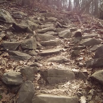
I didn't know if we should attempt the hike with our 4 year old and 18 month old but we did. I am feeling it today! But once we started I was determined to make it. The trail is wide most of the way but pretty steep the whole .8 mi so we required a lot of rest breaks! Some parts got narrow and you had to navigate through rocks but nothing too tough for our 4 year old. Just be careful of any mud or water. Views at the top are amazing!! Take plenty of water!! It's early spring; I can't even Imagine it in the summer! read more



5 years ago
Great spot. Definitely worth checking out for sunrise. The hike will drain your energy so pack accordingly read more


11 years ago
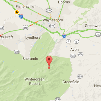
"I haven't been everywhere but it's on my list" Susan Sontag We came to the area from Virginia Beach and stayed in Waynesboro to celebrate my boyfriend's 30 something birthday. October is beautiful in this area and we wanted to witness it for ourselves. Did you know that Humpback Rock is a massive greenstone rock is so named for the visual effect of a "hump" it creates on the western face of the mountain? The hike itself is 2 miles and pretty steep. The beginning is easy but as you progress upward there are rocks and steps and can be slippery when wet. I am pretty fit and was winded from the incline at times. The hike is definitely worth the reward. We hiked Crabtree Falls the day before and actually prefer Humpback rocks because has the most amazing views in the area! ALMOST 360. I highly recommend Humpback rocks as a must do if you are in the area. You won't regret it.... read more





9 years ago
I'm not a hiker. I'm more of a "trailer". I like a nice trail to walk at an easy pace but this hike is doable! The way up is steep and will get ya but there are several spots to rest when needed. The hike began with wide gravel then once you go up the stairs, the trail narrows and is rocky. It feels like rock climbing at moments. Take it slow and steady. This hike is under 1 mile going up and seems to last forever. Just follow the blue markets to stay on track. read more


8 years ago
A steep trail with incredible reward. Although the sign tells you the trail is less than 1 mile, you will definitely sweat a lot just walking towards the rock because of the elevation. Its about 3 hours round trip. It's pretty fun, but I don't recommend this to anyone who has bad knees. read more


8 years ago
Really enjoyed this hike straight up the mountain but views work it not a long hike but u will be feeling it when climbing uphill over rocks and trees etc. I found the place my putting the humpback visitor center in my gps. A must in the area and check out blue mountain Brewery for lunch afterwards ! Great views! #onthespotmover read more



11 years ago
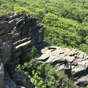
ROAD TRIP! Memorial Day weekend. Set out looking for Spy Rock and stopped here instead. Perfect! 1 mile up. 1 mile down. easy peasy right? That path went straight up. (I do prefer that rather than switchbacks). This sucker had me outta breath quick. What a great hike though. After the straight up hill using step logs, you bend left and have to rock climb a bit. Just enough to where you may need to use your hands..nothing major. Got to the top.... ----BEAR!!!! OMG. I was taking a picture of the HBR sign and was putting away my phone, when the guy behind me said firmly but quietly..:stop!" I looked up just in time to avoid running right into it! I stopped. Took a couple steps backward to where the guy (and his dog) were standing. The bear started walking toward us lazily... we just took some backward steps as he walked toward us, then he mosied into the woods like nothing was going on... A-Maz-Ing! I have pictures but it doesn't look exactly like what it was when you were there. So couple more yards and that's where I saw the edge of the Earth. Beautiful. Sharp layers of rock jutting out from the Earth and hanging over the mountain. Hopefully my pictures will have more to say than my words. Check them out! *A MUST DO HIKE! Does not take a lot of time and the view is worth every step. read more




9 years ago
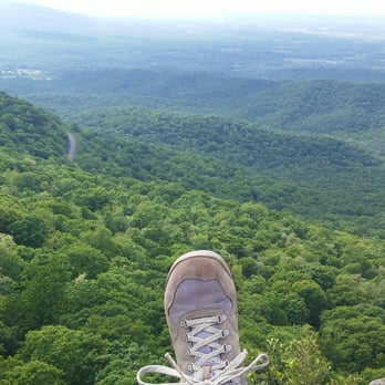
Great view from the top. Yes it is a steep trail but it is worth it. There is no way it is .8 miles but I'll play along. You can see for miles and miles. Part of the trail is gravel but there are steep parts to be aware of. read more


11 years ago

6 years ago
7 years ago

9 years ago


11 years ago
7 years ago
Page 1 of 2
More info about Humpback Rocks
Blue Ridge Pkwy
Rockfish, VA 22920
Directions
(540) 943-4716
Call Now
Visit Website
http://www.blueridgeparkway.org
Hours
Indoor Amenities
Outdoor Amenities