Saunders-Monticello Trail Photos


More like Saunders-Monticello Trail
Recommended Reviews - Saunders-Monticello Trail
Start your review...


Reviews With Photos


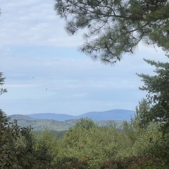
The Saunders-Monticello Trail is beautiful. It's two miles to the entrance of Monticello which is neat, so four miles total. You can walk, jog or bike it. I really enjoyed the views, Carter Overlook and all of the boardwalks.
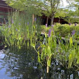

Lovely trails with lots of parking and a visitors center. The visitors center was fairly large with items such as books, postcards, and more. There were also bathrooms and maps outside. Lovely little courtyard. The trails were clean and easy to follow!
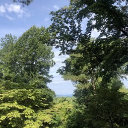

This was a great trail! The main four miles was very flat and well marked. It was filled with nice bridges and fun scenes! There are additional trails and offshoots from the main thoroughfare, however they are not well marked. Definitely beware if you go off the beaten path that it may be a little difficult to find your way back.


In Charlottesville for the day and not looking to drive 45+ miles for a hike through the mountains? Well, if you want to stay in the city and still get nice views and a work out in, this 4 mile (RT) hike is for you! On a muddy or snowy day, you'll appreciate the fact that is hike is mostly on paved trails or on a wooden boardwalk with a slow uphill climb. But perhaps my words don't describe this trail well. As noted on the website, "As it winds its way up the side of a steep mountain (Carter Mountain), the trail offers dramatic scenery of towering, native hardwood forest, deep ravines and panoramas of the Piedmont and Blue Ridge Mountains. The design of the trail was inspired, in part, by Thomas Jefferson's description of how he wished to present the spectacular views from Monticello: "Of prospect I have a rich profusion.it may be successively offered, & in different portions through vistas. with the advantage of shifting scenes as you advance on your way." I would hate to be the landscape architect that worked with Thomas Jefferson cause I have no idea what he just said. What I can say is that the trail has nice views, and there are several backhill/backcountry trails that veer off the paved path. You can start off the hike by the Monticello visitors center or at the other end at the arboretum. The trail map has the parking areas designated: https://www.monticello.org/sites/default/files/inline-pdfs/ParkwayTrails.pdf. What is super nice about this trail since it is connected to an arboretum, the trees are labelled. As someone who just went through a round of allergy testing, it is nice to see what I am allergic to up close and personal. White Oak? Birch? Black Walnut? Nice to meet you! One bit of bad news, dogs are not allowed on the trail itself and have to stay on the Kemper Park areas :(. Thomas Jefferson probably made that rule too.


Rained hard. We laughed and ran the trails. Great date day!!! Highly recommend- easy to walk and fun to run.
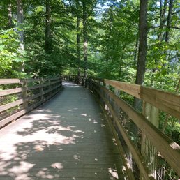

Very nice and easy trail walk for 2 miles. It was a beautiful day. You access the trail at the parking lot near Monticello visitor's center.


I enjoyed my walked with my dog here. Trail is easy and kids friendly too. Love to go on weekdays. My dog enjoy the walk too. The view along the trail is great and couple of water spot as well.


2 months ago
Really beautiful set of trails all very well maintained with a variety of distance/challenge loops. Easy and ample parking and Was able to manage with baby in carrier + dog and got some great views! read more


I had been to Monticello a few years ago but had no idea this trail even existed and better yet it's free and you don't have to pay Monticello admission to check it out. I believe it's about 4 miles there and back and much of it is on boardwalks but parts could get muddy if it rained. Luckily, it was sunny when we checked it out. It's not too strenuous and very well marked as long as you stay on the main trail. Parking was tough but we found a spot at the overflow lot just down the road from the trail lot and this way you get a little bit of bonus hiking to get your step count up. The trail itself wasn't too crowded and I assume 99% of Monticello tourists don't even know about it. It's worth checking out though if you're in the area. read more
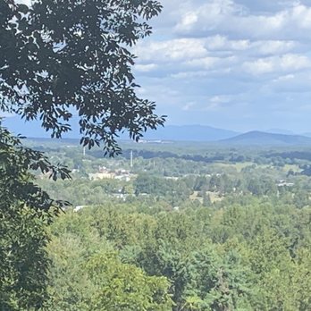


Not really a hiking trail. More like a path for a leisurely urbanish stroll surrounded by beautiful trees. Certainly worth checking out if you are in the Cville area, but I would not go out of your way to check this out. read more



6 years ago
The Saunders-Monticello Trail is beautiful. It's two miles to the entrance of Monticello which is neat, so four miles total. You can walk, jog or bike it. I really enjoyed the views, Carter Overlook and all of the boardwalks. read more


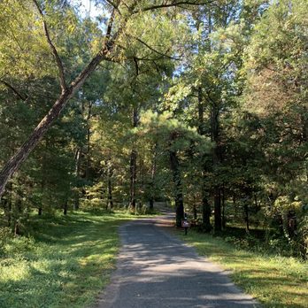


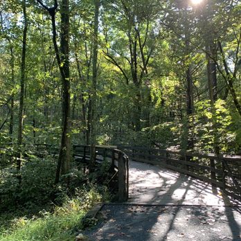


Lovely trails with lots of parking and a visitors center. The visitors center was fairly large with items such as books, postcards, and more. There were also bathrooms and maps outside. Lovely little courtyard. The trails were clean and easy to follow! read more


5 years ago
This was a great trail! The main four miles was very flat and well marked. It was filled with nice bridges and fun scenes! There are additional trails and offshoots from the main thoroughfare, however they are not well marked. Definitely beware if you go off the beaten path that it may be a little difficult to find your way back. read more
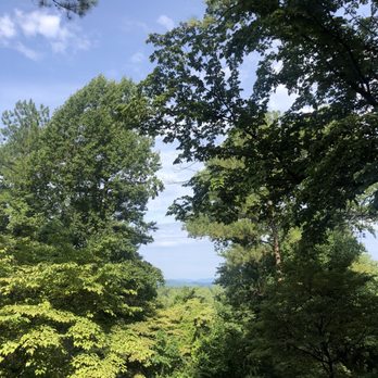


In Charlottesville for the day and not looking to drive 45+ miles for a hike through the mountains? Well, if you want to stay in the city and still get nice views and a work out in, this 4 mile (RT) hike is for you! On a muddy or snowy day, you'll appreciate the fact that is hike is mostly on paved trails or on a wooden boardwalk with a slow uphill climb. But perhaps my words don't describe this trail well. As noted on the website, "As it winds its way up the side of a steep mountain (Carter Mountain), the trail offers dramatic scenery of towering, native hardwood forest, deep ravines and panoramas of the Piedmont and Blue Ridge Mountains. The design of the trail was inspired, in part, by Thomas Jefferson's description of how he wished to present the spectacular views from Monticello: "Of prospect I have a rich profusion.it may be successively offered, & in different portions through vistas. with the advantage of shifting scenes as you advance on your way." I would hate to be the landscape architect that worked with Thomas Jefferson cause I have no idea what he just said. What I can say is that the trail has nice views, and there are several backhill/backcountry trails that veer off the paved path. You can start off the hike by the Monticello visitors center or at the other end at the arboretum. The trail map has the parking areas designated: https://www.monticello.org/sites/default/files/inline-pdfs/ParkwayTrails.pdf. What is super nice about this trail since it is connected to an arboretum, the trees are labelled. As someone who just went through a round of allergy testing, it is nice to see what I am allergic to up close and personal. White Oak? Birch? Black Walnut? Nice to meet you! One bit of bad news, dogs are not allowed on the trail itself and have to stay on the Kemper Park areas :(. Thomas Jefferson probably made that rule too. read more


5 years ago
Rained hard. We laughed and ran the trails. Great date day!!! Highly recommend- easy to walk and fun to run. read more


6 years ago
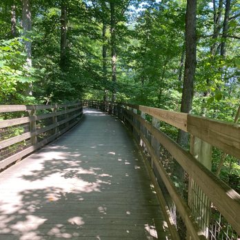
Very nice and easy trail walk for 2 miles. It was a beautiful day. You access the trail at the parking lot near Monticello visitor's center. read more

8 years ago
I enjoyed my walked with my dog here. Trail is easy and kids friendly too. Love to go on weekdays. My dog enjoy the walk too. The view along the trail is great and couple of water spot as well. read more


9 years ago


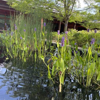
Absolutely gorgeous trail for a quick hike! There are no fees and plenty of parking, though parking does fill up a lot (but we always manage to find spaces). The path is well maintained and there is a beautiful wooden walkway that winds through the mountain. There are lots of trees and other plants, as well as a small pond. There are many little trails that branch off the main trail. Definitely recommend for those looking for a relaxing hike with good scenery! read more


10 years ago

9 years ago

9 years ago

9 years ago
More info about Saunders-Monticello Trail
931 Thomas Jefferson Pkwy
Charlottesville, VA 22902
Directions
(434) 984-9800
Call Now
Hours
Indoor Amenities
Outdoor Amenities
Ask the Community - Saunders-Monticello Trail
Review Highlights - Saunders-Monticello Trail


















Why does Yelp recommend reviews?
2 reviews that are not currently recommended
The reviews below are not factored into the business's overall star rating.

8 years ago

8 years ago
Saunders-Monticello Trail - hiking - Updated September 2026
Best of Charlottesville
People found Saunders-Monticello Trail by searching for…
Sunset View in Charlottesville, VA
Things to Do in Charlottesville, VA
Beautiful Views in Charlottesville, VA
Hiking Trails in Charlottesville, VA
Walking Trails in Charlottesville, VA
Watch Sunset in Charlottesville, VA
Secret Spots in Charlottesville, VA
Museums in Charlottesville, VA
Churches in Charlottesville, VA
Running Trails in Charlottesville, VA
Things to Do on a Rainy Day in Charlottesville, VA
Waterfall Hike in Charlottesville, VA
Parks for Kids in Charlottesville, VA
Off Road Trails in Charlottesville, VA
Places to Take Pictures in Charlottesville, VA
Public Services & Government in Charlottesville, VA
Secluded Spots in Charlottesville, VA
Picnic Areas in Charlottesville, VA
View Points in Charlottesville, VA
Scenic Drive in Charlottesville, VA
Great View Points for Sunset in Charlottesville, VA
Trending Searches in Charlottesville, VA
Apple Orchards near Saunders-Monticello Trail
Apple Picking near Saunders-Monticello Trail
Barbers near Saunders-Monticello Trail
Bike Shop near Saunders-Monticello Trail
Casinos near Saunders-Monticello Trail
Caves near Saunders-Monticello Trail
Cliff Jumping near Saunders-Monticello Trail
Consignment Shops near Saunders-Monticello Trail
Cruising Spots near Saunders-Monticello Trail
Dog Friendly Things To Do near Saunders-Monticello Trail
Ear Piercing near Saunders-Monticello Trail
Eyebrow Threading near Saunders-Monticello Trail
Flower Fields near Saunders-Monticello Trail
Hair Braiding near Saunders-Monticello Trail
Hiking near Saunders-Monticello Trail
Historic Restaurants near Saunders-Monticello Trail
Kids Haircut near Saunders-Monticello Trail
Lakes near Saunders-Monticello Trail
Mens Haircut near Saunders-Monticello Trail
Parks near Saunders-Monticello Trail
Picnic Areas near Saunders-Monticello Trail
Preschools near Saunders-Monticello Trail
Private Schools near Saunders-Monticello Trail
Public Golf Courses near Saunders-Monticello Trail
Public Services & Government near Saunders-Monticello Trail
Rock Quarry near Saunders-Monticello Trail
Running Trails near Saunders-Monticello Trail
Scenic Night View near Saunders-Monticello Trail
Scenic Overlook near Saunders-Monticello Trail
Secluded Spots near Saunders-Monticello Trail
Sunrise View near Saunders-Monticello Trail
Swimming Holes near Saunders-Monticello Trail
Things To Do This Weekend near Saunders-Monticello Trail
Browse Nearby
BEST of Charlottesville, Virginia Restaurants near Saunders-Monticello Trail
BEST of Charlottesville, Virginia Things to Do near Saunders-Monticello Trail
BEST of Charlottesville, Virginia Coffee near Saunders-Monticello Trail
BEST of Charlottesville, Virginia Parks near Saunders-Monticello Trail
BEST of Charlottesville, Virginia Breakfast near Saunders-Monticello Trail
BEST of Charlottesville, Virginia Shopping near Saunders-Monticello Trail
BEST of Charlottesville, Virginia Campgrounds near Saunders-Monticello Trail
Browse Brands
Related Searches in Charlottesville, VA
Affordable Kayak Rental Services in Charlottesville, Virginia
Best Dog Hiking Trails Around Charlottesville, Virginia
Best Fishing Locations and Guides in Charlottesville, Virginia
Best Fun Things to Do in Charlottesville, Virginia
Best Lookout Points to Visit in Charlottesville, Virginia
Best Places for Horseback Riding in Charlottesville, Virginia
Book Engaging Historical Tours in Charlottesville, Virginia
Check Out Off Road Trails in Charlottesville, Virginia
Discover Charming Historic Homes in Charlottesville, Virginia
Discover Dog Friendly Trails to Explore in Charlottesville, Virginia
Discover Famous Monuments in Charlottesville, Virginia
Discover Kid Friendly Hiking Trails in Charlottesville, Virginia
Discover Popular Landmarks in Charlottesville, Virginia
Discover Popular Photo Spots in Charlottesville, Virginia
Discover Scenic Mountain Bike Trails Near Charlottesville, Virginia
Discover Top Points of Interest in Charlottesville, Virginia
Discover a Hiking Trail in Charlottesville, Virginia
Discover a Library Near You in Charlottesville, Virginia
Discover the Best Caves to Explore in Charlottesville, Virginia
Discover the Best Interactive Museum in Charlottesville, Virginia
Discover the Best Night Hike Trails in Charlottesville, Virginia
Dog-Friendly Hikes With Dogs in Charlottesville, Virginia
Enjoy Camping Adventures Around Charlottesville, Virginia
Enjoy Exciting Mountain Biking Adventures in Charlottesville, Virginia
Enjoy Kayaking Adventures in Charlottesville, Virginia
Enjoy Off Leash Dog Hikes in Charlottesville, Virginia
Enjoy River Tubing Adventures in Charlottesville, Virginia
Enjoy Tent Camping Spots Around Charlottesville, Virginia
Enjoy a Beautiful Waterfall Hike in Charlottesville, Virginia
Enjoy the Best Picnic Spots and Ideas in Charlottesville, Virginia
Enjoy the Best Walking Trails in Charlottesville, Virginia
Experience Stunning Sunset Views in Charlottesville, Virginia
Explore Beautiful Botanical Gardens in Charlottesville, Virginia
Explore Beautiful Castles and Landmarks in Charlottesville, Virginia
Explore Beautiful Parks and Green Spaces in Charlottesville, Virginia
Explore Children's Museums Near Charlottesville, Virginia
Explore Easy Hikes Perfect for All in Charlottesville, Virginia
Explore Free Things to Do Around Charlottesville, Virginia
Explore Fun Activities to Do in Charlottesville, Virginia
Explore Fun Field Trips in Charlottesville, Virginia
Explore Popular Campgrounds Near Charlottesville, Virginia
Explore Popular Scenic Overlook Points in Charlottesville, Virginia
Explore Popular Scenic Views Near Charlottesville, Virginia
Explore Scenic Lakes to Visit in Charlottesville, Virginia
Explore Secret Spots Worth Visiting in Charlottesville, Virginia
Explore Top Art Galleries Located in Charlottesville, Virginia


