Humphrey's Trail Photos


You might also consider


More like Humphrey's Trail
Recommended Reviews - Humphrey's Trail
Start your review...


Reviews With Photos
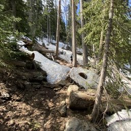

Hiked on 6/3/23 - I've done this hike a handful of times. It has ample free parking at the trailhead along with dumpsters and bathrooms available. Great amenities before a 11 mile hike. This particular day there was still a ton of snow on the trail, which made following the trail pretty difficult. The views are well worth it and it is a beautiful hike, but anticipate on taking significantly longer than normal. Make sure to pack water and snacks! Best to hit the trail early to avoid afternoon showers at the summit. Also, don't be discouraged by the false summits, nice steady pace will get ya there! Trail is primarily covered/shaded with trees. There is exposure of the elements at the beginning and last mile in a half ish. Happy hiking!


Wow, barely any trip reports on this one from November-April! If you are a mountaineer, this will be a fun and easy summit. If you are a casual hiker, this might be one of the harder hikes you've done. It had been two weeks since my 2nd shot of Moderna, so I planned my first hiking/climbing trip to the lower 48 in well over a year. I flew in Friday and met some friends that drove in from NV and CA. Our plan was to go up Saturday. As Saturday got closer, we realized it was the only day for weeks with bad weather in the forecast. Just our luck! Snow was predicted for about noon. The gang was game for an alpine start, so we woke up at 5am and hiked out of the yurt at 5:30am. By maybe 6:30ish, we were on the trail. The first mile was completely dry and went quick. By about mile 2 there was snow, which persisted all the way to the saddle. Lucky for us, cold overnight temps kept the snow firm and easy to walk on. (we took crampons and axes, didn't need either) Eventually we hit the saddle and walked the dry, Hawaii-looking-lava-landscape trail to the summit. Although it's only one mile, the altitude and deteriorating weather made it seem much longer. Eventually we reached the summit and we celebrated by cracking a crowler of IPA which was then distributed into super-classy red solo cups. Before we knew it, it was snowing. We posed for some cheesy photos with the summit sign (which had fallen off of the pole it was mounted on), and started making our way down. We left the summit, and saw a dozen poor souls just coming up into the snow. (many over-dressed with full-shank mountaineering boots and automatic crampons, maybe they were training for Denali or Rainier?) We decided to try a short cut. The team-minus-me was going to attempt to short-cut all the switchbacks by going straight down the snow slope. I decided to stick to the trail. Would the unknown line be any faster or would it be maddening post holing? The answer was: YES. It shaved ~20-30 minutes off the initial descent, but added some post-holing. We had good cell signal the entire way, and were able to communicate our locations to each other via elegant GPS screenshot trading. We met up and eventually used the snow to our advantage once again. We cut off most of the remaining switchbacks. (don't worry, we didn't damage the delicate alpine/forest environment, too much of the white stuff!) We were back in town before 3pm and enjoying crispy brews in Flagstaff, a great day out!


This was quite an adventure. I hiked this on Memorial Day Weekend as part of my high pointer bucket list (getting to the high point of every state). This was #16, and while it wasn't my favorite, it had a lot going for it. As high points go, this is a pretty straight-forward hike - from the Snowball parking lot, you're taking the Humphrey's Trail up to the top and back. That's it. However, as with any tougher, higher elevation hike, this had its complications. I decided to do this hike several months ago, but in the interim was keeping an eye on trail conditions. This area of Arizona had a ROUGH March in terms of snow, and it was becoming very clear in May that it was going to linger into the late spring. The day before summiting, AllTrails had several very recent reviews indicating about 75% snow coverage, and that turned out to be right on point. I procured some spikes for my hiking sneakers at the Peace Surplus in Flagstaff, which absolutely made the difference between getting to the top and not - a total gamechanger. The first mile and a half or so of the hike isn't bad. I didn't feel the thin air too much (I'm from NJ; our high point is less than 2000 feet), and the incline was pretty gradual. It's just a lot of meandering in the woods. Once it started to climb though, the snow coverage became a factor immediately. If you're doing this hike when snow is still on the ground, absolutely get out there early - I started later than I wanted, probably around 7AM, and that was too late. If you get out there around 5:30 or so, you have a shot at getting up and getting most of your hike done before that snow starts melting and becoming a serious problem. Even the next mile wasn't too bad; yes, there was snow completely covering the trail, but the biggest issue was that for some mystifying reason, there are no trail blazes in the woods - if they're there, I didn't see them/they were covered by the snow, but there was nothing on the trees. So as a result, you're literally just looking for the most footprints and hoping that other hikers will show up to validate your navigational decisions. Definitely lost the trail a few times, and that's a very obvious area to improve. Once I got past tree line and into the Saddle area (which had very little snow), there were blazes on the rocks that helped - though by that point a lot of what you're doing and where you're going is pretty obvious. Put blazes on the trees! The trail definitely picks up in intensity just below tree line when you start getting rewarded with the viewpoints. There was a gorgeous view of a nearby mountain and its ski slopes (I was glaring enviously at the skiers who were very obviously going to have an easier time getting down to the bottom), and you start getting some optics of the surrounding area especially to the west. This part was probably the most dangerous going up and down because the incline is significant, as is the snow - there was a guy at the summit who somehow did this in regular sneakers, and I have no idea how. In a lot of ways, I thought this was much easier once I hit the Saddle (I only knew its name because I encountered some local hikers right before it, and it certainly looked like one) and the snow was no longer an issue for the ascent. Yes, the air was thin - at that point you're right around 12,000 I'd guess - but you now have an insane view of the entire area. Humphreys really benefits from being a standalone peak. You can literally see the Grand Canyon at the top, and I was also impressed by the fact that you're so high you can tell the exact instant to the east that Arizona becomes a hardcore desert. Super wild. I don't want to minimize the altitude. I was definitely stopping every few minutes for a quick breather, but I also came very prepared with a lot of water and did a few tougher hikes beforehand. I did the Colorado high point a few years ago that was over 14,000 and ended up with a splitting headache and swollen paws. Not here, so maybe there's that big of a difference between 12,400 and 14,000+, but I preemptively took a few ibuprofen right at the start of this hike and didn't regret it. The descent was tough. That area right above tree line was pretty treacherous, and I tagged along with a group that included a native Flag guy who was familiar with the trail/mountain. His recommendation to basically forego the trail in most spots and just slide down piece by piece may have saved me from serious injury, and it's A LOT easier to do it in a group that can stop you before tumbling headfirst over the mountain or into a pine tree. Trust me. The rest of the hike down was slippery but it wasn't too bad once you hit the switchbacks and the descent wasn't as significant of an angle. Unfortunately due to the snow coverage there was minimal wildlife and no canine chums, but as often happens with a hardcore hike, I met a handful of really cool people. Awesome hike, but do it on Labor Day instead.

It was a very nice hike, shorter then most of the ones I've been on but be prepared to use a lot of stairs, the island trail drops 185 feet and has 273 stair steps, but is very beautiful .


Thinking about hiking here in snow? Winter Backcountry Permit may be required depending on the day you want to go. Call Coconino National Forest Service at (928) 527-3600 to check if you need a permit or not. I've been hiking here annually and this year was my 4th hike. When I called late April, they said they quit issuing a permit two weeks ago but warned me about still a lot of snow remained and asked if I was going to be prepared with crampons. I kept checking weather at the summit online. The day I originally wanted to go had 40 mph wind all day with temperature around 10F, windchill -9F. Above tree line, 40mph wind is brutal. I did it once in summer but you really have to stay low and craw like a baby. Changed to the next day when wind was 20mph and slightly warmer 20F, made the hike more pleasant. Most people was putting crampons around the sign in area, including myself. I had micro spikes. We saw one person training for Denali, he had a really spiky professional climber type. Even with my micro spikes, I slipped a couple of times. We spotted two groups with just regular shoes and no hiking poles, they said they were under prepared and they ended up turning around fairly quick. Trail is very difficult to find as they are covered gravely with snow. I saw a group of two came with GPS, they seemed to be more prepared for this type of hike. If I have an opportunity to come back, I would train more as walking in snow with crampons was a lot harder than I anticipated. Getting lost in the snow wasn't fun. We ended up walking towards the ski slopes, then walked down the ski slope area (ended up being a shorter route). Despite of this cold and hard hike, I really enjoyed this challenge.


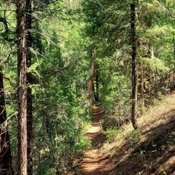
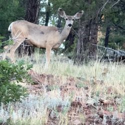
We arrived in Flagstaff the night before we hiked this peak and glad we did. It gave us an opportunity to acclimate a little to the change in altitude. We awoke early to hit this trail by 7:00am. My hubby and I trained for this climb all summer and it was everything we had hoped for. The peak is located within the Cococino National Forrest in the Kachina Peaks Wilderness. Driving through town and up to the base is only seven miles and we happened to see a pretty little doe on the roadside eating. We started in a large parking lot near the ski lifts and began to make our way up the trail. The trail quickly turned into a shaded forest full of fallen trees and logs. The trail houses many tree roots and rocks to maneuver around all the way up and back. Just before the trail really starts to ascend, there is a register to list your name so just in case you get trapped or hurt, emergency services can attempt to find you. As we made our way up the eleven switchbacks, we encountered people of all ages making their way up to the peak. This hike is so beautiful and the higher we climbed the more scenic it became. Once we rose up out of the switchbacks, we came to the saddle. Heavy winds blew and glad we had dressed in layers. Definitely a bit nippy this time of year. Now the hardest part came. There are two false peaks that you must climb past before getting to the summit. Thankfully there are guiding poles which help you stay on the trail and make it to the top. At this point there is lots of scrambling over boulders and heavy climbing. Be advised, the altitude will slow you down especially coming from Nevada where we are only at about 2500 feet. Flagstaff is the home of this Peak and they are at roughly 7000 feet. The drive to the base takes you up to approximately 9300 feet and your goal to the peak is 12,633 feet! As we approached the summit, I almost wanted to run up but the wind was blowing so hard, we had to stay low on the mountain. Once we summited, it was sheer joy for both of us! We were literally even with the clouds as they floated by. We could see all around the valley below and in the distance we viewed the Grand Canyon! Yes, we felt on top of the world even if it was only for a little while. Coming down was no easy feat and my knees felt it. I only used one trekking pole and I would recommend two if you have knee issues as it is a loooong way down. Once back at our car, we just sat for a moment taking in the accomplishment!! Yay!!!! This is a serious climb and I probably wouldn't recommend for kids under the age of 12, unless you have an athletic child. It is highly recommended that you are in good physical shape all the way around. This trail will test your physical and mental abilities but believe me it is so worth it being the tallest peak in the beautiful state of Arizona.


After seeing that movie about the guy who got trapped while hiking Humphrey's and had to cut his own arm off to escape, I was pretty intimidated... and curious to find that detached limb. And once I learned the hike was 10 miles round trip, with a 3300ft elevation gain, I dreamed this was the next daunting adventure I'd write about in my hiking journal... which is also Yelp. So I trained, for months, on Camelback and Piestewa, culminating in a jaunt up to Flatiron. Then I considered myself ready. Experienced hiker, and proficient pianist, Yuko H, organized the outing and provided a comprehensive "things to bring" list, which really saved my bacon. Down where I live, the temps we hovering near 110... but thanks to her suggestions, this first timer brought and wore the appropriate amount of clothing, which was: * 4 layers: short sleeve, long sleeve, with 2 thick hoodies * 2 layers: shorts with sweat pants * A thermal beanie, baseball cap, and two hoods * 2 pairs of socks and hiking boots * A pair of thermal road biking gloves Even with all that cotton up on me, I was still feeling a tad hypothermic at 12,633ft... but who cares? I had arrived... I made it! All those months of training were worth it. Little secret... the climb wasnt that hard... its just long. Like sitting through Waterworld long, followed by sitting through Waterworld again... except you're not sitting. I had a backpack full of Clif bars and 3L of water. I returned with 1L of water, and an excess of energy bars. I should have handed them out to passers by during my descent. Now its whats for dinner... My knees were feeling all rusty by the time I passed the sign-in sheet... momentarily causing me to walk all straight-legged, like Frankenstein, until I received a few curious glances which made me all self conscious. All in all, a great hike, and quite fascinating at 3am wearing a headlamp, whose comforting glow gives off a 30ft visibility. I'm checking this one off the list. Grand Canyon, here I come...


Hard hike but awesome. About 10 miles round trip from the Snowbowl parking lot. Pack enough food, water and warm clothing to layer. We tried to summit this in June but were snowed out. Fall season is much better, it will only be the ferocious wind that stops you for the final peak. For experienced Arizonan hikers this is a must, though there will likely be a ton of people on this busy trail. If you don't have time to summit it's about 8 miles round trip to the Saddle which is still a great hike and not as difficult.


This was definitely the easiest 12,000+ feet peak I've hiked. That being said, it was probably the most beautiful one as well. Not sure why it felt so easy, I was trying come up with reasons, there weren't any horrible switchbacks, no horrendous scree slopes, no super steep uphill portions. I think the entire hike was so gradual, it made it really easy to acclimatize to. Only thing I could come up with. Starting out at the Arizona Snowbowl Humphreys Peak trailhead, we got to walk through a huge field of Wildflowers that were incredible (I'm easily impressed when it comes to flowers). Once we actually hit the trail, again it was so beautiful. Tons of trees and vegetation throughout. The trail was well maintained, lots of rocks, but easily walked over. There were a few large trees that you did have to get yourself up and over tho. My friend kept calling this an aspen trail, it was almost like being in Colorado. There is a lava rock boulder area that was so crazy to look at. I kinda wanted to scramble up it. But alas, you're not allowed off trail. Once you hit the saddle, you start up to 3 false summits, and TONS of people. We did this during monsoon season, and started a little late (in my opinion) at 7am, but these people had to had started way earlier. Tons of trail runners, people with dogs, a few with kids. I enjoyed this last part, I like to scramble, there were just a few spots I was able to. The views from the top were incredible. We made it to the top before any storms started moving in, but the clouds stated forming fast, and we were advised to get off the mountain if we heard thunder. Luckily we had perfect weather, it wasn't even windy at the summit. I did this hike without using my trekking poles, and I thought the downhill was relatively easier on my knees than other hikes I've done. This is now one of my favorite peaks. Can't wait to go back and do it again! Next time I want to start from the Weatherford Trail. *side note, I've never seen so much used toilet paper on a trail. It was terrible. Take an empty plastic bag on your hike with you and take your TP with you people! Leave no trace!


Ever since moving back to AZ last September, it had been my goal to reach the state's highest point atop Humphreys Peak. After completing numerous higher-altitude and/or high-intensity hikes in the state (Mt Lemmon, Spruce Mountain, Flatiron, Picacho Peak, etc.), I figured I had completed enough training to tackle this gargantuan challenge. While it was definitely enough preparation, I think it's impossible to complete this hike without using every ounce of energy in you. My wife decided to join me in the trek, and knowing her sensitivities, recommended she take some acetaminophen prior to the hike (oh was she happy she did!). If you know you have altitude problems, it might be a good idea to plan accordingly and do your research ahead of time. We drove up from Chandler and reached the trailhead parking lot by 7:30 am. Hitting the trail at 7:45, we reached the saddle by 10:30 and spent some time admiring the view. It is at this point when you are greeted by the tree line and start of Arizona's only tundra. You are so high up that trees and other vegetation cannot grow. Brace yourselves for the final push in altitude my friends. After another approx 1.5 miles up the rocky false peaks, we reached Humphreys Peak! Definitely a one of a kind view. On clear days such as ours you could see the Grand Canyon. Just beware of all the bugs. And believe me -- there are a LOT of bugs. The hike down takes just as long as you need to watch your step. We finished at almost 4 pm completely drained but super accomplished. If you are up for the challenge, I highly recommend this hike.


Absolutely gorgeous! Myself, my husband, our 8 year old son and our lab hiked to Humphery's peak. We hiked on a beautiful clear day in early September and felt so lucky to experience the 360 degree view at the top. It was strenuous and we all felt the altitude a bit, but were happy we completed it. Go prepared, pack TONS of water, snacks and a lunch if you plan on taking your time. Our phones mapped us at 10.6 miles to the peak and back. Remember pack out what you pack in!!! There are no trash cans, please respect our Mother Earth and happy hiking!


10 months ago
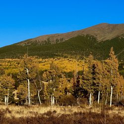
Trail Series, Part 41 Is there a bad time to go hiking in Flagstaff? Not that I'm aware of, but Fall is certainly a GREAT time for this! Just as the days become shorter and the temperatures cool, the Aspen leaves adorn the forest with a glorious yellow hue that seems to first absorb, and then reflect, the sunshine. While not the only location for getting your Fall groove on, we found "Humphrey's Peak Trail" (and its surrounding environs) to be generous providers of the vibes we were seeking. None of the trails that we traveled were paved and their difficulty ranged from easy to moderate. However, as you travel up the mountain you'll find that the rocky outcroppings become more frequent and the hike becomes more strenuous. Before long you'll find yourself at 10,000 feet, so you'll be in much thinner air than you're likely used to and your water/rest breaks should increase accordingly. Each trail we explored was well traveled, but the buddy system is still recommended (if for no other reason than to have someone to marvel at the beauty with). Wildlife sightings are common, but it is the rare sightings of Big Foot that are the most cherished. Ample parking and portable restrooms can be found at the trailhead located at the end of Lot 1 of the Arizona Snowbowl Resort. For those interested in traditional restrooms and/or a restaurant, both are located at the resort and an easy walk from this parking lot. If you visit Flagstaff in the Fall, please don't find yourself "leaving" without experiencing the "leafing" all around you this time of year! And that's...Henry's Take. Photo credit @danavoros #flagstafffallcolors #trailseries read more


1 year ago
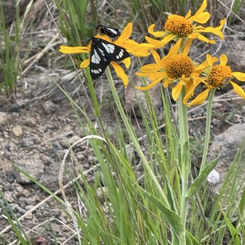
Mount Humphrey's is a fantastic hike, filled with solitude. It was challenging, humbling and motivating to hike the tallest peak in Arizona. This has been on my to do list for awhile and I was grateful to have completed this summit. read more





1 month ago

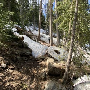
Hiked on 6/3/23 - I've done this hike a handful of times. It has ample free parking at the trailhead along with dumpsters and bathrooms available. Great amenities before a 11 mile hike. This particular day there was still a ton of snow on the trail, which made following the trail pretty difficult. The views are well worth it and it is a beautiful hike, but anticipate on taking significantly longer than normal. Make sure to pack water and snacks! Best to hit the trail early to avoid afternoon showers at the summit. Also, don't be discouraged by the false summits, nice steady pace will get ya there! Trail is primarily covered/shaded with trees. There is exposure of the elements at the beginning and last mile in a half ish. Happy hiking! read more


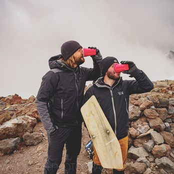
Wow, barely any trip reports on this one from November-April! If you are a mountaineer, this will be a fun and easy summit. If you are a casual hiker, this might be one of the harder hikes you've done. It had been two weeks since my 2nd shot of Moderna, so I planned my first hiking/climbing trip to the lower 48 in well over a year. I flew in Friday and met some friends that drove in from NV and CA. Our plan was to go up Saturday. As Saturday got closer, we realized it was the only day for weeks with bad weather in the forecast. Just our luck! Snow was predicted for about noon. The gang was game for an alpine start, so we woke up at 5am and hiked out of the yurt at 5:30am. By maybe 6:30ish, we were on the trail. The first mile was completely dry and went quick. By about mile 2 there was snow, which persisted all the way to the saddle. Lucky for us, cold overnight temps kept the snow firm and easy to walk on. (we took crampons and axes, didn't need either) Eventually we hit the saddle and walked the dry, Hawaii-looking-lava-landscape trail to the summit. Although it's only one mile, the altitude and deteriorating weather made it seem much longer. Eventually we reached the summit and we celebrated by cracking a crowler of IPA which was then distributed into super-classy red solo cups. Before we knew it, it was snowing. We posed for some cheesy photos with the summit sign (which had fallen off of the pole it was mounted on), and started making our way down. We left the summit, and saw a dozen poor souls just coming up into the snow. (many over-dressed with full-shank mountaineering boots and automatic crampons, maybe they were training for Denali or Rainier?) We decided to try a short cut. The team-minus-me was going to attempt to short-cut all the switchbacks by going straight down the snow slope. I decided to stick to the trail. Would the unknown line be any faster or would it be maddening post holing? The answer was: YES. It shaved ~20-30 minutes off the initial descent, but added some post-holing. We had good cell signal the entire way, and were able to communicate our locations to each other via elegant GPS screenshot trading. We met up and eventually used the snow to our advantage once again. We cut off most of the remaining switchbacks. (don't worry, we didn't damage the delicate alpine/forest environment, too much of the white stuff!) We were back in town before 3pm and enjoying crispy brews in Flagstaff, a great day out! read more




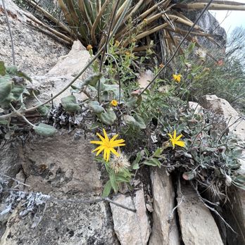
This was quite an adventure. I hiked this on Memorial Day Weekend as part of my high pointer bucket list (getting to the high point of every state). This was #16, and while it wasn't my favorite, it had a lot going for it. As high points go, this is a pretty straight-forward hike - from the Snowball parking lot, you're taking the Humphrey's Trail up to the top and back. That's it. However, as with any tougher, higher elevation hike, this had its complications. I decided to do this hike several months ago, but in the interim was keeping an eye on trail conditions. This area of Arizona had a ROUGH March in terms of snow, and it was becoming very clear in May that it was going to linger into the late spring. The day before summiting, AllTrails had several very recent reviews indicating about 75% snow coverage, and that turned out to be right on point. I procured some spikes for my hiking sneakers at the Peace Surplus in Flagstaff, which absolutely made the difference between getting to the top and not - a total gamechanger. The first mile and a half or so of the hike isn't bad. I didn't feel the thin air too much (I'm from NJ; our high point is less than 2000 feet), and the incline was pretty gradual. It's just a lot of meandering in the woods. Once it started to climb though, the snow coverage became a factor immediately. If you're doing this hike when snow is still on the ground, absolutely get out there early - I started later than I wanted, probably around 7AM, and that was too late. If you get out there around 5:30 or so, you have a shot at getting up and getting most of your hike done before that snow starts melting and becoming a serious problem. Even the next mile wasn't too bad; yes, there was snow completely covering the trail, but the biggest issue was that for some mystifying reason, there are no trail blazes in the woods - if they're there, I didn't see them/they were covered by the snow, but there was nothing on the trees. So as a result, you're literally just looking for the most footprints and hoping that other hikers will show up to validate your navigational decisions. Definitely lost the trail a few times, and that's a very obvious area to improve. Once I got past tree line and into the Saddle area (which had very little snow), there were blazes on the rocks that helped - though by that point a lot of what you're doing and where you're going is pretty obvious. Put blazes on the trees! The trail definitely picks up in intensity just below tree line when you start getting rewarded with the viewpoints. There was a gorgeous view of a nearby mountain and its ski slopes (I was glaring enviously at the skiers who were very obviously going to have an easier time getting down to the bottom), and you start getting some optics of the surrounding area especially to the west. This part was probably the most dangerous going up and down because the incline is significant, as is the snow - there was a guy at the summit who somehow did this in regular sneakers, and I have no idea how. In a lot of ways, I thought this was much easier once I hit the Saddle (I only knew its name because I encountered some local hikers right before it, and it certainly looked like one) and the snow was no longer an issue for the ascent. Yes, the air was thin - at that point you're right around 12,000 I'd guess - but you now have an insane view of the entire area. Humphreys really benefits from being a standalone peak. You can literally see the Grand Canyon at the top, and I was also impressed by the fact that you're so high you can tell the exact instant to the east that Arizona becomes a hardcore desert. Super wild. I don't want to minimize the altitude. I was definitely stopping every few minutes for a quick breather, but I also came very prepared with a lot of water and did a few tougher hikes beforehand. I did the Colorado high point a few years ago that was over 14,000 and ended up with a splitting headache and swollen paws. Not here, so maybe there's that big of a difference between 12,400 and 14,000+, but I preemptively took a few ibuprofen right at the start of this hike and didn't regret it. The descent was tough. That area right above tree line was pretty treacherous, and I tagged along with a group that included a native Flag guy who was familiar with the trail/mountain. His recommendation to basically forego the trail in most spots and just slide down piece by piece may have saved me from serious injury, and it's A LOT easier to do it in a group that can stop you before tumbling headfirst over the mountain or into a pine tree. Trust me. The rest of the hike down was slippery but it wasn't too bad once you hit the switchbacks and the descent wasn't as significant of an angle. Unfortunately due to the snow coverage there was minimal wildlife and no canine chums, but as often happens with a hardcore hike, I met a handful of really cool people. Awesome hike, but do it on Labor Day instead. read more


4 years ago
It was a very nice hike, shorter then most of the ones I've been on but be prepared to use a lot of stairs, the island trail drops 185 feet and has 273 stair steps, but is very beautiful . read more

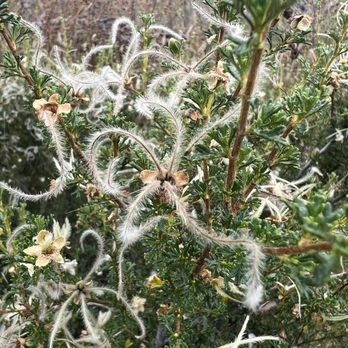


Thinking about hiking here in snow? Winter Backcountry Permit may be required depending on the day you want to go. Call Coconino National Forest Service at (928) 527-3600 to check if you need a permit or not. I've been hiking here annually and this year was my 4th hike. When I called late April, they said they quit issuing a permit two weeks ago but warned me about still a lot of snow remained and asked if I was going to be prepared with crampons. I kept checking weather at the summit online. The day I originally wanted to go had 40 mph wind all day with temperature around 10F, windchill -9F. Above tree line, 40mph wind is brutal. I did it once in summer but you really have to stay low and craw like a baby. Changed to the next day when wind was 20mph and slightly warmer 20F, made the hike more pleasant. Most people was putting crampons around the sign in area, including myself. I had micro spikes. We saw one person training for Denali, he had a really spiky professional climber type. Even with my micro spikes, I slipped a couple of times. We spotted two groups with just regular shoes and no hiking poles, they said they were under prepared and they ended up turning around fairly quick. Trail is very difficult to find as they are covered gravely with snow. I saw a group of two came with GPS, they seemed to be more prepared for this type of hike. If I have an opportunity to come back, I would train more as walking in snow with crampons was a lot harder than I anticipated. Getting lost in the snow wasn't fun. We ended up walking towards the ski slopes, then walked down the ski slope area (ended up being a shorter route). Despite of this cold and hard hike, I really enjoyed this challenge. read more


We arrived in Flagstaff the night before we hiked this peak and glad we did. It gave us an opportunity to acclimate a little to the change in altitude. We awoke early to hit this trail by 7:00am. My hubby and I trained for this climb all summer and it was everything we had hoped for. The peak is located within the Cococino National Forrest in the Kachina Peaks Wilderness. Driving through town and up to the base is only seven miles and we happened to see a pretty little doe on the roadside eating. We started in a large parking lot near the ski lifts and began to make our way up the trail. The trail quickly turned into a shaded forest full of fallen trees and logs. The trail houses many tree roots and rocks to maneuver around all the way up and back. Just before the trail really starts to ascend, there is a register to list your name so just in case you get trapped or hurt, emergency services can attempt to find you. As we made our way up the eleven switchbacks, we encountered people of all ages making their way up to the peak. This hike is so beautiful and the higher we climbed the more scenic it became. Once we rose up out of the switchbacks, we came to the saddle. Heavy winds blew and glad we had dressed in layers. Definitely a bit nippy this time of year. Now the hardest part came. There are two false peaks that you must climb past before getting to the summit. Thankfully there are guiding poles which help you stay on the trail and make it to the top. At this point there is lots of scrambling over boulders and heavy climbing. Be advised, the altitude will slow you down especially coming from Nevada where we are only at about 2500 feet. Flagstaff is the home of this Peak and they are at roughly 7000 feet. The drive to the base takes you up to approximately 9300 feet and your goal to the peak is 12,633 feet! As we approached the summit, I almost wanted to run up but the wind was blowing so hard, we had to stay low on the mountain. Once we summited, it was sheer joy for both of us! We were literally even with the clouds as they floated by. We could see all around the valley below and in the distance we viewed the Grand Canyon! Yes, we felt on top of the world even if it was only for a little while. Coming down was no easy feat and my knees felt it. I only used one trekking pole and I would recommend two if you have knee issues as it is a loooong way down. Once back at our car, we just sat for a moment taking in the accomplishment!! Yay!!!! This is a serious climb and I probably wouldn't recommend for kids under the age of 12, unless you have an athletic child. It is highly recommended that you are in good physical shape all the way around. This trail will test your physical and mental abilities but believe me it is so worth it being the tallest peak in the beautiful state of Arizona. read more

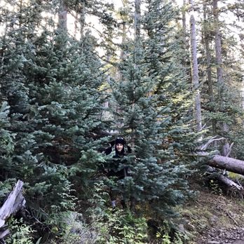

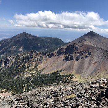


After seeing that movie about the guy who got trapped while hiking Humphrey's and had to cut his own arm off to escape, I was pretty intimidated... and curious to find that detached limb. And once I learned the hike was 10 miles round trip, with a 3300ft elevation gain, I dreamed this was the next daunting adventure I'd write about in my hiking journal... which is also Yelp. So I trained, for months, on Camelback and Piestewa, culminating in a jaunt up to Flatiron. Then I considered myself ready. Experienced hiker, and proficient pianist, Yuko H, organized the outing and provided a comprehensive "things to bring" list, which really saved my bacon. Down where I live, the temps we hovering near 110... but thanks to her suggestions, this first timer brought and wore the appropriate amount of clothing, which was: * 4 layers: short sleeve, long sleeve, with 2 thick hoodies * 2 layers: shorts with sweat pants * A thermal beanie, baseball cap, and two hoods * 2 pairs of socks and hiking boots * A pair of thermal road biking gloves Even with all that cotton up on me, I was still feeling a tad hypothermic at 12,633ft... but who cares? I had arrived... I made it! All those months of training were worth it. Little secret... the climb wasnt that hard... its just long. Like sitting through Waterworld long, followed by sitting through Waterworld again... except you're not sitting. I had a backpack full of Clif bars and 3L of water. I returned with 1L of water, and an excess of energy bars. I should have handed them out to passers by during my descent. Now its whats for dinner... My knees were feeling all rusty by the time I passed the sign-in sheet... momentarily causing me to walk all straight-legged, like Frankenstein, until I received a few curious glances which made me all self conscious. All in all, a great hike, and quite fascinating at 3am wearing a headlamp, whose comforting glow gives off a 30ft visibility. I'm checking this one off the list. Grand Canyon, here I come... read more




8 years ago
Hard hike but awesome. About 10 miles round trip from the Snowbowl parking lot. Pack enough food, water and warm clothing to layer. We tried to summit this in June but were snowed out. Fall season is much better, it will only be the ferocious wind that stops you for the final peak. For experienced Arizonan hikers this is a must, though there will likely be a ton of people on this busy trail. If you don't have time to summit it's about 8 miles round trip to the Saddle which is still a great hike and not as difficult. read more


8 years ago

4 years ago

4 years ago

This was definitely the easiest 12,000+ feet peak I've hiked. That being said, it was probably the most beautiful one as well. Not sure why it felt so easy, I was trying come up with reasons, there weren't any horrible switchbacks, no horrendous scree slopes, no super steep uphill portions. I think the entire hike was so gradual, it made it really easy to acclimatize to. Only thing I could come up with. Starting out at the Arizona Snowbowl Humphreys Peak trailhead, we got to walk through a huge field of Wildflowers that were incredible (I'm easily impressed when it comes to flowers). Once we actually hit the trail, again it was so beautiful. Tons of trees and vegetation throughout. The trail was well maintained, lots of rocks, but easily walked over. There were a few large trees that you did have to get yourself up and over tho. My friend kept calling this an aspen trail, it was almost like being in Colorado. There is a lava rock boulder area that was so crazy to look at. I kinda wanted to scramble up it. But alas, you're not allowed off trail. Once you hit the saddle, you start up to 3 false summits, and TONS of people. We did this during monsoon season, and started a little late (in my opinion) at 7am, but these people had to had started way earlier. Tons of trail runners, people with dogs, a few with kids. I enjoyed this last part, I like to scramble, there were just a few spots I was able to. The views from the top were incredible. We made it to the top before any storms started moving in, but the clouds stated forming fast, and we were advised to get off the mountain if we heard thunder. Luckily we had perfect weather, it wasn't even windy at the summit. I did this hike without using my trekking poles, and I thought the downhill was relatively easier on my knees than other hikes I've done. This is now one of my favorite peaks. Can't wait to go back and do it again! Next time I want to start from the Weatherford Trail. *side note, I've never seen so much used toilet paper on a trail. It was terrible. Take an empty plastic bag on your hike with you and take your TP with you people! Leave no trace! read more


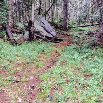
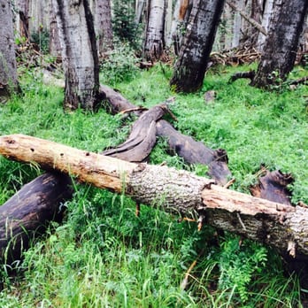


Ever since moving back to AZ last September, it had been my goal to reach the state's highest point atop Humphreys Peak. After completing numerous higher-altitude and/or high-intensity hikes in the state (Mt Lemmon, Spruce Mountain, Flatiron, Picacho Peak, etc.), I figured I had completed enough training to tackle this gargantuan challenge. While it was definitely enough preparation, I think it's impossible to complete this hike without using every ounce of energy in you. My wife decided to join me in the trek, and knowing her sensitivities, recommended she take some acetaminophen prior to the hike (oh was she happy she did!). If you know you have altitude problems, it might be a good idea to plan accordingly and do your research ahead of time. We drove up from Chandler and reached the trailhead parking lot by 7:30 am. Hitting the trail at 7:45, we reached the saddle by 10:30 and spent some time admiring the view. It is at this point when you are greeted by the tree line and start of Arizona's only tundra. You are so high up that trees and other vegetation cannot grow. Brace yourselves for the final push in altitude my friends. After another approx 1.5 miles up the rocky false peaks, we reached Humphreys Peak! Definitely a one of a kind view. On clear days such as ours you could see the Grand Canyon. Just beware of all the bugs. And believe me -- there are a LOT of bugs. The hike down takes just as long as you need to watch your step. We finished at almost 4 pm completely drained but super accomplished. If you are up for the challenge, I highly recommend this hike. read more




7 years ago

7 years ago

9 years ago
Absolutely gorgeous! Myself, my husband, our 8 year old son and our lab hiked to Humphery's peak. We hiked on a beautiful clear day in early September and felt so lucky to experience the 360 degree view at the top. It was strenuous and we all felt the altitude a bit, but were happy we completed it. Go prepared, pack TONS of water, snacks and a lunch if you plan on taking your time. Our phones mapped us at 10.6 miles to the peak and back. Remember pack out what you pack in!!! There are no trash cans, please respect our Mother Earth and happy hiking! read more



13 years ago

4.8 miles to the summit. There's a sign to Humphrey's Peak that will direct you to a dirt road parking lot on the way to the Arizona Snowbowl. You start off walking through a grassy meadow before entering a forest with tall trees galore. After about 3 miles of switchbacks, you emerge to the saddle, where the tree line begins to end. After 3/4 of a mile, you finally enter the only tundra in Arizona, where there are just rocks and no more trees to be seen. From that point there are 3 false summits that you ascend before going up the real summit. The view is incredibly beautiful. I went during late August, started at 6am and reached the top by 8:30am. It was pretty cold throughout, and it became windy at the top, but there was enough sunlight at the top to make up for it. There are plenty of markers once you reach the tundra so that you don't wander off trail or get lost. This is the highest point in Arizona, so would highly recommend if you ever visit Flagstaff. read more


10 years ago
This was an amazing adventure. My friend Jessica and I with my small 18 pound dog accomplished this hike. We started at 9am and got back to the trail head at 4pm! Super exhausted but we did it. Everything says its 4.8 miles or roughly 5-5.5 miles one way making it about 10-11 miles round trip. All I'm saying is both of our phones and fitbits clocked our summit and return at 14 miles! Go early, bring lots of water and some snacks bc the view up there is worth it! read more

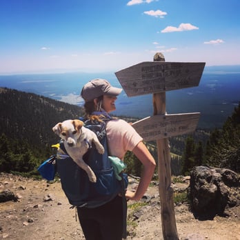


12 years ago
Awesomely beautiful trail. For the elevation you're climbing it's really not that tough. It's about a 8-9 mile hike to summit and back. With that being said, you don't have to go to the top there's other trails leading off of this one. Bring water and lunch that way you can picnic at the top read more


14 years ago
CANNOT beat my recent trip up this mountain. Recommended to start early morning so as to reach the summit before the afternoon storms that frequently happen. Fifteen minutes into the trail, just before getting to the log book.. a bear sighting. Continuing on up the hill, we were fortunate to stumble upon some wild raspberries. LOVED them. Around 10,000 feet, take a break on the rock fall... a slide of boulders and rocks streaking down the mountain. Continuing up past the 11,400 marker, you are almost to the saddle. The trail gets much steeper and trees thin out as you reach the treeline and edge into the tundra. Rocks, rocks, and more rocks. Altitude may affect those who are not used to it (me) so take it slowly. We had to rush a bit since clouds off in the distance were quickly making there way to us. There are 3 false summits so don't be tricked and KEEP going! Once at the top there are a couple wind break formations at the top, a wooden bench and military box with a log book and miscellaneous trinkets and reminders of previous hikers. Take some time to enjoy the view and eat some lunch you brought up with you before heading back down. MUST do at least once. read more


13 years ago

13 years ago
They say this is the easiest 12,000'+ peak to hike in the continental US. Knowing that I grabbed my brother, packed light, started early, and had a great time and amazing workout in the process. We went Sunday, September 1st which is an excellent time of year because the monsoons have moved on for the most part and its not too cold at the top. We started at approx. 6 am before sun up, and after about 4 miles we realized the sign at the start of the trail was incorrect 4.8 miles (maybe by the way the crow flies?). Both my brother and I had our MapMyRun GPS apps and it was approx. 7 miles (one way) and I say that because the app stopped working about 10,000'. We eventually made it past the 3 "false" peaks...more like heartbreak hills. You think its the end and then you get your heart broken by yet another, taller peak. At the top I was hoping to see the North Rim, but alas it was not to been seen that day. We still were able to get some amazing photos/video. It was great to hike through the forest and the tree line and see the different temperate zones on this mountain. read more


13 years ago

10 years ago

8 years ago
11 years ago
More info about Humphrey's Trail
9300 N Snowbowl Rd
Flagstaff, AZ 86001
Directions
Hours
Outdoor Amenities
Ask the Community - Humphrey's Trail
Review Highlights - Humphrey's Trail



















Why does Yelp recommend reviews?

Humphrey's Trail - hiking - Updated August 2026
Best of Flagstaff
People found Humphrey's Trail by searching for…
Trending Searches in Flagstaff, AZ
Barbershop For Men near Humphrey's Trail
Bike Shop near Humphrey's Trail
Cliff Jumping near Humphrey's Trail
Consignment Shops near Humphrey's Trail
Cruising Spots near Humphrey's Trail
Dog Friendly Things To Do near Humphrey's Trail
Ear Piercing near Humphrey's Trail
Elementary Schools near Humphrey's Trail
Eyebrow Threading near Humphrey's Trail
Hair Braiding near Humphrey's Trail
Kids Haircut near Humphrey's Trail
Pedicure near Humphrey's Trail
Picnic Areas near Humphrey's Trail
Preschools near Humphrey's Trail
Public Golf Courses near Humphrey's Trail
Running Trails near Humphrey's Trail
Scenic Night View near Humphrey's Trail
Scenic Overlook near Humphrey's Trail
Sports Card Shops near Humphrey's Trail
Sunrise View near Humphrey's Trail
Swimming Holes near Humphrey's Trail
Trading Card Shops near Humphrey's Trail
Uniforms near Humphrey's Trail
Browse Articles
Browse Nearby
Browse Brands
Related Searches in Flagstaff, AZ
Affordable Kayak Rental Services in Flagstaff, Arizona
Affordable Paddle Board Rental in Flagstaff, Arizona
Best Dog Hiking Trails Around Flagstaff, Arizona
Best Fishing Locations and Guides in Flagstaff, Arizona
Best Places for Horseback Riding in Flagstaff, Arizona
Best Sightseeing Experiences Available in Flagstaff, Arizona
Check Out Off Road Trails in Flagstaff, Arizona
Discover Dog Friendly Trails to Explore in Flagstaff, Arizona
Discover Easy Hiking Trails Near Flagstaff, Arizona
Discover Kid Friendly Hiking Trails in Flagstaff, Arizona
Discover Popular Bike Trails in Flagstaff, Arizona
Discover Top State Parks to Visit in Flagstaff, Arizona
Discover a Hiking Trail in Flagstaff, Arizona
Discover the Best Night Hike Trails in Flagstaff, Arizona
Dog-Friendly Hikes With Dogs in Flagstaff, Arizona
Enjoy Camping Adventures Around Flagstaff, Arizona
Enjoy Kayaking Adventures in Flagstaff, Arizona
Enjoy Off Leash Dog Hikes in Flagstaff, Arizona
Enjoy Scenic Places to Walk in Flagstaff, Arizona
Enjoy Tent Camping Spots Around Flagstaff, Arizona
Enjoy the Best Picnic Spots and Ideas in Flagstaff, Arizona
Enjoy the Best Walking Trails in Flagstaff, Arizona
Explore Beautiful Parks and Green Spaces in Flagstaff, Arizona
Explore Easy Hikes Perfect for All in Flagstaff, Arizona
Explore Fun Activities to Do in Flagstaff, Arizona
Explore Popular Campgrounds Near Flagstaff, Arizona
Explore Popular State Park Destinations in Flagstaff, Arizona
Explore Top Dog Parks in Flagstaff, Arizona Near You
Family Friendly Hiking With Kids in Flagstaff, Arizona
Find Beautiful Views in Flagstaff, Arizona
Find Parks and Recreation Activities in Flagstaff, Arizona
Find Popular Ziplining Spots Around Flagstaff, Arizona
Find the Best Parks BBQ Grills in Flagstaff, Arizona
Find the Best Parks for Picnics in Flagstaff, Arizona
Hiking Trails With Waterfalls in Flagstaff, Arizona
Off Leash Dog Hiking Trails in Flagstaff, Arizona
Picnic Areas With BBQ Pits Available in Flagstaff, Arizona
Popular Outdoor Activities to Try in Flagstaff, Arizona
Popular Picnic Spots to Visit in Flagstaff, Arizona
Safe River Swimming Areas in Flagstaff, Arizona
Safe and Fun Parks for Kids in Flagstaff, Arizona
Top Hiking Trails to Explore in Flagstaff, Arizona
Top Playgrounds for Kids to Enjoy in Flagstaff, Arizona
Top Running Trails to Explore in Flagstaff, Arizona
Top Swimming Lakes to Enjoy in Flagstaff, Arizona
Top Swimming Spots and Pools in Flagstaff, Arizona
Top-Rated Camping Sites in Flagstaff, Arizona


