1. Indian Vista

    1. Indian Vista

    0

    Banning, CA

    Cancel

    Open app

    Search

    Indian Vista

    3.7 (3 reviews)

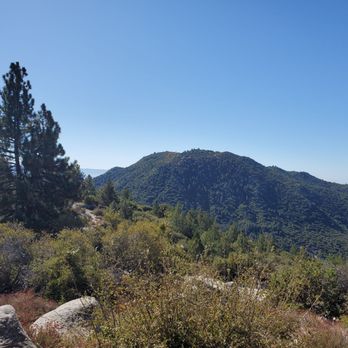
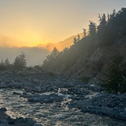
    Indian Vista Photos

    You might also consider

    Recommended Reviews - Indian Vista

    Your trust is our priority, so businesses can't pay to alter or remove their reviews. Learn more about reviews.
    Yelp app icon
    Browse more easily on the app
    Review Feed Illustration

    3 months ago

    Helpful 1
    Thanks 0
    Love this 0
    Oh no 0

    6 years ago

    Helpful 1
    Thanks 0
    Love this 1
    Oh no 0

    4 years ago

    Helpful 0
    Thanks 0
    Love this 0
    Oh no 0

    You might also consider

    Verify this business for free

    People searched for Hiking 1,468 times last month within 15 miles of this business.

    Verify this business

    Big Falls

    Big Falls

    4.5
    (78 reviews)
    20.7 mi

    The drive up to this trail is not bad at all! I sometimes get scared of driving up high into the…read moremountains but this was a pretty easy drive and there weren't any parts that I felt were scary. I was driving from Ontario, CA. You do need a pass to park in the lot. There are restrooms at the parking lot if you need to use them. The hike up is a pretty short one with pretty views! There are tons of shade from the trees and the water/waterfall was beautiful!

    I had a great safe visit. I paid the $5 Forest Adventure pass at Elkhorn General store on Valley of…read morethe Falls Dr, a 1.2 mi from the Big Falls Trailhead and Picnic area. I had a great time hiking with my senior father in law, and my family. The water was refreshing. The parking looks great this spring. This water flows into Hunington Beach, the sea, the Santa Ana River Wash. It was 52 degrees on group our walk through the creek and Cross the wash. Our walk was cut short by other hikers falling in the creek. Big falls trail will lead you along the river bed to cross the creek to a path of a waterfall overlook. The ice cold water was coming from the area of the mountainside has snow melting as we warm up this Spring season. The creek felt refreshing this morning, I dampened my On Running shoes with waterproof silicone in the waters by crossing the creek on a fallen branch. I refreshed my sun beaten hair with the ice melt waters. I like this trailhead. For years Water from San Bernardino mountains has collected in way of steel pipes that flow by gravity on the steep mountainside above a creek pumped in tunnels to Water Companies piped downhill to be bottled and sold as Arowhead Spring Mountain Water.

    Photos
    San Bernardino National Forest Trailhead
    San Bernardino National Forest Trailhead
    Hiking  big falls about a 1 mi out from the waterfall overlook
    Hiking big falls about a 1 mi out from the waterfall overlook
    Big Falls

    See all

    Oak Glen Preserve and Southern California Montane Botanic Garden

    Oak Glen Preserve and Southern California Montane Botanic Garden

    4.8
    (63 reviews)
    19.2 mi

    A beautiful, well maintained preserve with a stream, a few small ponds and waterfalls, and many…read morethemed trails such as: Hummingbird Hill, Falling Waters, Sunflower Lane, Pioneer Loop, Conifers of California, Wetlands Boardwalk, Deciduous Forest, The Artist's Palette, Hidden Hollow, Sacred Springs, and Children's Forest. While there are some dirt walk paths, it be difficult to navigate if in a wheel chair or if you have a stroller. There's a good sized parking lot, though during apple-picking season and when it snows it can be a bit difficult to find a spot. Regardless, if you're in the area, it's a place definitely worth the visit. Love and appreciate that they are dog-friendly to leashed and well mannered dogs and free admission, but donations are much appreciated.

    Absolutely loved getting my steps in and enjoyed the sights, sounds, and smells of all the flora…read moreand fauna in Oak Glen! Highly recommend going earlier in the day to beat the heat. Parking and admission is free. Wonderful information at the entrance of the garden. Just outside the garden past the parking lot (you'll see this upon entry) is a bbq spot and a gift shop. After walking around 2.5 miles, I tapped out and cooled down with an apple cider slushy. Lots of apple orchards in the area. I also took home a jar of apple butter as a souvenir. Had such a lovely time- highly recommend!

    Photos
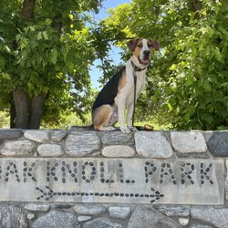
    Oak Glen Preserve's Oak Knoll Park has ample picnic tables for family fun and it's located next to the Children's Forest!
    Oak Glen Preserve's Oak Knoll Park has ample picnic tables for family fun and it's located next to the Children's Forest!
    Oak Glen Preserve and Southern California Montane Botanic Garden
    Oak Glen Preserve and Southern California Montane Botanic Garden

    See all

    The Wildlands Conservancy

    The Wildlands Conservancy

    4.5
    (31 reviews)
    19.2 mi

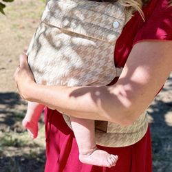
    came here a couple of weeks ago & my baby carrier apparently fell out of my stroller. I called and…read moresomeone turned it in when they found it. I asked if I could pay to have it shipped back to me and they refused. I then confirmed with the office that I could come by and pick it up this week. I drove 2 hours there and the office has "misplaced" it. They were careless and lacked any form of compassion to make the situation right.

    I discovered this spot while exploring the area and asking a local business for suggestions on pet…read morefriendly hikes. I live in Orange County and visit family near Loma Linda and make time to drive through Oak Glen and hike with my dog and cat at the Wildlands Conservancy. This is such a magical place and brings me much peace. It is beautiful, peaceful and from the tall sequoias to the tropical rainforest like trees, wild birds flying and chirping through them, sound of the woodpeckers and the fog rolling over the lake, it feels like a fairy tale. My pets love hiking here as well. Both entrance and parking at the Conservancy are free. It is very family and pet friendly with a petting zoo and food stands toward the other side as you drive in. There are also areas with picnic tables near the trails. The trails are very scenic and fairly easy with a portion that is somewhat steep which I would consider slightly moderate but not difficult. I highly recommend taking the time to visit this hidden gem.
    Photos
    General Sherman Sequoia Tree bark
    General Sherman Sequoia Tree bark
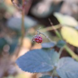
    A mini blackberry by its lonesome. So cute!
    A mini blackberry by its lonesome. So cute!
    Signage: "Help water the trees and watch them grow" (There's a bucket and a flowing stream... So neat!)
    See all

    Signage: "Help water the trees and watch them grow" (There's a bucket and a flowing stream... So neat!)
    Massacre Canyon

    Massacre Canyon

    3.3
    (8 reviews)
    12.7 mi

    Challenging but beautiful! Take the trail along the water, the mountain side one is dangerous.read more

    I love this place. Whenever I go to gramma's to do housework for her, I either go here or…read moreIdyllwild. I especially love this place on windy and rainy days. The high trail gets pretty sketchy and makes for a good time. For anyone wanting to know where this place gets its name, here goes. The local native tribes had a battle that ended here. One tribe made it to the waterfall and couldn't go anywhere. The other tribe held the high ground and slaughtered them. Google it. Anyway, parking sucks. There are a couple places off the side of the road to park. Other than that, you'll have to take your vehicle down a small hill and park in a dirt lot. Said dirt lot is a place where people like to run OHV's, and their trucks. There are some elevation changes and jumps. This used to be a loop until someone removed the rope from the highest section of the waterfall. The one at the lower half is still there. When the ropes were there, it was about a 5 mile loop.the trail doesn't end at the decent from the ridge to the waterfall. You can take the trail back another 12+ miles. It opens up to some Wild West looking shit, and then a bunch of huge boulders. The high trail is the fun part. It's pretty sketchy without high winds or rain. I prefer to come here with wind, and or rain, for a better time. The width of the high trail is about a foot, to 18 inches. At some spots, it may be unclear If you're not very experienced. At other spots there is no trail, so you'll have to stretch your legs pretty far, or make a short hop. There are plenty of rocks to get a foothold or handhold on, but be careful; some of it fragments quite easily. People also go shooting here, but usually well past the loop, and they don't aim at the trails. This place is not monitored by park rangers, so if you need anything, you'll need to call San Jacinto Sheriffs. Since it's not regulated, you can camp without permits. Have fun, be safe, watch for snakes, weird locals, keep an eye out for falling rocks, and yell down below if you happen to dislodge some rocks from the high trail. This is a good local playground; enjoy it and keep it clean.

    Photos
    Massacre Canyon
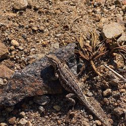
    Lizard
    Lizard
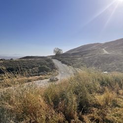
    Trail

    See all

    Trail

    Indian Vista - hiking - Updated July 2026

    Loading...
    Loading...
    Loading...