Iron Goat Trail Photos


You might also consider


More like Iron Goat Trail
Recommended Reviews - Iron Goat Trail
Start your review...


Reviews With Photos
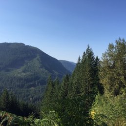

A most beautiful trail along the Stevens Pass a good 90 minutes east of Seattle. The trail follows an old train passage built in the early 1900s and eventually destroyed by unrelenting avalanches. You can still walk through the old train tunnels and see the lingering debris of wooden staircases crumbled under falling rocks. That's all very cool as are the vistas that look across what is now the Interstate 2 highway to bounty of evergreens in the hills across the valley. Those aspects are very cool, but the terrain itself is mostly rocky and uneven meaning you spend more time looking at where your shoes are stepping than at the views until you stop. The trail is either six miles total or 12 if you tack on an annex. I must admit as someone with a bit of vertigo, the annex was a white knuckle affair which only goes one way for three miles then returns the same three miles back. Knowing the narrow, steep precipice I'd have to re-navigate, I bailed on this annex a mile in. Also one of the switchback at the topmost part of the ascent is wide and fairly well groomed. However, the descending switchback to get back to the parking lot is so narrow and so steep in parts, you almost have booty scoot slowly to get down safely. Also, go early as that switchback after morning hours becomes even narrower with foot traffic going up and down. Also worth noting is parking does not accept Washington's Discovery Pass as it's a federal and not state park. So for $5 buy a federal pass online. There is a cement "bathroom" in the parking lot, but not one regular bathroom on the trail. So if you do plan doing all 12 miles, "go" at the very last minute before heading up, and don't drink water unless you have to.


My Grandad volunteered maintaining/working on this trail for much of his later portion of his life. He would bring me and my family up to go hiking for the day or part of the day. It was fun having him along as he would tell us about the history of the trail, how he helped maintain it, what drew him there, and point out different natural features, plants, and animals. One standout memory was using the port-a-potti that overlooks the highway. There is nothing between you and the surrounding mountains. Quiet a view! A trail that is fun for the whole family.
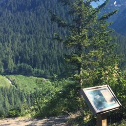

Loved this trail!!! We walked to Wellington- It took us about 5hours- mind you we had my in-laws who are in shape but love rest stops, snacks and of course we all stopped to read all the trail info. We learnt so much!!!! The views were unreal! I can't even imagine riding on a train on a cliffs edge... omg! Crazy to walk on and experience such a historic sight... yet sad and moving at the same time. The old concrete tunnel was amazing!


Just got done hiking this today. Fun hike. Interesting history. Trail is all passable. Beware of bears. Frequent sightings from other people but we didn't encounter any. So please be careful if you decide to do this trail.


For anyone looking for a fun and easy to slightly moderate trail, highly recommend this one!! Highlights of trail: 1. Parking Lot: Fairly large. Come early and beat the crowds :) 2. Trail Length: Used All Trails app to track and took about 7miles round trip for the loop 3. Trail Difficulty: Depending on how you start, difficulty level can vary. My friends and I opted to start the loop off at the switchbacks (going counterclockwise on the trail) and that was really the most tough part with the never ending incline. Once done with the switchbacks, it was smooth and easy sailing with the rest of the flat trail. If you want a shorter route and not finish the whole loop, just start the trail off clockwise and for the first couple of miles; it will be pretty flat before the gradual incline starts. 4. Trail Features: So many things to see!! :) Love reading the historic notes along the trail to give context about the various train tunnels and such. Tons of cool plants, mini waterfalls, and plenty of scenic viewpoints. 5. Other notes: Hiking poles not needed but I do suggest hiking boots or shoes with good tractions as some of the trail can get a bit rocky. Plus, there are a couple of streams to cross over, so shoes might get wet! Overall, peaceful hike and not too far of a drive from Seattle~ read more


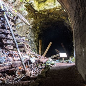
Weather is getting nice, but the weekend we went it was a little rainy, cloudy and wet outside. Whatever, deal with it. It's about a 90 min drive if you are coming from Seattle proper area, head towards Stevens Pass in Skykomish. We got there about 830am, so there was only a few cars in the little lot at the trail head. There's a port-a-john you can use if you need to go. The trail is relatively easy to medium depending on physical condition, small little climb when you start then it evens out when you get to the top of the upper loop and remains level all the way throughout. Bottom loop is pretty flat and wide with good views too. Do both. Depending on what you do, it can be about 7-9 miles round trip. Nice views, little waterfalls, cool & slightly spooky looking old train tunnels(you are not allowed to go inside), cool looking anchor wall, some signs along the way to explain some history of the Great Northern Railway over the Cascades. I enjoyed it, glad we took time to get outside, get some fresh air, and go to towns I've never been to. I read some articles and posts about paranormal activity there, unfortunately I didn't see any ghost. read more


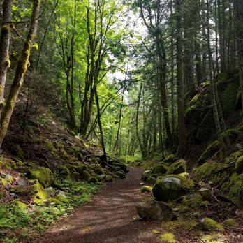
This is a very special find and a gold mine for homeschooling families who are looking for something that is "technically learning" but "actually fun." Iron goat trail is very close to Steven's pass. There are several trail-head options including one with ample parking, bus parking, bathrooms, and an old train car. We hiked the fully-accessible trail both ways with our 3, 7, and 9 year olds. The trail is well maintained though it does drop into some steep-ish areas at times. LOTS of beautiful vegetation - my daughter identified skunk-cabbage plants (apparently that's a thing). A few little streams and waterfalls. The tunnels and snow sheds are spooky in the best possible ways. The trails and boundaries are clearly marked. Placards along the way have some great information about engineering of trainlines through mountains (STEM homework DONE for the month) and also the history of the line (Social studies homework, also DONE for the month). There are a few benches on the trail - but they are a bit scarce. We ended up eating in the middle of the trail because everyone was about to dissolve into a hangry-meltdown. On a crisp fall morning, temperatures can be significantly colder than in the city - so gloves and hats were a must. Our one regret was that we had to rush back for kid-sport-related-activities so we couldn't do the whole loop! Good news however, everyone wants to go back with more time! read more




6 years ago
A most beautiful trail along the Stevens Pass a good 90 minutes east of Seattle. The trail follows an old train passage built in the early 1900s and eventually destroyed by unrelenting avalanches. You can still walk through the old train tunnels and see the lingering debris of wooden staircases crumbled under falling rocks. That's all very cool as are the vistas that look across what is now the Interstate 2 highway to bounty of evergreens in the hills across the valley. Those aspects are very cool, but the terrain itself is mostly rocky and uneven meaning you spend more time looking at where your shoes are stepping than at the views until you stop. The trail is either six miles total or 12 if you tack on an annex. I must admit as someone with a bit of vertigo, the annex was a white knuckle affair which only goes one way for three miles then returns the same three miles back. Knowing the narrow, steep precipice I'd have to re-navigate, I bailed on this annex a mile in. Also one of the switchback at the topmost part of the ascent is wide and fairly well groomed. However, the descending switchback to get back to the parking lot is so narrow and so steep in parts, you almost have booty scoot slowly to get down safely. Also, go early as that switchback after morning hours becomes even narrower with foot traffic going up and down. Also worth noting is parking does not accept Washington's Discovery Pass as it's a federal and not state park. So for $5 buy a federal pass online. There is a cement "bathroom" in the parking lot, but not one regular bathroom on the trail. So if you do plan doing all 12 miles, "go" at the very last minute before heading up, and don't drink water unless you have to. read more
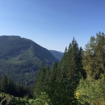

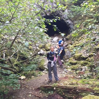


My Grandad volunteered maintaining/working on this trail for much of his later portion of his life. He would bring me and my family up to go hiking for the day or part of the day. It was fun having him along as he would tell us about the history of the trail, how he helped maintain it, what drew him there, and point out different natural features, plants, and animals. One standout memory was using the port-a-potti that overlooks the highway. There is nothing between you and the surrounding mountains. Quiet a view! A trail that is fun for the whole family. read more


Loved this trail!!! We walked to Wellington- It took us about 5hours- mind you we had my in-laws who are in shape but love rest stops, snacks and of course we all stopped to read all the trail info. We learnt so much!!!! The views were unreal! I can't even imagine riding on a train on a cliffs edge... omg! Crazy to walk on and experience such a historic sight... yet sad and moving at the same time. The old concrete tunnel was amazing! read more
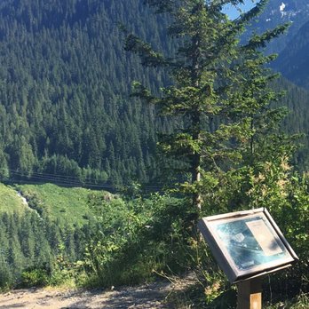


Just got done hiking this today. Fun hike. Interesting history. Trail is all passable. Beware of bears. Frequent sightings from other people but we didn't encounter any. So please be careful if you decide to do this trail. read more


7 years ago

11 years ago


16 years ago

12 years ago

15 years ago

12 years ago
First off this is not a backcountry trail. It is instead a very family friendly, ADA FRIENDLY trail. Although it is missing a few mountain lakes, the views are incredible. In addition the trail entirely follows a 9 mile segment of the Great Northern Railroad crossing across the Northern Cascades, built and completed in 1892. The railroad ran the route until 1929 when the longest US railroad tunnel was built 500 ft. below the original 1900s tunnel. Because of the maintenance issues caused by the Cascade Range Mountains, particularly with snowfall, a lot of money was spent on improving a line that would be in the end not profitable, eventually leading to its demise in 1933 at its total abandonment. As a result of its historical genre I was attracted to hike this trail many times, yes even before the official trail construction in 1996. I would later join with Volunteers for Outdoor Washington and the Forest Service to help build the trail. As always with railroad grade the trail is only a 2.2% steady grade to climb to the upper tunnel, which makes for an easy hike. Road access is at 3 points to the lower trail and the upper trail. The lower trail is the ADA access. There are many cement retaining walls as well as the Twin Tunnels. Between the Twin Tunnels is the only remaining intact woodsheds, albeit not in great shape. The view of the Skykomish river basin gets greater as you ascend. For a family this is a very easy assent. For a wheelchair this might prove difficult for 4 miles to get to the midpoint. I personally have pushed a person in a wheelchair uphill for 2 of those miles and did not find it exhausting at all. To also add to the enjoyment is the care of the interpretive signs along the way. They contain historical photos of the sight you are viewing. The upper trail has many more features of retaining walls and tunnels including a tunnel built in 1892. The tunnels often include the dates of their construction including the Windy Point Tunnel. The Forrest Service advises you not to enter Windy Point but because of its cement structure I have many times hiked through it without the use of a flashlight. The view before entering Windy Point Tunnel is breathtaking. There is a trail that goes around the tunnel that gives you a real view of the Skykomish River. Because many of the older tunnels used wood to shore them up they have collapsed and I have hesitated to explore them. Then just before you arrive at Wellington, also known as Tye, there is a cement snowshed. The first 20 ft. have collapsed due to a vain attempt to use dynamite to fully destroy the snowshed. Feel safe as you enter the shed past the destruction which will eventually lead you to Wellington. Beyond Wellington is the 2.2 mile tunnel that leads to the east side of the Cascades. Though I have hiked and even driven my pickup into the tunnel back in the 90s, the tunnel now has collapsed and is now impossible to traverse. I would never recommend that this hike be done in one day The views and sidetrips take up a lot of time. There are many cut-off trails that allow roundtrip day hikes. The only real danger I have discovered is that I get carried away and take on more than my time allows and realizing I have no food or water in my backpack. This is one trail I seek to hike a small segment on a yearly basis. I have brought many friends and families and never had a complaint yet. read more


More info about Iron Goat Trail
Skykomish, WA 98288
Directions
Visit Website
http://www.irongoat.org/
Hours
Outdoor Amenities