Cancel

    Open app

    Search

    Lake Hughes Road

    4.0 (1 review)

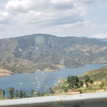
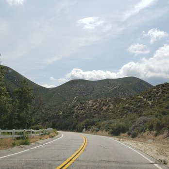
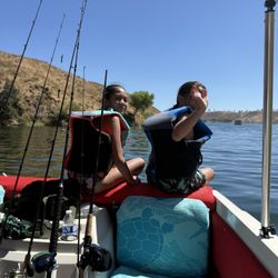
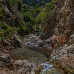
    Lake Hughes Road Photos

    Recommended Reviews - Lake Hughes Road

    Your trust is our priority, so businesses can't pay to alter or remove their reviews. Learn more about reviews.
    Yelp app icon
    Browse more easily on the app
    Review Feed Illustration

    7 years ago

    Helpful 8
    Thanks 0
    Love this 7
    Oh no 0

    Verify this business for free

    People searched for Local Flavor 148 times last month within 5 miles of this business.

    Verify this business

    Whitney Canyon Park

    Whitney Canyon Park

    4.5(66 reviews)
    18.0 km

    When you're ending the year 2025 with a hiking adventure. Let's begin this banger review…read more Whitney Canyon Park is a 442-acre park known for its diverse trails for hiking, biking, and horseback riding, featuring oak woodlands, chaparral, and riparian areas with seasonal waterfalls. It is located next to the freeway in Santa Clarita. I have been eyeing this trail/park for months and I am glad I crossed this on my All trails hiking list. I came on a late Monday morning and it was bloody windy (~45 mph) with a cool temp of 64 degrees. This park has multiple trials including Elsmere Trail. WCP has a wide track trail through a canyon that was known for oil drilling and ranching some of its remnants are still visible. Its trail has little to no tree shade but the trailhead was kept clear. I have seen some hikers (family and kids) and bikers along the way; most are friendly and nice. Parking lot is huge with no shades. Trash bins are available. Overall, it's a nice easy park to go hiking. I recommend it.

    A friend took me to Whitney Canyon Waterfall today, and wow what an adventure. The hike is…read moremoderate, about 3.5 miles, and parking is free. Reaching the waterfall is not for the faint of heart. You climb uphill, descend back down, reach a small waterfall, and then go through it to finally arrive at Whitney Waterfall. It's a bit sketchy, definitely thrilling, and absolutely worth it but only if you're prepared. Hiking shoes are a must. This trail is not recommended for kids or beginner hikers due to steep and slippery sections. It was 48 degrees and freezing cold today, so check the weather before you go and layer up. Also, there are no restrooms, so plan ahead. If you're looking for a raw, adventurous hike with a rewarding waterfall at the end, this one delivers.

    Photos
    Whitney Canyon Park - Heart rock

    Heart rock

    Whitney Canyon Park
    Whitney Canyon Park - Wide view down some of the falls.

    See all

    Wide view down some of the falls.

    Mulholland Drive - Sunset view at one of the overlooks

    Mulholland Drive

    4.6(149 reviews)
    46.5 kmBeverly Crest

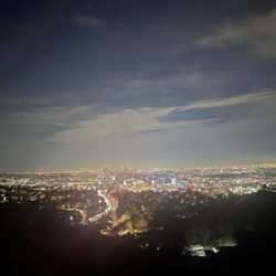
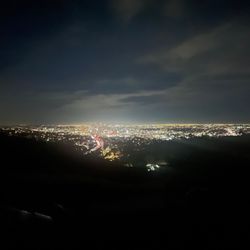
    Molhulland Drive, California…read more If you're looking for a chill, romantic drive, Mulholland Drive is a great pick!!! The views are beautiful, especially in the spring and fall when everything is green and wildflowers are blooming. The road winds through the hills, so you get nonstop scenic views. Driving with the top down and the wind in your hair makes it even better ~ super relaxing and enjoyable. It's the kind of drive where you just take it slow and enjoy the ride. There are several lookout spots where you can pull over, catch an amazing sunset, and later see Hollywood and San Fernando Valley city lights at night. Plus, there are plenty of spots perfect for Instagram ~ worthy photos. Definitely worth the drive.

    Mulholland Drive is one of those famous roads built a hundred years ago just to show off the…read moreamazing views of the city and the valley. I first drove up there way back in the early 90s, and I remember being totally blown away by how big Los Angeles looked from up high. I have been back plenty of times since then, and that twisty drive along the top of the hills honestly never gets old. It is a great place to just cruise around, especially when you pull over at the dirt patches to look down at the city lights. Even though the world down below has changed a lot, driving that road still feels exactly the same as it did on my first trip.

    Photos
    Mulholland Drive - Happy 2025!

    Happy 2025!

    Mulholland Drive - Happy 2025!

    Happy 2025!

    Mulholland Drive - Happy 2025!

    See all

    Happy 2025!

    Malibu Canyon - We made it

    Malibu Canyon

    4.4(21 reviews)
    52.3 km

    Malibu Canyon Road, also known as State Route 2, offers a scenic journey through the Santa Monica…read moreMountains, connecting the San Fernando Valley to Malibu. The winding road takes you through rolling hills, towering mountains, and lush canyons, offering captivating views at every turn. Just a word of caution: Be prepared for unpredictable traffic, especially on weekends and holidays. Also be sure to check the weather conditions beforehand, as heavy rain or fog can significantly impact visibility, or even worse, landslides. And another thing to consider, there are limited amenities along the way aside from a few gas stations and trailheads,

    Even after 20 years or so first experiencing driving through Malibu Canyon and Malibu Canyon Road,…read moreI still get a thrill going through this area and popping out from this winding narrow pass to the gorgeous views of the mountains surrounding Malibu and the Pacific Ocean. And just the opposite is true, too. I purposely cut off of PCH and head up into this canyon leaving the water views and the open sky to feel the exhilaration of driving through this curvy passage up through this canyon and eventually hitting Lost Hills onto the 101 Freeway. I freaking love it! If you go through here, get out of your car and into any one of the many turnouts available for people like me who just want to take it all in and enjoy the magnitude of the mountain that was cut through to be able to get to the other side. You will either to reach the San Fernando Valley going back south or go down into the Conejo Valley heading north. It's still a breathtaking, awe-inspiring ride through Malibu Canyon to me.

    Photos
    Malibu Canyon - Going down!!!

    Going down!!!

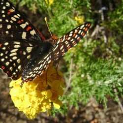
    Malibu Canyon - This butterfly was feasting along the Backbone Trail.

    This butterfly was feasting along the Backbone Trail.

    Malibu Canyon

    See all

    Bear Divide Trail - Natural succulents

    Bear Divide Trail

    4.4(7 reviews)
    13.4 km

    "The Bear" is used by the local firefighters for conditioning. From the trailhead to the water…read moretank, the record I'm told for completion is about 16 minutes for a little more than a mile. Since my first visit back in 2014 till now, the trail has really gone through the wringer from being ravaged by the elements. Burnt trees left over from previous wildfires as well as dips and ditches caused by runoff from heavy rain. The firefighters maintain the trail to an extent, but at its current state there is still work to be done. With that said, if it's a challenge you're looking for, then you've come to the right place. The sharp inclines and loose dirt make the ascension treacherous, but all the more satisfying. On the last visit, the foggy skies were leveled with one of the few false summits, literally heads in the clouds. The sunset off to the distance made for beautiful views of the city down below, and the wildflowers along the way were not only plentiful, but varied, including lupins, poppies, and buttercups. After reaching the water tank, we made a quick stop at the fire station before heading down. On the backside of "The Bear" to put it kindly, fallen trees, narrow paths, and poison oak makes this leg of the trip almost as daunting as the uphill. Where there used to be a bridge there's now a chasm that one must trek down and up before being back on the trail. In another instance, a fallen log was repurposed as a bridge for those brave enough to cross. Branches that used to grow out along mountain have been chainsawed, old shrubs swept out of the way. Despite all that, the views coming down were wonderful to take in, making it a calming stroll back down. Recommended for the bold and seasoned folks.

    Great spot just did it, no one around Went up to water…read moretower ,in the beginning of hike go right !instead of left it keeps you on ridge of mountain, I absolutely love this hike

    Photos
    Bear Divide Trail - Viewtiful

    Viewtiful

    Bear Divide Trail - Respite

    Respite

    Bear Divide Trail - It's doable

    See all

    It's doable

    O'Melveny Park - Someone made a Peak sign.

    O'Melveny Park

    4.7(273 reviews)
    22.8 kmGranada Hills

    A great park at the north end of San Fernando Valley. So many areas to spread out and enjoy…read more O'Melvany is listed as the second-largest public park in Los Angeles(behind Griffith Park), but still seems a pretty good secret, for the most part. On any given day you may see dogs playing, or training in social skills, exercise classes, families picnicking and kids running around. BUT ALSO BE ON THE LOOKOUT FOR WILDLIFE! Coyotes and mountain lions are very common, as are rattle snakes. But also bunnies, squirrels and an array of birds, for those who take the time to stop, listen, and try to identify. There is not a playground at this large park. Instead, the draw is toward it's many, well marked, hiking trails. This use to be John O'Melvany's ranch, until he deeded the land to Los Angeles(1976), with specifics for it to be used as a park. You'll still see orchards of grapefruit as you enter, with signs requesting you not remove the fruit from the area. The fruit has not been properly tended to in decades, so it's not really yummy grapefruit, but on occasion you'll see some people plucking and tasting to quell their curiosity. Mainly, to avoid the spread of fruit flies, the city requests that the yellow spheres be left in place. BUT OH THE AROMA OF THE FLOWERS FROM THESE TREES! And so many happy bees flitting about. Quite nice. This is also a park that allows access for equestrians. A very large dirt area for trailers to park and horses to be staged and prepped before heading off into the hills on the marked Equestrian Trail. If you do take the time to hike one of the many trails, you'll be rewarded with beautiful view of SFV. If you squint, you can almost imagine what it looked like pre-WWII, before the tract homes welcomed the veterans here. Many beautiful, very old, oak trees, eucalyptus and various maple species, along with a LOT of native shrubbery are found throughout the park and the one large bathroom at the center is well maintained. Hours are dawn to dusk, with gates at both the pedestrian entry and parking lot. Plenty of free parking in the lot and along the street. If you're up for an easy, but fairly long excursion, check out Bee Canyon Park. It starts just across the street from O'Melvany and DOES have a play area for kids. Also, it's trail runs all the way to Balboa. Cheers! "CC"

    Great hiking trail! It is uphill the whole time, so it's a little harder, but take breaks as…read moreneeded. Nice hike to see nature!

    Photos
    O'Melveny Park - Model (myself) IG: @ammysalamii Photography by IG: @richardesque

    Model (myself) IG: @ammysalamii Photography by IG: @richardesque

    O'Melveny Park - Poppy spotting March 2023

    Poppy spotting March 2023

    O'Melveny Park - Model (myself) IG: @ammysalamii Photography by IG: @richardesque

    See all

    Model (myself) IG: @ammysalamii Photography by IG: @richardesque

    Lake Hughes Road - localflavor - Updated September 2026

    Loading...
    Loading...
    Loading...