Lawson Peak Trail Photos



You might also consider


More like Lawson Peak Trail
Recommended Reviews - Lawson Peak Trail
Start your review...


Reviews With Photos


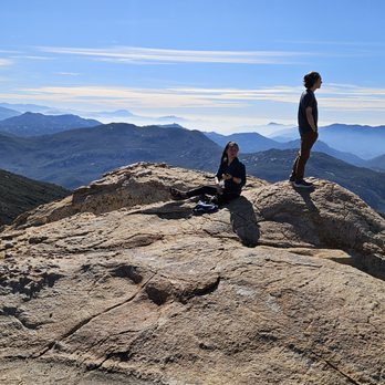
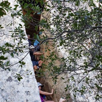
During different work breaks throughout the year I tend to venture out and try different hiking trails in the county. In January 2019 I tried Lawson as a hiking Meetup group I am in was going. Lawson Peak is a great location hike for several reasons: Pros - significant uphill to work the lower body -great panoramic view at the top -unique aspects such as the cave, Pancake Place, The Chimney Cons - no established parking lot and one must park along the highway I highly recommend you hike Lawson in the winter as there is no shade. I also recommend you come with a full stomach food as you will be burning many calories uphill. You should expect to spend about three hours to complete Lawson and that includes stopping for pics and breaks. Lawson Peak is now one of my most favorite hikes in San Diego County and I plan to return each year or so.


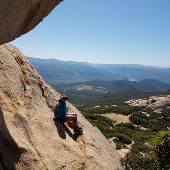
You're better of using secret canyon trail directions to get to the entrance. If you're on the dirt rd...turn back around and go to Lyond Valley Rd. Park by mile 13 and start your hike past the yellow gate. Bring pants and gloves because after the long hike up to the boulders you will have to do some rock climbing. Also you should bring a friend for safety and to pull/push yourself up and through the boulders. Great workout!


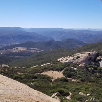
Great hike! Worked both my upper and lower muscle strength. We spent a loongg time trying to find the trail. Gps took us to a dirt road with lotsa private properties with no clear path to any trail. Most of these properties had loose dogs just ready to attack. Haha! We finally got it right by following Lyons Valley Road and parked at the Mile 13 marker. First part of the hike was lotsa little uphill...but not too bad. The hardest part was the boulders we had to climb to reach the peak. Bring gloves to help with your grip and someone stronger to help pull you up in some the harder parts of the boulder. Totally worth it!

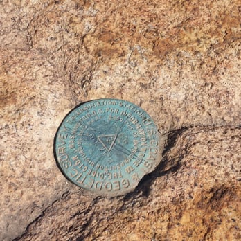
Hiked here for the first time at the end of October. This was definitely one of the more challenging, dangerous and fun hike I've done in Southern California! The first 2 miles was all uphill and the second half required some bouldering, climbing and finding your own way to the very top. When you get up there, it's so worth it. Bring lot of water, food and a first-aid kit. I thought I was going to died trying to climb over all those tricky rocks but ended up tripping on solid ground and scraped my knees when I was hiking back on the cleared hiking path. Wow, failed! Remember mile marker 13 is where you want to park your car on the side of the road. "Lawson Peak Trail is a 4.5 mile out and back trail located near Jamul, California that features a cave and is rated as difficult. The trail is primarily used for hiking, off road driving & rock climbing and is accessible from November until May. Dogs are also able to use this trail." The link below will help you if you want direction there and good luck! http://alltrails.com/trail/us/california/lawson-peak-trail


It had been over a decade since I've done this hike -- mostly because dogs are prohibited on this trail (and usually I like to take my dogs hiking) -- but this week I decided to do it again. The short of it: - The first mile is pretty uninteresting as it is on a fire road. - Then you hit an open dirt plateau, walk straight across to the open path on the opposite side. - The remaining 1.3 miles is really fun -- lots of scrambling up boulders, and then a little challenging rope climb through a chimney to get to the peak where there are fantastic views Things to know: Cell service is spotty up there, so if you are going to use Google Maps to find the trailhead,, start to navigate while you are still in a populated area with cell service. Finding the entrance to the chimney can be tricky. There were three of us that were close to it, but it took us about 10 minutes to find it. To make it easy for the rest of you to find: download the What3Words app in advance, and when you get to the point that you are actively looking for the chimney, put in the words "dreadful.joining.tilts" and hit Navigate / Compass Mode...this should guide you to the exact entrance of the chimney. (( Side note, if you are not familiar with What3Words, watch this cool 5 minute TedTalk by its founder: https://www.ted.com/talks/chris_sheldrick_a_precise_three_word_address_for_every_place_on_earth )) There are lots of holly-like shrubbery on the second half of the trail. Long pants aren't required, but they can definitely help you avoid abrasion. It gets hot there: the high was supposed to be 60 degrees in that area yesterday, but it felt like it was in the 70s when we were doing the hike. This is definitely a hike to do when the weather is cold in San Diego proper. Download the All-Trails trailmap in advance: the latter 1.3mi is not well-marked, and having that GPS accessible trailmap sped up our hike by letting us know if we were getting off the beaten path. For a meal afterwards, I recommend Panchos: we went to Panchos Mexican on Jamacha Rd....huge serving sizes, and very tasty. read more


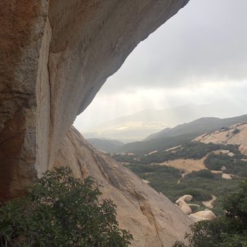
Hiked this back in early March. I liked that there were very few people on the trail. It is steep from the beginning but not too difficult. Small area to park by the start of the trail which is a yellow gate. Once you get close to the peak there is not much of a trail and you need to pick a path over boulders. I made my way around to the back of the peak on the west side and found the rope. There are some rock and some wooden make-shift steps to help you get up to the top with the cave. Sadly, maybe because I was alone with no one to assist and maybe not strong enough I did not make it up...bummer. It is just under 5 miles and will take 2-3 hrs most likely. read more




6 years ago
This is one of those unexpectedly cool hikes. And I say unexpectedly because it was just in the middle of nowhere, without a parking lot or anything. It was a fairly pretty hike all the way up/down. Granted, it was scorching hot outside when I did it, so maybe my memories of it are blurry, but as far as I can remember, despite the dryness and all, it was gorgeous at the top, and a decent workout all the way through. read more


During different work breaks throughout the year I tend to venture out and try different hiking trails in the county. In January 2019 I tried Lawson as a hiking Meetup group I am in was going. Lawson Peak is a great location hike for several reasons: Pros - significant uphill to work the lower body -great panoramic view at the top -unique aspects such as the cave, Pancake Place, The Chimney Cons - no established parking lot and one must park along the highway I highly recommend you hike Lawson in the winter as there is no shade. I also recommend you come with a full stomach food as you will be burning many calories uphill. You should expect to spend about three hours to complete Lawson and that includes stopping for pics and breaks. Lawson Peak is now one of my most favorite hikes in San Diego County and I plan to return each year or so. read more



7 years ago
You're better of using secret canyon trail directions to get to the entrance. If you're on the dirt rd...turn back around and go to Lyond Valley Rd. Park by mile 13 and start your hike past the yellow gate. Bring pants and gloves because after the long hike up to the boulders you will have to do some rock climbing. Also you should bring a friend for safety and to pull/push yourself up and through the boulders. Great workout! read more



6 years ago
Great hike! Worked both my upper and lower muscle strength. We spent a loongg time trying to find the trail. Gps took us to a dirt road with lotsa private properties with no clear path to any trail. Most of these properties had loose dogs just ready to attack. Haha! We finally got it right by following Lyons Valley Road and parked at the Mile 13 marker. First part of the hike was lotsa little uphill...but not too bad. The hardest part was the boulders we had to climb to reach the peak. Bring gloves to help with your grip and someone stronger to help pull you up in some the harder parts of the boulder. Totally worth it! read more




11 years ago
Hiked here for the first time at the end of October. This was definitely one of the more challenging, dangerous and fun hike I've done in Southern California! The first 2 miles was all uphill and the second half required some bouldering, climbing and finding your own way to the very top. When you get up there, it's so worth it. Bring lot of water, food and a first-aid kit. I thought I was going to died trying to climb over all those tricky rocks but ended up tripping on solid ground and scraped my knees when I was hiking back on the cleared hiking path. Wow, failed! Remember mile marker 13 is where you want to park your car on the side of the road. "Lawson Peak Trail is a 4.5 mile out and back trail located near Jamul, California that features a cave and is rated as difficult. The trail is primarily used for hiking, off road driving & rock climbing and is accessible from November until May. Dogs are also able to use this trail." The link below will help you if you want direction there and good luck! http://alltrails.com/trail/us/california/lawson-peak-trail read more


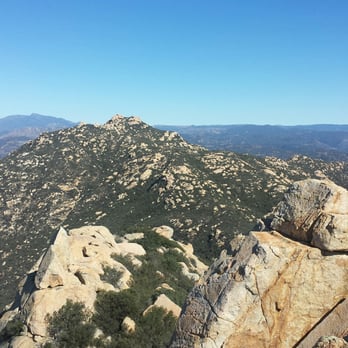


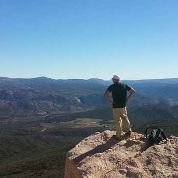


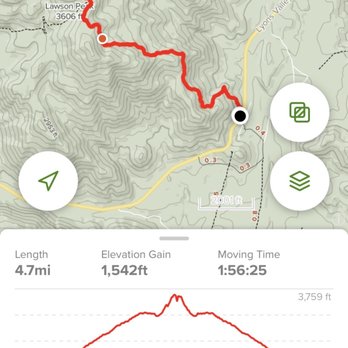
The trail was rated difficult by AllTrails which is why I decided to check it out. I wanted a good quick hike. I completed the hike in 2 hours and 17 minutes at 5.27 miles there and back. It is not at all hard for a fit individual, and a relatively dull trek for the first 1.5 miles. However, there are some great views once past the initial old fire road. There is some Boulder climbing in the last stretch, which wasn't too difficult for me. It was kind of fun. What I really enjoyed about this hike is that there was literally almost no one on this trail, so it was dead quiet for getting to tune with nature until I hit the boulders, then it became a bit windy. I am sure there are better trails in Cleveland national forest, so I have to say I may never go back to this trail again. It was nice, but not nice enough to be memorable. Average hike. read more


8 years ago
More info about Lawson Peak Trail
20603 Lyons Valley Rd
Alpine, CA 91901
Directions
Hours
Outdoor Amenities
Ask the Community - Lawson Peak Trail






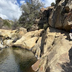


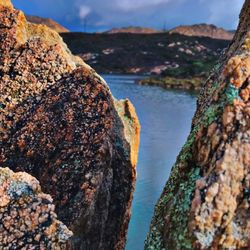


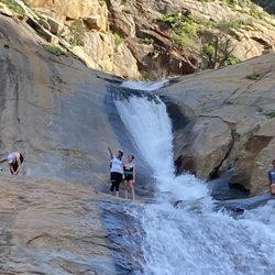



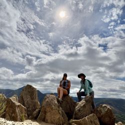
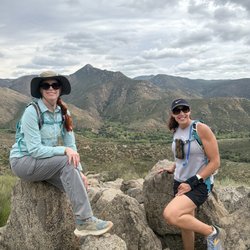
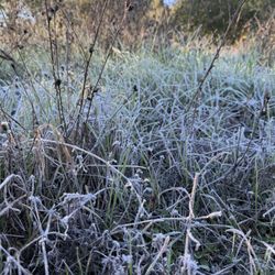


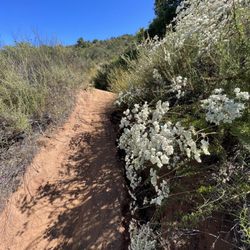



Lawson Peak Trail - hiking - Updated August 2026
Best of Alpine
People found Lawson Peak Trail by searching for…
Trending Searches in Alpine, CA
Barbershop For Men near Lawson Peak Trail
Beautiful Views near Lawson Peak Trail
Bike Shop near Lawson Peak Trail
Casinos near Lawson Peak Trail
Cliff Jumping near Lawson Peak Trail
Consignment Shops near Lawson Peak Trail
Cruising Spots near Lawson Peak Trail
Dog Friendly Things To Do near Lawson Peak Trail
Dog Friendly Trails near Lawson Peak Trail
Ear Piercing near Lawson Peak Trail
Elementary Schools near Lawson Peak Trail
Eyebrow Threading near Lawson Peak Trail
Flower Fields near Lawson Peak Trail
Free Picnic Areas near Lawson Peak Trail
Hair Braiding near Lawson Peak Trail
Kids Haircut near Lawson Peak Trail
Lookout Points near Lawson Peak Trail
Night Hike near Lawson Peak Trail
Off Road Trails near Lawson Peak Trail
Outdoor Activities near Lawson Peak Trail
Pedicure near Lawson Peak Trail
Picnic Areas near Lawson Peak Trail
Picnic Spots near Lawson Peak Trail
Public Golf Courses near Lawson Peak Trail
Public Pools near Lawson Peak Trail
River Swimming near Lawson Peak Trail
Rock Quarry near Lawson Peak Trail
Running Trails near Lawson Peak Trail
Scenic Night View near Lawson Peak Trail
Scenic Overlook near Lawson Peak Trail
Sunrise View near Lawson Peak Trail
Swimming Holes near Lawson Peak Trail
Trading Card Shops near Lawson Peak Trail
Uniforms near Lawson Peak Trail
Used Furniture Stores near Lawson Peak Trail
Watch Sunset near Lawson Peak Trail
Browse Brands
Related Searches in Alpine, CA
Affordable Bike Repair Services in Alpine, California
Affordable Cheap Bike Tune Up Services in Alpine, California
Affordable Kayak Rental Services in Alpine, California
Affordable Road Bike Rental in Alpine, California
Best Dirt Bike Riding Spots in Alpine, California
Best Dog Hiking Trails Around Alpine, California
Best Electric Bike Rental Services in Alpine, California
Best Fishing Locations and Guides in Alpine, California
Best Places for Horseback Riding in Alpine, California
Best Sightseeing Experiences Available in Alpine, California
Best Sledding Spots and Fun in Alpine, California
Best Waterfalls and Swimming Holes in Alpine, California
Check Out Off Road Trails in Alpine, California
Convenient Bike Sharing Programs in Alpine, California
Discover Dog Friendly Trails to Explore in Alpine, California
Discover Easy Hiking Trails Near Alpine, California
Discover Kid Friendly Hiking Trails in Alpine, California
Discover Popular Bike Tours in Alpine, California
Discover Popular Bike Trails in Alpine, California
Discover Scenic Bike Paths in Alpine, California
Discover Scenic Mountain Bike Trails Near Alpine, California
Discover Walking Parks in Alpine, California Near You
Discover a Hiking Trail in Alpine, California
Discover the Best Night Hike Trails in Alpine, California
Dog-Friendly Hikes With Dogs in Alpine, California
Enjoy Biking Adventures Around Alpine, California
Enjoy Camping Adventures Around Alpine, California
Enjoy Hiking Adventures in Alpine, California
Enjoy Kayaking Adventures in Alpine, California
Enjoy Off Leash Dog Hikes in Alpine, California
Enjoy Scenic Dirt Bike Trails Around Alpine, California
Enjoy Scenic Places to Walk in Alpine, California
Enjoy Tent Camping Spots Around Alpine, California
Enjoy a Beautiful Waterfall Hike in Alpine, California
Enjoy the Best Walking Path in Alpine, California
Enjoy the Best Walking Trails in Alpine, California
Explore BMX Bike Shops Near Alpine, California
Explore Bike Rentals Throughout Alpine, California
Explore Cycling Stores in Alpine, California
Explore Easy Hikes Perfect for All in Alpine, California
Explore Electric Bikes Available in Alpine, California
Explore Fun Activities to Do in Alpine, California
Explore Picnic Parks Near Alpine, California
Explore Popular Campgrounds Near Alpine, California
Explore Popular Scenic Views Near Alpine, California
Explore Popular State Park Destinations in Alpine, California


