Cancel

    Open app

    Search

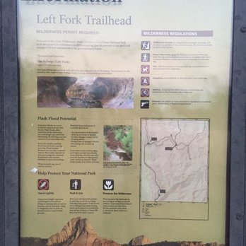
    Left Fork Trailhead

    5.0 (2 reviews)

    Left Fork Trailhead Photos

    Recommended Reviews - Left Fork Trailhead

    Your trust is our priority, so businesses can't pay to alter or remove their reviews. Learn more about reviews.
    Yelp app icon
    Browse more easily on the app
    Review Feed Illustration

    3 months ago

    Helpful 0
    Thanks 0
    Love this 0
    Oh no 0
    Photo of Yu P.
    73
    451
    5010

    9 years ago

    Helpful 0
    Thanks 0
    Love this 0
    Oh no 0

    Verify this business for free

    People searched for Hiking 230 times last month within 15 miles of this business.

    Verify this business

    Zion National Park - Don't feed the squirrels

    Zion National Park

    4.8(1.6k reviews)
    7.8 mi

    After Capitol Reef's stunning colored, sculpted mountains and Bryce Canyon's hoodoo amphitheater,…read moreZion offer s soaring mountains on each side of you, river, and many more non-hiker friendly trails besides the deadly Angel's Landing. It is an exceptionally well designed park with the free town and park shuttle system that centers at the Visitor Center and has many paved trails. - As you drive into Zion, you will go through the Zion-Mt Carmel tunnel - a 1.1 mile pitch black dark tunnel with no lighting, just a few windows of the stunning mountains as you drive through - The park and shuttles are free! Stay in Springdale for the closest location. The Best Western was very nice and Shuttle stop 4 - Favorite easy trails in my order of preference: -- Riverside Walk (2.2 miles, 57 ft elevation change, 1.5 hours) - paved path along the Virgin River in a Canyon -- Pa'rus Trail (1.7 or 3.5 miles, 50 ft elevation change, 1-2 hours) - start at park shuttle stop #3 (Canyon Junction-shuttle only stops going downhill - Not from the Visitor Center) for a 1.7 mile walk on a paved trail near the Human History museum, past the campgrounds and to the visitor center. If you start at the Visitor Center, then you will have to turnaround at Canyon Junction and it is 3.5 miles. - The Grotto Trail (1 miles, 35 ft, 0.5 hour) - dirt trail paralleling the road from Stop 6 (Grotto) to Stop 5 (Zion lodge) - saw and heard a wild turkey. - Weeping Rock Trail (0.4 miles, 98 ft, 0.5 hour) - short but steep paved trail ends at a rock alcove with dripping water - Lower Emerald Pool (2 miles, 150 ft, 1.5 hours) - paved trail to a small pool. It had been dry, so it was underwhelming but if it had rained more, it might have been better. If you are adventurous and like a good view and danger, then try to get a permit to hike Angel's Landing. Someone died the week before we arrived. In the park, there are 9 shuttle stops where you can get off to hike. The following stops have toilets (may be a pit toilet or flush toilet): stop 1 Visitor center - flush, 2 Zion Human History Museum - flush - but you have to walk a bit to get to the museum where the toilet are located outside, 5 Zion Lodge - flush -inside the lodge, 6 Grotto-pit?, 7 Weeping Rock-pit?, 9 Temple of Sinawava - pit.

    Truly breathtaking. No camera could do it justice. The views entering the park alone where a treat,…read morebut the main activity I did was hiking the narrows. I had to sign a waver to get the proper wear for the trek, they offer special water-resistant (not water proof) socks and boots, and a walking stick. Hiking the narrows was very enjoyable, a fun challenge with amazing views of the massive canyon wall on either side of the trail. The current was decently strong, and the rocks in the river where slippery at points, which made the walking stick crucial for balance. The water was waist high at it's deepest point, but it really depends on the weather at the time. Lots of cool rock formations and vegetation around each corner in the narrows. The staff was amazing, bus drivers where great, and the ladies at the visitor center where helpful. Parking was a nightmere though, but it wasn't the fault of the park itself. At the time I went it was packed. Would certainly recommend you visit this place, just make sure you visit when it has been dry for the last few days with no rain in the forecast, which reduces the risk of flash flooding and too strong currents in the narrows. Have fun!

    Photos
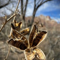
    Zion National Park - Very cool late February & early March dry flowers.

    Very cool late February & early March dry flowers.

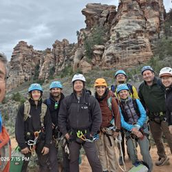
    Zion National Park - Friend met on Kayenta Trail

    Friend met on Kayenta Trail

    Zion National Park - The squirrels here have no fear! The even strike a pose for you! LOL

    See all

    The squirrels here have no fear! The even strike a pose for you! LOL

    The Grotto Trail - Friendly deer was hungry, it looked so skinny.  Poor thing.

    The Grotto Trail

    4.3(4 reviews)
    7.7 mi

    Short, pretty little trail that is almost a guaranteed on your visit if you're doing one of the…read moremain attraction hikes and depending on parking situations. It's only about 1 mile round trip and links you up to either Angel's Landing trail, Emerald Pools trail or the West Rim trail - so I wouldn't call this one an independent hike - you wouldn't be doing this one all on its own. It's more of a place for overflow parking for some of the main hikes with a small trail to get you to those actual trailheads. Bc of the parking issues for Angel's Landing, we had to park at the Grotto trailhead which is how we ended up on this trail. It's mostly flat, very well maintained, has a picnic area and nice restrooms. You get amazing views all along it, especially of Angel's Landing off in the distance! It's a great way to start the Angel's Landing hike tbh. We even saw deer!! And on our way out, some crazy clouds had rolled in and made the rock formations and mountains look so other-worldly and we even got snow as a bonus!! Definitely not disappointed we had to add some extra steps to our Angel's Landing hike! I got some great shots!

    Most people shuttle up and down Zion Canyon, and admittedly that's a great way to see the main…read morecanyon. But there are a few trails that actually parallel the road, and can take you from shuttle stop to shuttle stop. So I say, if you can walk the canyon, why not? That's kind of the point is to be out there, right? The Grotto Trail is a great example. Connecting Shuttle Stop 5 (Zion Lodge) and Shuttle Stop 6 (The Grotto) this is a wonderful way to see a little of the canyon on foot. You can walk it in either direction, so take your pick. It doesn't much matter as elevation gains are minimal, but I like to get off of the shuttle at a farther stop and work my way back. Sometimes in the off season, however, you may be able to find parking at one of the stops and not the other, so if you're headed to the Grotto for a popular hike there, you may have to park at the Lodge and walk up. Perfect! Take this trail. You can also take the Emerald Pools and then Kayenta trails which parallel (sort of) the opposite side of the road, but that's a much longer haul. The Grotto Trail is only a half mile long. This trail isn't exactly quiet or private as it does parallel the road, but they report a surprising amount of wildlife here. I've not seen them when I hiked, but look for deer who are very unamused but mostly indifferent to humans. They are all over the park. I can't say it's my top destination hike when I plan a trip to Zion, but if you can squeeze it in or are forced to walk when Grotto parking is full, you won't be disappointed by a meandering walk along the canyon floor.

    Photos
    The Grotto Trail - Grotto Trail @ stop #6 - 9/10/24

    Grotto Trail @ stop #6 - 9/10/24

    The Grotto Trail - Entrance

    Entrance

    The Grotto Trail - Hello deer friend. :)

    See all

    Hello deer friend. :)

    Watchman Trail

    Watchman Trail

    4.1(27 reviews)
    7.0 mi

    Epic journey for those ready for a moderate hike up the mountain but don't have stomach for…read morebalancing atop the narrow ridge of Angels Landing trail (such as me). The hike is very scenic and the views are amazing from the top! If you are camping, you can see your campsite from atop. This is still a moderately strenuous hike, so be sure your health is ready for some serious steps. The trail consists of both steps, flat paths and ascending paths without steps. There were just a couple spots that narrowed where I felt a little dizzy walking near the edge...yes, I am a chicken when it comes to heights. It didn't bother my wife. Be on the lookout for the beautifully colored aqua blue rocks during your hike! We also enjoyed some flowers that decorated the trail side. This was our favorite of three hikes we made on this day: 1. Watchman Trail 2. Narrows Riverside Walk 3. Lower Emerald Pools NOTE: Don't let your kiddos throw/kick rocks down as the trail zig-zags up the mountain and a rock could hit another hiker below and seriously hurt them.

    I really enjoyed this hike!! It ended up being quite a bit longer than I'd anticipated but I think…read moreit was worth it. It starts near the visitor center but wraps around the canyon face to end with a lovely overlook view of the canyon, with the watchman mountains to your left and the visitor center/springdale straight ahead. It's rockier than I thought it would be here, definitely watch your step. It took me a solid couple hours to do round trip and I'd already done several hikes that day/was tired so bear it in mind! But of all the hikes I did in Zion, this was actually one of my favorites (aside from Angel's landing). Would recommend!

    Photos
    Watchman Trail
    Watchman Trail
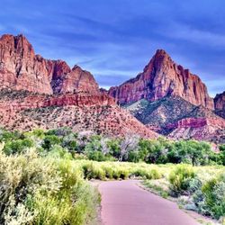
    Watchman Trail - Views from along the trail

    See all

    Views from along the trail

    Many Pools Trail - Stopping for lunch at 6008 feet!

    Many Pools Trail

    4.5(2 reviews)
    7.0 mi

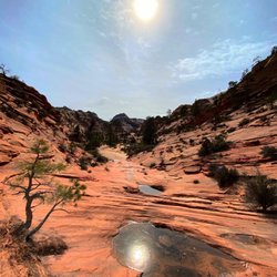
    It was a bit hard to locate the trailhead, but so happy we didn't give up wandering in circles &…read morewere able to run into people who pointed us in the right direction, because it was gorgeous & fun! When parking at the main lot, where GPS "Many Pools Trailhead" will bring you to, stand facing the bathrooms, with the larger river on your right. Then head all the way to the left, down the hill towards the woods. You'll be able to see a small trail in the sand headed down the hill around the left, almost seemingly under the road...that's it! The trail leads through the wooded area, through a tunnel (easy to navigate despite having ample water), and into a clearing where you being to hike up flat rocks, seeing the pools as you ascend to the top. We thought the pools were fascinating, as they had various shapes, depths, and the occasional waterfall. Would say this is a moderate hike, because of the incline, timing is based solely on how long you'd want to wander around each section- we also explored the river section opposite the trail if you go right from the parking lot down to the "beach area"

    This might just be my fave hike that we did during our whole trip to Zion! It's quite an adventure…read more- made me feel like a true explorer!! You'll be walking in dry creek beds and scrambling up dry, smooth waterfalls with chains of little pools (some really deep!) spilling down the mountains- and lots of rock scrambling up the mountains too- very similar to Angels Landing, but without the chains and maybe not quite as steep or dangerous for the most part. You start out going down the steep hill from the parking lot down into the Clear Creek bed and follow that until you get to the cool tunnel that takes you under highway 9. That's when you get into the Pine Creek bed that you'll pretty much follow the whole way. We definitely needed our poles and proper hiking boots. The rocks are smooth, slanted greatly in lots of places, and slick. This trail is definitely NOT for beginners - it's moderate in places and pretty strenuous in others. We made it up over 6000 feet as well! The trail isn't marked at all - very unclear - you'll really be dependent on a trail map - and it's not on the National Parks website or their maps! I think they like to keep it a secret lol. Luckily I had downloaded the trail map on the AllTrails app or we wouldn't never been able to do the whole trail. I highly recommend you do the same - and be sure to do it before you come into the park Bc we had ZERO signal most of the time. It's very much a hidden gem - we didn't see another soul and had the whole hike to ourselves! That being said, I would strongly recommend you don't hike this alone and bring bear spray and take all back country trail safety precautions. Parking is in a small lot not too long after the Mt Carmel tunnel (the big, main tunnel) and it'll be on your right. It has a tiny little building in it with a green roof which is the bathrooms yay!! They were fairly clean and well maintained but hardly had any TP so you may wanna bring some just in case.

    Photos
    Many Pools Trail - Some of the many pools!

    Some of the many pools!

    Many Pools Trail - Mountain Chickadee on the trail!

    Mountain Chickadee on the trail!

    Many Pools Trail - Views of some of the many pools from the trail

    See all

    Views of some of the many pools from the trail

    Left Fork Trailhead - hiking - Updated May 2026
    Loading...
    Loading...
    Loading...