Riverside Walk Photos



You might also consider


More like Riverside Walk
Recommended Reviews - Riverside Walk
Start your review...


Reviews With Photos


This is a very good place for walking around if you are in Springdale Utah. The Riverside Walk is refreshing and easy. Easily accessible by bike or even wheelchair. Nature is beautiful and has many benefits to enjoy. I always recommend walking around in nature and hiking trails. I love this place!
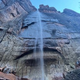

This Riverside Walk hike takes you to the entrance of The Narrows. The Riverside Walk is located at the very last shuttle stop and is the "farthest" into Zion you can go with the shuttle. This hike is super doable and I would definitely classify it as beginner, mostly flat surfaces and well paved. There are some waterfall features along the way and it follows right along the Virgin River, which offers some beautiful sights, but is otherwise a bit monotonous. Unfortunately for us, the Narrows were closed due to flash flood warnings when we went, so I would say don't go out of your way to do this hike unless you're going to be hiking the Narrows once you get here as well! But if you're looking for a very chill hike (2 mile round trip, can be done in less than an hour), this is definitely a good one to do! We did it because we had just finished up a 4 hour Angel's Landing hike and wanted to squeeze in a visit at least to the entrance of the Narrows before we left Zion for the day and did this hike quickly (around 40 minutes) towards the end of the day and caught one of the last shuttles back to the visitor center.


My family and I wanted to come to Zion National Park and avoid some of the more strenuous hikes as we were pretty hiked out. Riverside Walk was the ticket. You take the free shuttle to the last stop at the Temple where you're forced to exit. The walk is all paved but many sections are covered in sand. It's about a two-mile round trip with awesome views like the whole park. There are several stopping places if necessary. Bring water! Near the beginning there's a place to see the water rushing and many families were wading in. Further down the way you'll run into the squirrels. Some are extremely friendly because people have fed them. Don't because you risk a $100 fine. Many are tagged in their ears. At the end of the trail, there's more water to play in. Or you can continue on for one of the more strenuous paths called the Narrows. We didn't have the time to tackle the many hours for that one. Maybe someday. Overall, only my son and I completed the trail. My wife and daughter decided to just wait for us. Still, a good time for all.


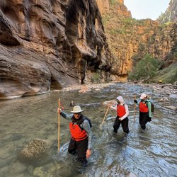
This is an EASY walk with enjoyable views along the Virgin River. It is a paved, mostly flat, and wheel chair accessible journey. Many like to play in the water and then turn around at end of walk to return. If you want to be up close and personal, there are many spots where you can get off the paved path and walk a dirt path right next to the river! LOOK FOR WILDLIFE: We enjoyed seeing a number of deer up close. They didn't seem to be afraid of people. The squirrels were also super friendly and would come right up to you without fear. I suspect people had been feeding them which is prohibited and you can be fined. WATCH HIKERS ENTER WATER FOR NARROWS HIKE: This used to be called the "Gateway to the Narrows" because the end of the river walk is the start of the hike on the "Narrows" which is literally in the river, through the narrow canyon. You can rent water suits and shoes for that hike. The Narrows is a difficult hike in the water and you must be aware of flash flooding as water can get up to head high! SPRING 2022 TOXIC ALGAE BLOOM: Unfortunately during our visit there was a toxic algae bloom in the Virgin River. Signs warned against drinking the water and even warned against touching the algae. Apparently they discovered it when a dog DIED when drinking from the river. We stayed out but many still played in the water and hiked the narrows.


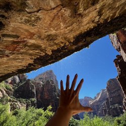
Great little trail to start off our last day in Zion! It's a short, flat, easy 2 mile hike on a paved trail that takes you to the entrance of The Narrows and gives you great views! At the end of this trail you'll find the spot where the tour companies start their hikes into The Narrows. We didn't see any tour groups - but there were individuals and couples dressed in all the waterproof gear and heading in!! The trail meanders alongside the Virgin River through the slot canyon that seems to get more narrow and close in as you go along. There are lots of little areas along the trail that open up and provide access to the riverside, which allows you to get close to the water. You could even get in the water if you want, but they did have warnings during our visit that the river was experiencing a bacterial overgrowth that is harmful. The cliffs rise up on all sides of the trail very dramatically! There's even an area where the cliff face is entirely drenched with water seeping out and makes for some nice dripping waterfalls! We always ran into some very curious ground squirrels begging for food - but it's a $100 fine if you feed them according to warning signs. There's plenty of parking and even some restrooms at the trailhead. This trail is at the very end of Zion Scenic Drive so you can't miss it Bc you can't go any further lol!


If you are planning on hiking the NARROWS, don't do Riverside Walk separately, do it the same time because you have to go through the Riverside Walk in order to get to the Narrows. It's also the last stop #9 so you don't want to go there 2 separate times...utilize the time wisely especially if you have limited time. It's very nice & easy walk (not hike). Hardly any water needed but good to bring a bottle. If you are doing this, I'd say take the time to enjoy the walk AFTER the Narrows because it's very calm and enjoyable after the tiring time at Narrows. You're going to need as much of it for the Narrows. It ends at the beginning of the Narrows with the rocks to the rest of the river. Still very nice pictures all around. Very do-able & great for the whole family. Recommend - 2 birds 1 stone.


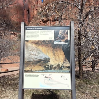
Riverside Walk is an easy and paved trail that leads to the Narrows- once you reach the water, you can turn around if you're not going on into the Virgin River. There are a few steep parts, but this is appropriate for everyone from kids to seniors and is about 1.5 miles. The trail starts at the Temple of Sinawava shuttle stop, where there are bathrooms and water stations. The trail takes you through wooded areas, alongside the water, and briefly to a swamp area. Highlights include the great views of the canyon walls and river, as well as multiple opportunities to see weeping rocks. This trail is a good option if you are near Zion but cannot make an entire day of it. Highly suggest taking the drive-through tunnel route out to see even more of this amazing park.


Riverside Walk is the last shuttle stop at Zion. It is about a 40min ride from the 1st shuttle stop at the Visitor Center. Most people come here to do The Narrows hike. Although it is not as popular and unique as The Narrows, the Riverside Walk is a pretty cool trail as well. It is paved and it goes alongside the river for about a mile. At the end of the trail, you will see lots of people posing for photos and others getting ready to start The Narrows. This trail is kids and family friendly. The scenery is beautiful and peaceful. Fantastic views of rocks, mountains and the Virgin River. Definitely recommend doing this one even if you are not doing The Narrows!


My husband and I enjoyed this walk. It's short and easy. You can walk on the paved sidewalk or on the dirt trail between the river and sidewalk. The dirt trail doesn't quite go through the entire hike, so we went on the dirt trail and on the sidewalk. Next time we will rent the gear and continue across the river to go into the Narrows.


Yup, its a River!! I'm guessing the height of this river depends on what season you visit. I came end of May 2012. Waters were up to your knees, and sometimes thighs at points. You walk the sides, never the middle in case currents are strong. Really fun! It connects to Temple of Sinawava where people are swimming and playing around. Best to rent or bring your own water/hike shoes with neoprene socks. The waters do get cold so keep those toes warm. I didn't actually do this hike. I came from Mystery Canyoneering, repelling off a mini waterfall into the Riverside to walk the Narrow....its beautiful.
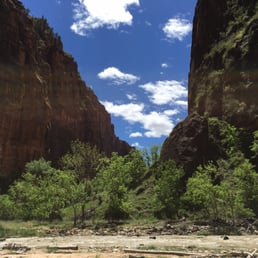

This is a fairly easy, flat, relaxing trail that is approximately 2 miles round trip. It starts at the Temple of Sinawava shuttle stop and takes you along the Virgin River. There are many river access points so you can get closer to the river and explore a bit more. The trail is very family-friendly, and it seemed more crowded than the other hikes in Zion! Nevertheless, it was still very relaxing walking along the river. The end of Riverside Walk is the start of the Narrows hike. The Narrows was closed when I was there, so just check beforehand with the Park if you want to do this hike!
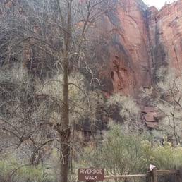

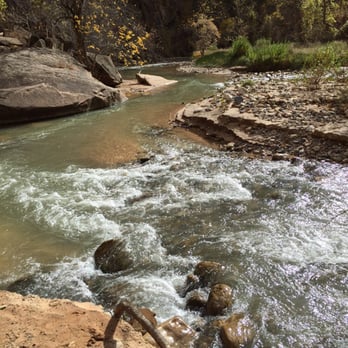
#17/100 For my 600th review, it had to be you- One of the most beautiful walks I have ever experienced and one that i will always remember. It's perfection in the most natural form. And I was very happy to have been here. It was about 32 degrees on a cold November morning with predictions of snow during the day. Well, the sun was shining and the wind was brisk. So we decided to head in to Zion and do the easiest trail. The Riverside Walk. It's one of the shortest hike approximately about a mile long. For Chel, it wasn't about trying to conquer all these different trails. It was really trying to appreciate one of mother nature's gift for us. And it was indeed priceless. The fresh air. The fall colors. The sound of the water streaming along the river. The wind whispering. And snow flurries. Don't miss this amazing place when in Zion. #thankful#for #my #C&H


Located at the Temple of Sinawava, which is shuttle stop #9 when the shuttle is running, this is a nice paved two mile round trip walk alongside the Virgin River. I got to see turkeys and deer though, so don't go rushing through or else you might miss some sweet wildlife viewing. If it has rained recently, there might be puddles or spots of mud. The trail ends at the river where The Narrows begin - aptly named as it's the most narrow part of the gorge. This hike passes through some swampland which is unusual terrain in the desert. It's due to the erosive forces of flash floods. Speaking of which, you shouldn't enter the The Narrows if there's any rain in the weather forecast or any rain in the surrounding areas. It's too risky to be caught in the canyon with any chance of flash floods. The trailhead/parking lot has water, as well as a lot of porta-potties. read more



5 months ago
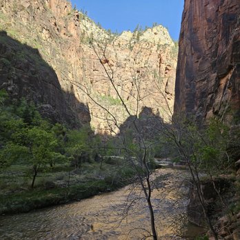
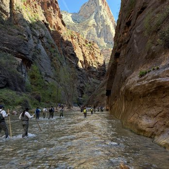
This hike is everything I read about it - chill, easy, paved, and CROWDED. Lots of families with kids and strollers and people just headed to the narrows along this path. I still enjoyed it and had fun going to the beginning of the narrows before turning back (which lots of people do who don't want to get wet). It's not a long walk either, like a mile or so so you can do it fast. It starts at the temple of Sinawava, plenty of signs point the way towards it. Would rec the walk even if you aren't going to do the narrows itself, just for the vibes :) read more

11 months ago

2 years ago
This is a very good place for walking around if you are in Springdale Utah. The Riverside Walk is refreshing and easy. Easily accessible by bike or even wheelchair. Nature is beautiful and has many benefits to enjoy. I always recommend walking around in nature and hiking trails. I love this place! read more


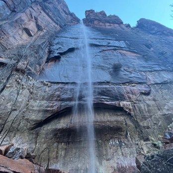
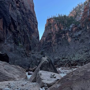
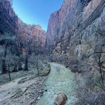
This Riverside Walk hike takes you to the entrance of The Narrows. The Riverside Walk is located at the very last shuttle stop and is the "farthest" into Zion you can go with the shuttle. This hike is super doable and I would definitely classify it as beginner, mostly flat surfaces and well paved. There are some waterfall features along the way and it follows right along the Virgin River, which offers some beautiful sights, but is otherwise a bit monotonous. Unfortunately for us, the Narrows were closed due to flash flood warnings when we went, so I would say don't go out of your way to do this hike unless you're going to be hiking the Narrows once you get here as well! But if you're looking for a very chill hike (2 mile round trip, can be done in less than an hour), this is definitely a good one to do! We did it because we had just finished up a 4 hour Angel's Landing hike and wanted to squeeze in a visit at least to the entrance of the Narrows before we left Zion for the day and did this hike quickly (around 40 minutes) towards the end of the day and caught one of the last shuttles back to the visitor center. read more



4 years ago
My family and I wanted to come to Zion National Park and avoid some of the more strenuous hikes as we were pretty hiked out. Riverside Walk was the ticket. You take the free shuttle to the last stop at the Temple where you're forced to exit. The walk is all paved but many sections are covered in sand. It's about a two-mile round trip with awesome views like the whole park. There are several stopping places if necessary. Bring water! Near the beginning there's a place to see the water rushing and many families were wading in. Further down the way you'll run into the squirrels. Some are extremely friendly because people have fed them. Don't because you risk a $100 fine. Many are tagged in their ears. At the end of the trail, there's more water to play in. Or you can continue on for one of the more strenuous paths called the Narrows. We didn't have the time to tackle the many hours for that one. Maybe someday. Overall, only my son and I completed the trail. My wife and daughter decided to just wait for us. Still, a good time for all. read more


This is an EASY walk with enjoyable views along the Virgin River. It is a paved, mostly flat, and wheel chair accessible journey. Many like to play in the water and then turn around at end of walk to return. If you want to be up close and personal, there are many spots where you can get off the paved path and walk a dirt path right next to the river! LOOK FOR WILDLIFE: We enjoyed seeing a number of deer up close. They didn't seem to be afraid of people. The squirrels were also super friendly and would come right up to you without fear. I suspect people had been feeding them which is prohibited and you can be fined. WATCH HIKERS ENTER WATER FOR NARROWS HIKE: This used to be called the "Gateway to the Narrows" because the end of the river walk is the start of the hike on the "Narrows" which is literally in the river, through the narrow canyon. You can rent water suits and shoes for that hike. The Narrows is a difficult hike in the water and you must be aware of flash flooding as water can get up to head high! SPRING 2022 TOXIC ALGAE BLOOM: Unfortunately during our visit there was a toxic algae bloom in the Virgin River. Signs warned against drinking the water and even warned against touching the algae. Apparently they discovered it when a dog DIED when drinking from the river. We stayed out but many still played in the water and hiked the narrows. read more


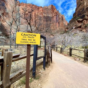
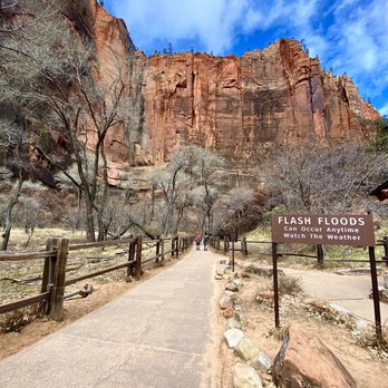
Great little trail to start off our last day in Zion! It's a short, flat, easy 2 mile hike on a paved trail that takes you to the entrance of The Narrows and gives you great views! At the end of this trail you'll find the spot where the tour companies start their hikes into The Narrows. We didn't see any tour groups - but there were individuals and couples dressed in all the waterproof gear and heading in!! The trail meanders alongside the Virgin River through the slot canyon that seems to get more narrow and close in as you go along. There are lots of little areas along the trail that open up and provide access to the riverside, which allows you to get close to the water. You could even get in the water if you want, but they did have warnings during our visit that the river was experiencing a bacterial overgrowth that is harmful. The cliffs rise up on all sides of the trail very dramatically! There's even an area where the cliff face is entirely drenched with water seeping out and makes for some nice dripping waterfalls! We always ran into some very curious ground squirrels begging for food - but it's a $100 fine if you feed them according to warning signs. There's plenty of parking and even some restrooms at the trailhead. This trail is at the very end of Zion Scenic Drive so you can't miss it Bc you can't go any further lol! read more



4 years ago

6 years ago
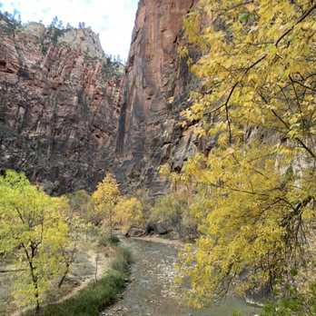
If you are planning on hiking the NARROWS, don't do Riverside Walk separately, do it the same time because you have to go through the Riverside Walk in order to get to the Narrows. It's also the last stop #9 so you don't want to go there 2 separate times...utilize the time wisely especially if you have limited time. It's very nice & easy walk (not hike). Hardly any water needed but good to bring a bottle. If you are doing this, I'd say take the time to enjoy the walk AFTER the Narrows because it's very calm and enjoyable after the tiring time at Narrows. You're going to need as much of it for the Narrows. It ends at the beginning of the Narrows with the rocks to the rest of the river. Still very nice pictures all around. Very do-able & great for the whole family. Recommend - 2 birds 1 stone. read more



2 years ago

2 years ago

10 years ago
Riverside Walk is an easy and paved trail that leads to the Narrows- once you reach the water, you can turn around if you're not going on into the Virgin River. There are a few steep parts, but this is appropriate for everyone from kids to seniors and is about 1.5 miles. The trail starts at the Temple of Sinawava shuttle stop, where there are bathrooms and water stations. The trail takes you through wooded areas, alongside the water, and briefly to a swamp area. Highlights include the great views of the canyon walls and river, as well as multiple opportunities to see weeping rocks. This trail is a good option if you are near Zion but cannot make an entire day of it. Highly suggest taking the drive-through tunnel route out to see even more of this amazing park. read more

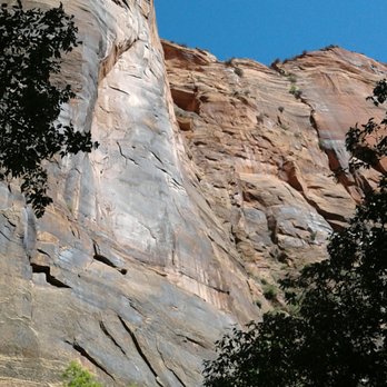
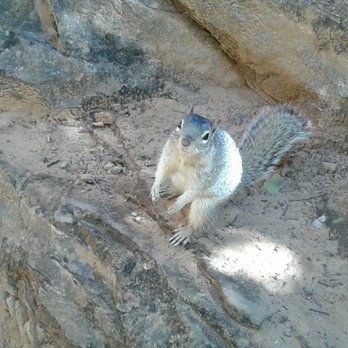


Riverside Walk is the last shuttle stop at Zion. It is about a 40min ride from the 1st shuttle stop at the Visitor Center. Most people come here to do The Narrows hike. Although it is not as popular and unique as The Narrows, the Riverside Walk is a pretty cool trail as well. It is paved and it goes alongside the river for about a mile. At the end of the trail, you will see lots of people posing for photos and others getting ready to start The Narrows. This trail is kids and family friendly. The scenery is beautiful and peaceful. Fantastic views of rocks, mountains and the Virgin River. Definitely recommend doing this one even if you are not doing The Narrows! read more



14 years ago

6 years ago
My husband and I enjoyed this walk. It's short and easy. You can walk on the paved sidewalk or on the dirt trail between the river and sidewalk. The dirt trail doesn't quite go through the entire hike, so we went on the dirt trail and on the sidewalk. Next time we will rent the gear and continue across the river to go into the Narrows. read more

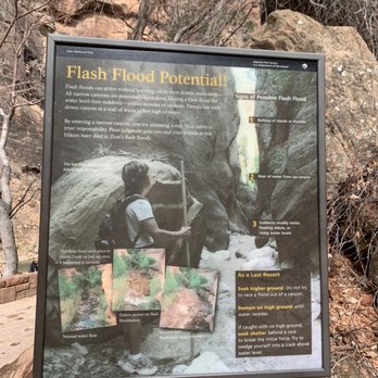




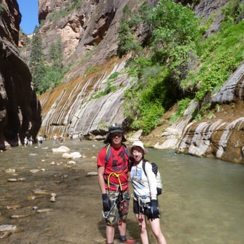
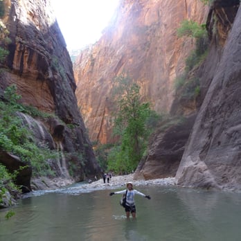
Yup, its a River!! I'm guessing the height of this river depends on what season you visit. I came end of May 2012. Waters were up to your knees, and sometimes thighs at points. You walk the sides, never the middle in case currents are strong. Really fun! It connects to Temple of Sinawava where people are swimming and playing around. Best to rent or bring your own water/hike shoes with neoprene socks. The waters do get cold so keep those toes warm. I didn't actually do this hike. I came from Mystery Canyoneering, repelling off a mini waterfall into the Riverside to walk the Narrow....its beautiful. read more




10 years ago
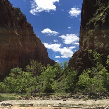
This is a fairly easy, flat, relaxing trail that is approximately 2 miles round trip. It starts at the Temple of Sinawava shuttle stop and takes you along the Virgin River. There are many river access points so you can get closer to the river and explore a bit more. The trail is very family-friendly, and it seemed more crowded than the other hikes in Zion! Nevertheless, it was still very relaxing walking along the river. The end of Riverside Walk is the start of the Narrows hike. The Narrows was closed when I was there, so just check beforehand with the Park if you want to do this hike! read more


6 years ago


#17/100 For my 600th review, it had to be you- One of the most beautiful walks I have ever experienced and one that i will always remember. It's perfection in the most natural form. And I was very happy to have been here. It was about 32 degrees on a cold November morning with predictions of snow during the day. Well, the sun was shining and the wind was brisk. So we decided to head in to Zion and do the easiest trail. The Riverside Walk. It's one of the shortest hike approximately about a mile long. For Chel, it wasn't about trying to conquer all these different trails. It was really trying to appreciate one of mother nature's gift for us. And it was indeed priceless. The fresh air. The fall colors. The sound of the water streaming along the river. The wind whispering. And snow flurries. Don't miss this amazing place when in Zion. #thankful#for #my #C&H read more
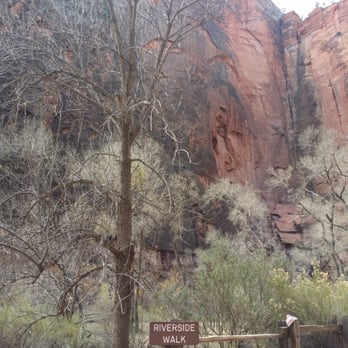


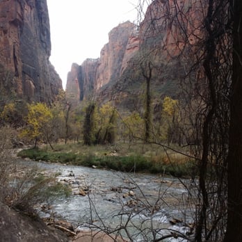
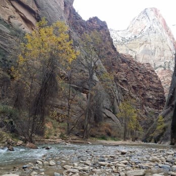

Tranquil and beautiful... Here we go again with another Zion moment but I can't help myself & after every trip I fall even harder for this place. This is the last shuttle stop & they have saved the best for last. It's a very easy hike that lasts about 45 mins before you reach the narrows where the real adventure begins. If you're anything like me it'll take you much longer because I stopped to take pics every few mins :) It's really challenging not to because the scenery is changing constantly and once again there's beauty everywhere you look. The sound of the river alone is worth stopping for, finding a rock to sit on and closing your eyes for a few mins. I haven't had a chance to attempt the narrows yet because it's too cold now but I have something to look forward to in the summer. This easy hike is still worth doing even if you won't be doing the narrows because it's so beautiful and once you reach the entrance to the narrows there are even more picture opportunities that keep getting better & better. See you soon Zion. read more


9 years ago
Great for families w small children, strollers, or the elderly! This is our first visit to Zion and we have 2 kids, ages 3 and 6. Our three year old is still a little grumpy guy, so we needed something easy and fun to do with him. A couple tips that we didn't know: Park opens at 9am. You pay $30 to get into the park, then go to Visitor Center for parking. For most trails, you park at the Zion Visitor Center and take the shuttle bus (free) to one of the 9 stops. Riverside Walk is stop number 9, the last one. (Stop is called "Temple of Sinawava") It was a 35+ minute ride to get to our stop. Hike is easy but regardless of the weather forecast, it's COLD if you go first thing in the morning. We only brought light sweatshirts bc the weather is supposed to get into the 80's today, but this trail is cool, breezy, and shaded so the kids were pretty cold for the first half of our hike. Trail is easy and wide. Mostly paved. Strollers and wheelchairs (w assistance on hills) would do fine. Where the trail dead ends is where the "narrows" starts. We took our time on the trail, so what would have been an hour hike roundtrip took a total of 3 hours because of the shuttle ride to and from, potty breaks, etc. Have fun! read more


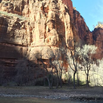
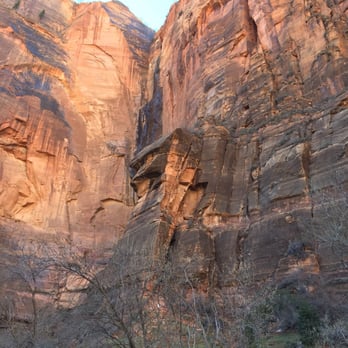
Deep in the heart of Zion canyon... We drove here to the last scenic point of our Zion map (point #9) and is also the final shuttle stop at the Temple of Sinawava. We hiked the Riverside Walk (formerly known as "Gateway to the Narrows") which is a nice paved trail. All around us, as we followed the leveled trail (elevation was mostly flat), were beautiful scenic views of the canyon walls, the vegetation, trees, moss, ferns, and the river. Hubby and I took our time on a leisurely stroll, soaking in the beauty of the canyon views and we also veered off the trail to get closer to the Virgin River. There were plenty of easy access trails to the river. We did not wet our feet during our visit (almost end of winter) as the water was cold and frigid at the time. Must feel great during the summer, though. We did not go as far as The Narrows, however. The whole hiking experience is about 2 miles (1-2 hours). The pavement is suitable for strollers and wheelchairs. In this hike I've seen families with small children as well as elderly folks. In other words, great family-friendly hike. There is no formal destination and you return the same way you came. The trail is so peaceful and beautiful. Enjoy the hike! Review #0463 read more






13 years ago

10 years ago
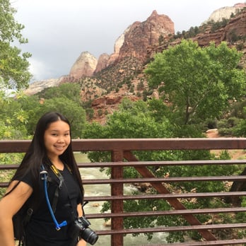
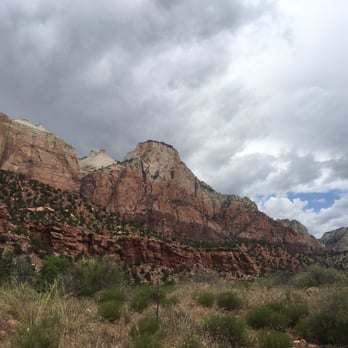
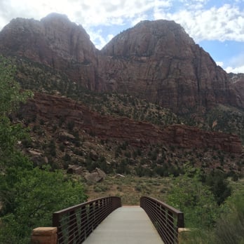
Nice little walking/biking path along the Virgin River... Well maintained and paved trail with cool bridges to cross as you make your way and wind along the river from side to side. Great for kids and older people! read more







7 years ago

11 years ago
This is the easiest hike in the Zion park. It is about a mile down heading to The Narrows. It's when you are at the narrow trail where the fun begins. Make sure to bring underwater type shoes. River can be a lil rocky here n there but overall. Strolling down the river for miles in between sandstone walls is an experience. Water was a little cold but tolerable. You have to park at the visiting center and take the shuttle to the river walk stop... Bring extra clothes, towels and enjoy the walk. read more


8 years ago
This train is beautiful! It leads up to the narrow! Along this trail you'll see a lot of wildlife. The wildlife walks up to people almost as though they do not fear people. The trail isn't long and is wheelchair accessible for the most part. Today Zion had a heavy rain fall so this trail was ideal! read more


6 years ago

This hike is very accessible! Saw kids as well as people powering through on their wheelchairs! It's mostly paved and flat trail. Easy to explore the area and enjoy the red mountains and cliffs. There's benches along the way in this trail and an incredible amount of good picture spots. Lots of squirrels so don't feed them! They will rummage through your pack if you leave it unattended. This trail at the end leads to Angels Landing. You'll see a lot of people walking this trail with their water shoes and hiking poles in tow. Don't let that intimidate you because you need neither of those things on this trail. I highly recommend bringing a lunch and picnic somewhere on the trail!! read more


13 years ago


6 years ago

15 years ago
Page 1 of 2
More info about Riverside Walk
Riverside Walk Reviews in Other Languages
Ask the Community - Riverside Walk
Review Highlights - Riverside Walk














Why does Yelp recommend reviews?
1 review that is not currently recommended
The reviews below are not factored into the business's overall star rating.

3 months ago
Riverside Walk - hiking - Updated October 2026
Best of Zion National Park
People found Riverside Walk by searching for…
Things to Do in Zion National Park, UT
Hiking Trails With Waterfalls in Zion National Park, UT
Scenic Drive in Zion National Park, UT
Parks in Zion National Park, UT
Tours in Zion National Park, UT
Photo Spots in Zion National Park, UT
Sunset View in Zion National Park, UT
River Swimming in Zion National Park, UT
Picnic Areas in Zion National Park, UT
Canyoneering in Zion National Park, UT
Dog Friendly Hiking Trails in Zion National Park, UT
Natural Hot Springs in Zion National Park, UT
Scenic View in Zion National Park, UT
Visitor Centers in Zion National Park, UT
Beaches in Zion National Park, UT
Off Road Trails in Zion National Park, UT
Scenic Overlook in Zion National Park, UT
Hiking With Kids in Zion National Park, UT
Hikes With Dogs in Zion National Park, UT
Waterfalls in Zion National Park, UT
Splash Pad in Zion National Park, UT
River Walk in Zion National Park, UT
Browse Nearby
BEST of Zion National Park, Utah Coffee near Riverside Walk
BEST of Zion National Park, Utah Parks near Riverside Walk
BEST of Zion National Park, Utah Restaurants near Riverside Walk
BEST of Zion National Park, Utah Things to Do near Riverside Walk
BEST of Zion National Park, Utah Breakfast near Riverside Walk
BEST of Zion National Park, Utah Scenic View near Riverside Walk
BEST of Zion National Park, Utah Campgrounds near Riverside Walk
BEST of Zion National Park, Utah Visitor Centers near Riverside Walk
BEST of Zion National Park, Utah Sledding near Riverside Walk


