Cancel

    Open app

    Search

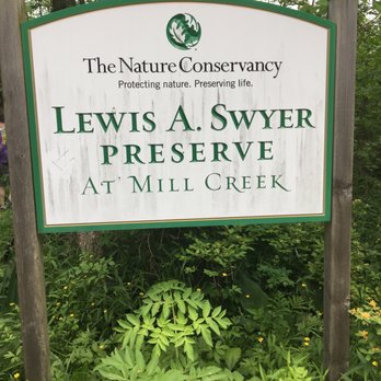
    Lewis A. Swyer Preserve

    3.5 (2 reviews)

    Lewis A. Swyer Preserve Photos

    Recommended Reviews - Lewis A. Swyer Preserve
    Your trust is our priority, so businesses can't pay to alter or remove their reviews. Learn more about reviews.
    Yelp app icon
    Browse more easily on the app
    Review Feed Illustration

    6 years ago

    Helpful 3
    Thanks 0
    Love this 1
    Oh no 1

    5 years ago

    Helpful 2
    Thanks 0
    Love this 2
    Oh no 0

    Verify this business for free

    People searched for Hiking 697 times last month within 15 miles of this business.

    Verify this business

    Kaaterskill Falls - March 2026

    Kaaterskill Falls

    4.6(167 reviews)
    21.2 mi

    The falls are truly incredible…read more The trail down to the bottom of the falls, is a bit tricky. But so incredibly worth it. I would suggest not to believe the sign saying 189 steps.... it is definitely more! Take drinking water because you'll need that for sure. We went back in August and the heat was definitely there. The parking lot was pretty packed but throughout the trails people were pretty evenly spaced out. Not so much at the base of the falls themselves but there was still plenty of room to move around freely.

    One of the tallest waterfall in NY, similar height to Taughannock Falls. Physical requirement is…read moredifferent tho, Kaaterskill Falls has about 500foot of elevation change and a lot of slippery stone steps at the end, if you come here when the weather is still cold. Parking: most people park at the Laurel-House Road parking area, because it is the closest. Or you can park at Mountain Top Historical Society, the old train station, which an extra mile. Starting from the old railroad station is nice, you can still see some old tracks on the ground. Walk to the overlook is fairly easy, once you get to the start point of Lower falls junction, it is where you need to be prepared. I recommend hiking shoe, especially in colder months where the ground is wet and iced. When you reach to the stone steps, they can get slippery. I am surprised no one fell in late March. Half of the steps were cover in ice and people were wearing regular sneakers. Once you reach the base of the two tier falls, the view is tremendous. If water levels are high, you can feel the energy of the water. There is a lot of spray from the falls when you get close. There is short trail to the middle tier pool. It was iced up during winter, spikes will definitely be useful. The end was amazing too. So close to the lead of the waterfall. You can keep going and follow Escarpment trail and follow the edge of the valley. There is monument for fireman Frank Layman who died during firefighting in 1900, at his monument, you can see route 23A bend around mountain. And if you keep going, there are a couple viewpoint to overlook the valley. Nice break points to enjoy the view and rest your legs.

    Photos
    Kaaterskill Falls - View Of Stream

    View Of Stream

    Kaaterskill Falls
    Kaaterskill Falls

    See all

    Devils Path

    Devils Path

    5.0(6 reviews)
    25.9 mi

    If you want to know the truth, the whole thing depressed the hell out of me right from the start…read more People talk about the Devil's Path up in the Catskills like it's some kind of grand, soul-searching experience, but mostly it's just thousands of feet of jagged rock sitting there waiting to break your ankle while some guy in brand-new high-tech hiking boots tells you how "restorative" the fresh air is. It's phony as hell. ​The trail isn't even really a path, it's just a continuous, miserable scramble over gigantic stone slabs, wet roots, and sheer drop-offs. You go straight up a mountain like Indian Head or Twin, huffing and puffing until you feel like dying, and then the trail just dumps you right back down into a ditch, forcing you to turn around and do it all over again on the next peak. You're grabbing onto tree roots and in the late fall,your sliding down slick, icy rock chimneys, trying not to pitch off the side of a cliff, while wet pine needles drop into your collar. ​Every time you finally drag yourself up to a ledge where the view is supposed to be "life-changing," you end up sitting on a damp stone next to three guys discussing their GPS watches and showing off their expensive trekking poles. It kills me, it really does. The forest itself is nice enough if everybody would just shut up for five minutes. Plus it smells like balsam fir and ancient damp earth, and when the fog rolls in through the hemlocks, it finally feels right to me because its dead quiet and honest. But then i ran into a troop of weekend warriors yelling across the ridge about their lap times. ​If you're crazy enough to tackle all twenty three miles of it which i certaindid not, you'll end up exhausted, soaked in sweat, and covered in mud, wondering why you didn't just stay in the city and get a sandwich and a beer. It'll test if you're tough enough, surelyim not anymore, it just makes me want to go lie down in a warm room by a fireplace with a little glass of brandy where nobody is talking about elevation gain.

    Wow, talk about a beautiful drive to get here! Completely isolated with the surrounding town…read morebringing you to the past. The narrow zig-zag roads getting here from the east are a blast to drive on. Taking the devil's path is no joke if you're doing the whole trail. Highly suggest packing light for the hike. Totally regretted my 35lb backpack setup. The elevation spikes and drops will put your knees and ankles to the test. The look out points are gorgeous. Each one deserves to be taken in during a break. The biodiversity is incredible here. You'll notice the nature changes at different points of the hike. Including the areas casted in darkness from the dense trees. The next drinkable source of water from the beginning is a far distance so make sure you pack accordingly. The devils tombstone is the halfway point which is where most people set up camp. Cant harp enough... snacks, snacks, snacks. Stay safe if you choose to part take on this hike! One of the best hikes I've been on.

    Photos
    Devils Path
    Devils Path
    Devils Path

    See all

    Christman Sanctuary

    Christman Sanctuary

    4.9(8 reviews)
    28.7 mi

    The topography of this place is undulating but not too challenging, even for someone like me, a…read morecouch potato. A river runs through it. Along the way, there are some waterfalls of differing levels. Obviously, the volume of water is dependent on recent precipitation. The "mood" of the place depends of that flow. On most occasions, I could hear the rush of water before actually seeing it. It's an added bonus to this place, changing on a daily basis. Like a lot of things upstate, you've got to be informed about a place before you know it exists. If a co-worker hadn't told me about this sanctuary, I doubt I would have found it on my own. There is no fee but the parking lot is small; there's space for about eight vehicles. Check it out. It's a neat place. It'll do some good to get some fresh air.

    Note to self: September may not be the absolute best time to come here because of the very low…read moreflow. Still, there are plenty of things to like about this...once you find it. The falls seem to be commonly known as Bozenkill Falls but the road sign (pictured) says Christman Sanctuary, and the gravel parking lot isn't massive so it may be easy to miss. The first 100+ metres is mostly boardwalks so it's easy enough to navigate. Then comes rocky, uphill trail, but at least markers are readily visible and aplenty. On our first visit I feel like we barely scratched the surface, so will look forward to another visit. Thank you whoever you are, for helping to preserve and maintain this sanctuary!

    Photos
    Christman Sanctuary
    Christman Sanctuary - After a rainfall.

    After a rainfall.

    Christman Sanctuary - Lower falls - Christman Sanctuary

    See all

    Lower falls - Christman Sanctuary

    Lewis A. Swyer Preserve - hiking - Updated August 2026

    Loading...
    Loading...
    Loading...