Cancel

Open app

Search

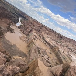
Little Colorado Scenic Overlook

4.0 (5 reviews)

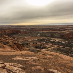
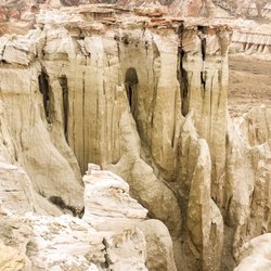
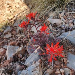
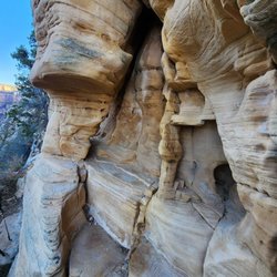
Little Colorado Scenic Overlook Photos

More like Little Colorado Scenic Overlook

Recommended Reviews - Little Colorado Scenic Overlook

Your trust is our priority, so businesses can't pay to alter or remove their reviews. Learn more about reviews.
Yelp app icon
Browse more easily on the app
Review Feed Illustration

11 months ago

Helpful 1
Thanks 0
Love this 1
Oh no 0

3 years ago

Helpful 0
Thanks 0
Love this 0
Oh no 0

9 years ago

Helpful 1
Thanks 0
Love this 2
Oh no 0

9 years ago

Helpful 1
Thanks 0
Love this 1
Oh no 0

Little Colorado Scenic Overlook Reviews in Other Languages

Verify this business for free

Get access to customer & competitor insights.

Verify this business

Dinosaur Tracks - Filing a police report about assault incident.

Dinosaur Tracks

4.2(97 reviews)
30.2 km

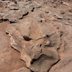
This is a quick and quirky roadside stop where there are real dinosaur tracks! We looked it up!…read moreIt's pretty amazing and there are Navajo men and women willing to walk you around to see specific fossils and tracks for donation/tip. We enjoyed the conversation and were happy to tip 20$ which felt fair--worth the stop

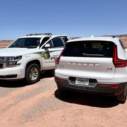
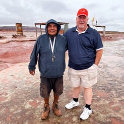
DANGER! WARNING! DO NOT GO HERE! If you do not pay for a tour (which is not mandatory), you may be…read moreassaulted. We stopped here & politely turned down the optional "tour" that we were immediately pressured to take (since we just wanted to just walk around on our own). I told them we were simply going to spend a few minutes there. After about 15 minutes, as we were leaving, we were suddenly, from out of nowhere, verbally assaulted when one man began pounding on our car window and screaming at us. Then, two other Navajo guides (see photo 1)--a man and woman--began yelling at us & threatening us, telling us to "Get the F---- out of here" and "You're not welcome!" THEN IT GOT VIOLENT when one large man (see photo 2) said "You better get the F--- out of here RIGHT NOW," picked up a large rock, and actually threw it at our windshield. It cracked (see photo 3). If it had shattered, my wife would've been covered with glass. We were in shock! It had escalated from nothing at all happening to extreme violence and us being in danger in literally seconds! He then began to walk toward the car and I realized both my wife and I were in serious danger. The guy was like 6'4, 240-275 lbs and in his twenties. I am 65 years old!!! These people are not just pushy, they are extremely violent. We immediately called the police when a safe distance down the road (see photo 4) and are pressing charges. We absolutely in danger. These people practically force you to pay up (when there is no fee, supposedly)--and if you don't pay, then you will be threatened (see other 1-star reviews on YELP detailing violence & aggression & assault) and, as in our case, actually attacked -- they are very violent.

Photos
Dinosaur Tracks
Dinosaur Tracks
Dinosaur Tracks

See all

Wupatki National Monument - Visitor center

Wupatki National Monument

4.7(118 reviews)
42.8 km

Worth every single hike For sure not crowded at all…read more For sure a hidden gem! We did all the ruins we could find and lived them all. Started from Sunset crater side and worked our way around. we had a family of 3 with a 16 yr old who loved it as well. For sure bring water and sun tan lotion!!

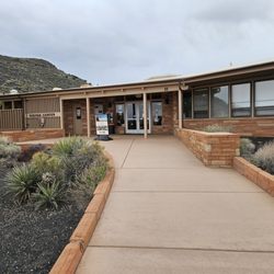
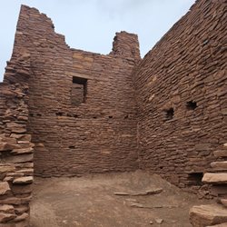
The main attraction here is the Wukoki Pueblo which is right behind the visitor center, and also a…read moregeological blowhole, from which wind escapes or gets sucked in from a cave system depending on the weather conditions. The day I visited, it was blowing pretty hard, enough to blow away a light jacket. There are also structures located here which are accessible from the road. You can walk right up to them, but be sure to avoid leaning on the wall or picking up artifacts. There were volunteers shoring up Wukoki Pueblo as erosion damages it and they want to preserve it for years to come. It was cool to see them work. The visitor center has a lot of information about the people who lived here, as well as the vibrant trading culture. For example, there were macaws brought here from Central America! There were no horses back then, so all goods were transported by foot. Very impressive. I bought the brochure/travel guide about the park from here as I found that they enriched the visit beyond the informational signs displayed. This is a neat monument that showcases the history of the area.

Photos
Wupatki National Monument - Wupatki national Monument visitor center

Wupatki national Monument visitor center

Wupatki National Monument - Lomaki/box canyon

Lomaki/box canyon

Wupatki National Monument - Citadel pueblo

See all

Citadel pueblo

Coal Mine Canyon

Coal Mine Canyon

4.7(3 reviews)
38.3 km

Beautiful view of Coal Mine Canyon. Located about 15 miles southeast of Tuba City. If you go please…read morebe respectful of the property and livestock. Place has a great history and folklore. You can see the coal seam in the rock. There are a few picnic tables and cooking grills. No signs and few people. The person who maintains the area lives nearby. There is no fee but donations are always appreciated. You may even be lucky enough to hear a story about living near this natural scenic wonder.

Are you tired of being surrounded by many tourists in Grand Canyon, Monument Valley and Antelope…read moreCanyon? If you are in that area, I highly recommend that you take a short side trip to "Coal Mine Canyon" in Tuba City. Coal Mine Canyon is not in most of guidebooks so you can enjoy the colorful canyon and the solitude. It is in the Navajo land and it is close to the eastern edge of Painted Desert. There is absolutely no sign to tell you where the canyon is so here is how to get there. 1. Drive to Tuba City on Route 160 2. There is only one major intersection in the city and from there, take Route 264 "South" 3. Drive about 15 miles or if you don't want to count the miles, drive your car at 60 mph for about 15 minutes. 4. You will see one new house and one windmill on your left. (Don't worry! These are the only structures around this area) 5. Turn left to the gravel road to go to the side of the house. 6. Park your car near the ruin of the old house after passing by the new house and walk to the rim of the canyon. When I got there with two other friends around 11:00 am, there was no other tourist. We enjoyed the canyon by walking around the rim for about an hour as if we had owned it. It was so quite and relaxing, just the sound of wind and the sound of a friend of mine urinating. If you have a chance to visit northern Arizona, I highly recommend you visit this hidden place!

Photos
Coal Mine Canyon
Coal Mine Canyon
Coal Mine Canyon

See all

Lava River Cave - Fork in the cave

Lava River Cave

4.6(102 reviews)
68.7 km

I was taken along on this trek last minute, thinking it would be a simple hike down to just chill…read moreinside the cave. I was wearing jeans and regular street sneakers. I also had no flashlight or headlamp of my own - I was reliant on two friends with flashlights. I totally acknowledge that I was completely unprepared, so take this review with a grain of salt and use your own judgment. HAVING SAID THAT...even if I knew what I was getting myself into, I still would have hated it and probably never gone. I am a "dirt trail with pretty views" kind of person so this was a nightmare for me. We climbed down the rocky cave entrance for about 5-10 minutes before fully leaving the light. I had to constantly watch where I was stepping so as to not step on a loose rock, fall and break my ankle. And it's really fun trying to "watch where you step" IN THE DARK. At the point where the decline ends and the entrance light is fully gone, I could have stopped, enjoyed the novelty of being in darkness and 50 degree moist air, and headed back. My friends convinced me that it "gets flat" soon...it does not get flat. I eventually had to head back because I was starting to panic. Later, I realized we didn't even make it a quarter of the way so I'm really glad I went back. This is NOT a beginner excursion. I was shocked to see children and elderly people coming down the cave entrance as I was leaving. I would NOT recommend this unless you are physically fit, healthy, and brave.

This cave is located in Newberry National Volcanic Monument. Since it is super popular, you have to…read moremake reservations on their website so that it's not overcrowded and to limit the disturbances to the cave. It gets pretty busy so make sure to set an alarm when the tickets get released. It's a 2.2 mile out and back cave, although if you're too tired or scared you can always turn around and head back. The deeper in the cave I went, the fewer the visitors. The process is pretty straight forward. Once you get checked in at the parking lot entrance, park and walk to the orientation tent where they ask if any of the clothing you are currently wearing has been to another cave (to avoid the spread of white nose syndrome in bats) and also some basic orienteering. They also have flashlights for rental if you forgot. These are really powerful flashlights so I highly recommend it since your cellphone light isn't going to cut it. It gets pretty chilly in there so bring jackets even if it's hot on the surface. The cave flooring is pretty even although there are some dips you might trip on if you're not prepared. No scrambling or anything strenuous. Very fun!

Photos
Lava River Cave - Entrance to the cave

Entrance to the cave

Lava River Cave - Inside the cave

Inside the cave

Lava River Cave

See all

Grandview Point - Still patches of snow early April

Grandview Point

4.6(14 reviews)
39.1 km

Increíble lugar! Tal cual lo esperaba muy limpio y bien cuidado! Espectacularrrrr! Únicamente hice…read moremiradores pero he visto otra gente que hizo helicóptero y una excursión en el agua. Será mi próximo viaje! También vimos que hay buses que llegan hasta ahí

Grandview Point is the start of the Grandview Trial to Horseshoe Mesa campground or further onto…read moreCottonwood Creek backcountry campground at the base of the Grand Canyon. At the overlook, there is plenty of parking and a separate lot for overnight campers. The lot will take you steps away from the overlook. Although breathtaking views, this side has no Colorado River. It's a dry scenic view (we went first week of April). The area is well maintained with bathrooms and water station at the top, but the Grandview Trail itself is not. Read up and prepare if you're planning to hike this trail; it was one of the most difficult and scary-sketchy hikes in my life so far. We hiked all the way down to the base where Cottonwood campground is. The initial trail was sketchy as it is. Going down from the overlook, some parts of the trail were barely a foot wide, and there was an area of crumbly red clay-type dirt that was sloped over a cliff that gave me the sweats and some anxiety when crossing. Once you get past the beginning sketchiness, it's not so bad, but there were various areas of rockslide to keep you on your toes to find the trail again. Keep in mind you're going into the canyon, so the entire way is clamoring down loose rocks. Keep those laces tight! Let's avoid another toenail-less summer! A good part of the switchbacks were paved with stone steps that reminded me of the Yellow Brick Road. I loved them; easy to walk on and less slippage going both down or back up. We started late and out of the we total trek, 4 miles we did in the dark with headlamps and sticks, so it is totally doable! Cottonwood's creek was but a tiny trickle when we got there. The seclusion is well worth the trek though. You do need to get a backcountry permit to camp here and there are no reserved numbers for the sites. It's first come first serve. I was told the entire way from viewpoint to Cottonwood was 5.6 miles one way, but honestly, it felt like 7 miles. Going back up was killer! Incline the entire way, but I promise you'll come out of there with some amazing glutes and calves. Would I do it again? Maybe need a break in between to forget about all the pain and suffering, while I look at all the amazing photos I got along the way. Then yes!

Photos
Grandview Point
Grandview Point - Looks like a miniature version of the Slot Canyons

Looks like a miniature version of the Slot Canyons

Grandview Point - Bones along the trail

See all

Bones along the trail

Grand Falls - Edge of a muddy cliff

Grand Falls

4.6(24 reviews)
63.8 km

This place has been on my bucket list and I was just waiting for the perfect chance where the water…read morewas flowing and I had a day off to make the drive. Well that occurred the other day for me and it did not disappoint! The drive out there is beautiful. The falls are amazing and I love that you can hike down to the bottom. It is a short hike down, but you will get very very muddy! Make sure to check the water flow on the website before planning to make the trek. It is absolutely worth it!

Grand falls is a fairly unique to Arizona attraction. The water over Grand Falls flows only with…read morethe weather, the water is fed by snow melt in the spring and monsoon rains in the summer. Visit in mid March / April to see it run from snow melt or during July / August and try to see it after a monsoon storm rolled through within the past couple of days. What makes this unique is the muddy or "chocolate" color of the water. Colloquially, Grand Falls is also known as Chocolate Falls, this is because of the chocolate color when the water is flowing. As the dry river that feeds this collects dirt, mud and debris most of the year, when the water is running the dirt from the normally dry riverbed and surrounding desert gives the unique color of mud or chocolate. The sheer force of nature here gives you some perspective on fragility of life. The sound of rushing water, the mist of water and dirt cakes everything within 100+ yards, the visual effects of falling water and multiple levels within the falls. The adventurer in me wanted to find my way down, climb my way up, go back behind the falls, and declare myself "champion of the waterfall", but the safety focussed parental side of my brain screamed, be careful, don't slip, don't hurt yourself, three points of contact when youre climbing around, test your footing before you put all your weight there. It's always a tough battle between that devil and angel when they get going. Today we compromised and I only climbed halfway down. There are a couple spots you can climb down a few feet and really get away from the crowd to take in the spectacular view of this beast. Use extreme caution though. During time of monsoon, the visitors areas are overrun with mud, your shoes will be covered and it is best if you have something you're willing to get covered in mud. What I'm trying to say is don't wear those nice loafers or driving shoes that you'd be sad to see stained, dirtied and or thrown away. During dry times or when visiting after a snowmelt, the *dry ground can be misleading. That clump of solid earth, might just be a dried up clump of mud that gives way with a few pounds of force. Be sure to test your footing with every step as you're climbing around here. The drive in, let's just say that I felt like a god passing all those people driving their Honda civics down this washboard, dirt road for 10 miles. This is what my off-road vehicle's suspension was built for. You certainly CAN take ANY vehicle to get here. There is nothing on the road driving to the falls that will be too challenging for a low clearance vehicle, but with that said, if you have the facilities to put air back in your tires, you will want to take air out of your tires when you get to the dirt road to make this drive much more pleasant, but doing so would require you to keep an air compressor in your vehicle. If you do have a compressor, take your tire's PSI down to about 20. Taking air out will give you a wider footprint which means more traction and it will also allow for more absorption of vibrations and significantly lower the awful sound of driving over washboard roads. When you're done and find the paved road again, put air back in to the level of factory specs, which can be found on the driver's door usually or the tires themselves will have a recommended PSI. If you don't have a compressor, take the road as fast or slow as you are comfortable, but man this was fun to drive at 40+ mph, passing everyone and splashing my way through every mud puddle I came across. I feel like I've accomplished one more thing on the AZ bucket list with this trip. I most certainly will add this one to my places to go when I've got adventurous family or friends in town. It truly was a fun day with spectacular views and inspiring sights of the power of nature.
Photos
Grand Falls
Grand Falls - Instagram: @telephonesmoothie

Instagram: @telephonesmoothie

Grand Falls - Instagram: @telephonesmoothie

See all

Instagram: @telephonesmoothie

Walnut Canyon National Monument - Gift shop

Walnut Canyon National Monument

4.7(197 reviews)
79.2 km

This was completely mind blowing We were a family of three…read moreand we completed it with no issues going to the island trail. To see the canyon on both sides, the sunny side and the shaded side was a big difference. I do recommend taking your time going up the stairs because you will be out of breath. But it is completely worth it for the views The staff was absolutely wonderful. They even have people walking down the trails. Would totally recommend

This is a cool place where you can see structures left by Native people (prehistoric culture…read moreSinagua) although there are also artifacts from the Archaic peoples before them who did not reside permanently in the canyon. There is a visitor center and two trails here. The Rim trail at a pretty even 0.75 miles is great for people who want a stroll that follows the canyon rim (out and back trail). You can see the structures from the rim, but it's even better with binoculars. The Island trail is slightly longer at 1 mi, but a steeper 185 vertical feet into the canyon with a whole bunch of stairs at the beginning, and returns the same way. I guess people get too tired to climb back up since there are numerous signs warning of the steep climb back. The trail begins at the back door exit of the visitor center, which they close at 4 pm (the entire monument closes at 5 pm, so they don't want anyone to start the trail and get locked in). Both trails were great and they had informational signs along the way. I really liked the Island trail since you get up close and personal with the structures. The visitor center was standard - offering a gift shop, bathrooms outside, and information about the history and significance of the area. The ranger staffing the information desk was pretty patient with the group of tourists and determining if they were fit to do the Island trail. It's a totally different vibe from the Grand Canyon, so don't expect huge views.

Photos
Walnut Canyon National Monument - The canyon

The canyon

Walnut Canyon National Monument - Women's restroom at the Visitor's Center

Women's restroom at the Visitor's Center

Walnut Canyon National Monument - Ancient Sinagua Cliff Dwellings near Flagstaff Arizona | Rees's Roots

See all

Ancient Sinagua Cliff Dwellings near Flagstaff Arizona | Rees's Roots

Little Colorado Scenic Overlook - landmarks - Updated July 2026

Loading...
Loading...
Loading...