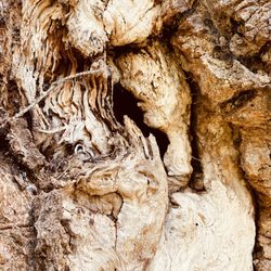
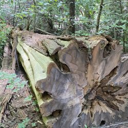
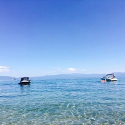
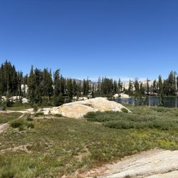
Main Tuolumne Ditch Trail Photos


You might also consider
More like Main Tuolumne Ditch Trail
Recommended Reviews - Main Tuolumne Ditch Trail
Start your review...

1 year ago
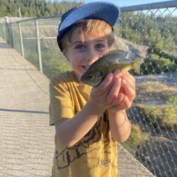
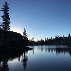
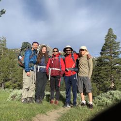
Everything about this walk, hike, views, sounds, was worth every moment of the visit. We had recent viewed this from someone else's Facebook post and decided it was part of our summer vibes. This was well worth it. FREE access, views, nature sounds, fishing. What more could you ask for. Pack your own snack or lunch even if you wanted too. You won't many benches to sit along the way, but hey, why not utilize one of the many massive tree trunks that were just cut up on the side of the trail. If you have any type of water shoes, bring those alongside your walking shoes. During our visit we did about a good 4 miles of trail visit. The road entering into the location is very narrow, and almost like a one vehicle a time passing.We would DEFINITELY see ourselves visiting here again. No IF, ANDs or BUTS about it. read more


1 year ago
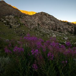
Beautiful views and a super unique hike. The dam at the end was very cool too. It was very hot so we could even get very close and get splashed by the dam water, cooling us off. Pro tip, you can drive up to near the dam and do the trail backwards if you want to be able to see the dam without hiking as long. One caveat, you have to walk single file so it's a bit hard to have any big group conversations. read more


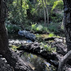
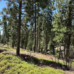
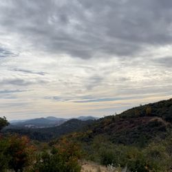
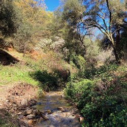
I had a wonderful hike with the family on Friday after Thanksgiving to work off all the eating while feeding our other senses. The Fall foliage colors were in full splendor as we breathed in the fresh air at 5000 ft elevation in the Sierra Nevada mountain, and we smiled to ourselves as we heard sounds on crunchy leaves below our feet. The Main Tuolumne Canal was originally built to supply water to the gold miners many years ago. Now is still used to supply water to local communities around the area. Copied from sonoracentral website - The first section of the Main Tuolumne Ditch Trail, Twain Harte to Lyons, is very scenic. It is a five mile one-way hike with a 300-foot elevation gain overall. The trail is mostly dirt single track with eight or so wooden flumes ranging from several yards to one mile in length. These flumes have 2 x 12″ planks in place for maintenance workers so you can use these planks to traverse the flumes but if you are the least bit afraid of heights I would recommend you walk around them. The best way to do this hike is to park at the old Sierra Pines Golf Course parking area and head northeast towards Lyons. In this direction the last mile or so before you get to the dam is all flume so, if you are squeamish with heights do not do this section. read more


1 year ago
3 years ago
5 years ago
More info about Main Tuolumne Ditch Trail
Twain Harte, CA 95383
Directions
Hours
Outdoor Amenities
Ask the Community - Main Tuolumne Ditch Trail


Main Tuolumne Ditch Trail - hiking - Updated July 2026
Best of Twain Harte
People found Main Tuolumne Ditch Trail by searching for…
Things to Do in Twain Harte, California
Parks in Twain Harte, California
Hiking Trails in Twain Harte, California
Fishing in Twain Harte, California
Walking Trails in Twain Harte, California
Dog Friendly Hiking Trails in Twain Harte, California
Scenic View in Twain Harte, California
Places to Take Pictures in Twain Harte, California
Off Road Trails in Twain Harte, California
Natural Hot Springs in Twain Harte, California
Off Leash Dog Hikes in Twain Harte, California
Secret Spots in Twain Harte, California
Running Trails in Twain Harte, California
Swimming Holes in Twain Harte, California
Fall Colors in Twain Harte, California
Waterfall Hike in Twain Harte, California
Easy Hikes in Twain Harte, California
Trail in Twain Harte, California
Beautiful Views in Twain Harte, California
Dog Friendly Parks in Twain Harte, California
Scenic Drive in Twain Harte, California
Sunday Fun Things to Do in Twain Harte, California
Browse Articles
Browse Nearby
BEST of Twain Harte, California Coffee near Main Tuolumne Ditch Trail
BEST of Twain Harte, California Walking Trails near Main Tuolumne Ditch Trail
BEST of Twain Harte, California Things to Do near Main Tuolumne Ditch Trail
BEST of Twain Harte, California Restaurants near Main Tuolumne Ditch Trail
BEST of Twain Harte, California Breakfast near Main Tuolumne Ditch Trail
BEST of Twain Harte, California Parks near Main Tuolumne Ditch Trail
BEST of Twain Harte, California Hot Springs near Main Tuolumne Ditch Trail
BEST of Twain Harte, California Caves near Main Tuolumne Ditch Trail
BEST of Twain Harte, California Campgrounds near Main Tuolumne Ditch Trail
Browse Brands
Trending Searches in Twain Harte, CA
Black Owned Nail Salons in Twain Harte, CA
Boat Rental in Twain Harte, CA
Cliff Jumping in Twain Harte, CA
Dog Swimming in Twain Harte, CA
Fishing Spots in Twain Harte, CA
Jet Ski Rental in Twain Harte, CA
Kayak Rental in Twain Harte, CA
Off Road Trails in Twain Harte, CA
Outdoor Activities in Twain Harte, CA
Public Pools in Twain Harte, CA
Public Shower in Twain Harte, CA
River Swimming in Twain Harte, CA
River Tubing in Twain Harte, CA
Running Trails in Twain Harte, CA
Swimming Holes in Twain Harte, CA
Swimming Lakes in Twain Harte, CA
People who viewed Main Tuolumne Ditch Trail also viewed
Don Pedro Lake Vista Point
2 reviews
Wild Yosemite
3 reviews
Red Hills Recreation Management Area
3 reviews
Pinecrest Lake
137 reviews
Columbia State Historic Park
227 reviews
Stanislaus National Forest Vista: Rim of the World
2 reviews
West Side Memorial Park
1 review
Railtown 1897 State Historic Park
128 reviews
Pinecrest Campground
72 reviews
New Melones Lake Marina
153 reviews