Maryland Heights Trail Photos


You might also consider

More like Maryland Heights Trail
Recommended Reviews - Maryland Heights Trail
Start your review...


Reviews With Photos


Bottom Line: A four-ish mile hike with enough climbing to equal 78 flights of stairs but the view at the top is rewarding. My husband and I found the Maryland Heights trail to be somewhat challenging but very doable, fun and rewarding. We're both in decent shape but certainly no gym rats or ninja warriors. I think it took us about an hour to the top and a little less to come back down. We also enjoyed a good 20 minutes on the overlook at the top. From what I can tell, the Maryland Heights Trail is the generic name given to a group of three different trails. Everyone starts out on the green blaze trail. Then the trail splits into a red blaze Overlook Cliff Trail and the blue blaze Stone Fort Trail. We stuck to the green blaze and red blaze trail that takes hikers to the famous overlook of Harper's Ferry. I think this is the path most people are referring to when they cite the Maryland Heights Trail. We thought about adding in the blue blaze Stone Fort Trail on the way back down but we hiked towards breakfast instead. As far as distance, the trail we hiked (from the trail head at Sandy Hook Road to the overlook) was about four miles but when we added in the distance we hiked to and from the town to the trail head that added another mile for a total of about five miles. For the five miles it took us 2.5 hours including breaks to enjoy snacks, peel off layers and check out the views. If we'd done the blue blaze Stone Fort Trail that would have added three more miles. As far as elevation, yep, this is a climb. All trails said I gained 1,115 ft. I'm not sure how relatable that is so here is another nugget - my watch said I climbed 78 flights of stairs. I don't know the average grade but according to what I recorded on all trails a grade of 15% to 23% was common and in some places it was over 30%. For comparison, I think the treadmills at my gym max out at 15% grade. As you near the overlook the trail starts to descend which means after a break at the overlook you have to start climbing again before the final descent towards the trail head at Sandy Hook Road. All Trails rates this hike as "moderate" on a scale of easy-moderate-hard. The National Park Service uses a scale of Easiest-Moderate-Moderately Strenuous-Strenuous-Very Strenuous. NPS rates the main green and red blaze Maryland Heights trail as moderate and rates the main trail plus the blue blaze Stone Fort Trail loop as strenuous. We saw hikers of all abilities on the trail ranging from multi-generation families to athletic trail runners. As far as crowds go, my husband and I hiked the trail on a Saturday in mid-April before National Park week. We started from the Harper's Ferry Train Station parking lot about 6:15am and we had the trail and overlook to ourselves until it was time to descend. By the time we got back to the parking lot about 8:45am it was full. Parking at the train station is $20 for three days or if you have an America the Beautiful annual park pass that works too. The use to be a small parking lot off of Sandy Hook Road but NPS has closed that for safety reasons so you pretty much have to pay to park either at the train station, at the Harper's Ferry National Historical Park Visitors Center or in town. Parking in the town is via the Park Mobile app, zone #7515. As far as restrooms, there wasn't much cover during the Spring. Perhaps there is more privacy when the trees have leafed out. The closest legit public restrooms that I am aware of is at the Harper's Ferry Train Station.


I read reviews of the Maryland Heights trail being pretty difficult. I've been to a few National Parks in my day, including Joshua Tree twice (the first time, hiking it solo), so I took most of those reviews with a grain of salt. Boy, was I wrong... Harpers Ferry has two parking lots and minimal street parking available. The first lot is the "Visitor's Center" lot and it is a little ways away from the main area of the town. The second lot is owned by the recreation department and charges $20 for all day parking per car. It's a pretty steep fee but keep in mind that it's likely being used to maintain and protect the area. If you do park in the recreation owned lot, it is much closer to the start of the Maryland Heights trail. Walk towards the water and the trail technically begins on that metal, walkway bridge. After you walk across the bridge, there's a metal spiral staircase that leads you down to the paved walking and biking path. It was at this point on the paved trail that I said to myself "What were those people talking about? This trail is super easy!" Cut to: me barely being able to catch my breath on the rocky, dirt, steep, uphill trail. The paved trail eventually leads to a small, wooden bridge which you use to cross the street. A rocky, dirt path reveals itself through the woods. That's where the real adventure began! Be patient as you make the hike up. For the most part, it's not that rocky until you get towards the end of the overlook trail. There is some serious rockiness! You really need to watch your step and take your time. Afterwards, the view is really amazing! You can see West Virginia, Maryland, and Virginia all intersect. I'm not sure if the effort was totally worth the reward, but I did feel pretty accomplished knowing I completed this crazy trail. Afterwards, my health app told me I did 85 flights of stairs and 6.5 miles. Dang! This trail definitely made me eat my words and made me question how it could be more challenging than anything I've ever hiked in Joshua Tree.


This trail will kick your butt, but the view at the top makes it so worth it! Definitely bring a walking stick or hiking poles with you. There are some very uneven sections! The hike is steep and arduous. There is a longer and a shorter trail--I opted for shorter because of time constraints. The view of the town at the end is breathtaking!


Notably, the footbridge that crossed from Harpers Ferry to this area was destroyed by a train derailment, causing serious disruption. But as of this writing, it's fixed, and a brand new fenced off walkway allows one to cross the river. The trail leads uphill from the canal, and has some minimal parking there so it is a good idea to come from Harpers Ferry. It is a steep grade, and I ended up not getting all the way to the lookout because I had dinner plans. You'll want to allow a couple of hours at least. Nonetheless, I still caught some nice views, it is a verdant area with some historical fortifications left in place as well.
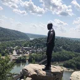

This was quite possibly the most challenging, coupled with the most fun trail I've ever been on. My Lady, one of my best friends and I sought out Harper's Ferry in an attempt to hike the Appalachian trail but stumbled on so much more. And for that, I am thankful. Our day started out like it usually does with us when doing these hikes - lost. But if you know anything about me, for as introverted as I naturally am, I can transform into an extrovert at any given moment and make a temporary friend, which I did, when I stumbled on two locals who were gracious enough to show us where to park, find us later on while still lost and walk us to the Jefferson Rock trail. Those guys were everywhere too. But more on them later. We hiked the 0.5 mile trail to Jefferson Rock and enjoyed the beautiful views, but I can't lie, apart of me was underwhelmed bc I didn't feel like we actually had a real hike, so we decided to continue walking into the town instead of back to our car. Fantastic idea. What we stumbled on was a beautiful, rustic, old town vibe with ice cream, frozen custard, and charming little shops galore. We stopped, ate, enjoyed the sites then continued walking through town before stumbling on an intimidating little bridge(atleast to me) that crossed water, and led us to the Maryland Heights trail that would consist of us hiking an entire mountain. And man oh man was that thing a beast. The experience was exhausting, but so worth it. The views, the sounds, the greenery, the wildlife, we had the time of our lives, but nothing could compare to when we finally made it to the top of the Maryland Heights Overlook. It was breathtaking guys. Absolutely stunning. You could see everything. One of the best views I've ever had the pleasure of seeing. I have lots of photos, and while I think they're good, they don't do what we witnessed any justice. Even still, I hope you can live vicariously through me for just a second and enjoy.


Harper's Ferry has been on my list for quite some time. When the weather finally let up on the weekend, I dragged my default hiking buddy (my younger sibling) to join me on the adventure. Before we headed to the trails, I did quite a bit of researching. A lot of the reviews mentioned there was limited parking or there was paid parking. I wanted to prevent paying for parking if possible but it was inevitable. There used to be a few parking spots at the foot of the trail but now barricaded and no longer accessible. There is parking on the same side of the trail in the neighborhood on Clark Road but for $20 all day. My suggestion is to get there early before the noon rush and park on the streets on the other side of the river at Harper's Ferry. It's way cheaper for about a dollar an hour. After we finished the hike, the streets were packed with many cars trying to find parking so they're left with neighborhood parking which is also $20. I loved that we went on such a beautiful day. Every where I turned was picture perfect. The con of it was that the trail was packed. For those wanting to get straight to the overlook of Harper's Ferry, there's a short trek to it right after the initial incline hike. If you're hungry for a longer hike like I was, there is a loop (blue markings) to follow that will lead to the overlook of Harper's Ferry as well. There is an overlook (Stone Fort) during this trail too so it's worth it. One website mentioned that the overall difficulty is medium. I say it gets a hard rating. Compared to Sugarloaf mountain which was rated as very difficult, I think Harper's Ferry beats it.


This trail is great! It's the perfect amount of challenge. From the town to the overlook I believe it's about 5-6 miles. You go up and up a bunch and then you kind of have to wind back down to get to the overlook. Parts of the trail near the overlook get a little congested and narrow but overall the trail is very well kept and clearly marked. On cooler weekend days there are often groups that go to the trail so it can get very crowded! We were lucky that we were just leaving the overlook when two LARGE groups were getting there (probably about 40 people). The town is fun to explore and grab a bite to eat. It's very easy to park in the upper parking lot and take the shuttle down!
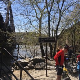

What a charming view from the top. What a majestic feeling to see such a confluence of history. And more than just where rivers and borders meet. I don't know about all this talk about a 2-mile hike. Here's the deal. The map indicates it is actually a 3-mile hike (1.5 mile up and then down again). However, that distance starts at the base across the bridge. Don't count on starting your hike here because I doubt you will be lucky enough to find parking across the bridge right at the base. And why would you!? Because instead you will probably enjoy the town first and then cross the bridge over. And you should! That's one of the best parts. Let me help you plan you trip. You can park in town or at the visitor center and take the shuttle to the drop off. From the shuttle stop to the base of the hike you will walk a good 1+ mile to cross the bridge over the Potomac and along the C&O canal path. And then you begin the hike. It can take you 2 to 2.5 hours with breaks for photos and such. But the total trip ended up being closer to 3.6 miles one way on our fitness tracker. You can follow the signs or follow the crowd. It's easy to navigate and all the loops will bring you back to the trail. There will be tons of kids, dogs, scouts, and tourists along the way.
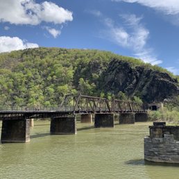

This is the hike you must do if you're visiting Harpers Ferry to do some hiking! It's a typical hike in that it's a moderate incline all the way to the top where you will be rewarded with a great view of the town and the confluence of the Shenandoah and Potomac rivers. It's roughly 3 miles round trip and will take you at least 2 hours. Bring a lunch with you so you can enjoy it at the top. I used a baby hiking backpack for the first time when I did this trail and it was a good hike to try it on since it's not too crazy. Lots of other parents had baby hiking backpacks as well. I went in April so the weather was great and there weren't really any biting insects. Don't forget water and sun screen!


Checked out the trail this year now that it reopened, and it was a blast! Definitely expect it to be a little crowded (especially when the weather is nice) and LOTS of dogs, but it's an easy enough trail and the views from the top are phenomenal. It's definitely worth hanging out for a little while at the top, so maybe pack lunch! Hardest part of this trail was finding parking. I got there at 11 AM on a holiday, and ended up having to park in the town Harper's Ferry by the AT Conservatory, since both the lots were completely full! Added a few extra miles to my hike, but since it was a nice day wasn't too bad.


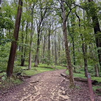
Rated as "moderate", this trail is decently wide to handle the high traffic it receives. Rocky with some areas heavier than other. Roots are also heavy in areas. Pretty steep grade/elevation makes for a good workout but the overlook makes it all worth it. The views of Harpers Ferry are spectacular!


This trail round trip is 5 to 6 miles. It's pretty strenuous on a mostly dirt, partly rocky trail. Not much leveling off here. It's all up and then all down. You can find the trailhead if starting in town: Crossing the footbridge over the Potomac River next to the train bridge and then walking the C&O towpath for maybe 1/2 mile or less. Cross a small bridge that puts you right across the road from the start! Once you reach the summit, you'll descend about 1/2 mile to the rocky overlook. Last time I went was a good 20 years ago. Though not much has changed in Harper's Ferry, I thought the view was a bit less dramatic than I remembered it to be. They did have part of the cliff roped off for the Falcons nesting... that's cool but overall, I really love the hike and view from Loudoun Heights a lot better. For that one, walk over and under Rte 340 bridge to start. It's the Appaliachian Trail if you follow from town up the steps from the church. Anyway, we enjoyed the hike but my butt muscles still hurt. Take and drink a lot of water! Plan to spend at least 2 hours hiking if not 3 considering your ability. Enjoy some ice cream in town afterward!
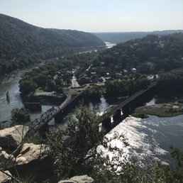

I don't normally go hiking but brother took me to this trail, It was simply amazing. The hike up the mountain was not easy but once you make it to the top you realize that it was worth the hike. The view from the top is breathtaking, sit on a rock under a tree and just enjoy the scenic view!! Definitely recommended!!!


Here at Harpers Ferry Historical Park in West Virginia, this Maryland Heights Trail may be one of the best hikes in the park. Due to construction in late September 2025, to access the trailhead, I had to take an extended 20-minute shuttle ride from the Visitor Center to an alternative location to begin the hike. Walking the paved path for 1/4 of a mile, there'll be a sign mentioning to access the trail...you must cross the street and go around a barrier on the initial climb. Maryland Heights Trail is 4.6 miles roundtrip gaining 1200 feet in elevation, but the pathway is clearly defined and suitable for most hikers. There'll be a halfway junction where to continue on...you must veer to the right as the Maryland Heights Trail changes its name to The Overlook Cliff Trail for 1.4 more miles. Next, follow the "4/10th's of a mile sign" to the right again, for the remaining push to the lookout. From here the trail descends downhill with some pesky rocks to maneuver around before noticing a total clearing of the forest and the wide open observation viewpoint. Arriving at Maryland Heights Overlook, it's a 300-foot vertical cliff showcasing Harpers Ferry's Historic Town at the confluence of the Potomac and Shenandoah Rivers. I was fortunate enough to even catch a CSX train crossing the original Baltimore and Ohio railroad tracks. Overall, Harpers Ferry is nestled within a vintage West Virginia backdrop consumed among colorfully green forests and mountains. Btw, if you're interested, you can walk the cobblestone streets of the Lower Town District. It's a throwback in time to the 1800's. Exploring around offers documented narratives helping to preserve our nation's history with more opportunities to appreciate nature at the banks of the Chesapeake and Ohio Canal. In the end, hiking this Maryland Heights Trail at Harpers Ferry National Historical Park makes for a worthwhile visit. read more


2 years ago


4 years ago
Bottom Line: A four-ish mile hike with enough climbing to equal 78 flights of stairs but the view at the top is rewarding. My husband and I found the Maryland Heights trail to be somewhat challenging but very doable, fun and rewarding. We're both in decent shape but certainly no gym rats or ninja warriors. I think it took us about an hour to the top and a little less to come back down. We also enjoyed a good 20 minutes on the overlook at the top. From what I can tell, the Maryland Heights Trail is the generic name given to a group of three different trails. Everyone starts out on the green blaze trail. Then the trail splits into a red blaze Overlook Cliff Trail and the blue blaze Stone Fort Trail. We stuck to the green blaze and red blaze trail that takes hikers to the famous overlook of Harper's Ferry. I think this is the path most people are referring to when they cite the Maryland Heights Trail. We thought about adding in the blue blaze Stone Fort Trail on the way back down but we hiked towards breakfast instead. As far as distance, the trail we hiked (from the trail head at Sandy Hook Road to the overlook) was about four miles but when we added in the distance we hiked to and from the town to the trail head that added another mile for a total of about five miles. For the five miles it took us 2.5 hours including breaks to enjoy snacks, peel off layers and check out the views. If we'd done the blue blaze Stone Fort Trail that would have added three more miles. As far as elevation, yep, this is a climb. All trails said I gained 1,115 ft. I'm not sure how relatable that is so here is another nugget - my watch said I climbed 78 flights of stairs. I don't know the average grade but according to what I recorded on all trails a grade of 15% to 23% was common and in some places it was over 30%. For comparison, I think the treadmills at my gym max out at 15% grade. As you near the overlook the trail starts to descend which means after a break at the overlook you have to start climbing again before the final descent towards the trail head at Sandy Hook Road. All Trails rates this hike as "moderate" on a scale of easy-moderate-hard. The National Park Service uses a scale of Easiest-Moderate-Moderately Strenuous-Strenuous-Very Strenuous. NPS rates the main green and red blaze Maryland Heights trail as moderate and rates the main trail plus the blue blaze Stone Fort Trail loop as strenuous. We saw hikers of all abilities on the trail ranging from multi-generation families to athletic trail runners. As far as crowds go, my husband and I hiked the trail on a Saturday in mid-April before National Park week. We started from the Harper's Ferry Train Station parking lot about 6:15am and we had the trail and overlook to ourselves until it was time to descend. By the time we got back to the parking lot about 8:45am it was full. Parking at the train station is $20 for three days or if you have an America the Beautiful annual park pass that works too. The use to be a small parking lot off of Sandy Hook Road but NPS has closed that for safety reasons so you pretty much have to pay to park either at the train station, at the Harper's Ferry National Historical Park Visitors Center or in town. Parking in the town is via the Park Mobile app, zone #7515. As far as restrooms, there wasn't much cover during the Spring. Perhaps there is more privacy when the trees have leafed out. The closest legit public restrooms that I am aware of is at the Harper's Ferry Train Station. read more


I read reviews of the Maryland Heights trail being pretty difficult. I've been to a few National Parks in my day, including Joshua Tree twice (the first time, hiking it solo), so I took most of those reviews with a grain of salt. Boy, was I wrong... Harpers Ferry has two parking lots and minimal street parking available. The first lot is the "Visitor's Center" lot and it is a little ways away from the main area of the town. The second lot is owned by the recreation department and charges $20 for all day parking per car. It's a pretty steep fee but keep in mind that it's likely being used to maintain and protect the area. If you do park in the recreation owned lot, it is much closer to the start of the Maryland Heights trail. Walk towards the water and the trail technically begins on that metal, walkway bridge. After you walk across the bridge, there's a metal spiral staircase that leads you down to the paved walking and biking path. It was at this point on the paved trail that I said to myself "What were those people talking about? This trail is super easy!" Cut to: me barely being able to catch my breath on the rocky, dirt, steep, uphill trail. The paved trail eventually leads to a small, wooden bridge which you use to cross the street. A rocky, dirt path reveals itself through the woods. That's where the real adventure began! Be patient as you make the hike up. For the most part, it's not that rocky until you get towards the end of the overlook trail. There is some serious rockiness! You really need to watch your step and take your time. Afterwards, the view is really amazing! You can see West Virginia, Maryland, and Virginia all intersect. I'm not sure if the effort was totally worth the reward, but I did feel pretty accomplished knowing I completed this crazy trail. Afterwards, my health app told me I did 85 flights of stairs and 6.5 miles. Dang! This trail definitely made me eat my words and made me question how it could be more challenging than anything I've ever hiked in Joshua Tree. read more


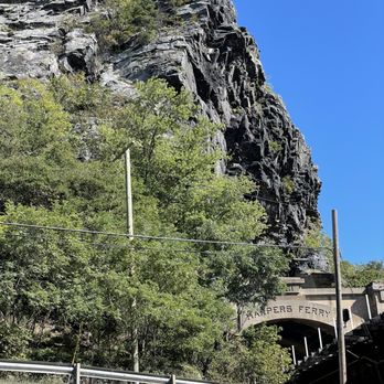

This trail will kick your butt, but the view at the top makes it so worth it! Definitely bring a walking stick or hiking poles with you. There are some very uneven sections! The hike is steep and arduous. There is a longer and a shorter trail--I opted for shorter because of time constraints. The view of the town at the end is breathtaking! read more


Notably, the footbridge that crossed from Harpers Ferry to this area was destroyed by a train derailment, causing serious disruption. But as of this writing, it's fixed, and a brand new fenced off walkway allows one to cross the river. The trail leads uphill from the canal, and has some minimal parking there so it is a good idea to come from Harpers Ferry. It is a steep grade, and I ended up not getting all the way to the lookout because I had dinner plans. You'll want to allow a couple of hours at least. Nonetheless, I still caught some nice views, it is a verdant area with some historical fortifications left in place as well. read more

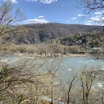


This was quite possibly the most challenging, coupled with the most fun trail I've ever been on. My Lady, one of my best friends and I sought out Harper's Ferry in an attempt to hike the Appalachian trail but stumbled on so much more. And for that, I am thankful. Our day started out like it usually does with us when doing these hikes - lost. But if you know anything about me, for as introverted as I naturally am, I can transform into an extrovert at any given moment and make a temporary friend, which I did, when I stumbled on two locals who were gracious enough to show us where to park, find us later on while still lost and walk us to the Jefferson Rock trail. Those guys were everywhere too. But more on them later. We hiked the 0.5 mile trail to Jefferson Rock and enjoyed the beautiful views, but I can't lie, apart of me was underwhelmed bc I didn't feel like we actually had a real hike, so we decided to continue walking into the town instead of back to our car. Fantastic idea. What we stumbled on was a beautiful, rustic, old town vibe with ice cream, frozen custard, and charming little shops galore. We stopped, ate, enjoyed the sites then continued walking through town before stumbling on an intimidating little bridge(atleast to me) that crossed water, and led us to the Maryland Heights trail that would consist of us hiking an entire mountain. And man oh man was that thing a beast. The experience was exhausting, but so worth it. The views, the sounds, the greenery, the wildlife, we had the time of our lives, but nothing could compare to when we finally made it to the top of the Maryland Heights Overlook. It was breathtaking guys. Absolutely stunning. You could see everything. One of the best views I've ever had the pleasure of seeing. I have lots of photos, and while I think they're good, they don't do what we witnessed any justice. Even still, I hope you can live vicariously through me for just a second and enjoy. read more
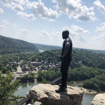



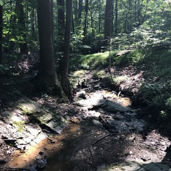


Harper's Ferry has been on my list for quite some time. When the weather finally let up on the weekend, I dragged my default hiking buddy (my younger sibling) to join me on the adventure. Before we headed to the trails, I did quite a bit of researching. A lot of the reviews mentioned there was limited parking or there was paid parking. I wanted to prevent paying for parking if possible but it was inevitable. There used to be a few parking spots at the foot of the trail but now barricaded and no longer accessible. There is parking on the same side of the trail in the neighborhood on Clark Road but for $20 all day. My suggestion is to get there early before the noon rush and park on the streets on the other side of the river at Harper's Ferry. It's way cheaper for about a dollar an hour. After we finished the hike, the streets were packed with many cars trying to find parking so they're left with neighborhood parking which is also $20. I loved that we went on such a beautiful day. Every where I turned was picture perfect. The con of it was that the trail was packed. For those wanting to get straight to the overlook of Harper's Ferry, there's a short trek to it right after the initial incline hike. If you're hungry for a longer hike like I was, there is a loop (blue markings) to follow that will lead to the overlook of Harper's Ferry as well. There is an overlook (Stone Fort) during this trail too so it's worth it. One website mentioned that the overall difficulty is medium. I say it gets a hard rating. Compared to Sugarloaf mountain which was rated as very difficult, I think Harper's Ferry beats it. read more


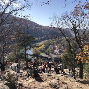


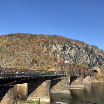
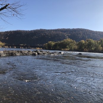

7 years ago
This trail is great! It's the perfect amount of challenge. From the town to the overlook I believe it's about 5-6 miles. You go up and up a bunch and then you kind of have to wind back down to get to the overlook. Parts of the trail near the overlook get a little congested and narrow but overall the trail is very well kept and clearly marked. On cooler weekend days there are often groups that go to the trail so it can get very crowded! We were lucky that we were just leaving the overlook when two LARGE groups were getting there (probably about 40 people). The town is fun to explore and grab a bite to eat. It's very easy to park in the upper parking lot and take the shuttle down! read more



8 years ago
What a charming view from the top. What a majestic feeling to see such a confluence of history. And more than just where rivers and borders meet. I don't know about all this talk about a 2-mile hike. Here's the deal. The map indicates it is actually a 3-mile hike (1.5 mile up and then down again). However, that distance starts at the base across the bridge. Don't count on starting your hike here because I doubt you will be lucky enough to find parking across the bridge right at the base. And why would you!? Because instead you will probably enjoy the town first and then cross the bridge over. And you should! That's one of the best parts. Let me help you plan you trip. You can park in town or at the visitor center and take the shuttle to the drop off. From the shuttle stop to the base of the hike you will walk a good 1+ mile to cross the bridge over the Potomac and along the C&O canal path. And then you begin the hike. It can take you 2 to 2.5 hours with breaks for photos and such. But the total trip ended up being closer to 3.6 miles one way on our fitness tracker. You can follow the signs or follow the crowd. It's easy to navigate and all the loops will bring you back to the trail. There will be tons of kids, dogs, scouts, and tourists along the way. read more
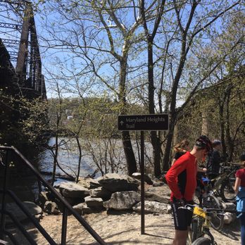

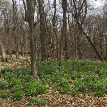


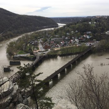


This is the hike you must do if you're visiting Harpers Ferry to do some hiking! It's a typical hike in that it's a moderate incline all the way to the top where you will be rewarded with a great view of the town and the confluence of the Shenandoah and Potomac rivers. It's roughly 3 miles round trip and will take you at least 2 hours. Bring a lunch with you so you can enjoy it at the top. I used a baby hiking backpack for the first time when I did this trail and it was a good hike to try it on since it's not too crazy. Lots of other parents had baby hiking backpacks as well. I went in April so the weather was great and there weren't really any biting insects. Don't forget water and sun screen! read more


6 years ago

7 years ago
Checked out the trail this year now that it reopened, and it was a blast! Definitely expect it to be a little crowded (especially when the weather is nice) and LOTS of dogs, but it's an easy enough trail and the views from the top are phenomenal. It's definitely worth hanging out for a little while at the top, so maybe pack lunch! Hardest part of this trail was finding parking. I got there at 11 AM on a holiday, and ended up having to park in the town Harper's Ferry by the AT Conservatory, since both the lots were completely full! Added a few extra miles to my hike, but since it was a nice day wasn't too bad. read more


5 years ago
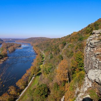
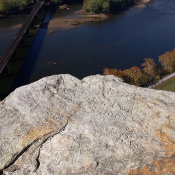
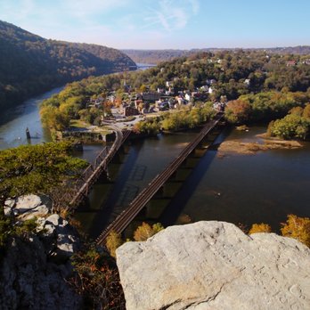
Rated as "moderate", this trail is decently wide to handle the high traffic it receives. Rocky with some areas heavier than other. Roots are also heavy in areas. Pretty steep grade/elevation makes for a good workout but the overlook makes it all worth it. The views of Harpers Ferry are spectacular! read more







7 years ago
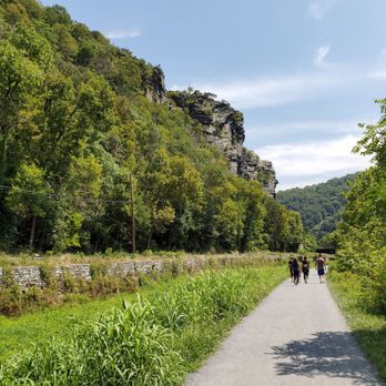
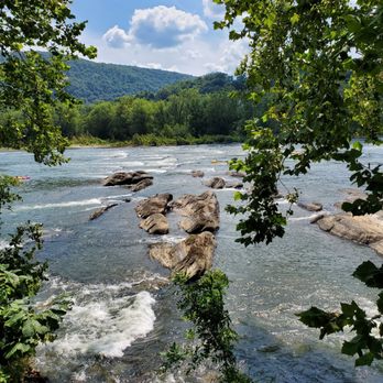
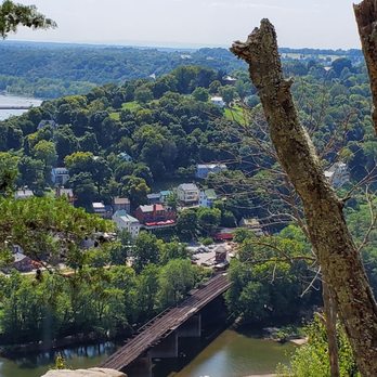
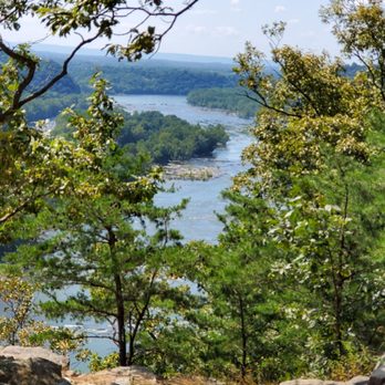
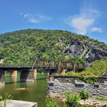
This trail round trip is 5 to 6 miles. It's pretty strenuous on a mostly dirt, partly rocky trail. Not much leveling off here. It's all up and then all down. You can find the trailhead if starting in town: Crossing the footbridge over the Potomac River next to the train bridge and then walking the C&O towpath for maybe 1/2 mile or less. Cross a small bridge that puts you right across the road from the start! Once you reach the summit, you'll descend about 1/2 mile to the rocky overlook. Last time I went was a good 20 years ago. Though not much has changed in Harper's Ferry, I thought the view was a bit less dramatic than I remembered it to be. They did have part of the cliff roped off for the Falcons nesting... that's cool but overall, I really love the hike and view from Loudoun Heights a lot better. For that one, walk over and under Rte 340 bridge to start. It's the Appaliachian Trail if you follow from town up the steps from the church. Anyway, we enjoyed the hike but my butt muscles still hurt. Take and drink a lot of water! Plan to spend at least 2 hours hiking if not 3 considering your ability. Enjoy some ice cream in town afterward! read more





9 years ago
I don't normally go hiking but brother took me to this trail, It was simply amazing. The hike up the mountain was not easy but once you make it to the top you realize that it was worth the hike. The view from the top is breathtaking, sit on a rock under a tree and just enjoy the scenic view!! Definitely recommended!!! read more
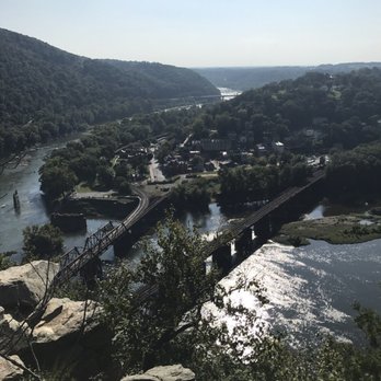

This hike was hard and fun! I did it with some friends on December 26, 2016. It's a great winter hike, but make sure you layer up because the ridge is windy and cold!! Highlights: -Awesome view of Harpers Ferry from the Main Overlook cliffs -Huge amount of Civil War history & artifacts -The trail is really well-maintained and well-marked -Fabulous view of the Potomac River from the ridge -Only an hour drive from Montgomery County! read more


8 years ago
This was a fun trail that provided a good workout for my girlfriend and I. I love the challenge of long uphill inclines and this one fit the bill. We went on 8/25/2018 and the weather was warm, but not too hot, with abundant sunshine. We took the Overlook Trail, which was worth the effort. I usually don't care for crowded hiking trails, and this time it was a little too crowded for my liking. However, it was to be expected on a Saturday and we had a great time. We plan to be back in the cooler months. read more


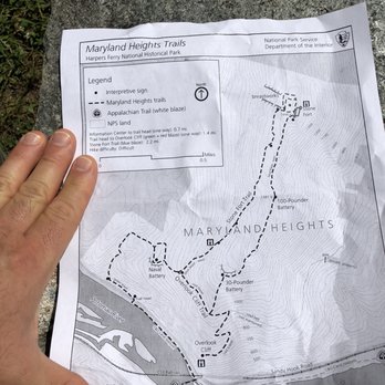


10 years ago
This hike was awesome! I would consider myself a beginner in the world of hiking, so I was definitely feeling it in my legs (lots of uphill walking). That being said, the view at the overlook is definitely worth the work! It has an amazing view of Harpers Ferry and the river. Brought our pup along and he enjoyed the hike as well! Highly recommended! We had some trouble parking, unless there are other places that I didn't know about (had to basically drive back and forth for a while til a spot opened up). Get there early for a spot! read more

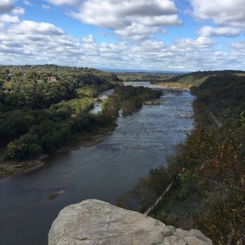
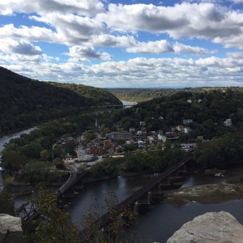
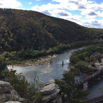


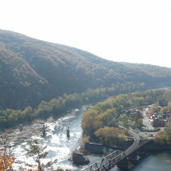
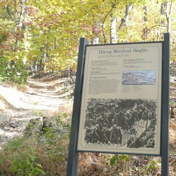
This trail is pretty historic and awesome. It goes by some historic sites dating back to the Civil War. The highlight of the entire trail is when it goes up against the top of the cliff where you are rewarded with a truly spectacular view of Harper's Ferry far below. There is a sign for Mennen's Talcum Powder painted on the cliff face below. All in all I have personally felt that the Maryland Heights trail system has been taken care of and maintained very well and professionally. read more







9 years ago
This is my favorite hike around Frederick. It is the perfect length, that is: it definitely tires you out but not so much that you feel unable to move the next day. It's energizing. It's a good substitute for going to the gym as it takes probably an hour and half to 2 hours but there's no factor of keeping yourself from getting bored and going home when your halfway done the trail like there could be at the gym. It's dog friendly! My dog loves this trail as much as I do. It's lovely in all seasons. Beautiful views. Sometimes parking gets full, so if you're going on a day it's likely to be busy be aware of that. read more


10 years ago
You're going to have a blast going up that 45 degree incline for 1.2 miles to get to the top, but the blue trial is totally worth it and you will not be disappointed! Your glutes will also hate you for days but at least you can reward it with some ice cream or nice dinner after. Take it slow and be careful of sliding rocks, but have fun and bring a buddy! read more


9 years ago
More info about Maryland Heights Trail
17 Shoreline Dr
Harpers Ferry, WV 25425
Directions
Hours
Outdoor Amenities
Ask the Community - Maryland Heights Trail
Review Highlights - Maryland Heights Trail








































Maryland Heights Trail - hiking - Updated August 2026
Best of Harpers Ferry
People found Maryland Heights Trail by searching for…
Things to Do in Harpers Ferry, WV
Photo Spots in Harpers Ferry, WV
Hiking Trails With Waterfalls in Harpers Ferry, WV
Beautiful Views in Harpers Ferry, WV
Scenic Drive in Harpers Ferry, WV
Scenic Overlook in Harpers Ferry, WV
Scenic View in Harpers Ferry, WV
Picnic Areas in Harpers Ferry, WV
Sunset View in Harpers Ferry, WV
Places to Take Pictures in Harpers Ferry, WV
Dog Friendly Hiking Trails in Harpers Ferry, WV
Off Road Trails in Harpers Ferry, WV
Waterfalls and Swimming Holes in Harpers Ferry, WV
Easy Hiking Trails in Harpers Ferry, WV
Running Trails in Harpers Ferry, WV
Playgrounds in Harpers Ferry, WV
Free Parking in Harpers Ferry, WV
Stairs Workout in Harpers Ferry, WV
Walking Trails in Harpers Ferry, WV
Day Trips in Harpers Ferry, WV
Natural Hot Springs in Harpers Ferry, WV
Trending Searches in Harpers Ferry, WV
Antiques near Maryland Heights Trail
Barbershop For Men near Maryland Heights Trail
Bike Shop near Maryland Heights Trail
Cliff Jumping near Maryland Heights Trail
Consignment Shops near Maryland Heights Trail
Cruising Spots near Maryland Heights Trail
Dog Friendly Things To Do near Maryland Heights Trail
Ear Piercing near Maryland Heights Trail
Eyebrow Threading near Maryland Heights Trail
Flower Fields near Maryland Heights Trail
Kids Haircut near Maryland Heights Trail
Lakes near Maryland Heights Trail
Lookout Points near Maryland Heights Trail
Mini Golf near Maryland Heights Trail
Parks near Maryland Heights Trail
Pedicure near Maryland Heights Trail
Permanent Makeup near Maryland Heights Trail
Picnic Areas near Maryland Heights Trail
Preschools near Maryland Heights Trail
Public Golf Courses near Maryland Heights Trail
Public Pools near Maryland Heights Trail
Rock Quarry near Maryland Heights Trail
Scenic Night View near Maryland Heights Trail
Scenic Overlook near Maryland Heights Trail
Sunrise View near Maryland Heights Trail
Swimming Holes near Maryland Heights Trail
Trading Card Shops near Maryland Heights Trail
Used Furniture Stores near Maryland Heights Trail
Browse Articles
Browse Nearby
BEST of Harpers Ferry, West Virginia Parks near Maryland Heights Trail
BEST of Harpers Ferry, West Virginia Restaurants near Maryland Heights Trail
BEST of Harpers Ferry, West Virginia Coffee near Maryland Heights Trail
BEST of Harpers Ferry, West Virginia Things to Do near Maryland Heights Trail
BEST of Harpers Ferry, West Virginia Breakfast near Maryland Heights Trail
BEST of Harpers Ferry, West Virginia Scenic View near Maryland Heights Trail
BEST of Harpers Ferry, West Virginia Caves near Maryland Heights Trail
BEST of Harpers Ferry, West Virginia Campgrounds near Maryland Heights Trail
BEST of Harpers Ferry, West Virginia Visitor Centers near Maryland Heights Trail
Browse Brands
Related Searches in Harpers Ferry, WV
Affordable Canoe Rental Options in Harpers Ferry, West Virginia
Affordable Kayak Rental Services in Harpers Ferry, West Virginia
Best Dog Hiking Trails Around Harpers Ferry, West Virginia
Best Fishing Locations and Guides in Harpers Ferry, West Virginia
Best Nature Trails for Hiking in Harpers Ferry, West Virginia
Best Places for Horseback Riding in Harpers Ferry, West Virginia
Check Out Off Road Trails in Harpers Ferry, West Virginia
Discover Dog Friendly Trails to Explore in Harpers Ferry, West Virginia
Discover Easy Hiking Trails Near Harpers Ferry, West Virginia
Discover Popular Bike Trails in Harpers Ferry, West Virginia
Discover Scenic Mountain Bike Trails Near Harpers Ferry, West Virginia
Discover a Hiking Trail in Harpers Ferry, West Virginia
Discover the Best Night Hike Trails in Harpers Ferry, West Virginia
Dog-Friendly Hikes With Dogs in Harpers Ferry, West Virginia
Enjoy Camping Adventures Around Harpers Ferry, West Virginia
Enjoy Exciting Mountain Biking Adventures in Harpers Ferry, West Virginia
Enjoy Kayaking Adventures in Harpers Ferry, West Virginia
Enjoy Off Leash Dog Hikes in Harpers Ferry, West Virginia
Enjoy River Tubing Adventures in Harpers Ferry, West Virginia
Enjoy Tent Camping Spots Around Harpers Ferry, West Virginia
Enjoy a Beautiful Waterfall Hike in Harpers Ferry, West Virginia
Enjoy the Best Walking Trails in Harpers Ferry, West Virginia
Explore Beautiful Parks and Green Spaces in Harpers Ferry, West Virginia
Explore Easy Hikes Perfect for All in Harpers Ferry, West Virginia
Explore Fun Activities to Do in Harpers Ferry, West Virginia
Explore Popular Campgrounds Near Harpers Ferry, West Virginia
Explore Popular View Points Around Harpers Ferry, West Virginia
Explore Top Dog Parks in Harpers Ferry, West Virginia Near You
Explore Top Water Parks in Harpers Ferry, West Virginia Today
Explore the Best Beach Spots in Harpers Ferry, West Virginia
Explore the Best Swimming Holes Around Harpers Ferry, West Virginia
Family Friendly Hiking With Kids in Harpers Ferry, West Virginia
Find Beautiful Views in Harpers Ferry, West Virginia
Find Popular Ziplining Spots Around Harpers Ferry, West Virginia
Find the Best Parks for Picnics in Harpers Ferry, West Virginia
Hiking Trails With Waterfalls in Harpers Ferry, West Virginia
Off Leash Dog Hiking Trails in Harpers Ferry, West Virginia
Plan a Scenic Drive Route Near Harpers Ferry, West Virginia
Popular Fishing Spots to Explore in Harpers Ferry, West Virginia
Popular Outdoor Activities to Try in Harpers Ferry, West Virginia
Popular Picnic Spots to Visit in Harpers Ferry, West Virginia
Safe River Swimming Areas in Harpers Ferry, West Virginia
Top Hiking Trails to Explore in Harpers Ferry, West Virginia
Top Running Trails to Explore in Harpers Ferry, West Virginia
Top Swimming Lakes to Enjoy in Harpers Ferry, West Virginia
Top Swimming Spots and Pools in Harpers Ferry, West Virginia
Top-Rated Camping Sites in Harpers Ferry, West Virginia
Walk Dog Friendly Hiking Trails in Harpers Ferry, West Virginia


