1. Mather Point

    1. Mather Point

    0

    Grand Canyon Village, AZ

    Cancel

    Open app

    Search

    Mather Point Photos

    You might also consider

    Recommended Reviews - Mather Point

    Your trust is our priority, so businesses can't pay to alter or remove their reviews. Learn more about reviews.
    Yelp app icon
    Browse more easily on the app
    Review Feed Illustration

    Reviews With Photos - Mather Point

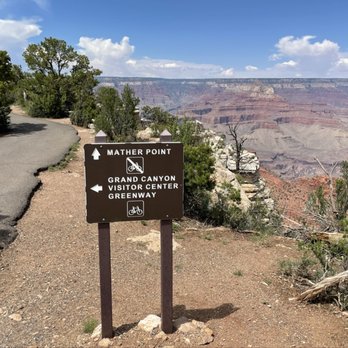
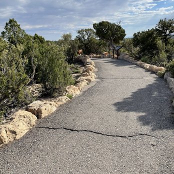
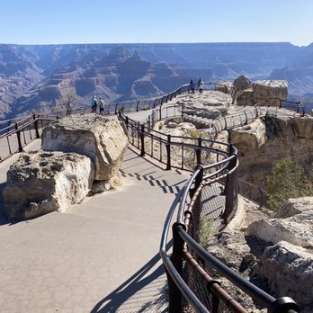
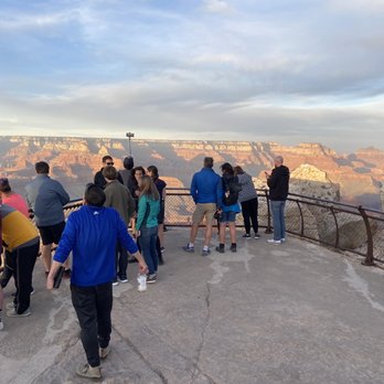
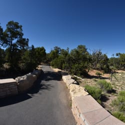
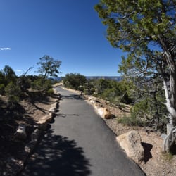
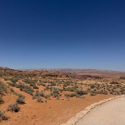
    Walking along the paved trail approaching Mather Point.  Photo is taken east of Mather Point.
    Daniel J.

    Please permit this old man to reminisce while I write this review on Mather Point (Grand Canyon National Park, Arizona). Today would have been my 25th wedding anniversary with a woman I loved dearly, and Mather Point was my chosen location for a pivotal moment in my life many years ago. And once again, I came to this beautiful location to reminisce on that wonderful day, and to write a few ramblings from a broken heart. I came here to remember that beautiful day, many years ago at this very location, when I proposed to a woman who would become my wife. I carefully chose Mather Point at the Grand Canyon for this moment because I believed it captured and symbolized my emotions, from the depths and beauty of my love to my firm belief that my love would be steadfast and last an eternity. I knew how I felt; my only hope was that she felt the same way. She said she did, but she changed her mind several years later. Sadly, I am still trying to understand how she could eventually hate the person who loved her the most, especially when her reasons are still unknown to me. So here I am again, reminiscing while observing the eternal and unchanged beauty of this location after all these years. As I sit here on a quaint park bench along a beautiful walkway that overlooks the Grand Canyon, I am watching an older couple, perhaps in their 80s, slowly walking hand-in-hand as they enjoy the natural beauty all around them. Undoubtedly, they are still in love, after all these years, and I am imagining that they are sharing a lifetime of beautiful memories they've experienced together. Of course, I'm quite jealous of this wonderful old couple because they have what I only dreamed of having someday, many years ago. As I depart this location, I am abandoning the belief that all people are capable of loving eternally, along with a trail of many tears. I have now learned that, unlike my love that resembles the depth and eternal beauty of the Grand Canyon, some people's love is more like the wind -- here one day and gone the next. My only hope is that this magnificent location can become a wonderful memory for many others, just as it has been for me, regardless of what has changed for me since that beautiful day many years ago.

    Gabriela M.

    A busy view point during the summer. We went during memorial weekend and this point was by far the busiest place in the south rim. Although it offers wonderful picturesque views of the Grand Canyon, you can find less busier viewpoints along the rim. It was almost impossible to get a picture with so many people trying to do the same. lol This review is not to discourage visitors but to advise that you visit this view point before 9am or after 4pm. You can walk to the viewpoint from the visitors center.

    (8/24/2024)
    Gwen W.

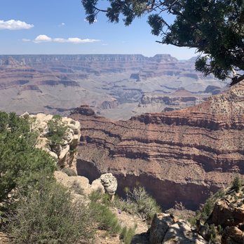
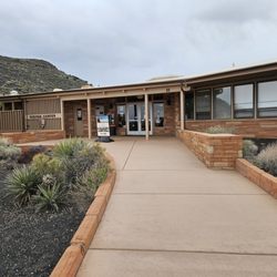
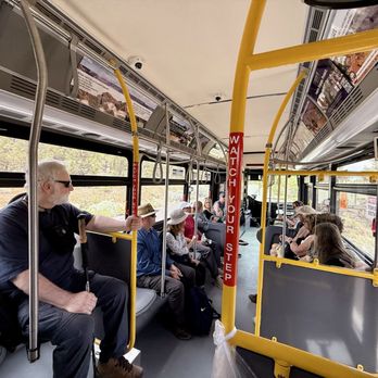
    Came, saw, pictured! We took a day trip to see Grand Canyon, and the views from Mather Point are quite awesome. Walking the paved path from the Welcome Center (.5 miles) has plenty of stopping spots along the way to get pictures. There's spots were people can venture out to the edge - at your own risk - to get even better, death-defying photos. The parking lot is large, no problems there. Our day just happened to be beautiful weather with a high of 76 degrees and rolling puffy clouds. The shuttle buses running four different routes stop at different points along the trail. They run every 10-15 minutes; very efficient as it really cuts down on general car traffic throughout the last half of the path. The different views of the striated rock, mixed with the different colors of sky as the day started to wind down made for wonderful digital memories!

    Travis T.

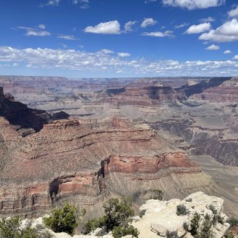
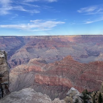
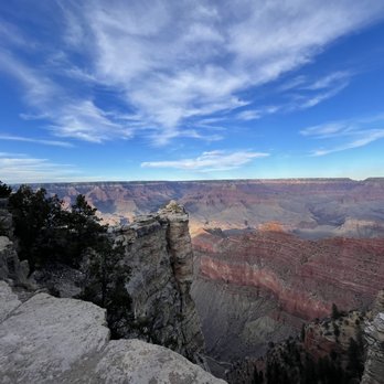
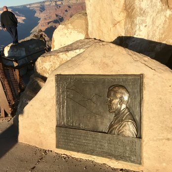
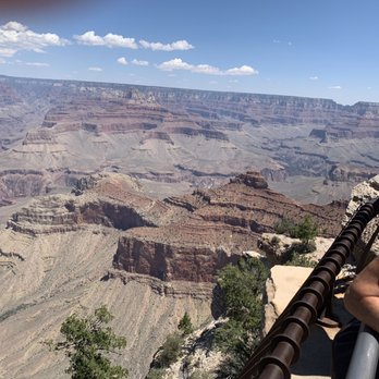
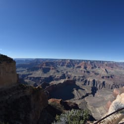
    This is a beautiful viewpoint to get a panoramic view of the Grand Canyon and a great introduction to the immensity of it. You can see a portion of the Colorado River and Phantom Ranch at the bottom. It is also a great spot for Sunrise and Sunset photos. Mather Point is a short walk from the visitor center and has plenty of parking nearby. It's the closest viewpoint to the southern entrance station and is a part of the Rim Trail. The downside is that this is a very popular viewing location and can get really crowded at times. Mather Point is named for Stephen Tyng Mather, the first director of the National Park Service.
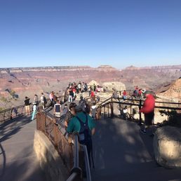
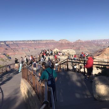
    A very busy Mather Point
    Shayla B.

    One of the most stunning viewpoints within Grand Canyon National Park! If you're visiting, you're almost bound to make a stop here. The views are literally breathtaking. Mather Point is located along the popular Rim Trail and provides sweeping views of the canyon. The viewpoint is named after Stephen Mather, the first director of the National Park Service and also one of the first advocates of Grand Canyon National Park. Mather Point is easily accessible since it's located right next to the Visitor Center. But with easy access comes large and busy crowds. This isn't a viewpoint that you'll be able to have all to yourself, but the views are still enticing nonetheless. This was definitely one of the most gorgeous views that I was able to witness while I visited the park. I can see why it's so popular; not only is it convenient, but this colorful view of the canyon is seriously jaw dropping.

    John H.

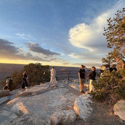
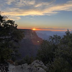
    The views are great but there are so many other great spots. This section is under a mile from the Visitor Center along the Rim Trail, which is probably part of its popularity. No bathrooms nearby. You can see the sunset off to the trees and the light reflects off the canyon.

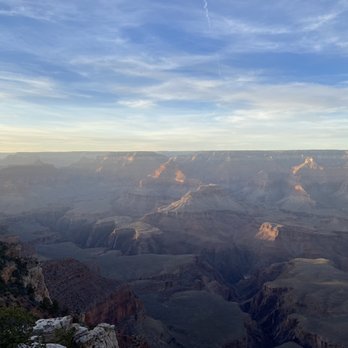
    Sunset
    Charles R.

    We loved this spott. I recommend you come about an hour n half after sunset and just look up and you will see the Milky Way Appear. We saw countless shooting stars. We also came for a day to see the sunset, but you want to arrive early to get to the point to see it all.

    The majestic elks on the way to the Grand Canyon
    Abhi S.

    First of all, I must tell you that my review is nothing compared to what this place and the view actually is. The view of the Grand Canyon from Mather Point is one of the best that you will ever see in your life. The peaks, the painting by the winds on the canyon walls throughout the millenia, the smell of the nature, the depth of the gorge, everything is from out of this world. You have to be here to realize the vastness, the depth and the beauty of this place. We arrived here during COVID times (a week ago) but almost no one was following the protocol. But the place is huge, so it's easy to keep distance. On the way there, you will pass through the beautiful roads, and will almost certainly see a cavalcade of cars stopped just to watch the majestic Elks. We were lucky to have seen them so up close. Remember, this place is pretty far off of the nearest eateries or gas stations, so be mindful of this. You might want to have water on yourself to stay hydrated as it can be hot and this place requires a loooot of walking. Overall, this was the fourth wonder of the world I saw and I can hands down tell you that it was the most beautiful one so far. It's worth it.

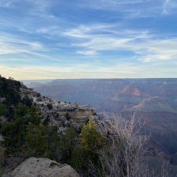
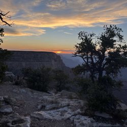
    Sunrise at Mathers Point !
    Yvette R.

    Great view for sunrise. Get there early and bundle up. You will find parking that early in the AM, but if you plan to leave and return you will NOT find the same parking. Recommend this as a starting point and use the shuttles.

    Drew B.

    I have to laugh a bit any time I see one of the world's great wonders -- natural or man-made -- on Yelp. I mean, c'mon, I'm not going to be able to convince someone to see, or avoid, something like the Grand Canyon. What I can do, however, is give recommendations on the best places to see the grandest of views. To me, two views stand out at the Grand Canyon: 1. The Desert View and Mary Jane Colter's stunning Watchtower and 2. Mather Point, an unforgettable vantage point at the South Rim of the Grand hole. Named for Stephen Tyng Mather, the first director of the National Park Service, you know you've reached Mather Point when you find a bronze plaque affixed to a rock: "He laid the foundation of the National Park Service, defining and establishing the policies under which its areas shall be developed and conserved unimpaired for future generations. There will never come an end to the good that he has done." It's a well-kept area with railings (not always the case!) and different levels of view. There are some large rocks on site that have become REAL popular, as one can stand on top, get some stellar photos, and also get a shot in one of those "king of the world" poses hovering over the Grand Canyon. From the location, you'll get expansive views of the South Rim, the Colorado River, Garden Creek, Tonto Trail, Pipe Creek, and, hell .... it's just a whole bunch of stunning, rust-red-rocked masterworks made by time. The area has an excellent gift shop/visitor's center, hiking trails, and short-cuts to other marvelous, unobstructed views of the Grand Canyon. And that's the Hole story.

    Chris S.

    It's the Grand Canyon. Can you give any part of it less than five stars and still call yourself an American? It's awe inspiring and beautiful. If you haven't been there, go there immediately!
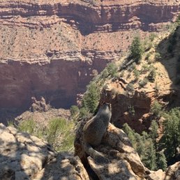
    Grand Canyon
    Charles G.

    Simply beautiful a must see military and veterans get in free too with was an awesome surprise can't wait to go back and spend a few days there and explore more

    Freezing in December

    See all

    1 month ago

    Helpful 32
    Thanks 10
    Love this 28
    Oh no 0

    3 months ago

    Helpful 0
    Thanks 0
    Love this 0
    Oh no 0

    4 months ago

    Helpful 1
    Thanks 1
    Love this 2
    Oh no 0

    11 months ago

    Helpful 17
    Thanks 10
    Love this 17
    Oh no 0

    1 year ago

    Helpful 4
    Thanks 2
    Love this 2
    Oh no 0

    1 year ago

    Helpful 2
    Thanks 0
    Love this 3
    Oh no 0
    Photo of Gwen W.
    970
    2023
    6161

    2 years ago

    Helpful 4
    Thanks 2
    Love this 5
    Oh no 0

    4 years ago

    Helpful 15
    Thanks 0
    Love this 15
    Oh no 0

    1 year ago

    THIS IS AMAZING! The views are incredible! Absolutely beautiful! If you don't 5 star this your wild!

    Helpful 0
    Thanks 0
    Love this 0
    Oh no 0

    6 years ago

    Helpful 13
    Thanks 0
    Love this 15
    Oh no 0
    Photo of Moto S.
    13
    562
    274

    3 years ago

    Helpful 1
    Thanks 0
    Love this 0
    Oh no 0
    Photo of John H.
    159
    1757
    9006

    4 years ago

    Helpful 1
    Thanks 0
    Love this 1
    Oh no 0
    Photo of Charles R.
    79
    202
    708

    3 years ago

    Helpful 0
    Thanks 0
    Love this 0
    Oh no 0

    5 years ago

    Helpful 1
    Thanks 1
    Love this 0
    Oh no 0

    4 years ago

    Helpful 0
    Thanks 0
    Love this 0
    Oh no 0
    Photo of Ana P.
    301
    487
    7284

    7 years ago

    Helpful 3
    Thanks 0
    Love this 2
    Oh no 0
    Photo of Drew B.
    2424
    1002
    9360

    8 years ago

    Helpful 56
    Thanks 0
    Love this 57
    Oh no 0
    Photo of Lane T.
    221
    340
    2436

    7 years ago

    Helpful 1
    Thanks 0
    Love this 1
    Oh no 0
    Photo of Chris S.
    351
    1151
    2201

    6 years ago

    Helpful 1
    Thanks 0
    Love this 1
    Oh no 0

    5 years ago

    Helpful 0
    Thanks 0
    Love this 0
    Oh no 0

    7 years ago

    Helpful 0
    Thanks 0
    Love this 0
    Oh no 0

    6 years ago

    Helpful 5
    Thanks 0
    Love this 4
    Oh no 0

    5 years ago

    Very busy spot. But definitely a must see. Great for pics especially on top of the front rock right as you walk up.

    Helpful 0
    Thanks 0
    Love this 0
    Oh no 0

    Mather Point Reviews in Other Languages

    Ask the Community - Mather Point

    Review Highlights - Mather Point

    Named the first director of the National Park Service, my partner and I came this morning via their free shuttle bus.

    Mentioned in 4 reviews

    Read more highlights

    Verify this business for free

    Get access to customer & competitor insights.

    Verify this business

    Bright Angel Trail - The water here tastes so good and minerally ;)

    Bright Angel Trail

    4.7(124 reviews)
    2.1 mi

    If one thinks hiking nine miles in or out of the Grand Canyon is as easy as walking to the store,…read morethink again. Located a few hundred yards from where we are staying, the Bright Angel Trail is one of the superhighways, with its heavenly name making it the most well-known trail. It follows an old Native American route zigzagging down a vertical wall and then cuts across the flat plateau to the river from the South Rim. Early this morning while the temperature was still cool, my partner and I took only a short distance. The trail was safe. We've seen hikers of all shapes, sizes, ages, and fitness levels. It was well-maintained, easy to follow, consistently about 4 feet wide, and has wider sections for passing. The steepness of the trail is very misleading on the way down. Plan on taking twice as long to hike up as it took to hike down. We enjoyed the views, which can be more spectacular in the canyon than from the rim. There is something about actually being in the canyon that is more memorable and moving than being on the rim.

    This is the most popular hiking trail into Grand Canyon! Even though it is well-traversed, this is…read morealso a dangerous trail for people who are not prepared, as it's wayy easier hiking down...but you have to contend with the hike up. Also, there is limited water on the trail (and sometimes there are pipeline breaks), with not a lot of shade. With hot weather, this could be a deadly hike. The trail head has bathrooms and a water filling station. Definitely use them before hiking down. This hike is well maintained, with mules sharing the trail. You can see them...or at least smell them as they leave poop on the trail. I hiked down to the Second Tunnel (1.8 miles) and it wasn't too bad, but I was unfortunately limited on time. It seems past this point the crowds thinned out. Havasupai Gardens at 9 miles round trip is the most the rangers recommend as a day trip. I loved how the view of the Canyon changed as I descended the trail!

    Photos
    Bright Angel Trail
    Bright Angel Trail - Two very happy tourists from Iowa.

    Two very happy tourists from Iowa.

    Bright Angel Trail - TEAM

    See all

    TEAM

    Grand Canyon National Park - Visitor's Center

    Grand Canyon National Park

    4.8(1.4k reviews)
    0.2 mi

    What's not to love when you witness a world wonder? Came…read moreduring the week not much traffic on a Thursday it was perfection. Plenty of parking and limitless views. It's labeled as a park yet it house many things: a hotel, a store, a deli, cabins, a train etc. I did a nice picnic under a tree took in the sights and enjoyed the canyon. The photos don't it justice.

    My brother and I spent two days at the park. The first day, we came up with the Grand Canyon…read morerailway, (see separate review), and then we came up to spend another day at the park. Both days were absolutely amazing. I don't care how many times you've been to the Grand Canyon, when you see it again, it's just like seeing it for the first time. Even though I've been to the canyon before, when I saw it for the first time this trip, I literally gasped at the beauty. The vastness of the canyon, the different colors, pictures do not do the place justice. The park is very large, and the drive along the south rim of the canyon is 20 to 25 miles long, with plenty of places to stop, and just view the magnificence of nature. If you want, you can park in one location, and then there are free, shuttle buses to get you around the park. I haven't been to the north rim, which is also part of the national park, but it is supposed to be just as beautiful, but more remote. The north rim is closed during the winter months due to snow. You can hike, or you can ride a bicycle in the park, which they rent. You can hike down into the canyon, or even ride a mule to the bottom of the canyon and spend the night. There's camping available, plenty of places to stay, (we stayed at the Yavapai Lodge,), and some of the hotels, like the El Tovar, are just gorgeous inside. There are snack bars, restaurants, souvenir shops, grocery stores, and a very nice visitor center. Yes, the park does get busy in the summer season, and there can be long lines, but there are lots and lots of places to go, and things to see. A little patience will go a long way. The entrance fee is $30 per car load, (It is quite a bit more expensive if you are not a US resident,) and you can also purchase national park passes, as well. I will never ever get tired of coming here....

    Photos
    Grand Canyon National Park - There is no better VIEW than this one. #gcnp

    There is no better VIEW than this one. #gcnp

    Grand Canyon National Park - Pima Point

    Pima Point

    Grand Canyon National Park - Pima Point

    See all

    Pima Point

    South Kaibab Trail - Mules

    South Kaibab Trail

    4.7(90 reviews)
    1.5 mi

    If you really want to understand the Grand Canyon, you don't stand at the rim. You step off it…read more South Kaibab Trail is not subtle about what it is. There's no easing into it, no gentle introduction. Within minutes, you're descending through tight switchbacks, the rim already pulling away behind you, and that comfortable "overlook" perspective is gone. You're in it now. What makes this trail different is the exposure. It rides out along a ridge, not tucked away or hidden, so the views are constant. There's no point where it closes in or gives you a break. Every step opens something new. Layers of rock stacked like pages, colors shifting depending on where the sun hits, distances that feel close until you realize they're anything but. Early on, you hit that first real vantage point where everything just drops away in front of you. It's the kind of moment that interrupts whatever you were thinking about. You stop, not because you planned to, but because you don't really have a choice. And then you keep going. The trail pulls you downward at a steady, unapologetic grade. It's not technical, but it demands attention. Your footing matters. Your pacing matters. Knees start to take notice on the way down, and somewhere in the back of your mind, you're already aware that every step you're taking is one you'll have to reverse later. There's almost no shade. That's not an exaggeration. Once the sun is up, it owns this trail. That's why going early isn't just a good idea, it's the difference between a great hike and a brutal one. In the early hours, the light cuts across the canyon at an angle, pulling out depth and contrast you just don't get later. Shadows stretch, colors deepen, and the entire landscape feels more alive. By midday, it flattens out and the heat starts pressing down in a way that changes the tone completely. As you descend, the canyon shifts around you. The rock underfoot changes color and texture, walls rise and fall, and the sense of scale keeps slipping just out of reach. You try to make sense of distance, but it doesn't behave the way you expect. What looks like a short stretch can take far longer than it should. Landmarks move. Perspectives lie. There's a point where the noise fades out. Fewer people, more space, just the sound of your own steps and the occasional wind moving through the canyon. It's quiet in a way that feels earned. Not empty, just stripped down to what matters. And then there's the reality check. Going down is the easy part. It always is. The climb back up is where this trail makes its case. The grade doesn't soften. The exposure doesn't change. It's you, the incline, and however well you managed your energy on the way down. It's not impossible, not even close, but it demands respect. You feel it in your legs, your lungs, your pace slowing whether you like it or not. But that's also where something shifts. You're not just looking at the canyon anymore. You're moving through it, working against it, understanding it in a physical way that no overlook can give you. The scale stops being abstract. It becomes something you measure in effort, in time, in breath. By the time you reach the top again, you've earned a completely different perspective than the one you started with. This trail doesn't offer comfort. It offers clarity. It strips things down to effort, environment, and awareness. And in return, it gives you one of the most direct, honest ways to experience the Grand Canyon. Five stars, no hesitation.

    I have done Bright Angle Trial a couple of times in the past to the bottom of the Grand Canyon…read more South Kaibab is the other big trail into the Canyon. Over the summer, we camped at the rim and decided to hike South Kaibab a little ways early in the morning before it got too hot. We ended up hiking all the way to Skeleton Point and back. As it approached afternoon, it started to get a little warm. I ended drinking all the water in my CamelBak just before I got to the top. The temperature was climbing fast and I had to use my cooling towel to stay cool. I got to say that I really gained a lot of respect for this Canyon during this short summer hike that I did. The South Kaibab Trail is a 7 mile hiking trail in Grand Canyon National Park that leads to the Colorado River. I like this trail because you get 360-degree views of the canyon after you pass Skeleton Point. The trail is mostly shaded until you reach Ooh Aah Point. Then you are out in the open. Up next is Cedar Ridge at 1.5 miles and then Skeleton Point at 3 miles. After that is the Tipoff and Black Suspension Bridge as you are descending into the Canyon. There is no water on the trail until you get to the bottom of the canyon at Bright Angel Campground and Phantom Ranch. So bring plenty of it along with snacks, sunscreen, etc. The hike is 15 miles (24 km) roundtrip to Phantom Ranch and will take at least 2 days to complete. If you get to the beginning of the trail early enough, you can probably find parking in the parking lot or on the side of the road. But it fills up quick. Another option is to take the free shuttle to the trailhead from the South Rim Visitor's Center. Both water and restrooms are located at the beginning of the trail. The hike is usually a little busy with people to start off with, but many turn around after reaching Ooh Aah Point. It is also fairly steep with lots of switchbacks, so bring poles if you need them for assistance. Be prepared for a climb on the way back to the parking lot during that last mile. Also keep an eye out for Mules as they use this trail regularly. My recent hike was in June and I saw many people with little or no water. I also saw people with footwear that should not be worn on this trail. It blew me away how uneducated and naive people are about doing these hikes into the canyon. I understand lots of tourists come here, but people need to be a little more careful when hiking the Grand Canyon. Many of the deaths that occur every year in this Canyon can be avoided. On the day that I visited and hiked this trail, they reported several heat related incidents that evening and one death. South Kaibab Trail is a great hike. Enjoy, make a plan and be responsible.

    Photos
    South Kaibab Trail - Shuttle Pickup/Drop-off

    Shuttle Pickup/Drop-off

    South Kaibab Trail
    South Kaibab Trail

    See all

    The Rim Trail

    The Rim Trail

    5.0(20 reviews)
    4.2 mi

    This trail is very nice for everyone of all ages and for leashed pets! It's pretty well defined so…read moreyou won't get lost. Most of the trail is paved and some sections are even accessible. It's pretty flat. I would say it's great for a stroll, walking at whatever pace you want for quiet views of the inner canyon. The only drawback is that there's no water on the trail, so be prepared. There are primitive toilets along the trail. At the end of the trail at Hermit's Rest there's running water (and the gift shop with snacks). There are nine scenic overlooks along this trail, although all along the trail you will see amazing views. If you would rather bike, you can bike on the road that kind of follows the rim, or take the shuttle. There are also shuttle stops at various points, so if you only want to do a portion of the Trail that's also doable.

    Walking the Rim Trail was easily our favorite part of visiting the Grand Canyon. It's the perfect…read moreway to take in those iconic South Rim views, especially since it's dog-friendly! The path is mostly paved, though we did hit a few moderately steep sections along the way.  There aren't water stations or restrooms directly on the trail, so definitely fill up and use the facilities at the popular stops whenever you can. We drove in and found parking near the lodges (no parking fees). While there are benches and shuttle stations to rest at, keep in mind that dogs aren't allowed on the shuttles, so you'll be walking the whole way back if traveling with your pup. We visited in early March and were definitely glad to have jackets for the chilly weather.

    Photos
    The Rim Trail
    The Rim Trail
    The Rim Trail

    See all

    Plateau Point - Gorgeous day to Plateau Point

    Plateau Point

    5.0(4 reviews)
    2.0 mi

    Probably one of the best but brutal hikes I have been on in awhile…read more I went with the AZ Trailblazers Hiking Club on this rim to Plateau Point 13 mile 3,000 feet elevation change in and out hike and so glad I did this hike. I actually wasn't too sure I was going to be able to finish because my right knee really started to hurt once down at Havasupai Gardens. But, I'm not someone that gives up, so I just told myself I would just push through the pain. We hiked another 1.5 miles to Plateau Point and what a beautiful spot, you can see right down into the Colorado River. I would love to be out here when its dark to see the night sky, will work on making that happen! The ascent is challenging, no matter who you are, but when you finally hit the top, victory is just so sweet! Highly recommend this hike for its beautiful views and make sure to mentally prepare for it. It is a meditative experience.

    I stood on the precipice, gazing down at the mighty Colorado River below. There was a faint whisper…read moreof the rapids below, and the winter sun of late afternoon was slowly sinking to the west, casting long shadows from the mighty canyon cliffs and covering much of the winding, chocolate river below in dark hues of brown, buff, and muted orange tones. At that moment, the pot of water on top of my backpacking stove began to boil and I retreated from the edge to turn off the stream of isobutane, remove the water, and mix the hot water with freeze-dried meals for me and my backpacking partner so we could enjoy dinner. A few minutes later we were back on the edge at the guardrail, slowly eating our dinner and letting the hot, salty food warm us from within while the last few moments of sunshine glowed on our faces. And that was the moment. That was the moment of complete peace, and direction, and clarity. Every decision we had made in our lives, up to that point, had led us to this point. Our friendship, our adventurous spirit, our very decision to embark on a trek to the Grand Canyon and every little thing had fallen in place to take us to the edge of Plateau Point where we knew that everything was going to be okay. I think back often on that moment. It's been a year and a half, but I can still feel the chilly January breeze, and also the absolute peace that accompanied it. We had wandered into the Arizona desert with questions and Plateau Point had spoken to us with answers. The sage and saguaro spoke wisdom to our hearts. Getting to Plateau Point, in the literal sense, is no small feat. It's down the Bright Angel Trail, emphasis on DOWN. They warn you that going down the Grand Canyon is optional, but going up is not. You must first hike the 4.5 miles (7.25km) to Indian Garden (listed separately here on Yelp) and that includes about 3000ft (915m) in elevation loss. From there, the trail out to Plateau Point is actually remarkably flat, dropping less than 100 feet (30m) on an additional 1.5 miles (2.4km) of trail. At the very edge of Plateau Point, you get to peer over massive cliffs and catch your first view of the River, but it's still about 1300ft (400m) below you. The views are legendary. If you're planning on this as a day hike, start extremely early in the day, and I wouldn't do it in the dead of summer. Those distances above are one way, so to start at the rim and make it back, you're going a full 12 miles (19.3km) and that's down 3000ft (915m) and back up again. It's brutal, and should only be attempted by seasoned hikers. If you're going as an overnighter, it's a bit more manageable. You can stay at Indian Garden in the campground (permits required) and drop your pack and go out as a leisurely stroll. The latter was our plan. That's how we arrived at Plateau Point, in the literal sense. But in the figurative sense we arrived at the overlook by making every decision we had ever made. And if you live the kind of life where every decision you make leads you to a time and place when the sun is setting and you're eating dinner while looking out on the Colorado in this sacred Canyon with a good buddy, then your life is going to be okay. Now, I don't know where life will take me next. I don't know what trail is ahead of me. Sometimes I think I see what may be on the trail, sometimes I wish beyond anything I've wished for before just to lace up my shoes and head off on an adventure, only to be held back alone at the trailhead. But I know no matter what, I was once at the edge of Plateau Point and everything was okay, and everything can be okay again.

    Photos
    Plateau Point - Beautiful Colorado River

    Beautiful Colorado River

    Plateau Point - Sunset, 9/23/18

    Sunset, 9/23/18

    Plateau Point - Rafters below the point down in the Colorado

    See all

    Rafters below the point down in the Colorado

    Hermit Road - Hermit's Rest Red Route Bus line

    Hermit Road

    4.2(5 reviews)
    4.2 mi

    I did an overnight at the Grand Canyon and booked one of those guided sunset bus tours that took…read moreyou down Hermit Road. It was a fun tour and the tour guide shared lots of information about the canyon along the way. Hermit Road is a pretty popular drive on the south rim that is about 7 miles long and begins just west of Grand Canyon Village. It doesn't take too long to drive from one end to the other. What makes Hermit Road popular are all the sightseeing stops and hiking trails along the way. There are many overlook points on Hermit Road. The ones that I stopped at and were Trailview Overlook, Hopi Point and Mohave Point. Trailview Overlook gives you a view of the switchbacks of Bright Angel Trail. Hopi Point gives you nice views of the Colorado River. Diminishing View at Hopi Point is an interesting perspective of the Grand Canyon because the view is impaired due to air pollutants. The shadows on the canyon walls from the sunset made for great photos. Mohave Point is one of the best spots to see the sun set and rise in the Grand Canyon. I got to witness the sun disappear behind a plateau. It was so beautiful and fun to photograph. I saw a cephalopod fossil nearby which proves that the top layer was once underwater millions of years ago. If you stop at Pima Point, you can hear the faint sounds of the Colorado River. There is a gift store and hiking trails near the end of Hermit Road at Hermit's Rest. Hermit Road is definitely worth the quick drive if you near the village area. It's good for driving, biking, hiking or you can take the shuttle. If you do take the free public park shuttle, it stops at every overlook point.

    The most incompetent bus service. This is why America can't have nice things. If you're planning on…read morevisiting Hermit's Rest by taking the Red Line bus, ensure that you have plenty of time to wait for the bus. You'll be waiting hours. They also don't load the buses properly. They leave multiple seats vacant and don't allow anyone to stand. This ensures that they'll fit 15 people per bus.

    Photos
    Hermit Road
    Hermit Road - View from Hermit's Rest

    View from Hermit's Rest

    Hermit Road

    See all

    Arizona River Runners - John Wakefield

    Arizona River Runners

    4.5(26 reviews)
    168.4 mi

    If you're looking for a "dip your toes in and call it adventure" kind of trip, this ain't it. This…read moreis the real deal and Arizona River Runners delivers it with a throttle. I went the motorized raft route, and I'll tell you straight, it's the perfect balance of thrill and sanity. You've got young guns, older folks, everybody laughing, holding on, and living the same moment. One minute you're punching through rapids, the next you're cruising those calm stretches at a steady clip, maybe 8 mph, just soaking it all in. And that's the beauty of it, you cover serious ground without sacrificing the experience. If you don't have 10 days to disappear into the canyon but still want to feel it in your bones, this is your move. Now listen, getting on the water in Grand Canyon isn't something you just wake up and decide to do. Permits, reservations, planning...this is high demand, bucket list territory. You do your homework, plan ahead, and you can make it happen. You wait till the last minute? Good luck. This isn't your local float trip. And then there's the part nobody really prepares you for. The canyon messes with you in a good way, mostly. I swear this is the second time I've felt like I saw Bigfoot out there. Not joking. Starts making you wonder, is it one Bigfoot, multiple, is he just pacing the canyon like he owns it? Add in a little déjà vu, the silence, the scale of it all, your mind starts wandering places you didn't expect. Daytime, it's raw. Sun beating down, heat cooking you alive, jumping into the river whether it looks crystal clear or straight up brown just to cool off. Nighttime, whole different world. Stars like you've never seen, Milky Way stretched across the sky, dead quiet except for the river and a crackling fire. Cold drink in hand, swapping stories, realizing you're sitting in one of the most unreal places on earth. But don't get it twisted, this place demands respect. The canyon is massive, and it'll remind you quick how small you are. People make it through just fine until they don't. Heat, terrain, isolation, it's not forgiving. There are spots out there where if something goes sideways, you're not just hiking your way out. That's part of what makes it real. End of the day, I'd do it again in a heartbeat. There's something about finishing a trip like this, grateful, a little humbled, maybe a little paranoid about Bigfoot, but knowing you just experienced something most people never will.

    I cannot say enough good things about this company. We did a "hikers" trip and it was amazing. The…read moreguides were great. They were knowledgeable, safety conscious, friendly and so much fun. The food was amazing. We were all impressed with the guides organizational skills and their cooking . We heard all the stories about the formation of the Grand Canyon and the history of its exploration. We got to hike to some spectacular locations. We rafted 6 days from Lees Ferry to Pipeline Beach then hiked out on Bright Angel Trail. We are already making plans to return and raft from Pipeline to the end. Our trip was everything we had hoped for and more. Highly recommended!!! Arizona River Runners does a spectacular job!

    Photos
    Arizona River Runners - On the giant cave beach

    On the giant cave beach

    Arizona River Runners
    Arizona River Runners - Beautiful views as we traveled the Colorado River.

    See all

    Beautiful views as we traveled the Colorado River.

    North Kaibab Trail

    North Kaibab Trail

    4.4(9 reviews)
    1.9 mi

    The North Rim was my first ever introduction to the Grand Canyon, and the North Kaibab Trail was…read morethe first hike I did when I got there. This was a while ago, but having been back recently, and having hiked the North Kaibab Trail again, it's given me some perspective on how amazing this trail truly is. Leaving not far from the campground, it takes you in the same direction as any other Grand Canyon Trail: down. They say that going down is optional but coming up is not, so you really need to assess your hiking skills and your physical condition before heading down. You might think to yourself, hey, I will just pop down to the springs and then pop back up. You might look at that mileage and say hey, I have all day, I can do 10 miles (some places say Roaring Springs is an 11-mile trip... my tracking calls it 10 but always overestimate). That's a big day no matter what, but remember that you're headed straight down and you have to come straight back up. That's like 3500' in elevation. And that's just to Roaring Springs. It never lets up, so just know before you go. If you're out here to flex for your Rim-To-Rim patch, good on you and you obvs should have done a lot to prepare. This is where you'll launch of you're SOBO, and this is where you'll weep with relief if you went NOBO. Despite multiple trips, I've only hiked two separate sections. I've hiked the aforementioned trip to Roaring Springs which is absolutely mindblowing. It's dry, it's steep, and after you pass that last water spigot, you buckle up. Then, out of seemingly nowhere you're at this huge waterfall and there's green everywhere. Our July trip had dragonflies landing all around; it was a wild and unexpected find, even though it's written about and on the map. You don't really expect it to be what it is, even though you know you're going to a spring. On the other end, I've hiked up the trail from Phantom to Ribbon Falls. this portion is still uphill, but less steep. The elevation is lower, so it's warmer there. Remember that the trailhead is above 8K and the bottom is in the 2400' range, so weather will vary drastically. Rim-to-rimmers have to plan for two climates, and that multiplies when you factor in day versus night. This bottom section is really lovely though, and Ribbon Falls is a wispy dream. The trail is very well maintained, and though it's highly trafficked, it's not nearly as packed as the South Kaibab Trail or the Bright Angel Trail. Indeed, the North Rim really has my heart. It was my first visit to see the big ol' hole in the earth and I really love the rustic cabins, the big windows on the lodge, and the huge pine trees and more laid back feel.

    We hiked this trail Rim-to-Rim in mid July. It's HOT down in the canyon (20 degrees hotter!). In…read moreother seasons, this trail is open, but the lodge is closed. There is water right at the trailhead, so no excuse to start out without water! We started at the North Kaibab Trail from the North Canyon at 4:10am. We took the shuttle from the lodge-- if you're staying there, it's complimentary, but you have to request at the front desk to be put on a list. For decent hikers, this is the best time to start if you're headed to Phantom Ranch for the night. If you're attempting all 24 miles in one day, begin earlier! The first mile or so were in the dark for us, but I won't forget the awful sand we walked through-- got all in my hiking boots. It's from the constant trudging of the mules taking people up and down to the Supai Tunnel (which is the most beautiful lookout, by the way!). Luckily, the sun was giving us enough visibility at this point and it was awesome. You don't need mules to at least go this far. It's just so beautiful!! WALK IT. Even if you don't intend to do the whole trail, get to the Supai tunnel. You won't regret it. We were just so amazed with the first few miles of this. It was majestic and so unique because of the elevation and plant life. You should be fine with the water on the trail and the bathrooms provided. We never had to collect from the streams or use the bathroom on the ground. There was plentiful if you plan right. I highly recommend visiting the Ribbon Falls. I cannot express just how beautiful this is. I soaked my shoes because when we went, the bridge was broken, but I recommend going further than the bridge and pass on the "Creek" side. I think the creek is less deep (no wet feet!). The Ribbon Falls were just SO beautiful. Most beautiful waterfall ever. We took the time to soak all our clothes before heading into the "box" before hitting Phantom Ranch. You don't want to get stuck in that during the day heat. We got to Phantom at 10:30 and didn't experience full sun in the box or any heat exhaustion. Very well marked and beat the crap out of our feet from all the DOWN DOWN DOWN in elevation. Didn't raise the heart rate much going down, but those feet sure were ready for a soak when we got to Phantom Ranch!

    Photos
    North Kaibab Trail
    North Kaibab Trail
    North Kaibab Trail

    See all

    Indian Garden Campground - Large group campsite.

    Indian Garden Campground

    5.0(3 reviews)
    1.5 mi

    It's magical and wonderful and if you're lucky enough to spend the night here, you'll lay away in…read moreyour bed even years later and think about it. Too much hype? Prove me wrong. I first encountered Indian Garden on a hike up the Bright Angel Trail, at least seven or eight years ago. That's the trail it's on, but I had come down the South Kaibab, stayed at the Bright Angel Campground (also magical and wonderful) and then taken the longer route up to the rim via Bright Angel. I remember popping up out of all those switchbacks from the Colorado, encountering the more gentle slope along the river, and being totally blown away by all the trees at Indian Garden. It's full on riparian corridor! Indeed, this little stretch of the river where the picnic grounds, ranger station, pump station, and campground are located is its own little world. Day hikers often congregate on the trail side of the river -- they recommend you don't descend beyond this point as a day hike -- and as I walked by almost a decade ago, I just knew I needed to come back and stay in the campground. Fast forward to January of 2017 when a wonderful set of circumstances, including a last chance backcountry permit, allowed me to fulfill that dream. This time, I descended the Bright Angel Trail and spent two nights in the canyon. The campground is located about 4.5 miles down (some charts list it at 4.8) from the rim on the Bright Angel Trail. The first three are steep descents, the last mile-ish is more gradual. All told, you descend over 3500 feet, which still puts you around 4.5 miles (4.1, depending on the chart) from Phantom Ranch with another 1300 or so feet to descend. It's actually the perfect setup for backpacking. You haul your full pack only 4.5 down and 4.5 up. Take two nights. On that full day in between, make the hike down to Phantom and the Colorado River with only a daypack. On your half-day, march out to Plateau Point with daypack. You get to see it all, but only have 9 miles of trek under full weight, and the uphill portion will be when your pack is the lightest. The campground itself is incredible, and I can only imagine how it looks when the trees are leaved out. I've only been in January, but it must be a shaded dream in the summer. There's one group site, and the rest are just first-come, first-served sites that probably accommodate up to 2 small backpacking tents. They also each have a rain/shade structure over a picnic table, and a small concrete pad where you should do your cooking. You'll get two small ammo cans to hold your food or garbage, which should be sealed when not in use. Save those critters! You'll also post your backcountry permit in the new permit box affixed to each structure. You must have a permit to sleep here. Besides the permit, there are a few other rules you should be aware of: There are quiet hours, no cooking allowed on the tables, all food must be stored in the ammo cans, no fires allowed, and all other park rules apply. It's also worth mentioning that you shouldn't approach wildlife, and definitely not feed them. The deer in the Grand Canyon are too accustomed to humans, and there are problems. We had a herd come right through camp which was very special, but a good reminder that we need to respect them for their own good. As for amenities, there are nice pit toilets (the fan noises are a little distracting), several water stations, and even a small hiker hut with art on display, and a lending library. Grab a book and read, then put it back when you're done. As I sit here typing this, my mind has wandered back to Indian Garden. I almost ache for that feeling of being in that special place, on an adventure I'll remember for the rest of my life. I didn't so much enter that place, as that place has entered into me and my soul. To spend a few nights there only makes me appreciate how rare and special it really is.

    I slept here, in the Inner Canyon. The deer walked right through camp and we sat still. The sun set…read morehigh above us against the edge of the canyon and then we were in a strip of stars. The second night was especially quiet, only two or three other campgrounds being used, and we all woke up early to hike out in the dusk to beat the snow. You should go, you should go, you should go. You can do the hike down to the campground, you can get a backcountry permit to camp there. You can carry your food in and use the clean pit toilets. I didn't know it, but I could do those things, and now I'm one of those people that's done those things so I can tell you: you can do it, and you should. Go in the off season when it's not 100 degrees, watch the light in the trees and feel surrounded by the walls of red and copper stone. Think about the people who gardened here in Indian Garden, and read their stories in the lovely tiny little library, and carry them and this place with you everywhere you go forever after. I know I will.

    Mather Point - parks - Updated July 2026

    Loading...
    Loading...
    Loading...