Mount Bonnell Photos


You might also consider
More like Mount Bonnell
Recommended Reviews - Mount Bonnell
Start your review...

Reviews With Photos
")
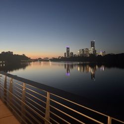
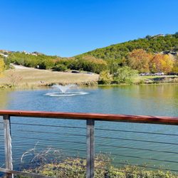
I've been to Mount Bonnell a couple of times but it's been a long while since I've been recently. It really hasn't changed much over the last 4 years; it tends to be pretty packed most evenings and especially on the weekends! There is parking along the road but be VERY mindful of locking your car and keeping valuables out of site because this is a common place where people's cars get broken into unfortunately. The walk up to the lookout is relatively short, I wouldn't call this a hike, it's more a big outdoor staircase to a pretty overlook where you can see the river and downtown Austin in the distance. It is lovely at sunset though! And you can walk a little bit further down from the lookout but as far as I know there isn't a main trail or a longer hike (but maybe there is one and I just don't know). Overall if you're visiting Austin or here for a short period of time, you definitely should make at least one trip out to Mt. bonnell! It isn't a place you really need to come visit several times tho unless you just like the view at the overlook.

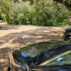
Highest point in Austin area. At the overlook you can see downtown Austin skyline, Colorado River and it's surrounding. You don't have to use the stairs to go up to the top, go to the other end of the parking lot and u can hike up to the top. It is a must see if u are in the area. Watch out for car break in tho.

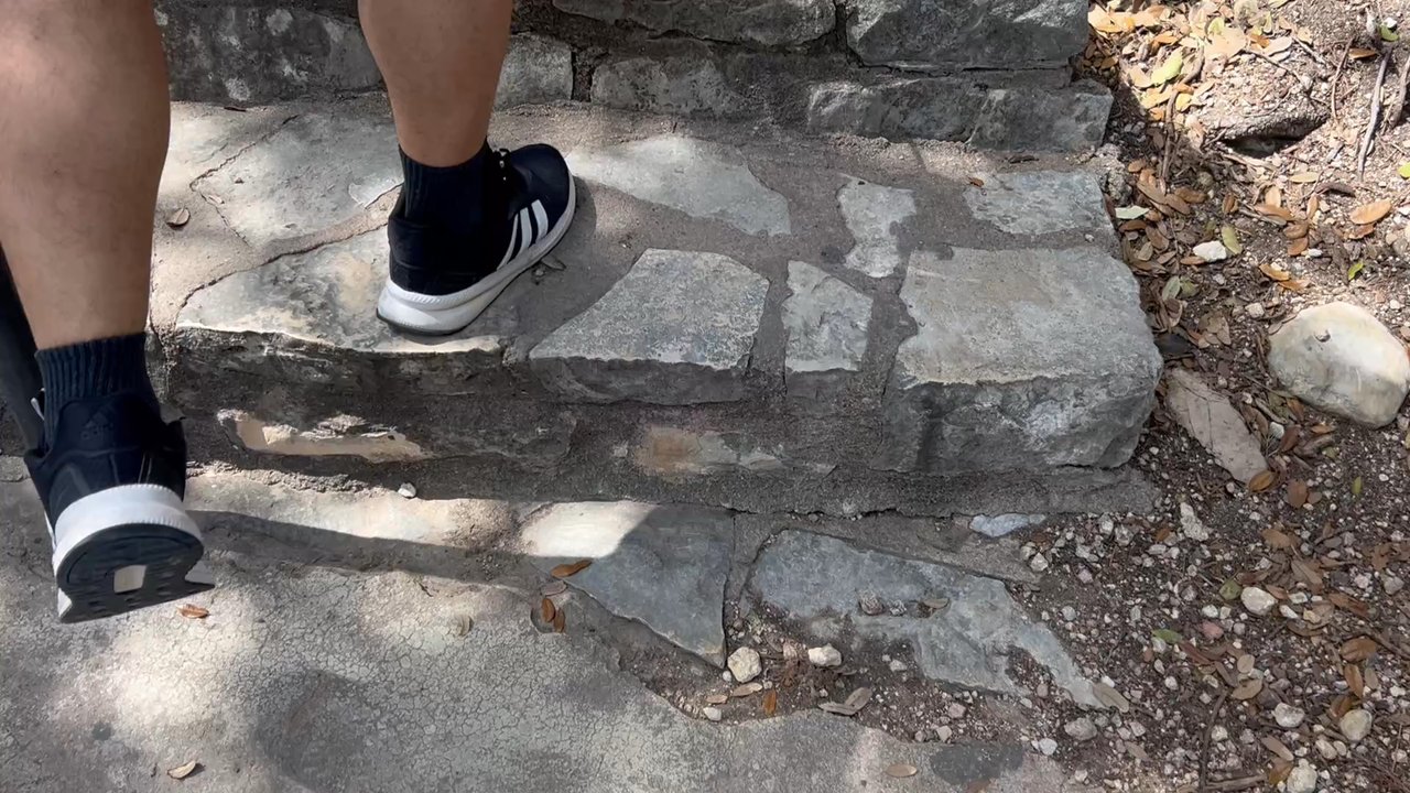
Anyone under the misunderstanding that Texas is flat,just needs to climb the Stairs of Mount Bonnell. While only 800 ft to the top,the stairs at almost a 45 degree angle can be moderately challenging if your over 40! If you're in the Austin area and want a break from the traffic, congestion and overbuilding,take a short trip to Mt Bonnell for a breather. Guaranteed to lower your blood pressure. Certainly a 5 Star View... Go!


Loved visiting Mount Bonnell on an overcast day! My GPS took me right to the bottom of the steps, where it was easy to park. I was a little nervous about parking, but it was easy! The flight of steps is steep, but not too bad. Once at the top you can look out and see the river and beautiful houses. This attraction is free and there were people having picnics up at the top. I would go back here. I was SO nervous that people let their kids just run wild up on top of the cliff. It is definitely not safe since you can just walk or stumble right off of the edge. I'd love to go back when the sun comes up. Pretty spot to take in the scenery!

Such a special spot in Austin! The views never cease to be breathtaking. Highly recommend coming at sunset. There are some spots to sit for a cute picnic. Be warned that at peak times there might be a lot of people and you may need to wait to take a photo. The initial climb up is definitely a bit tiring, approximately 50 stairs.


First time coming here!! There may be a short hiking path but we drove up to the parking spot where we just climbed up the stairs of 100 steps etc. from the top, the view was very nice and beautiful! You'll get to see either the scenery of the downtown Austin or the river! It's a nice location to look out the view and enjoy nature!! Come see it and have fun! Cheers

This spot should be on your Austin bucket list! It's an easy hike to get up to the overlook. Dogs are allowed here (on leash) too. The views of downtown and Lake Austin are stunning! Parking is relatively easy but there have reports of break-ins so lock up your valuables. Wear sunscreen and be ready to take some great photos.

So as you begin your trek up Mount Bonnell... you end it. Yup, the name is egregiously misleading. We will say the view is stunning and provides a great lookout point up and down the Colorado River. We understand it got its name because it's the highest point in Austin but if you come here expecting a hike then you're better off somewhere else. The parking can be tricky as it's immediately off the road and the steps up are a good workout for 40 seconds. For what it is though, it's a pretty lookout, just not really anything remarkable.
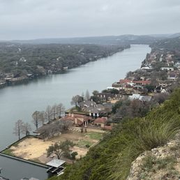

I brought my brother by on his visit from Kansas City. We hit this spot right after picking him up at the airport. It was a very hot day in May, so we appreciated the trails off the stairway with picnic tables to take a quick break and see the beautiful views of the Austin skyline. The views all the way around are wonderful. Especially the lake and beautiful homes along the lake.

8 years ago
This is a beautiful place to spend quality time. Can't beat the views on a sunny day and breath in the fresh air. Loved it and will definitely come back read more


10 years ago
It is beautiful place.the road to it along is mesmerizing.beautiful roadside.you have to do a little hike to see the view,wear comfy clothes,good sneakers, have your water and you are all ready. Beautiful view and surrounding area..though I felt envy to the house owners for having such beautiful houses beside lakeside.. read more


Mount Bonnell is about a fifteen minute, pleasant up-hill walk from my dad's, so I go there very often. In the warm months I take a cold drink, a friend, a book or my iPod, lay in the sun and just relax. When it's not quite as hot I like to walk around a bit more. Mt. B is very scenic, peaceful, and a great place to stop by, even if briefly, to chill out and see firsthand how beautiful and cool Austin is. read more

19 years ago
20 years ago
6 years ago
13 years ago
8 years ago
10 years ago
18 years ago
9 years ago
14 years ago
10 years ago
Been here a few times, and it never fails! Always the greatest at sunset! Took a few friends here this time around to enjoy the view, clear sky and breezy air. Had our desserts and fruits with us to enjoy the setting. It was our reward for the set of stairs we had to encounter. Parking is easy, many great spots to enjoy the view, dog friendly, people friendly, not many bugs either this year round. read more


17 years ago
19 years ago
10 years ago
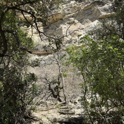
This was a pretty disappointing spot...unless we completely missed the good hiking trails, the one we were on lasted approximately 5 minutes and was a boring gravel trail. When you reach the top of Mount Bonnell the view is pretty nice and you get to see where all rich folk's homes which are pretty impressive. read more


9 years ago
I call this place the stairway to heaven. The stairs are pretty steep but nothing unbearable. The views of the water and hill country are beautiful. I will recommend this lookout spot to people visiting ATX. This is great for people who want the view, but don't want to do any actual hiking. read more

9 years ago
Just a quick drive and short hike and you've made it to the top of Mount Bonnell. We parked by the steps and walked up. Stunning views of Austin makes this place worth it for the photo ops. There's a trail that leads down to the right, not sure to where though. We walked halfway down to get a better view. read more


9 years ago


More info about Mount Bonnell
3800 Mt Bonnell Rd
Austin, TX 78731
Directions
(512) 974-6700
Call Now
Visit Website
https://www.mountbonnell.com
Hours
Indoor Amenities
Outdoor Amenities
Ask the Community - Mount Bonnell
How long does it take to get to the top?
In a few minutes really. It should be easy for most.
I have a very active 4 n 5 yr old and was wondering if it would be too dangerous for them? is their fencing of any sort of just straight cliff down? Or should i have a stroller?
A stroller won't work, long flight of steps If they climb up they will be tired. No safety fence.
Is this place stroller friendly?
Maybe a foldable small one but I wouldn't recommend as there're steep stairs. I carried my 2yr old daughter up to the top and was glad I didn't bring the stroller :)
Review Highlights - Mount Bonnell
You might also consider


Why does Yelp recommend reviews?
27 reviews that are not currently recommended
The reviews below are not factored into the business's overall star rating.
1 year ago
1 year ago
4 years ago
11 years ago
9 years ago
4 days ago
10 years ago
15 years ago
11 years ago
18 years ago
10 years ago
12 years ago
10 years ago
8 years ago
12 years ago
13 years ago
9 years ago
13 years ago
11 years ago
Mount Bonnell - hiking - Updated June 2026
Best of Austin
People found Mount Bonnell by searching for…
Trending Searches in Austin, TX
Baseball Fields near Mount Bonnell
Bike Trails near Mount Bonnell
Boat Rental near Mount Bonnell
Cliff Jumping near Mount Bonnell
Dog Friendly Things To Do near Mount Bonnell
Fishing Spots near Mount Bonnell
Flower Fields near Mount Bonnell
Flower Shop near Mount Bonnell
Free Water Parks near Mount Bonnell
Movie Theatre near Mount Bonnell
Natural Springs near Mount Bonnell
Nurseries & Gardening near Mount Bonnell
Outdoor Activities near Mount Bonnell
Outdoor Basketball Courts near Mount Bonnell
Parks With Pull Up Bars near Mount Bonnell
Pick Your Own Farms near Mount Bonnell
Picnic Areas near Mount Bonnell
Playgrounds near Mount Bonnell
Public Beaches near Mount Bonnell
Public Pools near Mount Bonnell
Rock Quarry near Mount Bonnell
Scenic Drive near Mount Bonnell
Secluded Spots near Mount Bonnell
Strawberry Picking near Mount Bonnell
Summer Camps near Mount Bonnell
Sunrise View near Mount Bonnell
Swimming Holes near Mount Bonnell
Swimming Lakes near Mount Bonnell
Swimming Pools near Mount Bonnell
Watch Sunset near Mount Bonnell
Browse Nearby
BEST of Austin, Texas Coffee near Mount Bonnell
BEST of Austin, Texas Restaurants near Mount Bonnell
BEST of Austin, Texas Things to Do near Mount Bonnell
BEST of Austin, Texas Walking Trails near Mount Bonnell
BEST of Austin, Texas Breakfast near Mount Bonnell
BEST of Austin, Texas Parks near Mount Bonnell
BEST of Austin, Texas Caves near Mount Bonnell
Browse Brands
Related Searches in Austin, TX
Affordable Kayak Rental Services in Austin, Texas
Best Fishing Locations and Guides in Austin, Texas
Best Nature Trails for Hiking in Austin, Texas
Best Off Leash Dog Parks in Austin, Texas
Best Parks for Parties and Events in Austin, Texas
Best Places for Horseback Riding in Austin, Texas
Best Water Parks for Kids in Austin, Texas
Best Waterfalls and Swimming Holes in Austin, Texas
Check Out Great Playgrounds in Austin, Texas
Check Out Off Road Trails in Austin, Texas
Discover Baseball Fields Around Austin, Texas
Discover Fun Toddler Parks in Austin, Texas for Your Little One
Discover Kid Friendly Hiking Trails in Austin, Texas
Discover Lakes & Ponds to Explore in Austin, Texas
Discover Popular Photo Spots in Austin, Texas
Discover Public Beaches to Visit in Austin, Texas
Discover Scenic Hiking Trails in Austin, Texas
Discover Scenic Mountain Bike Trails Near Austin, Texas
Discover Scenic Waterfall Spots in Austin, Texas
Discover Soccer Fields in Austin, Texas Near You
Discover Top Nature Parks to Visit in Austin, Texas
Discover Top Scenic Spots to Visit in Austin, Texas
Discover Top State Parks to Visit in Austin, Texas
Discover a Hiking Trail in Austin, Texas
Discover the Best Beaches in Austin, Texas
Discover the Best Kids Park Spots in Austin, Texas
Discover the Best Night Hike Trails in Austin, Texas
Dog-Friendly Hikes With Dogs in Austin, Texas
Enjoy Camping Adventures Around Austin, Texas
Enjoy Exciting Mountain Biking Adventures in Austin, Texas
Enjoy Kayaking Adventures in Austin, Texas
Enjoy Tent Camping Spots Around Austin, Texas
Enjoy a Beautiful Waterfall Hike in Austin, Texas
Enjoy the Best Picnic Spots and Ideas in Austin, Texas
Enjoy the Best Walking Path in Austin, Texas
Enjoy the Best Walking Trails in Austin, Texas
Exciting Cliff Jumping Spots in Austin, Texas
Explore Beautiful Parks and Green Spaces in Austin, Texas
Explore Easy Hikes Perfect for All in Austin, Texas
Explore Family-Friendly Zoos and Wildlife in Austin, Texas
Explore Free Picnic Areas Around Austin, Texas
Explore Fun Activities to Do in Austin, Texas
Explore Parks With Pull Up Bars in Austin, Texas
Explore Popular Campgrounds Near Austin, Texas
Explore Popular Picnic Areas Around Austin, Texas
Explore Popular RV Parks Around Austin, Texas
Explore Popular Recreation Centers Around Austin, Texas
Explore Popular Scenic Views Near Austin, Texas
Browse Articles
People who viewed Mount Bonnell also viewed
Covert Park At Mount Bonnell
50 reviews
The Boardwalk Trail at Lady Bird Lake
110 reviews
Sculpture Falls
37 reviews
Town Lake Metropolitan Parks
177 reviews
Hill Of Life Trail
24 reviews
Lou Neff Point
14 reviews
Town Lake, Barton Hills, 78704 (South Austin)
Barton Creek Greenbelt
38 reviews
78704 (South Austin)
River Place Nature Trail
252 reviews
Lady Bird Lake
124 reviews
East Austin
Ann & Roy Butler Hike & Bike Trail
27 reviews