Violet Crown Trail Photos


You might also consider


More like Violet Crown Trail
Recommended Reviews - Violet Crown Trail
Start your review...


Reviews With Photos


One of the best SouthWest Austin trails. It's an amazing place (Barton Creek Greenbelt) feels like your miles away from anything, yet you're within city limits. There is plenty of parking at a shopping center (Specs & Sams) near trail. The trailhead is less than 1/4 mile from the parking lot. It's a moderate level hike, plus dog friendly. Twin Falls and several other swimming holes are accessible from this trail. This is a safe trail, nevertheless I would recommend hiking with a friend.


This is very long trail with many entrances and trailheads. I entered at a trailhead just north of the Specs at 290 and Brodie Lane. It was a good mix of hills and flat trails, some through Barton Creek. The route was very shaded, which was welcome because of our current heat wave. I saw some women walking alone, but I personally would not do that as it seems very isolated. It's beautiful and in the city! Can't wait to explore more of this trail.


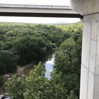
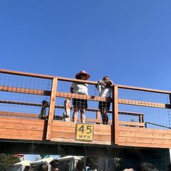
This new trail is amazing! I cant say enough good things about it! It makes getting to the greenbelt via bike so much easier and the view from the bridge the crosses the greenbelt is magnificent! I could rant and rant and rant about how awesome the existence of this trail is but I think everyone gets the point! Five solid stars for sure! Do yourself a favor get out and hike or bike this amazing trail near sunset!


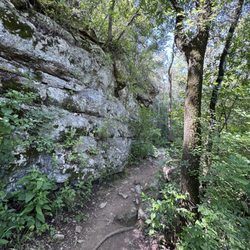
Beautiful new extension to the Barton Creek Greenbelt trail system. You can access it from the far end of the Spec's parking lot off 290 and Brodie. Just follow the crushed granite trail at the end of the Spec's parking lot that runs along the access road and you'll meet the trailhead shortly. This trail meets the main Greenbelt trail at about mile 4. The whole system is really a beautiful urban oasis filled with switchbacks, exposed tree roots and rock outcroppings, and (currently waterless) creek beds. There are no facilities or water on this trail. We loved it - kudos to the folks who made this enormous gift to our fair city possible!


Violet Crown Trail is basically a pathway that connects a bunch of greenbelts. It is protected lands to conserve water quality and provide more green space for people and animals alike. Once fully complete you will be able to go from the Barton Springs pool trailhead all the way up past sculpture falls. Park in the parking lot to the west of Spec's on Brodie (4970 W Hwy 290). After you park...walk through the parking lot toward the stop light and walk up the sidewalk on your left along the frontage road. You will see a crushed granite pathway running parallel to the service road. The main entrance is tucked a little way off the sidewalk through the trees. The first segment consists of rocky switchbacks that work their way down a steep hill. You will notice several paths that cross the main one. Be sure to stay on the trail and not wander into the creek bed...as that is not a trail. Dogs are supposed to be leashed and there are different segments of the trail that are pedestrian only and bikers are supposed to take an alternate route. Bring water!!


Pros: I wasn't initially impressed with this trail, but it greatly improves as you progress. I was very pleased after approximately one mile in. It's got a little bit of everything. Id rate it equal to most sections of the Greenbelt and better than some. Far superior to any of the McKinney Falls trails. Excellent amateur rock climbing and plenty of off-trail nooks to explore, I enjoyed the rock outcropping to the right of the first wooden bridge you'll cross. Cons: The road noise is overwhelming at times, it gradually tapers off and beings to be replaced by the pleasant trickling of running water. Then at approximately 2 miles in the trail passes underneath an overpass. Don't let this dissuade you, it's to be expected of any trail located in the Austin City Limits. SEE PIC BELOW FOR MAP TO THE TRAIL HEAD!

We're not experienced hikers, but this was a great trail for beginners! It's mostly flat and easy to follow, though very rocky in many sections, so good shoes are a must. The trail was beautiful, well maintained, and clearly marked once you're on it. One thing to note: mileage between points isn't posted at the entrance. Distance markers only appear after you start hiking, which made it a little hard to plan upfront. We ended up hiking about 5 miles round trip and didn't even cover the full trail. We brought lunch but underestimated how far we'd go and left it in the car. Definitely a lesson learned! There were several scenic spots along the way that would have been perfect for a lunch break. Overall, a solid option for beginners who want a scenic hike without intense elevation, as long as you're prepared for rocky terrain and bring what you need with you. I highly recommend to go early! We arrived around 10:30am on a Saturday and parking was filling up fast. Once we got back to the car around 1pm, there was a long line waiting for parking. Another notable mention is the restrooms! It could have been due to the time of day we arrived, but it was one of the cleanest and well maintained for a public facility. read more


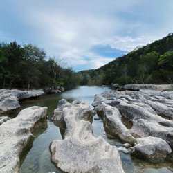
Hiked a little over a mile and a half down the violet Creek Trail at the spyglass Trail entrance during my lunch break. It was very nice. Not too hot or humid today in Austin. The trail is covered with different types of trees and a rock canyon that goes up quite a way as you go further down the trail. The trail is well marked and has mile markers along the way. There are even houses at the top of the canyon. They are pretty cool to look at as you make your way down the trail. The trail does have quite a few hikers, including families and mountain bikers riding down the trail. I plan on coming back soon on my bike and ride quite a ways further than I hiked today to see where the trail goes. I would definitely recommend this is a really cool trail in Austin to get out to nature and enjoy the day. read more


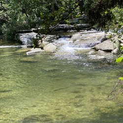
We are loving how long this trail is in both directions! For the longest time, my husband and I would park off of 290 in the business parking lot, go down the entrance trail, and up the right side for a few miles. We had been doing this route for years. It wasn't until earlier this year that we decided to go to the left. We have now done it three times and found something different each time. There is so much to offer! Some parts of the trail are flat and can be muddy after the rain, there are quite a bit of rocky areas so make sure that you have proper shoes (our friend has a bad knee and had a very hard time), there are exposed rock walls that are great for climbing, and also lots of streams for dipping in the summer. A couple times ago, we even ran into people doing a slackline from Mopac! There is always something to do and see on this trail. read more


One of the best SouthWest Austin trails. It's an amazing place (Barton Creek Greenbelt) feels like your miles away from anything, yet you're within city limits. There is plenty of parking at a shopping center (Specs & Sams) near trail. The trailhead is less than 1/4 mile from the parking lot. It's a moderate level hike, plus dog friendly. Twin Falls and several other swimming holes are accessible from this trail. This is a safe trail, nevertheless I would recommend hiking with a friend. read more


6 years ago

This is very long trail with many entrances and trailheads. I entered at a trailhead just north of the Specs at 290 and Brodie Lane. It was a good mix of hills and flat trails, some through Barton Creek. The route was very shaded, which was welcome because of our current heat wave. I saw some women walking alone, but I personally would not do that as it seems very isolated. It's beautiful and in the city! Can't wait to explore more of this trail. read more


This new trail is amazing! I cant say enough good things about it! It makes getting to the greenbelt via bike so much easier and the view from the bridge the crosses the greenbelt is magnificent! I could rant and rant and rant about how awesome the existence of this trail is but I think everyone gets the point! Five solid stars for sure! Do yourself a favor get out and hike or bike this amazing trail near sunset! read more



6 years ago

8 years ago

4 years ago
Meditative Rock stacking. Came out for a hike on Sunday afternoon. Very shady and cool. Just make sure and bring insect repellent. read more


Beautiful new extension to the Barton Creek Greenbelt trail system. You can access it from the far end of the Spec's parking lot off 290 and Brodie. Just follow the crushed granite trail at the end of the Spec's parking lot that runs along the access road and you'll meet the trailhead shortly. This trail meets the main Greenbelt trail at about mile 4. The whole system is really a beautiful urban oasis filled with switchbacks, exposed tree roots and rock outcroppings, and (currently waterless) creek beds. There are no facilities or water on this trail. We loved it - kudos to the folks who made this enormous gift to our fair city possible! read more




4 years ago
Good walking trail, but definitely not meant for strollers!!! I don't think the address listed here (on Bee Cave Rd) is correct. Listen to the other comments about getting onto the trail from the Spec's on Brodie. read more


Violet Crown Trail is basically a pathway that connects a bunch of greenbelts. It is protected lands to conserve water quality and provide more green space for people and animals alike. Once fully complete you will be able to go from the Barton Springs pool trailhead all the way up past sculpture falls. Park in the parking lot to the west of Spec's on Brodie (4970 W Hwy 290). After you park...walk through the parking lot toward the stop light and walk up the sidewalk on your left along the frontage road. You will see a crushed granite pathway running parallel to the service road. The main entrance is tucked a little way off the sidewalk through the trees. The first segment consists of rocky switchbacks that work their way down a steep hill. You will notice several paths that cross the main one. Be sure to stay on the trail and not wander into the creek bed...as that is not a trail. Dogs are supposed to be leashed and there are different segments of the trail that are pedestrian only and bikers are supposed to take an alternate route. Bring water!! read more


10 years ago
Pros: I wasn't initially impressed with this trail, but it greatly improves as you progress. I was very pleased after approximately one mile in. It's got a little bit of everything. Id rate it equal to most sections of the Greenbelt and better than some. Far superior to any of the McKinney Falls trails. Excellent amateur rock climbing and plenty of off-trail nooks to explore, I enjoyed the rock outcropping to the right of the first wooden bridge you'll cross. Cons: The road noise is overwhelming at times, it gradually tapers off and beings to be replaced by the pleasant trickling of running water. Then at approximately 2 miles in the trail passes underneath an overpass. Don't let this dissuade you, it's to be expected of any trail located in the Austin City Limits. SEE PIC BELOW FOR MAP TO THE TRAIL HEAD! read more


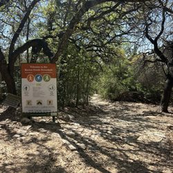
I love this new trail because it adds a bit of incline to the Greenbelt!! It also provides another access point (park at Spec's @Brodie and walk east down the path). The entrance is nice and has different information boards on the animals you might see and a pretty good map. If you start here you will be heading downhill for a bit and then you will hit the normal path and can go either north or south. It's A good option if you want a little hike to/from Twin Falls or you just want to add in a little uphill to your normal Greenbelt path! read more
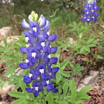


10 years ago

10 years ago

10 years ago

10 years ago
11 years ago
More info about Violet Crown Trail

Ask the Community - Violet Crown Trail
Review Highlights - Violet Crown Trail
You might also consider


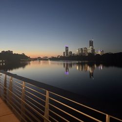


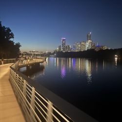
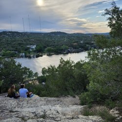















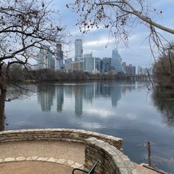


Violet Crown Trail - hiking - Updated August 2026
Best of Austin
People found Violet Crown Trail by searching for…
Trending Searches in Austin, TX
Antiques near Violet Crown Trail
Barbershop For Men near Violet Crown Trail
Bike Shop near Violet Crown Trail
Bird Sanctuary near Violet Crown Trail
Cliff Jumping near Violet Crown Trail
Consignment Shops near Violet Crown Trail
Cruising Spots near Violet Crown Trail
Dog Friendly Things To Do near Violet Crown Trail
Ear Piercing near Violet Crown Trail
Eyebrow Threading near Violet Crown Trail
Flower Fields near Violet Crown Trail
Hair Braiding near Violet Crown Trail
Kids Haircut near Violet Crown Trail
Mini Golf near Violet Crown Trail
Pedicure near Violet Crown Trail
Permanent Makeup near Violet Crown Trail
Picnic Areas near Violet Crown Trail
Public Golf Courses near Violet Crown Trail
Public Pools near Violet Crown Trail
Rock Quarry near Violet Crown Trail
Scenic Night View near Violet Crown Trail
Scenic Overlook near Violet Crown Trail
Sunrise View near Violet Crown Trail
Swimming Holes near Violet Crown Trail
Trading Card Shops near Violet Crown Trail
Used Furniture Stores near Violet Crown Trail
Browse Articles
Browse Nearby
Browse Brands
Related Searches in Austin, TX
Affordable Kayak Rental Services in Austin, Texas
Best Dog Hiking Trails Around Austin, Texas
Best Fishing Locations and Guides in Austin, Texas
Best Nature Trails for Hiking in Austin, Texas
Best Places for Horseback Riding in Austin, Texas
Best Sightseeing Experiences Available in Austin, Texas
Best Waterfalls and Swimming Holes in Austin, Texas
Check Out Off Road Trails in Austin, Texas
Discover Dog Friendly Trails to Explore in Austin, Texas
Discover Kid Friendly Hiking Trails in Austin, Texas
Discover Popular Bike Trails in Austin, Texas
Discover Walking Parks in Austin, Texas Near You
Discover a Hiking Trail in Austin, Texas
Discover the Best Night Hike Trails in Austin, Texas
Dog-Friendly Hikes With Dogs in Austin, Texas
Enjoy Camping Adventures Around Austin, Texas
Enjoy Kayaking Adventures in Austin, Texas
Enjoy Off Leash Dog Hikes in Austin, Texas
Enjoy Scenic Places to Walk in Austin, Texas
Enjoy Tent Camping Spots Around Austin, Texas
Enjoy a Beautiful Waterfall Hike in Austin, Texas
Enjoy the Best Walking Path in Austin, Texas
Enjoy the Best Walking Trails in Austin, Texas
Explore Beautiful Parks and Green Spaces in Austin, Texas
Explore Easy Hikes Perfect for All in Austin, Texas
Explore Fun Activities to Do in Austin, Texas
Explore Popular Campgrounds Near Austin, Texas
Explore Popular Dog Walking Trails in Austin, Texas
Explore Top Dog Parks in Austin, Texas Near You
Explore the Best Beach Spots in Austin, Texas
Explore the Best Swimming Holes Around Austin, Texas
Family Friendly Hiking With Kids in Austin, Texas
Find Beautiful Views in Austin, Texas
Find Popular Ziplining Spots Around Austin, Texas
Find Top-Rated Waterfalls in Austin, Texas Now
Find the Best Parks for Picnics in Austin, Texas
Hiking Trails With Waterfalls in Austin, Texas
Off Leash Dog Hiking Trails in Austin, Texas
Popular Outdoor Activities to Try in Austin, Texas
Popular Picnic Spots to Visit in Austin, Texas
Safe River Swimming Areas in Austin, Texas
Safe and Fun Parks for Kids in Austin, Texas
Top Hiking Trails to Explore in Austin, Texas
Top Running Trails to Explore in Austin, Texas
Top Swimming Lakes to Enjoy in Austin, Texas
Top Swimming Spots and Pools in Austin, Texas
Top-Rated Camping Sites in Austin, Texas


