Mount Diablo's Grand Loop Photos


You might also consider


More like Mount Diablo's Grand Loop
Recommended Reviews - Mount Diablo's Grand Loop
Start your review...


Reviews With Photos
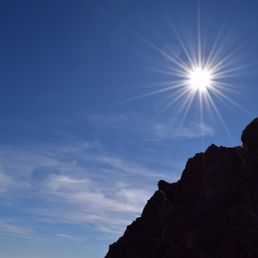

This was one of my first hikes. I absolutely loved it. Each time I hike here is like a different journey. The other hikers are always so friendly, and always willing to help or give tips. I go here once or twice a year, definitely worth it.


7 years ago
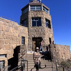
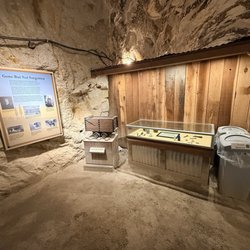
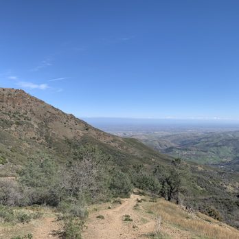
My favorite hike in the Bay Area (so far)! The grand loop consists of the Juniper Trail, Summit Trail, North Peak Trail, Bald Ridge Trail, Meridian Ridge, and finally Deer Flat Road. 6.8 miles with a total elevation change of 1,800 feet sounds like a lot, and it is (especially if you're used to flat trails). Definitely bring water and snacks for energy. Driving to Mt. Diablo is easy enough. Entering via South Gate, there is a $10 vehicle entrance fee. Going up the mountain itself can take up to 30 min, with avoiding bikers going both up and down the roads. I managed to find one of the last spots at the massive turnaround at Juniper Campground at 11am. I definitely recommend coming early just to find a spot. There's also bathrooms at the campground. Since the "trail" is a loop you can either start on the Juniper Trail and go clockwise or start on Deer Flat Road and go the opposite way. We chose to go clockwise and ascend ~700 ft up to the peak. There's a cool info center at the top detailing the mountain's history and wildlife of the area. The rest of the hike was descending 1,800 feet down and re-ascending 1,000 feet to make it back to our car. Honestly, I don't know if one direction would be easier than the other, but if you want pics at the top you might want to start at Juniper Trail first so you're not too sweaty at the top. The weather was nice for the first half of the hike, no clouds and barely any wind. But the second half was around the other side of the mountain so winds picked up. Definitely bring layers! read more




7 years ago
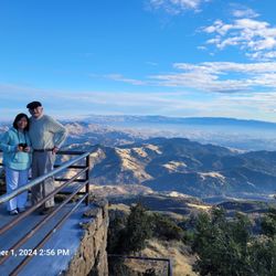
I haven't been to Mt. Diablo since I was a kid, so it was a blast from the past coming back! You can drive all the way to the summit, so my friend and I decided to hike the "grand loop," which covers ~7 miles and goes around the whole mountain. We were fortunate enough to have a very clear day, and you can see for miles and miles all the way around the mountain. Views were amazing. It was an eighteen hundred foot elevation gain, so no joke, but only about 400-500 per mile for the 3.5 miles that went uphill. Definitely was steep at points but very doable, even for those who aren't in the best hiking shape. Not sure I agree with my dad, who claims the views from the summit are some of the best in the world, but it was definitely well worth a visit, and I really enjoyed getting the 360 degree view throughout the course of the hike! A few tips: set your GPS for the juniper campground to get you to the nearest parking lot. I recommend going clockwise so you can end on a high with the summit (and a downhill!). The trail is hot always the best marked, so I recommend downloading a free app such as AllTrails to make sure you don't lose your way! read more

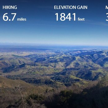


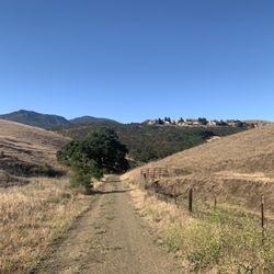
What to do when it's 70 degrees in February? Hike Mt Diablo's Grand Loop! We came here on a gorgeous day to try this moderate, 6.2 mile hike around of the summit of Mt Diablo. With clear skies and warm weather, we were in for spectacular views of the Bay Area. It's about a 30-40 minute drive from the 680 to the Diablo Valley Overlook/Juniper Campground where this hike begins. The views to start are pretty impressive and set the tone for the rest of the hike with large expanses of rolling green hills, meandering trails, and even copper mines in the distance. From Juniper Campground, we took Deer Flat Road to Meridian Ridge to Bald Ridge Trail to North Peak Trail around the other side of the mountain. Near the end, there's a hike up Summit Trail to the very top of the mountain and Juniper trail takes you back to the beginning. It's a wonderful loop with a little more uphill than downhill, but the scenery makes up for the hills so you convince yourself to keep going. Lots of pine cones dot the trails and there's a good mix of fire road and narrow trails. Bald Ridge Trail is a narrow path that takes you up to a beautiful vista point and North Peak Trail offers the most panoramic views. I kept looking around and saying "Wow!" the whole time. Can't wait to come back for the wild flowers in the spring. read more


9 years ago
This was one of my first hikes. I absolutely loved it. Each time I hike here is like a different journey. The other hikers are always so friendly, and always willing to help or give tips. I go here once or twice a year, definitely worth it. read more

7 years ago
This was a hard trail, even though, it was said to be a moderate hike. The hills were very steep and non ending. I am in pretty good shape but this was tough! It was a beautiful view but definitely would say take breaks when you can because towards the end it gets tough. read more


9 years ago
More info about Mount Diablo's Grand Loop
Summit Rd
Clayton, CA 94517
Directions
Hours
Outdoor Amenities