Iron Horse Trail Photos



You might also consider


More like Iron Horse Trail
Recommended Reviews - Iron Horse Trail
Start your review...


Reviews With Photos


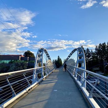
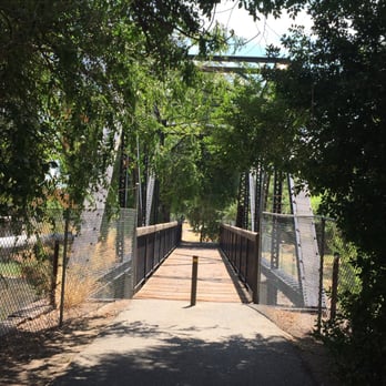
An excellent everyday trail! From Concord down to Alamo, you might just catch me running long distance or walking my dog. Some scenic parts, some trashy parts, regardless it sure serves it's purpose in our everyday active lives. I'm also lucky enough that I can cut over and cruise the Contra Costa Canal Trail to get to Heather Farms. From where I run, there's a few fancy bridges to cross as well, like the Robert I Schroder Bridge. This trail makes many connections to a several parks. I know bike riders just love cruising down it. People love strolling their kids along, or even run with their strollers. There are plenty of trees along the trail, and some streaks with no trees. Overall this isn't the greatest trail in the bay, as it does get broken up by major streets, but serviceable for long stretches. Hikers hike it, but again, I wouldn't call it the most challenging either. I dig it, I run it, I love it!


Normally I go running at Runyon Canyon in the Hollywood hills, but since I'm visiting family here in Northern California I decided to go for a run and this place was ok


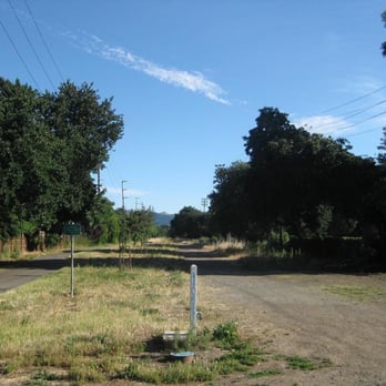
Took in the Iron horse Trail round-trip from the Pleasant Hill BART to the end of the line just south of the Dublin BART. That's a 42.6-mile round trip. It's flat and has some very nice scenery. The trail is flat and, heading south, there are really nice tailwinds to make the trip quicker than uncontrolled trip down a slip-and-slide. It's not perfect, though. Heading north, the headwinds are vicious -- the worst headwinds I've ever ridden against. I was giving it everything I had through Dublin and San Ramon and could not crack 8 MPH. My normal, easy speed is 13.5 MPH. I track these things. I'm a nerd. There is almost no tree cover except in Danville. I got the worst sunburn I've ever had on my arms and legs on my trip. Literally, my arms blistered. BLISTERED! Like bubble wrap, only nasty instead of fun. Wear STRONG sunblock. I use SPF 65 (I didn't use it when I rode the trail...) and I strongly suggest using at least SPF 45 and reapplying it a few times. There's no water south of Danville or north of Alamo. The water available is warm and tastes heavily of metal, but it's free and there and on a hot day will be welcome. I went through eight liter bottles of water on my trip (seven on the trip back) and the drinking fountain water was very nice to have. The Walnut Creek section of the trail is the hardest to ride. It goes through Downtown, which is nice, but the trail is poorly maintained and rough (by paved trail standards.) For me, growing up on gravel trails made this a fairly easy ride and the large bumps were fun, like mini roller coasters without the burden of harnesses. The trail has a lot of great qualities, though, especially through Danville. The Danville section passes through downtown and on the Saturday I went there was a farmer's market going on next to the trail. There are also a lot of great restaurants near the trail. For me, an ideal Saturday morning could be riding to Danville, trying a new restaurant, and riding home. The same can be said of the Walnut Creek segment which passes many more dining opportunities than the Danville length. However, Danville has a more scenic segment of trail. The San Ramon length is all business. It goes through some business park and then a golf course. It's not scenic, but it has signs that show you where you are. Nice touch, San Ramon. I dig it. My big advice on this trail is that just because it's a trail does not mean it's a cakewalk bike ride. Take it seriously on hot or sunny days because this is not a forgiving trail despite being flat and straight.


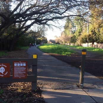
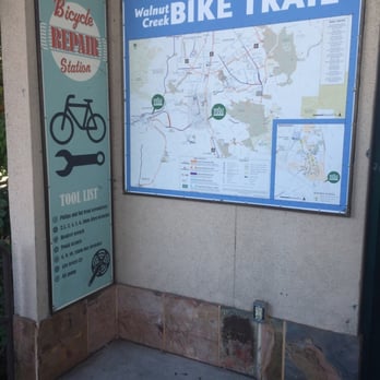
Love this walking, running, biking trail! It's pretty flat so not too strenuous. There are mile markers to help track how far you've gone. Trail maps are available at the entrance by the pleasant hill Bart stop. Early morning runs are my favorite! There's always other people on the trail, but it's never too crowded. It connects to several other parks, which are nice to picnic in (like walden park). Always super green and pretty in the spring, especially since we got rain!


The Iron Trail through Walnut Creek can be noisy due to traffic closer to the downtown. The trail itself gets much more pleasant closer to Alamo off Rudgear. Parking around the trail can also be difficult but as noted park closer to the Alamo side of the trail and it makes a much more pleasant walk.
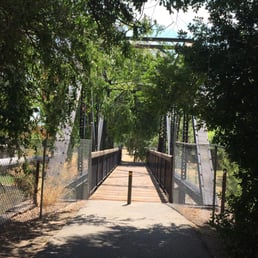

This trail is pretty long and one day I'll travel the full length. Whether you're a walker, runner, or cyclist, there is a stretch on the trail for you. Some areas get real intense sun beating down on you, but if you're on the trail to train, let it burn those calories right off you. So far I haven't come across really tough slopes, overall pretty flat with slight inclines spread sporadically. Since most of this trail runs through city limits, you'll get a mix of people on the pavement. You're never really alone unless you're on at an odd hour. I have yet to run this trail at night, so for the brave few of you, let me know what parts are well lit.


3 years ago
First let me say that this trail is far from uniform from one part to another. The northern portion near Concord COULD be scenic if all the encampments and trash was cleared out. This portion, miles 0-4, was recently repaved However there are no restrooms along this section. Miles 4-8 can be very congested with people walking dogs and pushing strollers. Even sections with "pedestrian only access" are largely unused and the multi purpose trail has most of the traffic. Miles 8-14 are not very scenic. Mostly backyards. Lots of cross streets making cycling less enjoyable. Miles 14-20 are more backyards and several more cross streets. There are a few narrow bridges over small creeks. Miles 20-24 are fairly industrial. The trail is much cleaner and better patrolled from Walnut Creek south. North is a totally different story. One park employee told me he thought I was brave to ride on that section of the trail. Not a place for families for sure. read more


I absolutely adore the Iron Horse Trail. Been walking and running this trail for many years now, and it's still just as beautiful as the first time that I stepped upon it. The entire trail measures roughly 32 miles one way and stretches from Concord all the way to Pleasanton. I've only been on the Concord/Pleasant Hill/Walnut Creek side, but my dream has always been to traverse the entire trail in increments over time. The trail is a flat paved path that will take you through a plethora of parks, connecting trails, under freeway overpasses, and through a few tunnels. There is always greenery on the trail, no matter what season it is. It's not particularly challenging and there aren't any inclines, but it's perfect for a casual stroll or a long distance run. At any given time, you'll witness people walking their dogs and pushing strollers. Many people train for marathons and long distance running here. It's a wonderful family friendly and community driven trail that feels very safe. What I enjoy most about traversing this trail are the stunning views that I'm graced with every single time that I'm here. This trail has truly exposed me to the beauty of Contra Cost County. So many gorgeous wild flowers and lush vegetation. An ample amount of rampant wildlife. The most beautiful and peaceful community parks. Entrancing Views of the nearby communities. You will get to experience all of this along the Iron Horse Trail. People are so friendly on this trail. You tell get a sense of community here. There are also many bikers that use this trail too. There are several rest benches and doggie pooh pickup stations. You always see a trash can nearby to encourage cleanliness. There are mile markers on the main trail, and a second path that also runs parallel to the main path for most of the duration. It's a great place to clear your mind and to breathe in the fresh local air. Walking down this trail has gotten me through some tough times in the past, and it's filled with so many memories. So grateful to have this local gem practically in my backyard. read more

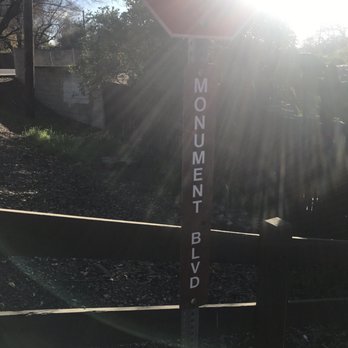


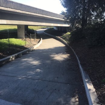


On CNN, I was reading the story of a young father who walked eleven miles every day for seven months to get to his UPS job until a kindly coworker took up a collection to surprise him with a car. That story made me realize he found a higher purpose and motivation to walk great distances. Me? I'm just trying to break 10,000 steps on my FitBit so I'm not mistaken for a sloth. That's why I found an excuse with the Iron Horse Trail, a suburban walkway stretching across two counties for forty miles between Pleasanton and Concord. I haven't had the temerity or frankly the interest to walk the entire trail. However, I have frequently taken advantage of the two-mile stretch between the Pleasant Hill BART station and Ygnacio Valley Road where I pick up the BART train at Walnut Creek to go home. Except for the slightly elevated footbridge over Treat Blvd., it's pretty flat and paved even if some stretches could use some pot hole repair. The foliage and flowers make for pleasant diversions along the way, the aggressive joggers and cyclists not so much, especially if they come up behind you without warning. Regardless, it gives me a bucolic setting that allows me time to meditate after a schedule-challenged day. read more


An excellent everyday trail! From Concord down to Alamo, you might just catch me running long distance or walking my dog. Some scenic parts, some trashy parts, regardless it sure serves it's purpose in our everyday active lives. I'm also lucky enough that I can cut over and cruise the Contra Costa Canal Trail to get to Heather Farms. From where I run, there's a few fancy bridges to cross as well, like the Robert I Schroder Bridge. This trail makes many connections to a several parks. I know bike riders just love cruising down it. People love strolling their kids along, or even run with their strollers. There are plenty of trees along the trail, and some streaks with no trees. Overall this isn't the greatest trail in the bay, as it does get broken up by major streets, but serviceable for long stretches. Hikers hike it, but again, I wouldn't call it the most challenging either. I dig it, I run it, I love it! read more


5 years ago
Normally I go running at Runyon Canyon in the Hollywood hills, but since I'm visiting family here in Northern California I decided to go for a run and this place was ok read more


14 years ago


16 years ago
Took in the Iron horse Trail round-trip from the Pleasant Hill BART to the end of the line just south of the Dublin BART. That's a 42.6-mile round trip. It's flat and has some very nice scenery. The trail is flat and, heading south, there are really nice tailwinds to make the trip quicker than uncontrolled trip down a slip-and-slide. It's not perfect, though. Heading north, the headwinds are vicious -- the worst headwinds I've ever ridden against. I was giving it everything I had through Dublin and San Ramon and could not crack 8 MPH. My normal, easy speed is 13.5 MPH. I track these things. I'm a nerd. There is almost no tree cover except in Danville. I got the worst sunburn I've ever had on my arms and legs on my trip. Literally, my arms blistered. BLISTERED! Like bubble wrap, only nasty instead of fun. Wear STRONG sunblock. I use SPF 65 (I didn't use it when I rode the trail...) and I strongly suggest using at least SPF 45 and reapplying it a few times. There's no water south of Danville or north of Alamo. The water available is warm and tastes heavily of metal, but it's free and there and on a hot day will be welcome. I went through eight liter bottles of water on my trip (seven on the trip back) and the drinking fountain water was very nice to have. The Walnut Creek section of the trail is the hardest to ride. It goes through Downtown, which is nice, but the trail is poorly maintained and rough (by paved trail standards.) For me, growing up on gravel trails made this a fairly easy ride and the large bumps were fun, like mini roller coasters without the burden of harnesses. The trail has a lot of great qualities, though, especially through Danville. The Danville section passes through downtown and on the Saturday I went there was a farmer's market going on next to the trail. There are also a lot of great restaurants near the trail. For me, an ideal Saturday morning could be riding to Danville, trying a new restaurant, and riding home. The same can be said of the Walnut Creek segment which passes many more dining opportunities than the Danville length. However, Danville has a more scenic segment of trail. The San Ramon length is all business. It goes through some business park and then a golf course. It's not scenic, but it has signs that show you where you are. Nice touch, San Ramon. I dig it. My big advice on this trail is that just because it's a trail does not mean it's a cakewalk bike ride. Take it seriously on hot or sunny days because this is not a forgiving trail despite being flat and straight. read more



7 years ago


11 years ago
Love this walking, running, biking trail! It's pretty flat so not too strenuous. There are mile markers to help track how far you've gone. Trail maps are available at the entrance by the pleasant hill Bart stop. Early morning runs are my favorite! There's always other people on the trail, but it's never too crowded. It connects to several other parks, which are nice to picnic in (like walden park). Always super green and pretty in the spring, especially since we got rain! read more



8 years ago
The Iron Trail through Walnut Creek can be noisy due to traffic closer to the downtown. The trail itself gets much more pleasant closer to Alamo off Rudgear. Parking around the trail can also be difficult but as noted park closer to the Alamo side of the trail and it makes a much more pleasant walk. read more


11 years ago
This trail is pretty long and one day I'll travel the full length. Whether you're a walker, runner, or cyclist, there is a stretch on the trail for you. Some areas get real intense sun beating down on you, but if you're on the trail to train, let it burn those calories right off you. So far I haven't come across really tough slopes, overall pretty flat with slight inclines spread sporadically. Since most of this trail runs through city limits, you'll get a mix of people on the pavement. You're never really alone unless you're on at an odd hour. I have yet to run this trail at night, so for the brave few of you, let me know what parts are well lit. read more


9 years ago
I've ran, biked and walked this trail. I used to bike from San Ramon to Walnut Creek and back for a good cardio work out and always ended up sore! The good sore of course... For anyone in the East Bay Area, this is a staple and go to spot to meet your outdoor exercise needs. The trail is always full of quite the selection of people. Anywhere from stay at home moms taking their kids out on a stroll, to avid bikers whose quads and calves make you question your life...and everyone in between. The trail is heavily populated after standard working hours but during the day time on week days, it's pretty empty and ideal for anyone who doesn't want to ring their bell to get people out of the way or just prefer solitude during a run or walk. There's a lot of houses lined among the trail and a few cool places to check out for a post work out meal such as high tech burrito in Danville or Pete's or anywhere in the downtown WC area as the trail dumps you near Macy's there. There's tons of cross streets in shopping areas for anyone on the trail to check out and take a break at. Super convenient! The trail is always clean and safe overall. My biggest tip is to work out before evening hours because the pathway isn't very well lit after sunset. Love the iron horse trail! read more


17 years ago

7 years ago


My husband and I love to walk here on the trail during sunset. There is greenery all along the trail which also runs right along the downtown. There are so many entries/exits into the trail from downtown, one of them right outside our apartment. There are boards all along describing the local habitat. There is an entrance close to the walnut creek library and civic park. There is also creek view near N Broadway. A lovely trail for regular bikers and joggers. read more


11 years ago

11 years ago
Just a quick note and I'll finish this review later at home. One of the best cycling, running or walking trails in the bay area. read more


14 years ago

9 years ago
6 years ago

10 years ago
19 years ago


18 years ago

17 years ago
Page 1 of 2
More info about Iron Horse Trail
Walnut Creek, CA 94597
Directions
Hours
Outdoor Amenities
Ask the Community - Iron Horse Trail
Review Highlights - Iron Horse Trail
You might also consider































Why does Yelp recommend reviews?
5 reviews that are not currently recommended
The reviews below are not factored into the business's overall star rating.

13 years ago

4 years ago

6 years ago

13 years ago

Iron Horse Trail - hiking - Updated August 2026
Best of Walnut Creek
People found Iron Horse Trail by searching for…
Walking Trails in Walnut Creek, CA
Hiking Trails in Walnut Creek, CA
Running Trails in Walnut Creek, CA
Photo Spots in Walnut Creek, CA
Abandoned Places in Walnut Creek, CA
Fall Foliage in Walnut Creek, CA
Fun Things to Do at Night in Walnut Creek, CA
Scenic View in Walnut Creek, CA
Walking Groups in Walnut Creek, CA
Bike Repair/Maintenance in Walnut Creek, CA
Easy Hikes in Walnut Creek, CA
Night Hike in Walnut Creek, CA
Off Leash Dog Hiking Trails in Walnut Creek, CA
Scenic Places to Walk in Walnut Creek, CA
Electric Bikes in Walnut Creek, CA
Used Bikes in Walnut Creek, CA
Sunrise Hike in Walnut Creek, CA
Sand Dunes in Walnut Creek, CA
Trending Searches in Walnut Creek, CA
Antiques near Iron Horse Trail
Barbershop For Men near Iron Horse Trail
Beautiful Views near Iron Horse Trail
Bike Shop near Iron Horse Trail
Bird Sanctuary near Iron Horse Trail
Cliff Jumping near Iron Horse Trail
Consignment Shops near Iron Horse Trail
Cruising Spots near Iron Horse Trail
Dog Friendly Things To Do near Iron Horse Trail
Dog Friendly Trails near Iron Horse Trail
Ear Piercing near Iron Horse Trail
Eyebrow Threading near Iron Horse Trail
Flower Fields near Iron Horse Trail
Free Picnic Areas near Iron Horse Trail
Kids Haircut near Iron Horse Trail
Lookout Points near Iron Horse Trail
Mini Golf near Iron Horse Trail
Nature Trails near Iron Horse Trail
Night Hike near Iron Horse Trail
Off Road Trails near Iron Horse Trail
Outdoor Activities near Iron Horse Trail
Pedicure near Iron Horse Trail
Permanent Makeup near Iron Horse Trail
Picnic Areas near Iron Horse Trail
Picnic Spots near Iron Horse Trail
Preschools near Iron Horse Trail
Public Golf Courses near Iron Horse Trail
Public Pools near Iron Horse Trail
River Swimming near Iron Horse Trail
Rock Quarry near Iron Horse Trail
Scenic Night View near Iron Horse Trail
Scenic Overlook near Iron Horse Trail
Sunrise View near Iron Horse Trail
Swimming Holes near Iron Horse Trail
Trading Card Shops near Iron Horse Trail
Used Furniture Stores near Iron Horse Trail
Watch Sunset near Iron Horse Trail
Browse Nearby
BEST of Walnut Creek, California Coffee near Iron Horse Trail
BEST of Walnut Creek, California Restaurants near Iron Horse Trail
BEST of Walnut Creek, California Things to Do near Iron Horse Trail
BEST of Walnut Creek, California Breakfast near Iron Horse Trail
BEST of Walnut Creek, California Walking Trails near Iron Horse Trail
BEST of Walnut Creek, California Parks near Iron Horse Trail
BEST of Walnut Creek, California Caves near Iron Horse Trail
BEST of Walnut Creek, California Campgrounds near Iron Horse Trail
BEST of Walnut Creek, California Sightseeing near Iron Horse Trail
Browse Brands
Related Searches in Walnut Creek, CA
Affordable Bike Repair Services in Walnut Creek, California
Affordable Bike Tune Up Services in Walnut Creek, California
Affordable Cheap Bike Tune Up Services in Walnut Creek, California
Affordable Kayak Rental Services in Walnut Creek, California
Best Dirt Bike Riding Spots in Walnut Creek, California
Best Dog Hiking Trails Around Walnut Creek, California
Best Electric Bike Rental Services in Walnut Creek, California
Best Fishing Locations and Guides in Walnut Creek, California
Best Nature Trails for Hiking in Walnut Creek, California
Best Places for Horseback Riding in Walnut Creek, California
Best Sightseeing Experiences Available in Walnut Creek, California
Check Out Off Road Trails in Walnut Creek, California
Convenient Bike Sharing Programs in Walnut Creek, California
Discover Dog Friendly Trails to Explore in Walnut Creek, California
Discover Easy Hiking Trails Near Walnut Creek, California
Discover Kid Friendly Hiking Trails in Walnut Creek, California
Discover Popular Bike Tours in Walnut Creek, California
Discover Popular Bike Trails in Walnut Creek, California
Discover Scenic Bike Paths in Walnut Creek, California
Discover Scenic Mountain Bike Trails Near Walnut Creek, California
Discover Walking Parks in Walnut Creek, California Near You
Discover a Hiking Trail in Walnut Creek, California
Discover the Best Night Hike Trails in Walnut Creek, California
Dog-Friendly Hikes With Dogs in Walnut Creek, California
Enjoy Biking Adventures Around Walnut Creek, California
Enjoy Camping Adventures Around Walnut Creek, California
Enjoy Hiking Adventures in Walnut Creek, California
Enjoy Kayaking Adventures in Walnut Creek, California
Enjoy Off Leash Dog Hikes in Walnut Creek, California
Enjoy Scenic Dirt Bike Trails Around Walnut Creek, California
Enjoy Scenic Places to Walk in Walnut Creek, California
Enjoy a Beautiful Waterfall Hike in Walnut Creek, California
Enjoy the Best Walking Path in Walnut Creek, California
Enjoy the Best Walking Trails in Walnut Creek, California
Explore BMX Bike Shops Near Walnut Creek, California
Explore Beautiful Parks and Green Spaces in Walnut Creek, California
Explore Bike Rentals Throughout Walnut Creek, California
Explore Cycling Stores in Walnut Creek, California
Explore Easy Hikes Perfect for All in Walnut Creek, California
Explore Electric Bikes Available in Walnut Creek, California
Explore Fun Activities to Do in Walnut Creek, California
Explore Popular Campgrounds Near Walnut Creek, California
Explore Popular Dog Walking Trails in Walnut Creek, California
Explore Popular Scenic Views Near Walnut Creek, California
Explore Top Dog Parks in Walnut Creek, California Near You
Explore the Best Beach Spots in Walnut Creek, California
Explore the Best Rock Climbing Areas in Walnut Creek, California
Family Friendly Hiking With Kids in Walnut Creek, California


