Mt Rose Hike Photos



You might also consider


More like Mt Rose Hike
Recommended Reviews - Mt Rose Hike
Start your review...


Reviews With Photos


Amazing hike, with incredible views along the way. I read in another review that this could be broke up into two hikes. One to the Waterfall and another to the summit. The two and half miles to the Waterfall's is fairly easy with level for the most part. With plenty of shade on the lower part of the hike. After the Waterfall it becomes more challenging but very doable. And the views at the summit are so worth it. I'd highly recommend this hike, loved it.

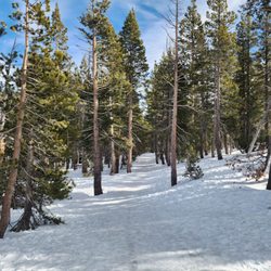
Darn me for thinking I could hike this trail with running shoes! Hey now, it was a very last minute idea. This place is great for snowshoeing. We saw lots a folks with their snowboards too! Restrooms are closed during winter.


I did this hike in early October so it was pretty cold and windy with some random ice in some water streams. It's a decent hike that'll take you about 4-5 hours. It sort of isn't clear where the summit of Mt. Rose is--I ended up following signs to a different peak (which added 1.5 miles) to get a good view of Lake Tahoe (was this actually the top of Mt. Rose? Who knows). Even then though, the view wasn't that majestic (compared to other views I've had of Tahoe) and the "summit" wasn't well defined. I wish there was a big sign that said you're at the summit of something that also states the elevation. I like it when the tops of mountains have wind shelters too. So, this is a definitely a moderate difficulty hike worth doing once, but honestly I wasn't that impressed. We should've done Mt. Tallac instead! Oh well, can't complain about getting good exercise on a nice Saturday morning.


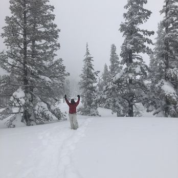
With nearly double the amount of snow this year in Lake Tahoe region we were lucky enough to snowshoe here! Stunning! Too bad it was foggy we couldn't see the lake.


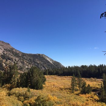
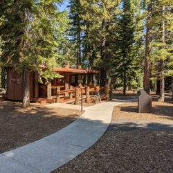
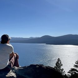
Destination Difficulty Mileage (One Way) 6 miles Elevation 8700'/10778' Directions to the trailhead Take Highway 431 (Mt. Rose Highway) north of Incline Village. Park at the trailhead located one mile south of the summit. Access Follow a dirt road for three miles through a lodgepole cloaked forest interspersed with mule ears and sagebrush. In the spring, a lush meadow at the halfway point is filled with lupine, paintbrush, and larkspur. The last two miles follow slippery switchbacks to the ridge line. Attractions and Considerations Mt. Rose (10,778'), one of the highest peaks near Lake Tahoe, offers excellent views of the lake, the city of Reno and the surrounding area. Write your name in the log book located at the summit to show the world you made it! _ _ _ _ _ _ _ _ _ _ _ _ _ _ _ _ _ _ _ _ _ _ _ _ _ _ _ _ _ _ _ Ok so now for my review; This is the 3rd highest peak in Tahoe. It is next to, looking down and over Mt Rose ski resort, the Reno valley and Lake Tahoe. This is a challenging hike that I did in about 4 1/2 hours, but you can definately make it longer. Once at the top, at 10, 778 ft, there are just the most incredible views! Totally worth the huffing and puffing of hiking at that altitude. There is a great trailhead at the top of 431 up north of Incline Village with restrooms and educational boards all over. ( It also doubles as a mini snow park here in the winter. )So you can't miss it! It also is part of the Tahoe Rim trail until you split off to go up Mt Rose. Strenuous hike? yes,, worth it? yes,...highly recommend it? DEFINATELY!


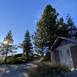
Looking for an epic hike that isn't too far from Reno? Look no further than Mount Rose! To find the trailhead, head up the Mount Rose Highway and once you reach near the top, you'll notice a decent sized parking lot off to the side of the Highway. The trailhead begins behind the bathrooms. This hike is slightly deceptive because for the first half (2.5 or so miles), it's relatively flat. I mean, you're definitely going upwards but you barely notice it (at least I didn't). Once you reach the waterfall (the unofficial halfway point), that's where things begin to get a bit more interesting. The scenery gets better and better, but the incline in the trail will get far more noticeable not just due to steepness, but due to the elevation as well. Many people were turning around as my friend and I continued going. In no way is this a difficult hike, however, it's definitely not easy either. If you're out of shape or have any medical problems, this may not be the hike for you. There's plenty of other gorgeous hikes in the area that would be more suitable. But if you think you can tackle the 10,778 foot Mountain, by all means give it a go. The hike is just shy of 11 miles round trip. Once at the summit, you'll have an amazing 360 view with Lake Tahoe on one side and Reno on the other. It makes for some amazing pano shots. read more


Okay, I am going to probably get a lot of hate from giving this hike 3 stars instead of 4 or 5 stars which seems to be the norm in terms of reviews. When I go on hikes, I prefer it to be flat, scenic and with pretty meadows. I was not expecting it to be quite scary actually as my husband reassured me that this hike was easy and flat; he was wrong trust me. The beginning of the hike was a steep uphill climb that was full of sand and dirt. Combined with the intense heat and the uneven rocks, I was already getting a shortness of breath when we climbed the uphill. My skin also got a burning sensation even though I slaughtered on sunscreen before the hike. I looked up the UV index on my phone and it was at level 11; wow, no wonder why I felt like I was burning! Thankfully, I brought some sunscreen with me so I started applying it to my face and skin again. The heat was also so intense that my hair started sticking to the back of my neck. Anyways, we continued our climb and when we reached the top, my heart started racing as I noticed we were a good 9000 feet up in the air and the trail was so thin and narrow that my husband and I had to make a single file line just to walk on it. I remember throughout the entire hike, I had to look down because the rocks were so uneven (trust me, they were everywhere) because I didn't want to fall and hurt myself. Another thing about being so high up, we encountered wind storms that constantly blew up dirt and sand on our faces; talk about feeling super dirty and gross! The sand and dirt got all over my clothes, skin and hair. Needless to say, I was not enjoying myself and I kept wishing we were lying on the beach instead listening to quiet waves and sunbathing. After a good 2 and a half mile hike, we finally reached the waterfall and relaxed. The waterfall was gorgeous and there were cute chipmunks too; this is why I gave my review three stars; this was the one good thing about our hike. When we got home that night, I scrubbed my face clean and washed my hair twice too. For avid hikers like my husband, this hike will be enjoyable as for me however, I will take a pass for next time. read more


8 years ago

14 years ago


Amazing hike, with incredible views along the way. I read in another review that this could be broke up into two hikes. One to the Waterfall and another to the summit. The two and half miles to the Waterfall's is fairly easy with level for the most part. With plenty of shade on the lower part of the hike. After the Waterfall it becomes more challenging but very doable. And the views at the summit are so worth it. I'd highly recommend this hike, loved it. read more


Darn me for thinking I could hike this trail with running shoes! Hey now, it was a very last minute idea. This place is great for snowshoeing. We saw lots a folks with their snowboards too! Restrooms are closed during winter. read more
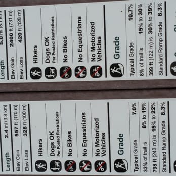




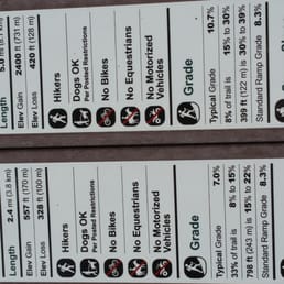
I did this hike in early October so it was pretty cold and windy with some random ice in some water streams. It's a decent hike that'll take you about 4-5 hours. It sort of isn't clear where the summit of Mt. Rose is--I ended up following signs to a different peak (which added 1.5 miles) to get a good view of Lake Tahoe (was this actually the top of Mt. Rose? Who knows). Even then though, the view wasn't that majestic (compared to other views I've had of Tahoe) and the "summit" wasn't well defined. I wish there was a big sign that said you're at the summit of something that also states the elevation. I like it when the tops of mountains have wind shelters too. So, this is a definitely a moderate difficulty hike worth doing once, but honestly I wasn't that impressed. We should've done Mt. Tallac instead! Oh well, can't complain about getting good exercise on a nice Saturday morning. read more






19 years ago
Destination Difficulty Mileage (One Way) 6 miles Elevation 8700'/10778' Directions to the trailhead Take Highway 431 (Mt. Rose Highway) north of Incline Village. Park at the trailhead located one mile south of the summit. Access Follow a dirt road for three miles through a lodgepole cloaked forest interspersed with mule ears and sagebrush. In the spring, a lush meadow at the halfway point is filled with lupine, paintbrush, and larkspur. The last two miles follow slippery switchbacks to the ridge line. Attractions and Considerations Mt. Rose (10,778'), one of the highest peaks near Lake Tahoe, offers excellent views of the lake, the city of Reno and the surrounding area. Write your name in the log book located at the summit to show the world you made it! _ _ _ _ _ _ _ _ _ _ _ _ _ _ _ _ _ _ _ _ _ _ _ _ _ _ _ _ _ _ _ Ok so now for my review; This is the 3rd highest peak in Tahoe. It is next to, looking down and over Mt Rose ski resort, the Reno valley and Lake Tahoe. This is a challenging hike that I did in about 4 1/2 hours, but you can definately make it longer. Once at the top, at 10, 778 ft, there are just the most incredible views! Totally worth the huffing and puffing of hiking at that altitude. There is a great trailhead at the top of 431 up north of Incline Village with restrooms and educational boards all over. ( It also doubles as a mini snow park here in the winter. )So you can't miss it! It also is part of the Tahoe Rim trail until you split off to go up Mt Rose. Strenuous hike? yes,, worth it? yes,...highly recommend it? DEFINATELY! read more


13 years ago

12 years ago

7 years ago
We had such a great time there. The trail is dog friendly and kid friendly. The slopes were of the right angles for sledding or just climbing up and down. We will visit again. read more


18 years ago

11 years ago
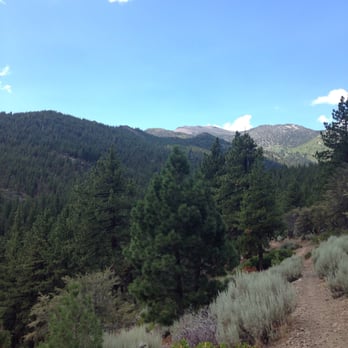
very beautiful hiking trail. i recommend bring the whole family for some outdoor fun! Truly love the abundance of shade from the trees and the cool breeze from the little creek. We also got to see and pet some horses along the trail. read more



12 years ago


10 years ago

12 years ago

16 years ago

12 years ago

13 years ago
More info about Mt Rose Hike
Highway 431
Incline Village, NV 89452
Directions
Hours
Outdoor Amenities
Ask the Community - Mt Rose Hike
Review Highlights - Mt Rose Hike
You might also consider

















Why does Yelp recommend reviews?


Mt Rose Hike - hiking - Updated September 2026
Best of Incline Village
People found Mt Rose Hike by searching for…
Hiking Trails With Waterfalls in Incline Village, NV
Attractions in Incline Village, NV
Places to Take Pictures in Incline Village, NV
Things to Do in Incline Village, NV
Campgrounds in Incline Village, NV
Beaches in Incline Village, NV
Natural Hot Springs in Incline Village, NV
Scenic View in Incline Village, NV
Free Parking in Incline Village, NV
Watch Sunset in Incline Village, NV
Scenic Drive in Incline Village, NV
Easy Hikes in Incline Village, NV
Walking Trails in Incline Village, NV
Fishing Spots in Incline Village, NV
Dog Friendly Hiking Trails in Incline Village, NV
Free Snow Play in Incline Village, NV
Photo Spots in Incline Village, NV
Running Trails in Incline Village, NV
Picnic Areas in Incline Village, NV
Parks for Kids in Incline Village, NV
Trending Searches in Incline Village, NV
Apple Orchards near Mt Rose Hike
Apple Picking near Mt Rose Hike
Blow Dry Bar near Mt Rose Hike
Cliff Jumping near Mt Rose Hike
Consignment Shops near Mt Rose Hike
Dog Friendly Things To Do near Mt Rose Hike
Dog Swimming near Mt Rose Hike
Eyebrow Threading near Mt Rose Hike
Eyelash Extensions near Mt Rose Hike
Kids Birthday Party near Mt Rose Hike
Makeup Artists near Mt Rose Hike
Off Road Trails near Mt Rose Hike
Picnic Areas near Mt Rose Hike
Places To Take Pictures near Mt Rose Hike
Private Schools near Mt Rose Hike
Public Shower near Mt Rose Hike
Scenic Night View near Mt Rose Hike
Scenic Overlook near Mt Rose Hike
Browse Articles
Browse Nearby
BEST of Incline Village, Nevada Coffee near Mt Rose Hike
BEST of Incline Village, Nevada Restaurants near Mt Rose Hike
BEST of Incline Village, Nevada Parks near Mt Rose Hike
BEST of Incline Village, Nevada Things to Do near Mt Rose Hike
BEST of Incline Village, Nevada Breakfast near Mt Rose Hike
BEST of Incline Village, Nevada Walking Trails near Mt Rose Hike
BEST of Incline Village, Nevada Campgrounds near Mt Rose Hike
BEST of Incline Village, Nevada Sightseeing near Mt Rose Hike
BEST of Incline Village, Nevada Visitor Centers near Mt Rose Hike
Browse Brands
Related Searches in Incline Village, NV
Affordable Kayak Rental Services in Incline Village, Nevada
Best Dog Hiking Trails Around Incline Village, Nevada
Best Fishing Locations and Guides in Incline Village, Nevada
Best Places for Horseback Riding in Incline Village, Nevada
Best Sightseeing Experiences Available in Incline Village, Nevada
Check Out Off Road Trails in Incline Village, Nevada
Discover Dog Friendly Trails to Explore in Incline Village, Nevada
Discover Easy Hiking Trails Near Incline Village, Nevada
Discover Kid Friendly Hiking Trails in Incline Village, Nevada
Discover Popular Bike Trails in Incline Village, Nevada
Discover Scenic Mountain Bike Trails Near Incline Village, Nevada
Discover a Hiking Trail in Incline Village, Nevada
Discover the Best Night Hike Trails in Incline Village, Nevada
Dog-Friendly Hikes With Dogs in Incline Village, Nevada
Enjoy Camping Adventures Around Incline Village, Nevada
Enjoy Kayaking Adventures in Incline Village, Nevada
Enjoy Off Leash Dog Hikes in Incline Village, Nevada
Enjoy Scenic Places to Walk in Incline Village, Nevada
Enjoy Tent Camping Spots Around Incline Village, Nevada
Enjoy a Beautiful Waterfall Hike in Incline Village, Nevada
Enjoy the Best Picnic Spots and Ideas in Incline Village, Nevada
Enjoy the Best Walking Path in Incline Village, Nevada
Enjoy the Best Walking Trails in Incline Village, Nevada
Explore Easy Hikes Perfect for All in Incline Village, Nevada
Explore Fun Activities to Do in Incline Village, Nevada
Explore Popular Campgrounds Near Incline Village, Nevada
Explore Popular State Park Destinations in Incline Village, Nevada
Explore Top Dog Parks in Incline Village, Nevada Near You
Explore the Best Beach Spots in Incline Village, Nevada
Family Friendly Hiking With Kids in Incline Village, Nevada
Find Popular Ziplining Spots Around Incline Village, Nevada
Find Top-Rated Waterfalls in Incline Village, Nevada Now
Find the Best Playgrounds to Visit in Incline Village, Nevada
Hiking Trails With Waterfalls in Incline Village, Nevada
Off Leash Dog Hiking Trails in Incline Village, Nevada
Play at a Splash Pad Park in Incline Village, Nevada
Popular Outdoor Activities to Try in Incline Village, Nevada
Popular Picnic Spots to Visit in Incline Village, Nevada
Popular Waterfall Hiking Trails in Incline Village, Nevada
Safe River Swimming Areas in Incline Village, Nevada
Safe and Fun Parks for Kids in Incline Village, Nevada
Top Hiking Trails to Explore in Incline Village, Nevada
Top Playgrounds for Kids to Enjoy in Incline Village, Nevada
Top Running Trails to Explore in Incline Village, Nevada
Top Swimming Spots and Pools in Incline Village, Nevada
Top Things to Do With Kids in Incline Village, Nevada
Top-Rated Camping Sites in Incline Village, Nevada
Walk Dog Friendly Hiking Trails in Incline Village, Nevada
Walk the Best Paved Walking Trails in Incline Village, Nevada


