Shirley Lake Trail Photos


You might also consider


More like Shirley Lake Trail
Recommended Reviews - Shirley Lake Trail
Start your review...


Reviews With Photos


We were really pleased with this hike. We had 3 kids with us (ages 6,8 &9) so were not able to do the entire hike, but what we did hike was beautiful. As it is fall, there were gorgeous colors, yet the water wasn't running. Be sure to wear hiking shoes or at least a shoe with a good grip as this hike includes some rock climbing. I brought my poles which came in handy. I can't wait to return when the fall is running.


This trail can be a little tough. It will depend on how far you want to go. If you plan to teach Shirley lake, expect some steep areas. Once the rocks start, the steepness and no shade are begin. We did have to crawl up in all fours in some areas. Make sure you wear good hiking shoes. We parked across from the apartment complex on the street. Our walked round trip took 3.5 hours, but that includes a good rest once we reached Shirley lake. Along the trail, they have blue markings that lead the way up. On the way down, it's a little more difficult to see the blue markings. We did get off the trail by mistake at one point on our way down. We were disappointed that the Creek was dry (September) and that the waterfalls weren't present. By the way, follow the Creek and it will lead you the right way. Once we reached Shirley lake, we sat for a while and enjoyed the scenery. I'm not sure what kind of construction is happening, but we could see machinery and vehicles across the lake. The lake isn't clear, but we saw dogs jumping in and having fun. Take plenty of water and sunscreen. Consider a snack as well. Download their app. It will keep your hike via gps and guide you


Hiking this trail and on to High Camp was probably the most difficult hike I've ever done due to elevation and terrain. Reading that the trail up is 3.6 miles is deceptive because the elevation gain is 2,109 feet. Yikes! If high elevation is not your strong suit, then take it slow if you've not had a chance to acclimate. On the hike with me were a bunch 60+/- year olds, so taking it slow was compulsory as was listening to their complaining. While on the hike, I used the Squaw/Alpine Summer App that I had previously downloaded which gave me the confidence I needed that I was on track. Yes, the hike was steep and strenuous, but the views were stunning and the waterfalls and flowing water were a visual treat. In August, the blue trail markers were easy to spot and thus, we had no trouble being on the right trail. At High Camp (8,200ft), we took photos to prove to ourselves that WE MADE IT! There were a lot of "doubters" in my group that feared we wouldn't make the last tram at 5pm. Also, we quickly visited the compact Olympic Museum (no charge) on the bottom floor which showcased when Squaw Valley hosted the 1960 Winter Olympics. Bringing more water than you think and re-applying sunscreen will be helpful. Although I read that many people completed the hike in 2.5-3 hours, my group took 5.5 hours which included several stops for rest and photos and a stop at Shirley Lake for lunch. As an avid hiker, I would definitely, hike this trail again.


Beautiful place to hike in the summer with wonderful mountain and stream views. Access to waterfalls and water flowing cliffs.


Need a pair of good hiking shoes! There are loose rocks so going downhill be careful and quite be quite steep at some spots. However view is very nice. Quiet not too many ppl (mid June). Take the tram to high camp and walk little bit to head if the trail. Can do picnic at the lake (and rest!) will go again!


First of all, there's no such thing as Shirley lake trail! There's only Shirley canyon trail and if you map it from yelp, you will get lost and end up in some random residential area. The correct address is: 1912 Chamonix Pl, Olympic Valley, CA 96146 and even then it won't take you to the trailhead but it'll take you pretty close to it. Try to find parking in Olympic village and walk up squaw peak road, when you see a "do not enter" sign for cars, walk up the hill and then down. See pic attached, I've marked an X where the actual trail starts. Hope this helps!


An uphill hike that is quite tiring, but very beautiful. I loved climbing the rocks, seeing the small waterfalls, & touching the cool running water. A little confusing when trying to find where to park & where the trail starts, but manageable. Many were swimming in the water, so I would advise bringing a swimsuit if you're interested. Otherwise, there are many great places to just feel the water with your fingers or dip your toes in. I didn't hike the whole trail to the end because the altitude gave me a headache. I wish I'd brought more drinking water because it was steeper than I expected. Overall, a fun hike with very pretty sights.


After my first hike at Shirley Lake Trail, I fell in love! Starting in the Squaw Valley village, this trail winds up through the beautiful Sierra mountains. You stay along a path full of water falls and little streams. You can stop at Shirley Lake or keep going up the mountains to stop at High Camp. If you go all the way up, the hike quickly becomes more of a moderate level. It is about 5 miles from the parking lot to High Camp but you can take the gondola down the mountain (for free). Beautiful hike! Amazing views! Definitely something I recommend.


We definitely felt like we had a good workout at the end of this hike. It was definitely a challenging hike for us. We don't get to hike as often as we like, but we do exercise five days a week. The hike started as a trail hike with occasional inclines. Then it turned to rock and it was all incline. For a short time it goes back to trail until the lake. After the lake it becomes like a gravel road, but is all steep incline. Some tips for the hike would be to follow the blue markers and to bring plenty of water. The trail isn't always obvious, but just keep looking for the blue marks on the trail. We only brought a bottle of water each and that wasn't nearly enough water. The final leg of the hike was really difficult without water. Once you make it to the top there is an observation deck to view the area below. The tram ride back down to the village is free if you can make it to the top as well.


What a great hike and gorgeous views....but BEWARE, it's still snowed in! I hiked yesterday May 28th. The hike starts off nice and well marked next to the river with a dirt path, some rocks and some snow. About an 45 minutes in the trail markers are covered in snow and therefore few and far between. I downloaded a map that had GPS location so I knew I was still on the trail, but if you don't have this it's easy to get lost. After an hour you're basically hiking through the snow. I hiked for about 2 1/2- 3 hours and made it to a gorgeous double waterfall (halfway to the lake I believe). I think this is the point they talk about hiking up boulders, but it was snowed and hard to tell. I turned around at this point as it was so snowed in it didn't seem safe to continue on. (The waterfall fell into snow and you couldn't see where the river went). If you do this hike right around now, bring a map on your phone I used this one: https://mappingsupport.com/p/gmap4.php?q=http://share.jointwork.net/tdr_file_site/tracks/Squaw_to_Shirley_and_High_Camp.GPX&t=t4


Went out with two kids (10 and 7) and they both were able to handle the hike pretty easily. Well, at least with minimal complaining. There are a few areas that are a little challenging, but all in all, very doable. Plus, if you follow the blue lines that are spray painted on rocks, it's hard to venture off course. Our original plan was to make it to the top and then take the tram down for free, but after going up about three miles, the trail looked to snow covered to continue (even though we're nearing the end of June!). On our descent down, we did encounter a guy with his dog who said he was going to the top and that a few of his friends had already made the same trek in the last couple of weeks, so it evidently is doable. Probably not doable (or wise) with kids. Great views of waterfalls and tons of picture opportunities. Definitely a fun way to see Tahoe while also burning off some calories! Tip--park at the base and save yourself about a half a mile walk from the Squaw parking lot.


This hike was absolutely gorgeous. There were many spots with waterfalls and flowing water and the views were breathtaking. The hike was challenging enough that it wasn't a walk in the park, and gorgeous enough nature surrounds you so that it's worth the challenge. The only thing is because it's so beautiful it is absolutely PACKED. There are hoards of people in extremely large groups (actually I've never even seen such huge groups of people hiking together before lol), and that was the only part that turned me off. But what are you gonna do, everyone knew how great it was so everyone flocked there. Weekend crowds
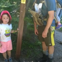

The hike is roughly broken into 3 sections. Section 1: Follows Squaw Creek and is mostly dirt trails through forested areas with the occasional short but steep scramble up boulders. Section 2: Climbs away from Squaw Creek ending at Shirley Lake. It is very steep, either scrambling up boulders or walking up granite slabs at around a 10% - 20% grade. This section is the hardest part of the hike. Section 3: From Shirley Lake up to the tram at High camp. This section is not as steep as before (but still steep) and is on a mostly dirt trail that roughly follows the intermediate downhill ski trail called Freeway. I hiked this with my 2 daughters (20-months and 4-year-old). I carried my 20-month (25 pounds) the entire way, and my 4-year-old (45 pounds) hiked Sections 1 and 3. For Section 2, I needed to carry both kids. Section 2 is class 2 in some locations. Although you could probably get up it without using hand holds, since I was lugging along about 70 pounds of kids (plus water, lunch, and 10 essentials), I needed hand holds in some spots to progress up. Overall, the hike took my family about 4.5 hours (obviously letting my 4-year-old set the pace), which included frequent brief rest stops and a 30 minute lunch stop at the top of the granite before Shirley Lake. I would estimate that with no kids, it would have been about a 1.5 - 2 hour hike. The trail for the most part was easy to follow. In places where there are many forks (Section 1 with lots of side trails over to Squaw Creek) or where the trail disappears (Section 2 with boulder or granite sections), look for the blue and/or black paint on the rocks. It is actually really well marked if you keep your eye out for the paint. I had lots of help because my 4-year-old loved looking for the paint and then would yell out "There's the blue!" Section 3 is well marked with Squaw Valley signs. As far as water, I carried 4L (1 gallon) for my family, and we made it to High Camp with about 0.5L left. If you bring purification tablets, there is water along the trail (Squaw Creek and Shirley Lake) to fill up from. Overall it was a great hike. Good views of Silver Peak on the way up, Tinker Knob near the top, as well as Granite Chief. Looking out to the east, you can see part of Lake Tahoe as well as Mount Rose. The tram ride back down was pretty fun too (and yes it is free). For the average hiker, I probably would not recommend taking young kids (yes, I am kind of crazy) unless they are good hikers and/or you are a strong hiker who can easier carry them over class 2 terrain. I would also note that if you are a beginner hiker and having trouble with the boulder scrambles in Section 1, you might want to consider turning around as these boulders foreshadow the much longer and harder boulder scrambles in Section 2.


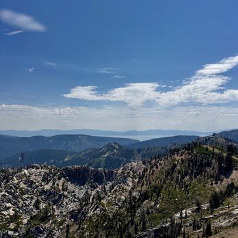
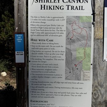
A must hike at least once a year ! Sure you will be climbing up/over some steep rocks but it's a worth it for the gorgerous view and you can take the tram down or hike back down if you at up to it We decide to take the tram that operated until September (you will have to check the time frame ) and did the 5 miles! read more






3 years ago
Uh, when they say this trail is not beginner-friendly they mean it. Came down to Lake Tahoe for a family birthday trip, and I was tasked with helping to select a trail for us to hike during the weekend. This was probably the most scenic one based on my research, so I chose this because if I'm in the area I may as well see the prettiest sights. And it was absolutely worth it! But my group absolutely got obliterated during the hike. The view is so beautiful that it makes up for the physical beating we got, and I had originally assumed because we were a group of adult we'd be able to power through (and we did...), but I wasn't sure we were going to make it by the last quarter of the hike up. Lots of hikers here though, that I could tell were experienced by how they blasted past us LOL as we never saw them again. My ego took a beating when a bunch of kids also blew past us. Hiking people are built different, but regardless everyone we ran by was really kind! Either a hello or excuse me to get by us. A couple of well behaved and fit hiking dogs too. My group got to this trail by 11am which was a little later than we had anticipated. I believe the estimate for this hike is like ~3 hours, but it took us closer to 4. There's a tram you can ride down at the top of the hike (very kind of them to provide this service). I was starting to sweat a little at the end of our hike as we were cutting it close, haha;; But yes, maybe steer clear or skip this hike if you're a beginner. I do believe most adults can power through this, but some members of our groups were gone by the end of this hike. Still this is probably the best and most beautiful hike I've been on so far, would totally do it again. Bring snacks and plenty of water!!! There is a giant parking lot that you can park at the bottom of the trail. It was free when we stopped by during off season, but I think you may need a pass for it during other times of the year. read more


We were really pleased with this hike. We had 3 kids with us (ages 6,8 &9) so were not able to do the entire hike, but what we did hike was beautiful. As it is fall, there were gorgeous colors, yet the water wasn't running. Be sure to wear hiking shoes or at least a shoe with a good grip as this hike includes some rock climbing. I brought my poles which came in handy. I can't wait to return when the fall is running. read more


This trail can be a little tough. It will depend on how far you want to go. If you plan to teach Shirley lake, expect some steep areas. Once the rocks start, the steepness and no shade are begin. We did have to crawl up in all fours in some areas. Make sure you wear good hiking shoes. We parked across from the apartment complex on the street. Our walked round trip took 3.5 hours, but that includes a good rest once we reached Shirley lake. Along the trail, they have blue markings that lead the way up. On the way down, it's a little more difficult to see the blue markings. We did get off the trail by mistake at one point on our way down. We were disappointed that the Creek was dry (September) and that the waterfalls weren't present. By the way, follow the Creek and it will lead you the right way. Once we reached Shirley lake, we sat for a while and enjoyed the scenery. I'm not sure what kind of construction is happening, but we could see machinery and vehicles across the lake. The lake isn't clear, but we saw dogs jumping in and having fun. Take plenty of water and sunscreen. Consider a snack as well. Download their app. It will keep your hike via gps and guide you read more


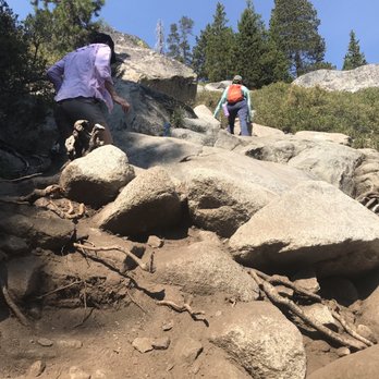

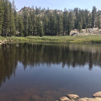


Hiking this trail and on to High Camp was probably the most difficult hike I've ever done due to elevation and terrain. Reading that the trail up is 3.6 miles is deceptive because the elevation gain is 2,109 feet. Yikes! If high elevation is not your strong suit, then take it slow if you've not had a chance to acclimate. On the hike with me were a bunch 60+/- year olds, so taking it slow was compulsory as was listening to their complaining. While on the hike, I used the Squaw/Alpine Summer App that I had previously downloaded which gave me the confidence I needed that I was on track. Yes, the hike was steep and strenuous, but the views were stunning and the waterfalls and flowing water were a visual treat. In August, the blue trail markers were easy to spot and thus, we had no trouble being on the right trail. At High Camp (8,200ft), we took photos to prove to ourselves that WE MADE IT! There were a lot of "doubters" in my group that feared we wouldn't make the last tram at 5pm. Also, we quickly visited the compact Olympic Museum (no charge) on the bottom floor which showcased when Squaw Valley hosted the 1960 Winter Olympics. Bringing more water than you think and re-applying sunscreen will be helpful. Although I read that many people completed the hike in 2.5-3 hours, my group took 5.5 hours which included several stops for rest and photos and a stop at Shirley Lake for lunch. As an avid hiker, I would definitely, hike this trail again. read more


3 years ago
Beautiful place to hike in the summer with wonderful mountain and stream views. Access to waterfalls and water flowing cliffs. read more


Need a pair of good hiking shoes! There are loose rocks so going downhill be careful and quite be quite steep at some spots. However view is very nice. Quiet not too many ppl (mid June). Take the tram to high camp and walk little bit to head if the trail. Can do picnic at the lake (and rest!) will go again! read more


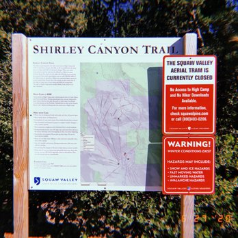
First of all, there's no such thing as Shirley lake trail! There's only Shirley canyon trail and if you map it from yelp, you will get lost and end up in some random residential area. The correct address is: 1912 Chamonix Pl, Olympic Valley, CA 96146 and even then it won't take you to the trailhead but it'll take you pretty close to it. Try to find parking in Olympic village and walk up squaw peak road, when you see a "do not enter" sign for cars, walk up the hill and then down. See pic attached, I've marked an X where the actual trail starts. Hope this helps! read more


An uphill hike that is quite tiring, but very beautiful. I loved climbing the rocks, seeing the small waterfalls, & touching the cool running water. A little confusing when trying to find where to park & where the trail starts, but manageable. Many were swimming in the water, so I would advise bringing a swimsuit if you're interested. Otherwise, there are many great places to just feel the water with your fingers or dip your toes in. I didn't hike the whole trail to the end because the altitude gave me a headache. I wish I'd brought more drinking water because it was steeper than I expected. Overall, a fun hike with very pretty sights. read more



2 years ago

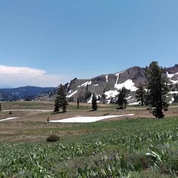
After my first hike at Shirley Lake Trail, I fell in love! Starting in the Squaw Valley village, this trail winds up through the beautiful Sierra mountains. You stay along a path full of water falls and little streams. You can stop at Shirley Lake or keep going up the mountains to stop at High Camp. If you go all the way up, the hike quickly becomes more of a moderate level. It is about 5 miles from the parking lot to High Camp but you can take the gondola down the mountain (for free). Beautiful hike! Amazing views! Definitely something I recommend. read more




3 years ago

We definitely felt like we had a good workout at the end of this hike. It was definitely a challenging hike for us. We don't get to hike as often as we like, but we do exercise five days a week. The hike started as a trail hike with occasional inclines. Then it turned to rock and it was all incline. For a short time it goes back to trail until the lake. After the lake it becomes like a gravel road, but is all steep incline. Some tips for the hike would be to follow the blue markers and to bring plenty of water. The trail isn't always obvious, but just keep looking for the blue marks on the trail. We only brought a bottle of water each and that wasn't nearly enough water. The final leg of the hike was really difficult without water. Once you make it to the top there is an observation deck to view the area below. The tram ride back down to the village is free if you can make it to the top as well. read more


9 years ago
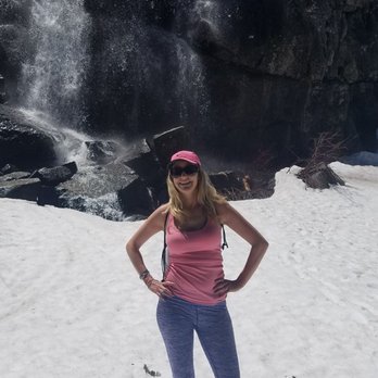
What a great hike and gorgeous views....but BEWARE, it's still snowed in! I hiked yesterday May 28th. The hike starts off nice and well marked next to the river with a dirt path, some rocks and some snow. About an 45 minutes in the trail markers are covered in snow and therefore few and far between. I downloaded a map that had GPS location so I knew I was still on the trail, but if you don't have this it's easy to get lost. After an hour you're basically hiking through the snow. I hiked for about 2 1/2- 3 hours and made it to a gorgeous double waterfall (halfway to the lake I believe). I think this is the point they talk about hiking up boulders, but it was snowed and hard to tell. I turned around at this point as it was so snowed in it didn't seem safe to continue on. (The waterfall fell into snow and you couldn't see where the river went). If you do this hike right around now, bring a map on your phone I used this one: https://mappingsupport.com/p/gmap4.php?q=http://share.jointwork.net/tdr_file_site/tracks/Squaw_to_Shirley_and_High_Camp.GPX&t=t4 read more



9 years ago
Went out with two kids (10 and 7) and they both were able to handle the hike pretty easily. Well, at least with minimal complaining. There are a few areas that are a little challenging, but all in all, very doable. Plus, if you follow the blue lines that are spray painted on rocks, it's hard to venture off course. Our original plan was to make it to the top and then take the tram down for free, but after going up about three miles, the trail looked to snow covered to continue (even though we're nearing the end of June!). On our descent down, we did encounter a guy with his dog who said he was going to the top and that a few of his friends had already made the same trek in the last couple of weeks, so it evidently is doable. Probably not doable (or wise) with kids. Great views of waterfalls and tons of picture opportunities. Definitely a fun way to see Tahoe while also burning off some calories! Tip--park at the base and save yourself about a half a mile walk from the Squaw parking lot. read more


3 years ago

This hike was absolutely gorgeous. There were many spots with waterfalls and flowing water and the views were breathtaking. The hike was challenging enough that it wasn't a walk in the park, and gorgeous enough nature surrounds you so that it's worth the challenge. The only thing is because it's so beautiful it is absolutely PACKED. There are hoards of people in extremely large groups (actually I've never even seen such huge groups of people hiking together before lol), and that was the only part that turned me off. But what are you gonna do, everyone knew how great it was so everyone flocked there. Weekend crowds read more


11 years ago
The hike is roughly broken into 3 sections. Section 1: Follows Squaw Creek and is mostly dirt trails through forested areas with the occasional short but steep scramble up boulders. Section 2: Climbs away from Squaw Creek ending at Shirley Lake. It is very steep, either scrambling up boulders or walking up granite slabs at around a 10% - 20% grade. This section is the hardest part of the hike. Section 3: From Shirley Lake up to the tram at High camp. This section is not as steep as before (but still steep) and is on a mostly dirt trail that roughly follows the intermediate downhill ski trail called Freeway. I hiked this with my 2 daughters (20-months and 4-year-old). I carried my 20-month (25 pounds) the entire way, and my 4-year-old (45 pounds) hiked Sections 1 and 3. For Section 2, I needed to carry both kids. Section 2 is class 2 in some locations. Although you could probably get up it without using hand holds, since I was lugging along about 70 pounds of kids (plus water, lunch, and 10 essentials), I needed hand holds in some spots to progress up. Overall, the hike took my family about 4.5 hours (obviously letting my 4-year-old set the pace), which included frequent brief rest stops and a 30 minute lunch stop at the top of the granite before Shirley Lake. I would estimate that with no kids, it would have been about a 1.5 - 2 hour hike. The trail for the most part was easy to follow. In places where there are many forks (Section 1 with lots of side trails over to Squaw Creek) or where the trail disappears (Section 2 with boulder or granite sections), look for the blue and/or black paint on the rocks. It is actually really well marked if you keep your eye out for the paint. I had lots of help because my 4-year-old loved looking for the paint and then would yell out "There's the blue!" Section 3 is well marked with Squaw Valley signs. As far as water, I carried 4L (1 gallon) for my family, and we made it to High Camp with about 0.5L left. If you bring purification tablets, there is water along the trail (Squaw Creek and Shirley Lake) to fill up from. Overall it was a great hike. Good views of Silver Peak on the way up, Tinker Knob near the top, as well as Granite Chief. Looking out to the east, you can see part of Lake Tahoe as well as Mount Rose. The tram ride back down was pretty fun too (and yes it is free). For the average hiker, I probably would not recommend taking young kids (yes, I am kind of crazy) unless they are good hikers and/or you are a strong hiker who can easier carry them over class 2 terrain. I would also note that if you are a beginner hiker and having trouble with the boulder scrambles in Section 1, you might want to consider turning around as these boulders foreshadow the much longer and harder boulder scrambles in Section 2. read more
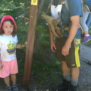


Disclaimer - this should actually be called the Shirley Canyon Trail. This is a wonderful, challenging trail with 2.5 miles straight up to the summit. I highly recommend trekking poles and very good hiking shoes! The trail is inside Squaw Valley Resort. Parking is free and you don't have to be staying at the resort to hike this. You have 3 options of how you can approach the trail: a) hike up and down b) hike up and take tram down for free (squaw valley high camp) c) pay to take the tram up and hike down. The last option is don't hike at all and take the tram up and down. We opted to hike up and take the tram down. The hike spans several types of terrain - dirt trail, rocky trail and massive boulders/mountainous (all granite). It's a strenuous hike with inspiring views as you climb higher and higher. Follow the blue markers so that you don't get lost on the trail. We went at a time where the creek was dry but like most reviewers noted that you should stay to the right of the creek bed. Although the hike was challenging, we saw lots of families with young kids and dogs doing the hike as well. You don't have to be an expert hiker; go at your own pace. We got to the top in 2 hours, while the lady at the info booth said it would take 3. The majority of the trail is unshaded so you definitely need a hat and spf. When you get close to the top at Lake Shirley, the lake is nothing spectacular. The water was very muddy and pretty much a huge breeding ground for mosquitoes. Didn't stick around there too long. It's a catch and release lake as well. I'd say the toughest portion is the last mile bc I was lower on energy and the altitude was getting higher and higher. My thoughts - push through!!! At the top, you're about 8100 feet high and it's so beautiful and serene up there. Can't beat mother nature - magnificent mountains, pine trees galore, wild flowers, fresh air and little critters all in harmony. It is rewarding getting to the top. Plus, you reach high camp and there's just a big party going on. You can stay and hang out where they have a rock wall, swimming pool, ice skating rink, gift shop or just chill on the deck. When we took the aerial tram back down, the views along the way were just as amazing. In my opinion, hiking up is more challenging than down, but hiking down is more dangerous. A lot of the trail, especially the portions where you have to climb the boulders can be difficult. You have to be cautious bc it would be easy to slip, fall or twist your ankle since it's very steep. Overall, my first Tahoe hike was a success! I'd do this one again! read more


12 years ago
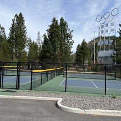
Great hike! Took us 3 hours from leaving our car to getting back to our car. We stopped at the lake for around...45 minutes to swim and hang out. Lots of people had snacks with them. We didn't bring water or food on the hike, but we were fine - it was nice to have our hands free to scramble up rocks! Of course, taking water is recommended. HOW TO GET THERE: Put "Squaw Valley Resort" into your GPS. As you approach the resort, you will have to either turn right or left. TURN RIGHT. There will be big olympic rings. Then, either go up the road that says "No entry" or make a sight right, to the parking lot, and right at the lot is the trail head. As you go up the trail, follow the blue markers on rocks. There are multiple paths to the top, but they all weave amongst each other and intersect, so you'll make it fine. Lots of cute dogs heading up with their people. DIFFICULTY: Not that hard, you will get winded, but you can just find a shady spot to rest. The first part is in the forest, and very shaded. The last part is more on sheer rocks, and not so shaded. It's a safe hike, not really any crazy sketchy stuff. VIEW: Very nice all along the hike. Lake is nice and shady. FREE SHUTTLE DOWN, but be SURE to call ahead because it is closed sometimes during the week on off season! Shuttle leaves around every 15 minutes. read more


16 years ago
Amaz-za-zing hike! There are many ways to enjoy this hike. Once we hiked up on Thanksgiving day. The stream was frozen in places (and the rocks slippery in places), but it was a great long (over 2 hours, maybe over 3?) hike. We actually went all the way up to high camp and took the cable car down (after hot chocolate *of course*!). My youngest was 7 at the time and the scenery was enough to keep him going (we are not hard core hikers, so this is notable). On many other occasions (in the summer), we have hiked up a fair ways then cut to the stream that runs to the right of the trail. Gorgeous pools and waterfalls for playing in (COLD WATER!!) The trail can be busy, but my feeling is that it is, after all, a quarter mile from a major resort--if you don't go early, expect company. Bring water and food and sunscreen. And most important, enjoy! read more


13 years ago
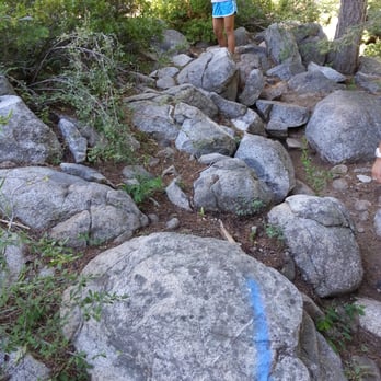
Just hiked this trail again on the July 4th weekend. This time there were lots of hikers on the trail and this time took us about 2 hours and 40 minutes, 20 min less than last year. Squaw added some route markers on the trail so that you won't get lost. But like I mentioned on my last review, just follow the blue marker painted on the stones throughout the trail you will not get lost for sure. Great hike and we are gonna do this every year now. read more
6 years ago


Wonderful hike. Beautiful uphill hike through the canyon to the top of the ridge and over the saddle to a pristine alpine lake. Then just another half mile or so uphill to the aerial tram. A sandwich and beer at the high camp then a scenic free ride down to the parking lot. What more could you ask for? We went in Early September. It was warm/hot so needed a good amount of water. Pay close attention to the blue spray paint markings on the rocks as there are many false trails. There are markers about every fifty feet or so. The water fall was not running (thanks global warming) but the lake at the top was beautiful and wonderfully cold. It says 2.3 miles to the lake, but it feels longer because it's a very steep climb. It took us about an hour and a half to get to the lake going at an easy pace. We were pleasantly surprised that the tram was running. What a treat to hike all the way up the mountain and then take a free ride down. The trams were running every twenty minutes. There is a sandwich deli and a bar at the high camp that was open. All in all beautiful hike. Only thing to be careful about is to follow the blue markers. And bring plenty of water. read more


Hiking poles and waterproof shoes are recommended! I came at the end of April right after the snow melted and got my feet wet while trying to cross a few creeks. There are also lots of trees and tree trunks on the way and not a very clear hiking path so the poles were very helpful. I saw many dogs and babies so it's not a very strenuous hike but not the easiest either. Beautiful view of the mountains and mini waterfalls! read more


9 years ago
We really love this trail. I'm not sure if it's formally an off-leash trail, but all dogs were so we followed suit. It's reasonably difficult and if you go in the spring, it's especially special because there's still snow and Shirley lake is crystal blue. You can spend some time in their pool on the top of squaw if you go in June-Aug. The lift down is free which takes you to the village. read more


16 years ago

13 years ago
Not a hike for beginners. Lots steep slopes and tricky footing. It is a solid intermediate hike. The good part is no mater how far up you make it there are great views and beautiful waterfalls. read more


11 years ago

11 years ago


10 years ago
Great hiking trail for all ages. Big trees, nice path and the sound of the water gushing is so relaxing and beautiful! read more


11 years ago
8 years ago
Great hard hike, totally doable and the lake is a great break point! Just finished hiking from the parking lot to the tram with my parents and my kids. Bring more water than you think you may need especially on a hot day. Dogs were plenty but all were very nice and everyone was so respectful of space and speed, boulder areas were challenging and the views were so rewarding. Once we reached the top, it was like staggering into an oasis! read more


12 years ago
Beautiful trail with a variety of plants along the way - pine, thimbleberry, manzanita, ceanothus/squaw carpet, native currants, mule ears, etc. Follow the blue arrows and stay to the right to be closer to the waterfalls (which kids and dogs love!). Shirley Lake is a nice place to have lunch. Squaw runs a free tram down from the top at High Camp. read more


10 years ago
Page 1 of 2
More info about Shirley Lake Trail
1909 Chamonix Pl
Olympic Valley, CA 96146
Directions
Visit Website
https://www.sierradayhikes.com/tahoe/shirley_lake.html
Hours
Indoor Amenities
Outdoor Amenities
Ask the Community - Shirley Lake Trail
Are dogs welcome on the Shirley Lake Trail?
Yes but may be steep and loose rocks. Be careful
Review Highlights - Shirley Lake Trail
You might also consider

















Why does Yelp recommend reviews?
2 reviews that are not currently recommended
The reviews below are not factored into the business's overall star rating.

11 years ago
10 years ago
Shirley Lake Trail - hiking - Updated September 2026
Best of Olympic Valley
People found Shirley Lake Trail by searching for…
Snow Play in Olympic Valley, CA
Hiking Trails With Waterfalls in Olympic Valley, CA
Things to Do in Olympic Valley, CA
Campgrounds in Olympic Valley, CA
Fishing Spots in Olympic Valley, CA
Rock Climbing in Olympic Valley, CA
Natural Hot Springs in Olympic Valley, CA
Scenic View in Olympic Valley, CA
Easy Hikes in Olympic Valley, CA
Photo Spots in Olympic Valley, CA
Scenic Overlook in Olympic Valley, CA
Walking Trails in Olympic Valley, CA
Swimming Lakes in Olympic Valley, CA
Tide Pools in Olympic Valley, CA
Off Road Trails in Olympic Valley, CA
Waterfalls and Swimming Holes in Olympic Valley, CA
Dog Friendly Hiking Trails in Olympic Valley, CA
Hiking With Kids in Olympic Valley, CA
Free Parking in Olympic Valley, CA
River Swimming in Olympic Valley, CA
Redwood Trees in Olympic Valley, CA
Browse Nearby
BEST of Olympic Valley, California Coffee near Shirley Lake Trail
BEST of Olympic Valley, California Restaurants near Shirley Lake Trail
BEST of Olympic Valley, California Breakfast near Shirley Lake Trail
BEST of Olympic Valley, California Things to Do near Shirley Lake Trail
BEST of Olympic Valley, California Shopping near Shirley Lake Trail
BEST of Olympic Valley, California Bike Rentals near Shirley Lake Trail
BEST of Olympic Valley, California Sledding near Shirley Lake Trail
BEST of Olympic Valley, California Snow Tubing near Shirley Lake Trail


