Cancel

    Open app

    Search

    Mt Theilson View Point Photos

    More like Mt Theilson View Point

    Recommended Reviews - Mt Theilson View Point

    Your trust is our priority, so businesses can't pay to alter or remove their reviews. Learn more about reviews.
    Yelp app icon
    Browse more easily on the app
    Review Feed Illustration
    Photo of Rob S.
    741
    2115
    49983

    7 years ago

    Helpful 2
    Thanks 0
    Love this 3
    Oh no 0
    Photo of Jesica D.
    139
    81
    16

    5 years ago

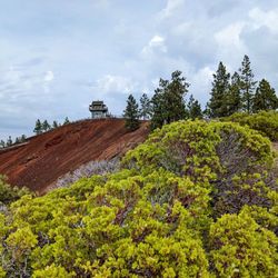
    You can see view of mountain theilson and diamond.. beautiful view.. best spring and summer time. Winter is hard

    Helpful 0
    Thanks 0
    Love this 0
    Oh no 0

    Verify this business for free

    Get access to customer & competitor insights.

    Verify this business

    Fort Rock State Park - Headed up the trail!

    Fort Rock State Park

    4.7(20 reviews)
    32.1 mi

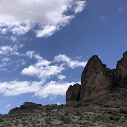
    Archeologists discovered 70 pairs of sandals made of sage brush that are 10,000 years old -…read moreuncovered in the rock cave, evidence of early humans in North America. During the Ice Age, Fort Rock was surrounded by water. Before drying up around 10,000 years ago, the lake with its associated wetlands and wildlife was the foundation of life for prehistoric humans. Prairie Falcon, Golden Eagle, Western Medowlark, Rock Wren and Yellow Belly Marmots live here. Raptors are currently nesting and some trails off limits. With binoculars we saw 4 Prairie Falcons perching and two flying as fledglings sang through the high cliff recessions in raptor nest homes. Look for white poop splashes high up cliffs - that is where the raptors perch and nest! Wife and I hiked through lush high desert with lots of sage and pinkish-reddish spiny hops bush, horse bush and desert sage. Many wildflowers in bloom. Wild buckwheat dominating the landscape. Also there was paint bruch, penstemon and larkspur. What a grand day for a hike in the wondrous Oregon outback! Colors in rocks, flowers and sands! Smells fragrant!

    Such a cool place to visit! About 70 miles southeast of Bend. There's a small gravel parking lot,…read morerestrooms with flush toilets, covered picnic area and a kiosk with information about the site. There are hiking options for everyone. It was pretty hot during out visit and no shade in the hiking area, so we only walked up to the base of the ring. It was still really cool to see. It's an old tuff ring set in what was a shallow sea in prehistoric times. The ring is about 4,460 feet in diameter and stands about 200 feet high above the surrounding plain. Sandals found in a nearby cave are the oldest ever discovered, dating back around 9,000-13,000 years. We really enjoyed our time here and the beautiful drive to the Oregon Outback. Would highly recommend.

    Photos
    Fort Rock State Park
    Fort Rock State Park
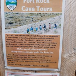
    Fort Rock State Park - Cave tours!

    See all

    Cave tours!

    Newberry National Volcanic Monument - Trail

    Newberry National Volcanic Monument

    4.5(52 reviews)
    35.3 mi

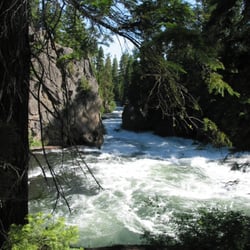
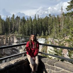
    This review is for 2 different trails. 1. Big Obsidian Flow…read moreTrail was a short and unique trail in Newberry National Volcanic Monument, Oregon. It was a ~0.7 miles round trip that took ~30 minutes to complete. Trail begins on a dirt path and shortly becomes a stairway to the obsidian lava flows. The lava flows were extremely rocky so hiking shoes are recommended. At the highest point of the trail was a distant view of Paulina Lake! Decent sized parking area at the trailhead. Restroom available at the parking lot. Short video of the hike for those interested! https://youtu.be/zshtzzNOCI0 2. Located 5 minutes from the Big Obsidian Flow Trail, Paulina Falls Trail was another short and rewarding trail. It was a ~0.5 miles round trip that took ~30 minutes to complete. Trail was mostly a decline towards the bottom of the waterfall on a dirt path! Limited parking area at the trailhead. Restroom available at the parking lot. Short video of the hike for those interested! https://youtu.be/Q28kfFT9QM0 The Lava Lands Visitor Center was about 30 minutes away.

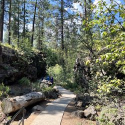
    We did the 1.1 mile Trail of the Molten Lands while in the Newberry National Volcanic Monument. The…read moretrail paved and in good condition. It is uphill and some spots are steep. There are informational signs in different sections of the trail. It was incredible to see how far the lava rock stretched. We stopped in the visitor center as well as the lava river caves and lava butte. We werent able to do the Pauline falls or Obsidian parts as the storms came in quick and hard. It is definitely a sight to see though. Its a milder trail than some others we've done this week and is an easier walk for most of the trail. There is also a half way point to loop around and you dont have to do the steep uphill portion to the look out area.

    Photos
    Newberry National Volcanic Monument - View from the obsidian flow

    View from the obsidian flow

    Newberry National Volcanic Monument - Lava Butte

    Lava Butte

    Newberry National Volcanic Monument - View of Palina lake from the Obsidian Flow trail.

    See all

    View of Palina lake from the Obsidian Flow trail.

    Lowell Covered Bridge - Sunset at Lowell covered bridge

    Lowell Covered Bridge

    3.6(5 reviews)
    62.2 mi

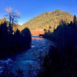
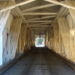
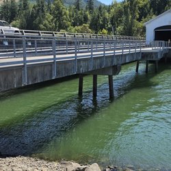
    Near Pioneer Street and Highway 58, Lowell, OR 97452…read more43.90957° N, 122.77952° W Lowell Covered Bridge is a nice spot to get out of the vehicle, stretch your legs, and literally take a short walk through some Oregon history. The original bridge at this location dates back to 1907, while the present covered bridge was built in 1945. At approximately 165 feet long and 24 feet wide, it is considered the widest covered bridge in Oregon. The bridge is no longer open to vehicle traffic and now serves as an interpretive center. A paved walkway with railings leads toward and through the bridge, with displays providing some of the history of covered bridges and the surrounding area. There are also several places along the walkway to stop and enjoy the view. The parking area is large enough that vehicles pulling trailers can maneuver through while still leaving room for regular passenger vehicles. That was something we appreciated while exploring the different recreation areas around Dexter Reservoir. The view across the reservoir is probably as much a reason to stop as the bridge itself. On our visit, we had the added experience of watching a floatplane fly over us and then come down onto the reservoir. Definitely not something we expected to see when we pulled in, but it added a memorable moment to the visit. This does not have to be a long stop. Even if you only have 15 or 20 minutes, it is worth getting out, walking through the bridge, reading some of the displays, and taking a few moments to enjoy the view across the water. See photos.

    The Lowell Covered Bridge is definitely worth a stop if you're in the area. It has a lot of history…read morebehind it, and I really liked that there are displays inside with information and photos about covered bridges in Oregon it makes it more than just something to look at. The views of Dexter Lake right next to it are gorgeous, and honestly, it's one of the best spots around to watch the sunset. It's also a great place to go fishing if you've got the time. Overall, it's a quick visit, but a really neat piece of history and a great photo spot.

    Photos
    Lowell Covered Bridge - Sign

    Sign

    Lowell Covered Bridge
    Lowell Covered Bridge

    See all

    Mt Theilson View Point - landmarks - Updated August 2026
    Loading...
    Loading...
    Loading...