Newspaper Rock State Historic Monument Photos



More like Newspaper Rock State Historic Monument
Recommended Reviews - Newspaper Rock State Historic Monument
Start your review...


Reviews With Photos


This is one of the coolest petroglyph sites I've personally seen. The artwork and symbols carved into this cliff face spans at least 1,500-2,000 years and includes carvings from at least 4 different Native American groups. The sheer number of petroglyphs, along with the variety and the detail of the designs make it well worth the slight detour off the highway to see it.
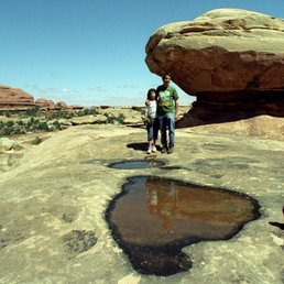

This is one of the West's most famous rock art sites, with a high density of petroglyphs. It was breath-taking as this is a massive expanse of rock all covered in etchings that are as old as 2,000 years ago. It had me contemplating our current existence and what things would look like 2,000 years from now. It was right off the road with a small parking lot with vault toilets. I came during the off season so the lot was empty, but it gets busy enough that there are traffic signs preventing people from parking on the road. Free to park and walk on the sidewalk to the cliff face. read more

6 years ago
NOTE: This petroglyph wall is not located in Monticello, but outside of town about 30 minutes. It's on Highway 211, on your way from US-191 into the Needles District of Canyonlands. I fixed the pin drop marker here on Yelp, but these things can be finicky. It's marked and on the side of the road, but GPS crowds can set to: 37.9879209, -109.5188924. Man, I really love this spot. I mean, it's a nice little get-out-and-stretch and won't take you more than a few minutes, but it's a nice roadside pull-off when you're already off and rolling on adventure. I first visited in 2005 or so and was struck by just how prolific all the petroglyphs are. Sometimes you only see a few in one place, but here at Newspaper Rock, it's plastered with characters. Pull off the highway, park, and walk up the paved path. It'll take you less than two minutes, so almost anyone from grandma to the little ones can make it. There's a small fence at the base of the rock to keep you from touching the panel, but you get a front row seat to the artwork. This is very near a campground, but there is a small toilet facility here so you can hit that up before you get into the park, or out to Lockhart, or wherever your travels are taking you. Note that this is not the only panel in the area. If you keep driving, pay attention to the cliffs and the walls around you--you can spy a few characters. But they're sparse, and in comparison to this amazing display, they may barely register. That's what makes this mysterious spot (but why were ancient inhabitants all tagging it???) so wonderful. read more


The Newspaper Rock State Historic Monument is one cool rock. Talk about history! This old rock has drawings dating back 2000+ year! I can't even wrap my head around that. The parking lot is pretty big and it's just a short walk to see the Newspaper Rock. There's a small low fence around the rock to prevent people from touching it, but you can get pretty close to look at all the different drawings. There are restrooms here with toilets that are like porta potty (just a hole, doesn't flush). I would hold it if possible, otherwise hold your breath and take you chance at the restroom. This monument is located in Utah on Rt. 11, about 23 miles from The Needles district of Canyonlands National Park. read more


14 years ago
This is one of the coolest petroglyph sites I've personally seen. The artwork and symbols carved into this cliff face spans at least 1,500-2,000 years and includes carvings from at least 4 different Native American groups. The sheer number of petroglyphs, along with the variety and the detail of the designs make it well worth the slight detour off the highway to see it. read more



14 years ago

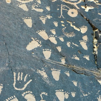
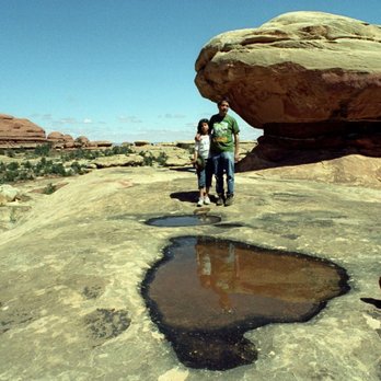
Newspaper Rock takes the form of a very small park, located just to the right-hand side of the road that leads to Canyonlands National Park. This road is Route 211. Newspaper Rock is about ten miles to the west of the main highway (Route 191). During my visit, there was a table of Native American gifts for sale, with a few women running the table. But I cannot recall if we did or did not buy any of the souvenirs. The rock contains pictures of deer, buffalo, antelope, and riders on horses, carved some 2,000 years ago. What can also be seen is a figure resembling Bart Simpson (see my photo). Further information on Newspaper Rock and on other ancient Native American "rock art" can be found in, e.g., Dobrez L (2014) Boletin del Museo Chileno de Arte Procolombino. 19:9-22, Rogers RA (2009) J. International Intercultural Comm. 2:44-65, and Gough G (2009) Sacred Landscape and Native American Rock Art -- Part II. 27:35-48. The dark areas of Newspaper Rock result from something called "desert varnish," which is a deposit of iron and manganese created with the aid of bacteria. After arriving at Canyonlands National Park, we took a hike to the Needles District (see my photo) and Elephant Hill (see my photo). read more


10 years ago
More info about Newspaper Rock State Historic Monument
Ask the Community - Newspaper Rock State Historic Monument


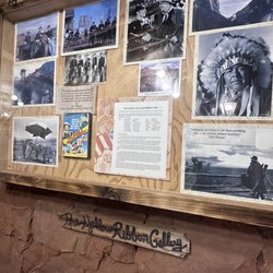


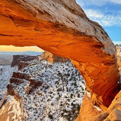


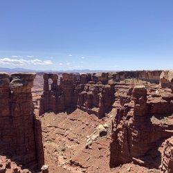
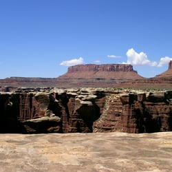













Newspaper Rock State Historic Monument - landmarks - Updated September 2026
Best of Monticello
Browse Brands
Related Searches in Monticello, UT
Best Fishing Locations and Guides in Monticello, Utah
Best Lookout Points to Visit in Monticello, Utah
Best Nature Trails for Hiking in Monticello, Utah
Best Things to Do on a Rainy Day in Monticello, Utah
Best Waterfalls and Swimming Holes in Monticello, Utah
Book Engaging Historical Tours in Monticello, Utah
Check Out Off Road Trails in Monticello, Utah
Discover Charming Historic Homes in Monticello, Utah
Discover Fun Things to Do Alone in Monticello, Utah
Discover Historic Sites and Places in Monticello, Utah
Discover Popular Landmarks in Monticello, Utah
Discover Popular Photo Spots in Monticello, Utah
Discover Top Nature Parks to Visit in Monticello, Utah
Discover the Best Caves to Explore in Monticello, Utah
Discover the Best Dinosaur Park Experiences in Monticello, Utah
Discover the Best Night Hike Trails in Monticello, Utah
Enjoy Hiking Adventures in Monticello, Utah
Enjoy Scenic Night View Experiences in Monticello, Utah
Enjoy the Best Night View Spots in Monticello, Utah
Enjoy the Best Walking Trails in Monticello, Utah
Experience Stunning Sunset Views in Monticello, Utah
Explore Beautiful Parks and Green Spaces in Monticello, Utah
Explore Free Things to Do Around Monticello, Utah
Explore Popular Scenic Overlook Points in Monticello, Utah
Explore Popular Scenic Views Near Monticello, Utah
Explore Popular View Points Around Monticello, Utah
Explore Scenic Lakes to Visit in Monticello, Utah
Explore Secret Spots Worth Visiting in Monticello, Utah
Explore Top Art Galleries Located in Monticello, Utah
Explore Venues & Event Spaces in Monticello, Utah
Find Beautiful Views in Monticello, Utah
Find Exciting Tours to Take in Monticello, Utah
Find Parks and Recreation Activities in Monticello, Utah
Find Top-Rated Waterfalls in Monticello, Utah Now
Find the Best Bridge Spots in Monticello, Utah
Find the Best Parks for Picnics in Monticello, Utah
Must-See Tourist Attractions Around Monticello, Utah
Perfect Spots to Watch Sunset in Monticello, Utah
Plan a Scenic Drive Route Near Monticello, Utah
Popular Picnic Spots to Visit in Monticello, Utah
Popular Places to Take Pictures in Monticello, Utah
Popular Places to Walk Around in Monticello, Utah
Popular Things to Do in Monticello, Utah
Popular Things to See in Monticello, Utah
Top Hiking Trails to Explore in Monticello, Utah
Visit Beautiful Gardens in Monticello, Utah
People found Newspaper Rock State Historic Monument by searching for…
Things to Do in Monticello, UT
Swimming Holes in Monticello, UT
Post Offices in Monticello, UT
Watch Sunset in Monticello, UT
Fishing Spots in Monticello, UT
Picnic Areas in Monticello, UT
Religious Organizations in Monticello, UT
Places to Take Pictures in Monticello, UT
Off Road Trails in Monticello, UT
Hiking Trails in Monticello, UT
Scenic Overlook in Monticello, UT




