Cancel

    Open app

    Search

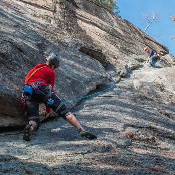
    Northern Vertical

    5.0 (2 reviews)
    Open 8:00 am - 8:00 pm

    Northern Vertical Photos

    You might also consider

    Recommended Reviews - Northern Vertical

    Your trust is our priority, so businesses can't pay to alter or remove their reviews. Learn more about reviews.
    Yelp app icon
    Browse more easily on the app
    Review Feed Illustration

    10 years ago

    Business owner information

    Photo of Ryan H.

    Ryan H.

    Helpful 0
    Thanks 0
    Love this 0
    Oh no 0

    11 years ago

    Helpful 0
    Thanks 0
    Love this 0
    Oh no 0

    Ask the Community - Northern Vertical

    Verify this business for free

    Get access to customer & competitor insights.

    Verify this business

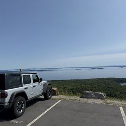
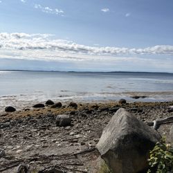
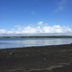
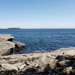
    Moose Point State Park - View from the trail

    Moose Point State Park

    4.6(5 reviews)
    7.4 km

    This is a nice little state park that we have driven but never stopped. Im so glad we stopped this…read moreday. Its on the water with a rocky beach. Lots of parking. The trail we walked went right along the ocean and had lots of picnic tables and benches to stop. Such a beautiful spot.

    I feel the need to preface all of my nature reviews with this: being 90% forested and having around…read more3500 miles of coastline, Maine has a tremendous amount of spaces, walkways, paths, and trails of all kinds and of all levels. There's something for everyone. What I'm reviewing is how a spot compares to similar outdoor spots in my personal opinion. Being in nature - and remembering to carry in, carry out - is always five stars! :) Parking? Yes. Loop trail? Kind of. Well marked signs? Not really. Element of surprise? No. For Cumberland County folks, Moose Point feels like a combination of Fort Williams Park and Mackworth Island. It's got grassy knolls to picnic on with views of Penobscot Bay, evergreen groves to meander through via wide and well maintained trails (some of which have benches, some of which have little staircases leading down to the pebbled water's edge), a gazebo for events, and during low tide there are tidal pools to explore (during high tide it's much more difficult to navigate because it's mostly just uneven rocks and not much of a shore). I think this is a beautiful spot in midcoast Maine, and I'm glad there are locations like it throughout the state. Personally, I don't necessarily feel the need to come back (except to get my Maine State Parks Passport Stamp!!!), just because we have something soooooooooooo similar so close. But I can see how it's a draw for so many!

    Photos
    Moose Point State Park
    Moose Point State Park
    Moose Point State Park

    See all

    Dyce Head Lighthouse

    Dyce Head Lighthouse

    4.4(5 reviews)
    17.6 km

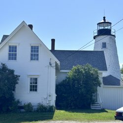
    Searching for lighthouses in Maine is as much fun as searching for covered bridges in Vermont and…read moreNew Hampshire. Obviously, the lighthouses are going to be set on the water, but they are also, most of the time, far removed from the main highways and roads. Such is the case here. In the lovely little town of Castine, sits Dyce Head Lighthouse. Dyce Head, or otherwise known as Dice Head, was built in 1828 for $5,000 on land owned by the Dyce family. The lighthouse was deactivated in 1937 and relit in 2008. Tours are available in the Summer only, every other Tuesday.

    Our first lighthouse of the day as we head south from Ellsworth, the Dyce Head Lighthouse is about…read more16 miles from US-1 onto the peninsula. There is a small parking lot here (too small!) and there is a nice walk around the lighthouse as the property is open for visitation. Dyce Head was nice and it is a lighthouse, but it was not my favorite of the ones we visited this weekend. There is a steep and narrow path down to the water which I would not recommend. The lighthouse was first established in 1829, the light was deactivated in 1937 and replaced with a simple skeleton tower that was destroyed by a storm. Following that, this old light was reactivated in 2008. The tower is 129 feet above the mean high tide point. It is officially a tower of rubble masonry laid in a lime mortar that was repaired in 1998 with a slurry injection of liquid concrete. The structure still stands. [Review 14881 overall, 383 of 2021, number 63 in Maine.]

    Photos
    Dyce Head Lighthouse
    Dyce Head Lighthouse
    Dyce Head Lighthouse

    See all

    Bald Mountain Trail

    Bald Mountain Trail

    5.0(2 reviews)
    24.3 km

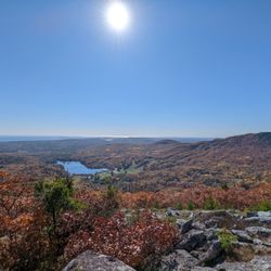
    This was a backup hike when we realized Camden Hills State Park didn't open until 9am and I wanted…read moreto get an early start. I was in no way disappointed with the hike I got. Bonus, no day use fee here. There is a decent size parking lot and a (mostly) well marked trail. We lost the trail at a couple points - I think mostly due to the amount of leaves and pine needles covering the trail, but we were able to pick it back up eventually. Most of the trail is marked with blue paint on the trees. Well shaded for most of the trail with gorgeous views. Make sure you have footwear with decent grip. Everything was pretty dry even after two days of rain before. It's a quick out and back with a decent elevation gain. On a Tuesday am we saw about 4 other groups on the trail - most with dogs. I am going to assume it might get busy on a weekend but it was a lovely peaceful sunny morning.

    I feel the need to preface all of my nature reviews with this: being 90% forested and having around…read more3,500 miles of coastline, Maine has a tremendous amount of spaces, walkways, paths, and trails of all kinds and of all levels. There's something for everyone. What I'm reviewing is how a spot compares to similar outdoor spots in my personal opinion. Being in nature - and remembering to carry in, carry out - is always five stars! :) Parking? Yes. Loop trail? No. Well marked signs? No. Element of surprise? Yes. What an unexpected gem this was! From the placard at the top of the mountain: "at 1,280 feet, Bald Mountain is the fifth highest peak on the eastern seaboard of the U.S. Given the number of its unusual ecological features, Bald Mountain has been designated as a focus area of statewide significance by the Maine Natural Areas Program... the mountain is home to a variety of threatened subalpine plan and lichen species uniquely adapted to extremes of temperature, wind, and precipitation that define these exposed mountain ledges. Given the exposure, shallow soils, and challenge of growing in bedrock cracks, the summits plants are also very sensitive to food traffic. We hope that you will help us care fo the mountain and it's wildlife." Stewardship of Bald Mountain includes: 1. Walk on the established managed trail. 2. Stay on bedrock to avoid vegetation. 3. Do not create or add to cairns (gathering stones on the summit disturbs shallow soil and plants to live around them). The exposed granite ledges are much wider and spacious than I thought they'd be - there's really so much to explore (respectfully) here! Come on a sunny, wind-free day and it's a warm, lovely place to sit and have a picnic. From the top you can see directly across to Little Ragged Mountain and Penobscot Bay, and Camden. It's a quick uphill at 1.2ish miles and there's a few sections with rock scrambles, and due to the thick forest the blazes and trail seem sporadic at times. I met a couple from Vermont at the top and we all agreed it was a little confusing at times (we couldn't entirely figure out where the blue blazes stopped/started at the top for example) - as were the multiple false summits, but honestly that's a positive here, because every time you think "well the view can't get better than this" you hike a bit more - and it does! Absolutely will come back again (especially in the summer when the blueberries are ripe)!

    Photos
    Bald Mountain Trail
    Bald Mountain Trail
    Bald Mountain Trail

    See all

    Reynolds Forest

    Reynolds Forest

    5.0(1 review)
    55.9 km

    I feel the need to preface all of my nature reviews with this: being 90% forested and having around…read more3500 miles of coastline, Maine has a tremendous amount of spaces, walkways, paths, and trails of all kinds and of all levels. There's something for everyone. What I'm reviewing is how a spot compares to similar outdoor spots in my personal opinion. Being in nature - and remembering to carry in, carry out - is always five stars! :) Parking? Sort of. Loop trail? Yes. Well marked signs? Yes. Element of surprise? Yes. What. A. Find. Whenever I'm journeying around Maine (checking out state parks or Atlas Obscura recommended spots), I try and also find a few trails or hiking spots to check out (because the state is huge, and when I'm in an area I'm not usually in, I want to discover spots I wouldn't otherwise!). Reynolds Forest was the best part of my day! In fact, one of the most standout spots I've been to in a while! According to the Kennebec Land Trust website (https://www.tklt.org/reynolds), "This 35 acre parcel provides visitors excellent birding opportunities, interesting wildflowers and floodplain species, and views of the powerful brook (now called Goff Brook), with its foaming water roaring over exposed rocks into stone-lined pools. Part of the conservation property not visible from the trail has seen an increase in invasive Japanese knotweed and non-native bush honeysuckle, and has served as a field research site for Colby College students studying invasive plant control methods." There's some parking off the shoulder of the main road, and the walk into the woods alongside Goff Brook is lovely. It's not long before you can suddenly hear the roaring of the (small, but mighty) waterfalls (which was once used for saw and grist mills. We made sure to come after a couple days of rain and it was worth it! We gently navigated out to some exposed rocks and sat in the sun, near the falls, surrounded by tall trees for a long time. Perfect spot for a picnic (and... I think we also spotted some foragers too). There's also a small Old Farm Loop Trail that passes by fields and an old foundation a little further beyond the Streamside Trail. BEWARE OF TICKS. BEWARE OF POISON IVY. WEAR APPROPRIATE SHOES.

    Photos
    Reynolds Forest
    Reynolds Forest
    Reynolds Forest

    See all

    Northern Vertical - rock_climbing - Updated August 2026
    Loading...
    Loading...
    Loading...