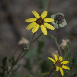
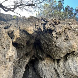
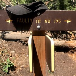
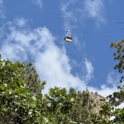
Ojito de San Antonio Open Space Photos


More like Ojito de San Antonio Open Space
Recommended Reviews - Ojito de San Antonio Open Space


More info about Ojito de San Antonio Open Space
Cedar Crest
New Mexico, NM 87008
Directions
(505) 314-0400
Call Now
Hours
Outdoor Amenities


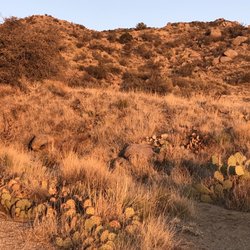

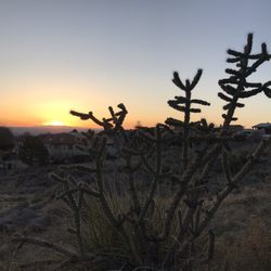


Ojito de San Antonio Open Space - hiking - Updated July 2026
Best of New Mexico
People found Ojito de San Antonio Open Space by searching for…
Things to Do in New Mexico, New Mexico
Hiking Trails in New Mexico, New Mexico
Walking Trails in New Mexico, New Mexico
Waterfalls in New Mexico, New Mexico
Running Trails in New Mexico, New Mexico
Off Road Trails in New Mexico, New Mexico
Fun Places to Go in New Mexico, New Mexico
Trails in New Mexico, New Mexico
Scenic View in New Mexico, New Mexico
Running Routes in New Mexico, New Mexico
Picnic Areas in New Mexico, New Mexico
Places to Visit in New Mexico, New Mexico
Picnic Areas BBQ Pits in New Mexico, New Mexico
Attractions in New Mexico, New Mexico
Open in New Mexico, New Mexico
Photo Spots in New Mexico, New Mexico
Free Campgrounds in New Mexico, New Mexico
Sunrise Hike in New Mexico, New Mexico
Picnic Spots in New Mexico, New Mexico
What to Do in New Mexico, New Mexico
Browse Nearby
BEST of New Mexico, New Mexico Parks near Ojito de San Antonio Open Space
BEST of New Mexico, New Mexico Walking Trails near Ojito de San Antonio Open Space
BEST of New Mexico, New Mexico Restaurants near Ojito de San Antonio Open Space
BEST of New Mexico, New Mexico Coffee near Ojito de San Antonio Open Space
BEST of New Mexico, New Mexico Things to Do near Ojito de San Antonio Open Space
BEST of New Mexico, New Mexico Campgrounds near Ojito de San Antonio Open Space
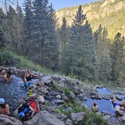
BEST of New Mexico, New Mexico Hot Springs near Ojito de San Antonio Open Space
BEST of New Mexico, New Mexico Breakfast near Ojito de San Antonio Open Space
BEST of New Mexico, New Mexico Ski Resorts near Ojito de San Antonio Open Space
Browse Brands
Browse Articles
People who viewed Ojito de San Antonio Open Space also viewed
Paseo del Bosque - Alameda Access Point
11 reviews
North Valley/Los Ranchos
Travertine Falls
1 review
Juan Tabo Cabin
1 review
Cibola National Forest
12 reviews
Business Parkway/Academy Acres
Boca Negra Canyon
21 reviews
Westside
Domingo Baca Trailhead 230
3 reviews
Michial M Emery Bear Canyon Trailhead
3 reviews
Sandia Mountains
22 reviews
Eastside
TWA Plane Crash Hiking Trail
5 reviews
Eastside
Sandia Park
12 reviews