
Paseo del Bosque - Alameda Access Point Photos


More like Paseo del Bosque - Alameda Access Point
Recommended Reviews - Paseo del Bosque - Alameda Access Point
Start your review...

Reviews With Photos

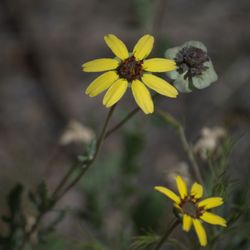
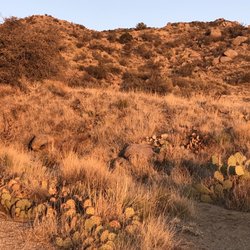
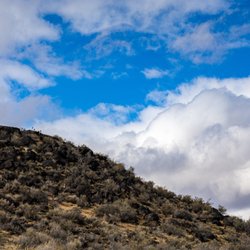
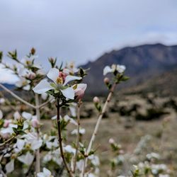
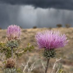
Neat scenery with great hiking trail. The early spring and late fall with winter are the best times to go if you don't like bugs. If you are a prepared explorer and can endure the bugs summer is an excellent time to hike through the Bosque! The green scenery and unique trees and wildlife make you feel like your outside the city. You can go toward the river and see all the ducks and wildlife it's beautiful. There's a picnic area on the other side of alameda along with a separate bridge above the river you can cross. If your a photographer and love doing landscapes this is the place to be! Such great views all around if your willing to explore!

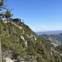
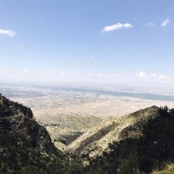
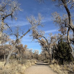
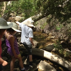
What a beautiful area of The Bosque! On this trail you get to take in the Cottonwood forest, the Rio Grande and the Sandias all in one place! There is a nice shaded picnic area on the NE side and a natural trail you can follow north of there. Sand, fallen tree branches, and critters abound. Lots of great scenery and views of the Rio Grande with the Sandias in the distance. Head south of the Alameda bridge to check out the wetlands and wildlife area and continue along the paved trail along the Rio if that's more your style. There are a couple porta potties near the parking lot on the SE side, otherwise no facilities around until you head further south. Runners, walkers, bikers and horseback riders are all common to see in this area. Plus some fishing when the water levels are high enough.

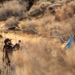
I really love this access point, awesome for a morning stroll. Whether you're walking solo, with a crew, staging a photography shoot, walking the dogs, hopping on your bicycle to Tingley Beach and back, or beyond, or just looking to throw a fishing line in, have a picnic, or jump on a raft and float the day away, this is such an effortless spot to do so. Little places like this bring such a smile to my face, it's the simple pleasures in life dahlings, and we're blessed to have so many in our neck o' the woods. read more


This is such a beautiful area to walk enjoy nature. I'm visiting from out of town and am looking for ways to destress from the work environment and I can't think of a better way than taking a walk along the trail. There is a paved trail you can walk or bike. Additionally you can walk along a dirt trail along the river. Parking is free see if no excuse not to get out there And enjoy mother nature. read more

Neat scenery with great hiking trail. The early spring and late fall with winter are the best times to go if you don't like bugs. If you are a prepared explorer and can endure the bugs summer is an excellent time to hike through the Bosque! The green scenery and unique trees and wildlife make you feel like your outside the city. You can go toward the river and see all the ducks and wildlife it's beautiful. There's a picnic area on the other side of alameda along with a separate bridge above the river you can cross. If your a photographer and love doing landscapes this is the place to be! Such great views all around if your willing to explore! read more

 of mine at the Alameda Bosque - Hiking Near Me - Albuquerque, New Mexico")
 of mine at the Alameda Bosque - Hiking Near Me - Albuquerque, New Mexico")
10 years ago
What a beautiful area of The Bosque! On this trail you get to take in the Cottonwood forest, the Rio Grande and the Sandias all in one place! There is a nice shaded picnic area on the NE side and a natural trail you can follow north of there. Sand, fallen tree branches, and critters abound. Lots of great scenery and views of the Rio Grande with the Sandias in the distance. Head south of the Alameda bridge to check out the wetlands and wildlife area and continue along the paved trail along the Rio if that's more your style. There are a couple porta potties near the parking lot on the SE side, otherwise no facilities around until you head further south. Runners, walkers, bikers and horseback riders are all common to see in this area. Plus some fishing when the water levels are high enough. read more


9 years ago
More info about Paseo del Bosque - Alameda Access Point
Ask the Community - Paseo del Bosque - Alameda Access Point
Review Highlights - Paseo del Bosque - Alameda Access Point


Paseo del Bosque - Alameda Access Point - hiking - Updated July 2026
Best of Albuquerque
People found Paseo del Bosque - Alameda Access Point by searching for…
Sunset View in Albuquerque, NM
Scenic View in Albuquerque, NM
Picnic Areas in Albuquerque, NM
Hiking Trails With Waterfalls in Albuquerque, NM
Walking Trails in Albuquerque, NM
Swimming Lakes in Albuquerque, NM
Playgrounds in Albuquerque, NM
Running Trails in Albuquerque, NM
Easy Hiking Trails in Albuquerque, NM
Places to Take Pictures in Albuquerque, NM
Secret Spots in Albuquerque, NM
Attractions in Albuquerque, NM
Parks With Shade in Albuquerque, NM
Photo Spots in Albuquerque, NM
Picnic Areas BBQ Pits in Albuquerque, NM
Natural Hot Springs in Albuquerque, NM
Lakes & Ponds in Albuquerque, NM
Trending Searches in Albuquerque, NM
Boat Tours near Paseo del Bosque - Alameda Access Point
Cliff Jumping near Paseo del Bosque - Alameda Access Point
Day Trips near Paseo del Bosque - Alameda Access Point
Dog Friendly Trails near Paseo del Bosque - Alameda Access Point
Kayak Rental near Paseo del Bosque - Alameda Access Point
Kids Activities Indoor near Paseo del Bosque - Alameda Access Point
Lakes near Paseo del Bosque - Alameda Access Point
Off Road Trails near Paseo del Bosque - Alameda Access Point
Outdoor Activities near Paseo del Bosque - Alameda Access Point
Parks For Picnics near Paseo del Bosque - Alameda Access Point
Places To Swim near Paseo del Bosque - Alameda Access Point
Places To Walk Around near Paseo del Bosque - Alameda Access Point
Public Shower near Paseo del Bosque - Alameda Access Point
Public Swimming Pools near Paseo del Bosque - Alameda Access Point
Rainy Day Activities near Paseo del Bosque - Alameda Access Point
River Swimming near Paseo del Bosque - Alameda Access Point
River Tubing near Paseo del Bosque - Alameda Access Point
Rock Quarry near Paseo del Bosque - Alameda Access Point
Scenic Night View near Paseo del Bosque - Alameda Access Point
Soccer Store near Paseo del Bosque - Alameda Access Point
State Parks Camping near Paseo del Bosque - Alameda Access Point
Sunrise View near Paseo del Bosque - Alameda Access Point
Swimming Holes near Paseo del Bosque - Alameda Access Point
Swimming Lakes near Paseo del Bosque - Alameda Access Point
U Pick Farms near Paseo del Bosque - Alameda Access Point
Watch Sunset near Paseo del Bosque - Alameda Access Point
Browse Articles
Browse Nearby
BEST of Albuquerque, New Mexico Coffee near Paseo del Bosque - Alameda Access Point
BEST of Albuquerque, New Mexico Restaurants near Paseo del Bosque - Alameda Access Point
BEST of Albuquerque, New Mexico Parks near Paseo del Bosque - Alameda Access Point
BEST of Albuquerque, New Mexico Things to Do near Paseo del Bosque - Alameda Access Point
BEST of Albuquerque, New Mexico Breakfast near Paseo del Bosque - Alameda Access Point
BEST of Albuquerque, New Mexico Photo Spots near Paseo del Bosque - Alameda Access Point
BEST of Albuquerque, New Mexico Taxis near Paseo del Bosque - Alameda Access Point
BEST of Albuquerque, New Mexico Campgrounds near Paseo del Bosque - Alameda Access Point
Browse Brands
Related Searches in Albuquerque, NM
Affordable Kayak Rental Services in Albuquerque, New Mexico
Best Dog Hiking Trails Around Albuquerque, New Mexico
Best Fishing Locations and Guides in Albuquerque, New Mexico
Best Places for Horseback Riding in Albuquerque, New Mexico
Best Sightseeing Experiences Available in Albuquerque, New Mexico
Check Out Off Road Trails in Albuquerque, New Mexico
Discover Dog Friendly Trails to Explore in Albuquerque, New Mexico
Discover Easy Hiking Trails Near Albuquerque, New Mexico
Discover Popular Bike Trails in Albuquerque, New Mexico
Discover a Hiking Trail in Albuquerque, New Mexico
Discover the Best Night Hike Trails in Albuquerque, New Mexico
Dog-Friendly Hikes With Dogs in Albuquerque, New Mexico
Enjoy Camping Adventures Around Albuquerque, New Mexico
Enjoy Kayaking Adventures in Albuquerque, New Mexico
Enjoy Off Leash Dog Hikes in Albuquerque, New Mexico
Enjoy Scenic Places to Walk in Albuquerque, New Mexico
Enjoy Tent Camping Spots Around Albuquerque, New Mexico
Enjoy the Best Walking Trails in Albuquerque, New Mexico
Experience Stunning Sunset Views in Albuquerque, New Mexico
Explore Beautiful Parks and Green Spaces in Albuquerque, New Mexico
Explore Easy Hikes Perfect for All in Albuquerque, New Mexico
Explore Fun Activities to Do in Albuquerque, New Mexico
Explore Popular Campgrounds Near Albuquerque, New Mexico
Explore Scenic Lakes to Visit in Albuquerque, New Mexico
Explore Top Dog Parks in Albuquerque, New Mexico Near You
Family Friendly Hiking With Kids in Albuquerque, New Mexico
Find Beautiful Views in Albuquerque, New Mexico
Find Cozy Camping Cabins in Albuquerque, New Mexico
Find Parks and Recreation Activities in Albuquerque, New Mexico
Find a Public Running Track in Albuquerque, New Mexico
Find the Best Parks for Picnics in Albuquerque, New Mexico
Find the Best Playgrounds to Visit in Albuquerque, New Mexico
Find the Best Scenic View Locations in Albuquerque, New Mexico
Hiking Trails With Waterfalls in Albuquerque, New Mexico
Off Leash Dog Hiking Trails in Albuquerque, New Mexico
Picnic Areas With BBQ Pits Available in Albuquerque, New Mexico
Plan a Scenic Drive Route Near Albuquerque, New Mexico
Popular Outdoor Activities to Try in Albuquerque, New Mexico
Popular Picnic Spots to Visit in Albuquerque, New Mexico
Safe and Fun Parks for Kids in Albuquerque, New Mexico
Top Hiking Trails to Explore in Albuquerque, New Mexico
Top Paddleboarding Activities in Albuquerque, New Mexico
Top Playgrounds for Kids to Enjoy in Albuquerque, New Mexico
Top Running Trails to Explore in Albuquerque, New Mexico
Top Swimming Lakes to Enjoy in Albuquerque, New Mexico
Top Swimming Spots and Pools in Albuquerque, New Mexico
Top Things to Do With Kids in Albuquerque, New Mexico


