Cancel

    Open app

    Search

    Osborne Mountain Trail

    5.0 (1 review)

    Osborne Mountain Trail Photos

    You might also consider

    More like Osborne Mountain Trail

    Recommended Reviews - Osborne Mountain Trail

    Your trust is our priority, so businesses can't pay to alter or remove their reviews. Learn more about reviews.
    Yelp app icon
    Browse more easily on the app
    Review Feed Illustration

    10 months ago

    Helpful 10
    Thanks 3
    Love this 11
    Oh no 0

    Verify this business for free

    People searched for Hiking 103 times last month within 15 miles of this business.

    Verify this business

    Mount Fremont Lookout Trail - Instagram: @telephonesmoothie

    Mount Fremont Lookout Trail

    4.8(5 reviews)
    2.9 mi

    One of my favorite hikes in Mt Rainier. The hike is rough, but the end is 100% worth it…read more You'll access the Sourdough Ridge Trail about 600 feet from the visitor center, take it for about 1.1 miles, you'll hit Frozen Lake, and then it's another 1.3 miles up to the Overlook. You will get the most incredible views of Mt Rainier. The initial start of the Sourdough Trail is steep and strenuous, but give it about 0.2 miles - it's going to level out and be easy until you get to Frozen Lake. Don't hold your breath for Frozen Lake. We came in September - there was nothing frozen, no snow, and it was more like a small pond. Maybe it looks pretty in early spring when the park re-opens? Anywho, the trail is definitely strenuous. Pace yourself, take breaks if you need it, and drink lots of water (and make sure to BRING plenty of water). The overlook is incredible, and the views of Mt Rainier are breathtaking. The ranger station wasn't staffed while we were there, but you could climb up it for a better view. Otherwise, take a seat on a rock, eat some snacks, and enjoy! Overall, this hike will probably leave you feeling a bit wrecked, but it is well-worth all the effort.

    Arrived 5:50am Saturday in mid September. It was also free national park day. The last hour or so…read moreto Sunrise Visitor Center (the trailhead) from Portland area is long and meandering and dark. I recommend downloading an offline map since there's no service. I wanted to get to the trailhead before sunrise. Once I got to Sunrise, the parking lot was 20-25% full and there were several parties starting their hike as well. I wish I brought a headlamp because it was pitch black. The bathrooms were open and the toilet flushed and the sinks had soap still. The trail is right behind the bathrooms. It took about an hour to get to the top. It's pretty rocky and most parts it's narrow so I would recommend hiking shoes. I was warming up because of the hike but at the lookout, it was so cold! Bring gloves, a hat and layers. The forecast said it would be cloudy. I checked Windy.com to see the cloud patterns before I left and there was an opening. I've been to Mt Rainier on a clear day but on a partially cloudy day it was just as nice.

    Photos
    Mount Fremont Lookout Trail - Instagram: @telephonesmoothie

    Instagram: @telephonesmoothie

    Mount Fremont Lookout Trail - Chipmunk Visitor

    Chipmunk Visitor

    Mount Fremont Lookout Trail

    See all

    Little Mashel Falls - It was a good hike! Definitely worth the view!

    Little Mashel Falls

    4.7(42 reviews)
    16.3 mi

    I've completed the Little Mashel Falls Hike around 10 times since 2022. I mostly conduct this hike…read moreduring the spring season. For many people or those weather-prone or ill-equipped, it's really wet and cold around this time. However, it's the best time to go because this is peak flow season for the middle fall and the increasing of waterfall spates (volume) around the three falls. On this particular day (late summer), the falls were dry. In other words, the falls were reduced significantly and very marginal to say the least. As far as the trail, it's pretty straightforward. It's relatively smooth, with a very slight incline for approximately 2 miles until you reach the falls. Make sure you're consistently traveling to the left directionally of the path until you see a large stone/rock stage to the left, which leads to a trail to all of the falls. About 200 feet in, the trail begins a slight decline. From this point, the pathways to all three falls feature moderate decline on the way in and inclines on the way out. However, this is one of the easiest water hikes I've ever done that even your most novice hikers would find eventful. The biggest and most beautiful fall of them all is the Middle. Tips: Make sure to check the weather report before you conduct this hike. It's notorious for sudden inclement weather such as scattered rain/hail storms especially during the spring. If you don't pack the right equipment, you will be stuck in the middle of a painful hail storm. Bring a rain coat or poncho because it gets really misty around the middle fall and you could find yourself quickly getting soaked. Lastly, a lot of people get lost trying to find the trail to the falls. I posted a picture of the rock for your reference. This is where you want to take a left and go to the falls.

    This is the way you should go when hiking to Little Marshall falls by way of Bud Blanchard…read moreTrailhead.

    Photos
    Little Mashel Falls
    Little Mashel Falls
    Little Mashel Falls - Stone (Landmark) entry trail leading to the falls

    See all

    Stone (Landmark) entry trail leading to the falls

    Reflection Lakes Loop Hike - Great reflection of mt Reinier

    Reflection Lakes Loop Hike

    4.7(9 reviews)
    11.7 mi

    This is a great hike for photographers if you want to get both a nice view of Mount Rainier and of…read moreits reflection in the lake. The best time to come here is on a clear day and when the water is calm. You get stunning views of the alpine lakes and of the mountain peaks in the background. I made two stops here during my trip because the wind had caused ripples on the water and I wasn't able to get a clear shot with my camera. The reflection was much more clearer the second stop. Reflection Lakes is located off of Stevens Canyon Road just south of Paradise in Mount Rainier National Park. After parking, head down to the lake to find the hiking trail. The parking lot can fill up during the busier part of the day. The Lakes Trail is a three mile loop trail that goes around the lake and starts from either end of the parking lot. Wildflowers border the lakes in summer which adds some nice color to your photographs. The park asks that you stay on the trail to protect the meadow around the lake. Pinnacle Peak Trail is another popular trail that starts south of the Reflection Lakes parking lot. I really enjoyed making a stop here. It is one of the best places to get an iconic picture of Mount Rainier. There is no swimming, fishing, or boating in Reflection Lakes. But nearby Louise Lake allows wading and fishing. You can only visit Reflection Lakes in the summer as Stevens Canyon Road closes up during the winter season.

    Made a quick stop here to see the reflection of Mt Rainier…read more Heard it's supposed to be beautiful at sunrise, but it was rainy during our visit so we forewent the early morning visit. Came around 9am-ish on a cloudy day and were able to see a decent reflection - can only imagine how beautiful it would be on a nice, sunny day. We did a bit of the walk around the lakes, and while the walk was nice, the best views come from the overlooks where you park. Definitely worth a quick stop while driving by. If the weather is good, consider sunrise - you might be in for a wonderful surprise.

    Photos
    Reflection Lakes Loop Hike - 9/21/24

    9/21/24

    Reflection Lakes Loop Hike
    Reflection Lakes Loop Hike - 9/21/24

    See all

    9/21/24

    Mount Rainier National Park - Incline Cider

    Mount Rainier National Park

    4.8(307 reviews)
    2.5 mi

    The most beautiful park. There was a lot of closures when I visited in 8/26, especially on the est…read moreside of park, so my access was limited. There are 4 main areas of the park: Longmire, Paradise, Stevens Canyon and Sunrise. Longmire: Very historical, with a walking Historical tour of the buildings, park inn, museum, old gas station, wilderness center and general store. Paradise: extremely busy! Get here before 7am or after 2pm to get a parking space. Includes an inn with gift shop, visitors center woth deli and store and ranger station. This is where the most popular Skyline Trail is located (5.5 miles, 1700ft elevation gain). Steven's Canyon/Ohanapecosh: campground, visitors center (both currently closed) Sunrise/White River: currently closed Even if you have mobility issues, there is plenty to see in this park. Along the southern border, there are 4-5 easy trails. A few are even paved and ADA accessible. There are several beautiful waterfalls and rivers to see just from the road pullouts too. 34/63

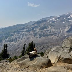
    One of America's most majestic peaks, Mount Rainier towers over the Washington landscape like a…read morebeacon, easily visible on clear days from downtown Seattle, 70 miles to the north. Close up, the mountain's 14,000' peak often disappears behind treetops and fog, playing a game of hide and seek with visitors traversing the winding roads of its sprawling national park, craning their necks for a glimpse of the summit. But a visit to Mount Rainier National Park is like a game of chance. You can leave Seattle, as we did recently, under clear morning skies, with the mountain looming far in the distance, and then watch the clouds slowly close in as you near your destination. Weather conditions can make all the difference here, so make sure you pay close attention before setting out. Mid July through early September provide the best window to see the mountain in all its summertime glory -- come earlier in the year and you may find an environment decidedly less accommodating for the casual hiker. Rainier offers dozens of hiking trails, waterfalls, lakes and scenic vistas, and the ideal visit requires multiple days to experience it all. If you're coming for a day trip from the Seattle area, arrive early to beat the traffic at the entrance and prioritize easily accessible spots like Narada Falls, Reflection Lake and Paradise Meadows, where parking spots quickly disappear by noon. We arrived at the South Entrance on a weekday around 9 a.m. and drove right up to the entrance gate, but the lines to enter during peak season, especially on weekends, can be notoriously long. A highly recommended stop is the Longmire Visitor Center, where the rangers will advise you on road and trail conditions and help you plan your day. The park's showstopper is the popular Skyline Trail, a moderately challenging 5.5-mile loop that climbs 1,500' from the parking lot at Paradise Meadows to the spectacular Panorama Point Overlook. In summer, the trail meanders through a breathtaking sea of wildflowers and offers views of glaciers and waterfalls as it works its way across Rainier's southern slope. But on our recent visit, in early June, we found out that a even a light rain can makes the park's spectacular Skyline Trail a dicey expedition. The cold drizzle we encountered at the trailhead quickly evolved into an icy mix of sleet and snow as our family neared Panorama Point, making the narrow trails dangerously slick. Despite coming equipped with winter jackets, warm gloves and sturdy hiking boots, the conditions forced us to retreat before reaching the trail's famous overlook, which was already shrouded in dense fog. Despite not being able to enjoy the views and scenery we had hoped for, our visit to Mount Rainier was an unforgettable experience -- a challenging but highly rewarding winter hike on snow-covered trails surrounded by glaciers, icy peaks, and furry marmots who bounded around us like giant squirrels posing for candid photos. It was also a reminder that any visit to a national park is subject to the grace of Mother Nature, and inspired us to plan a return trip to this spectacular place -- hopefully when we can see Rainier's summit against a blue Washington sky.

    Photos
    Mount Rainier National Park - Mount Rainier Wild Huckleberry Razzle Candy Bar

    Mount Rainier Wild Huckleberry Razzle Candy Bar

    Mount Rainier National Park - Mount Fremont Lookout Trail | Instagram: @telephonesmoothie

    Mount Fremont Lookout Trail | Instagram: @telephonesmoothie

    Mount Rainier National Park - Tolmie Peak Trail | Instagram: @telephonesmoothie

    See all

    Tolmie Peak Trail | Instagram: @telephonesmoothie

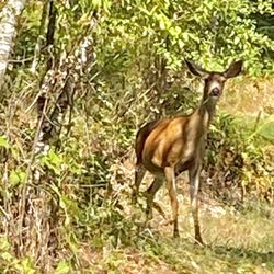
    Alder Lake Park - A friendly deer grazing at one of the camp sites.

    Alder Lake Park

    3.8(31 reviews)
    15.9 mi

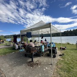
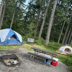
    There are two elements for me when it came to camping. One is the campground facility itself, the…read moresecond one is the campers demography, or mainly the neighbors. For the campground facility I'd say this park checked all the boxes for me. There's natural water body, clean toilet (even with shower, although I didn't use it), and I got to see deers! There's also a convenient store right outside the campground. What I hate was my neighbor. To be specific, the group of people check in later on the 5th of July at the campsites of 66 and 65. I've never seen campers this obnoxious in my life. Not only they arrived late and make a scene, they also kept their boring unseasoned music all the way til almost 1am! Like what kind of etiquette was that? Who raise those people? And they also had kids too. Yeah so besides these annoying neighbor I actually find this campground quite nice.

    I really wish we had a better experience at this campground. We were looking for something near…read moreMount Rainier, and this fit the bill. Some of the sites were basically right in the parking lot, but most of them were really nice. Ours was a walk-in site up the hill with lots of trees and greenery. It had a nice flat area along with a picnic table. The bathrooms were close and clean, and I loved having the lake nearby. However, the campground was really loud and rowdy. We stayed for two nights, and each night there were two to three large family groups that were loud until after 11 pm. We heard a car playing music with loud bass. A groups of kids entered the echoing bathroom and played, screaming, turning on the hand blowers, and spraying water everywhere. It was just really loud and the quiet hours were not enforced. The campground had all the ingredients to make a great stay. We just had a few loud groups that disturbed the otherwise quiet campground. I hope we just had bad timing.

    Photos
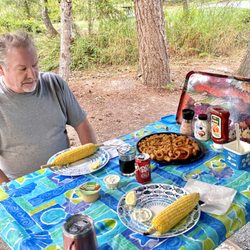
    Alder Lake Park - Eating outside so enjoyable, park well maintained and overseen constantly, no riff raff or noise.

    Eating outside so enjoyable, park well maintained and overseen constantly, no riff raff or noise.

    Alder Lake Park - Enjoying family time!

    Enjoying family time!

    Alder Lake Park - Our campsite 205

    See all

    Our campsite 205

    Skyline Loop - Posing for a photo

    Skyline Loop

    4.8(44 reviews)
    11.7 mi

    We parked at Henry M.Jackson Memorial Visitor Center. In the…read moreoverflow lot designated for people that plan to spend more than 2 hours. This place gets very crowded so parking is challenging. We checked out inside and got a map of all the hikes. There are bathrooms inside. We picked Skyline Loop because it was the hardest and were told it had breathtaking views. The trails head is marked with all the different trails with arrows guided for visitors. It starts off with an asphalt path but turns into gravel, rocks/steps. I recommend bringing walking sticks for balance. Please listen to the 10 essentials that they recommend. PROTECT THE MEADOWS! Stay on trails. Do not pick flowers. Leave No Trace of your visit. Pets are NOT allowed on trails. Do not feed or approach wildlife. Use a topographic map. Permit required for Wilderness camping. And PLEASE BRING WATER! Carry the "10 Essentials" A topographic map and compass, extra food, extra clothing/rain gear, emergency shelter, first aid kit, headlamp or flashlight and spare batteries, extra water, sunglasses and sunscreen, repair kit/tools, and waterproof matches-for emergency use only (fires are not allowed in the backcountry.) This is all from the flyer we picked up at the visitor center. This trail is difficult! It's all uphill (like a 10 -15 incline on treadmill) it's down hill on the way down. Spectacular views throughout the hike. Lots of wildlife! Highly recommend! I can't wait to go back to try all the other trails.

    1Billion/10 recommend! I'd love to lie and tell everyone this place sucks so no one will come here…read moreanymore and it wouldn't be so crowded. But this is probably on ny top 3 and im not sure it will fall off anytime soon. We visited on a holiday weekend, yes it was busy, yes driving up to paradise was insane, yes the parking was full but we made it up there found parking and decided to do Skyline since we only had time for a few that day. We started on steep side. The beginning is alllll incline and then you think you're done it's all incline again. I did see some older people and kids on the trail but not sure how far they went up because that steep incline plus the elevation is no joke. The views at the top are aaaaaamazing, unreal, beautiful, hard to describe if you've never been. The whole hike is beautiful so much to look at and wildlife is everywhere. Will definitely be back soon!

    Photos
    Skyline Loop
    Skyline Loop
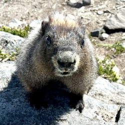
    Skyline Loop - Marmot

    See all

    Marmot

    Osborne Mountain Trail - hiking - Updated September 2026
    Loading...
    Loading...
    Loading...