Skyline Loop Photos


You might also consider


More like Skyline Loop
Recommended Reviews - Skyline Loop
Start your review...


Reviews With Photos


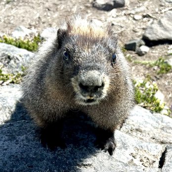
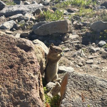
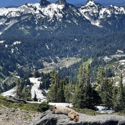
In my opinion, this is the most iconic hike in a Rainier. My friend who has gone many times told me this trail was the one to do if you have to pick, and it did not disappoint. I went on Thurs 7/3/25, and there was still a decent bit of slushy snow along higher parts of the trail, but the whole beginning was clear. They had signs in the visitor center (which I saw after already going up lol) saying that the east half of the trail should only be done if you have equipment and a lot of experience because there was an ongoing avalanche hazard. I ended up just not doing it for sake of time, since I didn't know - but can confirm the west portion up to panorama point is SUCH a stunner. I saw so much wildlife, mainly chipmunks and marmots, but also an eagle! The views EVERYWHERE are unmatched, especially at panorama where you can see mt. St. Helen, mt. Adams, and Mt. Hood. If you go to rainier, DONT miss this hike if you are physically able. It is pretty steep in some points but it smooths to a more gradual incline after a bit of a hard start. 10/10 would rec


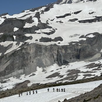
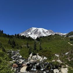
Review #1600 My Dad lived in the Seattle area for over ten years. So I have taken many flights to Sea-Tac airport from the Phoenix area. Many of those flights I flew over Mount Rainier and had a window seat. If you have never seen Mount Rainier from the sky, it is an incredible sight to see. Mount Rainier is a 14,410-foot active volcano in Washington's Cascade Range. I just love how its snow cap peeks through the clouds as you fly over it. I always told myself that someday I would visit it and hike to the base of the mountain. My Dad never had any interest in getting up close to it, so I knew I would have to do my own trip to see it. I took an overnight flight to Seattle-Tacoma and drove straight to Mount Rainier National Park. I got there really early and ended up sleeping in my truck for a couple of hours. The start of the Skyline Trail is located at the Henry M Jackson Memorial Visitor Center in Paradise. I was happy I got there early because the parking lot fills up quickly during the summer season. There were quite a number of people in the parking lot preparing to do this hike. The Skyline Trail is a 5.5 mile round trip loop trail. There are rangers on hand at the visitor center to answer any questions that you may and offer safety tips about the trail. There is also a water refill station if you need to fill up your CamelBak. Because the Skyline Trail is a loop, there are two different directions to begin the trail. There are steps just north of the visitor center that lead to the start of the trail. At the base of the steps is a quote from John Muir inscribed on it. I started the trail to the right (counterclockwise) so that I could see Myrtle Falls right away. You can get great photos of both Myrtle Falls and Mount Rainier in the background. I really enjoyed hiking thorough the wildflower meadows at the beginning of this side of the Skyline Loop. I was entertained by a number of marmots that would follow me as I was hiking. They are everywhere on the trail. The Skyline Trail gets a little more difficult the father you go. The elevation climb is 1700 feet and there are some ice slopes along the way that do not melt. I had to hike through a few snow patches that were a little slippery. Sometimes it was hard to see where the trail is. I finally made it to the base of Mount Rainier and had my lunch at Panorama Point. There are a waterfalls on the mountain that you can see from a distance. Seeing this mountain up close was absolutely amazing. You can see the Tatoosh Range and the Paradise Inn near the Visitor Center to the south from Panorama Point. I also caught a glimpse of some mountain climbers going further beyond the Skyline Trail to climb this incredible mountain. My feet were sore on my way back down. But overall, I was happy I finally accomplished this beautiful hike for the first time. It was an experience that I won't forget. If you do not want to do the full loop hike, you can break off the trail and take the Golden Gate Trail back down to shorten your trip. Just keep in mind that Paradise is a day use only area and dogs are not allowed on the trail. After your hike, take some time to check out the Visitor Center. You can get your National Park passport book stamped there and there are lots of exhibits about Mount Rainier to check out. There is also a of couple places to grab food in Paradise if you are hungry.


Truly amazing hike. About 4 1/2 miles which if you're in moderate shape, you should be fine. A few spots where I was on hands and knees going up some steep rocks, but definitely worth it. Elderly and small children. This might not be the hike for you.


One of my favorite hikes so far!! Definitely very crowded so I would start early. So many great views in this hike, animals, and foliage. Make sure to come prepared & pack plenty of water because it's not a casual hike. It took my bf and I about 4 hours to complete, with plenty of view and snack breaks! The trail is pretty crowded and people can be rude so remember to always practice leave no trace and be kind!!
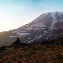

One of the best trails Mt Rainier has to offer. It's about 5.5 miles round trip and can be strenuous at times. That being said, Skyline has so much to offer and you can take as much or as little from it that you want. We dedicated our day to exploring this trail and started counterclockwise. Knowing what we do now, it would probably be an easier hike to go clockwise... Myrtle Falls is absolutely gorgeous. Both the falls and the surrounding landscape there are more beautiful than a postcard or picture of the same spot. It's only about 0.5 miles from the trailhead, and if that's all you have time for, I'd highly recommend doing it. We were going to cut it close on daylight when we started, so we cut through the Golden Gate trail to save a bit of time... definitely a rougher shortcut as there's some steep elevation there. Would be a much better shortcut if you were going down there rather than going up. Going counterclockwise like we did, we reached the top of the trail before we hit Panorama Point. The views of Mt Rainier and the valley were, in my opinion, much nicer here than at Panorama Point. If you're going clockwise, I'd recommend continuing past the point to see the best views. As I said, this hike can be strenuous and there are areas without shade. Definitely pack plenty of water, some snacks, a hat, and some sunscreen. Your future self will thank you. The trailhead is at the Paradise visitor center, so you can ask the rangers any questions as well as fill up your water. This trail gave us some of the best views of Mt Rainier, and I highly recommend you add it into your trip!


The Skyline Loop is the main hiking trail within the Paradise area of Mount Rainier National Park. The trailhead starts at the Jackson Visitor Center which has a parking lot and restrooms. The loop is 5.5 miles roundtrip and has only an 1,450 feet elevation gain but that's because the trailhead already starts at 5,400 feet elevation. You can start from either side to go up but it's more common to start clockwise. Along the hike up you'll go through the Alta Vista, Deadhorse Creek, and Glacier Vista trails. At the peak of the hike you'll reach Panorama Point Overlook which provides panoramic (of course) views of Mount Rainier. Throughout the trail are mountains and trees far and wide, all surrounding the beauty that is Mount Rainier. The trail was a little muddy and certain parts were pretty rocky with loose gravel but overall I enjoyed this hike.


i can finally check her off my list! probably the most popular trail at mt rainier ntl park... we woke up at 4am and drove 2 hours and even then parking was a little tough... could not imagine later on (once we left around 1pm the car line at the entrance went on for miles and parking lot was totally full) we went clockwise and so the first 10-15 minutes was all uphill and i struggled to breathe LOL but after a few miles in (almost 6 miles total) i finally managed to hike and walk all the way till the end. super friendly atmosphere with healthy hikers and nps rangers for guidance everywhere. i saw all ages from little babies to elderly couples MY DOPAMINE WAS THROUGH THE ROOF the views were so worth it :D


THE BEST HIKING EXPERIENCE IVE EVER HAD! My friends and I got in around 6:30am and started our hike around sunrise. The views were everything, especially in the morning. We came the first Saturday of October and it wasn't as packed in the morning, it slowly gets busy towards the afternoon though. We did the whole loop and let me tell you, the steepness will get you! It's an intermediate hike so please make sure to bring good shoes, snacks, and water. We did not expect there to be snow!! Would have totally brought chains or something because going downhill on snow was nerve wrenching! I fell so many times. Despite the fatigue it was so worth it! You can't beat this colorful foliage and scenery. It felt like going through the four seasons in one hike. So beautiful :')


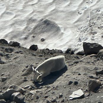
One of the most beautiful hikes in my opinion. As a travel nurse, my spouse and I aim to visit unique places in each state and get to experience nature. Mount Rainier has been in our bucket list and we were so glad we got the opportunity to experience its majestic glory! While the drive to get into Mt Rainier was almost 3 hours from our current location, we did not let that discourage us from visiting this wonderful place. Even in the gloomy, cold weather, Mt Rainier showed its beauty. Amazing meadows, wild colorful flowers, and mesmerizing fauna! We got the opportunity to see a mountain goat, ground hogs, deer, and elk! Be ready to hike and have a good time!


Definitely a top 5 hike of all time for me, this whimsical walk is a magical medley of rock, water, fog, and flower that got more magical with each hour. It was a combination of what walking towards the heavenly gates and being in the Irish Mountains might be like (I assume) as I floated through this skyline, carried by the views and when casting a glance towards my newfound mountain muse..mighty Mount Rainier.


Gorgeous hike. Took us a little over 3 hours. Probably takes between 3-4 hours depending on how often you stop. Beautiful wildlife and wildflowers along the way. Saw marmots, chipmunks, deer, and bears (from a safe distance away). Be sure to go early to avoid large crowds and intense sun..much of the trail is not shaded. Ankle support is strongly recommended...some areas are very rocky. We went counter-clockwise based on recommendations from AllTrails, not sure which way is the better way to go. Go clockwise and you hit the higher elevations more quickly in the beginning, go down the rocky parts, then end going down a ton of stairs and pavement with the gorgeous meadows. Go counter-clockwise and you begin with gorgeous meadows, then hike up the rocky parts, reach panorama point later, then go down a ton of stairs and pavement. The latter is rough on the knees. Pick your poison.


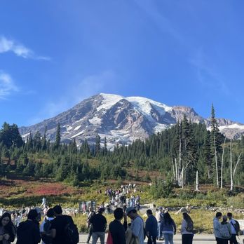
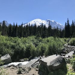
Skyline Loop is the quintessential hike at Mount Rainier National Park. If you only have time for one hike, make it Skyline Loop. It has the best views of Mt. Rainier, and depending on the time of year you visit, the lush meadows and colors will not disappoint you along this route. To access Skyline Loop, you start at this trail from the Paradise side or Henry M. Jackson visitor's center. Because Paradise is a popular starting point, get here as early as possible, especially if you're planning to hike Skyline Loop because it's 5.5. miles and will take 4.5 hours. If you start clockwise, from the main visitor's center entrance, you will hike up a really steep way, which in my opinion, was the hardest part of the hike. And personally, I'd rather get the hard stuff done first. For clockwise, you're heading towards the mountain, so epic views are to be seen along your misery, which is worth the steep incline. However, after you pass High Skyline, the highest point of the loop, it's pretty much downhill from there. If you want an epic view, but don't want to do the entire loop, most people stop at Glacier Peak, which is a good trek. However, if you can do it, I recommend going up to Panorama Point where you see the Tatoosh Range, with views of Mt. Adams, Mt. St. Helens and Mt. Baker. It's a lovely stop, which is where we took a break to have lunch. Just note that it is significantly more cold up here than below with the altitude, so bring a fleece. Finishing the loop, we saw beautiful meadows and fall colors, and went over streams and rocky pathways. I found the hiking poles helpful for going down. If you want a shortcut, you slacker, there is a trail that you can take, which cuts out a mile from the entire loop. But you will not regret doing the entire loop. It is absolutely breathtaking, and once you see Mt. Rainier again along the loop, it seems to be more beautiful each and every time. I can't recommend this hike enough at Mount Rainier National Park. This will take half a day, so if you have the time and capacity then do so. It's the best hike in the park.


Skyline Loop is one of the most gorgeous trails I've done, and definitely gives you a lot of bang for your buck. The trail starts at the Paradise Inn visitor center area. There is actually a pretty big network of trails in the area so you can modify your trail and mileage a bit depending on what you or your group wants to do. For the majority of the trail, you are pretty much looking at Mount Rainier on the face. Of course that is all dependent on the weather and clouds! It's steep at first but the views make it worth it! I felt like I was basically at the top of Rainier until I saw overnight trekkers starting their ascent up along the same path, haha. The trail is fairly exposed, so on a clear/cloudless day, you definitely want to have enough water and sun protection. You will probably see many marmots. At the "top" (not really a top though since it's a loop hike, you can see so many of the southern iconic mountain ranges). This hike is so worth it!!
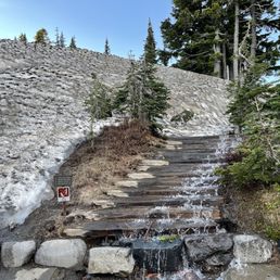

We parked at Henry M.Jackson Memorial Visitor Center. In the overflow lot designated for people that plan to spend more than 2 hours. This place gets very crowded so parking is challenging. We checked out inside and got a map of all the hikes. There are bathrooms inside. We picked Skyline Loop because it was the hardest and were told it had breathtaking views. The trails head is marked with all the different trails with arrows guided for visitors. It starts off with an asphalt path but turns into gravel, rocks/steps. I recommend bringing walking sticks for balance. Please listen to the 10 essentials that they recommend. PROTECT THE MEADOWS! Stay on trails. Do not pick flowers. Leave No Trace of your visit. Pets are NOT allowed on trails. Do not feed or approach wildlife. Use a topographic map. Permit required for Wilderness camping. And PLEASE BRING WATER! Carry the "10 Essentials" A topographic map and compass, extra food, extra clothing/rain gear, emergency shelter, first aid kit, headlamp or flashlight and spare batteries, extra water, sunglasses and sunscreen, repair kit/tools, and waterproof matches-for emergency use only (fires are not allowed in the backcountry.) This is all from the flyer we picked up at the visitor center. This trail is difficult! It's all uphill (like a 10 -15 incline on treadmill) it's down hill on the way down. Spectacular views throughout the hike. Lots of wildlife! Highly recommend! I can't wait to go back to try all the other trails. read more

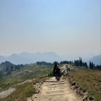


1Billion/10 recommend! I'd love to lie and tell everyone this place sucks so no one will come here anymore and it wouldn't be so crowded. But this is probably on ny top 3 and im not sure it will fall off anytime soon. We visited on a holiday weekend, yes it was busy, yes driving up to paradise was insane, yes the parking was full but we made it up there found parking and decided to do Skyline since we only had time for a few that day. We started on steep side. The beginning is alllll incline and then you think you're done it's all incline again. I did see some older people and kids on the trail but not sure how far they went up because that steep incline plus the elevation is no joke. The views at the top are aaaaaamazing, unreal, beautiful, hard to describe if you've never been. The whole hike is beautiful so much to look at and wildlife is everywhere. Will definitely be back soon! read more




2 months ago

1 year ago
In my opinion, this is the most iconic hike in a Rainier. My friend who has gone many times told me this trail was the one to do if you have to pick, and it did not disappoint. I went on Thurs 7/3/25, and there was still a decent bit of slushy snow along higher parts of the trail, but the whole beginning was clear. They had signs in the visitor center (which I saw after already going up lol) saying that the east half of the trail should only be done if you have equipment and a lot of experience because there was an ongoing avalanche hazard. I ended up just not doing it for sake of time, since I didn't know - but can confirm the west portion up to panorama point is SUCH a stunner. I saw so much wildlife, mainly chipmunks and marmots, but also an eagle! The views EVERYWHERE are unmatched, especially at panorama where you can see mt. St. Helen, mt. Adams, and Mt. Hood. If you go to rainier, DONT miss this hike if you are physically able. It is pretty steep in some points but it smooths to a more gradual incline after a bit of a hard start. 10/10 would rec read more


1 month ago

Review #1600 My Dad lived in the Seattle area for over ten years. So I have taken many flights to Sea-Tac airport from the Phoenix area. Many of those flights I flew over Mount Rainier and had a window seat. If you have never seen Mount Rainier from the sky, it is an incredible sight to see. Mount Rainier is a 14,410-foot active volcano in Washington's Cascade Range. I just love how its snow cap peeks through the clouds as you fly over it. I always told myself that someday I would visit it and hike to the base of the mountain. My Dad never had any interest in getting up close to it, so I knew I would have to do my own trip to see it. I took an overnight flight to Seattle-Tacoma and drove straight to Mount Rainier National Park. I got there really early and ended up sleeping in my truck for a couple of hours. The start of the Skyline Trail is located at the Henry M Jackson Memorial Visitor Center in Paradise. I was happy I got there early because the parking lot fills up quickly during the summer season. There were quite a number of people in the parking lot preparing to do this hike. The Skyline Trail is a 5.5 mile round trip loop trail. There are rangers on hand at the visitor center to answer any questions that you may and offer safety tips about the trail. There is also a water refill station if you need to fill up your CamelBak. Because the Skyline Trail is a loop, there are two different directions to begin the trail. There are steps just north of the visitor center that lead to the start of the trail. At the base of the steps is a quote from John Muir inscribed on it. I started the trail to the right (counterclockwise) so that I could see Myrtle Falls right away. You can get great photos of both Myrtle Falls and Mount Rainier in the background. I really enjoyed hiking thorough the wildflower meadows at the beginning of this side of the Skyline Loop. I was entertained by a number of marmots that would follow me as I was hiking. They are everywhere on the trail. The Skyline Trail gets a little more difficult the father you go. The elevation climb is 1700 feet and there are some ice slopes along the way that do not melt. I had to hike through a few snow patches that were a little slippery. Sometimes it was hard to see where the trail is. I finally made it to the base of Mount Rainier and had my lunch at Panorama Point. There are a waterfalls on the mountain that you can see from a distance. Seeing this mountain up close was absolutely amazing. You can see the Tatoosh Range and the Paradise Inn near the Visitor Center to the south from Panorama Point. I also caught a glimpse of some mountain climbers going further beyond the Skyline Trail to climb this incredible mountain. My feet were sore on my way back down. But overall, I was happy I finally accomplished this beautiful hike for the first time. It was an experience that I won't forget. If you do not want to do the full loop hike, you can break off the trail and take the Golden Gate Trail back down to shorten your trip. Just keep in mind that Paradise is a day use only area and dogs are not allowed on the trail. After your hike, take some time to check out the Visitor Center. You can get your National Park passport book stamped there and there are lots of exhibits about Mount Rainier to check out. There is also a of couple places to grab food in Paradise if you are hungry. read more



Truly amazing hike. About 4 1/2 miles which if you're in moderate shape, you should be fine. A few spots where I was on hands and knees going up some steep rocks, but definitely worth it. Elderly and small children. This might not be the hike for you. read more




One of my favorite hikes so far!! Definitely very crowded so I would start early. So many great views in this hike, animals, and foliage. Make sure to come prepared & pack plenty of water because it's not a casual hike. It took my bf and I about 4 hours to complete, with plenty of view and snack breaks! The trail is pretty crowded and people can be rude so remember to always practice leave no trace and be kind!! read more

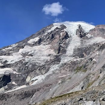


One of the best trails Mt Rainier has to offer. It's about 5.5 miles round trip and can be strenuous at times. That being said, Skyline has so much to offer and you can take as much or as little from it that you want. We dedicated our day to exploring this trail and started counterclockwise. Knowing what we do now, it would probably be an easier hike to go clockwise... Myrtle Falls is absolutely gorgeous. Both the falls and the surrounding landscape there are more beautiful than a postcard or picture of the same spot. It's only about 0.5 miles from the trailhead, and if that's all you have time for, I'd highly recommend doing it. We were going to cut it close on daylight when we started, so we cut through the Golden Gate trail to save a bit of time... definitely a rougher shortcut as there's some steep elevation there. Would be a much better shortcut if you were going down there rather than going up. Going counterclockwise like we did, we reached the top of the trail before we hit Panorama Point. The views of Mt Rainier and the valley were, in my opinion, much nicer here than at Panorama Point. If you're going clockwise, I'd recommend continuing past the point to see the best views. As I said, this hike can be strenuous and there are areas without shade. Definitely pack plenty of water, some snacks, a hat, and some sunscreen. Your future self will thank you. The trailhead is at the Paradise visitor center, so you can ask the rangers any questions as well as fill up your water. This trail gave us some of the best views of Mt Rainier, and I highly recommend you add it into your trip! read more
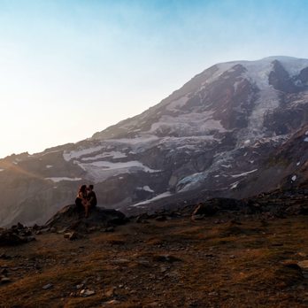


The Skyline Loop is the main hiking trail within the Paradise area of Mount Rainier National Park. The trailhead starts at the Jackson Visitor Center which has a parking lot and restrooms. The loop is 5.5 miles roundtrip and has only an 1,450 feet elevation gain but that's because the trailhead already starts at 5,400 feet elevation. You can start from either side to go up but it's more common to start clockwise. Along the hike up you'll go through the Alta Vista, Deadhorse Creek, and Glacier Vista trails. At the peak of the hike you'll reach Panorama Point Overlook which provides panoramic (of course) views of Mount Rainier. Throughout the trail are mountains and trees far and wide, all surrounding the beauty that is Mount Rainier. The trail was a little muddy and certain parts were pretty rocky with loose gravel but overall I enjoyed this hike. read more

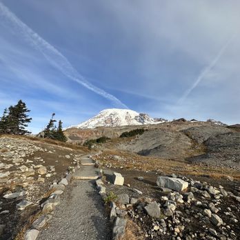

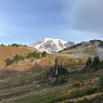


i can finally check her off my list! probably the most popular trail at mt rainier ntl park... we woke up at 4am and drove 2 hours and even then parking was a little tough... could not imagine later on (once we left around 1pm the car line at the entrance went on for miles and parking lot was totally full) we went clockwise and so the first 10-15 minutes was all uphill and i struggled to breathe LOL but after a few miles in (almost 6 miles total) i finally managed to hike and walk all the way till the end. super friendly atmosphere with healthy hikers and nps rangers for guidance everywhere. i saw all ages from little babies to elderly couples MY DOPAMINE WAS THROUGH THE ROOF the views were so worth it :D read more


THE BEST HIKING EXPERIENCE IVE EVER HAD! My friends and I got in around 6:30am and started our hike around sunrise. The views were everything, especially in the morning. We came the first Saturday of October and it wasn't as packed in the morning, it slowly gets busy towards the afternoon though. We did the whole loop and let me tell you, the steepness will get you! It's an intermediate hike so please make sure to bring good shoes, snacks, and water. We did not expect there to be snow!! Would have totally brought chains or something because going downhill on snow was nerve wrenching! I fell so many times. Despite the fatigue it was so worth it! You can't beat this colorful foliage and scenery. It felt like going through the four seasons in one hike. So beautiful :') read more


One of the most beautiful hikes in my opinion. As a travel nurse, my spouse and I aim to visit unique places in each state and get to experience nature. Mount Rainier has been in our bucket list and we were so glad we got the opportunity to experience its majestic glory! While the drive to get into Mt Rainier was almost 3 hours from our current location, we did not let that discourage us from visiting this wonderful place. Even in the gloomy, cold weather, Mt Rainier showed its beauty. Amazing meadows, wild colorful flowers, and mesmerizing fauna! We got the opportunity to see a mountain goat, ground hogs, deer, and elk! Be ready to hike and have a good time! read more


Definitely a top 5 hike of all time for me, this whimsical walk is a magical medley of rock, water, fog, and flower that got more magical with each hour. It was a combination of what walking towards the heavenly gates and being in the Irish Mountains might be like (I assume) as I floated through this skyline, carried by the views and when casting a glance towards my newfound mountain muse..mighty Mount Rainier. read more


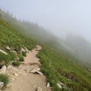


Gorgeous hike. Took us a little over 3 hours. Probably takes between 3-4 hours depending on how often you stop. Beautiful wildlife and wildflowers along the way. Saw marmots, chipmunks, deer, and bears (from a safe distance away). Be sure to go early to avoid large crowds and intense sun..much of the trail is not shaded. Ankle support is strongly recommended...some areas are very rocky. We went counter-clockwise based on recommendations from AllTrails, not sure which way is the better way to go. Go clockwise and you hit the higher elevations more quickly in the beginning, go down the rocky parts, then end going down a ton of stairs and pavement with the gorgeous meadows. Go counter-clockwise and you begin with gorgeous meadows, then hike up the rocky parts, reach panorama point later, then go down a ton of stairs and pavement. The latter is rough on the knees. Pick your poison. read more


5 years ago
Skyline Loop is the quintessential hike at Mount Rainier National Park. If you only have time for one hike, make it Skyline Loop. It has the best views of Mt. Rainier, and depending on the time of year you visit, the lush meadows and colors will not disappoint you along this route. To access Skyline Loop, you start at this trail from the Paradise side or Henry M. Jackson visitor's center. Because Paradise is a popular starting point, get here as early as possible, especially if you're planning to hike Skyline Loop because it's 5.5. miles and will take 4.5 hours. If you start clockwise, from the main visitor's center entrance, you will hike up a really steep way, which in my opinion, was the hardest part of the hike. And personally, I'd rather get the hard stuff done first. For clockwise, you're heading towards the mountain, so epic views are to be seen along your misery, which is worth the steep incline. However, after you pass High Skyline, the highest point of the loop, it's pretty much downhill from there. If you want an epic view, but don't want to do the entire loop, most people stop at Glacier Peak, which is a good trek. However, if you can do it, I recommend going up to Panorama Point where you see the Tatoosh Range, with views of Mt. Adams, Mt. St. Helens and Mt. Baker. It's a lovely stop, which is where we took a break to have lunch. Just note that it is significantly more cold up here than below with the altitude, so bring a fleece. Finishing the loop, we saw beautiful meadows and fall colors, and went over streams and rocky pathways. I found the hiking poles helpful for going down. If you want a shortcut, you slacker, there is a trail that you can take, which cuts out a mile from the entire loop. But you will not regret doing the entire loop. It is absolutely breathtaking, and once you see Mt. Rainier again along the loop, it seems to be more beautiful each and every time. I can't recommend this hike enough at Mount Rainier National Park. This will take half a day, so if you have the time and capacity then do so. It's the best hike in the park. read more


3 years ago
Skyline Loop is one of the most gorgeous trails I've done, and definitely gives you a lot of bang for your buck. The trail starts at the Paradise Inn visitor center area. There is actually a pretty big network of trails in the area so you can modify your trail and mileage a bit depending on what you or your group wants to do. For the majority of the trail, you are pretty much looking at Mount Rainier on the face. Of course that is all dependent on the weather and clouds! It's steep at first but the views make it worth it! I felt like I was basically at the top of Rainier until I saw overnight trekkers starting their ascent up along the same path, haha. The trail is fairly exposed, so on a clear/cloudless day, you definitely want to have enough water and sun protection. You will probably see many marmots. At the "top" (not really a top though since it's a loop hike, you can see so many of the southern iconic mountain ranges). This hike is so worth it!! read more


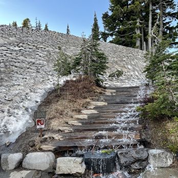

One of the most beautiful places that I've ever visited, and aptly named Paradise! Not too far off a drive from either Seattle or Portland, but carry ample food and water, and make sure there is enough gas in your vehicle's tank. Weather can play spoilsport, so check the forecast and plan accordingly! read more


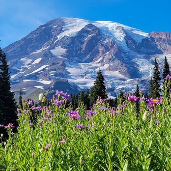


The Skyline Trail is one of the most use trail by hiker. The reason behind is this trail lead to waterfalls, connect to the top of Mount Rainier, connect to the glacier. The asphalt trail is easy walking for many people. The trail start at 5420 feet elevation at visitor center. This is also the are many guide mountain climbing companies gather. The top of the trail will elevated to 6800 feet for the panorama point overlook. It also connects to glacier vista at 6336 feet. Nisqually Glacier just next to it. Two waterfalls on the trail are the Sluiskin and Myrtle falls. The falls is smaller compared to Narada Falls. Along the trail wild flowers is blooming. Their bloom time is late August to September. You can overlook the Paradise Inn below and have direct access to the Inn. read more


The best place to view wildflowers in the summer-- I think the photos speak for themselves! The upper trails are best for mountain views and are also generally more crowded. The lower trails are better for viewing wildflowers, especially in late August. We also encountered 3 bears during our visit. They weren't as big as I imagined and kept to themselves, though they weren't afraid to get pretty close to people. The trail is mostly paved and very accessible/easy to walk. I went on a weekday around noon, and the parking lot/trailhead was extremely crowded. However it got better as we got further down the trail. Make sure to get a Mt. Rainer National Park pass ($50 annual or $30/week) to visit! read more


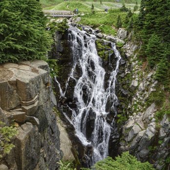


The Good- Scenery is amazing. Some of the best views, hikes and natural attractions in Washington State. Huge parking areas with plenty of spots. Good amenities. The Bad- Some pretty sketchy buckled asphalt on Skyline and Alta Vista. Made hiking with a younger child difficult. Inadequate restroom facilities for the amount of daily visitors. The Ugly- Litter. Unfortunately all up and down the trails there was a multitude of trash, socks, water bottles, wrappers, etc. wild be great if more Rangers/Park personnel could be present to help enforce rules & regs. The Skinny- Would go back in a second. Just SO beautiful. read more


5 years ago


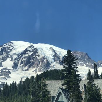
Ok, I'm no hiker and was terrified of this hike. Even more terrified when I found out that the trail my husband picked out for us was the most strenuous on the list! 5.5 - 6 miles total and it says it takes approximately 4.5 hours? Ahh-chemmm.....it took us 7 hours (there was a 1 hour lunch break on Panorama Point)...3 hours to get to Panorama Point and that was just 1.7 miles from the start. OMG! I know, we're slow, out of shape and I am afraid of heights! But, up the steeps and down the steeps, over the rocks (that moved under your feet, no less), the cliff areas, the gravel paths, the dirt paths, the paved paths, the water falls, the creeks, the rail-less bridges, all of it.....WE MADE IT! It was a great day, no fog, no rain! But no wildlife, either. Must have been the time of year. We started clockwise and the first .25 paved miles felt straight uphill and I was already complaining! But I hadn't given my mind, body and spirit a chance to let it all sink in. We stopped along the way. A lot! We took a ton of photos. We trudged and looked around. We ate an amazing prepared lunch (fruit, baguette, meats and cheese from Pike Place Market and mustard packs courtesy of McDonalds earlier that morning) on Panorama Point. There's supposed to be a bathroom......well, it was there. But it was CLOSED! Sorry, but nature called... We caught our breath and started UP again. We thought multiple times we had gotten to and past the "scary" part and once past each one I said - OH! I can do this! But nope.....it wasn't until we really got to the "scary" part - I literally had to scoot across the area on my butt, slowly, there was no room to walk with your feet apart from one another! Who made that section? It's not technical, you just gotta be careful. But, again, we got through it. Then it was supposed to be all downhill from there. But nope, the downhills were super steep putting quite a bit of pressure on your knees and ankles and feet. And a few very short flat areas and some more up hills.....but then more super steep downhills... We got to the Golden Gate and thought.....nah, we'll just stick to the Skyline, we're more than 1/2 way done! Well. As each distant sign we passed, showing how much progress we had made, felt like we were getting farther and farther away from the end point, it started feeling a little less enjoyable for a period - the pain in the lower joints was really setting in. When we saw the other end of the Golden Gate trail, we kinda wished we had taken the 1.5 mile shortcut. But at the end, you get done and you get to say "I DID IT!" Quite a good feeling. Amazing mountain. Amazing views. Amazing experience! read more
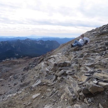


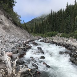
Great entry level trail for a first timer at Mt. Rainier that hits all the highlights you'd expect in a picturesque Mt rainier postcard. Wow wow wow! If you come here in the summer or mid September like we did, prepare to let your jaw drop as you take in some of the most breathtaking views and sights provided to you gratis by Mother nature. Okay fine, so there's a entrance fee of $25 per car, but it's totally worth it. Get a national park pass and watch it pay for itself because after coming here, you're gonna get addicted to national parks. The starting point for the trail starts near the Jackson visitor center near paradise, which is near the south side of the mountain, which tends to get really cold during the winter. As you will see, this place really lives up to its name because it is literally paradise, if you have the physical fitness to climb your way through the trail that is... Distance round trip is 5.5 miles with a pretty modest incline that will provide great cardio. Paths are extremely well paved in the beginning, with tons of signs so that you don't get lost. Just look for the sign that says "Skyline trail" at every fork and follow the arrows! My recommendation for those looking for a efficient trail that won't take up too much time, especially for the non hardcore outdoorsmen such as myself looking for a day trip, is to take the Skyline trail up to panorama point, and then transition to the Golden gate trail. You won't miss much from this shortcut and it will save you an extra two hours of hiking. This was recommended to me by the staff at the visitor center and boy was I grateful! If you like wildlife, you're gonna love this trail. We saw baby deer, tons of chubby marmots (I had no idea what a marmot was until I came here. They look like fat porcupine without quills), and cheeky chipmunks that aren't afraid to approach you. Just avoid feeding them! We went clockwise starting from the visitor center. The initial part of the trail included meadows and lush greenery. Following panorama point, the descent was more rocky with loose gravel and brown reddish terrain near the glaciers. Even closer to the end are meadows with beautiful wildflower blooms and small creeks from the glacier runoff. You'll even get to see a small waterfall! Please come here, but pick up after yourself and avoid stepping off trail onto the grass as they're working on reviving the meadows. Highly recommend as entry level trail for all visitors. read more


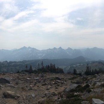


Amazing trail in the middle of nature with stunning views of Mt. Rainier, glaciers, falls and wildlife. The loop starts from the parking lot and it's immediately kind of steep, so don't rush it, approach it with patience and a steady pace. We decided to stay on the skyline loop because the trail map indicated various dangerous spots elsewhere. We got up to Glacier Vista, beyond that was signaled as dangerous and it definitely required at least the right shoes and maybe poles, it looked kind of steep and covered in snow. Up to that point we did encounter patches of snow, but it was doable. Some parts of the trail had water running through them, making it a bit of a challenge to comply with the signs stating that you should walk within the trails. Yesterday was a hot summer day, we were dressed pretty light and without the right equipment, but the trail was doable. Lots of families with small kids in the first portion of the trail. I would imagine that in colder seasons you would need to dress up for cold weather and wear appropriate hiking shoes and stuff. Highly recommended! read more


8 years ago

This trail was great! We had such a great time hiking it and the views above the clouds were amazing. The reason this isn't getting 5 stars from me is because it wasn't very enjoyable if you can't get above the clouds. It was so hard to see anything until you cleared them, so I wouldn't recommend it if you don't plan on at least getting to panorama point. read more


11 years ago
We took the skyline trail most of the way, we went down the golden gate trail. We have been up the same route twice in the last week and had completely different, amazing experiences! Totally worth every step of the way! First time up, we just took my 17-month-old and she did amazing, we saw lots of wildlife. Second time up, we took our daughter and my boys (10 & 8). They did great the whole way! It was exciting! It was an adventure! read more


9 years ago
An ideal trekking loop for all beginners . Mind blowing natures view . Easy to walk all the way to panorama point. Go during spring too once. Definitely a paradise read more




8 years ago

It's hard to rate the difficulty of this trail. If you are in good shape and hike often, this would probably be an average hike. If you are like me and have a Mom bod and rarely workout, this is a pretty tough hike. But worth every step! The views here are breathtaking. We went up from the parking lot which is pretty steep for the first half mile. Panorama Point is farther than it looks on a map, but once you've made it to Glacier Vista you HAVE to keep going to Panorama Point. From there we took High Skyline Trail up and around and then took Golden Valley Trail back down. This isn't a child friendly trail. The snow was over the trail and we had to shimmy down a few rocks ledges. We also forgot sunscreen and got fried. But again, worth every single step! I will recommend this Trail to every single person, no matter how in or out of shape they may be. Just do it. You will be so glad you did! read more


12 years ago
Did it countercounterclockwise from parking lot, meaning we didn't go straight up to Panorama Point but the other way around which I think is a nicer way to do it. it was September 2014 and it's truly a gorgeous place. read more
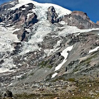


17 years ago

12 years ago
One of the most fun day hikes I have done. People call it strenuous, but I hiked with a 10 year old and a 9 year old and didn't get any complaints until the last half mile. We went clockwise to get the uphill portion knocked out right off...and it was a leg burning trudge up. But once we got to Panoramic Point, we stopped for lunch and a little rest to recuperate. From there we hiked down a small portion of the Glacier (in shorts and t-shirts) then finished the last half of the trail through the meadows and past some pretty waterfalls. From the top, on a clear day, you can see Mount Adams and Mount Saint Helens. If you are looking for a fun hike near Paradise, you have to do this trail. A few tips: Get there around 10am at the latest so you can get parking. Bring plenty of water because you will use a lot on the hike up. Bring a change of socks because there is a lot of water you have to cross when the glaciers are melting. The map is misleading if you want to avoid the dangerous snowy part...jump off the "Skyline Trail" and take the "High Skyline Trail" to avoid the snow. Finally, take a ton of pictures and have a blast!!! read more


11 years ago
The Skyline Loop (5.5 mi, 1450 ft. gain) has to be one of the best hiking trails I have ever been on. It's scenic, full of lush, colorful vegetation, varied in elevation and terrain, and just the right amount of challenge without feeling exhausted by the end. I would rate this trail as moderate in intensity, as I was not sore at all the next day but I did feel that I had a good workout by the end! There are so many photo opportunities throughout the loop, especially in the autumn months when the leaves are starting to change color. Initially, I thought the low-hanging fog would diminish the quality of the hike, but I realized later that the fog added a level of mystery that contributed to some incredibly epic photos. Further, when the fog lifted for 30 seconds, it was all the more dramatic to see the beauty all around us. Five stars! I would definitely recommend this trail to others and will likely do this one again with an extension on the 5.5mi by taking a few of the ancillary trails off of Skyline. SOME HELPFUL TIDBITS: *Parking is at the Paradise Visitors Center or in overflow lots nearby. *There are bathrooms at the Visitors Center and in an adjacent building through a "tunnel" arch. *Come on National Public Lands Day like us and park for free ^_^ *The drive to Paradise is all paved, unlike some of the trails around Mount Rainier. *Stay on the trail! These are protected forest lands to preserve. *Bring a sack lunch to eat at Panorama Point, where you'll also find a bathroom. *Bring layers, hat, mittens (if you're prone to cold hands). This is Washington people. You never know what kind of weather you're gonna get. It will definitely be colder in the mountains. *The Low Skyline Shortcut was actually blocked off for us due to unstable footing and snow. We ended up going on the rocky High Skyline Trail instead. *The loop can be hiked clockwise or counterclockwise. We hiked clockwise for the breathtaking views, although the initial climb was steep. Hiking counterclockwise has a lower initial elevation gain. read more


Page 1 of 2
More info about Skyline Loop
Ask the Community - Skyline Loop
Review Highlights - Skyline Loop
You might also consider


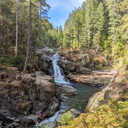


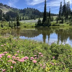


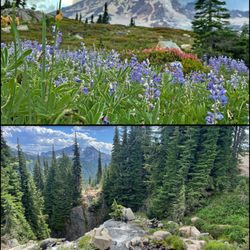








Why does Yelp recommend reviews?

Skyline Loop - hiking - Updated August 2026
Best of Mount Rainier
People found Skyline Loop by searching for…
Hiking Trails With Waterfalls in Mount Rainier, WA
Photo Spots in Mount Rainier, WA
Waterfalls and Swimming Holes in Mount Rainier, WA
Watch Sunset in Mount Rainier, WA
Scenic Drive in Mount Rainier, WA
Attractions in Mount Rainier, WA
Hiking With Kids in Mount Rainier, WA
Sunset View in Mount Rainier, WA
Easy Hikes in Mount Rainier, WA
Stairs Workout in Mount Rainier, WA
View Points in Mount Rainier, WA
Scenic View in Mount Rainier, WA
Scenic Spots in Mount Rainier, WA
Sunrise View in Mount Rainier, WA
Visitor Centers in Mount Rainier, WA
Things to Do With Kids in Mount Rainier, WA
Flower Fields in Mount Rainier, WA
Off Road Trails in Mount Rainier, WA
Snow Play in Mount Rainier, WA
Lookout Points in Mount Rainier, WA
Beautiful Views in Mount Rainier, WA
Browse Nearby
BEST of Mount Rainier, Washington Coffee near Skyline Loop
BEST of Mount Rainier, Washington Restaurants near Skyline Loop
BEST of Mount Rainier, Washington Things to Do near Skyline Loop
BEST of Mount Rainier, Washington Lakes near Skyline Loop
BEST of Mount Rainier, Washington Breakfast near Skyline Loop
BEST of Mount Rainier, Washington Bike Rentals near Skyline Loop
BEST of Mount Rainier, Washington Lodging near Skyline Loop
BEST of Mount Rainier, Washington Campgrounds near Skyline Loop


