Oxford Historical Marker Photos


More like Oxford Historical Marker
Recommended Reviews - Oxford Historical Marker
Start your review...

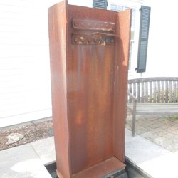
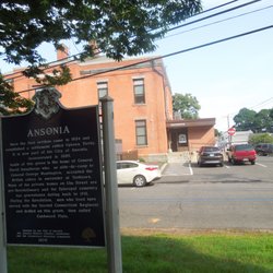
Ever hear of Tinkers to Evers to Chance? They were a famous double play combination of Chicago Cub infielders in the early 1900's. Ever hear of Paugussett to Pootatuck to Mattatuck? Well you might have if you ever stopped to read the Oxford Historical Marker! This is a two-sided marker from the CT Historical Commission with the familiar white lettering on a blue background. The same inscription appears on both sides. It's located on a strip of grass at the Oxford Town Office. The sign dates to 1978, and although the paint and lettering are in good condition, there is a disgusting whitish green slime on the top of one side of the sign. It might be tree pollen, or some kind of mold, but it looks like something out of 'Invasion of the Body Snatchers'. A few well spent seconds with a garden hose and a bucket of soapy water would sure do wonders, here. Hint, hint, hint. The full inscription reads: Originally part of Derby, Oxford was settled by people pushing inland from Derby, Stratford, and New Haven. Land was acquired in five purchases from the Paugussett and Pootatuck Indians. The first grant of settlement appears in Derby records of 1678. Bounds were set with Mattatuck, now Waterbury, in 1680. In 1741 the "Oxford district" was made a parish but did not become a separate town until 1798. Oxford long remained rural with grist and saw mills, wool growing, and coastal commerce via Derby and New Haven until the embargo of 1807. Many small farm industries flourished into mid-century, when the railroad in the Naugatuck Valley caused sweeping changes. With dwindling population, Oxford turned to poultry and dairy farming, which later declined as new highways provided better access to employment in neighboring towns. The airport, opened in 1969, with adjacent industrial areas, began a new chapter in the economic development of Oxford. Erected 1978 by the Town of Oxford, the Oxford Historical Society, Inc., and the Connecticut Historical Commission. read more


8 years ago
More info about Oxford Historical Marker


Why does Yelp recommend reviews?
1 review that is not currently recommended
The reviews below are not factored into the business's overall star rating.
8 years ago
Oxford Historical Marker - landmarks - Updated June 2026
Best of Oxford
People found Oxford Historical Marker by searching for…
Churches in Oxford, Connecticut
Things to Do in Oxford, Connecticut
Photo Spots in Oxford, Connecticut
Places to Take Pictures in Oxford, Connecticut
Religious Organizations in Oxford, Connecticut
Scenic Overlook in Oxford, Connecticut
Public Services & Government in Oxford, Connecticut
Landmarks in Oxford, Connecticut
View Points in Oxford, Connecticut
Boardwalk in Oxford, Connecticut
Reviews in Oxford, Connecticut
Sightseeing in Oxford, Connecticut
Attractions in Oxford, Connecticut
Baby Shower Locations in Oxford, Connecticut
Waterfall in Oxford, Connecticut
Scenic View in Oxford, Connecticut
Tourist Attractions in Oxford, Connecticut
Observation Deck in Oxford, Connecticut
DMV Road Test in Oxford, Connecticut
Browse Nearby
BEST of Oxford, Connecticut Restaurants near Oxford Historical Marker
BEST of Oxford, Connecticut Coffee near Oxford Historical Marker
BEST of Oxford, Connecticut Things to Do near Oxford Historical Marker
BEST of Oxford, Connecticut Museums near Oxford Historical Marker
BEST of Oxford, Connecticut Breakfast near Oxford Historical Marker
BEST of Oxford, Connecticut Parks near Oxford Historical Marker
BEST of Oxford, Connecticut Hotels near Oxford Historical Marker
Browse Brands
Browse Articles
People who viewed Oxford Historical Marker also viewed
Southbury Historical Marker
1 review
Woodbury Historical Marker
2 reviews
Weir Farm National Historical Park
27 reviews
Handsome Dan Statue
2 reviews
Squantz Pond State Park
5 reviews
Meriden World War I Memorial
1 review
Pearl Harbor Memorial Bridge
8 reviews
Gallaher Mansion & Cranbury Park
17 reviews
Beacon Falls Historical Marker
2 reviews
America's First Civil War Monument
2 reviews