Panorama Trail Photos


More like Panorama Trail
Recommended Reviews - Panorama Trail
Start your review...


Reviews With Photos


This is one of the best trails in Yosemite because you can take Mist Trail from Vernal Falls Trailhead up to Nevada Falls, and connect with the Panorama Trail -- all the way up to Glacier Point. The hike is about 8.2 miles from the Vernal Falls Trailhead to Glacier Point. We did this hike this past weekend and really worked ourselves out! It was spectacular, with phenomenal views of the Yosemite monoliths, including Half Dome, Vernal Falls, Nevada Falls, Liberty Cap, and more! :) We even saw a Coyote, walking uphill through the mountainside, as we were hiking. You should be in decent shape before you take on this trek. We did the hike upward from the valley floor all the way up to the elevation of Glacier Point at 7,214 feet above sea level. There is an easier route (supposedly) that you can take from Glacier Point down to the valley floor, but it may be hard on your knees. I think the uphill hike is probably better and easier. :) Some photos I captured are available here: https://ourwelltraveledlife.wordpress.com/2015/04/13/yosemite-national-park-a-west-coast-wonder/


If you are reading this review and have yet to hike the Panorama Trail, or haven't visited Yosemite at all, please take the following steps: 1. Turn off your computer. 2. Pack some hiking gear, trail mix, and water. 3. Get in your car. 4. Drive to Glacier Point, Yosemite (This applies to everyone, even if you live in Maine). 5. Get hiking. The Panorama Trail at Yosemite is by far the most beautiful hike I have ever had the pleasure of taking. You start off looking across the valley at Yosemite's big hitters, such as Half Dome, Vernal and Nevada Falls, and end up walking all the way around so you end up looking down at the water rushing down the falls. You cover some incredible ground. The hike is diverse and breathtaking. I recommend doing a one way trip of the Panorama Trail. We really liked starting from Glacier Point and hiking down to the Valley. It took us about 6 hours (this was with several stops to take in the beautiful vistas along the way). We ended up taking the John Muir Trail from Nevada Falls instead of the Mist Trail to avoid the steep downhill and crowd, which turned out to be a perfect decision. This hike is a little deceiving at first, if you start from GP. It's downhill and has a rather relaxed beginning. Later, it goes uphill and things change. Make sure you have plenty of snacks and water. I definitely underestimated this one. And a final note, don't tell too many people about this trail. Keep it between you and me. It is one of the less traveled trails and is far more enjoyable for that reason. Share this information sparingly. But first and foremost, check out this trail immediately and enjoy!


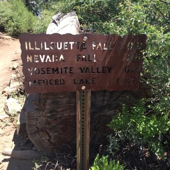
This review is for the NOT-SO-FIT MENTALLY-UNPREPARED BUT REALLY-WANT-TO-DO-IT HIKERS! My friend and I planned to do our very first day hike and chose to go all out with the four mile trail-panorama circuit route. Both of us are 22 and fairly fit, but definitely not as physically inept to tackle a strenuous hike as most others take weeks preparing for. We began our hike around 9am walking to the Four Mile Trail TH from camp 4 and began our way up, but since this review is for the Panorama Trail, I'll just start from when we began our way down. We started our trip downhill towards the Illiouette Falls around 2pm and quickly realized how strenuous the hike was going to be. By the time we reached the sign that told us only 1 more mile was left towards the first falls and 7 more miles left to the valley, it was already 3pm. One hour per mile?? At this rate, our hopes were beginning to get shot as it already felt like we wouldnt be reaching the valley floor until 10pm. After reachinf the beautiful Illiouette Falls, we were both extremely tired and dreading the fact that the next 1-2 miles looked like straight uphill in a not so shaded trail. After taking MULTIPLE stops with each shaded area we got, we reenergized with food, drank that water, had a few moments to contemplate what would happen and what we could possibly do if we COULDNT finish the trail in time, we finally got up and kept on going (at our own pace of course). We did get passed by a rude person making a snide comment at how we "should have worked harder...before getting here!!!" (Which in all honesty, yes maybe he did have a point to some degree, but nobody should fault someone for just trying to explore nature and do it to the best of our ability?!?) ANYWAY, nevada falls was BEAUTIFUL, and we didnt reach it until about 7pm. Prior to this stop, we had already mutually agreed to take the John Muir trail back to Happy Isles but ofcourse, we saw no such distinction between the trails when we passed it. We ended up at the top of the Mist Trail stairs and began the long journey down the Unforgivable Stairs of Doom (as I began to call it). Luck as I had it, I banged my knee EXTREMELY hard against a rock while trying to balance my way down on of the steep stairs which dampened my mojo for a quick second but, we still had 4ish miles to go?? Couldnt just be stuck there next to the a raging waterfall. After limping a good .5 miles, the pain eventually became one with my whole body and the numbness began. What even is pain? Mind over matter. We reached Vernal Falls fairly quickly but time began to pass even faster. The stairs are really NO. JOKE. If you have bad knees or ankles, dont even try doing this. But on the contrary, I can attest to having THE weakest knees and THE weakest ankles (my right ankle was already sprained before this hike even began), and I was able to do it! I pushed through the pain quite fluidly, not saying it was easy but I did it! By 8pm the sun was pretty much gone and all we had to do was walk the rest of the trail to the end and up to the Happy Isles shuttle stop. Finally reached the stops with plenty other hikers at 830. ALL IN ALL, it was a wonderful, life-changing hike. I feel like my body was put into a situation where I'd be forced to push it in ways I've never pushed it before. I lugged around a gallon + more of water and plenty of food plus a heavy Nikon D90. If you have a good hiking buddy, and the right intentions set, theres no reason why you wouldnt be able to do this trail :) (Cept rly though....was not anticipating how hard it'd be) (the reviews are no lie) (this is one of the most strenuous but rewarding hikes forshure)


This is a pretty nice trail with lots of great views. A lot of people will take the shuttle to Glacier Point and then hike back down to the Valley on this trail (or the reverse of that) My wife and I hiked up to Glacier point via the 4 mile trail (trail head is on the right side of the road driving east through the valley just before Swinging Bridge) and then used the Panorama Trail to get back down to the Valley floor. It was then another 3 mile walk back to our truck parked at the 4 mile trail head. There is a 3200 foot elevation change from the valley to GP, but this trail has a few hills to go over as well. There is also another 800 - 1000 foot drop down, across, and back up and out of the Illiouette Creek to add on top of that. Hiking down to the valley isn't that hard (even with the hike up and out of Illiouette Creek) unless you had already climbed up to Glacier Point instead of taking the shuttle to the top, or you can't sustain that long of a straight incline or decline. There are lots of awesome views along this trail, but the best is at the unmarked Panorama Point. This is located on the left about 3/4 of the way up from Illiouette Creek when hiking from GP down to the Valley. It's a short distance through some tight bushes to an overlook that once housed a guard rail, but lost it during a few rock slides in the 60's and 70's. This is a completely unobstructed view of most of the park. Do not miss it! The other great thing about this trail is that you get to see Nevada and Vernal Falls for free since this trail spills out into the John Muir trail just a short distance over from the top of Nevada Falls. From here, you can either go back over Nevada Falls and come down the Mist Valley Trail over Vernal Falls (Lots of stairs, lots of people, very steep, and very slick) or continue down the John Muir Trail until it meets back up with the Mist Valley Trail at the bottom. Since I have previously climbed up the Mist valley Trail to see Vernal and Nevada Falls, I elected to take the easier sloped (and less crowded) John Muir Trail down to the bottom. Do it on it's own, or do it as part of an all day loop, but if you like to hike, then definitely do it at least once.


If you're in Yosemite and want a hike with some of the most breathtaking views available then look no further than the Panorama Trail. Starting at Glacier Point, the trail offers great views of Half Dome as you hike your way down to Illilouette Falls at the valley floor before ascending up to Nevada Falls. It's about 8.5 miles one way and down hill for the most part, except for a climb (760 feet) after reaching the valley floor. I did this hike with a friend at 8am at the end of July, starting at Glacier Point, stopping for a rest at illilouette Creek, ascending to Nevada Falls before having a rest and dip in the water there, before heading back to Glacier Point. Once you reach Nevada Falls you have the option of continuing down the Mist Trail past Emerald Pool and Vernal Fall, but as we had parked our car at Glacier Point we thought we would hike it back. BIG BOO-BOO!!. As it was now midday it was over 100 degrees and I had a 3200 foot ascent back to Glacier Point with very little water. The hike from Nevada Fall to Glacier Point is still a hike with beautiful scenery, but is very strenuous. Ensure you're experienced enough and have water/food reserves if you take it on. Also don't forget to stop off at Panorama Point which is just off the trail about half a mile after crossing Illilouette Creek, it offers a great view of the back of Half Dome, Liberty Cap and Glacier Point. This trail was well sign posted along the way and we never lost the trail once, it's predominantly a series of switch backs and offers ever changing perspectives of some great Yosemite scenery. I would rate the down hill one way hike about 5/6 out of 10 for difficulty, while the return must be an 8/10. The crowd factor was low during the hike although Nevada Fall and Glacier Point both got busy as the morning wore on. There's only one thing I can guarantee with the Panorama Hike - you will remember the views and hike itself for a long long time to come.


Amazing hike. It is very difficult if you start from the bottom. We had kids 8 to 10 year olds and we took the tour bus to Glacier Point and hiked down. The first half was very easy and a beautiful resting spot near the river. I will say rest up because the next part is the difficult part and it is the switch back. Meaning switching to another mountain and up hill. For some it might be moderate but with kids and after 4m from Glacier Point it doesn't come at a good time! Take deep breaths it will end after a few miles. Then it goes down hill again. This down hill though is not easy. Rocks and jagged edges all over. But there is another resting point the Nevada Falls. It is simply gorgeous. This hike is tough for kids as it is around 9m but 9m of rugged rocks and trails. After Nevada falls you hike goes down to the base of the falls and then the trail opens up and is wide and easy. This is the finishing part and you walk to free shuttle and take it back to Valley lodge to pick up car. It is a once in a lifetime experience. Come prepared. We ran out of water and my son and I had two 2L hydration packs. We ran out of food. It took us 5 and a half hours to hike down.


Travelled: end of June 2016 (Friday-Sunday). Additional Travel: Camped two nights at Little Yosemite Campgrounds. Hiked to Half Dome Trailhead: Glacier Point (overnight parking allowed) Total Distance one way (Glacier Point - Happy Aisle): 8 miles Total Distance one way (Glacier Point - Little Yosemite Campgrounds): 6 miles Total Distance one way ( Little Yosemite Valley Campgrounds - Half Dome): 3.5 miles Difficulty: 3 (Out of 5) Permit required: No Additional Info: Shuttle Service (not free) available from Half Dome Village to Glacier Point Average Temp: 60'F (low) - 80'F (high) We started from Glacier Point were we parked our car (we planned on camping two nights at Little Yosemite Valley Campground because we also had permits to hike up Half Dome). After hiking just a few hundred feet, you will take a lot of pictures and have many oohs and aahs at the view. You will eventually have to move on and continue. Hiked a relatively easy 2 mile downhill to illilouette Falls. From there, we rested, had a snack and enjoyed the beauty of the river. The river was very fast and makes you want to just jump in and slide through the flat rocks! If you head pass the bridge, there is a safer area where you can soak your feet. Next,we headed out to Nevada Falls which began our first uphill climb. There was one set of switch backs which may be challenging for the beginner. Roughly more than 1.6 miles is uphill, then as you get closer to Nevada Falls, it levels off for a bit. Once you hit the last 1 mile mark, it's all downhill from there (total miles: 3.6 from illouette Falls). Nevada Falls is a grander waterfall compared to illouette Falls. There are many pockets where you can rest, kick off your shoes and just enjoy the beautiful backdrop of the valley. Watch out! Extreme selfie moments! This area is over populated with respectable hikers and dumb ones that go at the very edge of the drop down to take that perfect shot for their Instagram. The Panorama Trail continuous on towards the Valley where it passes through the Mist Trail and encounter Vernal Falls (you WILL get soaked along the stairs so bring a light rain coat or none at all in the summer since it would be quite refreshing) and then to Happy Aisle. If this is the route you will be planning, you have to call ahead of time to arrange a shuttle service: Park your car in Half Dome Village and have a shuttle take you to Glacier Point (from the village), otherwise it would be along way back to Glacier Point if you park your car there. Note: if you cannot get a shuttle service, then you pretty much have to head back to where started =). If you have any beginners in your group, I recommend getting that shuttle service, otherwise, they will really hate the climb back! Since we were staying two nights at Little Yosemite Valley Campgrounds, from Nevada Falls we headed to the right, after the bridge and headed uphill towards camp-this is the same trail towards Half Dome. This was a relatively short 1 mile hike to camp. From there, we used the toilet, cleaned up in the beautiful Merced River nearby and camped out. The next day, was our Half Dome climb (only 3.5 miles!). We REALLY took our time because we didn't have to hurry back down towards Glacier Point right away so, after our Half Dome hike, we went back to camp, soaked in the river, which was cold and perfect for our tired feet. The next day, we headed back to Glacier Point on the same Panorama Trail. Going back on the Panorama Trail to Glacier Point is not as bad as it seems (for the seasoned hiker). I carried roughly 15 - 18 lbs on my back and we finished the climb back relatively fast. Water was easy to come by when you have a water pump/filter so I just shared a camelback since there was no point in carrying two. Overall, this is one of the most picturesque hike in Yosemite. In my opinion, a whole lot better than climbing Yosemite Falls. There is definitely a lot less people on this trail. I would highly recommend this hike to anyone. Enjoy!


Unbelievable views along the entire trail. If you only have one day to spend in the Yosemite Valley area, then this is definitely the biggest bang for your buck vista wise. Here comes the biggest HOWEVER of all time though - definitely know what you're getting into and be prepared. I'm almost glad we didn't give this more than a cursory look before setting off since had I known what we were in for, then I may have never dared to attempt it. You need to be in good shape, I don't know that I could in good conscience recommend this to other beginners (though we are beginners and we made it) and bring plenty of water and some good snacks that will give you boosts of energy along the way. The elevation is no joke as well - if you're not used to it, as we weren't, then it can be an unpleasant surprise. Both my husband and I are in decent shape and while I'm (mostly) sure there were never any actual life threatening moments, I learned the true meaning of "bone tired" by the end of the day. My legs (particularly the hamstrings) and knees vehemently let me know about their displeasure for about three days after the hike. Thank goodness we were off to wine country after this and I could sooth my pains with some of the best red wines in the country. Our guide book of lies told us that the Panorama could be accomplished in 4-6 hours. I couldn't bring myself to check the actual time, but we were definitely on the 6+ range. I realize there are far, far better hikers in the world, but unless you can somehow float above the landscape/run the entire thing, then I see no earthly way to complete that monster in 4 hours. It also said there was, and I quote, "a bit of an uphill section." HA. Sure, buddy. "A bit" my (aching) left foot. That is a rough section, but in the grand scheme of the hike it actually isn't that long (a mile or two I believe). We hiked in early September so losing daylight was a concern by the end. This would be unbelievably treacherous at night - make sure you allow yourself plenty of time. The waterfalls were still lovely, but by this time of the year they are quite dry - something of a blessing when it came to the end and we (by mistake) took the Mist Trail down by Vernal Falls - AKA - never ending cliff walk/stairs of death. If those had been damp, as happens in the spring/early summer, I think I might have died a bit on the inside. I have... a thing when it comes to steep stairs/edges/open-air-to-your-untimely-death-on-the-right types of heights. I saw one poor woman who seemed more freaked than me, but nearly everyone else just skipped (or so it seemed to me) on down. If you'd like to avoid this part, then take the John Muir down instead. Bring a good guide book or map as the signs can be tough to spot in some areas. Do yourself a favor and take the shuttle or bus tour from Yosemite Lodge up to Glacier Point and hike down. Between the views of Half Dome at GP and all of the gorgeous spots along the Panorama, you really get an outstanding sense of this area of the park. I am super glad and very proud that we accomplished the trail - I think it's one of my favorite vacation memories of all time, which I can say now that my legs are finally back to normal. One last thing - we stayed at Camp Curry, which is great. They have a pizza patio and a small bar on site as well. That simple pizza and beer after completing the Panorama was possibly the best meal I have ever enjoyed. Period.


BEST HIKE I HAVE EVER DONE. .. To do this hike (Panorama Trail)you have three options 1) take the bus tour (no shuttle service) up to Glacier Point which only leaves from The Yosemite Lodge. Reservations required. Call the lodge. Note::: there is free "shuttle service" all over the Vallley floor including Happy Isles where the hike ends FYI. Our party did this. We did the 830 AM 2)hike up from the Valley floor on the 4 Mile Hike, starting point near the Swinging Bridge near Bridaveil Fall. Elevation gain almost 4,000feet. Note:: to do both hikes you will need to be especially fit. 3) hitch hike up. Hike down. Maybe another option is two cars. Good Luck. My son and GF are doing the 4 mile and Panorama. Of course they are half my age.....ha ha Park your car at Yosemite Lodge...free.Like many say here it has everything a GREAT hike should have. I went in late May and all the falls were on full display. It will be hard on your knees. It is not easy and I hike a lot. But I am old so many youngsters did pass me by. It is mostly downhill if you start at Glacier Point. A 700 foot elevation gain after about 2 miles awaits you. It is 8.5 miles long one way. Take the bus to Glacier Point. Give your self 6 hours or so and stop frequently to snap photos! I suggest the 830 bus from Yosemite Lodge. Reservations required. Or hitch hike up. Your choice. You will see Illouette Falls first. This one is mostly missed because the valley hikers usually do not go this far. Next will be Nevada Falls. The trail divides and you could either down the Mist Trail which is steep and slippery or the less demanding John Muir trail which gives you a lesser view of Vernal Falls but a most awesome view below Nevada Falls. All in all if you like to hike like I do this is the ONE to do in Yosemite. I would not bring my 2 year old but if you are in decent hiking shape do not miss this one! Beautiful!


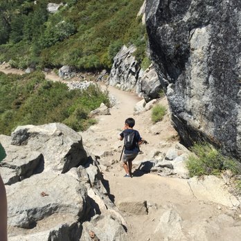
BEWARE TOURISTS. THIS HIKE IS NOT FOR YOU. I'm in my thirties and not an avid hiker. I'm not going to sugar coat this review because of the views. I'm going to be brutally honest about this trail, which changes from nicely paved dirt path to treacherous piles of jagged rocks (sometimes slippery if you're at Mist trail) that you need to figure out how to get down or up (depending on what direction you are taking) without falling and hurting yourself badly. Also, keep in mind there are other people sharing this path with you in the opposite direction so you not only need to navigate through the treachery of the rocks but also the people sharing them with you. I had planned to do the four mile trail (from Glacier point) because it was shorter but the Glacier point gift shop employee Jeremy said he had done this hike in 2 hours with his 40 year old mom and all he took was one water bottle with no problem. LIES!! The other gift shop employee Olivia said panorama trail was longer but definitely easier than four mile because it was less steep and all downhill. MORE LIES!!! Its because of what they both said that changed my mind to switch from four mile to panoramic trail. This trail is labeled as strenuous but should have "treacherous" added to it. There are parts of the trail where there are no signs and you lose your way because there is no clear path on where to go. At Vernal Falls, after you cross the bridge, you have to walk up a huge slab of rock to figure out which direction to go to continue on (you go right). It was late in the afternoon for us so there wasn't anyone around for us to follow. The bad signage, or lack thereof, was frustrating. If you see squiggly marks on the map (that you can get at the visitor centers) it means you have to walk down jagged/slippery rocks. 99% do not have rails. You could fall hard on your way to Neveda Falls or fall straight down slippery rocks at Mist trail (your shoes will get wet--mine were completely soaked). Some of the trail were paved dirt roads (which was what I was expecting, including the switchbacks) but many parts of this trail were just rocks stacked on top of rocks done by Yosemite staff to create a challenging hiking experience. You are climbing down these rocks for miles non stop. Your knees will hate you. There are no bathrooms. The first bathroom is at Nevada Falls. The first place where you will see a water fountain to refill your water is after Vernal Falls on the Mist trail and before you reach the Happy Isles Nature Center. After you reach the Happy Isles Nature center, you still have to walk a bit to the #16 shuttle stop. Our driver was ending her shift so she was making select stops. Thankfully she stopped at stop #8 to the Yosemite Valley Lodge where we had left our car. We got to our car by 8pm and took off for our hotel by 830pm. We were exhausted and now had to drive home down a winding trail to exit the park in the dark. It was a tough drive back to our hotel and we didn't expect to have a day like this. This trail is not all downhill from Glacier point. You have a good 2 miles of steep uphill hiking. There was not a lot of shade in the day hours during summer. I carried with me 3 waters, 1 gatorade, 1 snapple (bought at gift shop located at Glacier Point) and it was not enough to last me the 9 hours it took for us to complete this trail. I recommend bringing more if you plan to do this complete 9 mile route. Also, I recommend bringing a walking stick (or buying one at the gift shop for $22.99) and a bucket hat for $32.00). These are definitely worth the investment or added weight to your gear because in the 90 degree heat and the treacherous areas of the trail you will be so thankful to have had them. All in all, the waterfalls started to look the same to me. Illilouette Fall and Nevada falls looked very similar. If you want to get misty, do lower yosemite falls and walk towards the bottom of the falls (off trail) instead of Vernal Falls. Or take shuttle #16 and walk to Vernal Falls instead of seeing it from panoramic trail. In my opinion this trail was not worth the energy, sweat and tears. I was more impressed by Igazu falls and Niagara Falls when I visited them. I thought this trail would be like others I've taken when visiting other National parks or International parks. I thought it would be a cleared dirt path. I was WRONG. If you want to get great pictures of everything from Panoramic trail, I recommend breaking up your trip in two. First trip: park at Glacier point, walk to Illilouette Fall, then turn back. Second trip: take shuttle to #16 stop, walk Mist trail to see Vernal Fall and Nevada Fall. In my opinion, this is a much less strenuous and treacherous itinerary and you can see everything you would have seen on the Panoramic trail without the pain and stress. read more





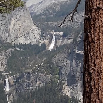
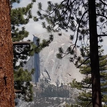
1. This hike has been called by many as the most beautiful hike in Yosemite. Ok, if not many people, at least me, who has done almost all the hikes in this park, except Half Dome. 2. We drove in just as Glacier Point was opening for the season in May 2015 . This year being El Nino with huge snowdrifts, Glacier Point road will be closed until June 2016. 3. We did both the Taft Point and Sentinel Dome hikes, using the single pit toilet bathroom at the trailhead, just in time ahead of a bus load of hikers. 4. Drove to nearby Glacier Point, overrun with tourists, checking out the views of the Yosemite Valley 3000 feet below, taking in awesome sights of El Capitan, 2425' Upper and Lower Yosemite Falls, tallest waterfall in North America, before heading onto the Panorama Trail. 5. Hardly a person on the Panorama Trail at 7,200 feet elevation, with an in your face view of Half Dome. This massive granite mountain is an awesome sight, dominating the landscape. 6. The trail becomes a series of downhill switchbacks, through vast forests of trees. In the distance we can see Vernal and Nevada Falls coming closer, roaring full blast in the late Spring, but disappearing by late Fall. 7. We walk along the edge of a cliff, fronting the Yosemite Valley, somewhat similar to walking along the south rim of the Grand Canyon. Great photographer's spots everywhere, of Half dome, and the two waterfalls, framed between the trees, as we go downhill. 8. Walk down the path two miles to the Illilouette Fall, and then on the John Muir trail to Nevada Falls, and then to Vernal Falls, and down the 700+ granite stairs of the Mist trail. We go past the Vernal Falls footbridge, onto the lower mist trail, all alongside the raging Merced river, swollen by the melted snow of winter. 9. People wade in the water in the summer, when the falls are a trickle, only to slip on the wet rocks, and fall into the river and become one of 200+ people each year who need to be rescued, and taken out on a stretcher on an equipment cart on the paved Lower Mist Trail 10. The entire trail is 8.5 miles one way, starting at 7,200 feet and ending at 4,020 feet elevation, taking about 8 hours, open from June to October. 11. We walk only two hours, one hour from Glacier Point, and one hour back, taking in the best views of the Panorama trail -the time limit for the wife before making another pit stop! 12. We come back in time to enjoy a awesome view of the sun glimmering on Half Dome, and then the sunset on the Dome, before a harrowing drive in the darkness along the winding Glacier Point mountain road at night, with speeding tailgaters close on my tail. read more





Panorama trail changed my life it should be made into a poem: Noses are red Butts are blue I'm so tired I came into this hiking trip with a massive cold and was sneezing literally everywhere. Honestly, I'm glad my camera was weather sealed because I was able to wash all the snot off of it, albeit involuntarily. Toward the beginning-middle we decided to go off-path to a relatively flat river bed. I will say though that thousands of years of water really polishes the riverbed quite nicely. It's more slippery than a freshly waxed bowling lane. Suffice it to say, I fell on my butt. And I slid down like 20 feet into a puddle in sub 40F weather. In all honesty, if this was actually a bowling lane I'd probably hit a strike. Pro-tip: I don't recommend it. But thankfully, nothing really happened besides the bluest ass cheeks outside of Vegas. So here's the rest of the review on this trail because the adventure doesn't stop there. We started this whole hike from top to bottom, so while it was mostly a downward hike, the sheer length and variety of obstacles of the trail made it more difficult than it had to be. Though there were small stretches of uphill hiking, the real exhausting part was toward the end with hundreds of steps of rocks that are a mix of slippery and laden with tourists - mostly of the Chinese variety. As the name implies, this whole hike is about going through all of Yosemite's landmark spots and is incredibly picturesque and photogenic. No matter the lack of an uphill climb, it was a 10 mile hike and we were obscenely tired toward the end. We walked and walked until we reached civilization, and passed the opposite entrance for the hike. And then it hit us. You know how all the guides suggest that you park at the bottom, and then take a shuttle to the top? Yeah. You should do that. The shuttles up to Glacier Point stop operating at 1 PM and we were well past that point. The National Park Service made it a point that they were not allowed to escort or give rides to people and that we were probably screwed. It was around 5 PM when we finished hiking, we were hangry at least 3 hours back, and we finally ate in a cafeteria at Yosemite village. We were rapidly losing daylight, phone battery (Yosemite at this point had no cell reception), and we had to figure out how to get back to the top parking lot. The only quick way up was a four mile ascent aptly named the Four Mile Trail. This basically condensed the whole 10 mile trip into a 4 mile struggle uphill past switchbacks, probably grizzly bears, man-eating plants, and at this point it was near pitch black. We decided at this point that it was best to split up - the other half stay back, and the other, more athletic half would tackle the trail. That was easier said than done because thirty minutes had passed and the group returned to the cafeteria, defeated, simply asking - where was the entrance? It was easily 8 PM at this point and we hadn't even started hiking up. After searching for another half hour, aided only by dimly lit cabin lights, they finally found the entrance after running into four hikers who had just descended from the trail. Unlike us, they parked at the bottom and they were willing to give us a ride back to our car. I followed them back to their car, waited 25 minutes while they were getting pizza, and began the almost hour long drive up the winding mountain roads. At this point, I honestly thought it was smooth sailing from here; I would pick them up at the cafeteria and that we could drive back to our hotel back at the park entrance. It was also at this point that I realized that my phone was dead. No maps, no contact. Yosemite is incredibly hard to navigate, doubly so with no GPS, and especially when its pitch black. It took me another half hour to get down to Yosemite village, and circled for another hour. When I thought all hope had been lost, I got pulled over by the park police. He stopped me for following another car too closely and speeding and questioned me on whether or not I had been drinking or smoking weed (I hadn't) but ultimately left me with just a warning. It was nearly midnight now, and I circled some more for 10 minutes. Apparently, I had passed my group because my friend threw a pen at the car and I was so tired and panicked that I hadn't noticed. A short U-turn later, I picked them up, headed back to the hotel, and we knocked out. Did I mention what a great trail this was? read more

This is one of the best trails in Yosemite because you can take Mist Trail from Vernal Falls Trailhead up to Nevada Falls, and connect with the Panorama Trail -- all the way up to Glacier Point. The hike is about 8.2 miles from the Vernal Falls Trailhead to Glacier Point. We did this hike this past weekend and really worked ourselves out! It was spectacular, with phenomenal views of the Yosemite monoliths, including Half Dome, Vernal Falls, Nevada Falls, Liberty Cap, and more! :) We even saw a Coyote, walking uphill through the mountainside, as we were hiking. You should be in decent shape before you take on this trek. We did the hike upward from the valley floor all the way up to the elevation of Glacier Point at 7,214 feet above sea level. There is an easier route (supposedly) that you can take from Glacier Point down to the valley floor, but it may be hard on your knees. I think the uphill hike is probably better and easier. :) Some photos I captured are available here: https://ourwelltraveledlife.wordpress.com/2015/04/13/yosemite-national-park-a-west-coast-wonder/ read more


4 years ago

If you are reading this review and have yet to hike the Panorama Trail, or haven't visited Yosemite at all, please take the following steps: 1. Turn off your computer. 2. Pack some hiking gear, trail mix, and water. 3. Get in your car. 4. Drive to Glacier Point, Yosemite (This applies to everyone, even if you live in Maine). 5. Get hiking. The Panorama Trail at Yosemite is by far the most beautiful hike I have ever had the pleasure of taking. You start off looking across the valley at Yosemite's big hitters, such as Half Dome, Vernal and Nevada Falls, and end up walking all the way around so you end up looking down at the water rushing down the falls. You cover some incredible ground. The hike is diverse and breathtaking. I recommend doing a one way trip of the Panorama Trail. We really liked starting from Glacier Point and hiking down to the Valley. It took us about 6 hours (this was with several stops to take in the beautiful vistas along the way). We ended up taking the John Muir Trail from Nevada Falls instead of the Mist Trail to avoid the steep downhill and crowd, which turned out to be a perfect decision. This hike is a little deceiving at first, if you start from GP. It's downhill and has a rather relaxed beginning. Later, it goes uphill and things change. Make sure you have plenty of snacks and water. I definitely underestimated this one. And a final note, don't tell too many people about this trail. Keep it between you and me. It is one of the less traveled trails and is far more enjoyable for that reason. Share this information sparingly. But first and foremost, check out this trail immediately and enjoy! read more


11 years ago
This review is for the NOT-SO-FIT MENTALLY-UNPREPARED BUT REALLY-WANT-TO-DO-IT HIKERS! My friend and I planned to do our very first day hike and chose to go all out with the four mile trail-panorama circuit route. Both of us are 22 and fairly fit, but definitely not as physically inept to tackle a strenuous hike as most others take weeks preparing for. We began our hike around 9am walking to the Four Mile Trail TH from camp 4 and began our way up, but since this review is for the Panorama Trail, I'll just start from when we began our way down. We started our trip downhill towards the Illiouette Falls around 2pm and quickly realized how strenuous the hike was going to be. By the time we reached the sign that told us only 1 more mile was left towards the first falls and 7 more miles left to the valley, it was already 3pm. One hour per mile?? At this rate, our hopes were beginning to get shot as it already felt like we wouldnt be reaching the valley floor until 10pm. After reachinf the beautiful Illiouette Falls, we were both extremely tired and dreading the fact that the next 1-2 miles looked like straight uphill in a not so shaded trail. After taking MULTIPLE stops with each shaded area we got, we reenergized with food, drank that water, had a few moments to contemplate what would happen and what we could possibly do if we COULDNT finish the trail in time, we finally got up and kept on going (at our own pace of course). We did get passed by a rude person making a snide comment at how we "should have worked harder...before getting here!!!" (Which in all honesty, yes maybe he did have a point to some degree, but nobody should fault someone for just trying to explore nature and do it to the best of our ability?!?) ANYWAY, nevada falls was BEAUTIFUL, and we didnt reach it until about 7pm. Prior to this stop, we had already mutually agreed to take the John Muir trail back to Happy Isles but ofcourse, we saw no such distinction between the trails when we passed it. We ended up at the top of the Mist Trail stairs and began the long journey down the Unforgivable Stairs of Doom (as I began to call it). Luck as I had it, I banged my knee EXTREMELY hard against a rock while trying to balance my way down on of the steep stairs which dampened my mojo for a quick second but, we still had 4ish miles to go?? Couldnt just be stuck there next to the a raging waterfall. After limping a good .5 miles, the pain eventually became one with my whole body and the numbness began. What even is pain? Mind over matter. We reached Vernal Falls fairly quickly but time began to pass even faster. The stairs are really NO. JOKE. If you have bad knees or ankles, dont even try doing this. But on the contrary, I can attest to having THE weakest knees and THE weakest ankles (my right ankle was already sprained before this hike even began), and I was able to do it! I pushed through the pain quite fluidly, not saying it was easy but I did it! By 8pm the sun was pretty much gone and all we had to do was walk the rest of the trail to the end and up to the Happy Isles shuttle stop. Finally reached the stops with plenty other hikers at 830. ALL IN ALL, it was a wonderful, life-changing hike. I feel like my body was put into a situation where I'd be forced to push it in ways I've never pushed it before. I lugged around a gallon + more of water and plenty of food plus a heavy Nikon D90. If you have a good hiking buddy, and the right intentions set, theres no reason why you wouldnt be able to do this trail :) (Cept rly though....was not anticipating how hard it'd be) (the reviews are no lie) (this is one of the most strenuous but rewarding hikes forshure) read more


This is a pretty nice trail with lots of great views. A lot of people will take the shuttle to Glacier Point and then hike back down to the Valley on this trail (or the reverse of that) My wife and I hiked up to Glacier point via the 4 mile trail (trail head is on the right side of the road driving east through the valley just before Swinging Bridge) and then used the Panorama Trail to get back down to the Valley floor. It was then another 3 mile walk back to our truck parked at the 4 mile trail head. There is a 3200 foot elevation change from the valley to GP, but this trail has a few hills to go over as well. There is also another 800 - 1000 foot drop down, across, and back up and out of the Illiouette Creek to add on top of that. Hiking down to the valley isn't that hard (even with the hike up and out of Illiouette Creek) unless you had already climbed up to Glacier Point instead of taking the shuttle to the top, or you can't sustain that long of a straight incline or decline. There are lots of awesome views along this trail, but the best is at the unmarked Panorama Point. This is located on the left about 3/4 of the way up from Illiouette Creek when hiking from GP down to the Valley. It's a short distance through some tight bushes to an overlook that once housed a guard rail, but lost it during a few rock slides in the 60's and 70's. This is a completely unobstructed view of most of the park. Do not miss it! The other great thing about this trail is that you get to see Nevada and Vernal Falls for free since this trail spills out into the John Muir trail just a short distance over from the top of Nevada Falls. From here, you can either go back over Nevada Falls and come down the Mist Valley Trail over Vernal Falls (Lots of stairs, lots of people, very steep, and very slick) or continue down the John Muir Trail until it meets back up with the Mist Valley Trail at the bottom. Since I have previously climbed up the Mist valley Trail to see Vernal and Nevada Falls, I elected to take the easier sloped (and less crowded) John Muir Trail down to the bottom. Do it on it's own, or do it as part of an all day loop, but if you like to hike, then definitely do it at least once. read more


15 years ago
If you're in Yosemite and want a hike with some of the most breathtaking views available then look no further than the Panorama Trail. Starting at Glacier Point, the trail offers great views of Half Dome as you hike your way down to Illilouette Falls at the valley floor before ascending up to Nevada Falls. It's about 8.5 miles one way and down hill for the most part, except for a climb (760 feet) after reaching the valley floor. I did this hike with a friend at 8am at the end of July, starting at Glacier Point, stopping for a rest at illilouette Creek, ascending to Nevada Falls before having a rest and dip in the water there, before heading back to Glacier Point. Once you reach Nevada Falls you have the option of continuing down the Mist Trail past Emerald Pool and Vernal Fall, but as we had parked our car at Glacier Point we thought we would hike it back. BIG BOO-BOO!!. As it was now midday it was over 100 degrees and I had a 3200 foot ascent back to Glacier Point with very little water. The hike from Nevada Fall to Glacier Point is still a hike with beautiful scenery, but is very strenuous. Ensure you're experienced enough and have water/food reserves if you take it on. Also don't forget to stop off at Panorama Point which is just off the trail about half a mile after crossing Illilouette Creek, it offers a great view of the back of Half Dome, Liberty Cap and Glacier Point. This trail was well sign posted along the way and we never lost the trail once, it's predominantly a series of switch backs and offers ever changing perspectives of some great Yosemite scenery. I would rate the down hill one way hike about 5/6 out of 10 for difficulty, while the return must be an 8/10. The crowd factor was low during the hike although Nevada Fall and Glacier Point both got busy as the morning wore on. There's only one thing I can guarantee with the Panorama Hike - you will remember the views and hike itself for a long long time to come. read more


13 years ago

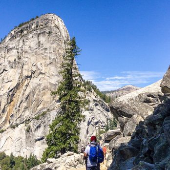
Amazing hike. It is very difficult if you start from the bottom. We had kids 8 to 10 year olds and we took the tour bus to Glacier Point and hiked down. The first half was very easy and a beautiful resting spot near the river. I will say rest up because the next part is the difficult part and it is the switch back. Meaning switching to another mountain and up hill. For some it might be moderate but with kids and after 4m from Glacier Point it doesn't come at a good time! Take deep breaths it will end after a few miles. Then it goes down hill again. This down hill though is not easy. Rocks and jagged edges all over. But there is another resting point the Nevada Falls. It is simply gorgeous. This hike is tough for kids as it is around 9m but 9m of rugged rocks and trails. After Nevada falls you hike goes down to the base of the falls and then the trail opens up and is wide and easy. This is the finishing part and you walk to free shuttle and take it back to Valley lodge to pick up car. It is a once in a lifetime experience. Come prepared. We ran out of water and my son and I had two 2L hydration packs. We ran out of food. It took us 5 and a half hours to hike down. read more




10 years ago
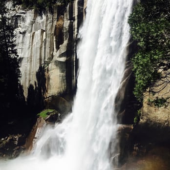
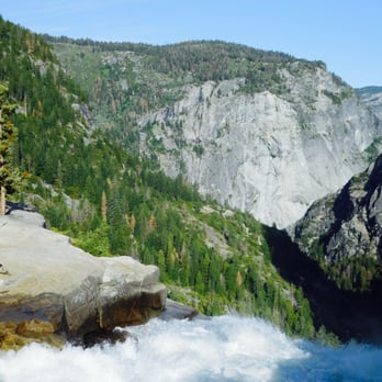
Travelled: end of June 2016 (Friday-Sunday). Additional Travel: Camped two nights at Little Yosemite Campgrounds. Hiked to Half Dome Trailhead: Glacier Point (overnight parking allowed) Total Distance one way (Glacier Point - Happy Aisle): 8 miles Total Distance one way (Glacier Point - Little Yosemite Campgrounds): 6 miles Total Distance one way ( Little Yosemite Valley Campgrounds - Half Dome): 3.5 miles Difficulty: 3 (Out of 5) Permit required: No Additional Info: Shuttle Service (not free) available from Half Dome Village to Glacier Point Average Temp: 60'F (low) - 80'F (high) We started from Glacier Point were we parked our car (we planned on camping two nights at Little Yosemite Valley Campground because we also had permits to hike up Half Dome). After hiking just a few hundred feet, you will take a lot of pictures and have many oohs and aahs at the view. You will eventually have to move on and continue. Hiked a relatively easy 2 mile downhill to illilouette Falls. From there, we rested, had a snack and enjoyed the beauty of the river. The river was very fast and makes you want to just jump in and slide through the flat rocks! If you head pass the bridge, there is a safer area where you can soak your feet. Next,we headed out to Nevada Falls which began our first uphill climb. There was one set of switch backs which may be challenging for the beginner. Roughly more than 1.6 miles is uphill, then as you get closer to Nevada Falls, it levels off for a bit. Once you hit the last 1 mile mark, it's all downhill from there (total miles: 3.6 from illouette Falls). Nevada Falls is a grander waterfall compared to illouette Falls. There are many pockets where you can rest, kick off your shoes and just enjoy the beautiful backdrop of the valley. Watch out! Extreme selfie moments! This area is over populated with respectable hikers and dumb ones that go at the very edge of the drop down to take that perfect shot for their Instagram. The Panorama Trail continuous on towards the Valley where it passes through the Mist Trail and encounter Vernal Falls (you WILL get soaked along the stairs so bring a light rain coat or none at all in the summer since it would be quite refreshing) and then to Happy Aisle. If this is the route you will be planning, you have to call ahead of time to arrange a shuttle service: Park your car in Half Dome Village and have a shuttle take you to Glacier Point (from the village), otherwise it would be along way back to Glacier Point if you park your car there. Note: if you cannot get a shuttle service, then you pretty much have to head back to where started =). If you have any beginners in your group, I recommend getting that shuttle service, otherwise, they will really hate the climb back! Since we were staying two nights at Little Yosemite Valley Campgrounds, from Nevada Falls we headed to the right, after the bridge and headed uphill towards camp-this is the same trail towards Half Dome. This was a relatively short 1 mile hike to camp. From there, we used the toilet, cleaned up in the beautiful Merced River nearby and camped out. The next day, was our Half Dome climb (only 3.5 miles!). We REALLY took our time because we didn't have to hurry back down towards Glacier Point right away so, after our Half Dome hike, we went back to camp, soaked in the river, which was cold and perfect for our tired feet. The next day, we headed back to Glacier Point on the same Panorama Trail. Going back on the Panorama Trail to Glacier Point is not as bad as it seems (for the seasoned hiker). I carried roughly 15 - 18 lbs on my back and we finished the climb back relatively fast. Water was easy to come by when you have a water pump/filter so I just shared a camelback since there was no point in carrying two. Overall, this is one of the most picturesque hike in Yosemite. In my opinion, a whole lot better than climbing Yosemite Falls. There is definitely a lot less people on this trail. I would highly recommend this hike to anyone. Enjoy! read more


11 years ago
Unbelievable views along the entire trail. If you only have one day to spend in the Yosemite Valley area, then this is definitely the biggest bang for your buck vista wise. Here comes the biggest HOWEVER of all time though - definitely know what you're getting into and be prepared. I'm almost glad we didn't give this more than a cursory look before setting off since had I known what we were in for, then I may have never dared to attempt it. You need to be in good shape, I don't know that I could in good conscience recommend this to other beginners (though we are beginners and we made it) and bring plenty of water and some good snacks that will give you boosts of energy along the way. The elevation is no joke as well - if you're not used to it, as we weren't, then it can be an unpleasant surprise. Both my husband and I are in decent shape and while I'm (mostly) sure there were never any actual life threatening moments, I learned the true meaning of "bone tired" by the end of the day. My legs (particularly the hamstrings) and knees vehemently let me know about their displeasure for about three days after the hike. Thank goodness we were off to wine country after this and I could sooth my pains with some of the best red wines in the country. Our guide book of lies told us that the Panorama could be accomplished in 4-6 hours. I couldn't bring myself to check the actual time, but we were definitely on the 6+ range. I realize there are far, far better hikers in the world, but unless you can somehow float above the landscape/run the entire thing, then I see no earthly way to complete that monster in 4 hours. It also said there was, and I quote, "a bit of an uphill section." HA. Sure, buddy. "A bit" my (aching) left foot. That is a rough section, but in the grand scheme of the hike it actually isn't that long (a mile or two I believe). We hiked in early September so losing daylight was a concern by the end. This would be unbelievably treacherous at night - make sure you allow yourself plenty of time. The waterfalls were still lovely, but by this time of the year they are quite dry - something of a blessing when it came to the end and we (by mistake) took the Mist Trail down by Vernal Falls - AKA - never ending cliff walk/stairs of death. If those had been damp, as happens in the spring/early summer, I think I might have died a bit on the inside. I have... a thing when it comes to steep stairs/edges/open-air-to-your-untimely-death-on-the-right types of heights. I saw one poor woman who seemed more freaked than me, but nearly everyone else just skipped (or so it seemed to me) on down. If you'd like to avoid this part, then take the John Muir down instead. Bring a good guide book or map as the signs can be tough to spot in some areas. Do yourself a favor and take the shuttle or bus tour from Yosemite Lodge up to Glacier Point and hike down. Between the views of Half Dome at GP and all of the gorgeous spots along the Panorama, you really get an outstanding sense of this area of the park. I am super glad and very proud that we accomplished the trail - I think it's one of my favorite vacation memories of all time, which I can say now that my legs are finally back to normal. One last thing - we stayed at Camp Curry, which is great. They have a pizza patio and a small bar on site as well. That simple pizza and beer after completing the Panorama was possibly the best meal I have ever enjoyed. Period. read more


11 years ago
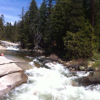
BEST HIKE I HAVE EVER DONE. .. To do this hike (Panorama Trail)you have three options 1) take the bus tour (no shuttle service) up to Glacier Point which only leaves from The Yosemite Lodge. Reservations required. Call the lodge. Note::: there is free "shuttle service" all over the Vallley floor including Happy Isles where the hike ends FYI. Our party did this. We did the 830 AM 2)hike up from the Valley floor on the 4 Mile Hike, starting point near the Swinging Bridge near Bridaveil Fall. Elevation gain almost 4,000feet. Note:: to do both hikes you will need to be especially fit. 3) hitch hike up. Hike down. Maybe another option is two cars. Good Luck. My son and GF are doing the 4 mile and Panorama. Of course they are half my age.....ha ha Park your car at Yosemite Lodge...free.Like many say here it has everything a GREAT hike should have. I went in late May and all the falls were on full display. It will be hard on your knees. It is not easy and I hike a lot. But I am old so many youngsters did pass me by. It is mostly downhill if you start at Glacier Point. A 700 foot elevation gain after about 2 miles awaits you. It is 8.5 miles long one way. Take the bus to Glacier Point. Give your self 6 hours or so and stop frequently to snap photos! I suggest the 830 bus from Yosemite Lodge. Reservations required. Or hitch hike up. Your choice. You will see Illouette Falls first. This one is mostly missed because the valley hikers usually do not go this far. Next will be Nevada Falls. The trail divides and you could either down the Mist Trail which is steep and slippery or the less demanding John Muir trail which gives you a lesser view of Vernal Falls but a most awesome view below Nevada Falls. All in all if you like to hike like I do this is the ONE to do in Yosemite. I would not bring my 2 year old but if you are in decent hiking shape do not miss this one! Beautiful! read more




12 years ago

11 years ago

10 years ago
After reading several reviews for this trail I finally convinced my wife that she would enjoy the Panorama Trail hike. She was concerned that you had to be young and in particularly good shape to make this so called Strenuous hike! There are a lot of various conclusions from reviews that may lead someone to think this is more difficult than what it actually is. Having just completed the hike last week I wanted to set the record straight for someone concerned about the trail & from a couple in their mid-50s and moderately fit. We took the one-way bus tour from the Lodge at Yosemite Falls to Glacier Point. (Note; book as far in advance as possible as both one way and round trip were sold out this day) Glacier Point is one of the best views of the entire park and you want to see that anyway. We took the 10 am tour & started out on Panorama Trail head at exactly noon. The weather was good, a high of about 81* F and the falls were roaring in early summer. I took 2 regular bottles of water and a 2 litter water bladder filled with ice and water and some snacks. (We had a big breakfast and would snack for lunch -Then reward ourselves with Pizza at Half Dome Village camp later for dinner) I carried just the one back pack for the two of us and each of us had a camera and walking stick. (one set Trekking Poles come in real handy) Walking at a moderate pace & taking in all the views we were probably passed by every other hiker we saw that after noon and the full 8.8 miles took us 7.10 hours to complete. We stopped at every waterfall with brief breaks & with a long rest / and snack break @ 5.2 miles in and at Nevada falls. We also found the lookout point mentioned in several reviews that is just after Illouette falls. I must note that after the Illouette falls about 2.7 mile into hike there is about a .50 to .75 mile hike up hill before starting down again. During this part of the Hike we were joined by a rather large full grown bear which was both thrilling and terrifying. But kind of made that part of the hike worthwhile. Most of the hike is downhill but there is some uphill while hiking. The views of the valley and of all water falls are unbelievable. I am so glad we took the time to enjoy the hike and see the valley and falls from this vantage point. We skipped the trail to Mist falls down (per my agreement to get my wife to go with me) and instead took the John Muir after Nevada falls. The john Muir offers some great view of the falls and is a series of pretty steep switch backs that can be hard on the knees calves and toes but probable the better alternative to Mist trail if you have concerns for your leg joints. I can from experience say this trail is worth the aches and pains the next day and could be considered a bit strenuous just due to the length and time spent to complete it. The down hills made both of us sore mainly in our calf muscles with my wife's the worst for a couple days' afterword's. I would say if you have knee or leg issues this could be painful as it is a long hike 8.8 miles. The weather was good for us but if it was hotter it could make it more difficult and you would likely need twice the water I took on our hike with each person carrying a 2 or 3-liter Bladder of water. Over all there is nothing along the trail that would be considered difficult or scary ... unless you have a close encounter with a bear like we did. Even that was kind of thrilling and exciting for the hike. I strongly recommend the Panorama trail and suggest walking in your home area for 8.5 mile walks before doing the trail. My wife and I were walking daily and doing 8 mile walks every now and then before heading to Yosemite. This took us a lot longer to complete than just walking around the neighborhood and small hills. But it is completely doable for anyone who wants the adventure. GOD Bless read more


11 years ago