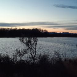
1. Picnic Rock Natural Area

    1. Picnic Rock Natural Area

    0

    Bellvue, CO

    Cancel

    Open app

    Search

    Picnic Rock Natural Area

    4.8 (4 reviews)

    Picnic Rock Natural Area Photos

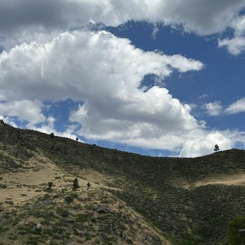
    More like Picnic Rock Natural Area
    Recommended Reviews - Picnic Rock Natural Area

    Your trust is our priority, so businesses can't pay to alter or remove their reviews. Learn more about reviews.
    Yelp app icon
    Browse more easily on the app
    Review Feed Illustration
    Photo of Lauren W.
    96
    58
    286

    11 months ago

    Helpful 0
    Thanks 0
    Love this 0
    Oh no 0

    6 years ago

    Helpful 9
    Thanks 0
    Love this 7
    Oh no 0
    Photo of Rich R.
    102
    14
    0

    3 years ago

    Helpful 0
    Thanks 0
    Love this 0
    Oh no 0

    6 years ago

    Helpful 1
    Thanks 0
    Love this 1
    Oh no 0

    Verify this business for free

    People searched for Hiking 337 times last month within 15 miles of this business.

    Verify this business

    Hewlett Gulch Trail

    Hewlett Gulch Trail

    4.7(3 reviews)
    4.9 mi

    Hewlett gulch is a 8.2 mile heavily trafficked trail near bellvue. It features a river and is…read morerated as moderate. Hewlett gulch is up the poudre canyon, a little further than grey rock. The parking lot is not overly big. This trail allows for off leash dogs. There is a bathroom at the trail head. There is not however any trash cans or dog poop bags. If you are coming to this trail with dogs please be sure to bring your own poop bags! Also be sure to pack out what you pack in, this includes your dog poop bags! Just pop them in your car on your way out and you could drop them at the gas station at the bottom of the canyon if you dont want to haul them all the way home. The first 2 miles are relatively flat and have multiple stream crossings. There are narrow bridges to cross on though. The first 2 miles are the prettiest in my opinion with all the water. once you get to the fork if you go left you will get the hardest over with first. The loop has no trees and no water, so on a hot day you will want to make sure that you get there before the heat. This trail does get busy on the weekends so would have a potential back up plan just in case there is no parking in the lot here.

    During this time of worry and fear, the best thing we can do (besides order takeout and delivery…read morefrom our favorite restaurants) is get outside and just breathe! It was a somber, foggy day in Fort Collins and the mountains were calling. As soon as we parked at the trailhead, the fog cleared and the sun came out. This trail has quickly become one of my favorites - a nice 8.2 mile out and back, with a large loop halfway through to liven things up. The first 3 miles are full of wildly changing landscapes. You begin walking through a grassy meadow, passing the remains of the homes the Huleatt family built in the 1920s, and have lots of stream crossings. When the waters are high, you just need to accept that it's likely you'll end up with a soggy shoe here and there. The incline is gentle and steady up until the start of the loop. I recommend going left at the fork to get the hard stuff over with faster - you gain a lot of altitude quite quickly, and it makes for a much easier-on-your-knees and relaxing slope around once you crest the top of the hike. After what feels like a bit of rock scrambling, you're rewarded with a view of the canyon that leads up to Red Feather Lakes out west, and a few magnificent homes that seem to pop up out of nowhere. Don't forget to enjoy your summit beer! The decline back to the trailhead is a complete 180 from the climb up, weaving through steep canyons with plenty of shade and plenty of spots for wild animals to hide in. I always recommend carrying bear spray and keeping an eye on your surroundings here! We came across of a pack of bighorn sheep on the way back to the car and paused to watch them traverse the sheer cliffs. The flowers during spring are some of the most beautiful I've seen, making certain spots appear as if they were out of a fairytale. This is NOT an easy hike, but that's what makes it all the more fun!

    Photos
    Hewlett Gulch Trail
    Hewlett Gulch Trail
    Hewlett Gulch Trail

    See all

    Reservoir Ridge Natural Area

    Reservoir Ridge Natural Area

    4.3(4 reviews)
    6.7 mi

    There are three separate entrances to Reservoir Ridge Natural Area - one off of Overland, one off…read moreof Michaud Lane and one on the western side right next to Horsetooth Reservoir. When I'm looking to add on some extra mileage (6 miles round trip), I start at the entrance off of Overland which has a fairly large parking area. While this trail doesn't have much (or any) shade, the rush of cool breeze you experience at the top is worth a little bit of heat. Start off early in the day to avoid parking crushes and heat exhaustion! You begin the hike walking on a wide, flat path and over a wooden bridge before coming to a fork in the trail. Turning right will get you to the Michaud Lane entrance (and can shave off 2 miles if you're looking for a shorter jaunt). Keep an eye out for snakes - we've seen a few rattlers in the area as of late! After about two miles, the incline begins. While it's more of a moderate climb, it does keep going up with no flat breaks, and you'll definitely break a sweat if you don't take a time to catch your breath! I recommend keeping right on the trail at the second fork so you have a better view once you crest. After a few corners, and a few false summits, you finally reach the top which overlooks the north end of the reservoir, a large valley and the Noosa yoghurt production facility. The descent is a little dusty and rocky, but you get to enjoy the view of the sun shimmering off the water and all the boats dancing around if you're willing to look away from each footstep. This trail also joins with the north end of the Foothills Trail on the descent, which you'll want to avoid unless you'd like to turn this into a double digit mileage hike! Study a map beforehand to plan your turns, then after your hike, head up to the Howling Cow Cafe for a refreshing ice blended coffee, a breakfast bagel and locally-made Noosa yoghurt to refuel and rehydrate after!

    Have done this hike many a times and generally do my hiking reviews on all trails not yelp. As a…read morehiker that is where I go for most up to date information. Positives : 1. It's close to town 2. There's not usually a ton of people out at this trail 3. It can give you 6-7 miles depending on which route you opt to take 4. It can give you some incline 5. You can get your hike in and be done in a couple of hours if you are short on time 6. There are bathrooms, dog poop bags, and trashcans at the trailhead 7. Nice view at top Negatives : 1. Zero shade 2. Zero water 3. Snakes. They are out and about now so be on the look out and listening for them. This is their home! They are frequently hiding in the low bushes or tall grass. If you are bringing your dogs or young kids you really need to be aware of this 4. Summer is a rough time to do this one be cause of all of the above. Be sure to pack out what you pack in and pick up your dog poop bags if you bring your dog. Too often just see them left by side of trail First stretch is flat and then you begin your ascent. It's nice to have something so close to town but would save it for spring or fall.

    Photos
    Reservoir Ridge Natural Area
    Reservoir Ridge Natural Area
    Reservoir Ridge Natural Area

    See all

    Picnic Rock Natural Area - hiking - Updated July 2026
    Loading...
    Loading...
    Loading...