Picture Lake Photos


You might also consider

More like Picture Lake
Recommended Reviews - Picture Lake
Start your review...


Reviews With Photos
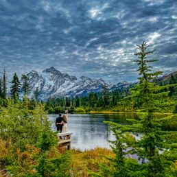

I think the views and "exploration" factor are much better further up in Heather Meadows, the Austin Pass picnic area, or even up at Artist Point. But when it comes to views, or those in wheelchairs, with walkers, or on crutches - this paved Picture Lake loop and the views are tough to beat!
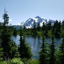

Picture Lake is something of a legend around here. Many paintings, photos, and other works of art have been dedicated to this lovely little spot along the road to the Mount Baker Ski Area. And there's a reason why. It is absolutely stunning. Whether you're there on a sunny, warm summer day or on a cold, cloudy winter day the lake is something to behold. Parking is sort of a hassle, as there isn't really a designated area. The best plan is a couple of pull-offs just past the lake. You can always so park at the nearby Lodge, though I'm not sure that's necessarily allowed. Either way, you haven't really experienced Whatcom County until you taken a picture of, you guessed it, Picture Lake.


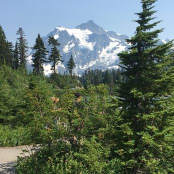
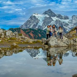
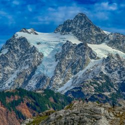
I have been here several times but never in the Fall! And Oh my goodness the fall colors are gorgeous! They have this nice paved trail that goes around the small lake for spectacular views of Mt. Shuksan. This is seriously the most beautiful mountain I have ever seen. It looks so unreal like a painting. You can not get a bad photo here. The trail is easy and accessible to anyone.


Wonderful short loop around the lake to take in the gorgeous views of the mountains and lake.
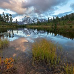

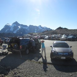
What can I say? I was trying to cure my incurable wanderlust in the Pacific Northwest. All of its natural beauty ready to be caressed and explored with my eyes and camera. Alas, it has taken me months to come to this part of Washington. One day, I decide to go for broke. Bad weather or not, I'm going finally go tackle the 542 and gaze at the wonder that is Mount Shuksan and Picture Lake. I'm sure glad I did because this place is UH-mazing. Yeah, I can say for how easy it is to access this place the rewards are insane. Usually, for views like this, I'd have to battle hordes of mosquitoes, schlep supplies of nasty freeze-dried food and spend nights and days inside a tiny tent under constant threat of becoming bear food. But not here, no sir! All you have to do is drive to this massive parking lot and walk a few meters on a loop and get rewarded this picture perfect view. Check out my pics, that's what I'm talking about. Make it part of your bucket list, you'll thank me later before you kick this bucket :) Not convinced? Read more - https://www.alwayswanderlust.com/picture-lake-mount-shuksan/


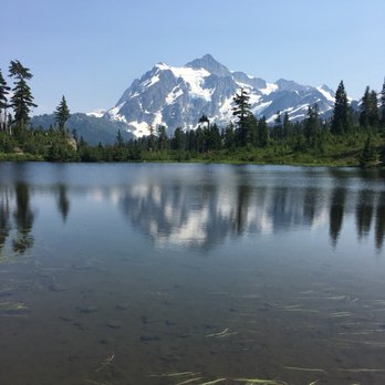
So scenic and so gorgeous! Steve and I have been wanting to come up to the Mt. Baker National Forest and Artist Point area for a considerable time now. The road up here (Artist Point specifically I would say) is closed for a good part of the year due to snow fall. It often times isn't until late June or July before you can drive all the way up to the top and some years the road never opens if the snow doesn't melt enough so that made timing a bit of a factor. When we heard that the road we seized the opportunity to go. Picture Lake was a nice little bonus to all of the other surrounding scenery... specifically Mount Shuksan and Mount Baker. The lake is so clear and the reflection so pristine that it isn't any wonder why it's called Picture Lake. There is a fine little walking path that makes a circle around the lake where you can get multiple angles for picture taking. We were up here with some haze due to smoke from forest fires but the vast majority of our pictures came in very clear including the pictures taken at Picture Lake. Well worth the drive. We live in Tacoma and it's about three... three and a half hours to reach from where we are. If you get out early you can beat some of the crowd that comes but not all of it... there are plenty of people with the same idea in mind. Don't let the other tourists deter you though. The views are breathtaking and is there for all to see.


Getting here is only half the fun. The drive on 542 east is bit winding and treacherous at times. My suggestion would be to take your time and pull over if you find yourself rubbernecking to all of the beauty that Mt Baker has to offer. Take a picture or 1000, the further up you get the more likely you'll never want to leave this place. Well until it gets dark and the wildlife come out to eat... This place is at the end of the highway, lots of snow covered peaks all around the park. You can now find that Autumn has kicked in and isn't letting up whatsoever. There are some road construction projects taking place right now, so please be patient. It's well worth the wait. Trust me on this. I have plenty of photos to show. Once you get to this location you may be a bit surprised that there are no two lane roads, "parking" as it were is on the left side marked off by a yellow line which may confuse the uninformed driver. Just make sure to be aware there are a ton of bewildered visitors that seem to wander off into the road to take pictures. Present company totally guilty; immediately, take me to wanderer jail. There are limited places to use the restroom so drink water sparingly, your pantalones and bladder will thank you. If you like Autumn colors, stunning views of snow covered mountain peaks, fresh air, alpine wilderness awesomeness and great conversations, then this is the place to visit. I'd so much as say that this is a must-do-it-now-bucket-list item to try out at least once in your life. My family was so surprised to learn of this place and now want me to take them there. I've never been in a place that had some many peaks all around me in my life. The lake water is still for the most part and great for mirror or long exposure photo shots. There are tons of "Please stay on the trail" signs every where and I'd stick to it. Most of the area has new growth and samplings galore. The paths have tons of oranges, reds and yellows all over. This will make any photography joyful with inspiration. Conclusion: Pack your patience, sunglasses, a good camera, snacks, wear layers as it might get a bit warm but on the side of the mountain where there is no sun it can get very cold. Lastly but most importantly make sure to purchase an annual permit to visit any National parks $35.00 or buy a day pass $10.00 from the park. This will cut down on possible tickets or fines. Just place them on your rear view mirror once you park and you're set to enjoy Picture lake and all it has to offer.


What a gorgeous place! We had a picnic and later wandered to some trails around the lake. It was very delightful and very scenic view. The drive there was also dazzling! Worth the drive and we couldn't have picked a better day to go.
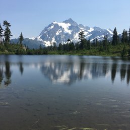

Nature at it's best. Long weekend with BF to see her son in Bellingham. We decided we needed a hike and drove to Mt. Baker. Another tourist told us this is called Picture Lake because it is one of the most photographed lakes in North America. Not sure how true that is, but it is a gorgeous sight.


What an incredible experience to visit Mt. Baker National park. Visiting Bellingham in June and getting a chance to go play in the snow only being 1 hr. and 10 min. away is just awesome. I love Washington State and all it has to offer. If only we could live here...


1 year ago
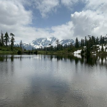
I highly recommend visiting Mount Baker and the Picture Lake area of the mountain. The views are extraordinary, it's a great way to spend the summer. The roads to the mountain are only open in the summer. read more



1 year ago

2 years ago
Definitely worth your stop when driving up to Artist Point. It's paved all the way around a short loop around the lake. However, I found myself stopping a ton, just to take in gorgeous views of Mount Shuksan. The fall colors made it all the more beautiful if that was even possible. I sometimes still find it difficult to believe that such an amazing view is relatively accessible to us in WA! read more


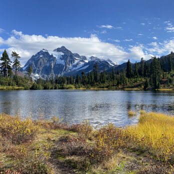


I think the views and "exploration" factor are much better further up in Heather Meadows, the Austin Pass picnic area, or even up at Artist Point. But when it comes to views, or those in wheelchairs, with walkers, or on crutches - this paved Picture Lake loop and the views are tough to beat! read more


1 year ago

7 years ago
Picture Lake is something of a legend around here. Many paintings, photos, and other works of art have been dedicated to this lovely little spot along the road to the Mount Baker Ski Area. And there's a reason why. It is absolutely stunning. Whether you're there on a sunny, warm summer day or on a cold, cloudy winter day the lake is something to behold. Parking is sort of a hassle, as there isn't really a designated area. The best plan is a couple of pull-offs just past the lake. You can always so park at the nearby Lodge, though I'm not sure that's necessarily allowed. Either way, you haven't really experienced Whatcom County until you taken a picture of, you guessed it, Picture Lake. read more


I have been here several times but never in the Fall! And Oh my goodness the fall colors are gorgeous! They have this nice paved trail that goes around the small lake for spectacular views of Mt. Shuksan. This is seriously the most beautiful mountain I have ever seen. It looks so unreal like a painting. You can not get a bad photo here. The trail is easy and accessible to anyone. read more


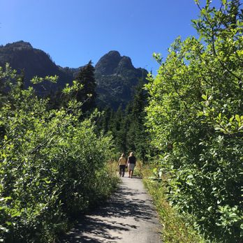


What can I say? I was trying to cure my incurable wanderlust in the Pacific Northwest. All of its natural beauty ready to be caressed and explored with my eyes and camera. Alas, it has taken me months to come to this part of Washington. One day, I decide to go for broke. Bad weather or not, I'm going finally go tackle the 542 and gaze at the wonder that is Mount Shuksan and Picture Lake. I'm sure glad I did because this place is UH-mazing. Yeah, I can say for how easy it is to access this place the rewards are insane. Usually, for views like this, I'd have to battle hordes of mosquitoes, schlep supplies of nasty freeze-dried food and spend nights and days inside a tiny tent under constant threat of becoming bear food. But not here, no sir! All you have to do is drive to this massive parking lot and walk a few meters on a loop and get rewarded this picture perfect view. Check out my pics, that's what I'm talking about. Make it part of your bucket list, you'll thank me later before you kick this bucket :) Not convinced? Read more - https://www.alwayswanderlust.com/picture-lake-mount-shuksan/ read more
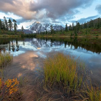

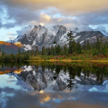


So scenic and so gorgeous! Steve and I have been wanting to come up to the Mt. Baker National Forest and Artist Point area for a considerable time now. The road up here (Artist Point specifically I would say) is closed for a good part of the year due to snow fall. It often times isn't until late June or July before you can drive all the way up to the top and some years the road never opens if the snow doesn't melt enough so that made timing a bit of a factor. When we heard that the road we seized the opportunity to go. Picture Lake was a nice little bonus to all of the other surrounding scenery... specifically Mount Shuksan and Mount Baker. The lake is so clear and the reflection so pristine that it isn't any wonder why it's called Picture Lake. There is a fine little walking path that makes a circle around the lake where you can get multiple angles for picture taking. We were up here with some haze due to smoke from forest fires but the vast majority of our pictures came in very clear including the pictures taken at Picture Lake. Well worth the drive. We live in Tacoma and it's about three... three and a half hours to reach from where we are. If you get out early you can beat some of the crowd that comes but not all of it... there are plenty of people with the same idea in mind. Don't let the other tourists deter you though. The views are breathtaking and is there for all to see. read more


Getting here is only half the fun. The drive on 542 east is bit winding and treacherous at times. My suggestion would be to take your time and pull over if you find yourself rubbernecking to all of the beauty that Mt Baker has to offer. Take a picture or 1000, the further up you get the more likely you'll never want to leave this place. Well until it gets dark and the wildlife come out to eat... This place is at the end of the highway, lots of snow covered peaks all around the park. You can now find that Autumn has kicked in and isn't letting up whatsoever. There are some road construction projects taking place right now, so please be patient. It's well worth the wait. Trust me on this. I have plenty of photos to show. Once you get to this location you may be a bit surprised that there are no two lane roads, "parking" as it were is on the left side marked off by a yellow line which may confuse the uninformed driver. Just make sure to be aware there are a ton of bewildered visitors that seem to wander off into the road to take pictures. Present company totally guilty; immediately, take me to wanderer jail. There are limited places to use the restroom so drink water sparingly, your pantalones and bladder will thank you. If you like Autumn colors, stunning views of snow covered mountain peaks, fresh air, alpine wilderness awesomeness and great conversations, then this is the place to visit. I'd so much as say that this is a must-do-it-now-bucket-list item to try out at least once in your life. My family was so surprised to learn of this place and now want me to take them there. I've never been in a place that had some many peaks all around me in my life. The lake water is still for the most part and great for mirror or long exposure photo shots. There are tons of "Please stay on the trail" signs every where and I'd stick to it. Most of the area has new growth and samplings galore. The paths have tons of oranges, reds and yellows all over. This will make any photography joyful with inspiration. Conclusion: Pack your patience, sunglasses, a good camera, snacks, wear layers as it might get a bit warm but on the side of the mountain where there is no sun it can get very cold. Lastly but most importantly make sure to purchase an annual permit to visit any National parks $35.00 or buy a day pass $10.00 from the park. This will cut down on possible tickets or fines. Just place them on your rear view mirror once you park and you're set to enjoy Picture lake and all it has to offer. read more


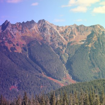
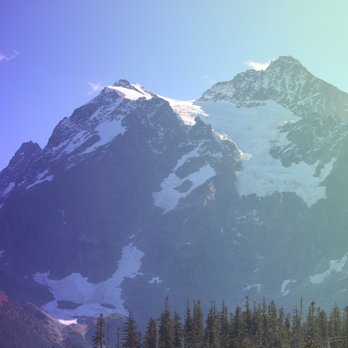

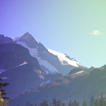


What a gorgeous place! We had a picnic and later wandered to some trails around the lake. It was very delightful and very scenic view. The drive there was also dazzling! Worth the drive and we couldn't have picked a better day to go. read more


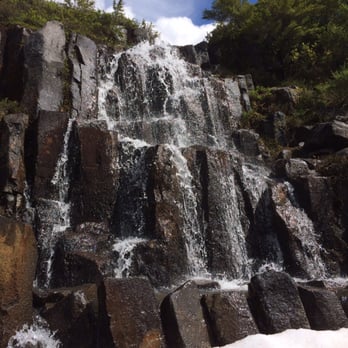
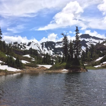
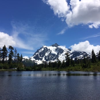

Nature at it's best. Long weekend with BF to see her son in Bellingham. We decided we needed a hike and drove to Mt. Baker. Another tourist told us this is called Picture Lake because it is one of the most photographed lakes in North America. Not sure how true that is, but it is a gorgeous sight. read more



What an incredible experience to visit Mt. Baker National park. Visiting Bellingham in June and getting a chance to go play in the snow only being 1 hr. and 10 min. away is just awesome. I love Washington State and all it has to offer. If only we could live here... read more


A tiny lake in Mt. Baker National Forest with a gorgeous view of the majestic Mount Shuksan and Snoqualmie National Forest. You should visit during the Fall because of the variety of colours you'll encounter. There aren't large crowds because it's still quite far away from large cities such as Seattle or Vancouver, B.C., but it's worth the drive. Also, most people don't know about this location, so it makes such a special place to visit. The nearby mountains are extremely colourful due to the changes in vegetation during the Fall months. Browns, golds, red, and yellows. Some of the scenery reminds me of the Grand Canyon. There's nothing like it anywhere else. It's one of the most beautiful locations for Fall photography. Best of all, no crowds and plenty of free parking! You don't have to worry about people walking in the background while you take photos. A lot of the landscape is unlike anything I've seen in British Columbia. If you hike up a bit, don't worry, it's nice and easy. You'll get a very nice closeup view of Mt. Shuksan. Postcard pretty natural beauty. Don't have to worry about bears, cougars, wolves, coyotes. I didn't see any of 'em. Therefore, it's a wonderful place to take the kids! Easy walking trails too! A rare gem in Washington State. read more


More info about Picture Lake
Ask the Community - Picture Lake
Review Highlights - Picture Lake


















Why does Yelp recommend reviews?
1 review that is not currently recommended
The reviews below are not factored into the business's overall star rating.

14 years ago
Picture Lake - parks - Updated August 2026
Best of Picture Lake
People found Picture Lake by searching for…
Things to Do in Picture Lake, WA
Picnic Areas in Picture Lake, WA
Hiking Trails in Picture Lake, WA
Picnic Spots in Picture Lake, WA
Sunset View in Picture Lake, WA
Watch Sunset in Picture Lake, WA
Scenic View in Picture Lake, WA
Night View in Picture Lake, WA
Attractions in Picture Lake, WA
River Swimming in Picture Lake, WA
Off Road Trails in Picture Lake, WA
Parks for Kids in Picture Lake, WA
Picnic Areas BBQ Pits in Picture Lake, WA
Walking Trails in Picture Lake, WA
Lookout Points in Picture Lake, WA
Playgrounds in Picture Lake, WA
Scenic Drive in Picture Lake, WA
Photo Spots in Picture Lake, WA
Canyoneering in Picture Lake, WA
Park & Forests in Picture Lake, WA
Browse Nearby
BEST of Picture Lake, Washington Things to Do near Picture Lake
BEST of Picture Lake, Washington Restaurants near Picture Lake
BEST of Picture Lake, Washington Coffee near Picture Lake
BEST of Picture Lake, Washington Breakfast near Picture Lake
BEST of Picture Lake, Washington Campgrounds near Picture Lake




