Plotter Kill Preserve Photos


More like Plotter Kill Preserve
Recommended Reviews - Plotter Kill Preserve
Start your review...


Reviews With Photos


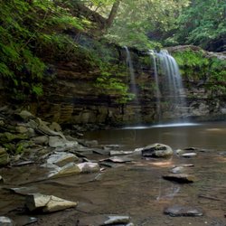
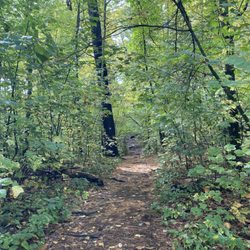
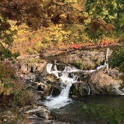
A very nice and large hiking trail about 7 miles long. The front entrance where mostly people go to. The red trail leads to the main waterfalls. There is also a way down to the bottom of the waterfall if you follow about 15 mins on the red trail. There also the back trails which is about a quarter mile before the front entrance. There is also parking in the back entrance. There is a shed as you walk into back trails in the left hand side. I have notice it seems to have more vegetation and numerous beaver dams that you wouldnt see at the front entrance. It is very lively with nature. I have seen multiple orange salamanders and frogs in the waters. If you decide to dip your toes into the water, beware and watch out for leeches. The flow of water is slow this time of year. And I think if I remember it is usually rapid falls during beginning of Spring when all the winter ice melts. It is also disappointing that you spot empty bottles all over the trails.
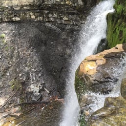

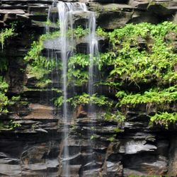
Excellent spot! 1) This spot has 3 large waterfalls. 2) The lower parts of each waterfalls was a climb to get to. 3) Prepare to get muddy.


Not for children under 8years super hard to get to bottom of falls but the creek before the falls was nice to splash in. Very flat and easy to wade in.


Had a great time walking through and hanging around the falls at Plotter kill. The hike was well marked and great for all types of hikers. Going off the trail a bit to the falls is the best part. I could lay in my hammock all day here. This place is for sure a gem Schenectady is hiding.


I'm finally understanding why everyone from the city considers Albany upstate New York. We are blessed with all kind of beauty and wonders in our backyards. I'm from the area and I didn't go another day without knowing this place exist. You can choose the length of trail you want to hike. Not much of elevation change but on a hot day, it feels like you got a workout in. Prepare for mud after rain and bring plenty of water.


What a gem. We have been visiting Plotter Kill for over a year and the changing seasonal characters of the part are just one of the many draws for us. The place is deceptively vast and you could easily get lost in it - not literally and in the most delightful ways. First off, parking is usually no problem since the parking lot fits about 20 vehicles, although there has been one occasion where it spilt over to the main road in the summer. The short trail from the parking lot to the first two forks is gorgeous with tree shade and mostly gravelly than the majority of the trails which are more natural. The creek and the falls are beautiful, although water level can be quite low in the summer and early fall. All in all this is a great park suitable for most people to navigate, and I'm glad for another natural reserve like this. read more


4 years ago
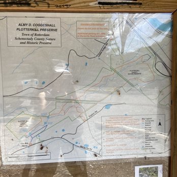
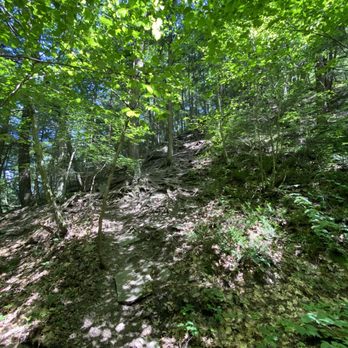
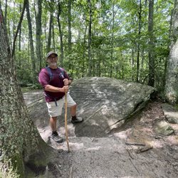
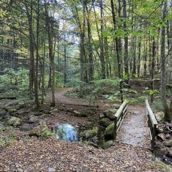
Gorgeous scenery here, but we had some issues with the trails/trail maps that I suspect weren't completely down to my being bad at reading them. What's shown on the map at the entrance doesn't seem to conform to reality, and many trails are very obviously blocked off with warning signs, end in abrupt dead ends, or head off in directions that don't seem to reflect what the map shows. The blue trail on the map brings you past several waterfalls, but the real one seemed to reroute you away from the water and onto a muddy track through the woods heading in the opposite direction. This might have eventually led back in the direction of the falls, but we decided to turn back from when the mud got tough to deal with. To find the interesting bits in my pictures, we went to the first observation point on the blue trail, doubled back to take the bridge to the red trail, then went past there and took the yellow trail to the water before heading back to the parking lot, with a few accidental detours in between. With all of the backtracking and wrong turns I'd guesstimate that we walked a total of about three miles, but if you were more systematic about it you could probably do it under two. However, the short dead-end yellow trail especially was very steep and somewhat challenging for keeping our footing on the downhill, so appropriate hiking/walking shoes are still a good idea. Don't come here in flip flops! All in all this was still totally worth it, but I'd be really happy to learn that they've managed to re-open the trails that have been closed (for safety reasons?) and/or updated the maps to make it a bit easier to hit the scenic highlights. read more


Nice place to hike. I always go to this place since it's near my apartment especially in Autumn where the leaves are gorgeous. Going here late summer would be a little disappointment if you are to watch the waterfalls since there's not much water. read more




A very nice and large hiking trail about 7 miles long. The front entrance where mostly people go to. The red trail leads to the main waterfalls. There is also a way down to the bottom of the waterfall if you follow about 15 mins on the red trail. There also the back trails which is about a quarter mile before the front entrance. There is also parking in the back entrance. There is a shed as you walk into back trails in the left hand side. I have notice it seems to have more vegetation and numerous beaver dams that you wouldnt see at the front entrance. It is very lively with nature. I have seen multiple orange salamanders and frogs in the waters. If you decide to dip your toes into the water, beware and watch out for leeches. The flow of water is slow this time of year. And I think if I remember it is usually rapid falls during beginning of Spring when all the winter ice melts. It is also disappointing that you spot empty bottles all over the trails. read more


10 years ago
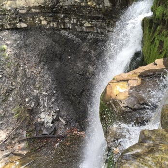
Excellent spot! 1) This spot has 3 large waterfalls. 2) The lower parts of each waterfalls was a climb to get to. 3) Prepare to get muddy. read more


7 years ago
Not for children under 8years super hard to get to bottom of falls but the creek before the falls was nice to splash in. Very flat and easy to wade in. read more


7 years ago

Had a great time walking through and hanging around the falls at Plotter kill. The hike was well marked and great for all types of hikers. Going off the trail a bit to the falls is the best part. I could lay in my hammock all day here. This place is for sure a gem Schenectady is hiding. read more


9 years ago
I'm finally understanding why everyone from the city considers Albany upstate New York. We are blessed with all kind of beauty and wonders in our backyards. I'm from the area and I didn't go another day without knowing this place exist. You can choose the length of trail you want to hike. Not much of elevation change but on a hot day, it feels like you got a workout in. Prepare for mud after rain and bring plenty of water. read more


6 years ago

13 years ago

10 years ago
Absolutely gorgeous hiking and photo location. The trails have a great variety of features both natural and man-made (attractive bridges, fences, stairs) and while the waterfall portion is certainly the more immediately gratifying, the full loop is worth a look, if only for the feeling of complete solitude and discovery when you stumble on rock formations and lesser-visited, more modest falls deeper into the trail system. read more


9 years ago

13 years ago
10 years ago
9 years ago
More info about Plotter Kill Preserve
620 State St
Rotterdam, NY 12306
Directions
(518) 386-2225
Call Now
Hours
Outdoor Amenities
Ask the Community - Plotter Kill Preserve
Review Highlights - Plotter Kill Preserve












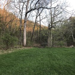

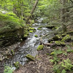
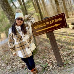


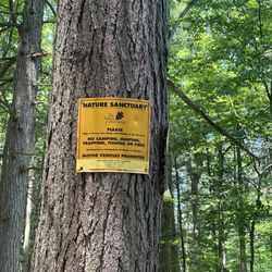
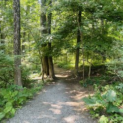


Plotter Kill Preserve - hiking - Updated August 2026
Best of Rotterdam
People found Plotter Kill Preserve by searching for…
Hiking Trails With Waterfalls in Rotterdam, NY
Places to Take Pictures in Rotterdam, NY
Walking Trails in Rotterdam, NY
Waterfalls and Swimming Holes in Rotterdam, NY
Scenic Overlook in Rotterdam, NY
Beautiful Views in Rotterdam, NY
Off Road Trails in Rotterdam, NY
Dog Friendly Hiking Trails in Rotterdam, NY
Swimming Lakes in Rotterdam, NY
Things to Do on a Rainy Day in Rotterdam, NY
Fun Things to Do at Night in Rotterdam, NY
Trending Searches in Rotterdam, NY
Barbershop For Men near Plotter Kill Preserve
Bike Shop near Plotter Kill Preserve
Cliff Jumping near Plotter Kill Preserve
Consignment Shops near Plotter Kill Preserve
Dog Friendly Things To Do near Plotter Kill Preserve
Ear Piercing near Plotter Kill Preserve
Elementary Schools near Plotter Kill Preserve
Eyebrow Threading near Plotter Kill Preserve
Flower Fields near Plotter Kill Preserve
Hair Braiding near Plotter Kill Preserve
Kids Haircut near Plotter Kill Preserve
Lakes near Plotter Kill Preserve
Parks near Plotter Kill Preserve
Pedicure near Plotter Kill Preserve
Picnic Areas near Plotter Kill Preserve
Preschools near Plotter Kill Preserve
Public Golf Courses near Plotter Kill Preserve
Public Pools near Plotter Kill Preserve
Running Trails near Plotter Kill Preserve
Scenic Overlook near Plotter Kill Preserve
Swimming Holes near Plotter Kill Preserve
Trading Card Shops near Plotter Kill Preserve
Uniforms near Plotter Kill Preserve
Browse Articles
Browse Nearby
Browse Brands
Related Searches in Rotterdam, NY
Affordable Kayak Rental Services in Rotterdam, New York
Best Dog Hiking Trails Around Rotterdam, New York
Best Fishing Locations and Guides in Rotterdam, New York
Best Places for Horseback Riding in Rotterdam, New York
Best Waterfalls and Swimming Holes in Rotterdam, New York
Check Out Off Road Trails in Rotterdam, New York
Discover Dog Friendly Trails to Explore in Rotterdam, New York
Discover Popular Bike Trails in Rotterdam, New York
Discover a Hiking Trail in Rotterdam, New York
Discover the Best Beaches in Rotterdam, New York
Discover the Best Night Hike Trails in Rotterdam, New York
Dog-Friendly Hikes With Dogs in Rotterdam, New York
Enjoy Exciting Mountain Biking Adventures in Rotterdam, New York
Enjoy Off Leash Dog Hikes in Rotterdam, New York
Enjoy Tent Camping Spots Around Rotterdam, New York
Enjoy the Best Walking Trails in Rotterdam, New York
Experience Thrilling White Water Rafting in Rotterdam, New York
Explore Beautiful Parks and Green Spaces in Rotterdam, New York
Explore Easy Hikes Perfect for All in Rotterdam, New York
Explore Fun Activities to Do in Rotterdam, New York
Explore Popular Campgrounds Near Rotterdam, New York
Explore Top Dog Parks in Rotterdam, New York Near You
Explore Top Water Parks in Rotterdam, New York Today
Explore the Best Beach Spots in Rotterdam, New York
Explore the Best Swimming Holes Around Rotterdam, New York
Family Friendly Hiking With Kids in Rotterdam, New York
Find Fun Things to Do With Kids in Rotterdam, New York
Find Parks and Recreation Activities in Rotterdam, New York
Find Popular Ziplining Spots Around Rotterdam, New York
Find Top-Rated Waterfalls in Rotterdam, New York Now
Find the Best Playgrounds to Visit in Rotterdam, New York
Hiking Trails With Waterfalls in Rotterdam, New York
Off Leash Dog Hiking Trails in Rotterdam, New York
Perfect Spots to Watch Sunset in Rotterdam, New York
Plan a Scenic Drive Route Near Rotterdam, New York
Popular Fishing Spots to Explore in Rotterdam, New York
Popular Outdoor Activities to Try in Rotterdam, New York
Popular Picnic Spots to Visit in Rotterdam, New York
Safe River Swimming Areas in Rotterdam, New York
Safe and Fun Parks for Kids in Rotterdam, New York
Top Hiking Trails to Explore in Rotterdam, New York
Top Paddleboarding Activities in Rotterdam, New York
Top Playgrounds for Kids to Enjoy in Rotterdam, New York
Top RV Campgrounds to Visit in Rotterdam, New York
Top Running Trails to Explore in Rotterdam, New York
Top Swimming Lakes to Enjoy in Rotterdam, New York
Top Swimming Spots and Pools in Rotterdam, New York


