Poverty Point World Heritage Site
Poverty Point World Heritage Site Photos
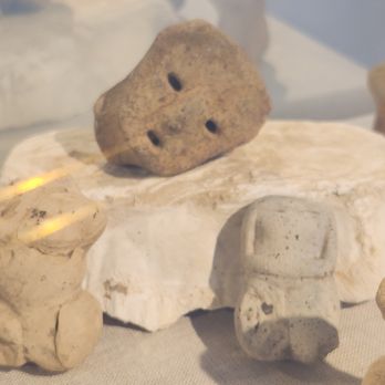


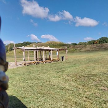
More like Poverty Point World Heritage Site
Recommended Reviews - Poverty Point World Heritage Site
Start your review...


Reviews With Photos


My husband and I visited Poverty Point World Heritage Site today during our trip to New Orleans. We are both UNESCO nerds and try to visit as many sites as we can. Let me preface this by saying it is not a visual stunner in comparison to some other sites. The sites is essentially a 3 mile hike or short tram/car ride around the loop of the park. There are a series of small mounds and markers. These mounds are very similar to other UNESCO sites that I have visited in southern Spain, Peru, and Cahokia Mounds in Illinois. What makes this site distinctive is the age of the mounds and an opportunity to learn about a little talked about era in North American history, the Poverty Point Era. It is fascinating to learn about the sheer scale of what is took to build these mounds, the size and scale of which is remarkable considering the time. If you have the time and the ability, I would recommend doing the walk. It is scenically lovely with the opportunities to do some bird watching and take some landscape photos. The guidebook that you receive with the $4 entrance fee is very thorough, as are the markers dotted throughout the site. I would also recommend visiting the museum exhibits before doing the walk, something I wish I had done. Again, this is not a site for everyone; it is really geared for history nerds who want to do more than just red a Wikipedia entry. Staff is very helpful and are able to answer most questions you may have.
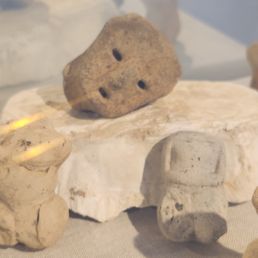

We watched a video series about old civilizations in North America and one of those presented was Poverty Point. The name Poverty Point was named after the farm that used to be there. They would call their plots, Poverty Point, Last Chance, Going Broke, etc. This is a settlement dating back some 10,000 years ago and it has the largest mound in the United States at a height of 72 feet. That's over 7 stories tall! I hiked up to the top that had a great 360-degree view of the area. Very good trail going to the top. The museum was very informative as to the culture that was there. Even though so much is unknown about the peoples that lived here, they do know that it was one of the most influential ones at the time. They had a self-guided auto tour with numbered stops with a guide to follow. That was one of the best parts. Very, very interesting place. Be sure to talk with one of the rangers as they are very passionate and have much more knowledge to give about the site.


Loved seeing the artifacts. We took the walking trail and enjoyed the fall breeze while learning about the Native Americans.
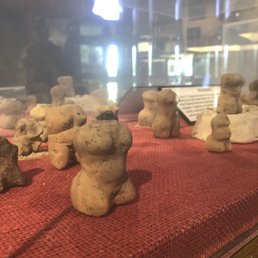

Poverty Point is a very impressive site by itself but the tourism infrastructure that they have is better than most state/national parks - especially for it being in the middle of nowhere in NE Louisiana. The bathrooms could use some work but I was very surprised and glad that they offered an included tram tour. We drove around it by ourselves afterward but it was nice having someone point our things and recall the history at the beginning. Eric did a great job of being thorough, accurate, and friendly. It's a must-go if you're anywhere in the area as it offers an amazing glimpse of the people who used to live here as well as the misconceptions that persists in the US education system about Native culture.


We visited Poverty Point World Heritage Site today and had a great experience. It's a UNESCO Heritage Site, a National Parks Service site, and a Louisiana State Park. There's a visitor center (with a film and a small exhibition), where you pay a $4 fee for adults. It's free for children 12 and under and seniors 62 and over. You can stamp your National Parks passports in the visitor center. We looked around the exhibition briefly but had read a lot online in preparation for our trip, so we felt as if we had a good background on the history of the site -- which is incredible! We opted for the driving loop around the site and used the paper guide from the visitor center to inform our drive. The loop is 2 miles long and has markers for important spots along the drive. Would definitely recommend getting out of the car at marker #5, which is mound #1, and walking to the top via the wood path/stairs. The view from the top is awesome. I'd imagine that some people could spend a few hours here, but we were limited by time so were in and out in an hour. The site is pretty out of the way, but if you're able to work it into a weekend trip, would recommend a visit.


2 months ago

3 years ago
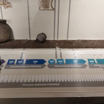
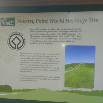
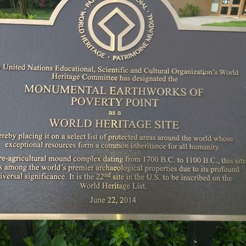
Review 1500 I have had my eye on coming here for quite some time now. This is well worth the trip. You start in the Visitors Center and you can either walk the mounds, drive yourself around, or take the ranger guided tour in their super golf cart. I would suggest going on the ranger guided tour. Everything was just wonderful. Come! Poverty Point World Heritage Site is a story 3,400 years in the making. A trading hub, an engineering marvel, a monument to ingenuity--there are many ways to describe Poverty Point. In 2014, a new label was added: UNESCO World Heritage Site. read more





1 year ago
2 years ago

My husband and I visited Poverty Point World Heritage Site today during our trip to New Orleans. We are both UNESCO nerds and try to visit as many sites as we can. Let me preface this by saying it is not a visual stunner in comparison to some other sites. The sites is essentially a 3 mile hike or short tram/car ride around the loop of the park. There are a series of small mounds and markers. These mounds are very similar to other UNESCO sites that I have visited in southern Spain, Peru, and Cahokia Mounds in Illinois. What makes this site distinctive is the age of the mounds and an opportunity to learn about a little talked about era in North American history, the Poverty Point Era. It is fascinating to learn about the sheer scale of what is took to build these mounds, the size and scale of which is remarkable considering the time. If you have the time and the ability, I would recommend doing the walk. It is scenically lovely with the opportunities to do some bird watching and take some landscape photos. The guidebook that you receive with the $4 entrance fee is very thorough, as are the markers dotted throughout the site. I would also recommend visiting the museum exhibits before doing the walk, something I wish I had done. Again, this is not a site for everyone; it is really geared for history nerds who want to do more than just red a Wikipedia entry. Staff is very helpful and are able to answer most questions you may have. read more


5 years ago

2 years ago
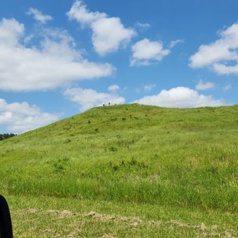
We watched a video series about old civilizations in North America and one of those presented was Poverty Point. The name Poverty Point was named after the farm that used to be there. They would call their plots, Poverty Point, Last Chance, Going Broke, etc. This is a settlement dating back some 10,000 years ago and it has the largest mound in the United States at a height of 72 feet. That's over 7 stories tall! I hiked up to the top that had a great 360-degree view of the area. Very good trail going to the top. The museum was very informative as to the culture that was there. Even though so much is unknown about the peoples that lived here, they do know that it was one of the most influential ones at the time. They had a self-guided auto tour with numbered stops with a guide to follow. That was one of the best parts. Very, very interesting place. Be sure to talk with one of the rangers as they are very passionate and have much more knowledge to give about the site. read more


5 years ago
Loved seeing the artifacts. We took the walking trail and enjoyed the fall breeze while learning about the Native Americans. read more


7 years ago
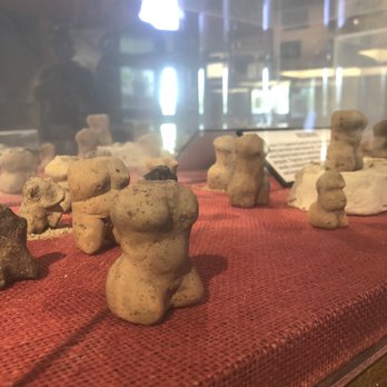
Poverty Point is a very impressive site by itself but the tourism infrastructure that they have is better than most state/national parks - especially for it being in the middle of nowhere in NE Louisiana. The bathrooms could use some work but I was very surprised and glad that they offered an included tram tour. We drove around it by ourselves afterward but it was nice having someone point our things and recall the history at the beginning. Eric did a great job of being thorough, accurate, and friendly. It's a must-go if you're anywhere in the area as it offers an amazing glimpse of the people who used to live here as well as the misconceptions that persists in the US education system about Native culture. read more


3 years ago

We visited Poverty Point World Heritage Site today and had a great experience. It's a UNESCO Heritage Site, a National Parks Service site, and a Louisiana State Park. There's a visitor center (with a film and a small exhibition), where you pay a $4 fee for adults. It's free for children 12 and under and seniors 62 and over. You can stamp your National Parks passports in the visitor center. We looked around the exhibition briefly but had read a lot online in preparation for our trip, so we felt as if we had a good background on the history of the site -- which is incredible! We opted for the driving loop around the site and used the paper guide from the visitor center to inform our drive. The loop is 2 miles long and has markers for important spots along the drive. Would definitely recommend getting out of the car at marker #5, which is mound #1, and walking to the top via the wood path/stairs. The view from the top is awesome. I'd imagine that some people could spend a few hours here, but we were limited by time so were in and out in an hour. The site is pretty out of the way, but if you're able to work it into a weekend trip, would recommend a visit. read more


5 years ago

8 years ago
5 years ago
6 years ago
Beautiful site and wonderful staff here! Definitely stop by the visitors center to learn about the tools they used and history to gain a full appreciation for when you walk up the mounds. The woman at the front desk even gave us demonstrations of some tools. Very neat! It's a lovely walk as well. read more


7 years ago

9 years ago
Wow!!!! I couldn't believe the massive size of this archeological site!!! A great afternoon exploring the area. read more




9 years ago
More info about Poverty Point World Heritage Site
6859 Hwy 577
Pioneer, LA 71266
Directions
(318) 926-5492
Call Now
Hours
Other Amenities