
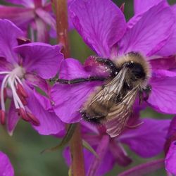
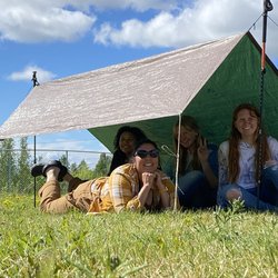
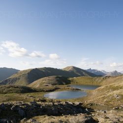
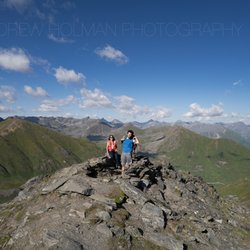
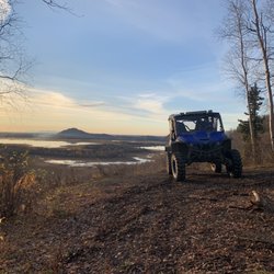
Reed Lakes Trail Photos


More like Reed Lakes Trail
Recommended Reviews - Reed Lakes Trail
Start your review...

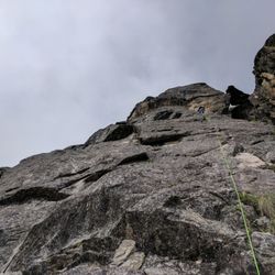
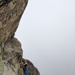
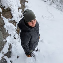
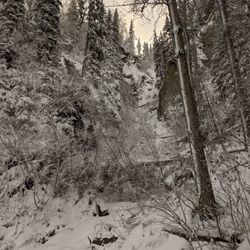
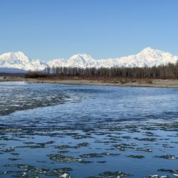
Besides April Bowl (https://www.yelp.com/biz/summit-lake-state-recreation-site-april-bowl-trail-willow), this might be the most-trafficked trail in Hatcher Pass. (https://www.yelp.com/biz/hatcher-pass-state-recreation-area-fishhook?page_src=best_of_yelp) And that ain't a knock against it! In the summer, you'll find lush green lichen-infused granite rocks and other-worldly turquoise water. It also makes for a fun weekend backpacking trip. In the fall, you'll find bright orange and red tundra loaded with blueberries. In the winter you'll find fresh, bright-white snow ripe for XC skiing or snow shoeing. The terrain at the trailhead is pretty rough, I'd recommend NOT parking right at the trailhead unless you like the bottom of your car getting scraped. If you continue down Archangel road you: 1) Should have a high clearance vehicle, the road rapidly degrades. 2) Will access Archangel Valley (https://www.yelp.com/biz/archangel-valley-palmer) a great place to rock climb and/or pitch a tent. But, I digress. The hike itself is about 4.5 miles with about 1,600 feet of gain. It's fairly moderate but it does have a boulder field in the middle where there is no trail and you'll need to do some minor route-finding. It can get slippery if there is snow (right now). Make sure you take a pole in the summer, and some good waterproof boots (and probably gaiters) if there is snow in late fall. In winter, it might be a good idea to take skis or snow shoes. read more


More info about Reed Lakes Trail


Reed Lakes Trail - hiking - Updated July 2026
Best of Fishhook
People found Reed Lakes Trail by searching for…
Places to Swim in Fishhook, AK
Dog Friendly Trails in Fishhook, AK
Scenic Overlook in Fishhook, AK
Playgrounds for Kids in Fishhook, AK
Swimming Holes in Fishhook, AK
Walking Trails in Fishhook, AK
Tourist Attractions in Fishhook, AK
Lookout Points in Fishhook, AK
Fishing Charter in Fishhook, AK
Bouldering Gym in Fishhook, AK
Trending Searches in Fishhook, AK
Browse Articles
Browse Brands
Related Searches in Fishhook, AK
Affordable Canoe Rental Options in Fishhook, Alaska
Affordable Kayak Rental Services in Fishhook, Alaska
Best Boat Launch Spots in Fishhook, Alaska
Best Fishing Locations and Guides in Fishhook, Alaska
Best Nature Trails for Hiking in Fishhook, Alaska
Best Sightseeing Experiences Available in Fishhook, Alaska
Best Spots for Star Gazing in Fishhook, Alaska
Best Waterfalls and Swimming Holes in Fishhook, Alaska
Book a Dinner Cruise Experience in Fishhook, Alaska
Check Out Off Road Trails in Fishhook, Alaska
Discover Lakes & Ponds to Explore in Fishhook, Alaska
Discover Popular Bike Trails in Fishhook, Alaska
Discover Top Boat Tours in Fishhook, Alaska for All Ages
Discover the Best Fishing Lake in Fishhook, Alaska
Discover the Best Running Track in Fishhook, Alaska
Dog-Friendly Hikes With Dogs in Fishhook, Alaska
Enjoy Camping Adventures Around Fishhook, Alaska
Enjoy Hiking Adventures in Fishhook, Alaska
Enjoy Kayaking Adventures in Fishhook, Alaska
Enjoy Tent Camping Spots Around Fishhook, Alaska
Enjoy Water Activities and Fun in Fishhook, Alaska
Enjoy the Best Picnic Spots and Ideas in Fishhook, Alaska
Enjoy the Best Walking Trails in Fishhook, Alaska
Explore Beautiful Parks and Green Spaces in Fishhook, Alaska
Explore Boat Rentals for Every Need in Fishhook, Alaska
Explore Easy Hikes Perfect for All in Fishhook, Alaska
Explore Free Picnic Areas Around Fishhook, Alaska
Explore Parks With Lakes to Visit in Fishhook, Alaska
Explore Picnic Parks Near Fishhook, Alaska
Explore Popular Campgrounds Near Fishhook, Alaska
Explore Popular Picnic Areas Around Fishhook, Alaska
Explore Popular RV Parks Around Fishhook, Alaska
Explore Popular Scenic Overlook Points in Fishhook, Alaska
Explore Popular State Park Destinations in Fishhook, Alaska
Explore Scenic Lakes to Visit in Fishhook, Alaska
Explore the Best Bait Shops Around Fishhook, Alaska
Explore the Best Boating Spots in Fishhook, Alaska
Explore the Scenic River in Fishhook, Alaska
Find Cozy Camping Cabins in Fishhook, Alaska
Find Exciting Tours to Take in Fishhook, Alaska
Find Parks and Recreation Activities in Fishhook, Alaska
Find Top Dog Swimming Spots in Fishhook, Alaska
Great Places to Swim in Fishhook, Alaska
Locate a Public Shower Facility in Fishhook, Alaska
Perfect Spots to Watch Sunset in Fishhook, Alaska
Picnic Areas With BBQ Pits Available in Fishhook, Alaska
Popular Fishing Spots to Explore in Fishhook, Alaska
People who viewed Reed Lakes Trail also viewed
Hatcher Pass State Recreation Area
18 reviews
Lazy Mountain Trail Head
4 reviews
Summit Lake State Recreation Site - April Bowl Trail
1 review
Finger Lake State Recreation
1 review
West Butte Trail
2 reviews
Palmer Hay Flats State Game Refuge
1 review
Fern Mine at Archangel Valley
2 reviews
Archangel Nordic
1 review
Alaska Horse Adventures
27 reviews
Alaska Zipline Adventure Park
7 reviews