San Luis Rey Bike Trail Photos


You might also consider


More like San Luis Rey Bike Trail
Recommended Reviews - San Luis Rey Bike Trail
Start your review...


Reviews With Photos


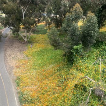
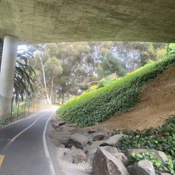
I loved this trail. It's fun great for all biking levels. I also d Found it to be safe and refreshing. Not too busy so lots of room to ride. Found a beautiful place on the trail to take a rest that was shaded with plenty of trees and beautiful flowers. It was truly a wonderland.


San Luis Rey trail actually extends further to the east. You can take your horses out on trail. There's not yet a horse trailer parking area. There might be some plans in the future to add a parking lot off the 76. The trail extends down a long little gopher Canyon and runs along the 76 freeway and goes around into the Bonsall hill area.


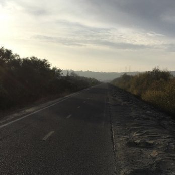
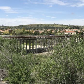
One of San Diego's best bike trails, this 10 mile there-and-back bike path is very family-friendly. There are many entry points to this trail, but the recommend starting point would be at Mance Buchanon Park. If a full 10 miles is simply too much, you can also park at the dirt lot off of Douglas, though it's a little sketchy, your round trip will only be 7 miles. The path is mostly flat, unless you take the paths under the various street bridges. Your biggest challenge will be biking toward the beach. You'll get the headwinds which will make it harder to ride. Obviously the ride back gets the benefit of the wind at your back. Things you'll see - Trains - A cool green bridge - Squirrels running right out in front you while you're biking The negative - There are vagrants all around this area. I wouldn't recommend a women biking this trail alone early or late.


There's actually two trails along this river: a dirt path, intended for walking, and a raised, paved path, intended for biking. I suggest the bike trail, as it's more visible, has more traffic, and just overall feels safer. I rarely see anybody on the dirt trail... The bike path is about 8 miles long, runs mostly parallel to the 76, and ends at the harbor. It's fun because the trail has distance markings painted on it, I think every 2/10 of a mile. It's mostly flat, with a few turnabouts and a few benches near the underpasses. It's relatively well-maintained; cracks seem to be filled fast. People walk their dogs, ride bikes, skateboard and rollerblade the trail. I can make it to the beach in about an hour and a half walking. It's usually not very scenic..the river bed is pretty dry and full of dying trees. One thing to watch out for are homeless camps in the bushes. I've never been encountered by anyone but people have come out of seemingly nowhere onto the trail. In the summer, I once saw a mountain lion sitting on the trail. It was nearing sunset. Thing had huge paws! I've been using this trail over a decade and I'm always hoping to see one again. Especially because I carry my phone and can snap a picture! There's a huge blind spot between the concrete pillars going under the 5 freeway- the turn is sharp and path gets super narrow. Be careful along this section of the trail. Overall, I highly recommend it. There's Nana's Sweet Shop for ice cream at the end of the trail, the beach, restaurants, restrooms, and Nautical Bean. Pros: - dog-friendly - easy/moderate walk - raised/visible - free parking at major streets Cons: - dog messes - some dark areas - can get crowded; listen for traffic - no bike cops like before
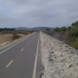

Really impressed with this bike trail. It's well protected from traffic and very well engineered. It's mostly flat, riding West you get head wind from the beach and riding East the wind is at your back. Choose your direction wisely if you're out of shape. It's kind of hard to find the on and off ramps to the trail, they aren't all marked from Google maps so you need to explore the neighborhood a bit. Once I figure it out it should be easy. From my place, it's about a 30 minute ride to the beach which is pretty amazing. There are a ton of people out so ride courteously and use the correct lanes. There were many riders who were training but I didn't feel like they were running the other riders off the path. Everyone was polite. This is protected enough from traffic so I'll probably use headphones next time! Check this place out!


This is a great trail to do if you're looking for a long stroll. I wouldn't call it a hike because it's paved the entire way. It's just less involved with nature and exploring because it's paved. I did a total of 6 miles while being 5 months pregnant and it was a really easy workout. It's all mostly flat and there's a lot to look at since you're walking along the outskirts of Oceanside. The trail felt unsafe at times as a female walking by myself. People kept coming out of the lower banks onto the trail and there were a lot of homeless people in certain parts. This trail leads you through quite a lot of different parts of Oceanside so you get a handful of nature along the way. There's no shade on any part of the trail so keep that in mind for hot weather!


A trail that goes to the beach... Yes please!!! We started our bike ride from Mance Buchanon Park. There is plenty of parking and it appears relatively safe compared to the rest of the neighborhood. The trail is relatively flat and paved with the exception of a few ramps to go up and down. As a beginner biker (haven't ridden a bike since I was a kid)... The trail was relatively easy. The trail was windy at times which made it a tad difficult. My hubby and I rode together taking breaks as needed along the way. There are a couple large open spots but most of the time you have to pull off the side to not get in anyone's way. My hubby said the trail was brutal on a mountain bike because it was all flat and paved. I don't know any better as I don't have a comparison. However, yes, your tush will be sore without proper padding. I would know! It was a descent work out 14.4 miles from Mance Buchanon Park and to the beach and back. You'll see painted mileage markers on the trail (look down). We went on a Friday after work and didn't encounter too many people on bikes but more walkers as we approached the park on our way back. I agree with other reviewers. There isn't a whole lot to see as a walker. This is in no way a hike. The trail is more suitable for bikers- specifically those with road bikes. As you pass the river, yes, there was actually water in the river, there will be a turnout to the right which will take you up a "s" shaped ramp. I got off my bike for this one. There was just no way I could make it up such a steep incline as a beginner. Once up the ramp, you'll see the beach. Cross the street and continue to go straight. There is a small entry way into the beach... We didn't get far here as the sand sunk our bikes, lol. It was definitely a nice trail to try out and reward yourself with the beach. It would probably be nice to bike out there and eat at the harbor and bike back. It was tough on the tush for a mountain biker- especially a beginner such as myself. I need some recovery time before I return and definitely proper padding! Otherwise, enjoy the trail!


I really love this trail. But, it's more of a "trail". It's a little paved road going down a path. Super awesome to run on & it's nice to make it look like a road because people know which side to be on! Because there's all sorts of people exercising on this stretch - bikers, runners (my husband & I), dog walkers, or just people wanting to walk & get some fresh air. It's a good distance - especially if you just want to enjoy the beauty & awesome weather of oceanside! It's right by my house so it's very convenient when I don't wanna drive all the way to the gym. PS - i'd go when there's sunlight. I've never been here during the early morning darkness or night darkness but i'd reckon that it's pretty weird & sketchy! lol just to be safe.


The San Luis Rey River trail runs right behind my home in the SLR area of Oceanside, and has been a source of recreation, relaxation, meditation, and exercise for everyone in my family for almost eight years now. It's my daily go-to source st any time of the day or night that inspires my creativity, boosts my productivity, releases my negativity, and has provided my "zen" over the years. People have warned me against going out on the trail at night, but if you've got a good flashlight, a decent intent, and have self defense skills (all of which I possess to some degree!), then you're really not in any danger. Sometimes, there are teenagers that hang out down there - and I've come to know some of them on my nightly wanderings. There are also many homeless individuals who live there in the basin when it's not full of water (which has been most of the time during the years we have lived in this neighborhood). I have taken them food and blankets and clothing, because seriously, they're not doing any harm and calling the police on them is not going to do anything but demoralize another human being. They have as much a right to be there as I do, they just stick around a bit longer. :) It is a trail that runs for miles inland down to the beach, and I've taken the entire trail more times than I can count. There's a bike path, you can hike it, and if you're in good enough shape, a run or jog is a good way to build up some cardio. For me, I like to walk at a light stride. I rarely (but sometimes do) take music, just because I like to be aware of my surroundings (especially if I'm alone), but overall, it's much more peaceful to stroll along with one's thoughts and focus on the sounds of nature and the world around you. I am fond of the area around my home, and sometimes still take the trek down to the beach, where I will often pass by others who are very friendly and out either in groups or walks/biking solo. My family has enjoyed group walks down the trail over the years, and it has given us a sense of closeness that I don't often get to have with my older son now that he's an adult...while keeping those ties to my youngest strong in the meantime. It's easy to sit around a TV or computer and wait for the day to end as you watch another video or show, but getting outside in nature with the people you love is invigorating...and it prompts good mental and physical health as well. It's a free perk of living in the area I do, and I am serious when I say that the sunsets and terrain you'll see on your walks are some of the most breathtaking you'll ever know in your life. It's a slice of nature carved through a suburban jungle that offers some much-needed lucidity at times...but overall, provides some of the best free recreational opportunities that this area has to offer. Check it out - there are many places to park if you don't live within walking distance - in my area there is a bridge on Douglas just between El Camino Real and North River Rd., where you can bring picnic supplies, biking gear, hiking gear, or even beachwear if that's where you're planning to end up at the end of your journey (just remember, it's a few miles to get back...save some return energy for that trip! Happy walking, running, biking, and wandering! If you see me out at any time of the day or night, feel free to say hi and let me know you saw me on Yelp (just so I don't think you're a creeper or something...haha!). Hope to see you on the trail!

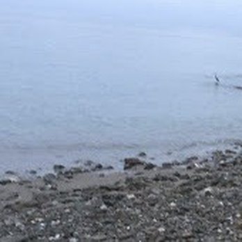
I used the entrance not far from the pier/strand. It's a decent option for cyclists, walkers and runners to avoid cars. Some areas are scenic, other spots are unattractive. Not really any shade, so not recommended on hot days. Riding back to the beach got windy. It appears generally safe, but I did see several large homeless encampments hidden in the brush, a homeless couple standing along the path in one spot and another homeless woman smoking while coming out of the brush alongside the trail, so be aware of your surroundings and at least take some pepper spray and a whistle just in case.


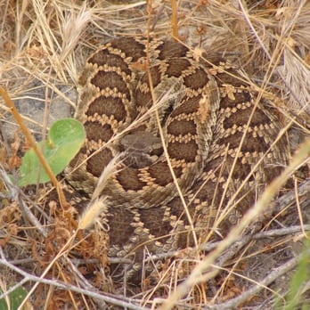
Ive been coming to this trail on & off for several years now. I've only walked it & haven't gone all the way to the ocean yet. Someday I'll bike it and do that. I start by Mance but perhaps I'll try from Douglas another time. Watch out for nature. Rattle snakes in particular. I only heard them on this visit. This time around I saw mainly birds such as white Herring, Hawks and Hummingbirds. I also saw some caterpillars crossing the road~~and oddly I was chuckling and grateful they crossed before the bikes rolled by. This flat trail is great for walkers, joggers, runners, & pro Bikers in particular. I've seen all sorts of people here from moms with strollers to dads with toddlers in tow. I'm starting to see tents in the bush area below suggesting an increase in homelessness. Be on alert and happy trails to you!


So I don't really know where this trail starts out but it extends all the way to the Ocean. I've always entered it at College Blvd. and North River Road. There are 2 paths on both side of the aqueduct/river. If you go on the left side aka "Bike Trail" it is paved. Whereas the right side (closer to North River Road is not paved. So it would be closer to Trail running. I usually just run from this entrance to the Douglas bridge which is 3 miles all together. This would be my 2# pick behind Guajome Park. Besides the scenery you have less chance of running into a snake on this trail. Both sides of the Trail are completely exposed to the sun. So do not go running here in the peak hours of the day unless you are a glutton for punishment. The left side/Bike Trail had way more people on it. So if you like solitary running where you are the only person I would go out onto the trail part. Also there is literally no lighting after it gets dark. So if you are running around 5pm I would run on the Bike trail side next to the new Park they put it. Both sides have built in parking lots.


Nice trail I went for a run on earlier. The rain has made some erosion. They have done some updates to the trail to make the divots in the road more bearable. The run was nice. Not flat but lots to see, which was nice. Parking isn't great but its manageable.


3 years ago
I'll update this later once I've explored the path more, but for now, it's a beautiful biking trail! read more


1 year ago

3 years ago

I loved this trail. It's fun great for all biking levels. I also d Found it to be safe and refreshing. Not too busy so lots of room to ride. Found a beautiful place on the trail to take a rest that was shaded with plenty of trees and beautiful flowers. It was truly a wonderland. read more






3 years ago
San Luis Rey trail actually extends further to the east. You can take your horses out on trail. There's not yet a horse trailer parking area. There might be some plans in the future to add a parking lot off the 76. The trail extends down a long little gopher Canyon and runs along the 76 freeway and goes around into the Bonsall hill area. read more
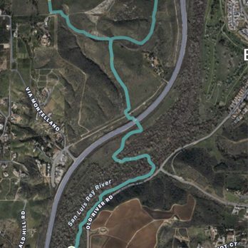


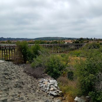
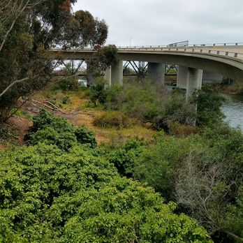
One of San Diego's best bike trails, this 10 mile there-and-back bike path is very family-friendly. There are many entry points to this trail, but the recommend starting point would be at Mance Buchanon Park. If a full 10 miles is simply too much, you can also park at the dirt lot off of Douglas, though it's a little sketchy, your round trip will only be 7 miles. The path is mostly flat, unless you take the paths under the various street bridges. Your biggest challenge will be biking toward the beach. You'll get the headwinds which will make it harder to ride. Obviously the ride back gets the benefit of the wind at your back. Things you'll see - Trains - A cool green bridge - Squirrels running right out in front you while you're biking The negative - There are vagrants all around this area. I wouldn't recommend a women biking this trail alone early or late. read more





3 years ago

There's actually two trails along this river: a dirt path, intended for walking, and a raised, paved path, intended for biking. I suggest the bike trail, as it's more visible, has more traffic, and just overall feels safer. I rarely see anybody on the dirt trail... The bike path is about 8 miles long, runs mostly parallel to the 76, and ends at the harbor. It's fun because the trail has distance markings painted on it, I think every 2/10 of a mile. It's mostly flat, with a few turnabouts and a few benches near the underpasses. It's relatively well-maintained; cracks seem to be filled fast. People walk their dogs, ride bikes, skateboard and rollerblade the trail. I can make it to the beach in about an hour and a half walking. It's usually not very scenic..the river bed is pretty dry and full of dying trees. One thing to watch out for are homeless camps in the bushes. I've never been encountered by anyone but people have come out of seemingly nowhere onto the trail. In the summer, I once saw a mountain lion sitting on the trail. It was nearing sunset. Thing had huge paws! I've been using this trail over a decade and I'm always hoping to see one again. Especially because I carry my phone and can snap a picture! There's a huge blind spot between the concrete pillars going under the 5 freeway- the turn is sharp and path gets super narrow. Be careful along this section of the trail. Overall, I highly recommend it. There's Nana's Sweet Shop for ice cream at the end of the trail, the beach, restaurants, restrooms, and Nautical Bean. Pros: - dog-friendly - easy/moderate walk - raised/visible - free parking at major streets Cons: - dog messes - some dark areas - can get crowded; listen for traffic - no bike cops like before read more


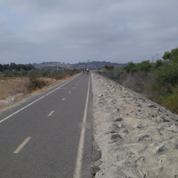
Really impressed with this bike trail. It's well protected from traffic and very well engineered. It's mostly flat, riding West you get head wind from the beach and riding East the wind is at your back. Choose your direction wisely if you're out of shape. It's kind of hard to find the on and off ramps to the trail, they aren't all marked from Google maps so you need to explore the neighborhood a bit. Once I figure it out it should be easy. From my place, it's about a 30 minute ride to the beach which is pretty amazing. There are a ton of people out so ride courteously and use the correct lanes. There were many riders who were training but I didn't feel like they were running the other riders off the path. Everyone was polite. This is protected enough from traffic so I'll probably use headphones next time! Check this place out! read more

11 years ago

This is a great trail to do if you're looking for a long stroll. I wouldn't call it a hike because it's paved the entire way. It's just less involved with nature and exploring because it's paved. I did a total of 6 miles while being 5 months pregnant and it was a really easy workout. It's all mostly flat and there's a lot to look at since you're walking along the outskirts of Oceanside. The trail felt unsafe at times as a female walking by myself. People kept coming out of the lower banks onto the trail and there were a lot of homeless people in certain parts. This trail leads you through quite a lot of different parts of Oceanside so you get a handful of nature along the way. There's no shade on any part of the trail so keep that in mind for hot weather! read more



A trail that goes to the beach... Yes please!!! We started our bike ride from Mance Buchanon Park. There is plenty of parking and it appears relatively safe compared to the rest of the neighborhood. The trail is relatively flat and paved with the exception of a few ramps to go up and down. As a beginner biker (haven't ridden a bike since I was a kid)... The trail was relatively easy. The trail was windy at times which made it a tad difficult. My hubby and I rode together taking breaks as needed along the way. There are a couple large open spots but most of the time you have to pull off the side to not get in anyone's way. My hubby said the trail was brutal on a mountain bike because it was all flat and paved. I don't know any better as I don't have a comparison. However, yes, your tush will be sore without proper padding. I would know! It was a descent work out 14.4 miles from Mance Buchanon Park and to the beach and back. You'll see painted mileage markers on the trail (look down). We went on a Friday after work and didn't encounter too many people on bikes but more walkers as we approached the park on our way back. I agree with other reviewers. There isn't a whole lot to see as a walker. This is in no way a hike. The trail is more suitable for bikers- specifically those with road bikes. As you pass the river, yes, there was actually water in the river, there will be a turnout to the right which will take you up a "s" shaped ramp. I got off my bike for this one. There was just no way I could make it up such a steep incline as a beginner. Once up the ramp, you'll see the beach. Cross the street and continue to go straight. There is a small entry way into the beach... We didn't get far here as the sand sunk our bikes, lol. It was definitely a nice trail to try out and reward yourself with the beach. It would probably be nice to bike out there and eat at the harbor and bike back. It was tough on the tush for a mountain biker- especially a beginner such as myself. I need some recovery time before I return and definitely proper padding! Otherwise, enjoy the trail! read more


I really love this trail. But, it's more of a "trail". It's a little paved road going down a path. Super awesome to run on & it's nice to make it look like a road because people know which side to be on! Because there's all sorts of people exercising on this stretch - bikers, runners (my husband & I), dog walkers, or just people wanting to walk & get some fresh air. It's a good distance - especially if you just want to enjoy the beauty & awesome weather of oceanside! It's right by my house so it's very convenient when I don't wanna drive all the way to the gym. PS - i'd go when there's sunlight. I've never been here during the early morning darkness or night darkness but i'd reckon that it's pretty weird & sketchy! lol just to be safe. read more


The San Luis Rey River trail runs right behind my home in the SLR area of Oceanside, and has been a source of recreation, relaxation, meditation, and exercise for everyone in my family for almost eight years now. It's my daily go-to source st any time of the day or night that inspires my creativity, boosts my productivity, releases my negativity, and has provided my "zen" over the years. People have warned me against going out on the trail at night, but if you've got a good flashlight, a decent intent, and have self defense skills (all of which I possess to some degree!), then you're really not in any danger. Sometimes, there are teenagers that hang out down there - and I've come to know some of them on my nightly wanderings. There are also many homeless individuals who live there in the basin when it's not full of water (which has been most of the time during the years we have lived in this neighborhood). I have taken them food and blankets and clothing, because seriously, they're not doing any harm and calling the police on them is not going to do anything but demoralize another human being. They have as much a right to be there as I do, they just stick around a bit longer. :) It is a trail that runs for miles inland down to the beach, and I've taken the entire trail more times than I can count. There's a bike path, you can hike it, and if you're in good enough shape, a run or jog is a good way to build up some cardio. For me, I like to walk at a light stride. I rarely (but sometimes do) take music, just because I like to be aware of my surroundings (especially if I'm alone), but overall, it's much more peaceful to stroll along with one's thoughts and focus on the sounds of nature and the world around you. I am fond of the area around my home, and sometimes still take the trek down to the beach, where I will often pass by others who are very friendly and out either in groups or walks/biking solo. My family has enjoyed group walks down the trail over the years, and it has given us a sense of closeness that I don't often get to have with my older son now that he's an adult...while keeping those ties to my youngest strong in the meantime. It's easy to sit around a TV or computer and wait for the day to end as you watch another video or show, but getting outside in nature with the people you love is invigorating...and it prompts good mental and physical health as well. It's a free perk of living in the area I do, and I am serious when I say that the sunsets and terrain you'll see on your walks are some of the most breathtaking you'll ever know in your life. It's a slice of nature carved through a suburban jungle that offers some much-needed lucidity at times...but overall, provides some of the best free recreational opportunities that this area has to offer. Check it out - there are many places to park if you don't live within walking distance - in my area there is a bridge on Douglas just between El Camino Real and North River Rd., where you can bring picnic supplies, biking gear, hiking gear, or even beachwear if that's where you're planning to end up at the end of your journey (just remember, it's a few miles to get back...save some return energy for that trip! Happy walking, running, biking, and wandering! If you see me out at any time of the day or night, feel free to say hi and let me know you saw me on Yelp (just so I don't think you're a creeper or something...haha!). Hope to see you on the trail! read more




4 years ago
I used the entrance not far from the pier/strand. It's a decent option for cyclists, walkers and runners to avoid cars. Some areas are scenic, other spots are unattractive. Not really any shade, so not recommended on hot days. Riding back to the beach got windy. It appears generally safe, but I did see several large homeless encampments hidden in the brush, a homeless couple standing along the path in one spot and another homeless woman smoking while coming out of the brush alongside the trail, so be aware of your surroundings and at least take some pepper spray and a whistle just in case. read more


9 years ago
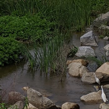
Ive been coming to this trail on & off for several years now. I've only walked it & haven't gone all the way to the ocean yet. Someday I'll bike it and do that. I start by Mance but perhaps I'll try from Douglas another time. Watch out for nature. Rattle snakes in particular. I only heard them on this visit. This time around I saw mainly birds such as white Herring, Hawks and Hummingbirds. I also saw some caterpillars crossing the road~~and oddly I was chuckling and grateful they crossed before the bikes rolled by. This flat trail is great for walkers, joggers, runners, & pro Bikers in particular. I've seen all sorts of people here from moms with strollers to dads with toddlers in tow. I'm starting to see tents in the bush area below suggesting an increase in homelessness. Be on alert and happy trails to you! read more


So I don't really know where this trail starts out but it extends all the way to the Ocean. I've always entered it at College Blvd. and North River Road. There are 2 paths on both side of the aqueduct/river. If you go on the left side aka "Bike Trail" it is paved. Whereas the right side (closer to North River Road is not paved. So it would be closer to Trail running. I usually just run from this entrance to the Douglas bridge which is 3 miles all together. This would be my 2# pick behind Guajome Park. Besides the scenery you have less chance of running into a snake on this trail. Both sides of the Trail are completely exposed to the sun. So do not go running here in the peak hours of the day unless you are a glutton for punishment. The left side/Bike Trail had way more people on it. So if you like solitary running where you are the only person I would go out onto the trail part. Also there is literally no lighting after it gets dark. So if you are running around 5pm I would run on the Bike trail side next to the new Park they put it. Both sides have built in parking lots. read more


7 years ago
Nice trail I went for a run on earlier. The rain has made some erosion. They have done some updates to the trail to make the divots in the road more bearable. The run was nice. Not flat but lots to see, which was nice. Parking isn't great but its manageable. read more


7 years ago
I'm a re-beginning bike rider (yes at 57 years old ). This trail is pretty well paved, mostly flat, but not without a few hairy underpass parts but offers has a lot of gorgeous views. There are several on and off locations, Douglas St., a few neighborhoods, the Skate-park etc... It runs from North Santa Fe down to the Harbor. We've rode it 5 or 6 times now and have made it to the 5 Freeway but not quite the Harbor YET! I think it's around a 15 mile round trip and for me at least...it feels like it. You do see a lot of walkers and joggers on the weekends and many very experienced bike riders. If you are a novice, like me, just take your time and stay to the right. Most people passing are polite and give you a "to your left" or a ring of their bell...but do keep and eye and ear out. On a clear weekend morning, you can see sky divers floating down to earth every few minutes. That's ANOTHER fun thing to do in Oceanside. Been there, DONE that! I look forward to making the entire round trip soon...Fingers crossed! read more




7 years ago

12 years ago
MISSING BOY. THE FAMILY BELIEVES THIS IS WHERE HE WENT MISSING!!! I am attempting to get in contact with your station. There is a boy who has been missing since Tuesday and we were hoping for some help spreading his picture and the info in attempt to reunite the family. Janel Joy Dowlearn is his mother. He went missing in Oceanside CA on 6/24/2014 at 10 pm. He is likely wearing a black fedora he is 5'2'' and 90 lbs. he has brown hair and brown eyes. please contact the Oceanside police or janel at 760-518-9637. The boy in my profile picture is Shawn. read more


6 years ago

13 years ago

14 years ago

13 years ago

7 years ago

11 years ago

13 years ago

16 years ago
The river trails starts on the north side of the Santa Fe/ 76 intersection. The part from there until College is pretty.. even some shade! But after that shade is sparse. I have hiked from beginning to end (on different days of course) I believe the trail is about 8 miles long. Enjoy :-) read more




14 years ago

13 years ago
This is a great trail for running and from the looks of it, a great trail for cycling! I haven't completed the whole trail yet but that is the goal for one day. There is always plenty of parking at the trail head and the trail is well kept. Saturdays are a little busier but nothing I can't handle. There are bathrooms and a water fountain at the park so it is a nice place to cool down. read more


10 years ago

11 years ago
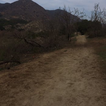
Good trail to hike if you're just starting out. Pretty easy hike but will make you sweat if you're not in the best shape! Very good place for a family hike! Just watch out for the cow manure! read more


9 years ago

8 years ago
Page 1 of 2
More info about San Luis Rey Bike Trail
College Blvd And N River Rd
Oceanside, CA 92057
Directions
Visit Website
https://visitoceanside.org/travel-tips/san-luis-rey-river/
Hours
Indoor Amenities
Outdoor Amenities
Ask the Community - San Luis Rey Bike Trail
How are people about wearing masks when nearby? Visiting Nurses here for the surge, want to go hiking but given the level of nonmasking we see & needing a break from N95s we wear, wejust want to simple mask, but wary where people are lax?
No mask is required. I don't wear one when I bike but I'm also going 14mph +
Are dirt bikes allowed?
No please do not!!! This is a small path and it's bicycles and walkers/runners. Some people ride in the river bed but it's not allowed and a sensitive area. Please go elsewhere for this activity and keep the path safe for the people using it.
Will be in town for 5 days, Will be staying in Carlsbad. Besides san luis rey trail, any suggestions on some ez/moderate walks/hikes? i've done cowles and some other ones in SD, so looking for some others in the area 15-20m driving?
San Onofre State Beach has a nice VERY EASY paved trail along coast.
Review Highlights - San Luis Rey Bike Trail
You might also consider












Why does Yelp recommend reviews?


San Luis Rey Bike Trail - hiking - Updated September 2026
Best of Oceanside
People found San Luis Rey Bike Trail by searching for…
Places to Take Pictures in Oceanside, CA
Hiking Trails in Oceanside, CA
Beautiful Views in Oceanside, CA
Things to Do With Kids in Oceanside, CA
Dirt Bike Riding in Oceanside, CA
Dog Friendly Beaches in Oceanside, CA
Running Trails in Oceanside, CA
Walking Trails in Oceanside, CA
Off Road Trails in Oceanside, CA
Rollerblading in Oceanside, CA
Dog Friendly Hiking Trails in Oceanside, CA
Fun Things to Do at Night in Oceanside, CA
Trending Searches in Oceanside, CA
Apple Orchards near San Luis Rey Bike Trail
Apple Picking near San Luis Rey Bike Trail
Barbershop near San Luis Rey Bike Trail
Beautiful Views near San Luis Rey Bike Trail
Bike Shop near San Luis Rey Bike Trail
Blowout near San Luis Rey Bike Trail
Casinos near San Luis Rey Bike Trail
Cliff Jumping near San Luis Rey Bike Trail
Consignment Shops near San Luis Rey Bike Trail
Cruising Spots near San Luis Rey Bike Trail
Dog Friendly Things To Do near San Luis Rey Bike Trail
Dog Friendly Trails near San Luis Rey Bike Trail
Estheticians near San Luis Rey Bike Trail
Eyelash Extensions near San Luis Rey Bike Trail
Free Picnic Areas near San Luis Rey Bike Trail
Furniture Stores near San Luis Rey Bike Trail
Hiking Trails With Waterfalls near San Luis Rey Bike Trail
Kids Birthday Party near San Luis Rey Bike Trail
Lookout Points near San Luis Rey Bike Trail
Makeup Artists near San Luis Rey Bike Trail
Mattresses near San Luis Rey Bike Trail
Nature Trails near San Luis Rey Bike Trail
Night Hike near San Luis Rey Bike Trail
Off Road Trails near San Luis Rey Bike Trail
Outdoor Activities near San Luis Rey Bike Trail
Parks near San Luis Rey Bike Trail
Picnic Areas near San Luis Rey Bike Trail
Picnic Spots near San Luis Rey Bike Trail
Places To Take Pictures near San Luis Rey Bike Trail
Public Shower near San Luis Rey Bike Trail
River Swimming near San Luis Rey Bike Trail
Rock Quarry near San Luis Rey Bike Trail
Scenic Night View near San Luis Rey Bike Trail
Scenic Overlook near San Luis Rey Bike Trail
Sugaring near San Luis Rey Bike Trail
Sunrise View near San Luis Rey Bike Trail
Swimming Holes near San Luis Rey Bike Trail
Teeth Whitening near San Luis Rey Bike Trail
Browse Nearby
BEST of Oceanside, California Coffee near San Luis Rey Bike Trail
BEST of Oceanside, California Restaurants near San Luis Rey Bike Trail
BEST of Oceanside, California Things to Do near San Luis Rey Bike Trail
BEST of Oceanside, California Breakfast near San Luis Rey Bike Trail
BEST of Oceanside, California Walking Trails near San Luis Rey Bike Trail
BEST of Oceanside, California Parks near San Luis Rey Bike Trail
BEST of Oceanside, California Campgrounds near San Luis Rey Bike Trail
BEST of Oceanside, California Caves near San Luis Rey Bike Trail
BEST of Oceanside, California Sightseeing near San Luis Rey Bike Trail
Browse Brands
Related Searches in Oceanside, CA
Affordable Bike Repair Services in Oceanside, California
Affordable Bike Tune Up Services in Oceanside, California
Affordable Cheap Bike Tune Up Services in Oceanside, California
Affordable Kayak Rental Services in Oceanside, California
Affordable Road Bike Rental in Oceanside, California
Best Dirt Bike Riding Spots in Oceanside, California
Best Dog Hiking Trails Around Oceanside, California
Best Electric Bike Rental Services in Oceanside, California
Best Fishing Locations and Guides in Oceanside, California
Best Nature Trails for Hiking in Oceanside, California
Best Places for Horseback Riding in Oceanside, California
Best Sightseeing Experiences Available in Oceanside, California
Best Sledding Spots and Fun in Oceanside, California
Check Out Off Road Trails in Oceanside, California
Convenient Bike Sharing Programs in Oceanside, California
Discover Dog Friendly Trails to Explore in Oceanside, California
Discover Easy Hiking Trails Near Oceanside, California
Discover Kid Friendly Hiking Trails in Oceanside, California
Discover Popular Bike Tours in Oceanside, California
Discover Popular Bike Trails in Oceanside, California
Discover Scenic Bike Paths in Oceanside, California
Discover Scenic Mountain Bike Trails Near Oceanside, California
Discover Walking Parks in Oceanside, California Near You
Discover a Hiking Trail in Oceanside, California
Discover the Best Night Hike Trails in Oceanside, California
Dog-Friendly Hikes With Dogs in Oceanside, California
Enjoy Biking Adventures Around Oceanside, California
Enjoy Camping Adventures Around Oceanside, California
Enjoy Hiking Adventures in Oceanside, California
Enjoy Kayaking Adventures in Oceanside, California
Enjoy Off Leash Dog Hikes in Oceanside, California
Enjoy Scenic Dirt Bike Trails Around Oceanside, California
Enjoy Scenic Places to Walk in Oceanside, California
Enjoy Tent Camping Spots Around Oceanside, California
Enjoy a Beautiful Waterfall Hike in Oceanside, California
Enjoy the Best Walking Path in Oceanside, California
Enjoy the Best Walking Trails in Oceanside, California
Exciting Snow Tubing Experiences in Oceanside, California
Explore BMX Bike Shops Near Oceanside, California
Explore Beautiful Parks and Green Spaces in Oceanside, California
Explore Bike Rentals Throughout Oceanside, California
Explore Easy Hikes Perfect for All in Oceanside, California
Explore Electric Bikes Available in Oceanside, California
Explore Fun Activities to Do in Oceanside, California
Explore Popular Campgrounds Near Oceanside, California
Explore Popular Dog Walking Trails in Oceanside, California


