Cancel

    Open app

    Search

    Seven Mile Canoe Trail

    5.0 (1 review)

    Seven Mile Canoe Trail Photos

    You might also consider

    Recommended Reviews - Seven Mile Canoe Trail

    Your trust is our priority, so businesses can't pay to alter or remove their reviews. Learn more about reviews.
    Yelp app icon
    Browse more easily on the app
    Review Feed Illustration

    7 years ago

    Helpful 2
    Thanks 0
    Love this 1
    Oh no 0

    Verify this business for free

    Get access to customer & competitor insights.

    Verify this business

    Pioneer Falls - Leftover berries

    Pioneer Falls

    4.0(2 reviews)
    18.0 km

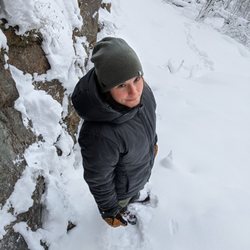
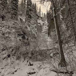
    Joy G's review is bang-on!…read more There is so little info (beta, as we say in climbing) about this hike, that I'm shocked it is actually marked on google maps. (the previous map-marker was off, I put in a fix, you should be able to navigate to this spot from Yelp now) Not only is the trailhead marked, so is the trail! (on google maps, NOT in real life) I did this on a frigid winter day. The (very short) road to the trailhead is not plowed, so use good judgement if you don't have good: tires, clearance, etc. (but it's so short, you can park on a pullout and walk in) There is no sign marking this trail either. Most of the falls was under snow when I was here. The falls were at least partially frozen underneath. Still, this is a nice place to go. It's shockingly short and feels shockingly remote. I'll be back in the summer, I wonder how far up you can wade?

    I have no idea why, but Pioneer Falls is one of the best kept secrets in the valley. People who've…read morelived here their whole lives have never heard of it, it's not in any guidebooks, it doesn't have an address, and the sign is so inconspicuous it's like they WANT you to miss it. The falls is absolutely lovely and is very very close to the road, but not visible from the road. From the little parking lot, it is a Very short walk to the base of the falls. The walk to the base is an easy walk less than a city block's distance the should be accessible to anyone on foot. The falls is (guessing here) is probably about 800 feet, but cannot be viewed in its entirety from any one vantage point. The trail isn't maintained, but if you have good footwear and a walking stick if you like, you can leapfrog over rocks and fallen logs up a few hundred feet (less than a half mile) to the widest part of the falls. At this point you can go no further because the canyon walls close in. I would LOVE to see these falls from above. We did find ourselves in need of bandaids after this little jaunt due to bare legs and leaping over fallen logs. I've got crappy knees and the was also one little spot I had to scooch down on my but because if I had tried to step down I probably would have blown out my knee (hence why I use a walking stick ) I think most people wouldn't have this issue though. These falls are exceptionally beautiful in my opinion, second in the Anchorage area, only to Thunderbird Falls. However, I wouldn't make the trip to the Valley solely for the falls, since it's such a short little hike. I suggest if you drive out that way, visit other nearby sites such as Knik River Public Use Area, Eklutna Tail race, the reindeer farm, Pyrah's U-pick, or Austin Helmers Pioneer Ridge Trail. Enjoy.

    Photos
    Pioneer Falls - Getting ready to go down

    Getting ready to go down

    Pioneer Falls - "Parking lot"

    "Parking lot"

    Pioneer Falls - Going up

    See all

    Going up

    Alaska Glacier Experience & Wilderness ATV Tours - Picture heaven!

    Alaska Glacier Experience & Wilderness ATV Tours

    4.5(12 reviews)
    29.9 km

    I'm not sure I can adequately describe this experience. We may not have done it because it cost…read more about the same as our r/t airline tickets from Florida but one in our party said....."we have to do this"...ok. I can say I am VERY glad we did, it is well run-safety always an issue with helicopters and winds, white outs and such. Once in the air and feeling the winds move us around between tight snow capped cliffs; I felt some anxiety. Where we left from (headquarters) was chilly but no snow, where we landed in 18" of new snow from over night...hello. It was like a different world, kind of in a basin with snow capped mountains all around..beautiful! The dogs are leashed to their dog houses and were very excited we had come to allow them to run! Our driver was Dallas Seadey the winner of this years Iditarod as well as 5 other times! How cool is that? He granddad was in the first race ever so it's in his blood. Dallas was so friendly, down to earth and a treasure of information. He and the dogs are in sync. It was cold, believe me, but I wouldn't have missed this for anything!

    Fantastic. Bucket-list kind of thing. Took my two adult sons out for a 4 hour trip, and wish it…read morecould have been longer. I will admit to some trepidation as I am not in the best of shape (think too "round" and too used to sitting), but it worked out great! A perfect mixture of the fun of driving ATVs in the wilderness with stops to explore nature and learn the natural history of this special place. Started with Oliver picking is up at the hotel in Anchorage. In a brand new and spacious van. He is prompt, smart, and very engaging. A delightful conversationalist for the 40 min drive to the launch point. We were then provided excellent, new, or seemingly new equipment (gloves, gators, helmets, and ATVs) and then given a safety briefing, and operations review of the equipment. And we were off... A wonderful morning of trails through woods, through stream beds, up to glacial lakes. We saw bald eagles, 1 moose, some sheep, and felt like we were in a truly special place. The guides were careful to make sure we had a fabulous (and safe) time. On the way back, we came to the aid of a stranded Alaskan who had lost a belt on their ATV, and we brought him back out. It's difficult to imagine a better morning introduction to Alaska. Would recommend it to anyone...no, no everyone!

    Photos
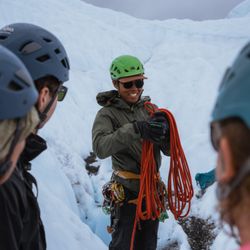
    Alaska Glacier Experience & Wilderness ATV Tours - Yes, these were actual customers during a tour. We don't stage photos here! ;)

    Yes, these were actual customers during a tour. We don't stage photos here! ;)

    Alaska Glacier Experience & Wilderness ATV Tours - Iceberg hopping is a favorite pastime of ours!  How far will you go for the ultimate experience?

    Iceberg hopping is a favorite pastime of ours! How far will you go for the ultimate experience?

    Alaska Glacier Experience & Wilderness ATV Tours - Dallas guiding the team.

    See all

    Dallas guiding the team.

    Bold Peak - rope has seen better days

    Bold Peak

    5.0(1 review)
    34.7 km

    What a great hike/climb!…read more Depending on who you ask, this is either an extremely difficult hike or a non-technical climb. There is one section where, if you don't have experience rock climbing, you might be pretty sketched out. But, fear not, there are fixed ropes! I'd just caution on not relying on them 100%. I might also recommend wearing a helmet. This climb starts at Eklutna Lake: https://www.yelp.com/biz/eklutna-lakeside-trail-eklutna From there you travel 10.5 miles along the lake to the trailhead. I'd HIGHLY recommend doing this with a mountain bike. I rented one from here (they are open till 10pm!): https://www.yelp.com/biz/downtown-bicycle-rental-sales-and-repair-anchorage?osq=mountain+bike I'm not a good cyclist and it took me about 90 minutes to get to the trailhead. Once there, you go up a densely vegetated trail for about 1.6 miles. It's not quite bush whacking but...in a month or two it probably will be. Eventually you find a creek, take this up into a large, scree-riddled gully. You then ride this gully up to the summit. And it's gorgeous. As you undulate up and down the gully, the canyon narrows and widens, the vegetation changes, creeks wind through it, it's incredible. Eventually you're on the SE face which is a pretty easy scree-scramble to the summit. Views from the summit are incredible. The main thing that makes this hard is the gain: 7,000 ft of it. That's a lot for a Chugach hike. (For comparison, Flattop is about 1,300 ft)

    Photos
    Bold Peak
    Bold Peak
    Bold Peak

    See all

    Pioneer Ridge - Austin Helmers Trail - going up!

    Pioneer Ridge - Austin Helmers Trail

    4.8(5 reviews)
    24.8 km

    I really like this trail. It's the type of trail that you can't pin the direction it's going to go…read more You're kind of just weaving your way up and around. The trail (in October when we went) gets progressively more muddy as the you get higher. Most of the first couple miles are in the trees and shrubs. Around the 2.4 mile mark you come to a picnic table and an open viewing area. All that said, it's really not a great trail when it's muddy. Scary in places really. Especially coming down. Excited to try it out in summer after a couple really warm, really dry days.

    Probably the most brutal hike in the Anchorage bowl!…read more It's short on mileage but HEAVY on gain. Trail has great views of the Knick Glacier as well as some nice wild flower-sprinkled tundra near the end. The trail ends at a ridge that eventually reaches the shorter of Pioneer Peak's two summits. I would not recommend this section unless you are very comfortable with exposed scrambling and/or you are a confident rock climber. Once on the South Summit you can glimpse at the slighty taller, "true" summit: the North Summit. Our intentions were to downclimb from the South Summit and then go upthe North...but after climbing down the ball bearing scree with sickening runouts, we decided to go get breakfast in Palmer instead. It's very tough to get to the true summit from this trail head, best options would be: 1) Do it when there is snow on the summits, might be easier to downclimb and then climb up the other side if there is enough snow. At least you could arrest a fall with an axe. 2) Climb the North Face route, which leads directly to the North Summit. This is best done in late spring. There is considerable avalanche risk if conditions aren't perfect. 3) Have bigger balls than us and just go for it when it's dry.

    Photos
    Pioneer Ridge - Austin Helmers Trail
    Pioneer Ridge - Austin Helmers Trail
    Pioneer Ridge - Austin Helmers Trail

    See all

    Archangel Valley

    Archangel Valley

    5.0(1 review)
    23.9 km

    Welcome. Welcome to…read morethe best rock climbing (on the road system) in Alaska! The good news: - Rock quality is good, great for Alaska. - Views are stunning: this area looks like medieval Scottish highlands. You'll keep expecting a bunch of kilted warriors to run out from behind some granite rock band, chasing a wounded Grendel. The bad news: - It's pretty much mandatory to have a high clearance vehicle to reach the good climbing (which is at absolute end of Archangel Rd, past the gate). All trucks can make it, and most SUV's and Subaru's should be able to make the journey as well. Anything else WILL get heavily scrapped. This road is very rough and very rocky. You know how the warnings about most roads in Alaska (Haul Rd, McCarthy Rd, Denali Hwy, etc) are just ghost stories designed to scare tourists? THIS IS NOT LIKE THAT. There are deep ruts and there are large embedded rocks. You don't need 4WD or AWD, the road is flat. But your vehicle better have its belly at least 7 inches off the ground. - The weather. Generally not good. It's wet and rainy here almost all the time. It can be birdies and sunshine and lawn mowin' and crisp Coors Light in Palmer but...be a land of dreary granite buttresses up here. So, what if I don't about climbing? What's in this valley for me? I'm glad you asked. About 2.9 miles down the trail (you can do this in just about any car, if you drive carefully) you'll find a trailhead and parking lot. This is the Reed Lakes Trailhead. It's a moderate hike to some beautiful lakes. It also has pretty good berry-pickin' in the fall, but don't tell anyone! If you drive to the end of the trail you can poke around the Fern Mine: https://www.yelp.com/biz/fern-mine-at-archangel-valley-palmer If you wander at least 0.5 miles away from the road, there are many spots where you are allowed to backcountry camp here. Highly recommended, it's picturesque and it's free! This road gets shut down as soon as the snow sticks, so don't even try it! It is open for winter recreation activities, though.

    Photos
    Archangel Valley
    Archangel Valley
    Archangel Valley

    See all

    Matanuska Peak Trail - Terminus views

    Matanuska Peak Trail

    4.5(2 reviews)
    15.8 km

    Starting at the trailhead on Smith Road you'll head in on a relatively flat trail…read more It becomes mostly uphill at the moment that you take a slight left off the ATV trail. Don't worry, it's clearly labeled here and you'll know you're on the right trail because there will be a marker. Around 4600 you'll start to hear rushing water off to your left. Around 5400-5600 you'll hit your first view of Palmer and the Butte/Pioneer off to your left. Mostly uphill until 9800. Then it smooths out in the McRoberts Basin for about two miles. You Lazy Creek at 10800 After you cross the gulch around mile 4, it gets steep and strenuous. The top is just shy of 6 miles. The last marker I saw was 29700. In the future I might mountain bike in 4-5 miles. Or backpack in four miles, set up camp and hike to the summit with a couple water bottles. Certainly worth the views, but the books don't lie. It's a strenuous trail.

    Only on Alaska Yelp can you be first to review a very popular hike!…read more Even if you don't know this peak, you know this peak. It's the "other" prominent peak (besides Pioneer) that looms over Palmer. This is the "big boy" corollary to the neighboring Lazy Mountain trail: https://www.yelp.com/biz/lazy-mountain-trail-head-palmer The trail starts out on a 4x4 road. It's pretty wide with hard packed gravel. Eventually it narrows and gets VERY brushy. Seriously, practice your "HEY BEAR"'s, because the vegetation really overtakes the middle part of this trail. Eventually you'll emerge from the brush and out onto alpine tundra. The trail is the obvious dirty path running through the hills of alpine prairie. Lots of grounds squirrels here. Now you're at the base of Matanuska Peak. Don't be like me. Take a trekking pole. The final 1,000 ft of gain to the summit would be WAY easier with a pole to balance on! Some rock is white and sticky, but lose. Some rock is solid, but covered in black lichen and therefore slippery. Choose your poison! (trail markers guide you up the entire trail, even up through the scree and rock, keep an eye out) The summit is pretty small, you'll definitely get to know the other people on the top. (can get crowded in the summer) Great views of the Chugach: Ice Cream Cone peak, Knik Glacier, Pioneer Peak, Twin Peaks, and the Palmer valley. I found the hike down from the summit to be much easier/faster, but my knees are feeling stronger these days. If you have bad knees...again, get yourself a pole. Stats for this trail: Miles R/T: 8 Elevation gain: 5,670 ft

    Photos
    Matanuska Peak Trail - Terminus views

    Terminus views

    Matanuska Peak Trail - Took this for Mom, and now I share it with ya'll

    Took this for Mom, and now I share it with ya'll

    Matanuska Peak Trail - Beginning of the scree/rock section to the summit

    See all

    Beginning of the scree/rock section to the summit

    Seven Mile Canoe Trail - canyoneering - Updated September 2026

    Loading...
    Loading...
    Loading...