Shoal Creek Trail Photos


You might also consider


More like Shoal Creek Trail
Recommended Reviews - Shoal Creek Trail
Start your review...


Reviews With Photos
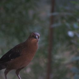

Love the photos I get around here! Peaceful place to collect your thoughts or have some fun walks!
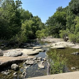

A hidden treasure of a trail that runs on the east side of N Lamar Blvd along Shoal Creek. The trail starts at Ann and Roy Butler hike and bike trail downtown and heads north for miles- today I walked the section between Pease Park and 31st street. There is lots of shade, a few benches to rest, waterfalls to see and hear, and serene beauty all so close to town. While it's not heavily traveled, there are always people usually with their dogs enjoying themselves. The trail is gravel, dirt and asphalt. The part closer to 31st st is against a limestone wall- such a neat spot but not ada accessible.


This park is truly a hidden gem. Right in the heart of the city, you feel like a mini vacation or getaway, which is otherwise hard to do during this pandemic. We started at Peace Park around 15th St and went through Seider Park to emerge on 35th St. The total walk was about 60 minutes, 75 if you stop for awe as I couldn't help but do. There are several points to go down to the stream and picnic - wish we had brought something with us. There are a couple of different parking areas if you want to picnic mostly or engage in a shorter walk. The trail is mostly flat and also paved. I'd say more than 80% of the path is naturally shaded so a late morning walk is feasible in the summer months. The very end near 29th-31st street becomes a bit rocky. The hike through nature is rejuvenating and relaxing. People maintain their social distance and there weren't many people to begin with. Signage was solid though.


Great spot for a quick run or short bike ride. I love how close it is to the city, but makes you feel like you're miles away. Plenty of gravel/dirt paths, decent amount of shade and some waterways (weather permitting).


Ever get bored of running the same old loop around Lady Bird Lake? Maybe there's a special event going on at Auditorium Shores and you can't find a place to park down there... Perhaps you're just looking for a less crowded but still urban trail option? Today is the day to give the 76 acre Shoal Creek Greenbelt a try. Assuming you start at the northern-most trail head at 38th Street, what'll you see on your 4.5-ish mile run south to Lady Bird Lake? -- a historical marker about one of Austin's original European settlers -- a few natural springs bubbling forth -- the creek, dry in places, deep in others -- birds, turtles, fish, bats, and squirrels, oh my! -- limestone walls -- fossils -- playgrounds -- splashpads -- bridges (you'll go under at least 6 or 7 of 'em) -- a high school football stadium http://www.yelp.com/biz/house-park-stadium-austin -- a concrete skate & BMX park http://www.yelp.com/biz/austin-bmx-and-skate-park-austin -- a dirt BMX park http://ninthstreetbmx.com/ -- skyscrapers -- walkers, runners, cyclists, strollers -- people & pups of all kinds (including a few non-aggressive homeless campers) I love that most of this trail system is shaded and that it offers a variety of terrain, from bridge-covered concrete paths to gravel trails to limestone canyons to rocky creekbeds to wooden bridges and so on. Once you get into downtown, you even get a half mile or so of our original board walk that lets out right next to Tiniest Bar in Texas (a great place for a beer & burrito break if you time it just right). Due to the 2015 Memorial Day floods, there are a few sections of the mid-trail from 31st to Pease Park that are marked as closed for construction at this time (September 2015), but it appears that most runners are ignoring the warnings at this point; I saw plenty of folks jogging around the trail blockers, but you can also take the alternate sidewalk routes that hug Lamar Blvd for these sections. Another potential problem area is from 5th Street to the lake, as commercial construction has various short portions of the trail re-routed. Pay attention to the signs and you'll be fine, though you may have to carry your bike or stroller up some stairs. A full map of the Shoal Creek Greenbelt is available here: https://brykerwoodsaustin.files.wordpress.com/2013/10/shoalcreeek_2010.pdf A map of the official off leash area from 29th to 24th Street is here: http://www.austintexas.gov/sites/default/files/files/Parks/GIS/Shoal_Creek_OLA_Kiosk.pdf Water and/or restrooms are available at these stops along the way: -- Seiders Springs Park http://www.yelp.com/biz/seiders-springs-park-austin -- Bailey Park http://www.yelp.com/biz/bailey-park-austin -- Caswell Tennis Center http://www.yelp.com/biz/caswell-tennis-center-austin -- Pease Park http://www.yelp.com/biz/pease-park-austin -- Shoal Creek Beach (off the Butler Trail at Lady Bird Lake just south of Seaholm Power Plant complex)


My friend and I came here after a recommendation from a local. It was a beautiful day, so we wanted to be outside. We entered the trail on the Cesar Chavez side and walked for a while. Along the way, we were passed by several joggers and walkers. Some with strollers, some with dogs. As we looked out on the creek, there were several paddle boarders and kayak-ers enjoying the afternoon. We saw several ducks and a turtle, as well. We came across one bathroom, but it was closed. I'm not sure if there are more down the way. It was very relaxing and has ample amount of shade (which was welcome on our walk).


It's a million degrees out today, so it's the perfect day to romp around the Greenbelt. The path is a little too rocky for my wheelchair, so it's not completely accessible. But that's okay! It's absolutely gorgeous regardless. The water running through the creek is romantically Austin, another glimpse of Texas beauty.


11 months ago
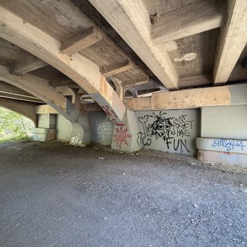
while I was looking for more of a trail hike we had a nice walk at this location. the start point given on all trails took us to a close portion of the trail however we were able to walk along side lamar to get onto the trial. lots of trees , wild flowers, & random art. this trail leads you into peace park where there's restrooms, splash pads, picnic tables and sometimes you will catch a event going on in the park. perfect for a stroll with the family. taking off one star due to closed portions of the trail. read more



3 months ago
this trail is a really nice spot to walk around and chill. as long as you dont care about the homeless people living around and the smell, its actually a great spot to walk around. just maybe dont walk around here at night. read more







2 years ago
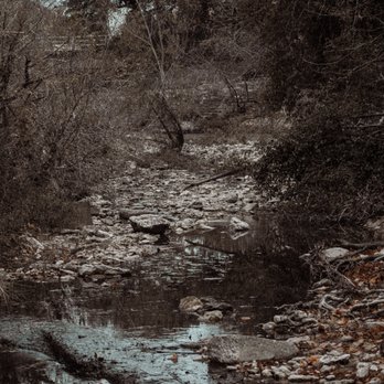
Love the photos I get around here! Peaceful place to collect your thoughts or have some fun walks! read more


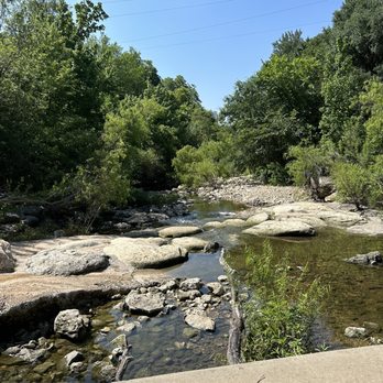
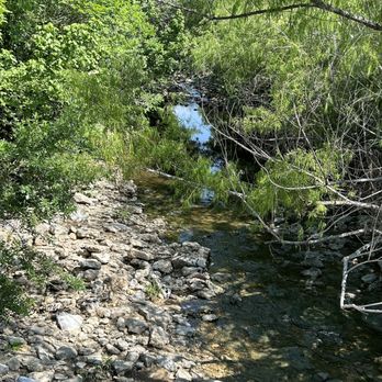
A hidden treasure of a trail that runs on the east side of N Lamar Blvd along Shoal Creek. The trail starts at Ann and Roy Butler hike and bike trail downtown and heads north for miles- today I walked the section between Pease Park and 31st street. There is lots of shade, a few benches to rest, waterfalls to see and hear, and serene beauty all so close to town. While it's not heavily traveled, there are always people usually with their dogs enjoying themselves. The trail is gravel, dirt and asphalt. The part closer to 31st st is against a limestone wall- such a neat spot but not ada accessible. read more



6 years ago
This park is truly a hidden gem. Right in the heart of the city, you feel like a mini vacation or getaway, which is otherwise hard to do during this pandemic. We started at Peace Park around 15th St and went through Seider Park to emerge on 35th St. The total walk was about 60 minutes, 75 if you stop for awe as I couldn't help but do. There are several points to go down to the stream and picnic - wish we had brought something with us. There are a couple of different parking areas if you want to picnic mostly or engage in a shorter walk. The trail is mostly flat and also paved. I'd say more than 80% of the path is naturally shaded so a late morning walk is feasible in the summer months. The very end near 29th-31st street becomes a bit rocky. The hike through nature is rejuvenating and relaxing. People maintain their social distance and there weren't many people to begin with. Signage was solid though. read more

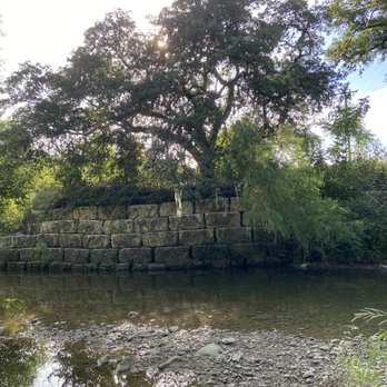


Great spot for a quick run or short bike ride. I love how close it is to the city, but makes you feel like you're miles away. Plenty of gravel/dirt paths, decent amount of shade and some waterways (weather permitting). read more


11 years ago
Ever get bored of running the same old loop around Lady Bird Lake? Maybe there's a special event going on at Auditorium Shores and you can't find a place to park down there... Perhaps you're just looking for a less crowded but still urban trail option? Today is the day to give the 76 acre Shoal Creek Greenbelt a try. Assuming you start at the northern-most trail head at 38th Street, what'll you see on your 4.5-ish mile run south to Lady Bird Lake? -- a historical marker about one of Austin's original European settlers -- a few natural springs bubbling forth -- the creek, dry in places, deep in others -- birds, turtles, fish, bats, and squirrels, oh my! -- limestone walls -- fossils -- playgrounds -- splashpads -- bridges (you'll go under at least 6 or 7 of 'em) -- a high school football stadium http://www.yelp.com/biz/house-park-stadium-austin -- a concrete skate & BMX park http://www.yelp.com/biz/austin-bmx-and-skate-park-austin -- a dirt BMX park http://ninthstreetbmx.com/ -- skyscrapers -- walkers, runners, cyclists, strollers -- people & pups of all kinds (including a few non-aggressive homeless campers) I love that most of this trail system is shaded and that it offers a variety of terrain, from bridge-covered concrete paths to gravel trails to limestone canyons to rocky creekbeds to wooden bridges and so on. Once you get into downtown, you even get a half mile or so of our original board walk that lets out right next to Tiniest Bar in Texas (a great place for a beer & burrito break if you time it just right). Due to the 2015 Memorial Day floods, there are a few sections of the mid-trail from 31st to Pease Park that are marked as closed for construction at this time (September 2015), but it appears that most runners are ignoring the warnings at this point; I saw plenty of folks jogging around the trail blockers, but you can also take the alternate sidewalk routes that hug Lamar Blvd for these sections. Another potential problem area is from 5th Street to the lake, as commercial construction has various short portions of the trail re-routed. Pay attention to the signs and you'll be fine, though you may have to carry your bike or stroller up some stairs. A full map of the Shoal Creek Greenbelt is available here: https://brykerwoodsaustin.files.wordpress.com/2013/10/shoalcreeek_2010.pdf A map of the official off leash area from 29th to 24th Street is here: http://www.austintexas.gov/sites/default/files/files/Parks/GIS/Shoal_Creek_OLA_Kiosk.pdf Water and/or restrooms are available at these stops along the way: -- Seiders Springs Park http://www.yelp.com/biz/seiders-springs-park-austin -- Bailey Park http://www.yelp.com/biz/bailey-park-austin -- Caswell Tennis Center http://www.yelp.com/biz/caswell-tennis-center-austin -- Pease Park http://www.yelp.com/biz/pease-park-austin -- Shoal Creek Beach (off the Butler Trail at Lady Bird Lake just south of Seaholm Power Plant complex) read more


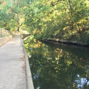


My friend and I came here after a recommendation from a local. It was a beautiful day, so we wanted to be outside. We entered the trail on the Cesar Chavez side and walked for a while. Along the way, we were passed by several joggers and walkers. Some with strollers, some with dogs. As we looked out on the creek, there were several paddle boarders and kayak-ers enjoying the afternoon. We saw several ducks and a turtle, as well. We came across one bathroom, but it was closed. I'm not sure if there are more down the way. It was very relaxing and has ample amount of shade (which was welcome on our walk). read more


7 years ago

19 years ago

11 years ago
It's a million degrees out today, so it's the perfect day to romp around the Greenbelt. The path is a little too rocky for my wheelchair, so it's not completely accessible. But that's okay! It's absolutely gorgeous regardless. The water running through the creek is romantically Austin, another glimpse of Texas beauty. read more


18 years ago

13 years ago
More info about Shoal Creek Trail
W 35th St
Austin, TX 78703
Bryker Woods
Directions
Hours
Outdoor Amenities
Ask the Community - Shoal Creek Trail
Review Highlights - Shoal Creek Trail
You might also consider


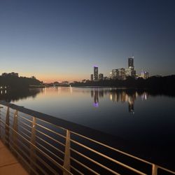


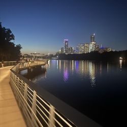
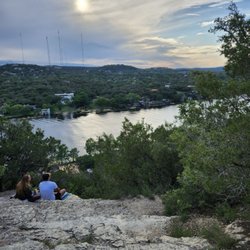


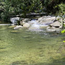
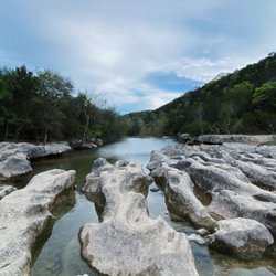


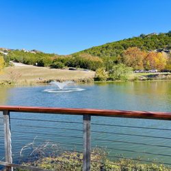



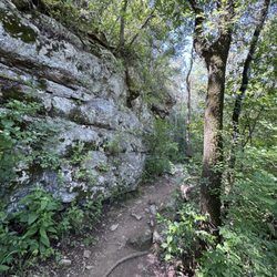


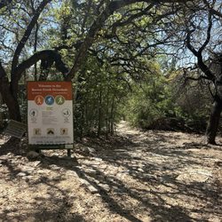


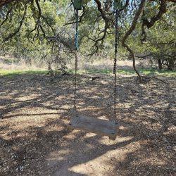


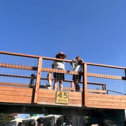


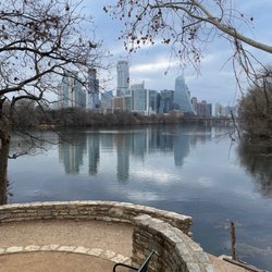


Shoal Creek Trail - hiking - Updated August 2026
Best of Austin
People found Shoal Creek Trail by searching for…
Trending Searches in Austin, TX
Antiques near Shoal Creek Trail
Barbershop For Men near Shoal Creek Trail
Bike Shop near Shoal Creek Trail
Bird Sanctuary near Shoal Creek Trail
Cliff Jumping near Shoal Creek Trail
Consignment Shops near Shoal Creek Trail
Cruising Spots near Shoal Creek Trail
Dog Friendly Things To Do near Shoal Creek Trail
Ear Piercing near Shoal Creek Trail
Eyebrow Threading near Shoal Creek Trail
Flower Fields near Shoal Creek Trail
Hair Braiding near Shoal Creek Trail
Kids Haircut near Shoal Creek Trail
Mini Golf near Shoal Creek Trail
Pedicure near Shoal Creek Trail
Permanent Makeup near Shoal Creek Trail
Picnic Areas near Shoal Creek Trail
Public Golf Courses near Shoal Creek Trail
Public Pools near Shoal Creek Trail
Rock Quarry near Shoal Creek Trail
Scenic Night View near Shoal Creek Trail
Scenic Overlook near Shoal Creek Trail
Sunrise View near Shoal Creek Trail
Swimming Holes near Shoal Creek Trail
Trading Card Shops near Shoal Creek Trail
Used Furniture Stores near Shoal Creek Trail
Browse Articles
Browse Nearby
BEST of Austin, Texas Coffee near Shoal Creek Trail
BEST of Austin, Texas Restaurants near Shoal Creek Trail
BEST of Austin, Texas Things to Do near Shoal Creek Trail
BEST of Austin, Texas Walking Trails near Shoal Creek Trail
BEST of Austin, Texas Breakfast near Shoal Creek Trail
BEST of Austin, Texas Parks near Shoal Creek Trail
BEST of Austin, Texas Caves near Shoal Creek Trail
Browse Brands
Related Searches in Austin, TX
Affordable Kayak Rental Services in Austin, Texas
Best Dog Hiking Trails Around Austin, Texas
Best Fishing Locations and Guides in Austin, Texas
Best Nature Trails for Hiking in Austin, Texas
Best Places for Horseback Riding in Austin, Texas
Best Sightseeing Experiences Available in Austin, Texas
Best Waterfalls and Swimming Holes in Austin, Texas
Check Out Off Road Trails in Austin, Texas
Discover Dog Friendly Trails to Explore in Austin, Texas
Discover Kid Friendly Hiking Trails in Austin, Texas
Discover Popular Bike Trails in Austin, Texas
Discover Walking Parks in Austin, Texas Near You
Discover a Hiking Trail in Austin, Texas
Discover the Best Night Hike Trails in Austin, Texas
Dog-Friendly Hikes With Dogs in Austin, Texas
Enjoy Camping Adventures Around Austin, Texas
Enjoy Kayaking Adventures in Austin, Texas
Enjoy Off Leash Dog Hikes in Austin, Texas
Enjoy Scenic Places to Walk in Austin, Texas
Enjoy Tent Camping Spots Around Austin, Texas
Enjoy a Beautiful Waterfall Hike in Austin, Texas
Enjoy the Best Walking Path in Austin, Texas
Enjoy the Best Walking Trails in Austin, Texas
Explore Beautiful Parks and Green Spaces in Austin, Texas
Explore Easy Hikes Perfect for All in Austin, Texas
Explore Fun Activities to Do in Austin, Texas
Explore Popular Campgrounds Near Austin, Texas
Explore Popular Dog Walking Trails in Austin, Texas
Explore Top Dog Parks in Austin, Texas Near You
Explore the Best Beach Spots in Austin, Texas
Explore the Best Swimming Holes Around Austin, Texas
Family Friendly Hiking With Kids in Austin, Texas
Find Beautiful Views in Austin, Texas
Find Popular Ziplining Spots Around Austin, Texas
Find Top-Rated Waterfalls in Austin, Texas Now
Find the Best Parks for Picnics in Austin, Texas
Hiking Trails With Waterfalls in Austin, Texas
Off Leash Dog Hiking Trails in Austin, Texas
Popular Outdoor Activities to Try in Austin, Texas
Popular Picnic Spots to Visit in Austin, Texas
Safe River Swimming Areas in Austin, Texas
Safe and Fun Parks for Kids in Austin, Texas
Top Hiking Trails to Explore in Austin, Texas
Top Running Trails to Explore in Austin, Texas
Top Swimming Lakes to Enjoy in Austin, Texas
Top Swimming Spots and Pools in Austin, Texas
Top-Rated Camping Sites in Austin, Texas


