Pacific Crest Trail at Chinook Pass Photos


More like Pacific Crest Trail at Chinook Pass
Recommended Reviews - Pacific Crest Trail at Chinook Pass
Start your review...



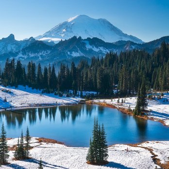
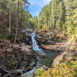
The Chinook pass has several trails and the part of the Pacific Crest Trail does run through it. It's an amazing place to gaze at Mount Rainier with a few lakes to punctuate the view. It does get crowded on the weekends so you'll often see photographers and tourists congregating at Tipsoo Lake. But veer off the parking lot a little and hike around and up the Pass and you'll see a less popular lake that's equally immersive and picturesque. You might even find some solitude. read more

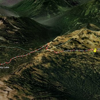
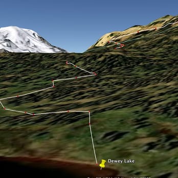
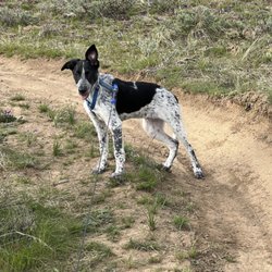
On August 27th, took a drive to Chinook Pass which was about 2.5 hours. I left the Tri-Cities at about 7:30. Made a quick stop at the Ranger Station in Naches, WA to pick up a Wilderness Pass and find out conditions up in the mountains. Like clockwork, I made it to the trailhead around 10am. This was a new hike. I have a tendency to repeat hikes. Repeat them monthly, annually, cerebrally. This time I was hiking a completely new hike. This was a trail I was entering blindly. I briefly looked at it via Google Earth months ago, but I didn't know what I was in store for. I didn't know where I was going. Surely there would be an awesome lake on the agenda. Fields of wildflowers must be on the menu. Huckleberries? Yeah, they will be sirening me. Gunner & Gomez (my dogs)? They just wanted a new place to go pee. We wanted to hit the trail and get away from the parking area and WA-410 ASAP. It's funny how trails can clear slates. Within a few switchbacks and the passing of a few batches of trees, we were gone. Almost instantly, we stole our first view of a scene subconsciously hoped for all summer: a clear & sunny sky and a sky-blue alpine lake surrounded by craggly mountain ridges. This is the medicine I needed. I don't know the name of this lake, but it offered a nice "welcome back" to the mountains. I lead the dogs down to the water, and they, of course, sauntered into the water. I think they thought we had reached our destination. "Sorry guys, this is just the beginning!" I know they were calling me a "bastard" in their corgi brains. We got back on the trail and continued south. We passed a few hikers just starting their multi-day trips down south and other hikers finishing their long trips north (why can't I be like these people!?). Overnight backcountry trips are nothing. I dream about what a 3-4 day trip would be like, or a 4-6 month trip along the entirety of the PCT---from Mexico to British Columbia. I couldn't even imagine what that would be like. Daydreaming is part of the drill when hiking. Ha! It's funny about hiking. When you're out on your own, your mind has this uncanny ability to wander. It's always nice to think about your life. Think about those you are close to. Think about hikes in the future. Think about all that's happened since the last time you were in the mountains. It's amazing. My brain can hopscotch from topic to topic and before I know it, miles have been walked. Daydreaming is not a bad thing. Ok, so I was at the top of a ridge, and I could see a huge lake below: Dewey Lake--the lunchtime destination. Finally made it down to the lake. This was a huge lake. It was beautiful, and it was big. We sauntered up to the water, and walked along the "beach" for a little. It would have been nice to hike a little more...but it was lunchtime. So, chilled at the lake and had a nice lunch. I then did some huckleberry pickin'. Oh yeah. The huckleberries were yummy, and I could have easily spent hours picking. But I had to get back on the trail. So off I went. All in all this was a nice and quick day hike with spectacular views. Can't wait to extend this day hike into a many-days hike! read more



More info about Pacific Crest Trail at Chinook Pass
Chinook Pass WA-410
Yakima, WA 98937
Directions
Hours
Outdoor Amenities









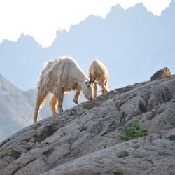


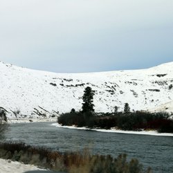



Pacific Crest Trail at Chinook Pass - hiking - Updated September 2026
Best of Yakima
People found Pacific Crest Trail at Chinook Pass by searching for…
Trending Searches in Yakima, WA
Apple Orchards near Pacific Crest Trail at Chinook Pass
Apple Picking near Pacific Crest Trail at Chinook Pass
Barbershop near Pacific Crest Trail at Chinook Pass
Bike Shop near Pacific Crest Trail at Chinook Pass
Casinos near Pacific Crest Trail at Chinook Pass
Cliff Jumping near Pacific Crest Trail at Chinook Pass
Consignment Shops near Pacific Crest Trail at Chinook Pass
Dog Friendly Things To Do near Pacific Crest Trail at Chinook Pass
Estheticians near Pacific Crest Trail at Chinook Pass
Eyelash Extensions near Pacific Crest Trail at Chinook Pass
Hiking Trails With Waterfalls near Pacific Crest Trail at Chinook Pass
Kids Birthday Party near Pacific Crest Trail at Chinook Pass
Makeup Artists near Pacific Crest Trail at Chinook Pass
Middle Schools & High Schools near Pacific Crest Trail at Chinook Pass
Musical Instruments & Teachers near Pacific Crest Trail at Chinook Pass
Parks near Pacific Crest Trail at Chinook Pass
Picnic Areas near Pacific Crest Trail at Chinook Pass
Places To Take Pictures near Pacific Crest Trail at Chinook Pass
Public Shower near Pacific Crest Trail at Chinook Pass
Rock Quarry near Pacific Crest Trail at Chinook Pass
Sunrise View near Pacific Crest Trail at Chinook Pass
Swimming Holes near Pacific Crest Trail at Chinook Pass
Teeth Whitening near Pacific Crest Trail at Chinook Pass
Browse Articles
Browse Brands
Related Searches in Yakima, WA
Affordable Kayak Rental Services in Yakima, Washington
Best Dog Hiking Trails Around Yakima, Washington
Best Fishing Locations and Guides in Yakima, Washington
Best Places for Horseback Riding in Yakima, Washington
Best Sledding Spots and Fun in Yakima, Washington
Check Out Off Road Trails in Yakima, Washington
Discover Dog Friendly Trails to Explore in Yakima, Washington
Discover Top Nature Parks to Visit in Yakima, Washington
Discover Top State Parks to Visit in Yakima, Washington
Discover a Hiking Trail in Yakima, Washington
Discover the Best Night Hike Trails in Yakima, Washington
Dog-Friendly Hikes With Dogs in Yakima, Washington
Enjoy Camping Adventures Around Yakima, Washington
Enjoy Exciting Mountain Biking Adventures in Yakima, Washington
Enjoy Off Leash Dog Hikes in Yakima, Washington
Enjoy Tent Camping Spots Around Yakima, Washington
Enjoy the Best Walking Trails in Yakima, Washington
Experience Stunning Sunset Views in Yakima, Washington
Explore Beautiful Parks and Green Spaces in Yakima, Washington
Explore Easy Hikes Perfect for All in Yakima, Washington
Explore Fun Activities to Do in Yakima, Washington
Explore Popular Campgrounds Near Yakima, Washington
Explore Popular RV Parks Around Yakima, Washington
Explore Popular Scenic Overlook Points in Yakima, Washington
Explore Scenic Lakes to Visit in Yakima, Washington
Explore Top Dog Parks in Yakima, Washington Near You
Explore Top Water Parks in Yakima, Washington Today
Explore the Best Swimming Holes Around Yakima, Washington
Family Friendly Hiking With Kids in Yakima, Washington
Find the Best Playgrounds to Visit in Yakima, Washington
Hiking Trails With Waterfalls in Yakima, Washington
Off Leash Dog Hiking Trails in Yakima, Washington
Plan a Scenic Drive Route Near Yakima, Washington
Popular Fishing Spots to Explore in Yakima, Washington
Popular Kids Activities in Yakima, Washington
Popular Outdoor Activities to Try in Yakima, Washington
Popular Picnic Spots to Visit in Yakima, Washington
Safe River Swimming Areas in Yakima, Washington
Safe and Fun Parks for Kids in Yakima, Washington
Top Hiking Trails to Explore in Yakima, Washington
Top Playgrounds for Kids to Enjoy in Yakima, Washington
Top Running Trails to Explore in Yakima, Washington
Top Swimming Lakes to Enjoy in Yakima, Washington
Top Swimming Spots and Pools in Yakima, Washington
Top Things to Do With Kids in Yakima, Washington


