South Mesa Trailhead Photos


You might also consider

More like South Mesa Trailhead
Recommended Reviews - South Mesa Trailhead
Start your review...


Reviews With Photos


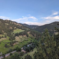
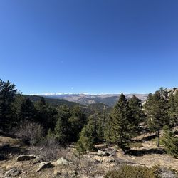
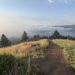
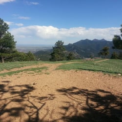
Upon arriving at our chosen trailhead mid-morning on Saturday to be told it was at capacity, Kristin M. and I consulted our phones and came up with Plan B. So we made our way back down the road to South Mesa Trailhead and soak up some of the gorgeous Eldorado Canyon vistas. ++ South Mesa Trailhead features a moderately sized pay parking lot. Though I am uncertain if you still have to pay if you have a State Park Pass... But it does fill up fast on the weekend so come early! ++ The parking area does feature a restroom. Yay! ++ There's plenty of trails to connect and spend your day taking in the amazing views. We primarily stuck to the Mesa Trail which offered gorgeous views of the area. ++ There's a sweet little creek close to the parking area that makes a great spot for you furry friend to cool off their paws after a good long hike. ++ For the most part trails are are wide and gravel covered through the open meadows. As you go further towards Shadow Canyon is becomes packed dirt and a bit narrower. +/- Much of the trail we were on was not shaded. So make sure to bring sunblock and lots of water. +/- The trail is moderately marked. We found ourselves having to use our phones to navigate our way back to the car. -- Some dog owners either fail to pick up their furry friend's poop, or they bag it and leave it elsewhere on the trail. As a considerate dog owner and avid hiker this drives me crazy. It's not hard! Seeing that I am trying to make the most of my State Park Pass and take in as much of the Colorado State Parks as possible, I'm sure I'll be making my way back to both Eldorado Canyon and South Mesa Trailhead in the future. #optoutside
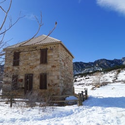

The South Mesa trailhead marks the south end of the Mesa Trail and is also an excellent departure point for Bear Peak and South Boulder Peak. The lower elevation trails meander through rolling grasslands and sparsely wooded hills, while trails like Shadow Canyon angle steeply up rocky, forested pathways. For history buffs, there are the dwellings of homesteaders. In other words, there's a bit of something for everyone. HELPFUL HINTS: - I was annoyed to learn in June 2011 they started a trial parking fee here ($5 a day or $25 per year), although no charge for vehicles registered in Boulder County. There used to only be a parking fee for Flagstaff Rd pullouts. There isn't another convenient place to park (Doudy Draw is also included in the new feed area) unless you want to hike/bike in. - Leash laws are in effect for canine companions unless they have a voice and sight tag. Please pick up after your dog. - Like most Boulder trails, those in this area get beat down shortly after a snow so while traction devices or poles may be useful, you probably won't need gaiters or snowshoes unless you're making first tracks or plan to go cross-country. - No bikes (typical Boulder regs). - Picnic area. No grills/stoves allowed. - See the website for a trail map and area closures.


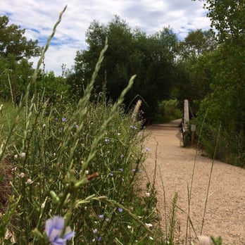
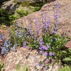
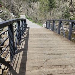
What a surprise! It was our 1st time here, paid $5 for parking in the parking lot. Passed a bridge, into the trail, great views, wild flowers everywhere, so pretty! Dog and family friendly, will be back!


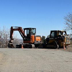
Pretty good trailhead. Bathroom facilities present. Need to pay for parking. Note, half the parking lot is closed off with construction equipment, there's another lot just across the road but parking is kind of a nightmare. Carpool if you can. I will go back to this area for sure!


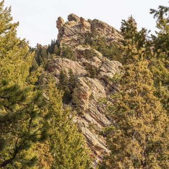
Great trailhead and general area for hiking and trail recreation. I group this along with Doudy Draw and Fowler TH since they are all pretty close, and you can hike to each within a few miles if parking fills at one. That said, it gets busy here even on weekdays, and except a tough search for a spot on a nice day. There's a fee for non Boulder Cnty cars. It's a great place to recreate, with access to likely a few hundred miles of trails. Many peaks to climb, like Bear and South Boulder make this a popular place to start your Boulder hike. It's a bit less crowded than something like NCAR or the flatirons, and there's a lot of trails that branch off. Do download a dedicated map application like Strava or alltrails, and pack some supplies. It's enough trails it can get confusing even to veteran hikers. Have a great time and happy trails! read more


Pretty darn steep hike. Really after the first two miles it's all up hill. Barefooted it until about .1 miles from the summit of South Peak. Kept my spikes on for Bear Peak as well and a bit on the way down. Overall conditions aren't that bad, few patches of ice - last half mile all packed, icy snow. $5 fee for parking if you're not a Boulder resident. read more

6 years ago
I lived in CO for eight years and never knew about this trail space. It was the perfect place to see the Flatirons and enjoy some socially distanced hiking. I went on a Wednesday morning and there were minimal people and stoked to say everyone has masks on or ready and available (thanks Boulder county for putting logical laws and order in place!). $5 to park at the trailhead, cash, and by 10 a.m. it was full and people were circling. I saw a couple snakes on the hike so I grabbed my dog and went another direction. They have a trail where dogs aren't allowed but there were other trails to supplement. We spent about two hours there and there was plenty of shaded space to stop off and grab water or a snack. I would definitely keep this hike in mind for next time I'm in CO. read more


Upon arriving at our chosen trailhead mid-morning on Saturday to be told it was at capacity, Kristin M. and I consulted our phones and came up with Plan B. So we made our way back down the road to South Mesa Trailhead and soak up some of the gorgeous Eldorado Canyon vistas. ++ South Mesa Trailhead features a moderately sized pay parking lot. Though I am uncertain if you still have to pay if you have a State Park Pass... But it does fill up fast on the weekend so come early! ++ The parking area does feature a restroom. Yay! ++ There's plenty of trails to connect and spend your day taking in the amazing views. We primarily stuck to the Mesa Trail which offered gorgeous views of the area. ++ There's a sweet little creek close to the parking area that makes a great spot for you furry friend to cool off their paws after a good long hike. ++ For the most part trails are are wide and gravel covered through the open meadows. As you go further towards Shadow Canyon is becomes packed dirt and a bit narrower. +/- Much of the trail we were on was not shaded. So make sure to bring sunblock and lots of water. +/- The trail is moderately marked. We found ourselves having to use our phones to navigate our way back to the car. -- Some dog owners either fail to pick up their furry friend's poop, or they bag it and leave it elsewhere on the trail. As a considerate dog owner and avid hiker this drives me crazy. It's not hard! Seeing that I am trying to make the most of my State Park Pass and take in as much of the Colorado State Parks as possible, I'm sure I'll be making my way back to both Eldorado Canyon and South Mesa Trailhead in the future. #optoutside read more


15 years ago
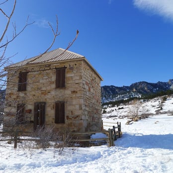
The South Mesa trailhead marks the south end of the Mesa Trail and is also an excellent departure point for Bear Peak and South Boulder Peak. The lower elevation trails meander through rolling grasslands and sparsely wooded hills, while trails like Shadow Canyon angle steeply up rocky, forested pathways. For history buffs, there are the dwellings of homesteaders. In other words, there's a bit of something for everyone. HELPFUL HINTS: - I was annoyed to learn in June 2011 they started a trial parking fee here ($5 a day or $25 per year), although no charge for vehicles registered in Boulder County. There used to only be a parking fee for Flagstaff Rd pullouts. There isn't another convenient place to park (Doudy Draw is also included in the new feed area) unless you want to hike/bike in. - Leash laws are in effect for canine companions unless they have a voice and sight tag. Please pick up after your dog. - Like most Boulder trails, those in this area get beat down shortly after a snow so while traction devices or poles may be useful, you probably won't need gaiters or snowshoes unless you're making first tracks or plan to go cross-country. - No bikes (typical Boulder regs). - Picnic area. No grills/stoves allowed. - See the website for a trail map and area closures. read more


11 years ago
What a surprise! It was our 1st time here, paid $5 for parking in the parking lot. Passed a bridge, into the trail, great views, wild flowers everywhere, so pretty! Dog and family friendly, will be back! read more




6 years ago

9 years ago
Pretty good trailhead. Bathroom facilities present. Need to pay for parking. Note, half the parking lot is closed off with construction equipment, there's another lot just across the road but parking is kind of a nightmare. Carpool if you can. I will go back to this area for sure! read more


More info about South Mesa Trailhead
Ask the Community - South Mesa Trailhead
Review Highlights - South Mesa Trailhead









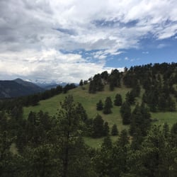


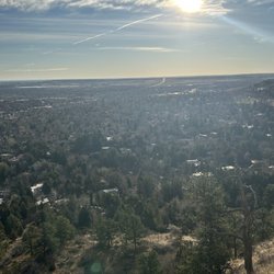




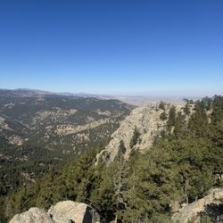



South Mesa Trailhead - hiking - Updated September 2026
Best of Boulder
People found South Mesa Trailhead by searching for…
Off Leash Dog Hikes in Boulder, CO
Hiking Trails With Waterfalls in Boulder, CO
Dog Friendly Hiking Trails in Boulder, CO
Scenic Overlook in Boulder, CO
Parks BBQ Grills in Boulder, CO
Off Road Trails in Boulder, CO
Mountain Bike Trails in Boulder, CO
Stroller Friendly Hikes in Boulder, CO
Trending Searches in Boulder, CO
Archery near South Mesa Trailhead
Barbershop For Men near South Mesa Trailhead
Bike Shop near South Mesa Trailhead
Bird Sanctuary near South Mesa Trailhead
Casinos near South Mesa Trailhead
Cliff Jumping near South Mesa Trailhead
Consignment Shops near South Mesa Trailhead
Cruising Spots near South Mesa Trailhead
Dog Friendly Things To Do near South Mesa Trailhead
Ear Piercing near South Mesa Trailhead
Elementary Schools near South Mesa Trailhead
Eyebrow Threading near South Mesa Trailhead
Flower Fields near South Mesa Trailhead
Hair Braiding near South Mesa Trailhead
Kids Haircut near South Mesa Trailhead
Lakes near South Mesa Trailhead
Lookout Points near South Mesa Trailhead
Parks near South Mesa Trailhead
Pedicure near South Mesa Trailhead
Picnic Areas near South Mesa Trailhead
Public Golf Courses near South Mesa Trailhead
Rock Quarry near South Mesa Trailhead
Scenic Night View near South Mesa Trailhead
Scenic Overlook near South Mesa Trailhead
Sunrise View near South Mesa Trailhead
Swimming Holes near South Mesa Trailhead
Trading Card Shops near South Mesa Trailhead
Uniforms near South Mesa Trailhead
Browse Articles
Browse Nearby
BEST of Boulder, Colorado Things to Do near South Mesa Trailhead
BEST of Boulder, Colorado Restaurants near South Mesa Trailhead
BEST of Boulder, Colorado Swimming Holes near South Mesa Trailhead
BEST of Boulder, Colorado Parks near South Mesa Trailhead
BEST of Boulder, Colorado Coffee near South Mesa Trailhead
BEST of Boulder, Colorado Breakfast near South Mesa Trailhead
BEST of Boulder, Colorado Ski Resorts near South Mesa Trailhead
Browse Brands
Related Searches in Boulder, CO
Affordable Kayak Rental Services in Boulder, Colorado
Best Dog Hiking Trails Around Boulder, Colorado
Best Fishing Locations and Guides in Boulder, Colorado
Best Nature Trails for Hiking in Boulder, Colorado
Best Places for Horseback Riding in Boulder, Colorado
Best Sightseeing Experiences Available in Boulder, Colorado
Check Out Off Road Trails in Boulder, Colorado
Discover Dog Friendly Trails to Explore in Boulder, Colorado
Discover Kid Friendly Hiking Trails in Boulder, Colorado
Discover Popular Bike Trails in Boulder, Colorado
Discover Scenic Mountain Bike Trails Near Boulder, Colorado
Discover a Hiking Trail in Boulder, Colorado
Discover the Best Night Hike Trails in Boulder, Colorado
Dog-Friendly Hikes With Dogs in Boulder, Colorado
Enjoy Camping Adventures Around Boulder, Colorado
Enjoy Kayaking Adventures in Boulder, Colorado
Enjoy Off Leash Dog Hikes in Boulder, Colorado
Enjoy Tent Camping Spots Around Boulder, Colorado
Enjoy a Beautiful Waterfall Hike in Boulder, Colorado
Enjoy the Best Walking Trails in Boulder, Colorado
Experience Thrilling White Water Rafting in Boulder, Colorado
Explore Beautiful Parks and Green Spaces in Boulder, Colorado
Explore Easy Hikes Perfect for All in Boulder, Colorado
Explore Fun Activities to Do in Boulder, Colorado
Explore Popular Campgrounds Near Boulder, Colorado
Explore Popular State Park Destinations in Boulder, Colorado
Explore Top Dog Parks in Boulder, Colorado Near You
Explore Top Water Parks in Boulder, Colorado Today
Family Friendly Hiking With Kids in Boulder, Colorado
Find Popular Ziplining Spots Around Boulder, Colorado
Find Top-Rated Waterfalls in Boulder, Colorado Now
Find the Best Parks for Picnics in Boulder, Colorado
Find the Best Playgrounds to Visit in Boulder, Colorado
Hiking Trails With Waterfalls in Boulder, Colorado
Off Leash Dog Hiking Trails in Boulder, Colorado
Picnic Areas With BBQ Pits Available in Boulder, Colorado
Plan a Scenic Drive Route Near Boulder, Colorado
Popular Outdoor Activities to Try in Boulder, Colorado
Popular Picnic Spots to Visit in Boulder, Colorado
Safe River Swimming Areas in Boulder, Colorado
Safe and Fun Parks for Kids in Boulder, Colorado
Top Hiking Trails to Explore in Boulder, Colorado
Top Playgrounds for Kids to Enjoy in Boulder, Colorado
Top Running Trails to Explore in Boulder, Colorado
Top Swimming Lakes to Enjoy in Boulder, Colorado
Top Swimming Spots and Pools in Boulder, Colorado
Top-Rated Camping Sites in Boulder, Colorado


